


Search for another town


Free U.S. delivery 7 to 10 days after you order
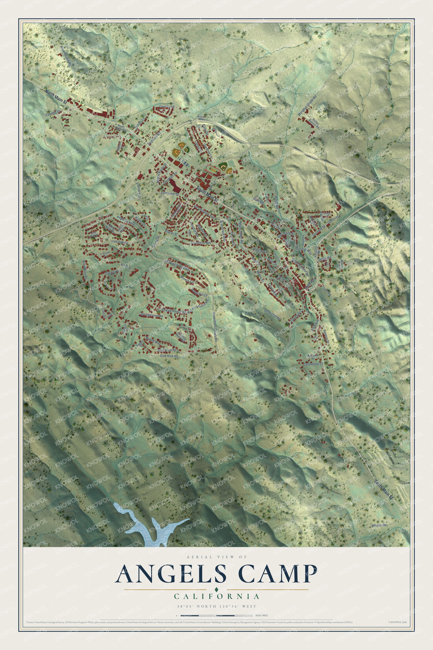
Angels Camp, California Map Art
Building by building, with labeled streets and shaded relief.
12" x 18" Archival Matte Print
A Map of Home. A Work of Art.
Explore Angels Camp, California from a whole new perspective. Created using aerial imagery and detailed geographic data, this map captures Angels Camp building by building, with labeled streets, familiar landmarks, and shaded topographical relief that highlights the natural contours of the landscape.
Combining modern data with the timeless character of a vintage atlas, this map is just as interesting up close as it is beautiful on the wall. Whether you grew up in Angels Camp, spent memorable years there, or call it home today, this unique map is a great way to celebrate a place that means something to you. Zoom in on the preview to look for your street, and then order a print to put your memories on the wall.
Three ways to hang it

Unframed archival matte, a black wood frame or a white wood frame.
Up close
Geography Worth Displaying
This map was created using accurate cartographic data and authoritative geographic sources, including the U.S. Geological Survey and the Census Bureau. The map brings together terrain, waterways, roads, and building detail. The majority of the streets are labeled, houses are accurately depicted, and the topography is derived from government sources. Combining local data with carefully composed color and shading leads to this beautifully detailed Angels Camp artwork for your wall.
Rather than simply showing street outlines, we’ve included as many of the street names as we could reasonably fit on the map while keeping their names legible. Zoom in on the high resolution preview to see exactly what’s on the map. We truly set out to create a statement piece for anyone who loves Angels Camp. So whether it’s for you, or a gift for someone you love, we hope this map of Angels Camp brings back fond memories.
Read the story behind this map of Angels Camp, California from 2026.

Find your street
Names on the Angels Camp map
Every name below is printed on this map. Look for your street, your school, the park where you played, or the pond down the road.
Places and landmarks2
- Altaville
- Big Horn Mobile Home Park
Streets and roads97
- South Main Street
- North Main Street
- Acorn Drive
- Angel Oaks Drive
- Selkirk Ranch Road
- Bush Street
- Jumping Frog Way
- Suzanne Drive
- Easy Circle
- Smith Flat Road
- Murphys Grade Road
- Greenhorn Creek Road
- Stockton Road
- Gold Cliff Road
- Mark Twain Road
- Live Oak Drive
- Blair Mine Road
- Brunner Hill Road
- Gardner Lane
- Tuolumne Avenue
- Purdy Road
- Centennial Lane
- Finnegan Lane
- Bret Harte Drive
- Cow Kick Road
- Dogtown Road
- Catalpa Lane
- Stanislaus Avenue
- Fairview Drive
- Dads Road
Show all 97 streets
- Tryon Road
- Depot Road
- Demarest Street
- Alpine Avenue
- Amador Avenue
- Miners Circle
- Country Lane
- Minna Street
- San Joaquin Avenue
- Casey Street
- Spyglass Circle
- Oneida Street
- Springhouse Road
- Whittle Road
- Monte Verde Street
- Sonora Street
- Miwuk Way
- South Summit Road
- Park Avenue
- Booster Way
- Copello Drive
- Kurt Drive
- Crystal Street
- Clifton Lane
- Sierra Street
- Foundry Lane
- Corral Loop
- West Street
- Birds Way
- Love Street
- Lee Lane
- Placer Street
- Thistle Way
- Bragg Street
- McCauley Ranch Road
- Grinding Rock Road
- Dutsch Court
- Utica Lane
- Rolleri Bypass Road
- Echo Street
- Stork Road
- Rocky Ridge Lane
- Suzanne Court
- Deveggio Lane
- Moose Trail
- North Baker Street
- Pointe Drive
- Wilson Street
- Albasio Court
- Ramorini Lane
- Vallecito Road
- Leaf Court
- Live Oak Court
- Raggio Court
- Kids Court
- Broglio Way
- El Dorado Court
- Stelte Court
- Mary Belle Way
- Avery Ridge Trail
- Oak Place
- Tryon Court
- Mayo Road
- Easy Street
- Sultana Lane
- Hillside Court
- Pine Street
Names are listed as they appear on the printed map. Zoom into the product photos to find them.
About Angels Camp, California
Angels Camp is a city of 3,667 people and the only incorporated city in Calaveras County. In May 1848 Henry Pinkney Angell, a Rhode Island man, is said to have set out from Monterey with 92 men to look for gold. After working Weber Creek that July, the party moved on and camped where a small branch of the Stanislaus River meets Dry Creek. Angell opened a store on the creek bank and traded supplies for gold, and by the spring of 1849 about 300 miners lived in the camp.
The loose gold in the creeks gave out within a few years, and people started to drift away. Then in 1854 miners struck a quartz vein 10 to 90 feet wide on ground that the Winters brothers and Davis & Company were sluicing, and the town filled up again. The Sierra Railroad arrived in 1902, and the town was incorporated in 1912 as Angels.
“It was here that Samuel Clemens first heard the yarn that was later to bring him fame as Mark Twain, author of The Jumping Frog of Calaveras County.”
- From Carson's Creek to AngelsThe first post office opened in 1851 under the name Carson's Creek. It took the town's new name in 1853, the same year Angell opened Magee and Angel's Hotel. Over the years the place has also been called Angel's Camp, Angels City, Clearlake and simply Angels.
- Stamp mills until 1942New methods in the 1880s let miners dig deeper, and the mines opened then turned out more than $20 million in gold, crushed by stamp mills in town. The 1890 census counted 917 residents. The big mines shut during World War I, came back in the 1930s for at least $30 million more, and closed for good in 1942 as non-essential. People said the quiet after the last mill stopped kept the town awake.
- Frogtown's JubileeMark Twain claimed he heard the tale behind "The Celebrated Jumping Frog of Calaveras County" at the Angels Hotel in 1865. Every May the town still honors that story with the Jumping Frog Jubilee, held on the county fairgrounds a short way east of the city limits, and that is why Angels Camp is nicknamed Frogtown. The Angels Hotel joined the National Register in 1972.
- Historical Landmark No. 287The whole city is California Historical Landmark #287. Its mines produced over $100 million in all, and stories say outlaws such as Black Bart and Joaquin Murieta spent time here.
Keep exploring California
Angels Camp is one of 1,990 California towns we've mapped. Every dot on the map is a print of its own.
The search covers every state, California first.
Near Angels Camp
Order 2 or more town maps and save 10%. Shown in the size and finish you picked above, so they hang as a set.
- Vallecito 12" x 18" / Archival Matte Print $39.99
- Douglas Flat 12" x 18" / Archival Matte Print $39.99
- Tuttletown 12" x 18" / Archival Matte Print $39.99
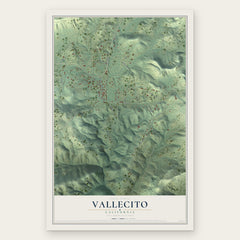
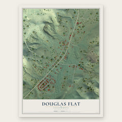

More maps nearby: Murphys, Columbia, Mountain Ranch, Copperopolis and Sheep Ranch.
The art of mapping a place
How This Map Was Made
Real places. Remarkable detail. Discover the layers that turn geographic data into a map of home.

The view from above
Aerial imagery reveals the character of the land: woodland, open fields, and the patterns of a place.

The shape of the land
Elevation data brings hills, valleys, and subtle changes in the landscape into view.

The details of home
Roads, waterways, and building footprints come together to make the map feel unmistakably local.

Geography becomes art
Considered color, shading, and typography bring the layers together in a map made for your wall.


Process illustrated with Mendon, Massachusetts. Aerial imagery: USDA NAIP. Terrain: USGS 3D Elevation Program. Map details and finished artwork: KNOWOL.
The Details
About This Print
Choose an archival matte print, or a black or white Ayous wood frame. The archival matte print is unframed.
Select your size and finish above to see the matching product image and price.
Materials & Craftsmanship
A contemporary map with the character of a classic atlas, printed on archival matte paper. Optional frames are made from Ayous wood.
Your printed map does not include the watermark shown in the full-map preview.
Shipping & Delivery
Free shipping within the United States. Every print is made to order in the USA.
Buying a gift? Add a note in your cart and we'll include it. We never put prices in the package.
Prints ship within 2 to 3 business days. Allow 7 to 10 days total from ordering for delivery. Timing may vary during holidays or periods of high order volume.
Read our shipping policy.
Returns and damaged prints
Each print is made to order. Change-of-mind refunds are not available after production.
If your print arrives damaged, misprinted or incorrect, contact support@knowol.com within 30 days of receiving it. Include your order number, photos and a description of the issue.
Read our full refund and replacement policy. For questions about your order, email support@knowol.com.