


Search for another town





Free U.S. delivery 7 to 10 days after you order
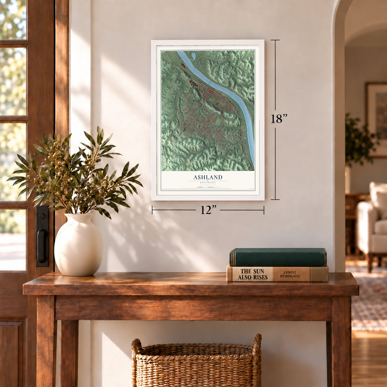
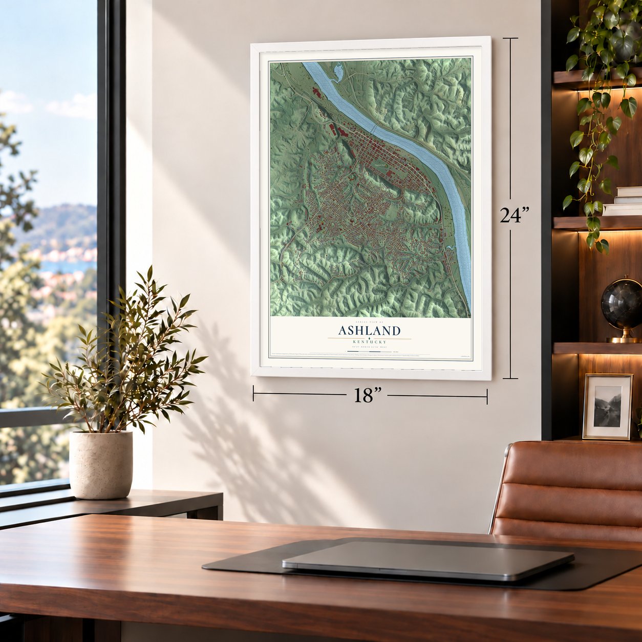
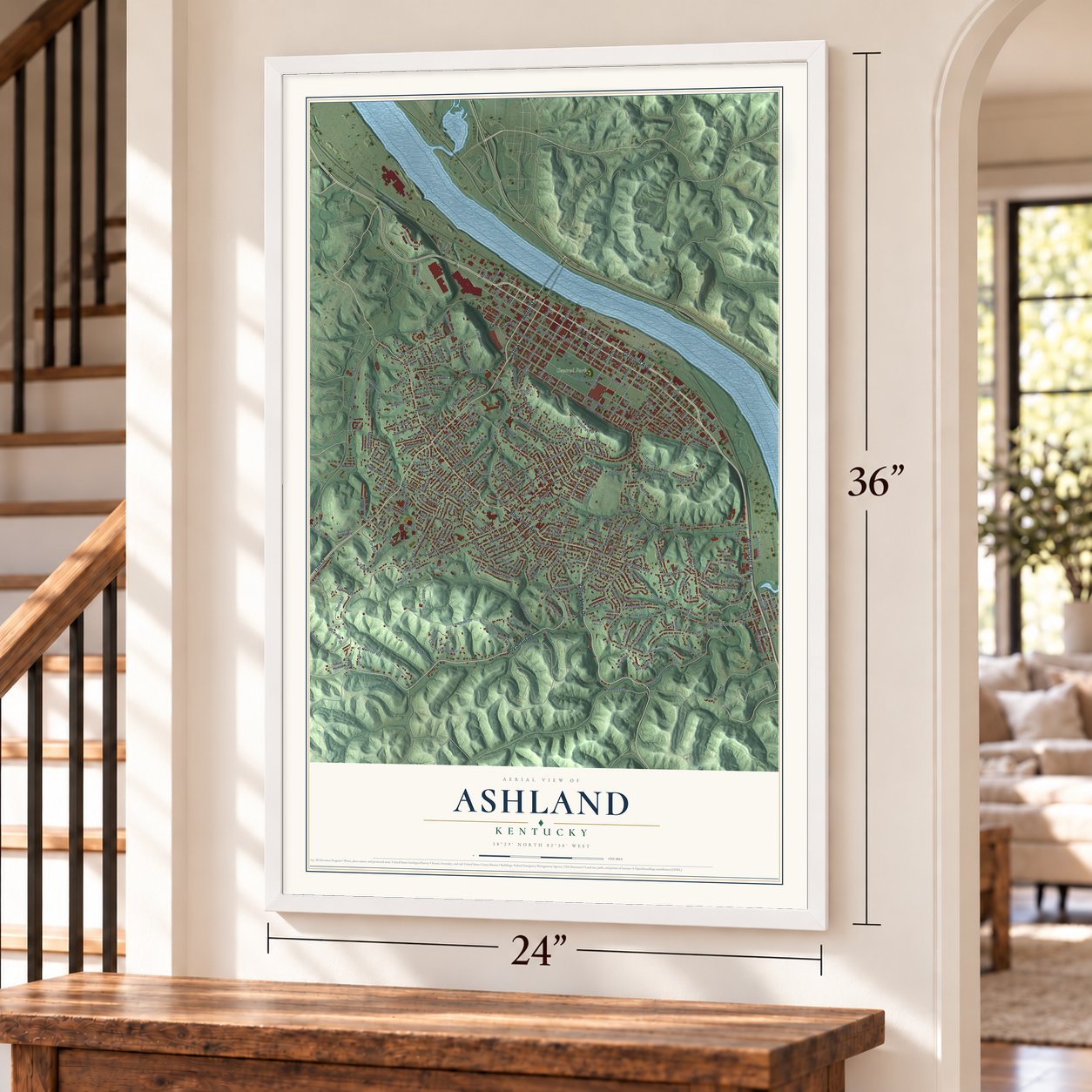
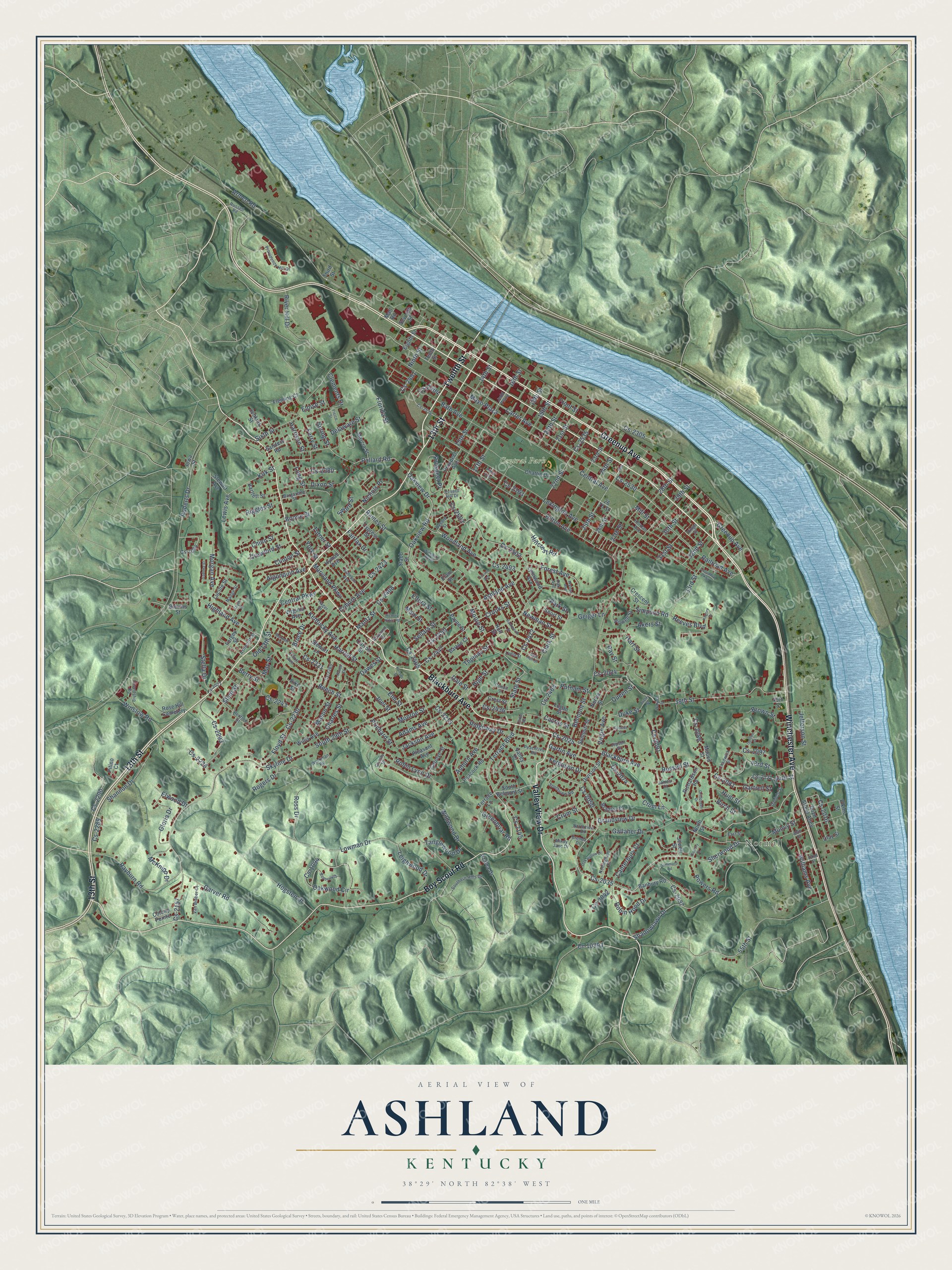
Ashland, Kentucky Map Art
Building by building, with labeled streets and shaded relief.
12" x 18" Archival Matte Print
A Map of Home. A Work of Art.
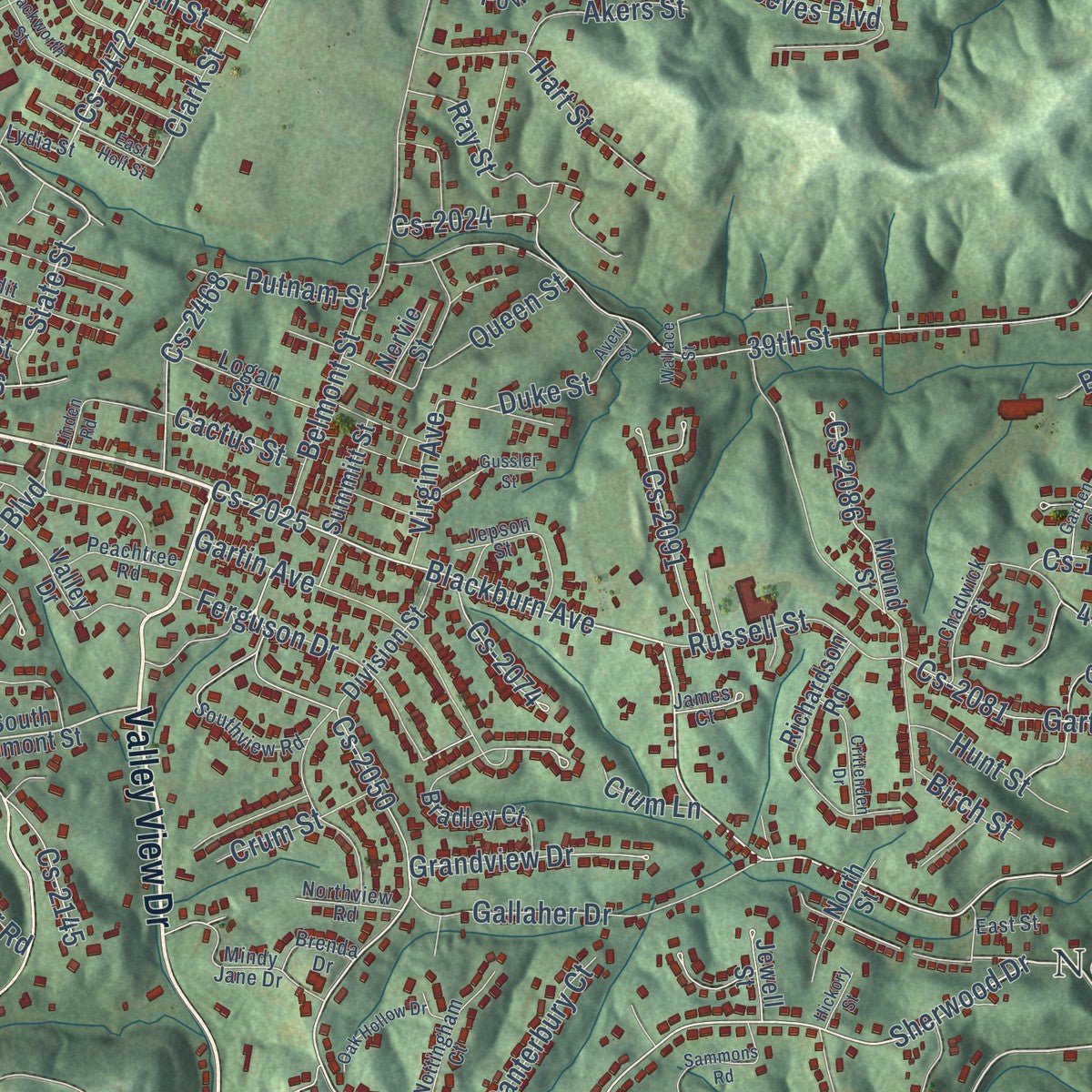
Explore Ashland, Kentucky from a whole new perspective. Created using aerial imagery and detailed geographic data, this map captures Ashland building by building, with labeled streets, familiar landmarks, and shaded topographical relief that highlights the natural contours of the landscape.
Combining modern data with the timeless character of a vintage atlas, this map is just as interesting up close as it is beautiful on the wall. Whether you grew up in Ashland, spent memorable years there, or call it home today, this unique map is a great way to celebrate a place that means something to you. Zoom in on the preview to look for your street, and then order a print to put your memories on the wall.
Three ways to hang it
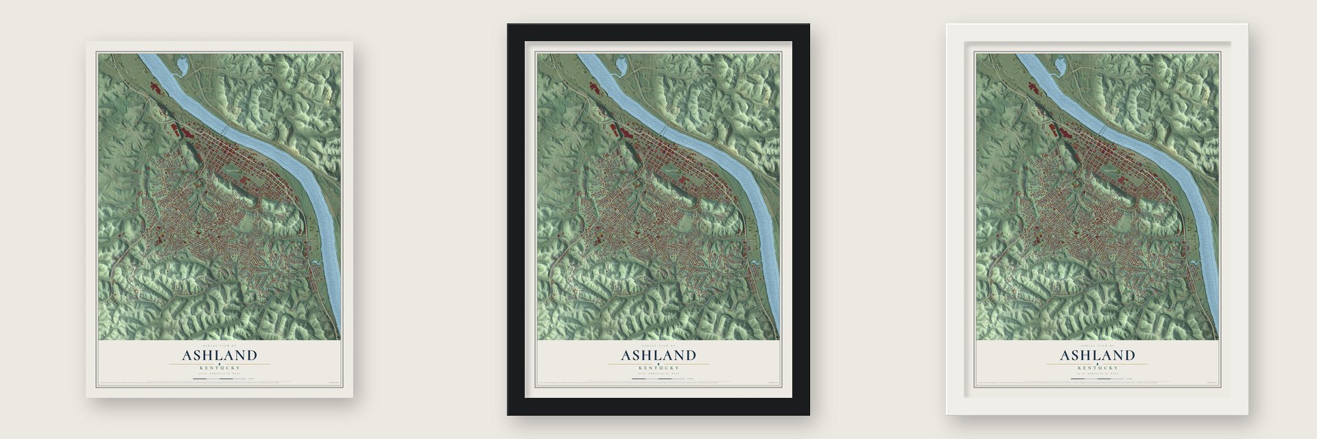
Unframed archival matte, a black wood frame or a white wood frame.
Up close
Geography Worth Displaying
This map was created using accurate cartographic data and authoritative geographic sources, including the U.S. Geological Survey and the Census Bureau. The map brings together terrain, waterways, roads, and building detail. The majority of the streets are labeled, houses are accurately depicted, and the topography is derived from government sources. Combining local data with carefully composed color and shading leads to this beautifully detailed Ashland artwork for your wall.
Rather than simply showing street outlines, we’ve included as many of the street names as we could reasonably fit on the map while keeping their names legible. Zoom in on the high resolution preview to see exactly what’s on the map. We truly set out to create a statement piece for anyone who loves Ashland. So whether it’s for you, or a gift for someone you love, we hope this map of Ashland brings back fond memories.
Read the story behind this map of Ashland, Kentucky from 2026.

Find your street
Names on the Ashland map
Every name below is printed on this map. Look for your street, your school, the park where you played, or the pond down the road.
Places and landmarks3
- Normal
- Central Park
- Rose Hill Cemetery
Streets and roads332
- Winchester Avenue
- 13th Street
- Greenup Avenue
- Blackburn Avenue
- Valley View Drive
- Twelfth Street
- Boy Scout Road
- Cs-2025
- Shadowlawn Drive
- State Street
- Moore Street
- 32nd Street
- Cs-2035
- Sherwood Drive
- Cs-2050
- Grandview Drive
- Oakview Drive
- Newman Street
- Cs-2472
- 33rd Street
- Park Street
- Cs-2231
- Pollard Road
- Woodland Avenue
- Armco Road
- Auburn Avenue
- Kirk Street
- Reeves Boulevard
- Cs-2081
- Ramey Street
Show all 332 streets
- Prospect Place
- Front Street
- Central Avenue
- Carter Avenue
- Cs-2530
- Mayo Plaza
- 29th Street
- Skyline Drive
- Cs-2157
- Bath Avenue
- Lexington Avenue
- Cs-2405
- Oakview Road
- 39th Street
- Cs-2024
- Hilton Avenue
- Ashland Avenue
- Roberts Drive
- Lowman Drive
- Hogsten Drive
- Belmont Street
- River Hill Drive
- South 29th Street
- Forest Avenue
- Cs-2502
- Gartrell Street
- Beech Street
- Shannon Drive
- Terrace Boulevard
- Cs-1094
- Oakwood Circle
- Cs-2535
- Morgan Avenue
- Sixth Street
- Robin Lynn Drive
- Cs-2230
- Floyd Street
- Rayburn Road
- Crooks Street
- Cs-2447
- 22nd Street
- Garver Road
- 16th Street
- Cs-2493
- Ross Drive
- 17th Street
- 15th Street
- Long Street
- 25th Street
- Dixon Street
- Cs-2016
- Gartin Avenue
- 14th Street
- Gallaher Drive
- Cs-2503
- 43rd Street
- Ferguson Drive
- 24th Street
- Ninth Street
- Berry Street
- Jackson Avenue
- Monroe Street
- 31st Street
- Tanglewood Drive
- Adams Avenue
- Kentucky Avenue
- Ray Street
- Sellars Street
- Wildwood Drive
- 44th Street
- Robin Hood Drive
- 30th Street
- Main Street
- Williams Avenue
- Cs-2293
- 20th Street
- Cs-2408
- 21st Street
- Cs-2163
- Highland Avenue
- 18th Street
- Hart Street
- Old 13th Street
- Coburn Avenue
- 55th Street
- Hunt Street
- Simpson Road
- Leighwood Drive
- Winslow Road
- Gloria Drive
- Cs-2215
- 28th Street
- Nichols Place
- Prichard Street
- 19th Street
- Dawes Street
- Cs-2290
- Delaware Street
- Cs-2037
- Boone Street
- Russell Street
- McKnipp Drive
- Thomas Street
- Ridgeway Drive
- High Street
- Stella Drive
- May Street
- Cs-2091
- Cs-2450
- Chinn Street
- Railroad Avenue
- Cs-2145
- Algonquin Avenue
- Crum Street
- Maryland Parkway
- Cactus Street
- Elm Street
- Cs-2086
- Canterbury Court
- Slem Street
- Clements Drive
- Cs-2468
- Powers Road
- Central Parkway
- Hillcrest Road
- Putnam Street
- Cs-2226
- Crawford Street
- Mason Street
- Akers Street
- Riggles Street
- 27th Street
- Clinton Street
- Greenbriar Road
- Fairfax Drive
- Harrod Street
- Cs-2074
- Joel Street
- Virgin Avenue
- Sword Street
- Cs-2305
- Cs-2380
- Brown Street
- Queen Street
- Geiger Lane
- Elwood Drive
- Cs-2042
- Rogers Drive
- Cs-2436
- Jefferson Street
- Lewis Avenue
- Charles Street
- Cs-2243
- Cs-1097
- Clark Street
- Spring Street
- Muncy Street
- Harrison Street
- Ferry Street
- Florida Street
- Cs-2423
- Birch Street
- Cs-2404
- Turner Street
- Duke Street
- Eltura Street
- Mantz Street
- Cs-2401
- Crum Lane
- Bruce Drive
- Cs-2289
- Mill Street
- Eloise Street
- York Street
- Dale Street
- South Belmont Street
- Elkins Street
- 23rd Street
- Prospect Avenue
- Eighth Street
- Chattin Drive
- Cs-2121
- Holt Street
- Peacock Road
- Bradley Court
- Pleasant Avenue
- Banbury Road
- Richardson Road
- Clay Street
- Mound Street
- Willis Avenue
- Division Street
- Cs-1064
- Seventh Street
- Virginia Avenue
- 26th Street
- Marcia Street
- Crest Street
- Powell Street
- Tenth Street
- Summitt Street
- Lucille Street
- Boyd Street Alley
- Payne Street
- Logan Street
- Forgey Street
- 40th Street
- Crescent Street
- Hyman Avenue
- Stewart Lane
- Barton Court
- Carolyn Street
- North Street
- Lynnwood Avenue
- Colony Pointe
- Valley Drive
- Jenkins Street
- Fleming Court
- Bartlett Street
- Carroll Street
- Terrace Lane
- Stewart Avenue
- Short Street
- Azalea Drive
- 26 Th Street
- Jewell Street
- Cypress Street
- Pitino Court
- Stabb Street
- Sanders Road
- Blevins Street
- Nervie Street
- Elam Street
- Iowa Street
- Third Street
- Mall Road
- Pike Street
- Dysard Hill Drive
- Providence Hill Drive
- Cs-2534
- Southview Road
- Wilshire Boulevard
- Cs-2265
- Southern Hills Drive
- Elliott Avenue
- Friendship Road
- Mindy Jane Drive
- Nottingham Court
- Altamont Drive
- Condit Street
- Daniels Street
- Dysard Street
- Johnson Avenue
- Brenda Drive
- Peachtree Road
- Van Bibber Court
- Chadwick Street
- Ashworth Street
- Margarette Street
- Hager Street
- Northview Road
- Lydia Street
- Workman Road
- Madge Street
- Jepson Street
- Herman Avenue
- James Court
- Russell Road
- Oak Avenue
- Christy Street
- Cs-2022
- Renfroe Street
- 52nd Street
- 49th Street
- East Street
- Judd Plaza
- Ringo Street
- Hackworth Street
- Hickory Ridge Road
- Hilton Alley
- Bayberry Drive
- Sammons Road
- Pierce Street
- Cogan Street
- Kansas Street
- Locust Avenue
- Crittenden Drive
- Maxwell Street
- Oak Hollow Drive
- Gussler Street
- Garden Court
- Kilgore Drive
- East Holt Street
- Ladoka Street
- Walnut Avenue
- Ranch Court
- Columbia Parkway
- Avery Street
- Wallace Street
- Hickory Street
- 25th
- Linden Road
Names are listed as they appear on the printed map. Zoom into the product photos to find them.
About Ashland, Kentucky
Ashland is a city of 21,625 people in Boyd County, on the south bank of the Ohio River where Kentucky meets Ohio, close to West Virginia. In 1786 the Poage family left the Shenandoah Valley, crossed the Cumberland Gap and built a homestead beside the river, which people called Poage's Landing. For decades the settlement around it was mostly one big extended family.
That changed in 1854. The Kentucky General Assembly chartered the Kentucky Iron, Coal, and Manufacturing Company to build on the valley's pig iron trade. The same year the town took the name Ashland, for Henry Clay's estate in Lexington. The legislature incorporated the city in 1856, and later its big employers included Armco, Ashland Oil and Refining Company and the C&O Railroad.
- Armco's Ashland WorksAmerican Rolling Mill Co. opened its Ashland Works steel mill on the Ohio River in 1922. The plant spread over 700 acres, set world production records and at its peak employed about 7,000 people. Residents held scrap drives to keep it running during World War II. Armco later became part of AK Steel, which closed the mill for good in 2019.
- The Paramount, built in 1930The Paramount Theatre on Winchester Avenue was built in 1930 as an Art Deco movie house, and it joined the National Register in 1975. As the Paramount Arts Center it now stages shows for eastern Kentucky, Ohio and West Virginia, teaches summer classes for children and hosts the Festival of Trees each winter.
- Mounds in Central ParkThe Indian Mounds in Ashland's 47-acre Central Park are on the National Register. So are the First Presbyterian Church, listed in 1973, the Henry Clay Hotel in 1984, the U.S. Post Office in 1988 and the Ashland Armory in 2002.
- Tomcats under the lightsThe Ashland Tomcats played their first game under the lights at Putnam Stadium in 1944, and the stadium is still their home field. The football program has won 11 state championships, and the boys' basketball team has won a national title and 4 state titles.
Keep exploring Kentucky
Ashland is one of 659 Kentucky towns we've mapped. Every dot on the map is a print of its own.
The search covers every state, Kentucky first.
Near Ashland
Order 2 or more town maps and save 10%. Shown in the size and finish you picked above, so they hang as a set.
- Ironville 12" x 18" / Archival Matte Print $39.99
- Summit 12" x 18" / Archival Matte Print $39.99
- Bellefonte 12" x 18" / Archival Matte Print $39.99

More maps nearby: Catlettsburg, Russell, Cannonsburg, Flatwoods and Raceland.
The art of mapping a place
How This Map Was Made
Real places. Remarkable detail. Discover the layers that turn geographic data into a map of home.

The view from above
Aerial imagery reveals the character of the land: woodland, open fields, and the patterns of a place.

The shape of the land
Elevation data brings hills, valleys, and subtle changes in the landscape into view.

The details of home
Roads, waterways, and building footprints come together to make the map feel unmistakably local.

Geography becomes art
Considered color, shading, and typography bring the layers together in a map made for your wall.


Process illustrated with Mendon, Massachusetts. Aerial imagery: USDA NAIP. Terrain: USGS 3D Elevation Program. Map details and finished artwork: KNOWOL.
The Details
About This Print
Choose an archival matte print, or a black or white Ayous wood frame. The archival matte print is unframed.
Select your size and finish above to see the matching product image and price.
Materials & Craftsmanship
A contemporary map with the character of a classic atlas, printed on archival matte paper. Optional frames are made from Ayous wood.
Your printed map does not include the watermark shown in the full-map preview.
Shipping & Delivery
Free shipping within the United States. Every print is made to order in the USA.
Buying a gift? Add a note in your cart and we'll include it. We never put prices in the package.
Prints ship within 2 to 3 business days. Allow 7 to 10 days total from ordering for delivery. Timing may vary during holidays or periods of high order volume.
Read our shipping policy.
Returns and damaged prints
Each print is made to order. Change-of-mind refunds are not available after production.
If your print arrives damaged, misprinted or incorrect, contact support@knowol.com within 30 days of receiving it. Include your order number, photos and a description of the issue.
Read our full refund and replacement policy. For questions about your order, email support@knowol.com.