


Search for another town





Free U.S. delivery 7 to 10 days after you order
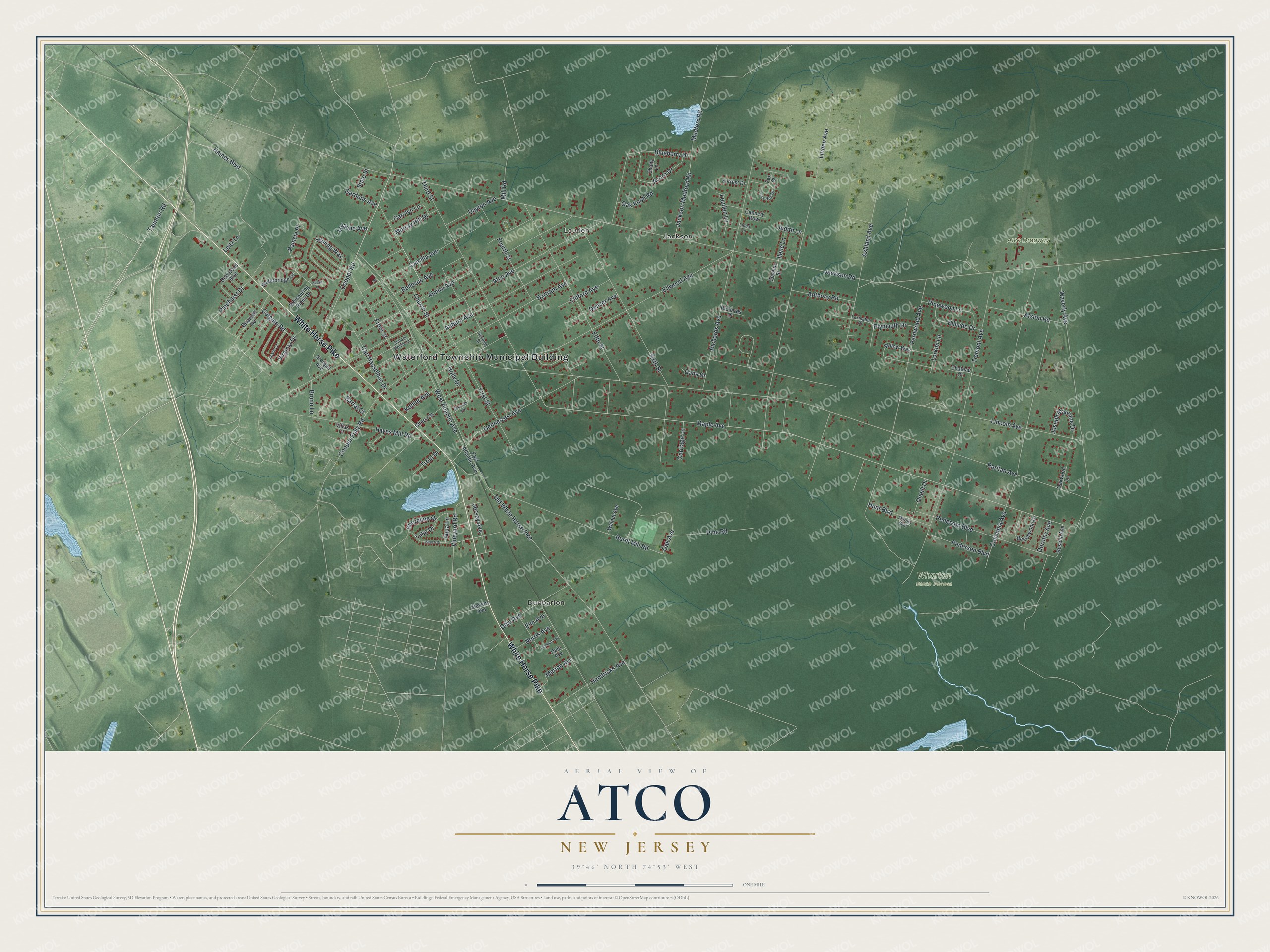
Atco, New Jersey Map Art
Building by building, with labeled streets and shaded relief.
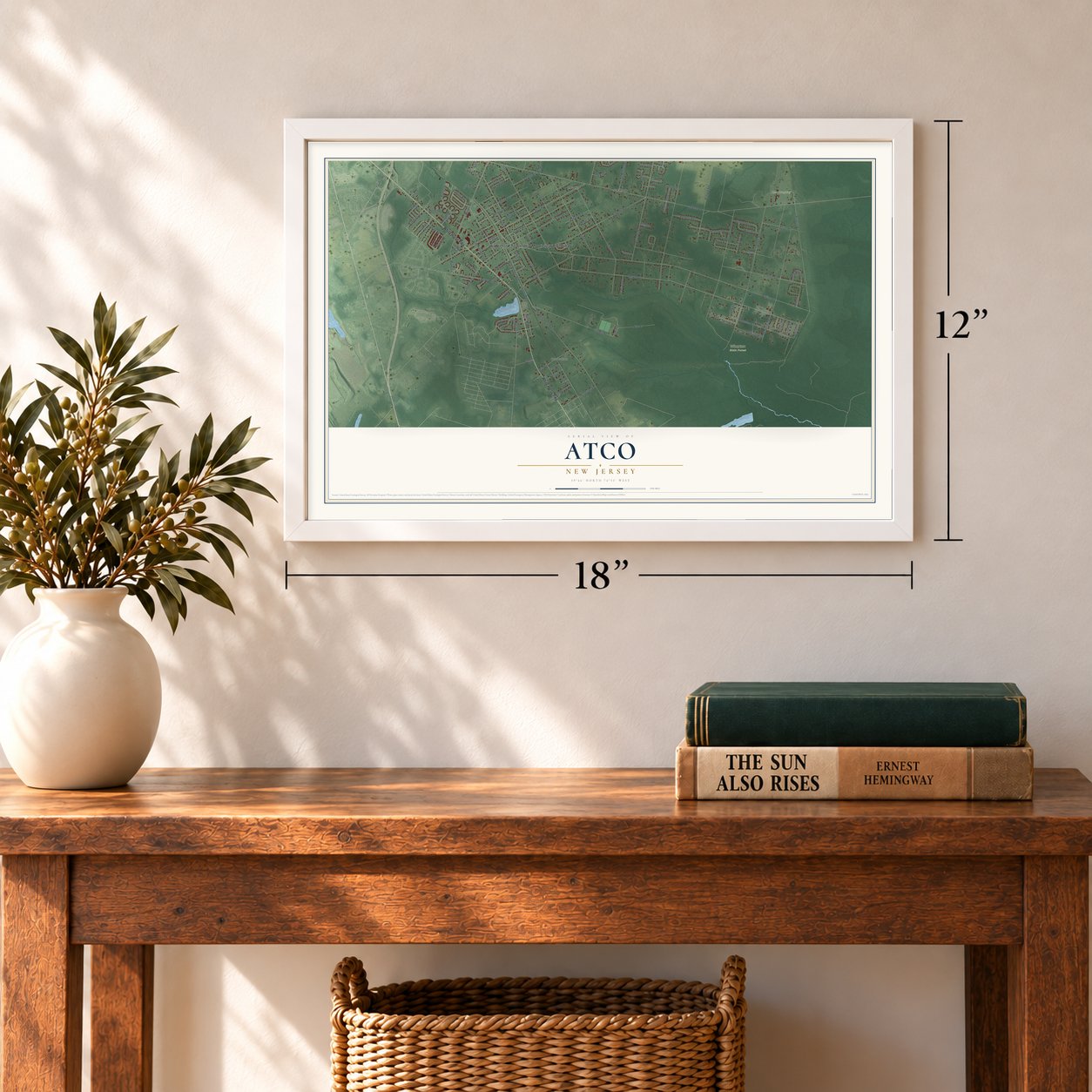
12" x 18" Archival Matte Print
A Map of Home. A Work of Art.
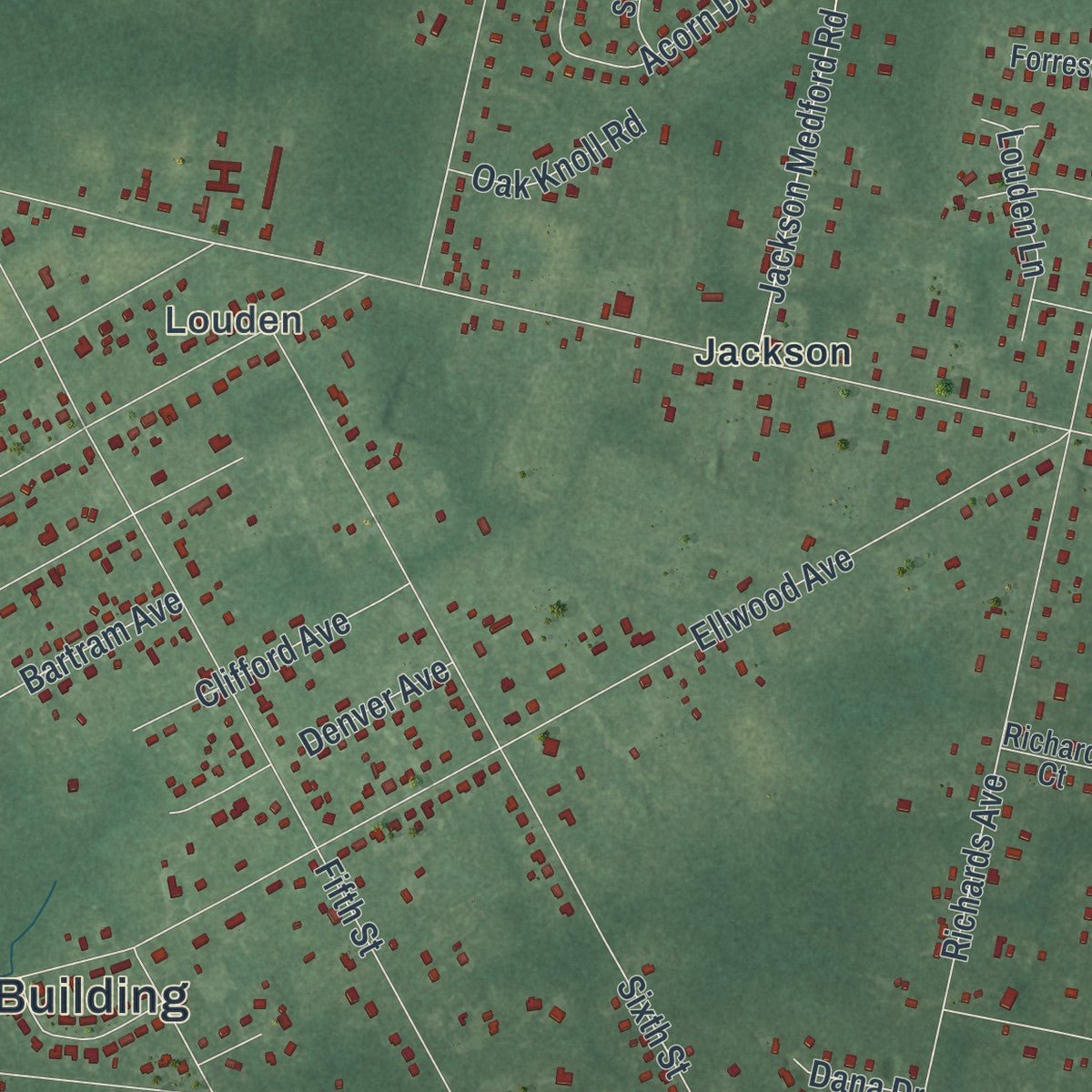
Explore Atco, New Jersey from a whole new perspective. Created using aerial imagery and detailed geographic data, this map captures Atco building by building, with labeled streets, familiar landmarks, and shaded topographical relief that highlights the natural contours of the landscape.
Combining modern data with the timeless character of a vintage atlas, this map is just as interesting up close as it is beautiful on the wall. Whether you grew up in Atco, spent memorable years there, or call it home today, this unique map is a great way to celebrate a place that means something to you. Zoom in on the preview to look for your street, and then order a print to put your memories on the wall.
Three ways to hang it
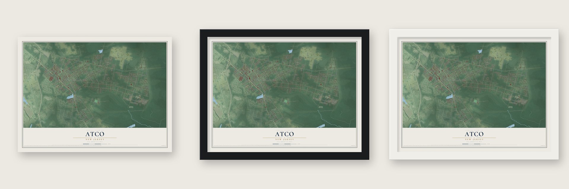
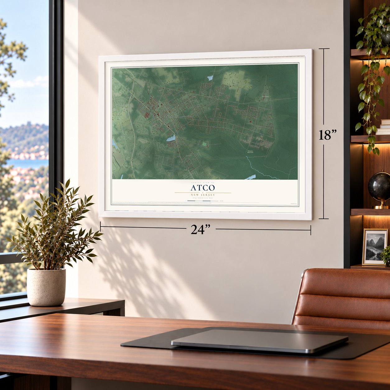
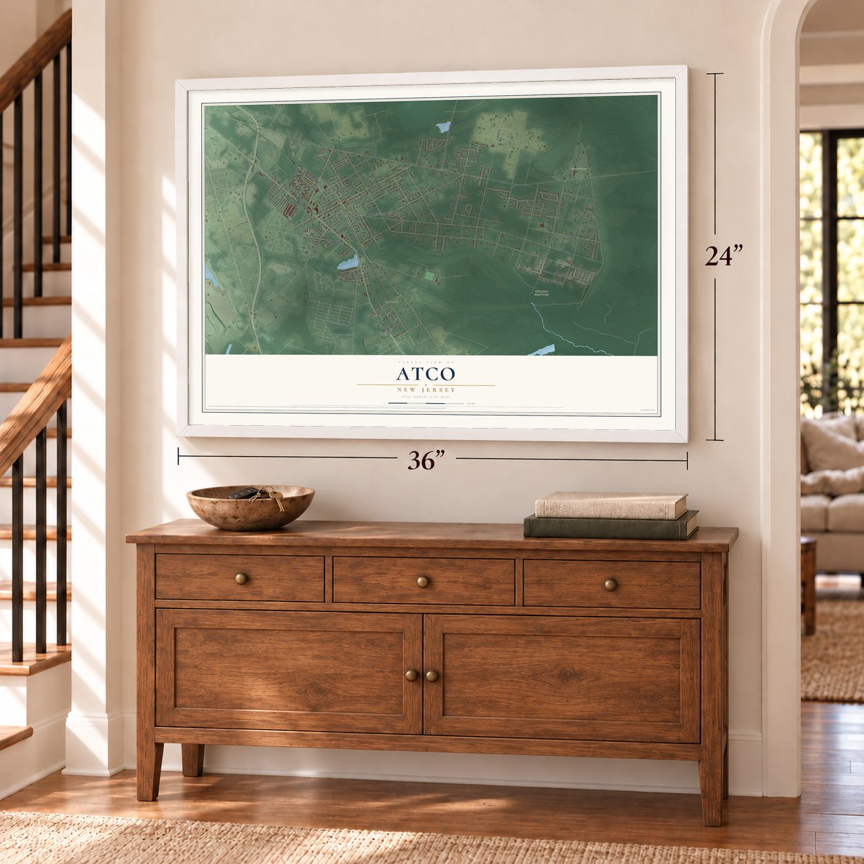
Unframed archival matte, a black wood frame or a white wood frame.
Up close
Geography Worth Displaying
This map was created using accurate cartographic data and authoritative geographic sources, including the U.S. Geological Survey (USGS) and FEMA. The map brings together terrain, waterways, roads, and building detail. The majority of the streets are labeled, houses are accurately depicted, and the topography is derived from government sources. Combining local data with carefully composed color and shading leads to this beautifully detailed Atco artwork for your wall.
Rather than simply showing street outlines, we’ve included as many of the street names as we could reasonably fit on the map while keeping their names legible. Zoom in on the high resolution preview to see exactly what’s on the map. We truly set out to create a statement piece for anyone who loves Atco. So whether it’s for you, or a gift for someone you love, we hope this map of Atco brings back fond memories.
Explore the full map of Atco, New Jersey and read about the local places it shows.

Find your street
Names on the Atco map
Every name below is printed on this map. Look for your street, your school, the park where you played, or the pond down the road.
Places and landmarks6
- Waterford Township Municipal Building
- Dunbarton
- Louden
- Atco Dragway
- Wharton State Forest
- Jackson
Streets and roads123
- White Horse Pike
- Cooper Road
- Taunton Road
- Pamela Place
- First Street
- Maple Avenue
- Jackson Medford Road
- Oak Avenue
- Raritan Avenue
- Jackson Road
- Atco Avenue
- Waverly Avenue
- Linden Avenue
- Tremont Avenue
- West Atlantic Avenue
- Fernwood Avenue
- Lincoln Avenue
- Old White Horse Pike
- Ellwood Avenue
- Third Street
- Columbia Avenue
- Sixth Street
- Auburn Avenue
- Ashland Avenue
- Richards Avenue
- Fifth Street
- Bartram Avenue
- Almira Avenue
- Burnt Mill Road
- Haines Boulevard
Show all 123 streets
- Pederson Boulevard
- Front Street
- Gennessee Avenue
- Fourth Street
- Clifford Avenue
- Bellevue Avenue
- Medford Road
- Camilla Avenue
- Hayes Mill Road
- Gardens Avenue
- Atsion Road
- Sapling Way
- Virginia Drive
- Carl Hasselhan Drive
- Dayton Avenue
- Church Street
- Vineyard Road
- Colgate Road
- Acorn Drive
- Hendricks Avenue
- Ohio Avenue
- Hunt Boulevard
- Cooper Folly Road
- Pinewood Lane
- Pine Road
- Anthony Road
- Blueberry Drive
- Hillside Drive
- Joseph Maurone Drive
- Bruno Lane
- Pedersen Boulevard
- Denver Avenue
- Lake Drive
- Jersey Avenue
- Carolyn Lane
- Murray Hill Drive
- Merion Avenue
- Pinehurst Drive
- Louden Lane
- Norris Avenue
- Plymouth Drive
- Kohler Avenue
- Holly Drive
- Oak Knoll Road
- Shoreline Drive
- Lorkim Lane
- Carriage Lane
- Lelache Avenue
- Trout Drive
- Elm Avenue
- Dorothy Avenue
- Oneill Drive
- Ilene Lane
- Mill Road
- Aqua Lane
- Leitz Lane
- State Street
- Judith Lane
- Bartal Court
- Dana Drive
- Rosella Avenue
- East Atlantic Avenue
- Whispering Pines Drive
- Beechwood Drive
- Willow Way
- Briarcliff Road
- Waterbridge Drive
- Granger Avenue
- Cherry Street
- Fox Court
- Walnut Avenue
- Shady Lane
- Deerpond Boulevard
- Oakwood Lane
- Forrest Drive
- Cannery Row
- Chateau Court
- Richards Court
- Sesame Street
- Villas Court
- Stevens Avenue
- Dale Avenue
- Second Street
- Fox Run Drive
- Martha Boulevard
- Lexington Drive
- Josie Lane
- School House Lane
- Linda Lane
- Beach Drive
- Lambert Avenue
- Sherman Avenue
- Susan Court
Names are listed as they appear on the printed map. Zoom into the product photos to find them.
About Atco, New Jersey
Atco is a community of 9,058 people in Waterford Township, Camden County, on the western fringe of the Pine Barrens and Wharton State Forest. The Camden and Atlantic Railroad, founded in 1854, built its line through the Pinelands to reach Atlantic City. Soon afterward the Raritan and Delaware Bay Railroad came through as well, linking the place with Toms River, Waretown, Atsion and Vineland.
The name most likely comes from the Atlantic Transport Company of West Virginia. Between 1902 and 1903 that company placed a contract for four large ships with Camden's New York Shipbuilding Corporation, and the name Atco may have caught on around then. Another story says the word comes from a native phrase for "land of many deer."
- Waterford, chartered in 1695A royal charter created Waterford Township on June 1, 1695, when this ground still belonged to Gloucester County, and the township took its name from Waterford, Ireland. Waterford was one of the original townships when Camden County was formed in 1844, and its village of Long-a-Coming, now the borough of Berlin, served as the county seat until 1848. The township later gave up land to create Cherry Hill, Chesilhurst, Voorhees and Berlin Township.
- Atco Dragway, 1959 to 2023The quarter-mile drag strip opened in 1959 as the Atco Raceway and later became the Atco Dragway. It ran under NHRA sanction and was counted as the oldest drag strip in New Jersey. An episode of Viva La Bam was shot there in 2005, and Atco also served as a location for the movie Eddie and the Cruisers. The dragway shut down without warning on July 18, 2023.
- A train station since 1989Atco station opened on September 17, 1989, on NJ Transit's Atlantic City Line, which runs between Philadelphia's 30th Street Station and Atlantic City. It stands off Route 73 where the old Bishop's Bridge station used to be.
Keep exploring New Jersey
Atco is one of 990 New Jersey towns we've mapped. Every dot on the map is a print of its own.
The search covers every state, New Jersey first.
Near Atco
Order 2 or more town maps and save 10%. Shown in the size and finish you picked above, so they hang as a set.
- Waterford 12" x 18" / Archival Matte Print $39.99
- Chesilhurst 12" x 18" / Archival Matte Print $39.99
- Berlin Township 12" x 18" / Archival Matte Print $39.99

More maps nearby: Berlin Borough, West Berlin, Ancora, Winslow and Pine Valley.
The art of mapping a place
How This Map Was Made
Real places. Remarkable detail. Discover the layers that turn geographic data into a map of home.

The view from above
Aerial imagery reveals the character of the land: woodland, open fields, and the patterns of a place.

The shape of the land
Elevation data brings hills, valleys, and subtle changes in the landscape into view.

The details of home
Roads, waterways, and building footprints come together to make the map feel unmistakably local.

Geography becomes art
Considered color, shading, and typography bring the layers together in a map made for your wall.


Process illustrated with Mendon, Massachusetts. Aerial imagery: USDA NAIP. Terrain: USGS 3D Elevation Program. Map details and finished artwork: KNOWOL.
The Details
About This Print
Choose an archival matte print, or a black or white Ayous wood frame. The archival matte print is unframed.
Select your size and finish above to see the matching product image and price.
Materials & Craftsmanship
A contemporary map with the character of a classic atlas, printed on archival matte paper. Optional frames are made from Ayous wood.
Your printed map does not include the watermark shown in the full-map preview.
Shipping & Delivery
Free shipping within the United States. Every print is made to order in the USA.
Buying a gift? Add a note in your cart and we'll include it. We never put prices in the package.
Prints ship within 2 to 3 business days. Allow 7 to 10 days total from ordering for delivery. Timing may vary during holidays or periods of high order volume.
Read our shipping policy.
Returns and damaged prints
Each print is made to order. Change-of-mind refunds are not available after production.
If your print arrives damaged, misprinted or incorrect, contact support@knowol.com within 30 days of receiving it. Include your order number, photos and a description of the issue.
Read our full refund and replacement policy. For questions about your order, email support@knowol.com.