
Search for another town




Free U.S. delivery 7 to 10 days after you order
Atlanta, Georgia Map Art
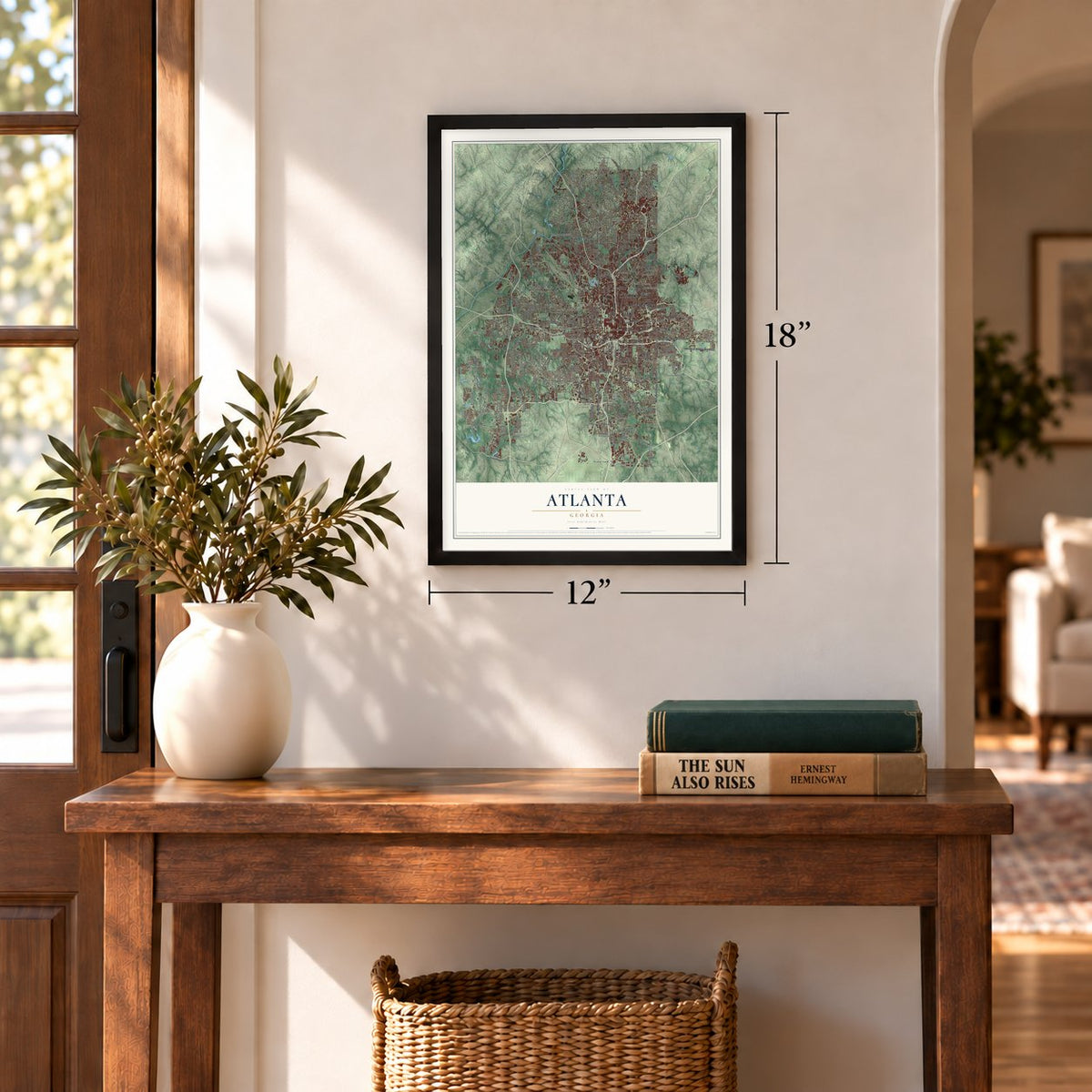
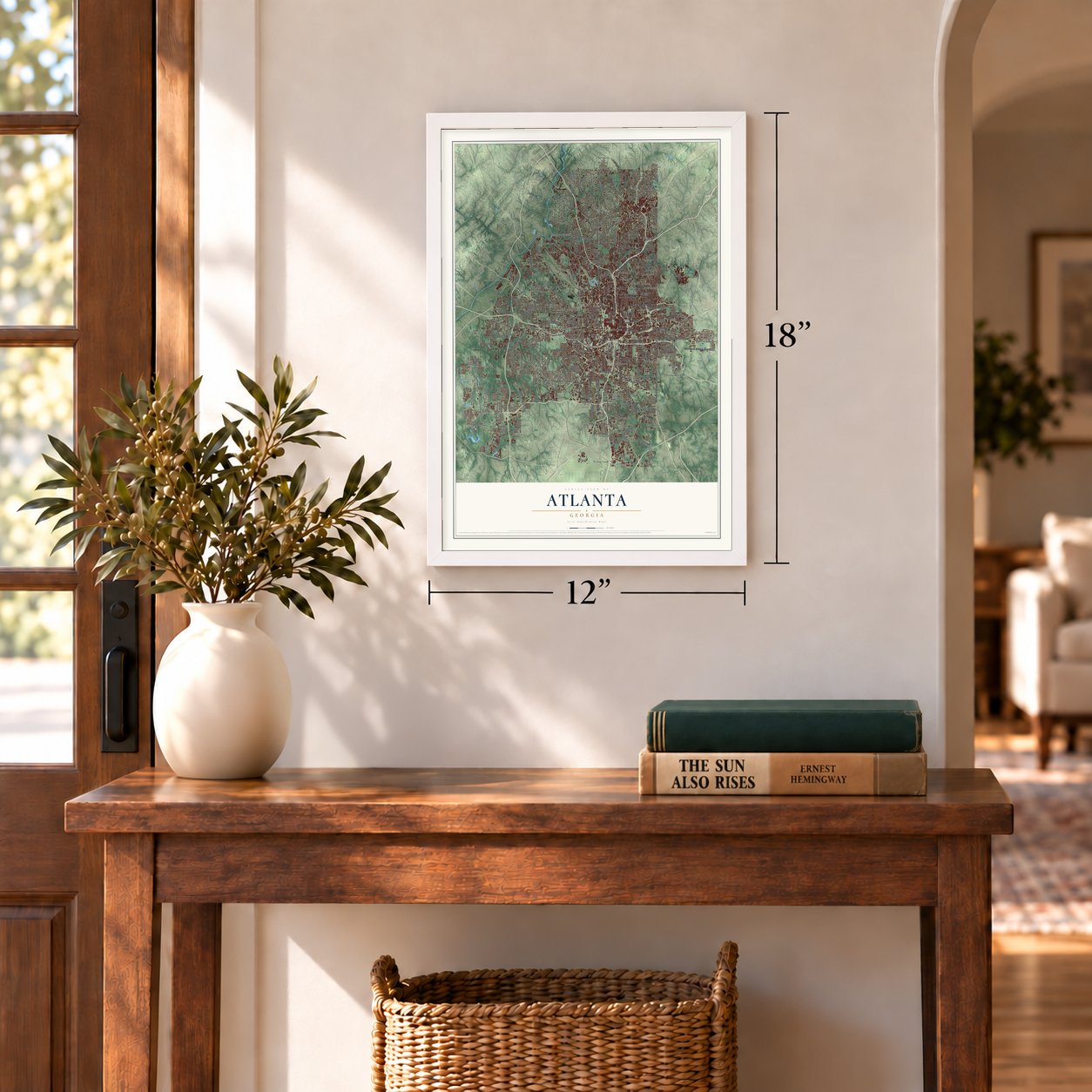
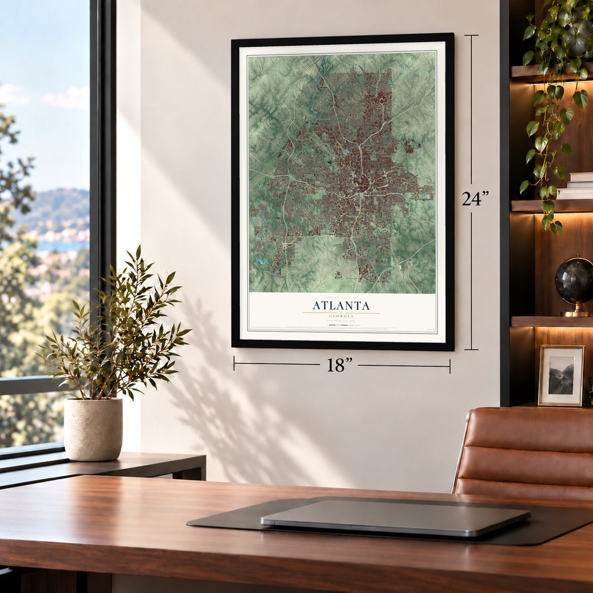
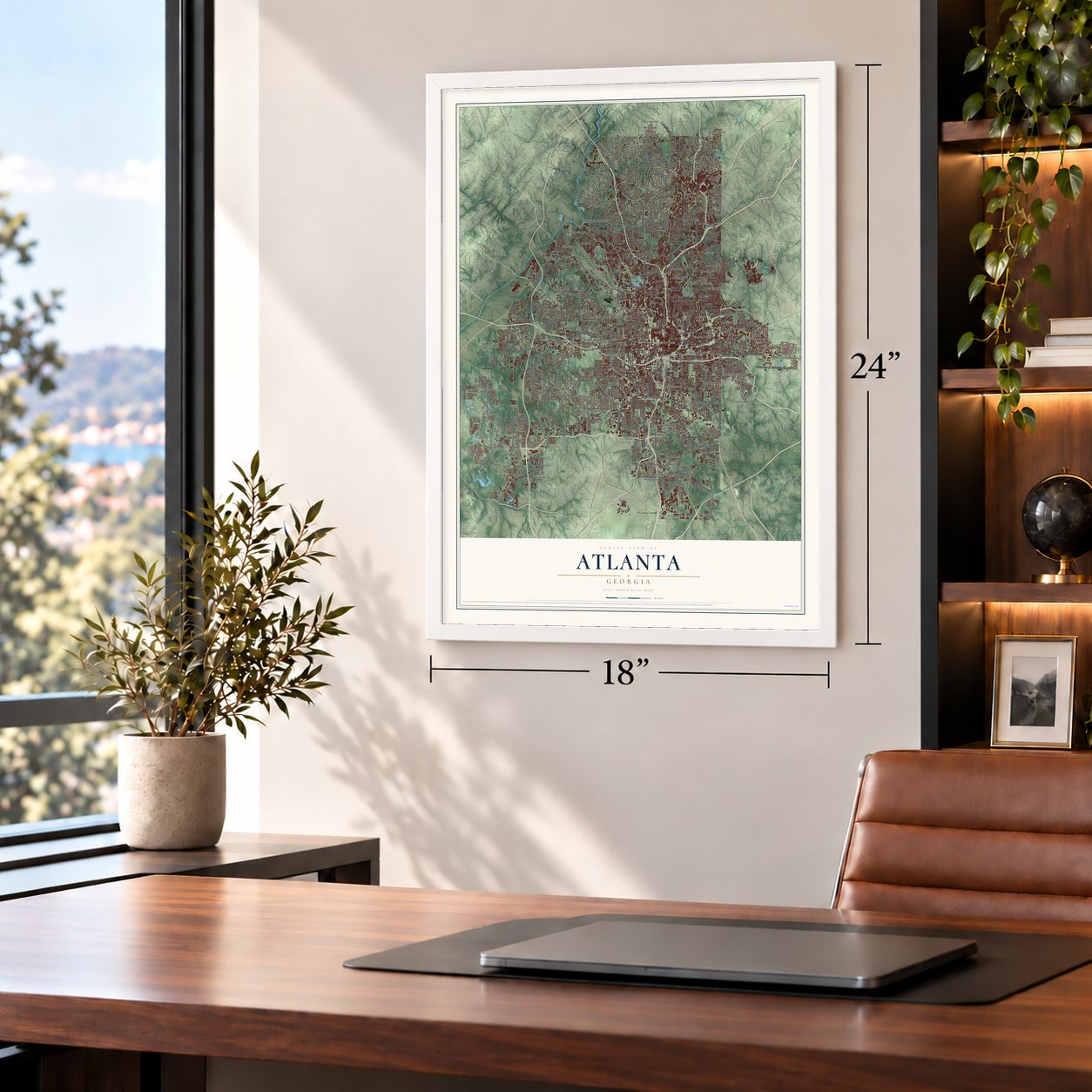
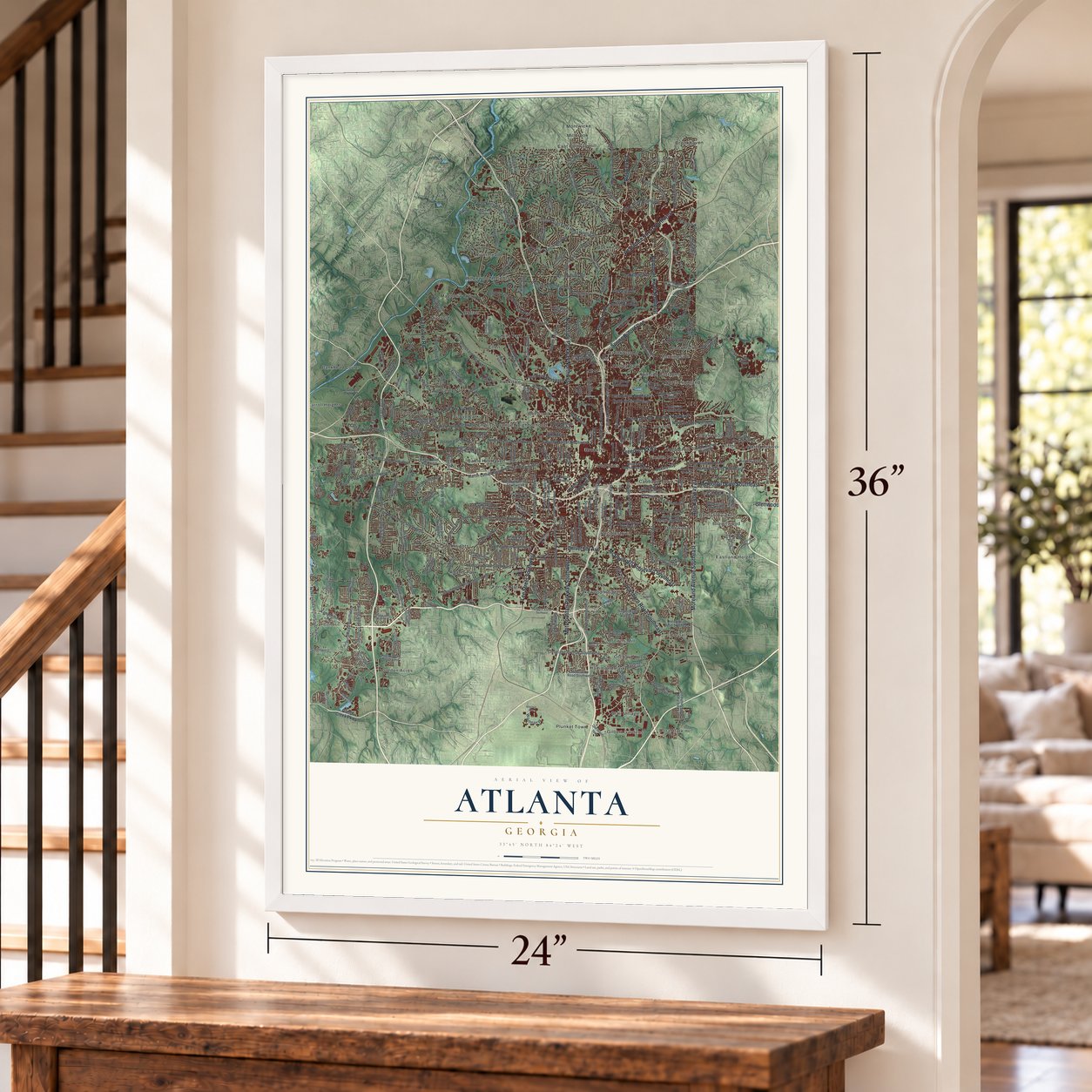
A new map of Atlanta, Georgia, made in 2026 and printed to order on thick archival matte paper.
12" x 18" Archival Matte Print
A Map of Home. A Work of Art.
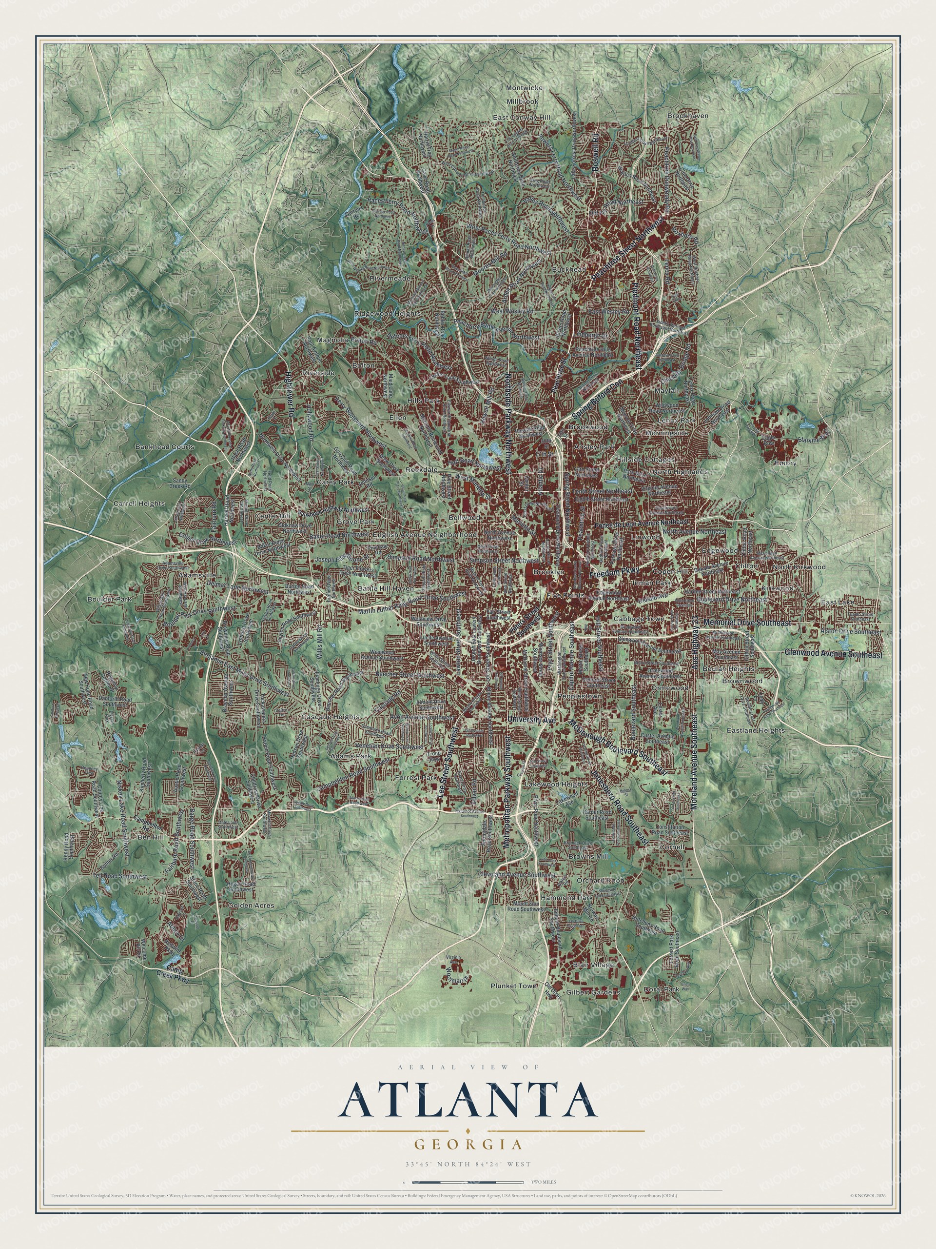
Explore Atlanta, Georgia from a whole new perspective. Created using aerial imagery and detailed geographic data, this map captures Atlanta building by building, with labeled streets, familiar landmarks, and shaded topographical relief that highlights the natural contours of the landscape.
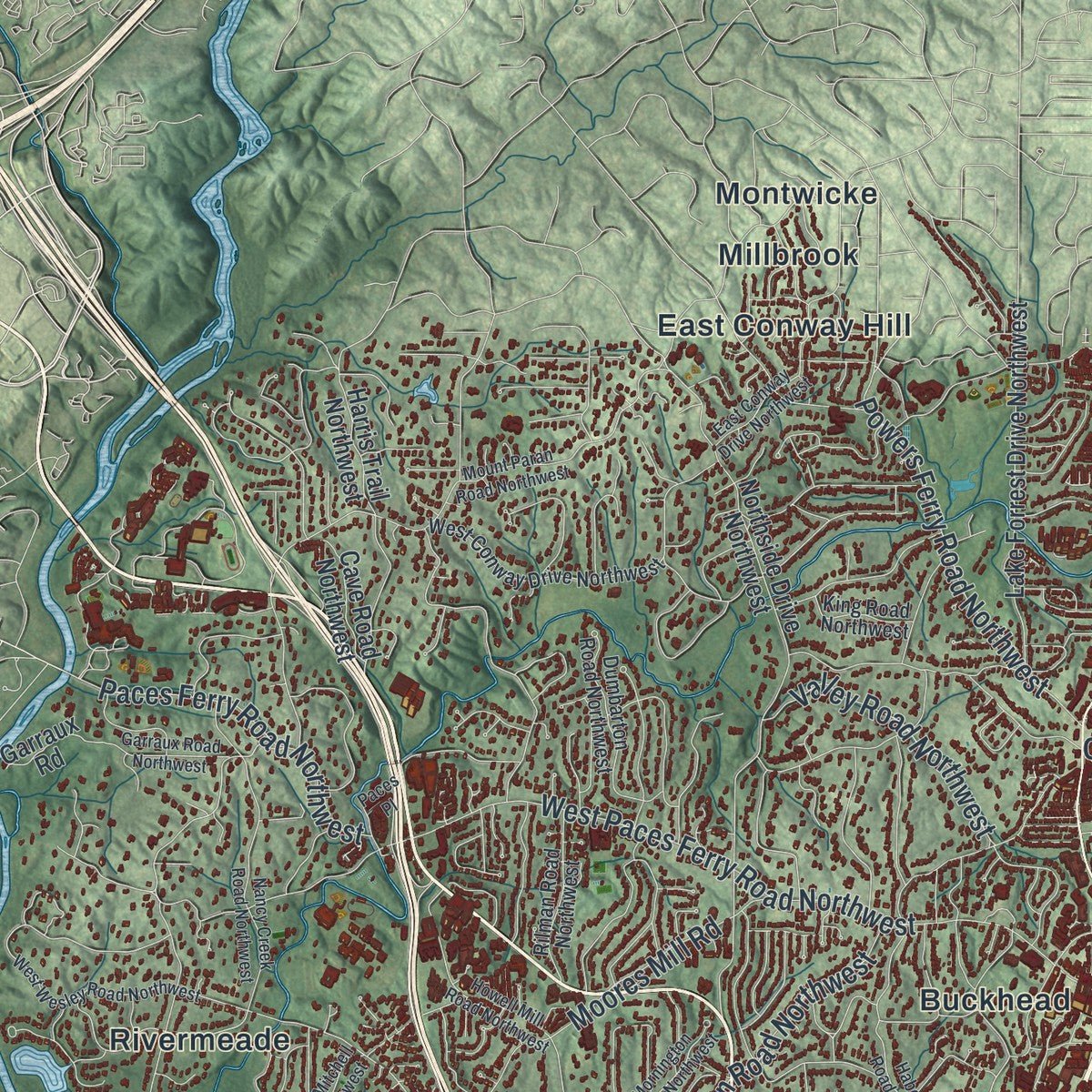
Combining modern data with the timeless character of a vintage atlas, this map is just as interesting up close as it is beautiful on the wall. Whether you grew up in Atlanta, spent memorable years there, or call it home today, this unique map is a great way to celebrate a place that means something to you. Zoom in on the preview to look for your street, and then order a print to put your memories on the wall.
Three ways to hang it
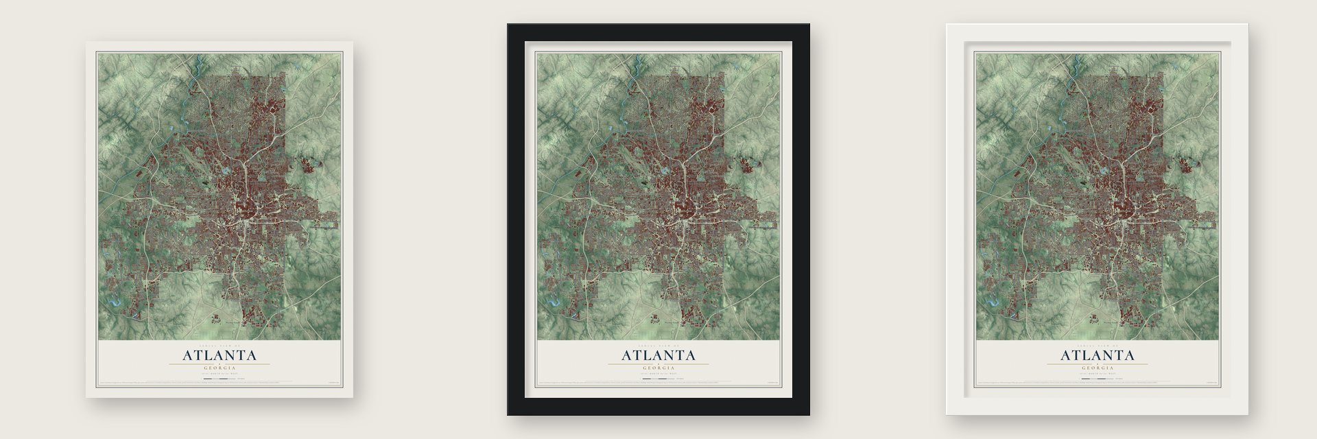
Unframed archival matte, a black wood frame or a white wood frame.
Up close
Geography Worth Displaying
This map was created using accurate cartographic data and authoritative geographic sources, including the U.S. Geological Survey (USGS) and FEMA. The map brings together terrain, waterways, roads, and building detail. The majority of the streets are labeled, houses are accurately depicted, and the topography is derived from government sources. Combining local data with carefully composed color and shading leads to this beautifully detailed Atlanta artwork for your wall.
Rather than simply showing street outlines, we’ve included as many of the street names as we could reasonably fit on the map while keeping their names legible. Zoom in on the high resolution preview to see exactly what’s on the map. We truly set out to create a statement piece for anyone who loves Atlanta. So whether it’s for you, or a gift for someone you love, we hope this map of Atlanta brings back fond memories.
Explore the full map of Atlanta, Georgia and read about the local places it shows.

About Atlanta, Georgia
Atlanta is Georgia's capital and largest city, home to 498,715 people at the 2020 census and the seat of Fulton County. In 1836 Georgia's lawmakers in the General Assembly approved a new state railroad, the Western and Atlantic, to tie the port of Savannah to the Midwest. Engineers marked the southern end of the line with a "zero milepost," set on what is now Foundry Street in Five Points.
Within a year a settlement had grown around the marker. People called it Terminus, then Thrasherville, for a merchant who put up houses and a general store there. By 1842 it had six buildings and 30 residents and took the name Marthasville, for Governor Wilson Lumpkin's daughter Martha. John Edgar Thomson of the Georgia Railroad then proposed Atlanta, after the Western and Atlantic, and the town was incorporated under that name on December 29, 1847.
“for one tavern, a blacksmith shop, a grocery store, and nothing else”
- Surrendered in 1864By 1860 Atlanta had 9,554 people, and its railroads made it a Confederate supply hub. General William Tecumseh Sherman's Union Army besieged the city for four months. On September 1, 1864, General John Bell Hood pulled out, and the next day Mayor James Calhoun surrendered. Sherman ordered civilians to leave, and the city was almost entirely burned. Atlanta rebuilt after the war, and in 1868 the state capital moved here from Milledgeville.
- Capital of the New SouthBy the 1880 census Atlanta had passed Savannah as Georgia's largest city. Henry W. Grady, editor of the Atlanta Constitution, spent the 1880s pitching it to investors as a New South city built on a modern economy instead of farming. In 1895 Atlanta held the Cotton States and International Exposition, which drew nearly 800,000 visitors.
- The Great Atlanta FireOn May 21, 1917, fire swept through what is now the Old Fourth Ward. It destroyed 1,938 buildings and left 10,000 people without homes, but only one person died.
- Gone with the Wind, 1939Margaret Mitchell of Atlanta wrote the novel, and the film premiered at Loew's Grand Theatre on December 15, 1939. Producer David O. Selznick came to the opening, along with Clark Gable, Vivien Leigh and Olivia de Havilland from the cast. Hattie McDaniel, who won an Oscar for the film, was kept out because segregation laws barred her.
- The 1956 Sugar Bowl fightGeorgia Tech was set to play Pitt, whose roster included Black fullback Bobby Grier. Governor Marvin Griffin asked that Tech stay out of integrated events, but Tech president Blake R. Van Leer refused and threatened to resign. Students from Tech and the University of Georgia marched on the governor's mansion and surrounded it until 3:30 a.m. On December 5 the board of regents voted 13 to 1 to let the game go on.
Find your street
Names on the Atlanta map
Every name below is printed on this map. Look for your street, your school, the park where you played, or the pond down the road.
Places and landmarks63
- Grant Park
- Adams Park
- Adamsville
- Ansley Park
- Bankhead Courts
- Battle Hill Haven
- Bellwood
- Ben Hill
- Beulah Heights
- Blair Village
- Bolton
- Boulder Park
Show all 63 places
- Brookhaven
- Brooklyn
- Brookwood
- Browns Mill
- Brownwood
- Buckhead
- Cabbage Town
- Carey Park
- Carroll Heights
- Cascade Heights
- Center Hill
- Clifton
- Copen Hill
- Cornell
- Doral Park
- East Conway Hill
- East Lake
- Eastland Heights
- Edgewood
- Ellen
- Emory
- English Avenue Neighborhood
- Five Points
- Forrest Park
- Gilbert Gardens
- Golden Acres
- Grove Park
- Hammond Park
- Hills Park
- Hillside Cottages
- Inman Park
- Kirkwood
- Lakewood Heights
- Lenox Park
- Linwood
- Magnolia
- Mayfair
- Millbrook
- Montwicke
- Morningside
- North Highlands
- North Kirkwood
- Orchard Knob
- Ormewood
- Peoplestown
- Plunket Town
- Ridgewood Heights
- Rivermeade
- Riverside
- Rockdale
- Elysian Park
Streets and roads288
- Northside Parkway Northwest
- Peachtree Street Northwest
- Aus Highway 23
- Moreland Avenue Southeast
- Spring Buford Con
- Freedom Parkway
- Metropolitan Parkway Southwest
- Lee Street Southwest
- Jonesboro Road Southeast
- Hightower Road
- Memorial Drive Southeast
- Piedmont Road Northeast
- Glenwood Avenue Southeast
- Roswell Road
- McDonough Boulevard Southeast
- University Avenue
- Martin Luther King Junior Drive Southwest
- Peachtree Street
- Boulevard Drive Northeast
- Spring Street Northwest
- Cleveland Avenue Southwest
- North Avenue Northeast
- Simpson Street Northwest
- Simpson Road Northwest
- Lindbergh Drive
- Joseph East Boone Street
- Fairburn Road Southwest
- Cascade Road
- West Paces Ferry Road Northwest
- Campbellton Road Southwest
Show all 288 streets
- Bolton Road
- Howell Mill Road
- Peachtree Battle Avenue Northwest
- Moores Mill Road
- Niskey Lake Road Southwest
- Hollywood Road
- Boulevard Southeast
- Benjamin East Mays Drive Southwest
- Boulder Park Drive Southwest
- Perry Boulevard Northwest
- Collier Drive Northwest
- West Wesley Road
- Marietta Street
- Lenox Road
- Hill Street Southeast
- 17th Street
- Venetian Drive Southwest
- Avon Avenue Southwest
- Valley Road Northwest
- Sylvan Road
- Beecher Street Southwest
- Powers Ferry Road Northwest
- Pryor Street Southwest
- Defoors Ferry Road Northwest
- Arden Road Northwest
- Peachtree Dunwoody Road
- Capitol Avenue Southeast
- Lawton Street Southwest
- Paces Ferry Road Northwest
- Baker Road Northwest
- Cheshire Bridge Road
- Barge Road Southwest
- Tell Road Southwest
- Fairburn Road
- Alston Drive Southeast
- Old Ivy Road Northeast
- East Wesley Road
- Huff Road Northwest
- Delmar Lane Northwest
- Dekalb Avenue
- Willis Mill Road
- Tenth Street Northeast
- Abbey Drive
- West Marietta Street
- Roxboro Road
- Atlantic Drive
- Starvine Way
- Woolman Place
- Ponce de Leon Avenue Northeast
- Peters Street Southwest
- Camp Creek Parkway
- Mount Zion Road Southwest
- 14th Street Northeast
- Northside Drive Northwest
- Parkway Drive Northeast
- Lakewood Avenue
- 20th Street
- Martin Street Southeast
- Eagle Row
- Marietta Boulevard Northwest
- Forrest Park Road Southeast
- Browns Mill Road
- Monroe Drive Northeast
- Pryor Road Southwest
- North Avenue Northwest
- Techwood Drive Northwest
- Wieuca Road Northeast
- Peyton Road Southwest
- Lynhurst Drive Southwest
- Clifton Road Northeast
- Collier Lane Southwest
- Westview Drive Southwest
- Edgewood Avenue Northeast
- Dekalb Avenue Northeast
- Kimberly Road Southwest
- Lenox Road Northeast
- Childress Drive Southwest
- Stone Road Southwest
- Club Drive Northeast
- County Line Road Southwest
- Joseph East Lowery Boulevard Southwest
- Harwell Road Northwest
- McDaniel Street Southwest
- Dodson Drive Southwest
- Springdale Road Southwest
- Brownlee Road Southwest
- Ormewood Avenue Southeast
- Northwest Drive Northwest
- Lake Forrest Drive Northwest
- Virginia Avenue Northeast
- Hogan Road Southwest
- Fair Street Southwest
- Butner Road
- Lucile Avenue Southwest
- Windsor Street Southwest
- Drew Drive Northwest
- Gun Club Road Northwest
- Johnson Road
- Harbin Road Southwest
- Custer Avenue Southeast
- Westwood Avenue Southwest
- Hutchens Road Southeast
- Tiger Flowers Drive Northwest
- Allene Avenue Southwest
- Wildwood Road Northeast
- Flamingo Drive Southwest
- Beecher Road Southwest
- Empire Boulevard Southwest
- Paul Avenue Northwest
- Bohler Road Northwest
- Clifton Street Southeast
- Peachtree Hills Avenue Northeast
- Hardee Street Northeast
- Eighth Street Northeast
- Constitution Road Southeast
- Austin Road Southwest
- Oldknow Drive Northwest
- Baker Ridge Drive Northwest
- Harper Road Southeast
- Redwine Parkway
- Johnson Road Northeast
- Danforth Road Southwest
- Braemar Avenue Southwest
- Kenny Road Southwest
- Tuckawanna Drive Southwest
- Ormond Street Southeast
- Harris Trail Northwest
- New Hope Road Southwest
- 18th Street
- Burton Road Northwest
- Maid Lane Northwest
- May Avenue Southeast
- Park Drive Northeast
- Rice Street Northwest
- Cave Road Northwest
- Regency Center Drive
- Old Dixie Highway
- Hascall Road Northwest
- Welcome All Road
- Nash Road Northwest
- Almont Drive Southwest
- Rivers Road Northwest
- Sandy Creek Road
- Garraux Road
- Center Street
- Pinedale Road
- Lester Avenue
- Troop Row
- Leah Lane
- Bankhead Highway Northwest
- Campbellton Road
- Washington Street Southwest
- Bouldercrest Drive Southeast
- McLendon Avenue Northeast
- West Conway Drive Northwest
- Sidney Marcus Boulevard Northeast
- Piedmont Avenue Northeast
- Woodward Avenue Southeast
- Ferst Drive Northwest
- Berne Street Southeast
- White Street Southwest
- West Roxboro Road Northeast
- Chappell Road Northwest
- Greenwood Avenue Northeast
- Ellsworth Industrial Drive Northwest
- Waters Road
- Sandtown Road Southwest
- Luckie Street Northwest
- Armour Drive Northeast
- Mayson Turner Road Northwest
- Loridans Drive Northeast
- Harlan Road Southwest
- Wilson Mill Road Southwest
- Cativo Drive Southwest
- Welch Street Southwest
- Evans Drive Southwest
- McPherson Avenue Southeast
- Vine Street Northwest
- Wisteria Lane Southwest
- Dumbarton Road Northwest
- Bromack Drive Southeast
- Skipper Drive Northwest
- Dale Lane Southwest
- Rilman Road Northwest
- Adamsville Drive Southwest
- Regency Trce
- King Road Northwest
- Neal Street Northwest
- Bedford Place Northeast
- Fairfield Place Northwest
- Tupelo Street Southeast
- Maxwell Drive Southwest
- Dawson Lane
- Wilson Road Northwest
- Field Road Northwest
- Virginia Avenue
- Landau Lane
- Veltre Terrace
- Lakewood Avenue Southwest
- Marietta Road Northwest
- Mount Paran Road Northwest
- West Wesley Road Northwest
- Habersham Road Northwest
- Murphy Avenue Southwest
- Nancy Creek Road Northwest
- Woodland Avenue Southeast
- Delowe Drive Southwest
- Griffin Street Northwest
- Wylie Street Southeast
- Margaret Mitchell Drive Northwest
- Springside Drive Southeast
- Browns Mill Road Southeast
- Howell Mill Road Northwest
- Dollar Mill Road Southwest
- Dill Avenue Southwest
- Fayetteville Road Southeast
- East Conway Drive Northwest
- Atlanta Industrial Parkway Northwest
- Peachtree Center Avenue Northeast
- The Fontainebleau Southwest
- East Brookhaven Drive Northeast
- Grove Park Place Northwest
- Oak Drive Southeast
- Lansing Street Southeast
- Alfred Road Northwest
- Holly Road Northwest
- Mornington Drive Northwest
- Garraux Road Northwest
- Glenview Drive Southwest
- Walthall Drive Northwest
- Alison Court Southwest
- First Street Northwest
- Lorenzo Drive Southwest
- Oakshire Way
- Peavine Creek Drive
- Gibson Street Southeast
- Willow Trail Southwest
- Dale Drive Northeast
- Main Street
- Cardova Drive Northeast
- Falcon Drive Southwest
- Turner Road Southeast
- Ivydale Drive Southwest
- Erica Way
- Casplan Street
- Guilford Forest Drive
- Watts Road Northwest
- Helena Street
- Taft Street Southwest
- Tift Avenue Southwest
- Judy Lane Southwest
- Celeste Lane
- Carousel Drive
- Paces Place
- Vale Close
- Maldo Drive
- Lofty Lane
- King Street
Names are listed as they appear on the printed map. Zoom into the product photos to find them.
The art of mapping a place
How This Map Was Made
Real places. Remarkable detail. Discover the layers that turn geographic data into a map of home.

The view from above
Aerial imagery reveals the character of the land: woodland, open fields, and the patterns of a place.

The shape of the land
Elevation data brings hills, valleys, and subtle changes in the landscape into view.

The details of home
Roads, waterways, and building footprints come together to make the map feel unmistakably local.

Geography becomes art
Considered color, shading, and typography bring the layers together in a map made for your wall.


Process illustrated with Mendon, Massachusetts. Aerial imagery: USDA NAIP. Terrain: USGS 3D Elevation Program. Map details and finished artwork: KNOWOL.
The Details
About This Print
Choose an archival matte print, or a black or white Ayous wood frame. The archival matte print is unframed.
Select your size and finish above to see the matching product image and price.
Materials & Craftsmanship
A contemporary map with the character of a classic atlas, printed on archival matte paper. Optional frames are made from Ayous wood.
Your printed map does not include the watermark shown in the full-map preview.
Shipping & Delivery
Free shipping within the United States. Every print is made to order in the USA.
Buying a gift? Add a note in your cart and we'll include it. We never put prices in the package.
Prints ship within 2 to 3 business days. Allow 7 to 10 days total from ordering for delivery. Timing may vary during holidays or periods of high order volume.
Read our shipping policy.
Returns and damaged prints
Each print is made to order. Change-of-mind refunds are not available after production.
If your print arrives damaged, misprinted or incorrect, contact support@knowol.com within 30 days of receiving it. Include your order number, photos and a description of the issue.
Read our full refund and replacement policy. For questions about your order, email support@knowol.com.
Find your town
Looking for another city?
Find a map of home in our Georgia collection, or any town in the country.
Nearby
Maps of towns near Atlanta
Know someone from one of these towns? Their map makes a great gift.
 Washington Park
, Georgia
From $39.99See the map
 Historic Westin Heights-Bankhead
, Georgia
From $39.99See the map
 Hunter Hills
, Georgia
From $39.99See the map
More maps nearby: Just Us, Vine City, Ashview Heights, English Avenue and Mozley Park.