
Search for another town





Free U.S. delivery 7 to 10 days after you order
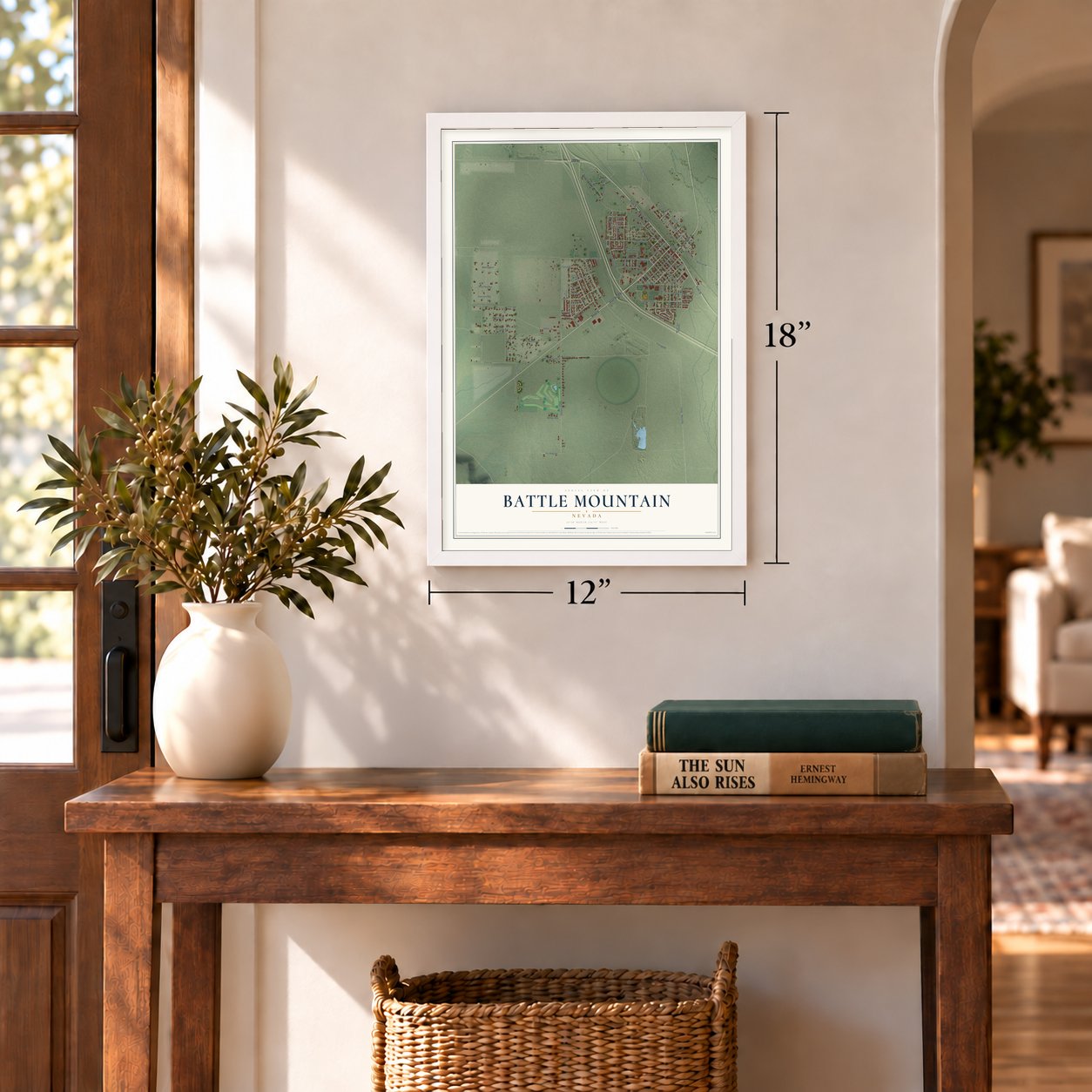
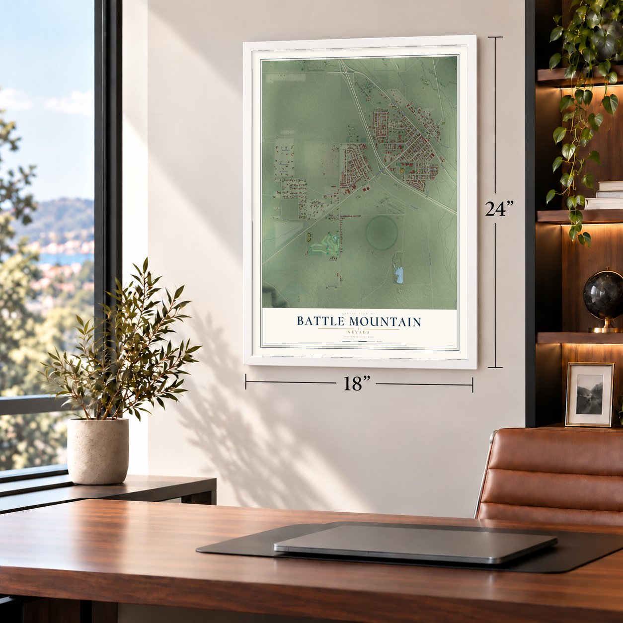
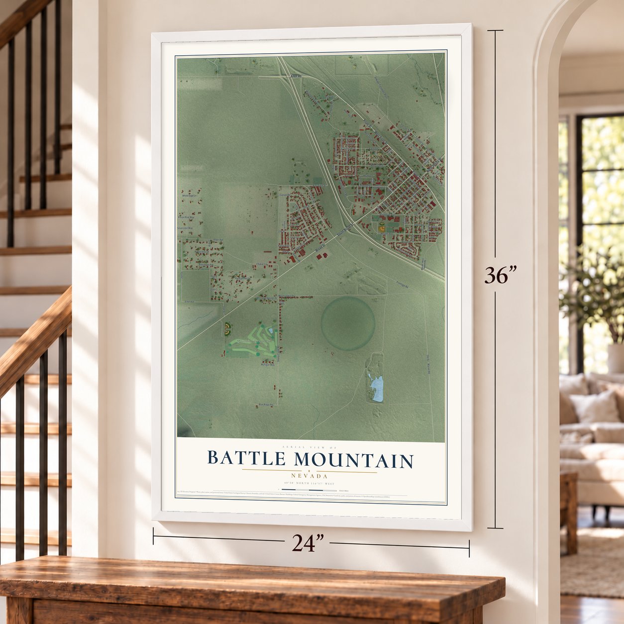
Battle Mountain, Nevada Map Art
Building by building, with labeled streets and shaded relief.
12" x 18" Archival Matte Print
A Map of Home. A Work of Art.
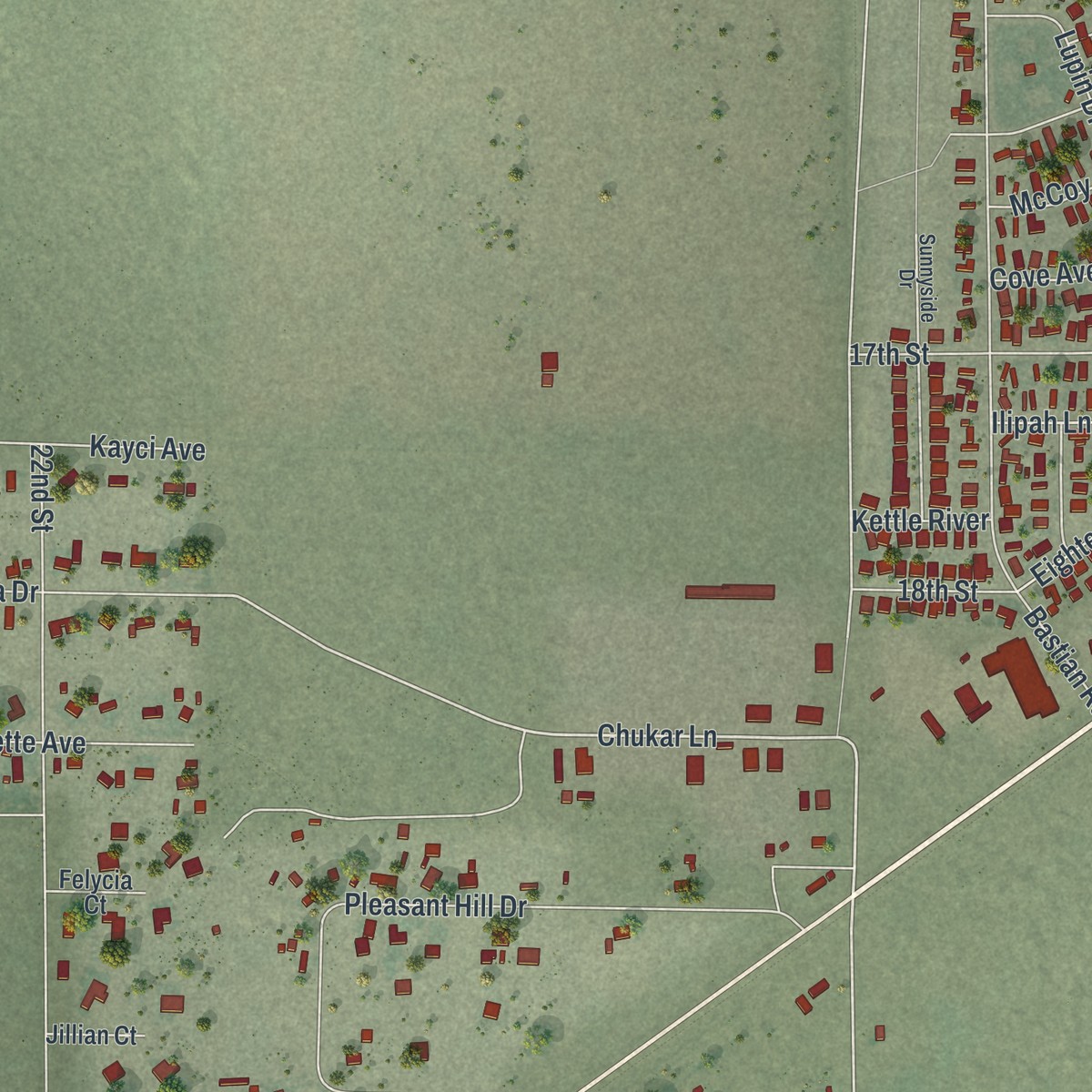
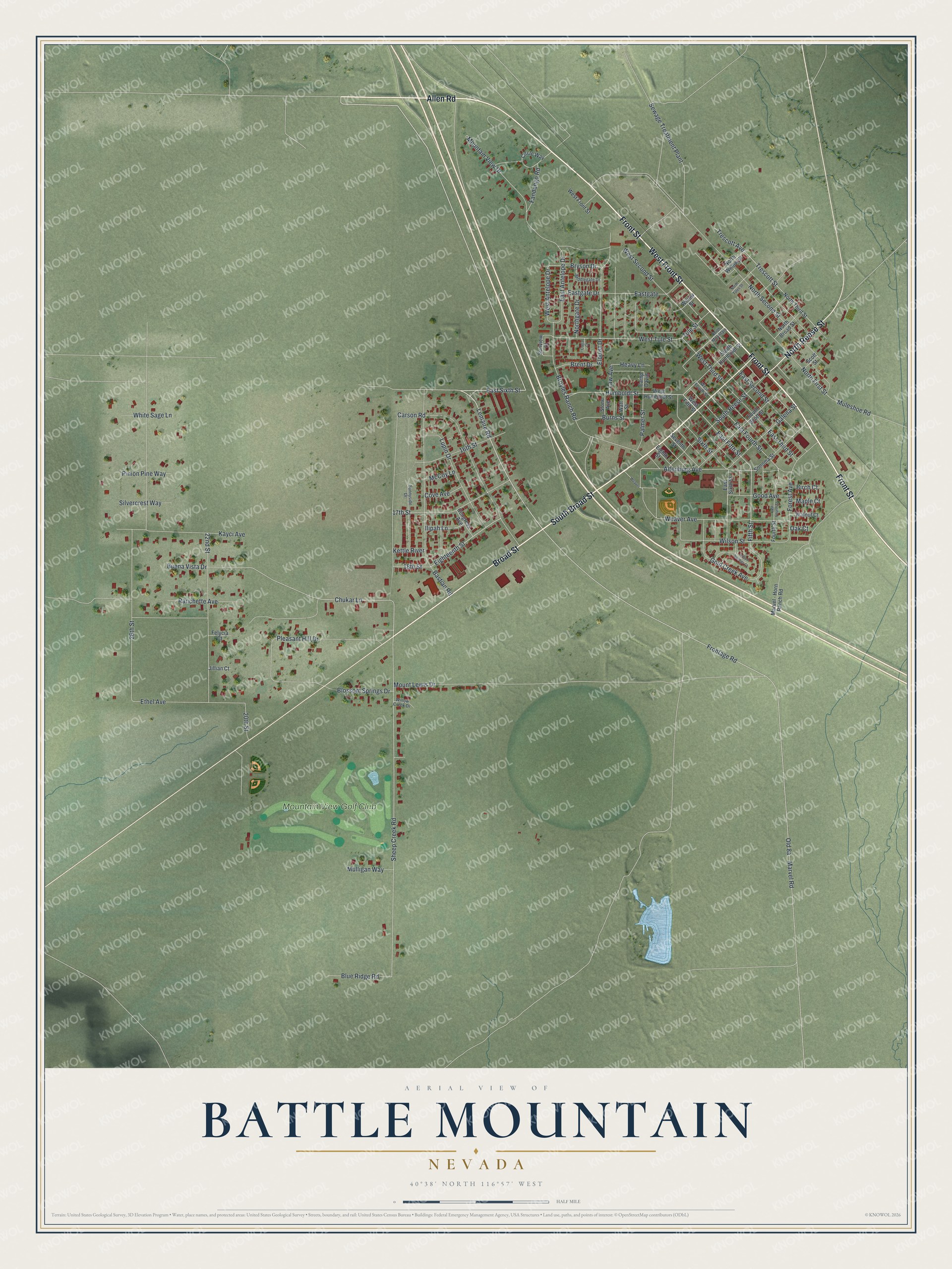
Explore Battle Mountain, Nevada from a whole new perspective. Created using aerial imagery and detailed geographic data, this map captures Battle Mountain building by building, with labeled streets, familiar landmarks, and shaded topographical relief that highlights the natural contours of the landscape.
Combining modern data with the timeless character of a vintage atlas, this map is just as interesting up close as it is beautiful on the wall. Whether you grew up in Battle Mountain, spent memorable years there, or call it home today, this unique map is a great way to celebrate a place that means something to you. Zoom in on the preview to look for your street, and then order a print to put your memories on the wall.
Three ways to hang it
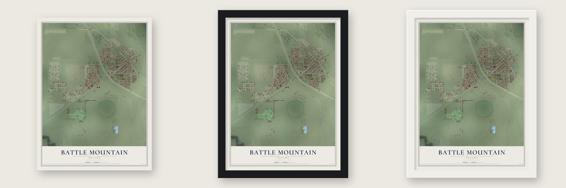
Unframed archival matte, a black wood frame or a white wood frame.
Up close
Geography Worth Displaying
This map was created using accurate cartographic data and authoritative geographic sources, including the U.S. Geological Survey and the Census Bureau. The map brings together terrain, waterways, roads, and building detail. The majority of the streets are labeled, houses are accurately depicted, and the topography is derived from government sources. Combining local data with carefully composed color and shading leads to this beautifully detailed Battle Mountain artwork for your wall.
Rather than simply showing street outlines, we’ve included as many of the street names as we could reasonably fit on the map while keeping their names legible. Zoom in on the high resolution preview to see exactly what’s on the map. We truly set out to create a statement piece for anyone who loves Battle Mountain. So whether it’s for you, or a gift for someone you love, we hope this map of Battle Mountain brings back fond memories.
Read the story behind this map of Battle Mountain, Nevada from 2026.
Find your street
Names on the Battle Mountain map
Every name below is printed on this map. Look for your street, your school, the park where you played, or the pond down the road.
Places and landmarks1
- Mountain View Golf Club
Streets and roads113
- South Broad Street
- Broad Street
- Front Street
- West Front Street
- Allen Road
- North Reese Street
- Lemaire Road
- East Sixth Street
- Humboldt Street
- Chukar Lane
- East Fourth Street
- East Fifth Street
- Fifth Street
- Sheep Creek Road
- West Tule Street
- Frontage Road
- Gold Creek Avenue
- West Third Street
- East Second Street
- 26th Street
- East Antelope Drive
- Weaver Avenue
- Ethel Avenue
- North First Street
- Altenburg Avenue
- Eastgate Drive
- Eastgate
- Mount Lewis Drive
- Marvel Road
- North Second Street
Show all 113 streets
- Bastian Road
- Pleasant Hill Drive
- Carson Road
- Broyles Ranch Road
- 22nd Street
- West Second Street
- Mountain View Drive
- South Reese Street
- Elquist Drive
- 17th Street
- 18th Street
- Trescott Street
- Sewage Treatment Plant
- Sixth Street
- Lupin Drive
- Forest Avenue
- Kayci Avenue
- East Third Street
- Wilson Street
- 16th Street
- Galena Street
- Eighteenth Street
- Buena Vista Drive
- Ranchette Avenue
- Blossom Springs Drive
- West Antelope Drive
- Burns Street
- Blue Ridge Road
- Good Avenue
- Palmer Street
- Bryson Drive
- Silvercrest Way
- Fandango Road
- White Sage Lane
- Pinion Pine Way
- Mulligan Way
- Northgate Drive
- Brent Drive
- Muleshoe Road
- Ilipah Lane
- Cove Avenue
- Heavy Lane
- Tule Street
- Trescott Avenue
- 20th Street
- Kettle River
- McCoy Lane
- Maple Court
- Birch Court
- Law Avenue
- Oak Court
- West Fifth Street
- West Humboldt Street
- Circle Way
- Seventh Street
- Camp David
- North Willow Street
- South Scott Street
- North Third Street
- Sonoma Street
- South Humboldt Street
- Eighth Street
- Sunview Court
- Marvel - Horn Ranch Road
- North Broad Street
- Congress Avenue
- Walnut Court
- Fourth Street
- Watt Street
- Stone Avenue
- Felycia Court
- Jillian Court
- Willow Street
- Scott Street
- North Mountain
- West Fourth Street
- Sunnyside Drive
- Middlegate Drive
- Willow Creek Drive
- North Tules Street
- Indian Springs Court
- Weaver
- Corral Court
Names are listed as they appear on the printed map. Zoom into the product photos to find them.
About Battle Mountain, Nevada
Battle Mountain is a town of 3,705 people and the county seat of Lander County, where the Reese River meets the Humboldt. Copper ore turned up in the area in 1866, and the Central Pacific Railroad opened a station at Argenta to serve the mines. In October 1868 the railroad added a siding on the Reese River here, five miles to the west. Early in 1870 it moved the Argenta station to that siding and called it Battle Mountain Switch, and a town grew around it that January.
Mud wagon stages and heavy freight wagons soon filled the roads running north and south. The governor vetoed a bill for a railroad to the silver mines around Austin, but in 1874 Nevada lawmakers passed it over his objection, and the line was finished in 1880. Battle Mountain was its operating headquarters until the railroad was abandoned in 1938.
- County seat since 1979Over the years Battle Mountain grew larger than Austin, the old mining town to the south. On May 15, 1979, Lander County voters approved moving the county seat here in a special election, and the Nevada Supreme Court later upheld the result.
- From copper to goldCopper mining in the Battle Mountain district began in 1866. The Copper Canyon Mine ran from 1917 until 1955, open-pit mining began in 1967, and in 1979 the mines turned from copper ores to gold and silver. The Fortitude deposit was found in 1981 and the Surprise gold deposit in 1986, and gold mining is now the town's main business.
- 89.59 mph on a bicycleEvery year, riders bring streamlined bicycles to a flat, straight piece of Highway 305 outside town for the World Human Powered Speed Challenge. There, on September 16, 2016, Todd Reichert pedaled 89.59 mph over 200 meters, beating the 83.13 mph record Sebastiaan Bowier had set in 2013. In 2019 Ilona Peltier of France set the women's record at 78.61 mph.
- The Armpit FestivalIn December 2001 Gene Weingarten of The Washington Post named Battle Mountain the "Armpit of America." The town turned the insult into publicity and held an Armpit Festival every year from 2002 to 2005, sponsored by Old Spice, with deodorant-themed prizes for the winners.
Keep exploring Nevada
Battle Mountain is one of 152 Nevada towns we've mapped. Every dot on the map is a print of its own.
The search covers every state, Nevada first.
Near Battle Mountain
Order 2 or more town maps and save 10%. Shown in the size and finish you picked above, so they hang as a set.
- Valmy 12" x 18" / Archival Matte Print $39.99
- Crescent Valley 12" x 18" / Archival Matte Print $39.99
- Golconda 12" x 18" / Archival Matte Print $39.99


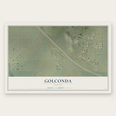
More maps nearby: Midas, Grass Valley, Carlin, Winnemucca and Tuscarora.
The art of mapping a place
How This Map Was Made
Real places. Remarkable detail. Discover the layers that turn geographic data into a map of home.

The view from above
Aerial imagery reveals the character of the land: woodland, open fields, and the patterns of a place.

The shape of the land
Elevation data brings hills, valleys, and subtle changes in the landscape into view.

The details of home
Roads, waterways, and building footprints come together to make the map feel unmistakably local.

Geography becomes art
Considered color, shading, and typography bring the layers together in a map made for your wall.


Process illustrated with Mendon, Massachusetts. Aerial imagery: USDA NAIP. Terrain: USGS 3D Elevation Program. Map details and finished artwork: KNOWOL.
The Details
About This Print
Choose an archival matte print, or a black or white Ayous wood frame. The archival matte print is unframed.
Select your size and finish above to see the matching product image and price.
Materials & Craftsmanship
A contemporary map with the character of a classic atlas, printed on archival matte paper. Optional frames are made from Ayous wood.
Your printed map does not include the watermark shown in the full-map preview.
Shipping & Delivery
Free shipping within the United States. Every print is made to order in the USA.
Buying a gift? Add a note in your cart and we'll include it. We never put prices in the package.
Prints ship within 2 to 3 business days. Allow 7 to 10 days total from ordering for delivery. Timing may vary during holidays or periods of high order volume.
Read our shipping policy.
Returns and damaged prints
Each print is made to order. Change-of-mind refunds are not available after production.
If your print arrives damaged, misprinted or incorrect, contact support@knowol.com within 30 days of receiving it. Include your order number, photos and a description of the issue.
Read our full refund and replacement policy. For questions about your order, email support@knowol.com.