
Search for another town



Free U.S. delivery 7 to 10 days after you order
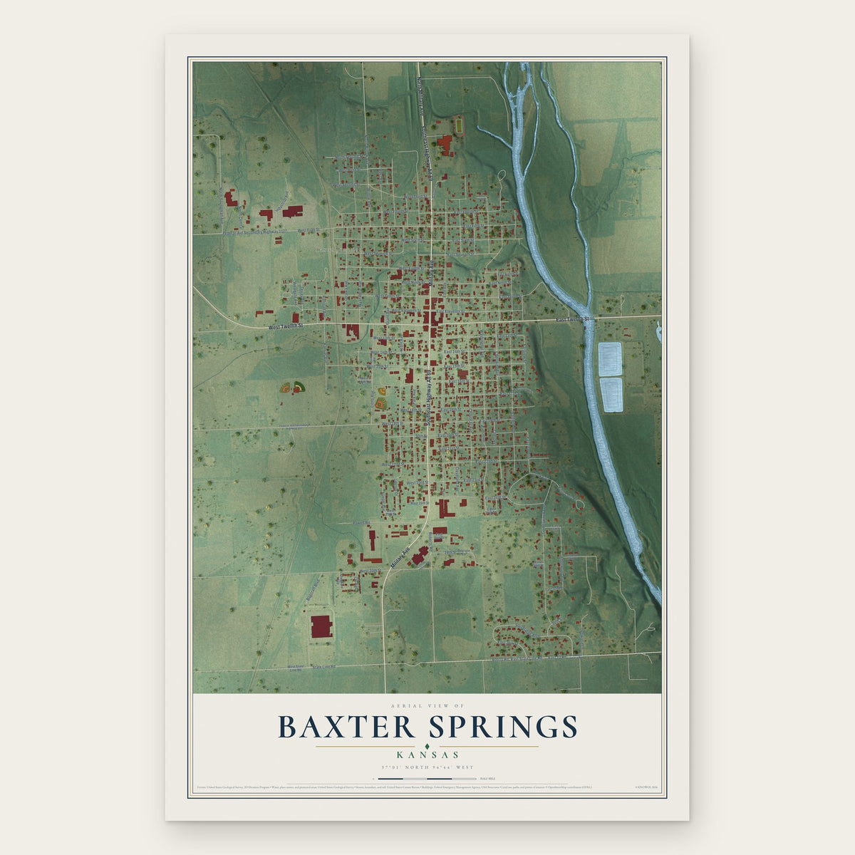
Baxter Springs, Kansas Map Art
Building by building, with labeled streets and shaded relief.
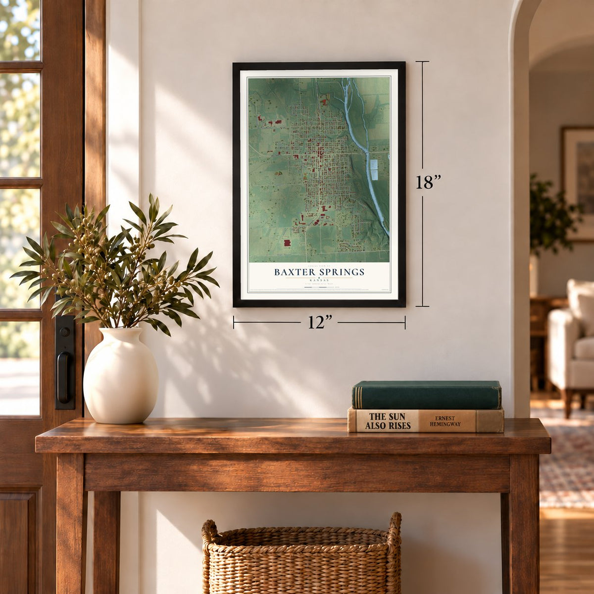
12" x 18" Archival Matte Print
A Map of Home. A Work of Art.
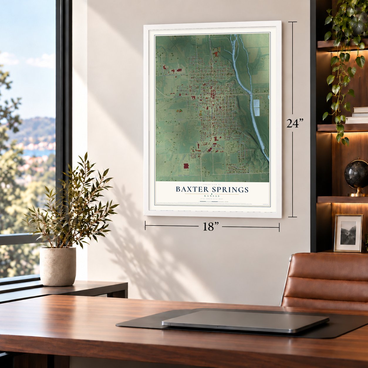
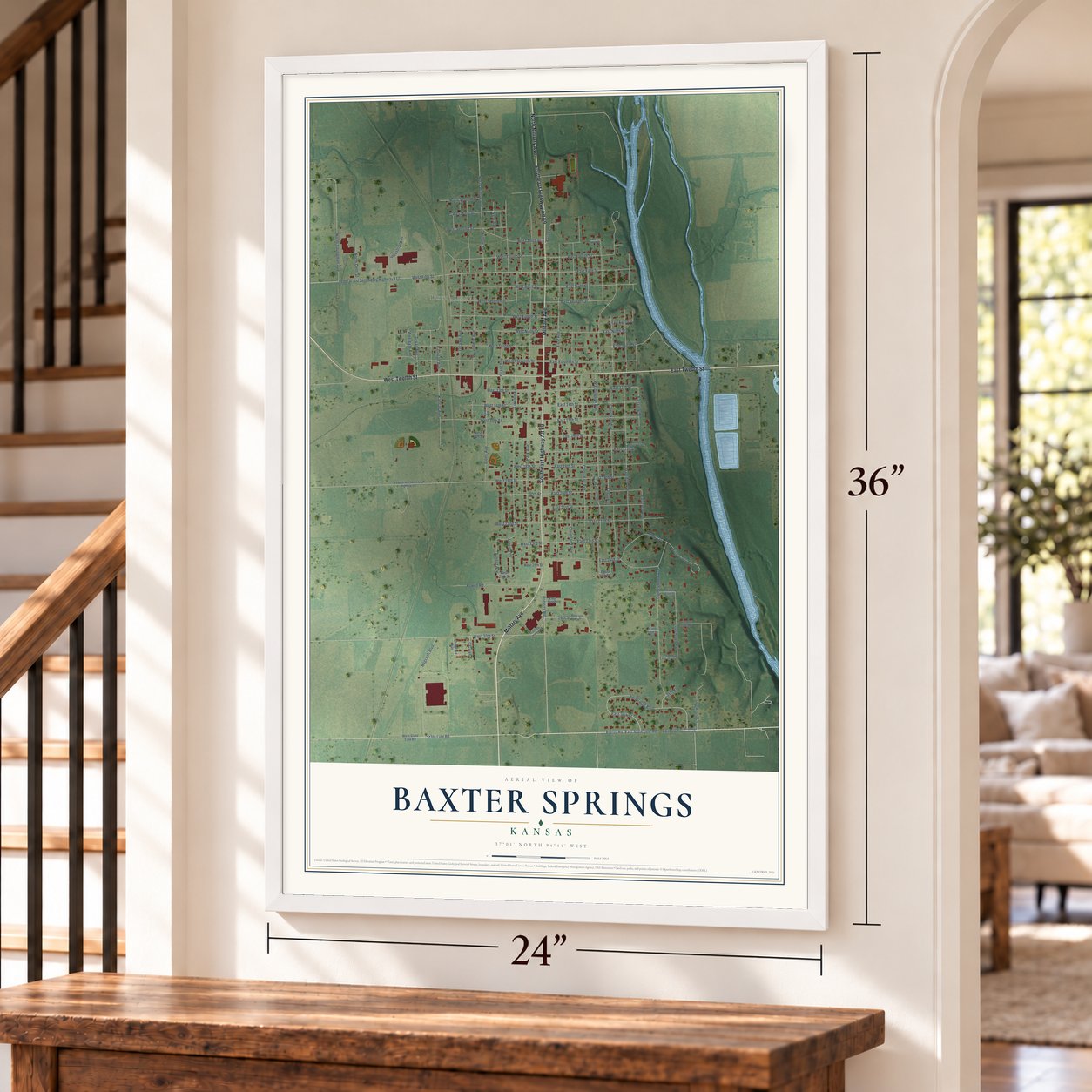
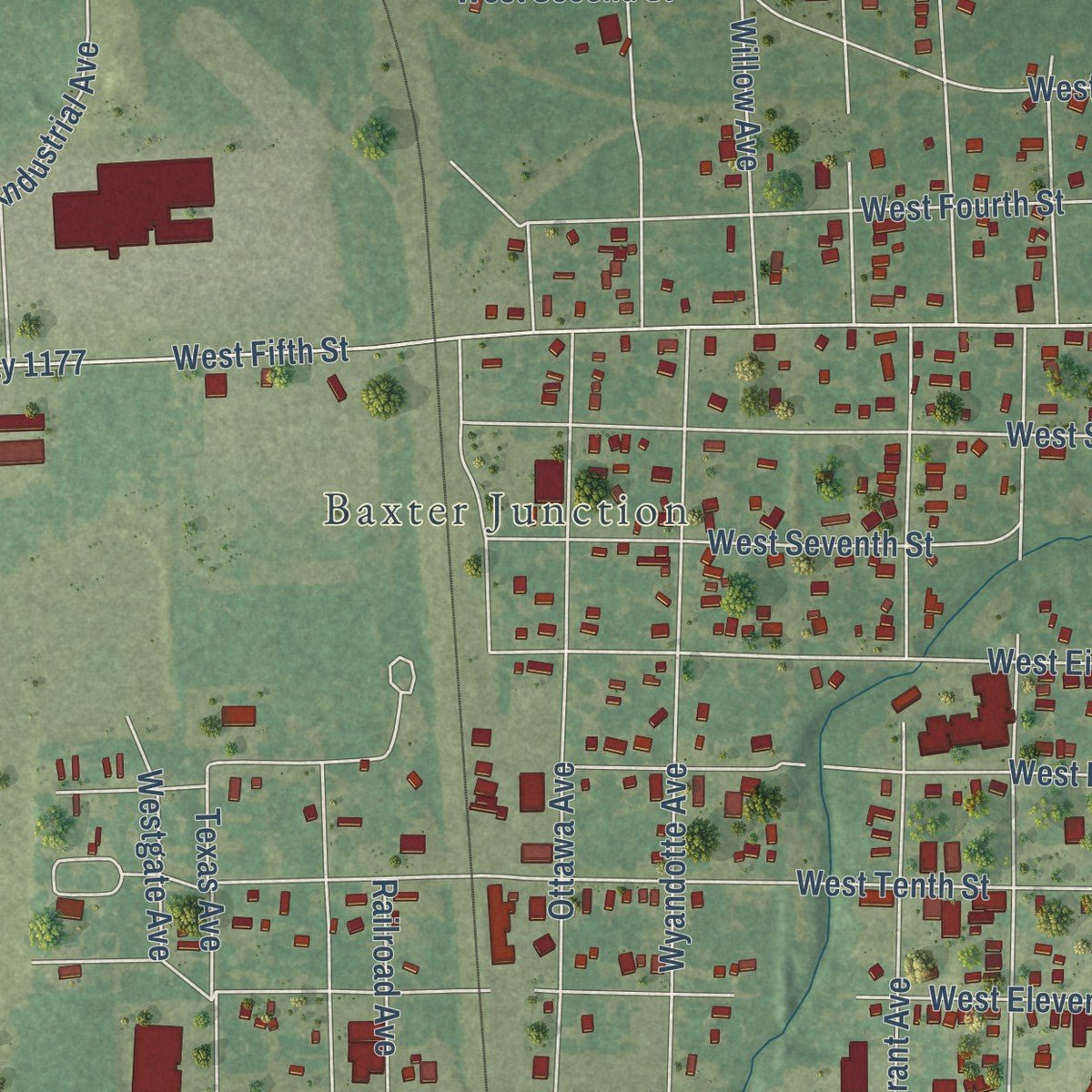
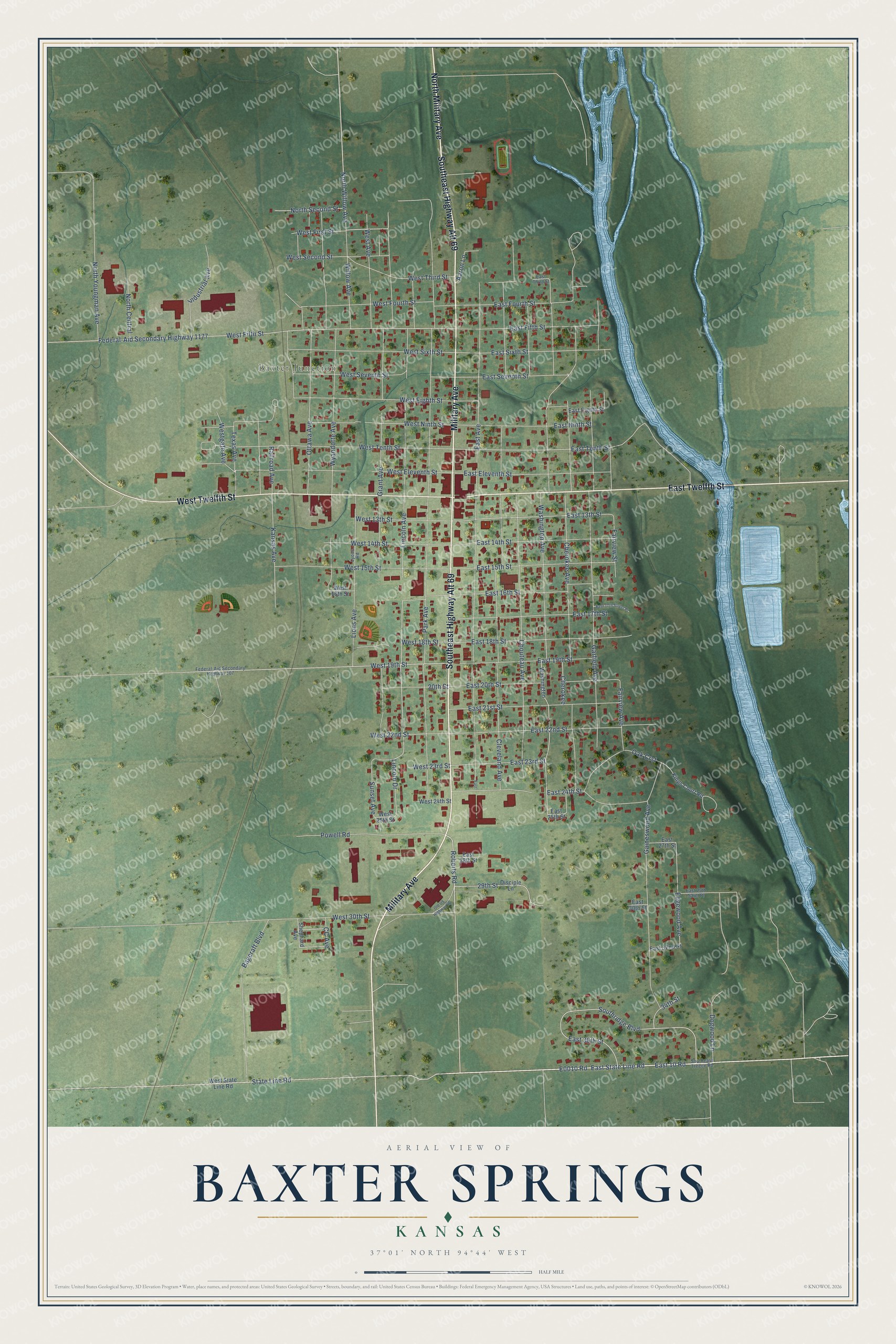
Explore Baxter Springs, Kansas from a whole new perspective. Created using aerial imagery and detailed geographic data, this map captures Baxter Springs building by building, with labeled streets, familiar landmarks, and shaded topographical relief that highlights the natural contours of the landscape.
Combining modern data with the timeless character of a vintage atlas, this map is just as interesting up close as it is beautiful on the wall. Whether you grew up in Baxter Springs, spent memorable years there, or call it home today, this unique map is a great way to celebrate a place that means something to you. Zoom in on the preview to look for your street, and then order a print to put your memories on the wall.
Three ways to hang it
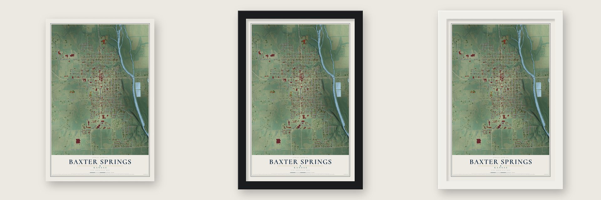
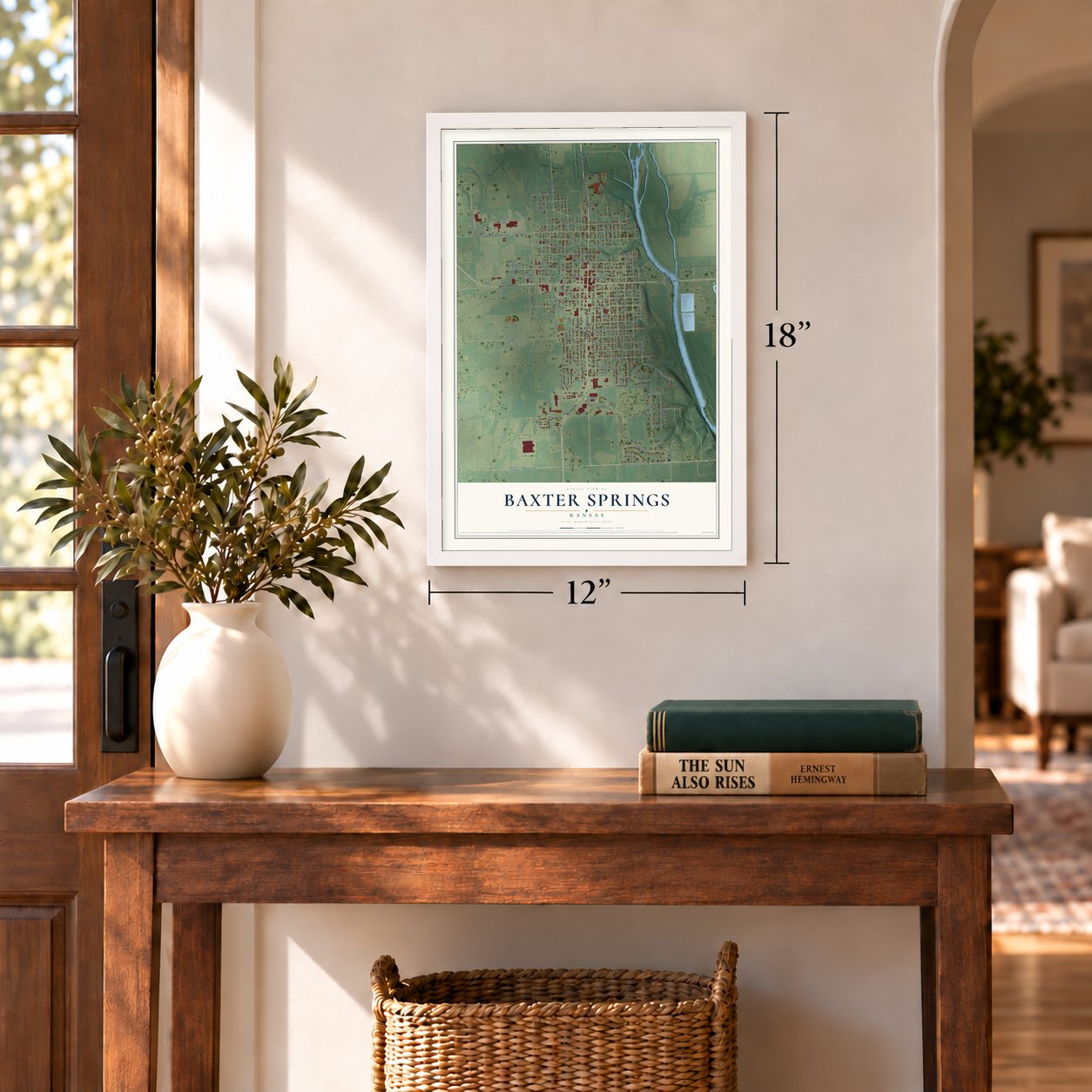
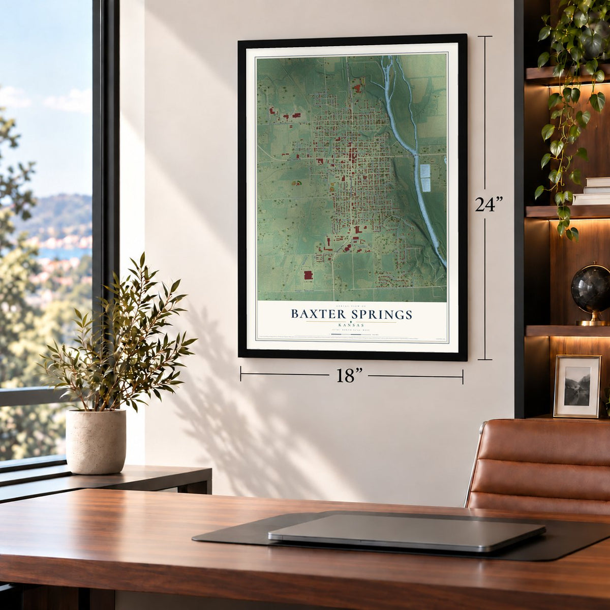
Unframed archival matte, a black wood frame or a white wood frame.
Up close
Geography Worth Displaying
This map was created using accurate cartographic data and authoritative geographic sources, including the U.S. Geological Survey and the Census Bureau. The map brings together terrain, waterways, roads, and building detail. The majority of the streets are labeled, houses are accurately depicted, and the topography is derived from government sources. Combining local data with carefully composed color and shading leads to this beautifully detailed Baxter Springs artwork for your wall.
Rather than simply showing street outlines, we’ve included as many of the street names as we could reasonably fit on the map while keeping their names legible. Zoom in on the high resolution preview to see exactly what’s on the map. We truly set out to create a statement piece for anyone who loves Baxter Springs. So whether it’s for you, or a gift for someone you love, we hope this map of Baxter Springs brings back fond memories.
Read the story behind this map of Baxter Springs, Kansas from 2026.

Find your street
Names on the Baxter Springs map
Every name below is printed on this map. Look for your street, your school, the park where you played, or the pond down the road.
Places and landmarks1
- Baxter Junction
Streets and roads111
- Southeast Highway Alt 69
- North Military Avenue
- Military Avenue
- East Twelfth Street
- West Twelfth Street
- East 10 Road
- East State Line Road
- Roberts Road
- State Line Road
- Southridge Boulevard
- West First Street
- East 36th Street
- Washington Avenue
- North Willow Avenue
- Lincoln Avenue
- East 21st Street
- East 13th Street
- East Tenth Street
- Fairview Street
- West Eighth Street
- West 23rd Street
- Lincoln Drive
- Cherokee Avenue
- East Fourth Street
- East Seventh Street
- Edgewood Avenue
- Park Avenue
- East Avenue
- Cleveland Avenue
- Garfield Avenue
Show all 111 streets
- Grant Avenue
- Federal-Aid Secondary Highway 1177
- West Fifth Street
- Wyandotte Avenue
- Chouteau Avenue
- West Tenth Street
- Gaineswood Avenue
- West 30th Street
- West Ninth Street
- West Eleventh Street
- Ottawa Avenue
- East 22nd Street
- Fairview Avenue
- East 18th Street
- Bagcraft Boulevard
- West 15th Street
- Lions Avenue
- West Sixth Street
- East 15th Street
- Kansas Avenue
- East 14th Street
- East 16th Street
- East Eleventh Street
- East 17th Street
- East Sixth Street
- West Fourth Street
- East 20th Street
- Powell Road
- West 19th Street
- East 19th Street
- East Fifth Street
- West Seventh Street
- East Ninth Street
- East 24th Street
- West 14th Street
- West Third Street
- Oak Crst
- West Second Street
- Willow Avenue
- Industrial Avenue
- 29th Street
- West 13th Street
- East 23rd Street
- North Youngman Avenue
- West Avenue
- West 18th Street
- West 22nd Street
- Texas Avenue
- Sunset Avenue
- North Second Street
- 20th Street
- Dogwood Lane
- North Central
- Westgate Avenue
- Aaron Lane
- Railroad Avenue
- Cherokee
- CC Avenue
- 34th Street
- West State Line Road
- East 25th Street
- Disciple Lane
- Kings Court Road
- East Eighth Street
- West 16th Street
- Washington
- East 32nd Street
- West 24th Street
- East 27th Street
- East 28th Street
- Shephard Avenue
- East 30th Street
- West 25th Street
- Southeast Treece Road
- Federal-Aid Secondary Highway 107
- East Third Street
- East 29th Saint Place
- Lyons Road
- Old US Highway 66
- East 17th Street Place
- East
Names are listed as they appear on the printed map. Zoom into the product photos to find them.
About Baxter Springs, Kansas
Baxter Springs is a city of 3,888 people in Cherokee County, on the western bank of the Spring River less than two miles from the Oklahoma line. A. Baxter claimed land here in 1858, while it still belonged to the government, and in 1865 Jeff Davis and a man named Armstrong staked claims next to his. Texas cattle drives were halting nearby, so in 1866 Capt. M. Man and his partner, J. J. Barnes, platted an eighty-acre town site. They named it for Baxter and for the springs, which people believed could heal.
The cattle trade made the town grow fast, and by 1872 nearly 4,000 people lived here. Sure of a great future, the town voted $150,000 in bonds for the Kansas City, Fort Scott & Gulf Railroad in 1869, then more for a school, a courthouse and jail, and streets, until it owed more than all its property was worth. When new laws pushed the cattle trail west and lead mines drew people away, owners abandoned lots to escape the taxes, and some lots sold for 17 cents. Bondholders finally settled for 18 to 50 cents on the dollar, and the last $20,000 was refinanced with 6 percent funding bonds in January 1880.
“Society was in a state of chaos.”
- The Black Dog TrailOsage men under Chief Black Dog finished a trail by 1803 that ran from their winter lands east of here southwest to the Great Salt Plains in present-day Oklahoma. They paused at the springs to heal on the way to their summer hunts. Cleared of brush and rocks, with earth ramps down to the fords, the trail let eight riders travel side by side, and it became the first improved road in Kansas and Oklahoma.
- The fight at Fort Blair, 1863Union troops built small posts here, including Fort Baxter, Camp Ben Butler and Camp Hunter. On October 4, 1863, about 400 of Quantrill's raiders bound for Texas attacked Fort Blair while part of its garrison was away. The defenders, mostly United States Colored Troops, held it. On the prairie the raiders then overwhelmed a separate party of 103 Union men, killing nearly all. Later that year the army withdrew to Fort Scott and tore down Fort Baxter.
- County seat, then notBaxter Springs became the seat of Cherokee County in November 1867, but in February 1869 the seat moved to Columbus. The town still hoped to win it back, and in 1871 it voted $10,000 in bonds to build a courthouse and jail it planned to give to the county.
- Ordinance 42Lead strikes across the tri-state area revived the region's towns in the early 1900s. The Baxter Springs city council passed Ordinance 42, which sharply limited mining inside city limits, and that spared the town the damage nearby towns suffered. Mine owners built grand houses here, and many mining executives kept their offices in town.
- On Route 66 since 1926In 1926 the downtown main street became part of Route 66, the highway between Chicago and Los Angeles, and motels and quick places to eat grew up along it. Route 66 passed through only three towns in Kansas, and Baxter Springs was one of them.
Keep exploring Kansas
Baxter Springs is one of 761 Kansas towns we've mapped. Every dot on the map is a print of its own.
The search covers every state, Kansas first.
Near Baxter Springs
Order 2 or more town maps and save 10%. Shown in the size and finish you picked above, so they hang as a set.
- Lowell 12" x 18" / Archival Matte Print $39.99
- Riverton 12" x 18" / Archival Matte Print $39.99
- Galena 12" x 18" / Archival Matte Print $39.99

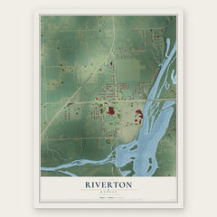

More maps nearby: Crestline, Columbus, Hallowell, Scammon and Roseland.
The art of mapping a place
How This Map Was Made
Real places. Remarkable detail. Discover the layers that turn geographic data into a map of home.

The view from above
Aerial imagery reveals the character of the land: woodland, open fields, and the patterns of a place.

The shape of the land
Elevation data brings hills, valleys, and subtle changes in the landscape into view.

The details of home
Roads, waterways, and building footprints come together to make the map feel unmistakably local.

Geography becomes art
Considered color, shading, and typography bring the layers together in a map made for your wall.


Process illustrated with Mendon, Massachusetts. Aerial imagery: USDA NAIP. Terrain: USGS 3D Elevation Program. Map details and finished artwork: KNOWOL.
The Details
About This Print
Choose an archival matte print, or a black or white Ayous wood frame. The archival matte print is unframed.
Select your size and finish above to see the matching product image and price.
Materials & Craftsmanship
A contemporary map with the character of a classic atlas, printed on archival matte paper. Optional frames are made from Ayous wood.
Your printed map does not include the watermark shown in the full-map preview.
Shipping & Delivery
Free shipping within the United States. Every print is made to order in the USA.
Buying a gift? Add a note in your cart and we'll include it. We never put prices in the package.
Prints ship within 2 to 3 business days. Allow 7 to 10 days total from ordering for delivery. Timing may vary during holidays or periods of high order volume.
Read our shipping policy.
Returns and damaged prints
Each print is made to order. Change-of-mind refunds are not available after production.
If your print arrives damaged, misprinted or incorrect, contact support@knowol.com within 30 days of receiving it. Include your order number, photos and a description of the issue.
Read our full refund and replacement policy. For questions about your order, email support@knowol.com.