
Search for another town

Free U.S. delivery 7 to 10 days after you order
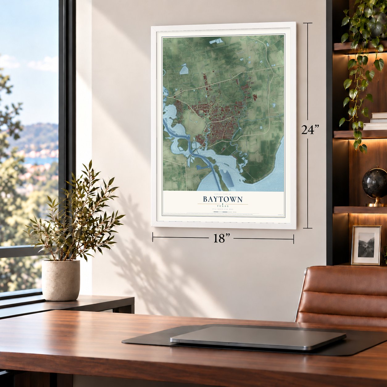
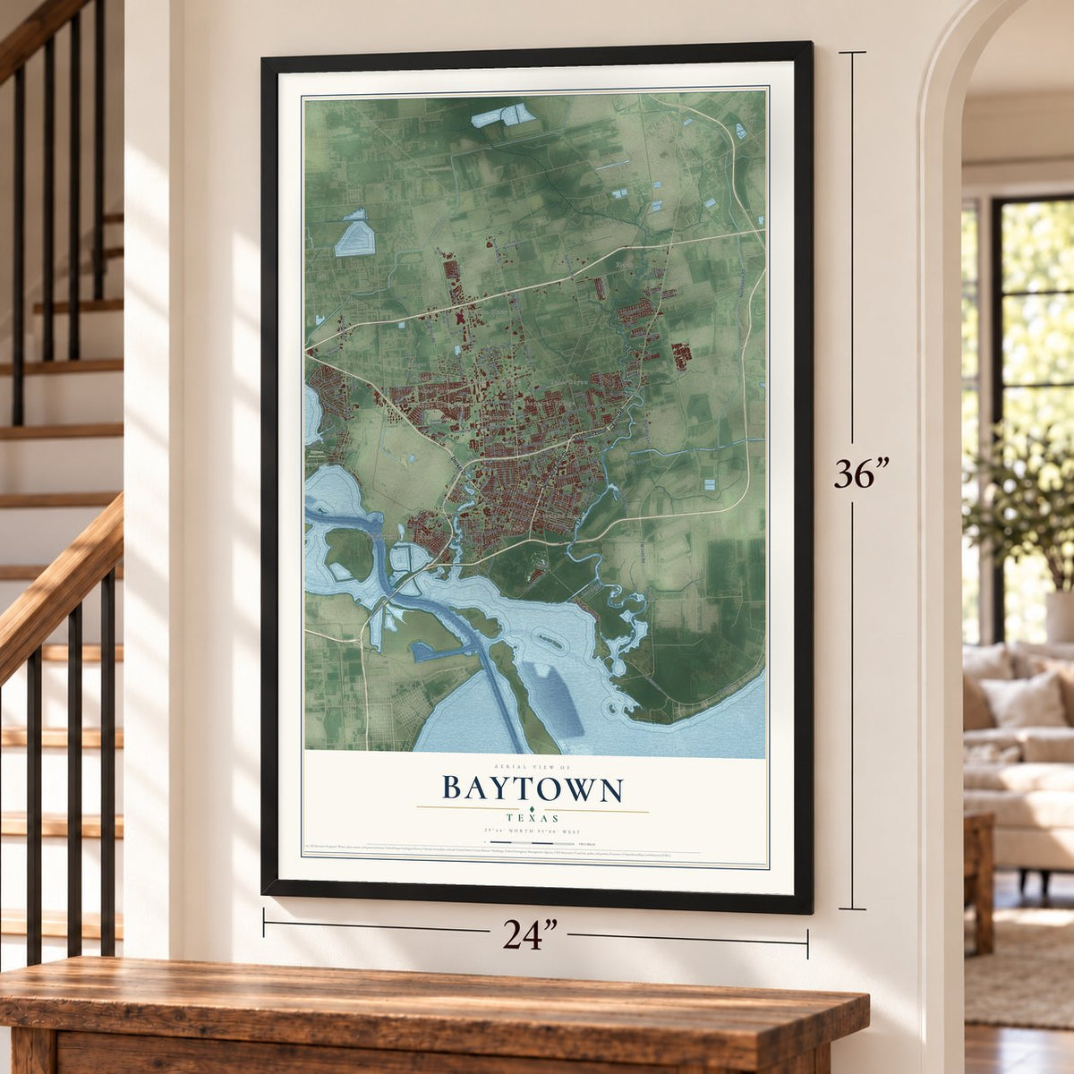
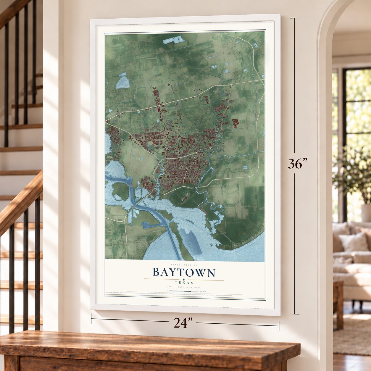
Baytown, Texas Map Art
Building by building, with labeled streets and shaded relief.
12" x 18" Archival Matte Print
A Map of Home. A Work of Art.
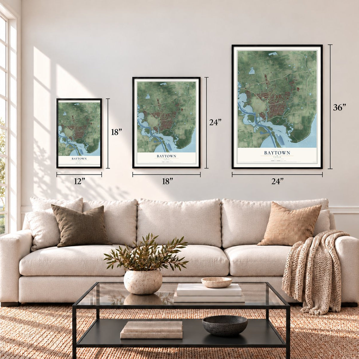
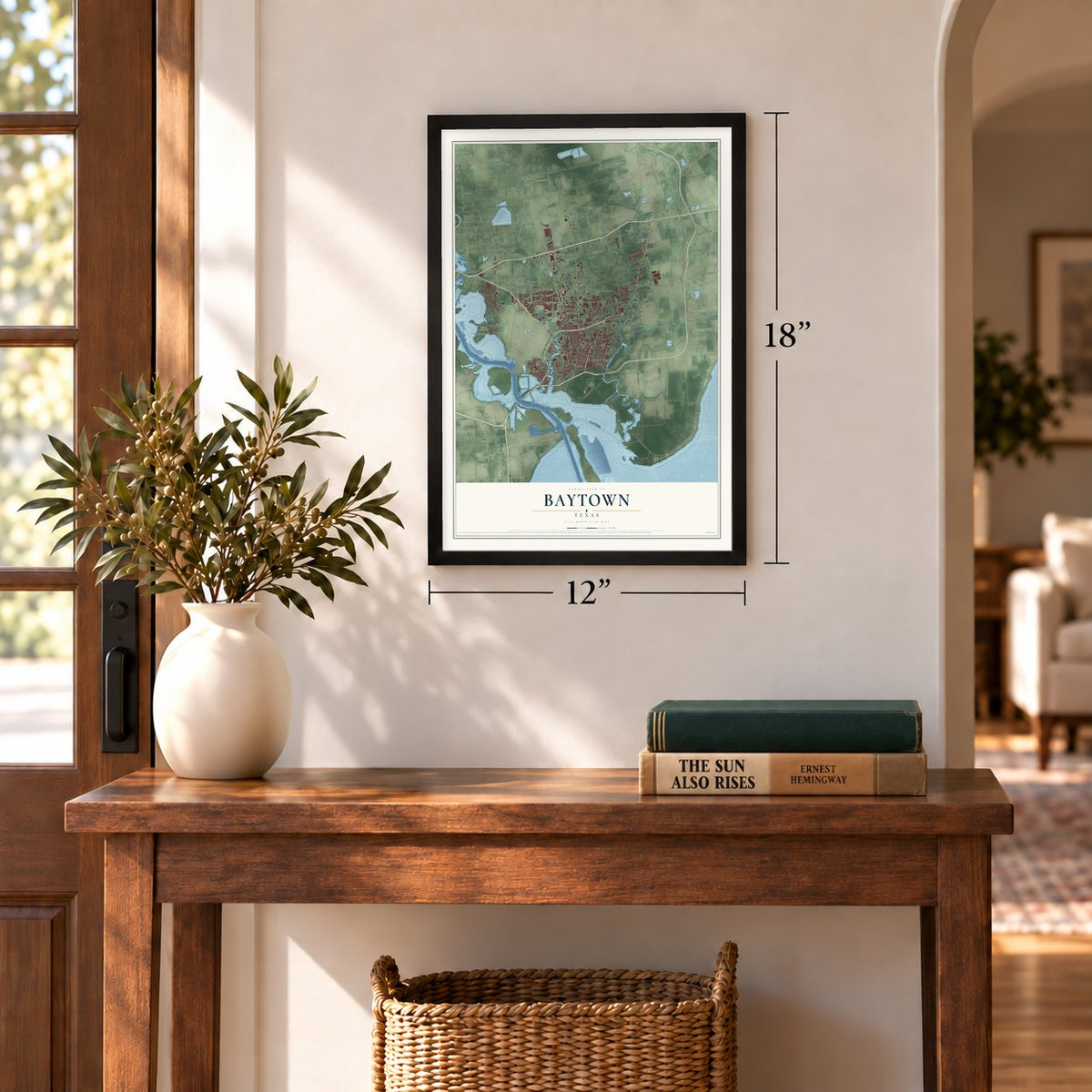
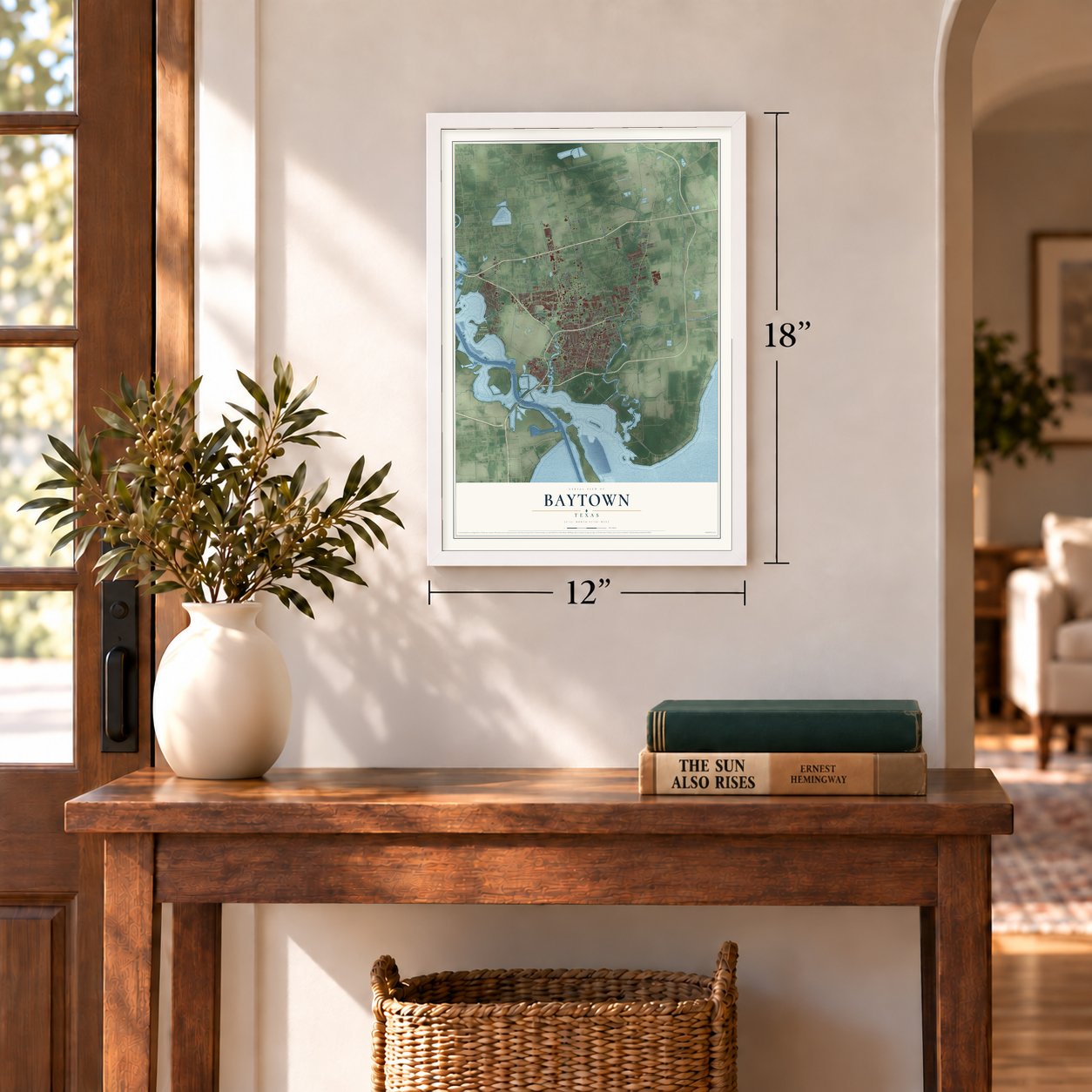
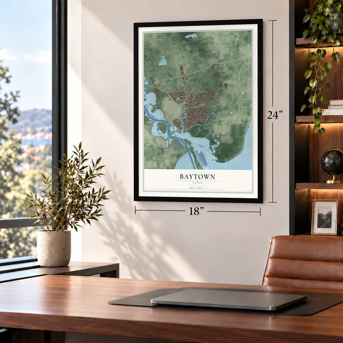
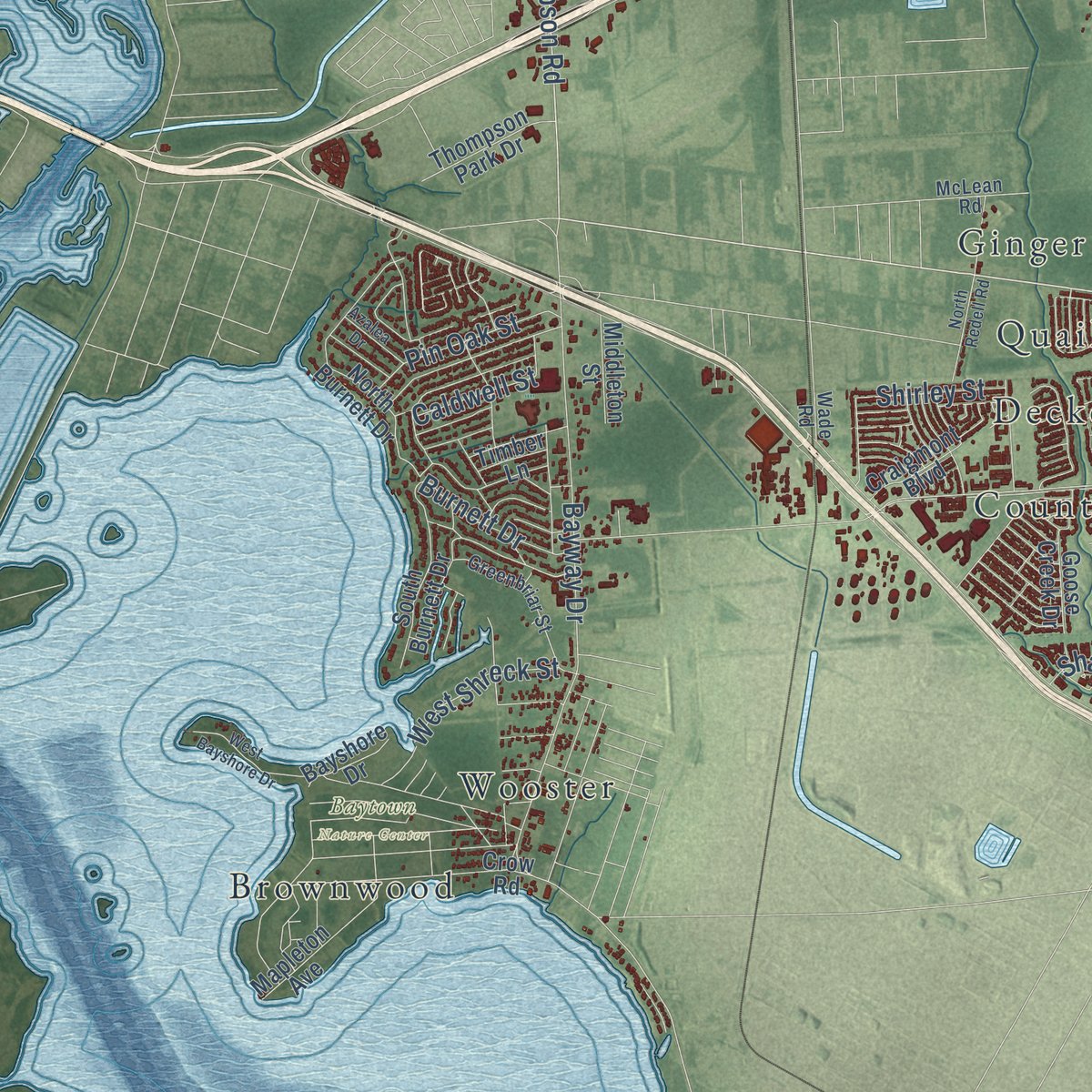
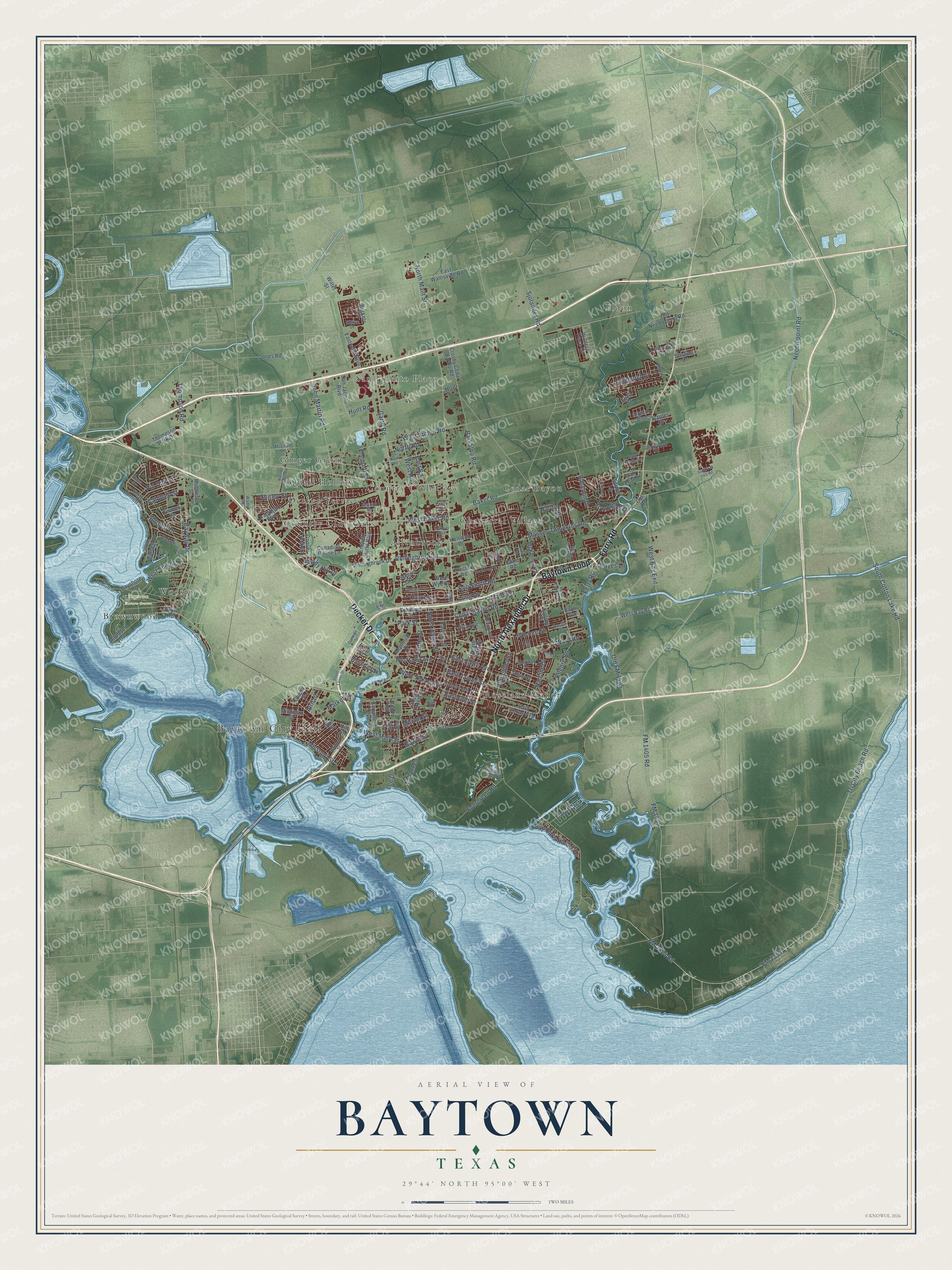
Explore Baytown, Texas from a whole new perspective. Created using aerial imagery and detailed geographic data, this map captures Baytown building by building, with labeled streets, familiar landmarks, and shaded topographical relief that highlights the natural contours of the landscape.
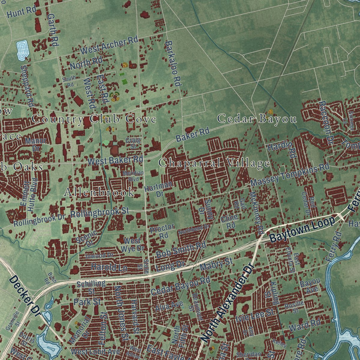
Combining modern data with the timeless character of a vintage atlas, this map is just as interesting up close as it is beautiful on the wall. Whether you grew up in Baytown, spent memorable years there, or call it home today, this unique map is a great way to celebrate a place that means something to you. Zoom in on the preview to look for your street, and then order a print to put your memories on the wall.
Three ways to hang it
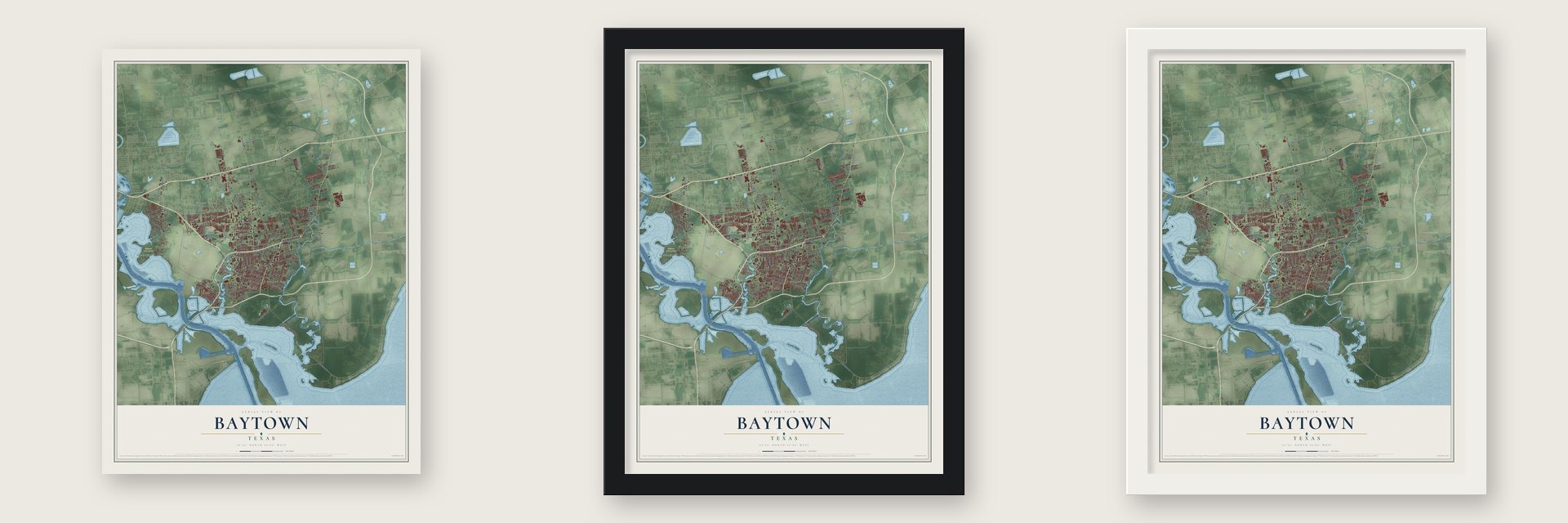
Unframed archival matte, a black wood frame or a white wood frame.
Up close
Geography Worth Displaying
This map was created using accurate cartographic data and authoritative geographic sources, including the U.S. Geological Survey and the Census Bureau. The map brings together terrain, waterways, roads, and building detail. The majority of the streets are labeled, houses are accurately depicted, and the topography is derived from government sources. Combining local data with carefully composed color and shading leads to this beautifully detailed Baytown artwork for your wall.
Rather than simply showing street outlines, we’ve included as many of the street names as we could reasonably fit on the map while keeping their names legible. Zoom in on the high resolution preview to see exactly what’s on the map. We truly set out to create a statement piece for anyone who loves Baytown. So whether it’s for you, or a gift for someone you love, we hope this map of Baytown brings back fond memories.
Find your street
Names on the Baytown map
Every name below is printed on this map. Look for your street, your school, the park where you played, or the pond down the road.
Places and landmarks16
- Baytown City Hall
- Baytown Nature Center
- Eldon
- Chaparral Village
- Decker Terrace
- Roseland Manor
- San Jacinto Place
- Pelly
- Allenbrook
- Cedar Bayou
- Country Club Cove
- Wooster
Show all 16 places
- Quail Hollow
- Brownwood
- Country Club Oaks
- Ginger Green
Streets and roads165
- North Alexander Drive
- Ferry Road
- Baytown Loop
- Decker Drive
- Tri City Beach Road
- FM 2354 Road
- Garth Road
- South Cotton Lake Road
- West Main Street
- FM 2354
- Kilgore Road
- Thompson Road
- North Main Street
- East James Street
- Danubina Street
- West Baker Road
- Bayway Drive
- FM 1405 Road
- Needlepoint Road
- Massey Tompkins Road
- Ward Road
- FM 1405
- Old FM 1405
- Barkaloo Road
- Market Street
- Evergreen Road
- Cedar Bayou Road
- Baker Road
- Lee Drive
- Hunt Road
Show all 165 streets
- John Martin Road
- Rollingbrook Street
- West Texas Avenue
- Park Street
- Sjolander Road
- East Fayle Avenue
- Bob Smith Road
- West Bay Exit
- West Archer Road
- North Jones Street
- Pinehurst Drive
- Narcille Street
- Missouri Street
- Bay Oaks Harbor Drive
- Felton Street
- Raccoon Drive
- Miriam Street
- Harold Lane
- Pin Oak Street
- East Road
- West Road
- West Shreck Street
- Mabry Street
- Tompkins Drive
- Burnett Drive
- Caldwell Street
- Shady Hill Drive
- North Road
- Hardin Road
- Carol Crst
- Airhart
- East Gulf Street
- Bowie Street
- Shirley Street
- Ivie Lee Street
- Tallant Lane
- Hayes Lane
- Hunt
- Long Drive
- East Texas Avenue
- Hunters Trace Lane
- West Bay Road
- Crosby Cedar Bayou Road
- East Wallisville Road
- San Jacinto Boulevard
- Crow Road
- Emmett Hutto Boulevard
- Rollingbrook Drive
- North Burnett Drive
- West Gulf Street
- Eastpoint Boulevard
- Schilling Street
- South Pruett Street
- McKinney Road
- Jones Road
- West Lobit Avenue
- Mapleton Avenue
- Bayshore Drive
- North Fifth Street
- South Burnett Drive
- Old Needlepoint Road
- Olive Street
- Memorial Drive
- Hartman Drive
- Goose Creek Drive
- Manor Drive
- Yupon Street
- Harvard Street
- Thompson Park Drive
- Sheppard Road
- Barrymore Boulevard
- Utah Street
- Canadian Goose Lane
- Timber Lane
- Craigmont Boulevard
- Lynnwood Drive
- Sterling Drive
- Middleton Street
- Crystal Boulevard
- Alva Avenue
- Michigan Street
- Berkely Court
- West Wye Drive
- Staples Drive
- Proctor Road
- Spring Lane
- Oak Leaf Drive
- Scenic Drive
- Kipling Street
- Elm Street
- Cherry Street
- Sunny Drive
- Ellen Street
- Willet Street
- Bayou Avenue
- Cline Road
- Old Road
- Hill Street
- Greenbriar Street
- Beaumont Street
- East Elvinta Street
- Inwood Drive
- East De Fee Street
- Sheridan Drive
- State Street
- Devinwood Drive
- Red Cedar Drive
- McLean Road
- Ash Street
- Britton Street
- Rosille Street
- Dorris Street
- William Scott Street
- Shale Drive
- Maple Lane
- Wade Road
- Gail Road
- Craig Street
- South Alexander Drive
- South Lanier Drive
- Bush Road
- South Road
- South FM 565 Road
- West Bayshore Drive
- North Redell Road
- Meridian Boulevard
- Summer Lane
- Northbend Drive
- West Adoue
- Cedar Landing Drive
- Azalea Drive
- Granville Street
- Amy Drive
- Kelley
- High Street
Names are listed as they appear on the printed map. Zoom into the product photos to find them.
About Baytown, Texas
Baytown is a city of 83,701 people in Harris County, with a few neighborhoods across Cedar Bayou in Chambers County, on the north shore of Galveston Bay. In 1822 Nathaniel Lynch began ferrying travelers across the spot where Buffalo Bayou meets the San Jacinto River, and the Lynchburg Ferry still carries traffic there today. Two years later William Scott received a grant of more than 9,000 acres that took in most of the land Baytown covers now. Scott was among the Old Three Hundred, the first colonists Stephen F. Austin brought to Texas.
The modern city began as three rival towns. Goose Creek came first, named for the bayou where Canada geese spent the winter. The Goose Creek Oil Field then set off booms that created Pelly in the late 1910s and Baytown in the early 1920s. Merger talk started soon after World War I, but Baytown resisted for years. The towns finally agreed to join in 1947, voters picked the name Baytown, and the combined city was officially founded on January 24, 1948.
- Drilling in the bay, 1916While developing the Goose Creek Oil Field in 1916, the Humble Oil and Refining Company set up the first offshore drilling operation in Texas and only the second in the country. Ross S. Sterling, who later became governor of Texas, had founded the company with his partners. Humble went on to build the Baytown Refinery, and today the ExxonMobil Baytown Complex, dating to 1919, holds the largest refinery in the United States.
- K'nesseth Israel, 1930The oil boom drew many newcomers to the three towns, among them Jewish families who started their own congregation. In 1930 they founded K'nesseth Israel, and the K'nesseth Israel Synagogue joined the National Register in 2024.
- Steel from 1970United States Steel opened its Texas Works near Baytown in 1970. The mill shut down in July 1986, when the American steel industry was in decline and the economy was poor. Jindal Steel later bought the plant, and it now runs as JSW Steel USA.
- A 450-acre nature preserveBaytown Nature Center fills a peninsula on the Houston Ship Channel, with Burnet Bay, Crystal Bay and Scott Bay on three sides. It serves as a park and a wildlife sanctuary, home to hundreds of bird species along with mammals, reptiles and sea life.
Keep exploring Texas
Baytown is one of 2,049 Texas towns we've mapped. Every dot on the map is a print of its own.
The search covers every state, Texas first.
Near Baytown
Order 2 or more town maps and save 10%. Shown in the size and finish you picked above, so they hang as a set.
- Highlands 12" x 18" / Archival Matte Print $39.99
- Morgan's Point 12" x 18" / Archival Matte Print $39.99
- Beach City 12" x 18" / Archival Matte Print $39.99


More maps nearby: Mont Belvieu, La Porte, Channelview, Barrett and Cove.
The art of mapping a place
How This Map Was Made
Real places. Remarkable detail. Discover the layers that turn geographic data into a map of home.

The view from above
Aerial imagery reveals the character of the land: woodland, open fields, and the patterns of a place.

The shape of the land
Elevation data brings hills, valleys, and subtle changes in the landscape into view.

The details of home
Roads, waterways, and building footprints come together to make the map feel unmistakably local.

Geography becomes art
Considered color, shading, and typography bring the layers together in a map made for your wall.


Process illustrated with Mendon, Massachusetts. Aerial imagery: USDA NAIP. Terrain: USGS 3D Elevation Program. Map details and finished artwork: KNOWOL.
The Details
About This Print
Choose an archival matte print, or a black or white Ayous wood frame. The archival matte print is unframed.
Select your size and finish above to see the matching product image and price.
Materials & Craftsmanship
A contemporary map with the character of a classic atlas, printed on archival matte paper. Optional frames are made from Ayous wood.
Your printed map does not include the watermark shown in the full-map preview.
Shipping & Delivery
Free shipping within the United States. Every print is made to order in the USA.
Buying a gift? Add a note in your cart and we'll include it. We never put prices in the package.
Prints ship within 2 to 3 business days. Allow 7 to 10 days total from ordering for delivery. Timing may vary during holidays or periods of high order volume.
Read our shipping policy.
Returns and damaged prints
Each print is made to order. Change-of-mind refunds are not available after production.
If your print arrives damaged, misprinted or incorrect, contact support@knowol.com within 30 days of receiving it. Include your order number, photos and a description of the issue.
Read our full refund and replacement policy. For questions about your order, email support@knowol.com.