
Search for another town





Free U.S. delivery 7 to 10 days after you order
Bend, Oregon Map Art
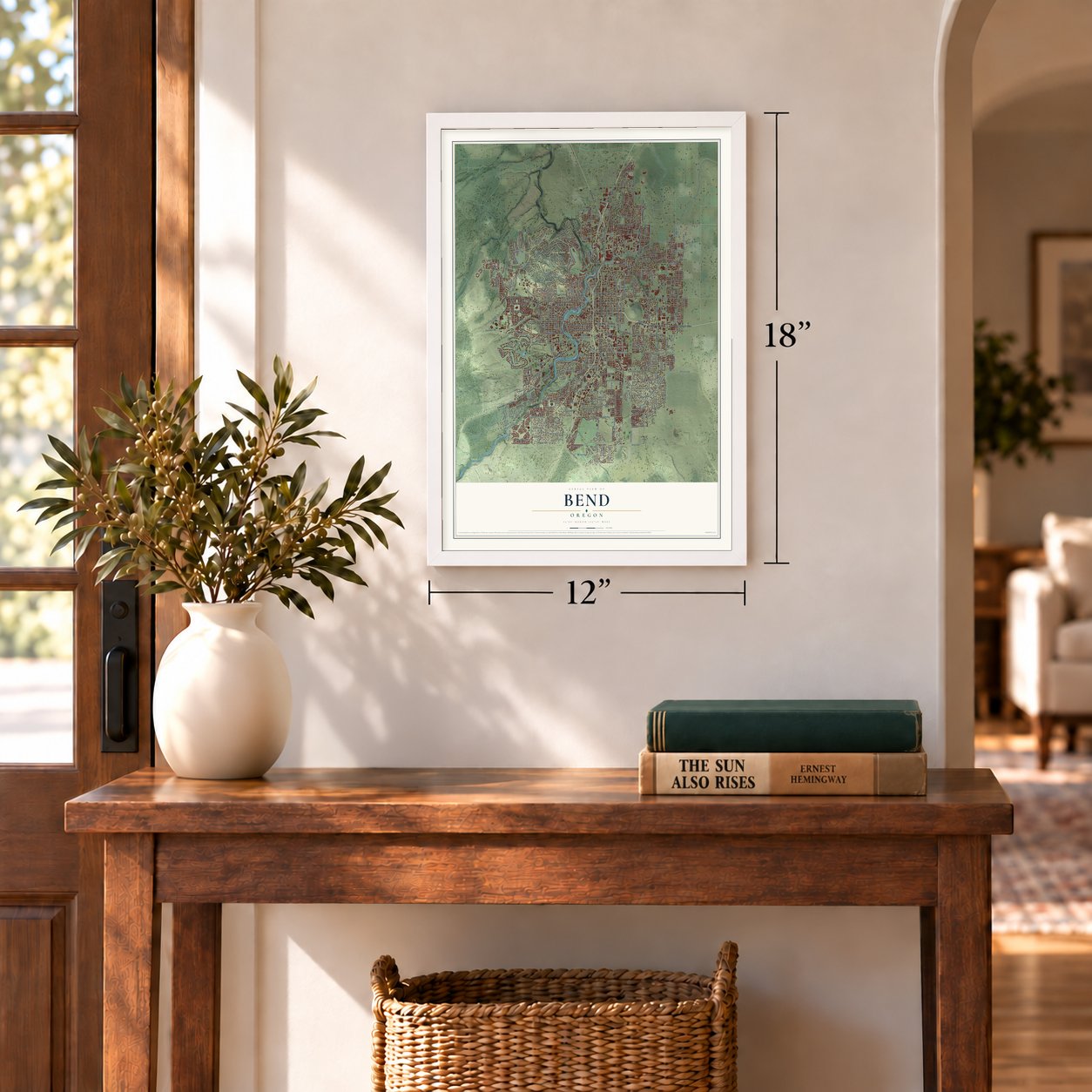
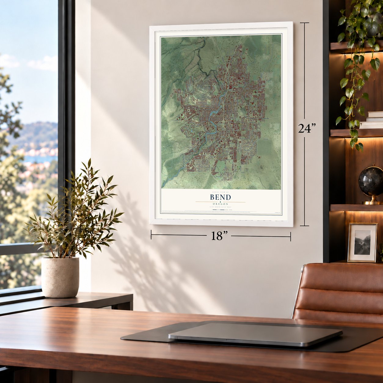
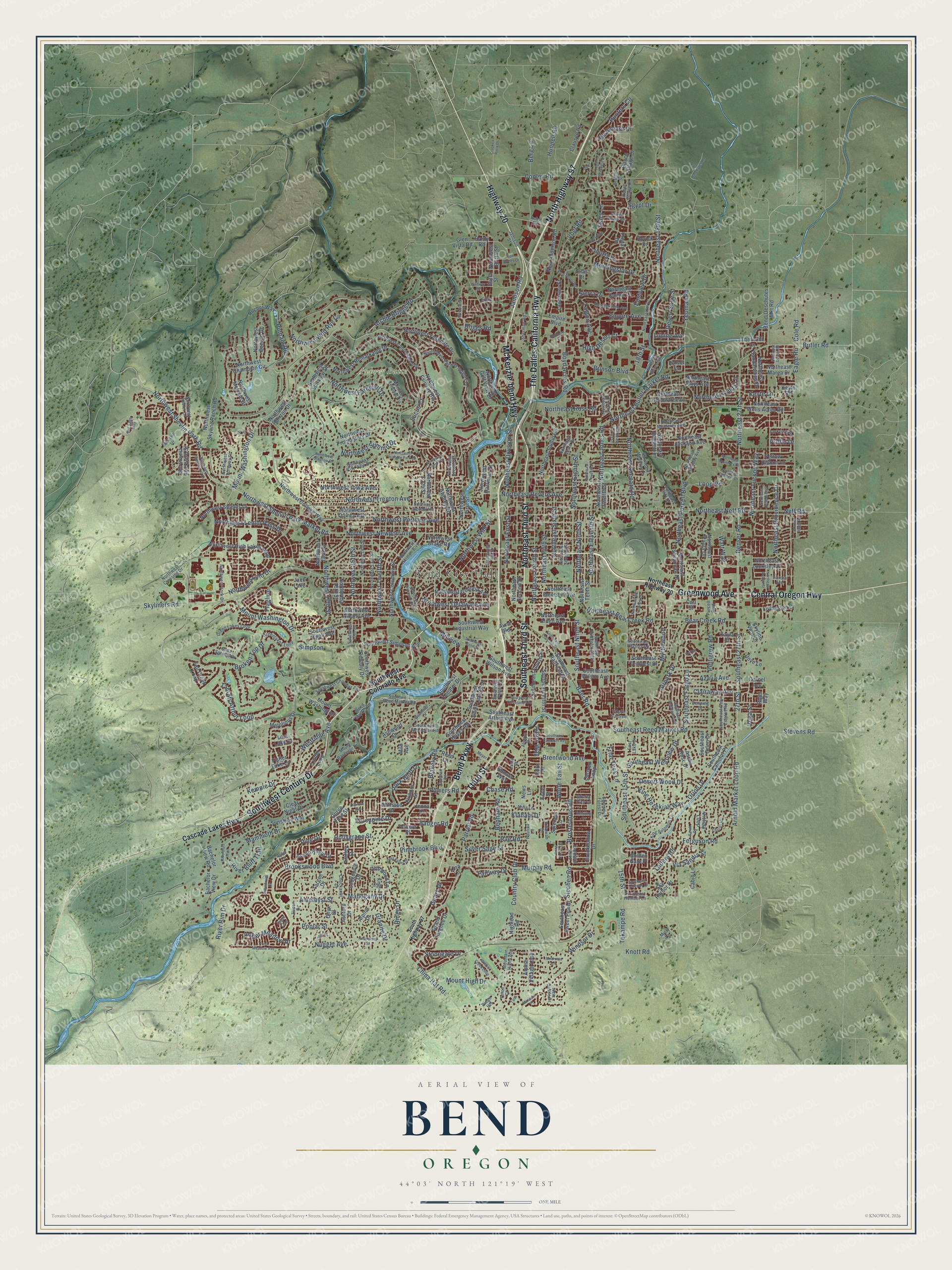
A new map of Bend, Oregon, made in 2026 and printed to order on thick archival matte paper.
12" x 18" Archival Matte Print
A Map of Home. A Work of Art.
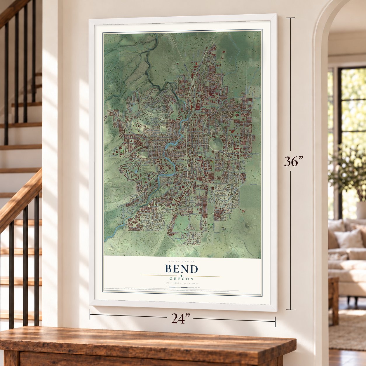
Explore Bend, Oregon from a whole new perspective. Created using aerial imagery and detailed geographic data, this map captures Bend building by building, with labeled streets, familiar landmarks, and shaded topographical relief that highlights the natural contours of the landscape.
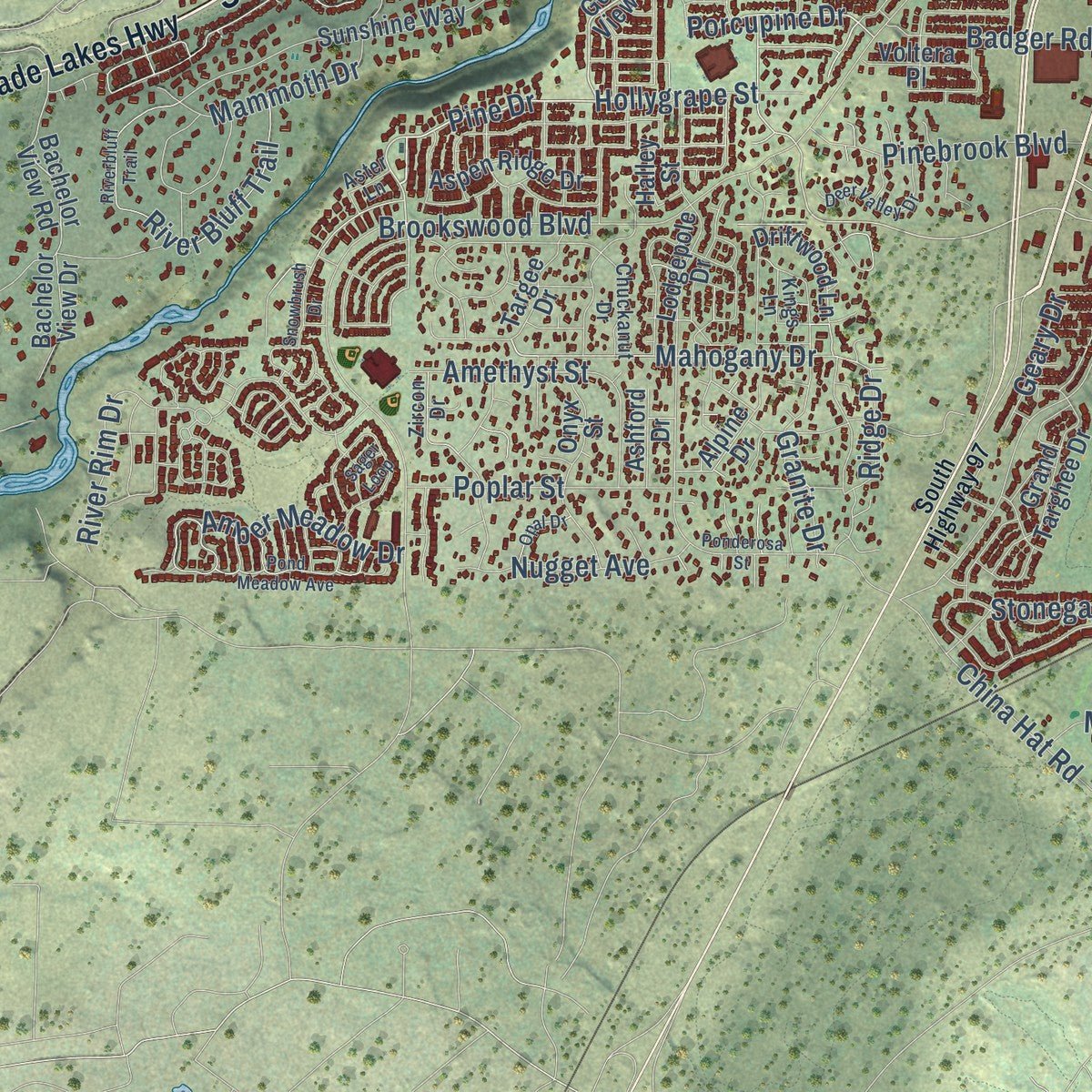
Combining modern data with the timeless character of a vintage atlas, this map is just as interesting up close as it is beautiful on the wall. Whether you grew up in Bend, spent memorable years there, or call it home today, this unique map is a great way to celebrate a place that means something to you. Zoom in on the preview to look for your street, and then order a print to put your memories on the wall.
Three ways to hang it
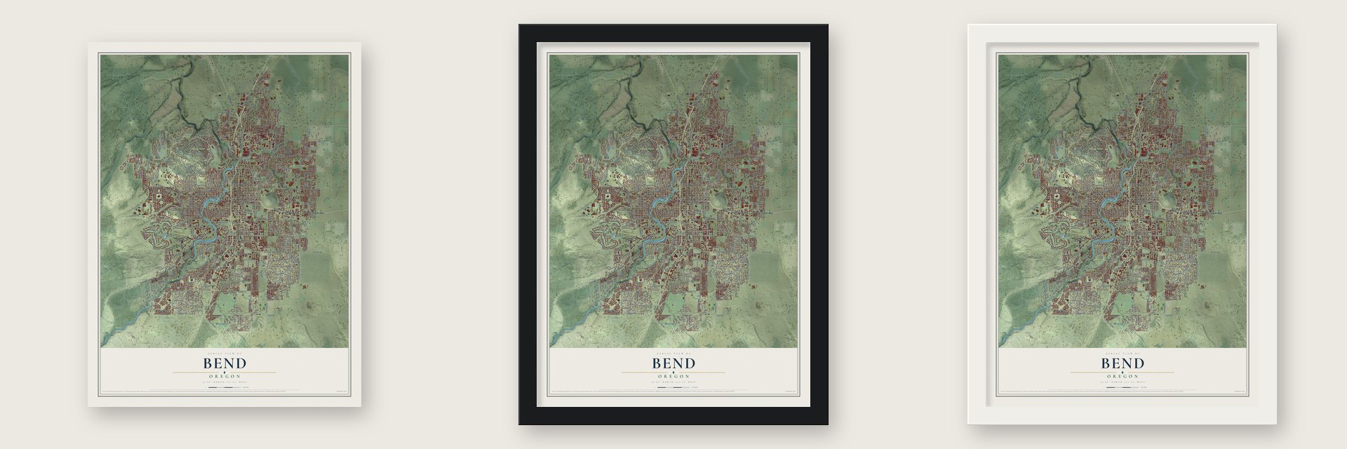
Unframed archival matte, a black wood frame or a white wood frame.
Up close
Geography Worth Displaying
This map was created using accurate cartographic data and authoritative geographic sources, including the U.S. Geological Survey and the Census Bureau. The map brings together terrain, waterways, roads, and building detail. The majority of the streets are labeled, houses are accurately depicted, and the topography is derived from government sources. Combining local data with carefully composed color and shading leads to this beautifully detailed Bend artwork for your wall.
Rather than simply showing street outlines, we’ve included as many of the street names as we could reasonably fit on the map while keeping their names legible. Zoom in on the high resolution preview to see exactly what’s on the map. We truly set out to create a statement piece for anyone who loves Bend. So whether it’s for you, or a gift for someone you love, we hope this map of Bend brings back fond memories.

About Bend, Oregon
From the Historical Marker Database: "Bend got its first real fire station in 1920. It housed two vehicles and had one person on duty at all times. Under Carlon's leadership the Fire Department developed a fine reputation and became a model for the nation."
From the Upper Deschutes Watershed Council: "Bend was platted by the Pilot Butte Development Company, and the plat was filed for record on June 7, 1904. The new town soon had a hotel and some mercantile stores."
Find your street
Names on the Bend map
Every name below is printed on this map. Look for your street, your school, the park where you played, or the pond down the road.
Places and landmarks3
- Bend City Hall
- Awbrey Butte
- Jack Lake
Streets and roads409
- The Dalles-California Highway
- McKenzie-bend Highway
- North Highway 97
- Greenwood Avenue
- Third Street
- Southwest Century Drive
- Southeast Third Street
- Central Oregon Highway
- Northeast Third Street
- Highway 20
- Bend Parkway
- Mount Washington Drive
- Northeast Butler Market Road
- Southeast Reed Market Road
- Brosterhous Road
- Northwest Shevlin Park Road
- Northwest Shelvin Park Market Road
- Skyliners Road
- Sipchen Road
- Pine Drive
- Hollygrape Street
- Northwest Newport Avenue
- Murphy Road
- Simpson
- Baer Road
- Butler Road
- Northwest Twelfth Street
- Southeast Ninth Street
- Mahogany Drive
- Desert Wood Drive
Show all 409 streets
- Northeast Ninth Street
- Yeoman Road
- Porcupine Drive
- Brookswood Boulevard
- 27th Street
- Northeast Purcell Boulevard
- Northeast 27th Street
- Arnold Market Loop Road
- Boyd Acres Road
- Parrell Road
- Cooley Road
- Northwest Summit Drive
- Denser Road
- Southeast 27th Street
- Knott Road
- Eagle Road
- Southeast 15th Street
- Northeast Fourth Street
- Northwest Wild Rye Circle
- Northeast Eighth Street
- Northeast Fifth Street
- Archie Briggs Road
- Briggs Road
- Northwest Portland Avenue
- Northeast 18th Street
- Tam McArthur Loop
- Northeast Sixth Street
- Empire Avenue
- Broken Top Drive
- Northeast Neff Road
- Northwest Wall Street
- Northwest Trenton Avenue
- Bear Creek Road
- Northeast Revere Avenue
- Loop Road
- Northwest Lolo Drive
- Country Club Drive
- Ferguson Road
- Northeast Providence Drive
- Northwest Farewell Drive
- Powers Road
- Hunters Circle
- Tekampe Road
- Pettigrew Road
- 15th Street
- Mammoth Drive
- Southeast Fargo Lane
- Northeast Shepard Road
- Northeast Bear Creek Road
- Putnam Road
- River Bluff Trail
- Rae Road
- Mount High Drive
- Vogt Road
- Brinson Boulevard
- Ladera Road
- Liberty Lane
- China Hat Road
- Northeast Eleventh Street
- King Hezekiah Way
- Stevens Road
- Northeast Tucson Way
- Northwest Lemhi Pass Drive
- Northeast Jones Road
- Granite Drive
- Flagline
- Poplar Street
- Northeast Division Street
- Southeast Westview Drive
- Neff Road
- Badger Road
- Northeast First Street
- Northwest 15th Street
- Benham Road
- Northwest Delaware Avenue
- Blakely Road
- Klahani Drive
- Amethyst Street
- Northwest Iowa Avenue
- Westridge Avenue
- River Rim Drive
- Morningstar Drive
- Geary Drive
- Eastview Drive
- Jamison Road
- Pinebrook Boulevard
- 18th Street
- Airpark Drive
- Northeast Ross Road
- Hunnell Road
- Desert Sage Street
- Brentwood Avenue
- Rock Bluff Lane
- Cole Road
- Northeast Lynda Lane
- Sierra Drive
- Amber Meadow Drive
- Clairaway Avenue
- Via Sandia Street
- Nugget Avenue
- Stonegate Drive
- Northwest 17th Street
- Beaumont Drive
- Azalia Avenue
- Silver Sage Street
- Keyte Lane
- Fairway Drive
- Friar Tuck Lane
- Berg Lane
- White Tail Street
- High Desert Court
- Myrtlewood
- Millview
- Kemple Drive
- Stacy Lane
- Watt Way
- Lucus Court
- Layton Avenue
- Windsor Drive
- Aaron Way
- Orion Drive
- Lupine Avenue
- Egypt Drive
- Ridge Drive
- Chase Road
- Puffin Drive
- Vega Street
- Southwest Colorado Avenue
- Cascade Lakes Highway
- Southwest Simpson Avenue
- Gorge View Street
- Mount Washington
- Driftwood Lane
- Southeast Railroad Street
- Hardy Road
- Northwest College Way
- Bachelor View Road
- Glen Vista Road
- Southeast Fifth Street
- Alpine Village Loop
- Southwest Hayes Road
- Southwest Silver Lake Boulevard
- Southeast Orion Drive
- Britta Street
- Northeast Second Street
- Northeast Wells Acres Road
- Northwest Champion Circle
- Northwest Skyline Ranch Road
- Nels Anderson Road
- Southeast Wilson Avenue
- Northwest Starview Drive
- Northwest Harriman Street
- Northwest High Lakes Loop
- Northeast Tenth Street
- Northwest Awbrey Road
- Northwest Quincy Avenue
- Lodgepole Drive
- Bachelor View Drive
- Northwest Remarkable Drive
- Northeast Twelfth Street
- Northeast Locksley Drive
- Northwest Columbia Street
- Empire Boulevard
- Northwest Fairway Heights
- Southeast Fourth Street
- Northwest First Street
- Northwest Albany Avenue
- Sunshine Way
- Northwest Horizon Drive
- Northeast Emerson Avenue
- Northwest Shields Drive
- Northwest Yosemite Drive
- Northeast Daggett Lane
- Northwest Promontory Drive
- Southwest Industrial Way
- Northwest Sixth Street
- Southwest Knoll Avenue
- Reed Lane
- Grand Targhee Drive
- Ranch Village Drive
- Northwest Georgia Avenue
- Bend-Deschutes Mkt Road
- Metolious Drive
- Northeast Jackson Avenue
- Northeast Studio Road
- Northwest Melville Drive
- Skyline View Drive
- Targee Drive
- Southwest Wilson Avenue
- Northwest Golf View Drive
- Onyx Street
- Fall Creek Loop
- Yellow Ribbon Lane
- Northwest 16th Street
- Northeast Marea Drive
- Southeast Camelot Place
- Ashwood Drive
- Livingston Drive
- Southeast Sweet Pea Drive
- Keyte Road
- Elkhorn Street
- Southeast Arthur Avenue
- Northeast Paula Drive
- Northwest Drake Road
- Northeast Alden Avenue
- Ascha Rose Court
- Aspen Ridge Drive
- Northeast Savannah Drive
- Northwest Conrad Drive
- Northwest Brickyard Street
- Sky Harbor Drive
- Fisher Lake Lane
- Northeast Sandalwood Drive
- Victory Loop
- Southwest Theater Drive
- Darnel Avenue
- Clear Night Drive
- Thornhill Lane
- Northeast Hollowtree Lane
- Clausen Road
- Northwest Britta Street
- Southeast Tempest Drive
- Brookhollow Drive
- Carmen Loop
- Northwest 18th Street
- Northeast Comet Lane
- Lancaster Street
- Rocher Way
- Cabin Lane
- Highlead Road
- Golden Gate Place
- Linton Loop
- Cliffrose Drive
- Alpine Drive
- Voltera Place
- Dove Lane
- Northeast Mays Avenue
- Rigel Way
- Tristar Drive
- Rorick Drive
- Ashford Drive
- Splendor Lane
- Sonata Way
- Lost Lake Drive
- Jenna Drive
- Edro Place
- Kayla Court
- Purser Lane
- Halley Street
- Kobe Street
- News Lane
- Aune Road
- Carl Street
- Lora Lane
- Milo Avenue
- Silas Drive
- Ellie Lane
- Northeast Highway 20
- Reed Market Road
- Southwest Reed Market Road
- Northwest City View Drive
- Northwest 14th Street
- Mount Bachelor Drive
- Purcell Boulevard
- Northwest Redfield Circle
- Green Lakes Loop
- Greenlakes Loop
- Northwest Crossing Drive
- Northwest Hill Street
- North West Fairway Heights Drive
- Northeast Seventh Street
- Chuckanut Drive
- Northwest 13th Street
- Northwest Second Street
- Northwest Constellation Drive
- Mountain High Loop
- Northwest Harmon Boulevard
- Southeast Bridgeford Boulevard
- Larkspur Loop
- Southwest Chandler Avenue
- Ranch Village Court
- Boulderfield Avenue
- Sherwood Forest Drive
- McClain Drive
- Northwest York Drive
- Northeast Meadow Lane
- Southwest McClellan Road
- Northeast Holliday Avenue
- King Solomon Lane
- Lamoine Lane
- Northeast Monterey Avenue
- Northeast Lotno Drive
- Larkview Road
- Ahha Lane
- Southeast Daly Estates Road
- Soda Springs Drive
- Northeast Cliff Drive
- Zircon Drive
- Snow Peaks Drive
- Northeast Keats Drive
- Duncan Lane
- Southwest 15th Street
- Northwest Imbler Drive
- Robal Road
- Southwest Pelton Place
- Northwest Torsway Street
- Killowan Drive
- Sherman Road
- East Lake Drive
- Kings Lane
- Paulina Lane
- Southeast Humber Lane
- Denning Drive
- Southeast Virginia Road
- South Suntree
- Teton Court
- New Castle Drive
- Alstrup Road
- Jamison Street
- Cherry Tree Lane
- Lucia Street
- Brahma Court
- Aster Lane
- Aurora Avenue
- Ridge Heights
- Misty Lane
- South Highway 97
- Pond Meadow Avenue
- Northwest Riverside Boulevard
- Northwest Hillside Park Drive
- Snowbrush Drive
- Mazama Place
- Southwest Bond Street
- Northwest Saginaw Avenue
- Riverbluff Trail
- Willow Creek Loop
- Ponderosa Street
- Northwest Glassow Drive
- Southeast Shadowood Drive
- Northwest Sonora Drive
- Southeast Logsden Street
- North East 18th Street
- Halfway Road
- Northwest Summerhill Drive
- Southeast Cleveland Avenue
- Southeast Cameron Avenue
- Riverstone Drive
- Northeast Dalton Street
- Deer Valley Drive
- Northeast Mc Cartney Drive
- Northeast Courtney Drive
- Old Deschutes Road
- Northeast Daniel Road
- Sarah Drive
- Woodriver Lane
- Fred Meyer Road
- Poe Sholes Drive
- Southeast Gateway Drive
- Northeast Billyeu Way
- Glacier Ridge Road
- High Standard Drive
- Big Sage Way
- Northeast Eleventh Place
- Northeast Diablo Way
- Northeast Conners Drive
- Ambrosia Lane
- Opal Drive
- Charity Lane
- Cone Flower Street
- Redwing Lane
- Kenzie Avenue
- Northeast Harvey Lane
- Builders Court
- Crooked Rock Drive
- Sager Loop
- Harley Lane
- Meyer Drive
- Taos
- Colt Lane
Names are listed as they appear on the printed map. Zoom into the product photos to find them.
The art of mapping a place
How This Map Was Made
Real places. Remarkable detail. Discover the layers that turn geographic data into a map of home.

The view from above
Aerial imagery reveals the character of the land: woodland, open fields, and the patterns of a place.

The shape of the land
Elevation data brings hills, valleys, and subtle changes in the landscape into view.

The details of home
Roads, waterways, and building footprints come together to make the map feel unmistakably local.

Geography becomes art
Considered color, shading, and typography bring the layers together in a map made for your wall.


Process illustrated with Mendon, Massachusetts. Aerial imagery: USDA NAIP. Terrain: USGS 3D Elevation Program. Map details and finished artwork: KNOWOL.
The Details
About This Print
Choose an archival matte print, or a black or white Ayous wood frame. The archival matte print is unframed.
Select your size and finish above to see the matching product image and price.
Materials & Craftsmanship
A contemporary map with the character of a classic atlas, printed on archival matte paper. Optional frames are made from Ayous wood.
Your printed map does not include the watermark shown in the full-map preview.
Shipping & Delivery
Free shipping within the United States. Every print is made to order in the USA.
Buying a gift? Add a note in your cart and we'll include it. We never put prices in the package.
Prints ship within 2 to 3 business days. Allow 7 to 10 days total from ordering for delivery. Timing may vary during holidays or periods of high order volume.
Read our shipping policy.
Returns and damaged prints
Each print is made to order. Change-of-mind refunds are not available after production.
If your print arrives damaged, misprinted or incorrect, contact support@knowol.com within 30 days of receiving it. Include your order number, photos and a description of the issue.
Read our full refund and replacement policy. For questions about your order, email support@knowol.com.
Find your town
Looking for another city?
Find a map of home in our Oregon collection, or any town in the country.
Nearby
Maps of towns near Bend
Know someone from one of these towns? Their map makes a great gift.
 Tetherow
, Oregon
From $39.99See the map
 Seventh Mountain
, Oregon
From $39.99See the map
 Deschutes River Woods
, Oregon
From $39.99See the map
More maps nearby: Tumalo, Pronghorn, Sunriver, Eagle Crest and Redmond.