
Search for another town

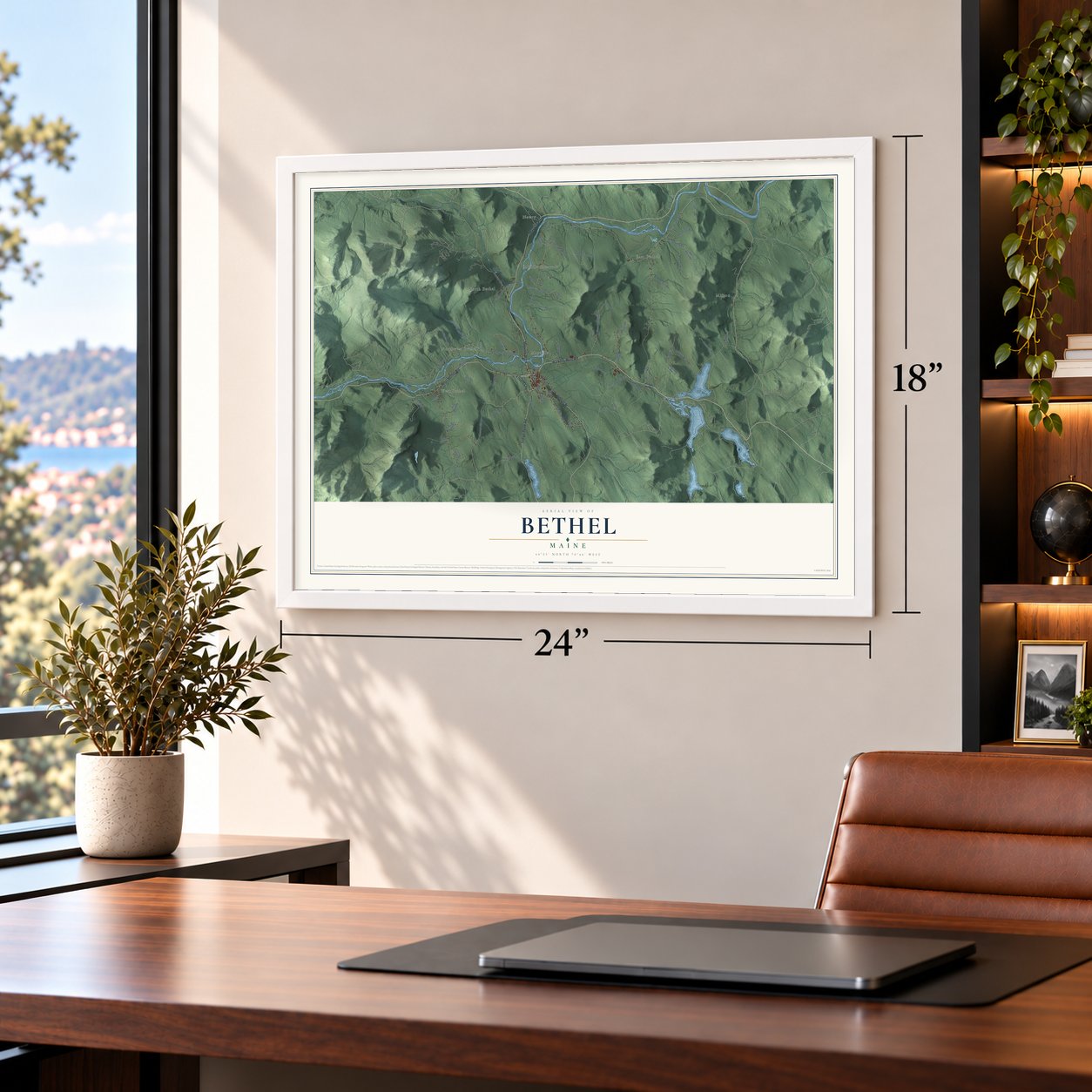
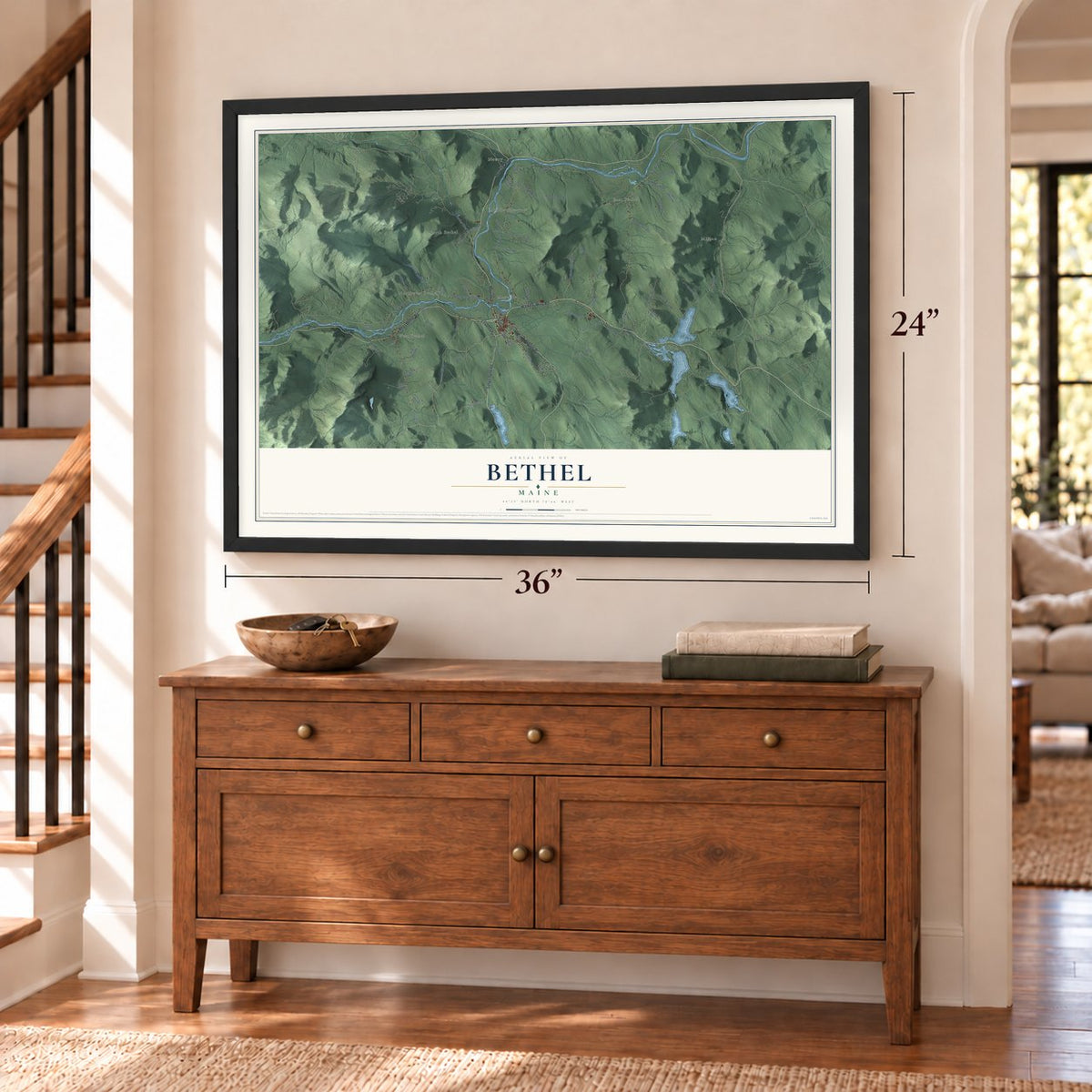
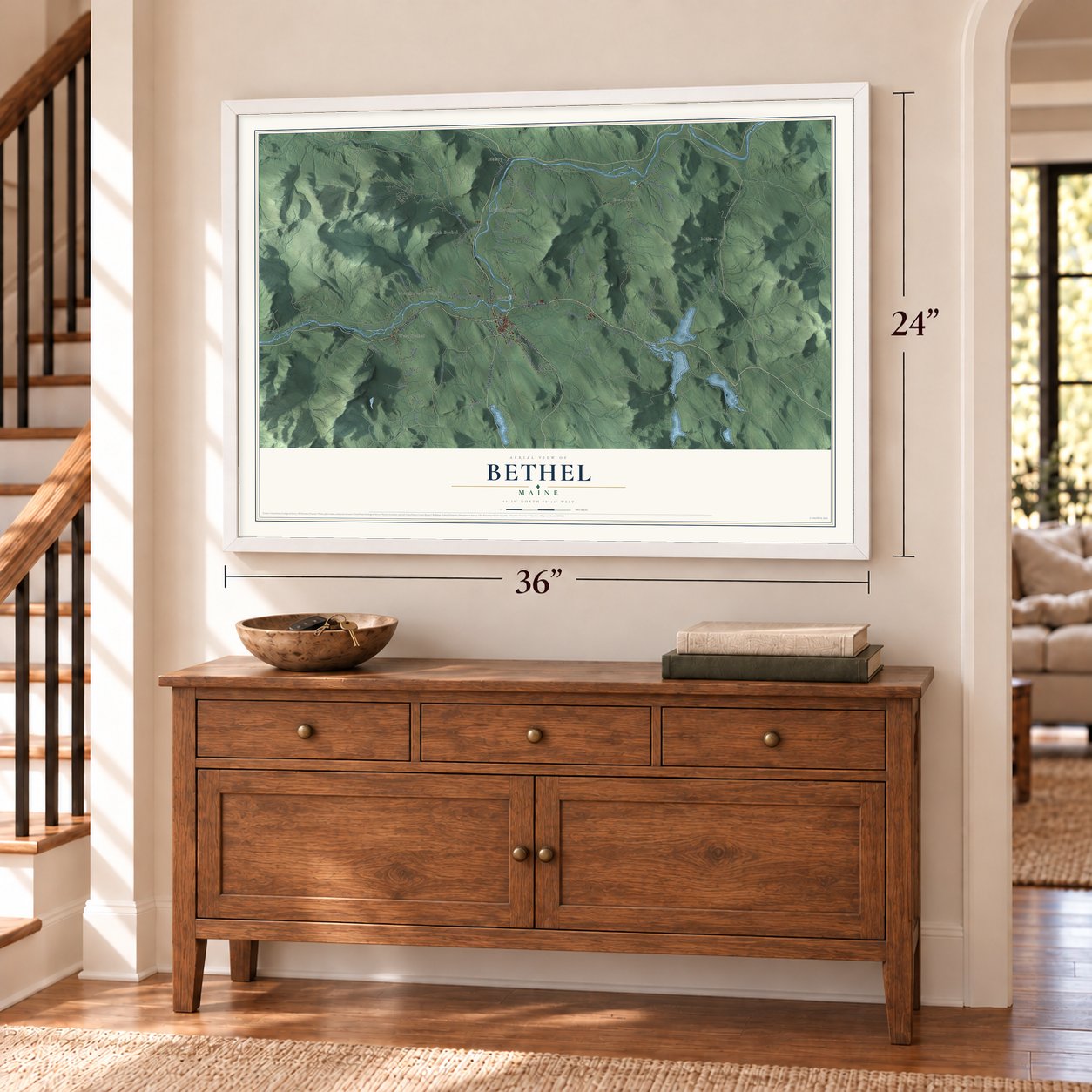

Free U.S. delivery 7 to 10 days after you order
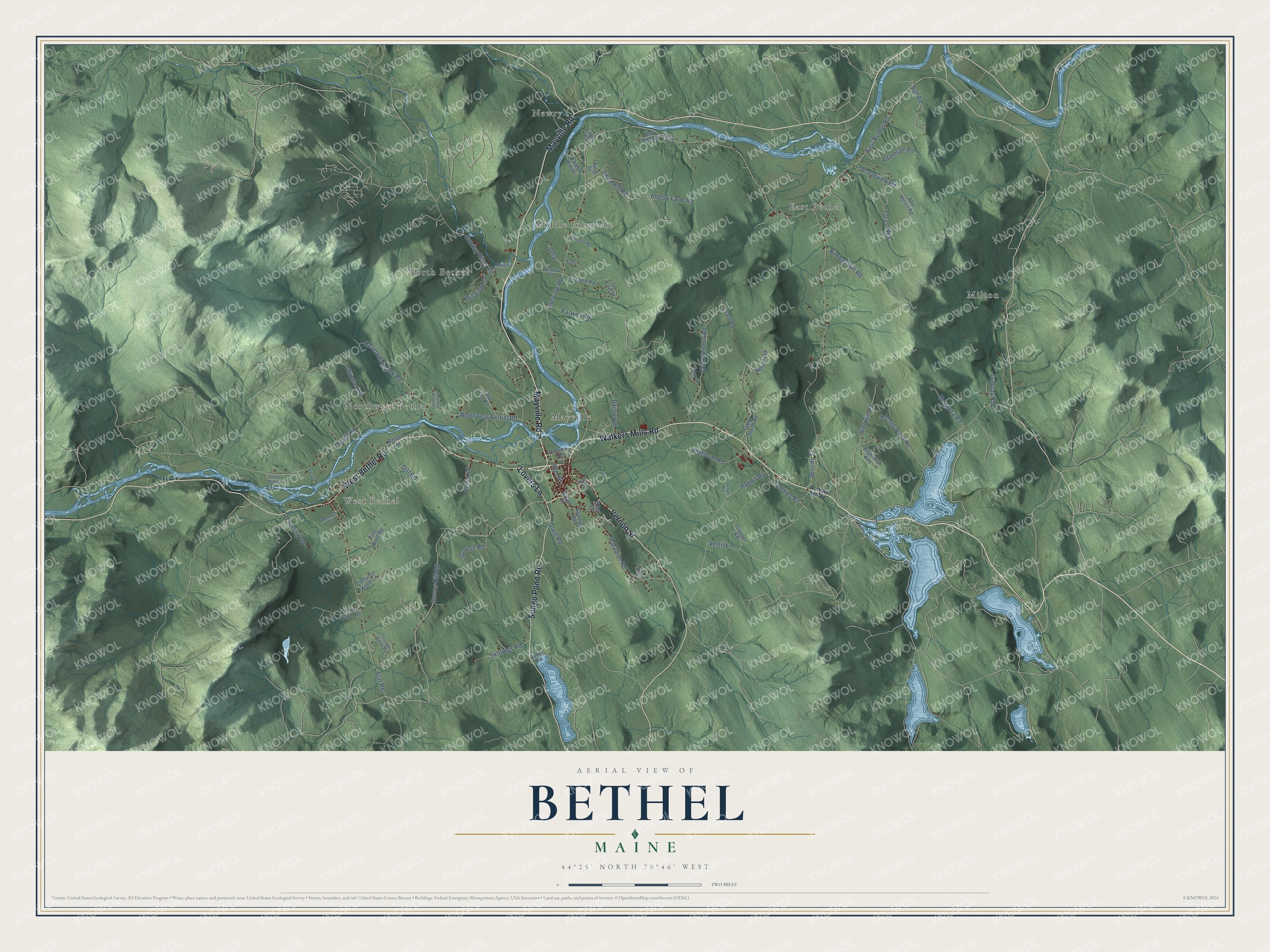
Bethel, Maine Map Art
Building by building, with labeled streets and shaded relief.
12" x 18" Archival Matte Print
A Map of Home. A Work of Art.
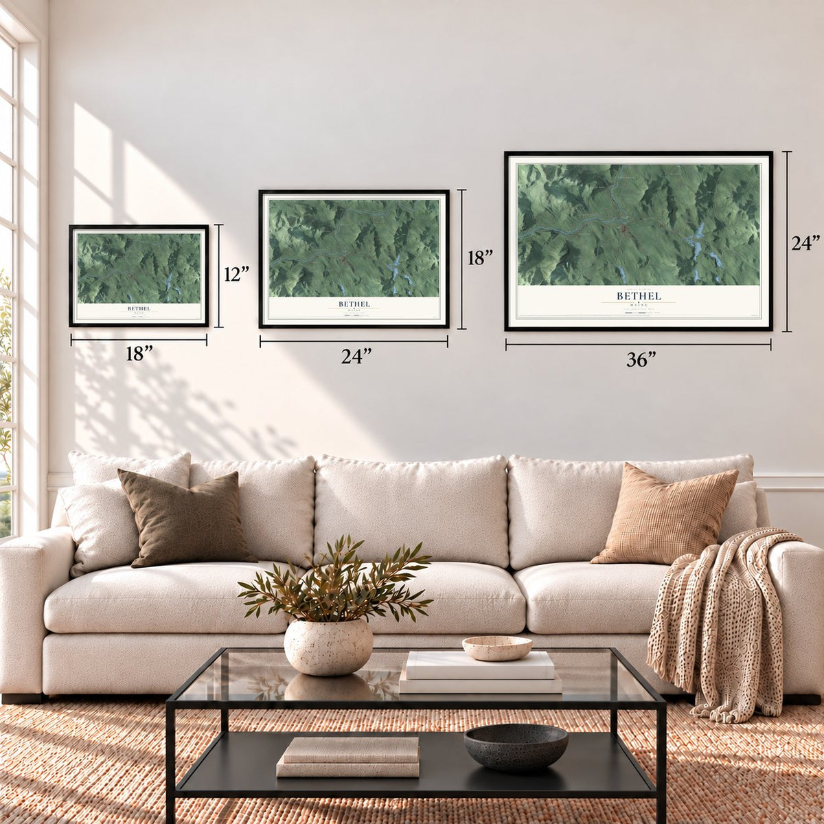
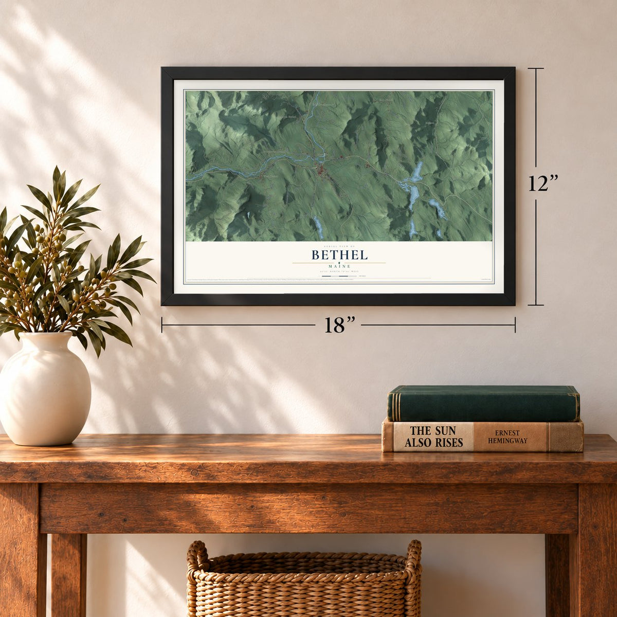
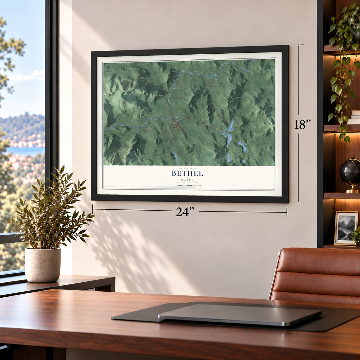
Explore Bethel, Maine from a whole new perspective. Created using aerial imagery and detailed geographic data, this map captures Bethel building by building, with labeled streets, familiar landmarks, and shaded topographical relief that highlights the natural contours of the landscape.
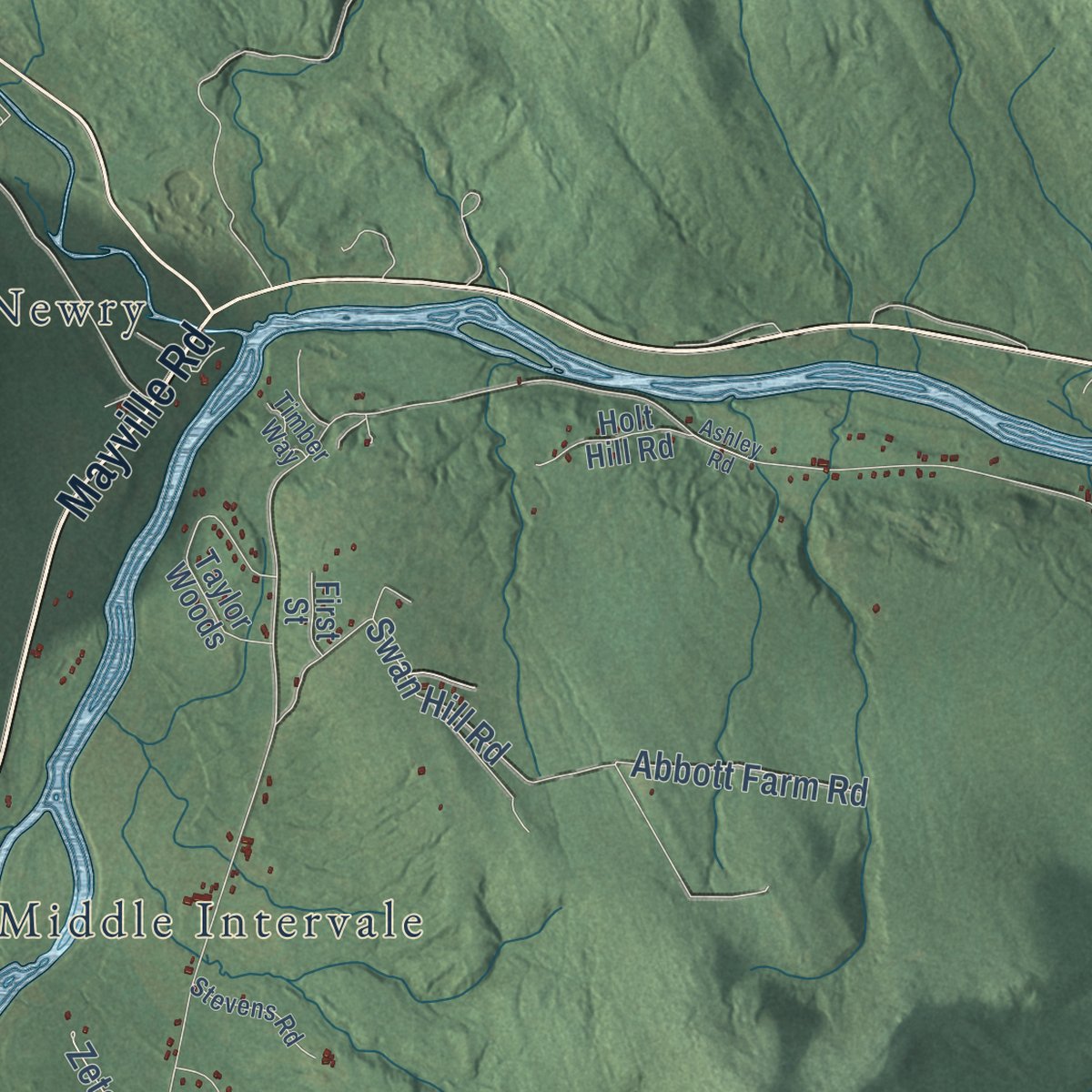
Combining modern data with the timeless character of a vintage atlas, this map is just as interesting up close as it is beautiful on the wall. Whether you grew up in Bethel, spent memorable years there, or call it home today, this unique map is a great way to celebrate a place that means something to you. Zoom in on the preview to look for your street, and then order a print to put your memories on the wall.
Three ways to hang it
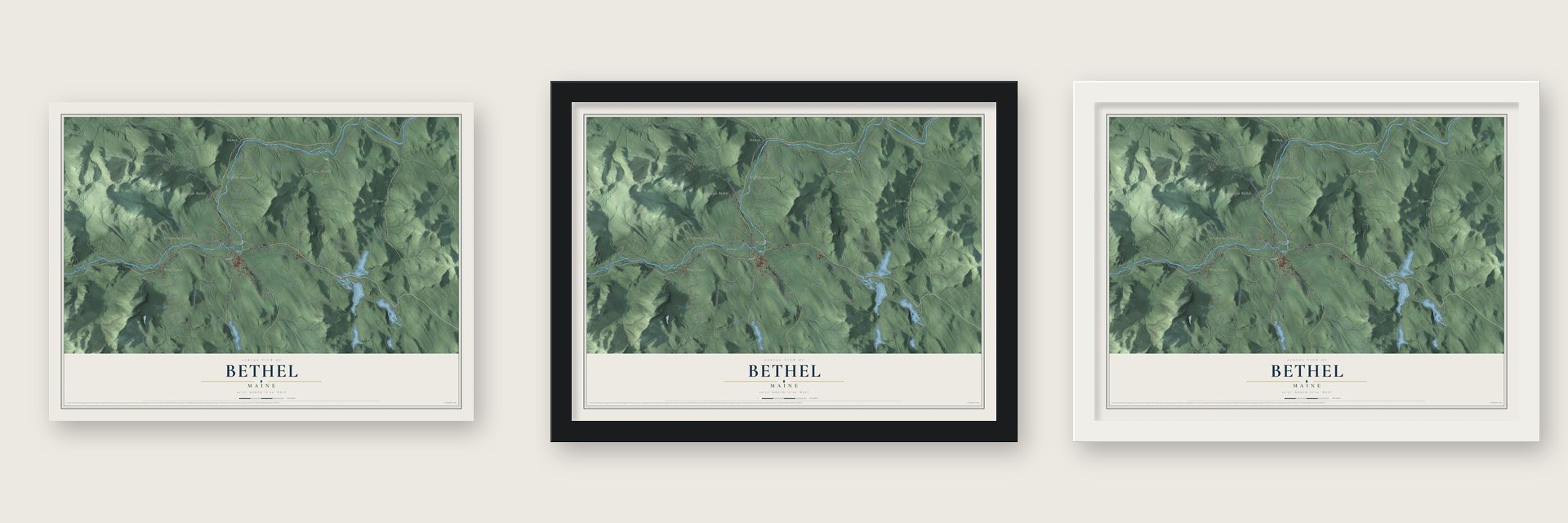
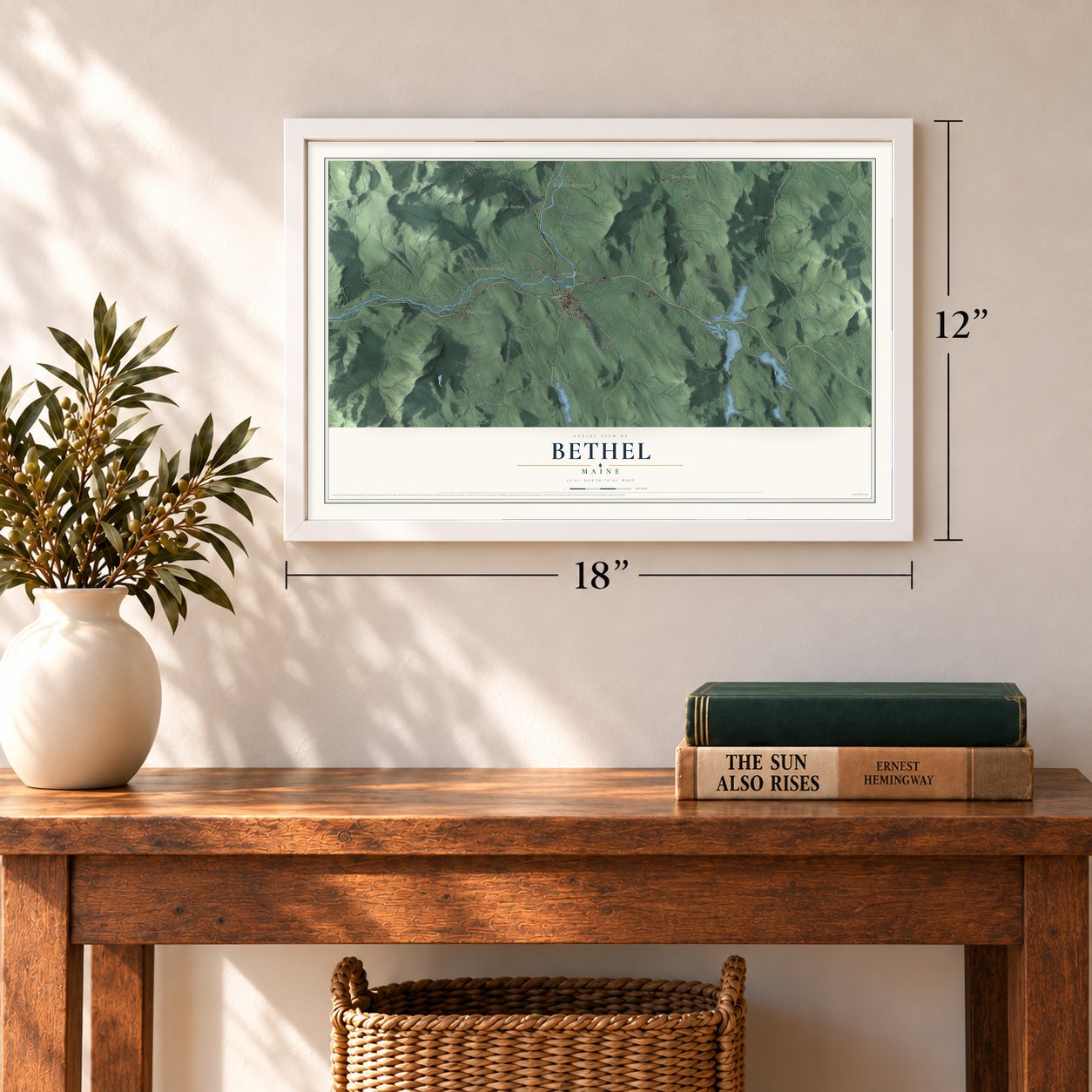
Unframed archival matte, a black wood frame or a white wood frame.
Up close
Geography Worth Displaying
This map was created using accurate cartographic data and authoritative geographic sources, including the U.S. Geological Survey (USGS) and FEMA. The map brings together terrain, waterways, roads, and building detail. The majority of the streets are labeled, houses are accurately depicted, and the topography is derived from government sources. Combining local data with carefully composed color and shading leads to this beautifully detailed Bethel artwork for your wall.
Rather than simply showing street outlines, we’ve included as many of the street names as we could reasonably fit on the map while keeping their names legible. Zoom in on the high resolution preview to see exactly what’s on the map. We truly set out to create a statement piece for anyone who loves Bethel. So whether it’s for you, or a gift for someone you love, we hope this map of Bethel brings back fond memories.
Explore the full map of Bethel, Maine and read about the local places it shows.
Find your street
Names on the Bethel map
Every name below is printed on this map. Look for your street, your school, the park where you played, or the pond down the road.
Places and landmarks8
- West Bethel
- Milton
- Middle Intervale
- Mayville
- East Bethel
- Newry
- North Bethel
- Northwest Bethel
Streets and roads81
- Mayville Road
- West Bethel Road
- Walkers Mills Road
- Songo Pond Road
- Vernon Street
- Lovers Lane
- Grover Hill Road
- Northwest Bethel Road
- Intervale Road
- East Bethel Road
- North Road
- Flat Road
- Farwell Road
- Bird Hill Road
- Paradise Road
- Chandler Hill Road
- Swan Hill Road
- Lowe Road
- Platinum Road
- Sunday River Road
- Rabbit Road
- Reservoir Brook Road
- Grandview Road
- Taras Way
- Ash Road
- Abbott Farm Road
- Skillings Road
- Adamson Road
- Bailey Road
- Grouse Road
Show all 81 streets
- Bloody Street
- Bonanza Road
- Kimball Hill Road
- Fleming Road
- Eddies Road
- Nevel Road
- Annis Road
- Duquay Road
- Dirt Road
- Verril Lane
- Zeta
- Elm Street
- Barker Road
- Chapman Hill
- Abe Merril Road
- Chestnut Knoll Lane
- Osgood Road
- Old Iron Road
- McCrillis Brook Road
- Trapper Road
- Taylor Smith Road
- Fairway Road
- Will View Road
- Taylor Woods
- Highland Avenue
- Chase Road
- Eden Lane
- Pine Bluff Road
- Parkway Road
- Holt Hill Road
- Smith Farm Road
- Broad Street
- First Street
- Baker Road
- Thunder Snow Road
- Stevens Road
- Martin's Lane
- Winslow Road
- Oak Ridge Drive
- Monach Circle
- Timber Way
- Haley
- Tyler Street
- Walkers Mill Road
- Hideaway Lane
- Jordan Woods
- Hemlock Ridge Road
- Gibson Road
- Brown Road
- Willard Road
- Ashley Road
Names are listed as they appear on the printed map. Zoom into the product photos to find them.
About Bethel, Maine
Bethel is a town of 2,504 people in Oxford County, on the Androscoggin River below the Mahoosuc Range. In 1769 the Massachusetts General Court granted the land as Sudbury-Canada to Josiah Richardson and others, rewarding those who had fought in the 1690 Battle of Quebec. Nathaniel Segar began clearing a farm in 1774, but the Revolution kept most grantees away. Only 10 families were living there on August 3, 1781, when raiders plundered the settlement in what became the final Indian attack in Maine.
The raiders carried off Segar and Benjamin Clark, who stayed captive in Quebec until the war ended. Peace brought a rush of newcomers, and the plantation became the incorporated town of Bethel on June 10, 1796, taking a Genesis name meaning "House of God." A road between Portland and Errol, New Hampshire, opened through town in 1802 and is now Route 26. Farmers on the rich intervales became known for hay and potatoes, and in winter they logged for the water-powered sawmills.
- The railroad brought summer guestsTrains of the Atlantic and St. Lawrence Railroad reached Bethel on March 10, 1851, bringing city families escaping summer heat. Hotels rose on Bethel Hill and around the common. The largest was the Prospect Hotel, started in 1863 with a cupola for mountain views. From 1897 to 1926, noted musicians came for William Rogers Chapman's Maine Music Festivals. Fire ruined most of the Prospect in 1911, and when cars let tourists roam, trackside hotels lost guests and came down.
- Dr. Mason's house on the commonMoses Mason began practicing medicine here in 1813, when Bethel Hill had just four houses. He became the town's first postmaster and served two terms in Congress. Around 1830 the traveling artist Rufus Porter painted harbor and forest murals in the hall and stairwell of Mason's Broad Street home. The Dr. Moses Mason House still faces the common, and the Bethel Historical Society runs it as a museum.
- Gould Academy since 1836The school opened in 1836 as Bethel Academy and was later renamed for the Reverend Daniel Gould, whose fortune of $842 went to it. Every local child attended high school there until Telstar High School opened in 1969. Starting in 1947, psychologist Kurt Lewin's National Training Laboratories held summer sessions at the academy that shaped the new field of organizational development. In 2008 NTL shifted its headquarters to Alexandria, Virginia, though it still keeps a small summer presence here.
- A clinic that built an innDr. John George Gehring treated nervous disorders at his home on Broad Street, and his clinic drew many wealthy patients. They paid to build the Bethel Inn, which was dedicated to him. The Gehring Clinic is on the National Register.
- Meeting houses on the intervalesThe Middle Intervale Meeting House went up in 1816 to serve Baptists, Congregationalists and the town meeting, and it was remodeled in Greek Revival style in 1857, after which the Baptists used it alone. In East Bethel, Baptists and Methodists shared the Lower Meeting House, built in 1831. Its cemetery dates its first burial to 1817, and Deacon Asa Kimball Jr., founder of Bethel's Baptist congregation, was laid to rest there in 1823.
Keep exploring Maine
Bethel is one of 536 Maine towns we've mapped. Every dot on the map is a print of its own.
The search covers every state, Maine first.
Near Bethel
Order 2 or more town maps and save 10%. Shown in the size and finish you picked above, so they hang as a set.
- Hanover 12" x 18" / Archival Matte Print $39.99
- Greenwood 12" x 18" / Archival Matte Print $39.99
- Newry 12" x 18" / Archival Matte Print $39.99

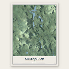
More maps nearby: Gilead, Woodstock, Rumford, Andover and Stoneham.
The art of mapping a place
How This Map Was Made
Real places. Remarkable detail. Discover the layers that turn geographic data into a map of home.

The view from above
Aerial imagery reveals the character of the land: woodland, open fields, and the patterns of a place.

The shape of the land
Elevation data brings hills, valleys, and subtle changes in the landscape into view.

The details of home
Roads, waterways, and building footprints come together to make the map feel unmistakably local.

Geography becomes art
Considered color, shading, and typography bring the layers together in a map made for your wall.


Process illustrated with Mendon, Massachusetts. Aerial imagery: USDA NAIP. Terrain: USGS 3D Elevation Program. Map details and finished artwork: KNOWOL.
The Details
About This Print
Choose an archival matte print, or a black or white Ayous wood frame. The archival matte print is unframed.
Select your size and finish above to see the matching product image and price.
Materials & Craftsmanship
A contemporary map with the character of a classic atlas, printed on archival matte paper. Optional frames are made from Ayous wood.
Your printed map does not include the watermark shown in the full-map preview.
Shipping & Delivery
Free shipping within the United States. Every print is made to order in the USA.
Buying a gift? Add a note in your cart and we'll include it. We never put prices in the package.
Prints ship within 2 to 3 business days. Allow 7 to 10 days total from ordering for delivery. Timing may vary during holidays or periods of high order volume.
Read our shipping policy.
Returns and damaged prints
Each print is made to order. Change-of-mind refunds are not available after production.
If your print arrives damaged, misprinted or incorrect, contact support@knowol.com within 30 days of receiving it. Include your order number, photos and a description of the issue.
Read our full refund and replacement policy. For questions about your order, email support@knowol.com.