
Search for another town


Free U.S. delivery 7 to 10 days after you order
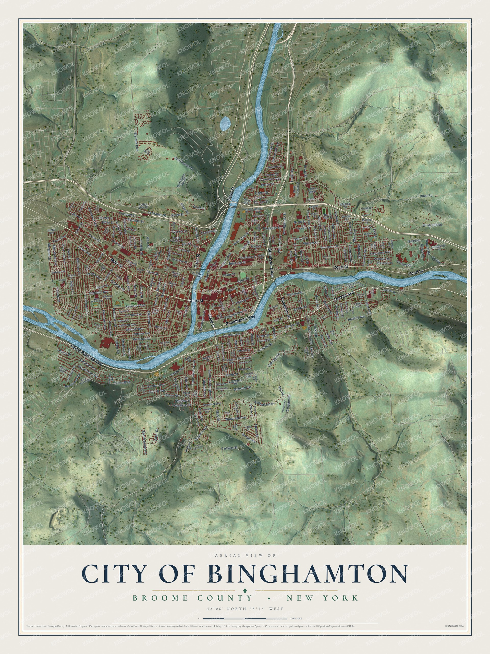
City of Binghamton, Broome County, New York Map Art
Building by building, with labeled streets and shaded relief.
12" x 18" Archival Matte Print
A Map of Home. A Work of Art.
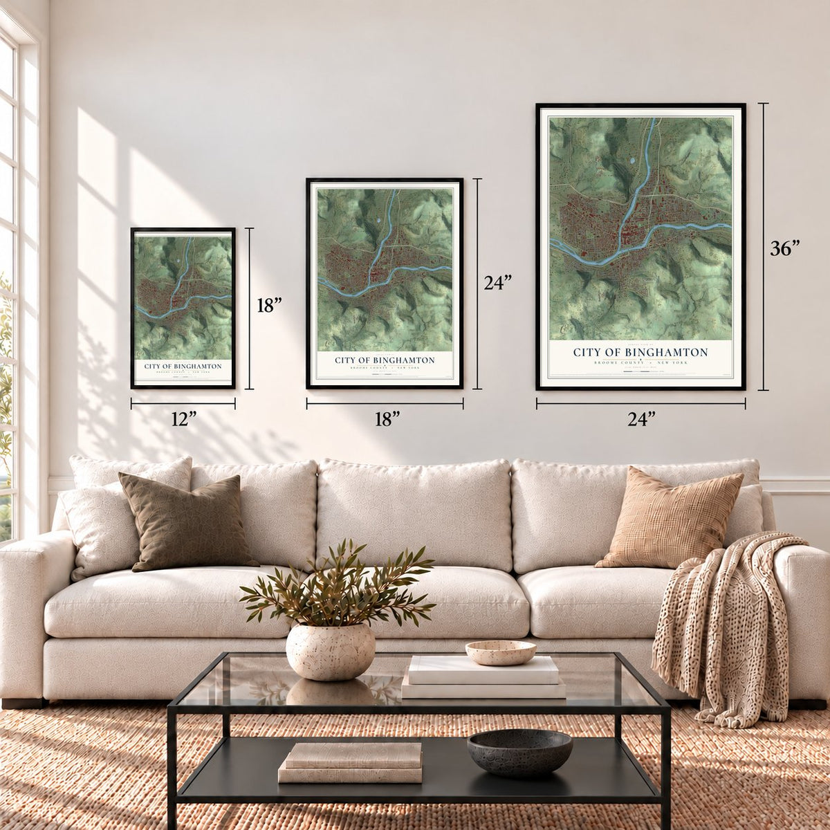
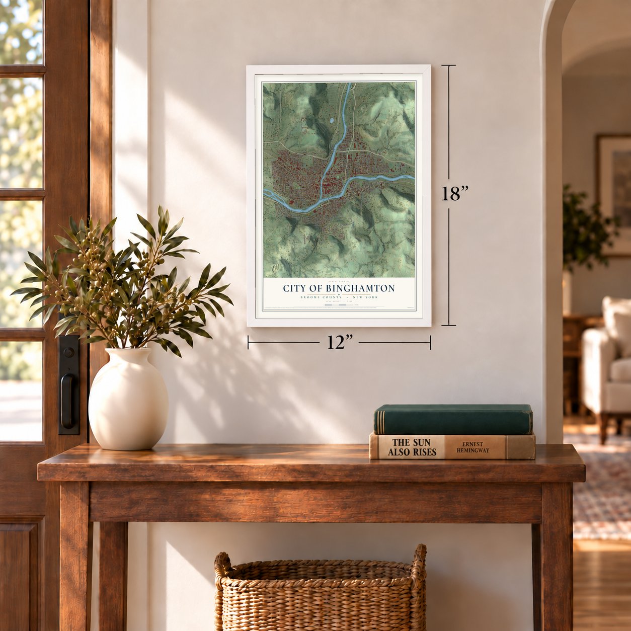
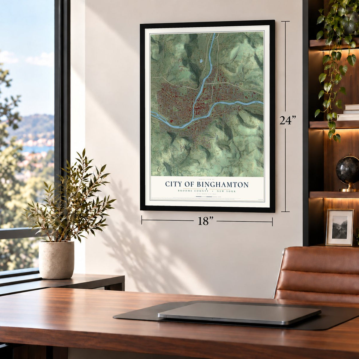
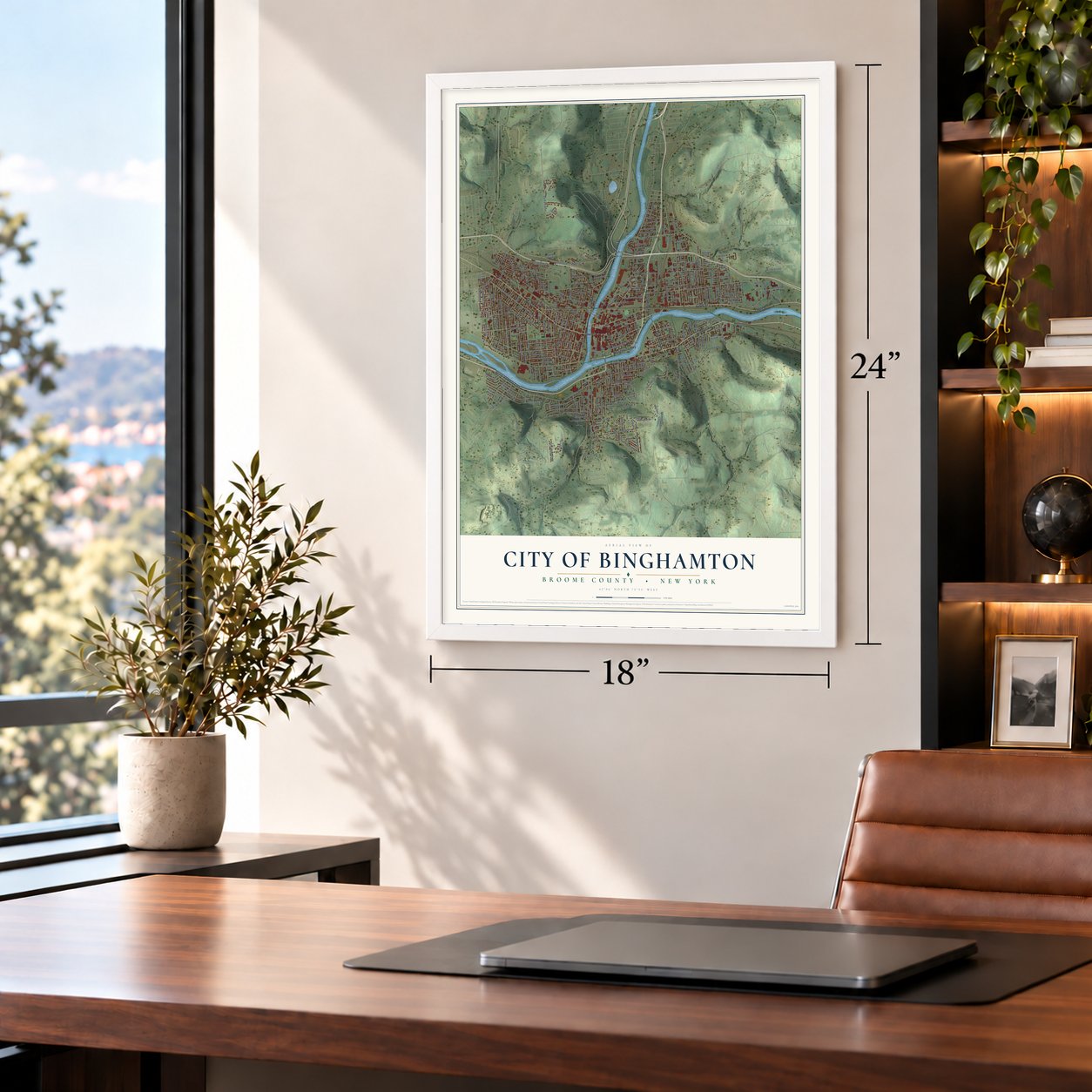
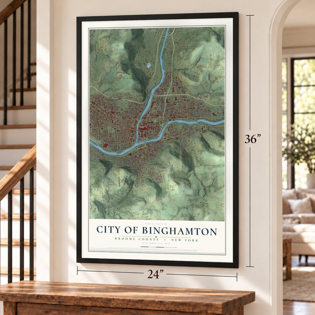
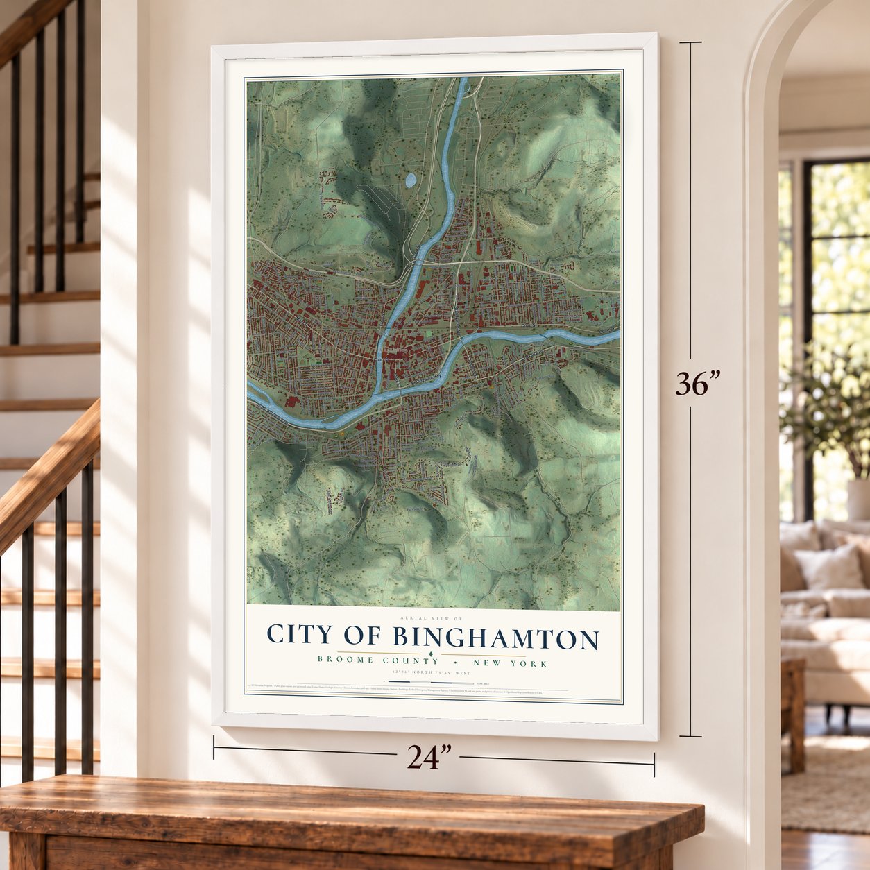
Explore Binghamton, New York from a whole new perspective. Created using aerial imagery and detailed geographic data, this map captures Binghamton building by building, with labeled streets, familiar landmarks, and shaded topographical relief that highlights the natural contours of the landscape.
Combining modern data with the timeless character of a vintage atlas, this map is just as interesting up close as it is beautiful on the wall. Whether you grew up in Binghamton, spent memorable years there, or call it home today, this unique map is a great way to celebrate a place that means something to you. Zoom in on the preview to look for your street, and then order a print to put your memories on the wall.
Three ways to hang it
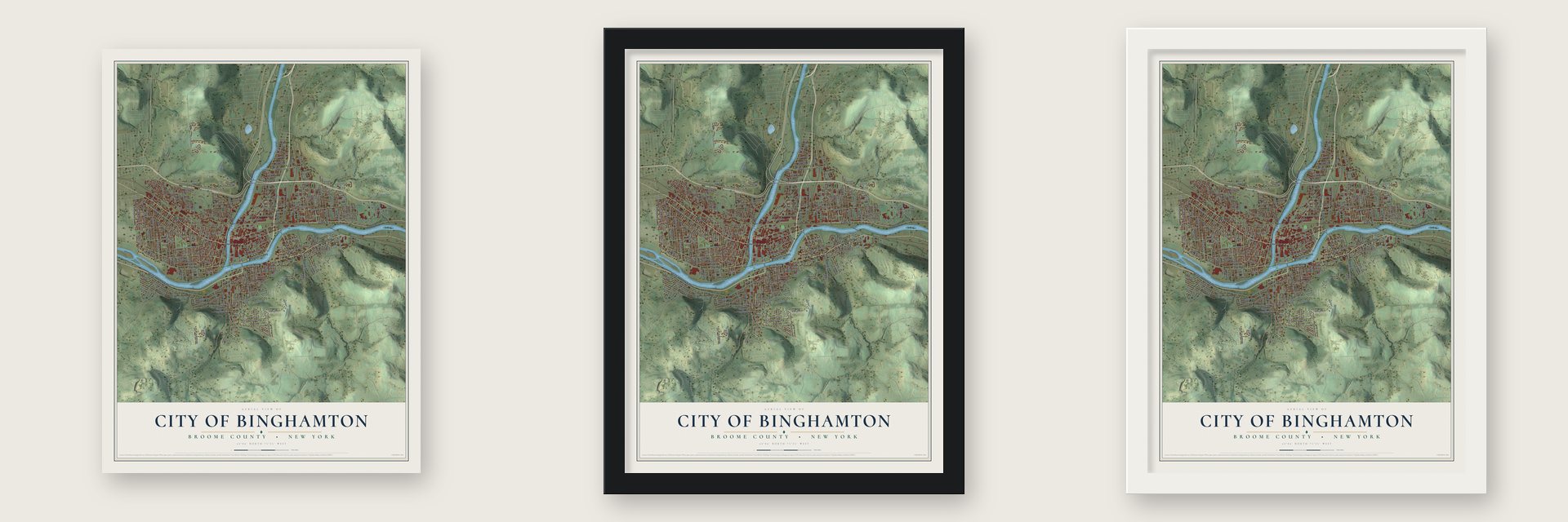
Unframed archival matte, a black wood frame or a white wood frame.
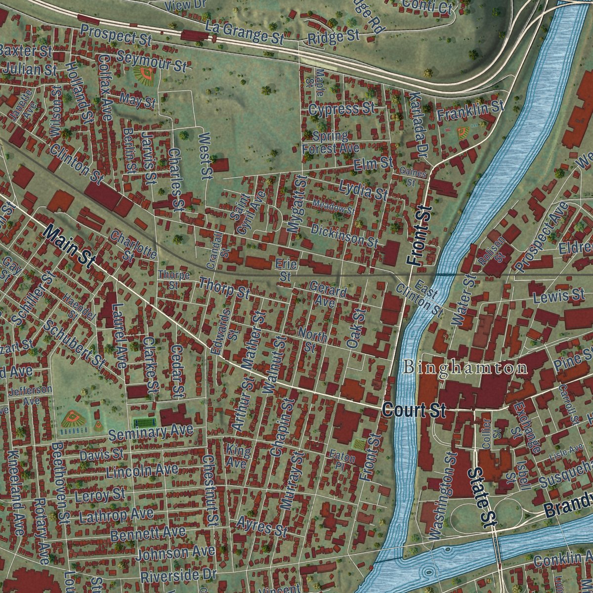
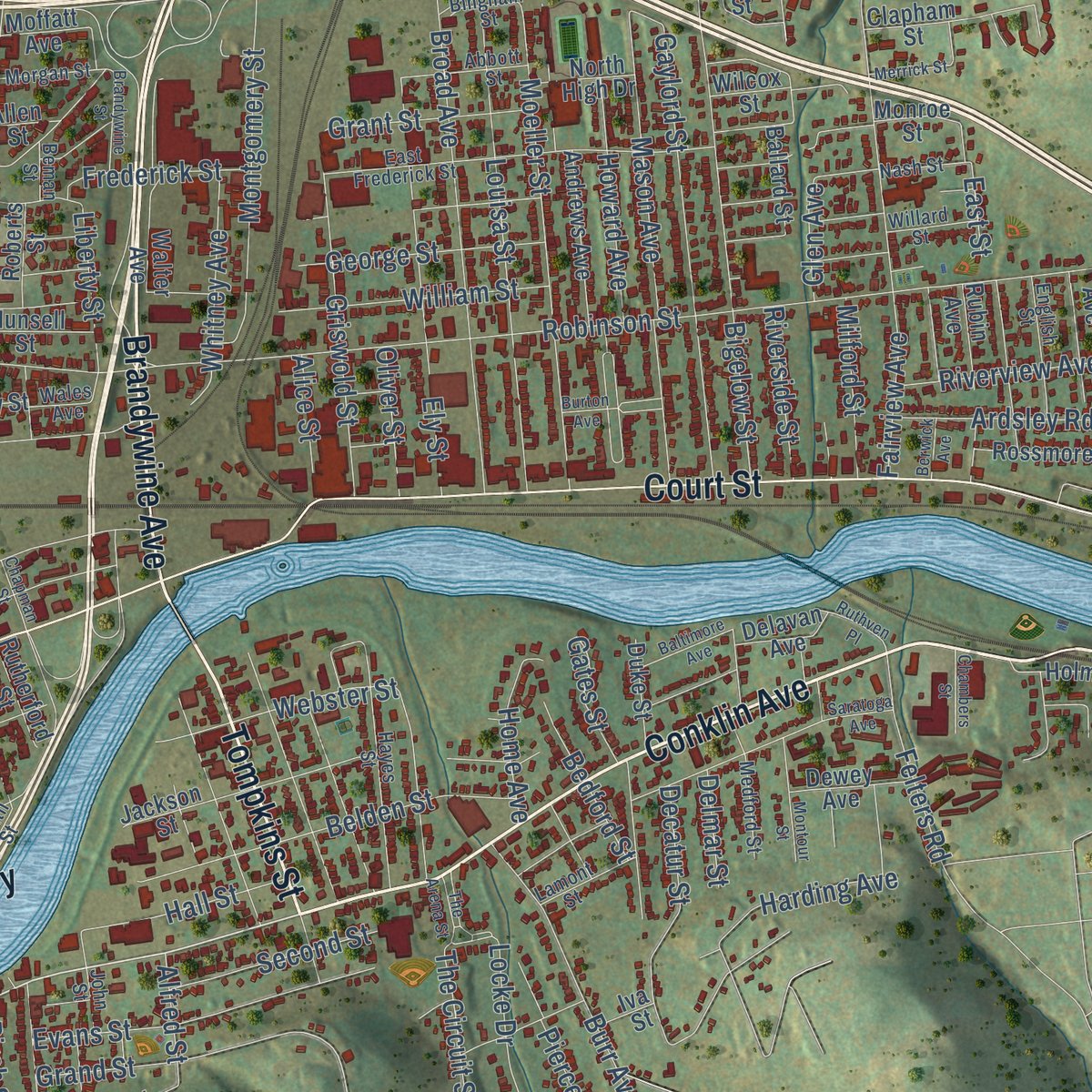
Up close
Geography Worth Displaying
This map was created using accurate cartographic data and authoritative geographic sources, including the U.S. Geological Survey (USGS) and FEMA. The map brings together terrain, waterways, roads, and building detail. The majority of the streets are labeled, houses are accurately depicted, and the topography is derived from government sources. Combining local data with carefully composed color and shading leads to this beautifully detailed Binghamton artwork for your wall.
Rather than simply showing street outlines, we’ve included as many of the street names as we could reasonably fit on the map while keeping their names legible. Zoom in on the high resolution preview to see exactly what’s on the map. We truly set out to create a statement piece for anyone who loves Binghamton. So whether it’s for you, or a gift for someone you love, we hope this map of Binghamton brings back fond memories.
Explore the full map of City of Binghamton, Broome County, New York and read about the local places it shows.

Find your street
Names on the Binghamton City (Broome County) map
Every name below is printed on this map. Look for your street, your school, the park where you played, or the pond down the road.
Places and landmarks2
- Binghamton
- Ely Park
Streets and roads328
- Conklin Avenue
- Tompkins Street
- Brandywine Avenue
- State Street
- Front Street
- Vestal Parkway East
- Court Street
- Main Street
- Brandywine Highway
- Pennsylvania Avenue
- La Grange Street
- Ridge Road
- Conti Court
- Ridge Street
- Oakridge Drive
- Prospect Avenue
- Croydon Road
- Vestal Avenue
- Robinson Street
- Chenango Street
- Riverside Drive
- Prospect Street
- Century Drive
- Crestmont Road
- Oak Street
- Leroy Street
- Murray Street
- Clinton Street
- Bevier Street
- Park Avenue
Show all 328 streets
- Matthews Street
- Broad Avenue
- Henry Street
- Laurel Avenue
- Hawley Street
- Ely Park Boulevard
- Crary Avenue
- Moeller Street
- South Washington Street
- Clifton Boulevard
- Chapin Street
- Mary Street
- Helen Street
- Water Street
- Mill Street
- West End Avenue
- Schubert Street
- Beethoven Street
- Seminary Avenue
- Fairview Avenue
- Gaylord Street
- Gillen Drive
- Montgomery Street
- Susquehanna Street
- Bigelow Street
- Howard Avenue
- Louisa Street
- Mason Avenue
- Highland Avenue
- Eldredge Street
- Audubon Avenue
- Glenwood Avenue
- Grand Boulevard
- Golf Course Road
- Walnut Street
- Morgan Road
- Margaret Street
- Aldrich Avenue
- Moore Avenue
- Windy Hill Road
- Decatur Street
- Ely Street
- Chestnut Street
- Vine Street
- Hiner Road
- Blackstone Avenue
- Belden Street
- Washington Street
- Woodland Avenue
- Mygatt Street
- Park Street
- Griswold Street
- Kendall Avenue
- Kenilworth Road
- Wagner Road
- Evans Street
- Bennett Avenue
- Charles Street
- Kneeland Avenue
- Pine Street
- Cleveland Avenue
- Mitchell Avenue
- Jarvis Street
- Elm Street
- Rotary Avenue
- North Road
- Burr Avenue
- Frederick Street
- Harding Avenue
- Holland Street
- Lincoln Avenue
- Lathrop Avenue
- William Street
- Grand Street
- Rush Avenue
- Johnson Avenue
- Liberty Street
- The Circuit Street
- Schiller Street
- West State Street
- Colfax Avenue
- Broad Street
- Hall Street
- Webster Street
- Thorp Street
- George Street
- Timberland Drive
- Travis Avenue
- Lake Avenue
- Whitney Avenue
- James Street
- Bayless Avenue
- East Hamton Road
- Hotchkiss Street
- Ardsley Road
- Midwood Drive
- Second Street
- Riverview Avenue
- Felters Road
- Emma Street
- Patricia Street
- Lewis Street
- Locke Drive
- Floral Avenue
- Lookout Street
- Grant Street
- Tremont Avenue
- Glen Avenue
- Baxter Street
- Kriska Lane
- West Street
- Clarke Street
- Rugby Road
- Home Avenue
- East Street
- Seymour Street
- Jerome Avenue
- Milford Street
- Bedford Street
- Julian Street
- Dennison Avenue
- Riverside Street
- Lennox Drive
- Spring Street
- Roosevelt Avenue
- Amsbry Street
- Lydia Street
- Avon Road
- Linden Street
- Cypress Street
- Cary Street
- Gates Street
- Oliver Street
- Karlada Drive
- Parkway Street
- Alice Street
- Sturges Street
- Ayres Street
- Cedar Street
- Stratford Place
- Mather Street
- Sheldon Street
- Lourdes Road
- Mill Road
- Tracy Street
- Alfred Street
- Ogden Street
- Franklin Street
- Arthur Street
- Brown Street
- Delmar Street
- Pierce Street
- Birch Street
- Cross Street
- North Street
- Larchmont Road
- Exchange Street
- Sherwood Avenue
- Fayette Street
- Davis Street
- Charlotte Street
- Jackson Street
- Broadmoor Drive
- Gerard Avenue
- Spellicy Boulevard
- Dickinson Street
- Mozart Street
- Walter Avenue
- East Clinton Street
- Andrews Avenue
- Brookfield Road
- Golf Course Svc Road
- Brook Avenue
- Pig Alley
- Spring Forest Avenue
- Monroe Street
- Vincent Street
- Garden Avenue
- Ballard Street
- Earle Drive
- Vermont Avenue
- Lanesboro Street
- Rossmore Place
- Phinn Avenue
- Wilcox Street
- Doubleday Street
- Munsell Street
- Moffatt Avenue
- Valley View Drive
- North Griswold Street
- Edgewood Road
- Dewey Avenue
- Saint Cyril Avenue
- Parsons Street
- Stokes Avenue
- Edwards Street
- Wilson Street
- Esther Avenue
- Rutherford Street
- Duane Avenue
- Duke Street
- Rexford Street
- Newton Avenue
- Delavan Avenue
- Edna Avenue
- Rubin Avenue
- Cohoes Street
- North High Drive
- Holmes Place
- Roberts Street
- Berlin Street
- High Street
- Ivanhoe Road
- Cornell Avenue
- Kane Avenue
- Devon Boulevard
- May Street
- Espial Drive
- Clapham Street
- Martha Street
- Whiting Street
- Grand Avenue
- Isbell Street
- Maple Avenue
- Allen Street
- North Avenue
- Iva Street
- Hill Street
- Zane Road
- King Avenue
- Gay Street
- Erie Street
- East Frederick Street
- Carroll Street
- Thorpe Street
- Hayes Street
- Crandall Street
- Haendel Street
- Nash Street
- Fuller Hollow Road
- Medford Street
- English Street
- Corbett Avenue
- Abbott Street
- Farview Avenue
- Clarence Street
- Lamont Street
- Harrison Street
- Christopher Street
- Euclid Avenue
- Morgan Street
- Camden Road
- West Middle Avenue
- Wales Avenue
- Willard Street
- Rolison Street
- Truesdell Street
- South Street
- Jefferson Avenue
- Eaton Place
- Maple Street
- Janette Avenue
- Bingham Street
- Collier Street
- Briar Court
- John Street
- Beman Street
- Pratt Court
- Saratoga Avenue
- Park Terrace Place
- The Arena Street
- Spaulding Road
- Allendale Road
- Burton Avenue
- Montour Street
- Brandywine Street
- Livingston Street
- Oneonta Street
- Meadow Street
- New Street
- Baltimore Avenue
- Loraine Avenue
- Campbell Road
- Lisle Avenue
- Columbus Street
- Ruthven Place
- Chambers Street
- Merrick Street
- Minden Avenue
- Ellsworth Road
- Chapman Street
- Giles Street
- Gaines Street
- Berwick Avenue
- Carlton Street
- Armory Lane
- Brevity Court
- Green Street
Names are listed as they appear on the printed map. Zoom into the product photos to find them.
About the City of Binghamton, Broome County, New York
Binghamton honors William Bingham, a rich Philadelphia man who bought a 10,000 acre patent here in 1786. His land agent, Joshua Whitney, picked the spot where the Chenango meets the Susquehanna. The settlement was first called Chenango Point. It took the name Binghamton when it became a village in 1834.
Edwin Link invented the flight simulator in Binghamton. Along with the rise of IBM, which was founded in the area, his work helped move the region toward a high-tech economy during and after World War II.
- A national firstThe New York State Inebriate Asylum opened in Binghamton in 1858. It was the first center in the country to treat alcoholism as a disease.
Keep exploring New York
City of Binghamton is one of 2,165 New York towns we've mapped. Every dot on the map is a print of its own.
The search covers every state, New York first.
Near City of Binghamton
Order 2 or more town maps and save 10%. Shown in the size and finish you picked above, so they hang as a set.
- Dickinson 12" x 18" / Archival Matte Print $39.99
- Port Dickinson 12" x 18" / Archival Matte Print $39.99
- Binghamton University 12" x 18" / Archival Matte Print $39.99


More maps nearby: Johnson City, Town of Binghamton, Chenango Bridge, Conklin and Kirkwood.
The art of mapping a place
How This Map Was Made
Real places. Remarkable detail. Discover the layers that turn geographic data into a map of home.

The view from above
Aerial imagery reveals the character of the land: woodland, open fields, and the patterns of a place.

The shape of the land
Elevation data brings hills, valleys, and subtle changes in the landscape into view.

The details of home
Roads, waterways, and building footprints come together to make the map feel unmistakably local.

Geography becomes art
Considered color, shading, and typography bring the layers together in a map made for your wall.


Process illustrated with Mendon, Massachusetts. Aerial imagery: USDA NAIP. Terrain: USGS 3D Elevation Program. Map details and finished artwork: KNOWOL.
The Details
About This Print
Choose an archival matte print, or a black or white Ayous wood frame. The archival matte print is unframed.
Select your size and finish above to see the matching product image and price.
Materials & Craftsmanship
A contemporary map with the character of a classic atlas, printed on archival matte paper. Optional frames are made from Ayous wood.
Your printed map does not include the watermark shown in the full-map preview.
Shipping & Delivery
Free shipping within the United States. Every print is made to order in the USA.
Buying a gift? Add a note in your cart and we'll include it. We never put prices in the package.
Prints ship within 2 to 3 business days. Allow 7 to 10 days total from ordering for delivery. Timing may vary during holidays or periods of high order volume.
Read our shipping policy.
Returns and damaged prints
Each print is made to order. Change-of-mind refunds are not available after production.
If your print arrives damaged, misprinted or incorrect, contact support@knowol.com within 30 days of receiving it. Include your order number, photos and a description of the issue.
Read our full refund and replacement policy. For questions about your order, email support@knowol.com.