
Search for another town


Free U.S. delivery 7 to 10 days after you order
Bismarck, North Dakota Map Art
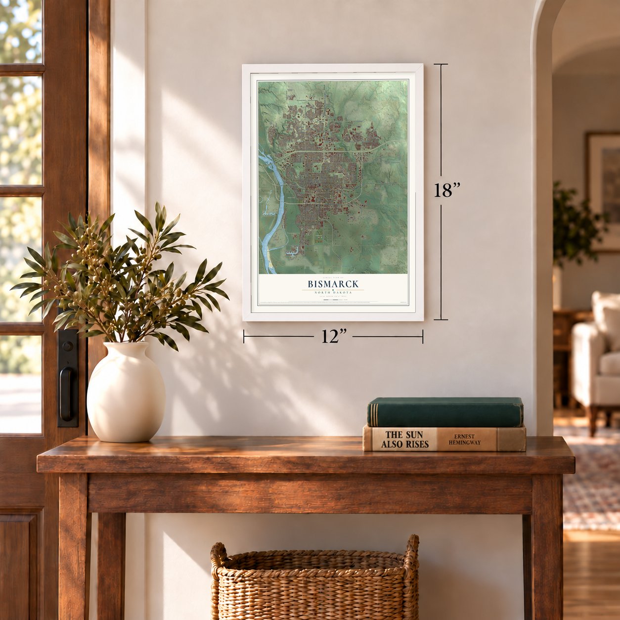
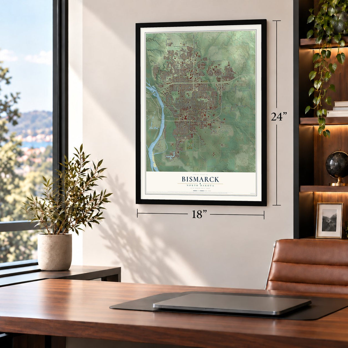
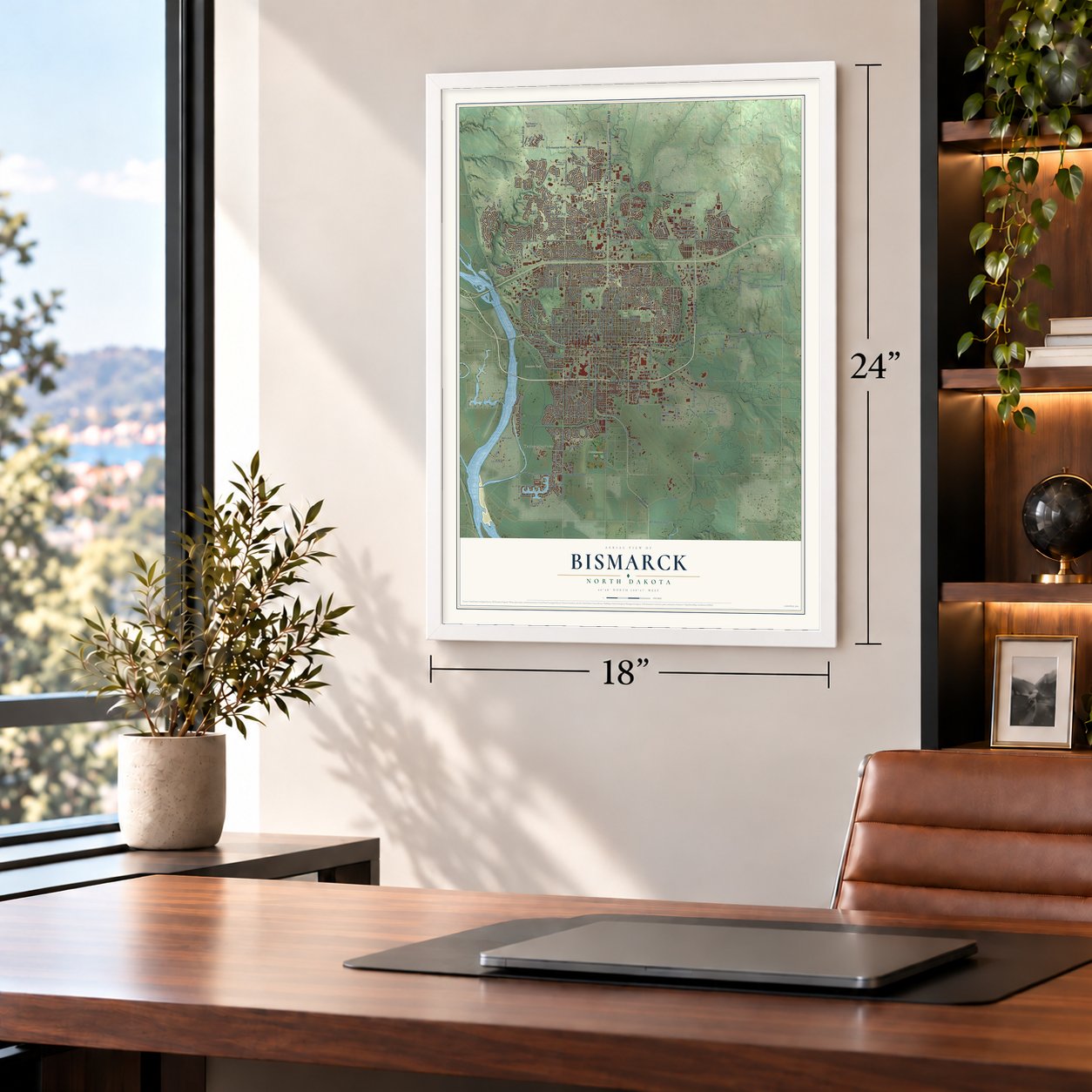
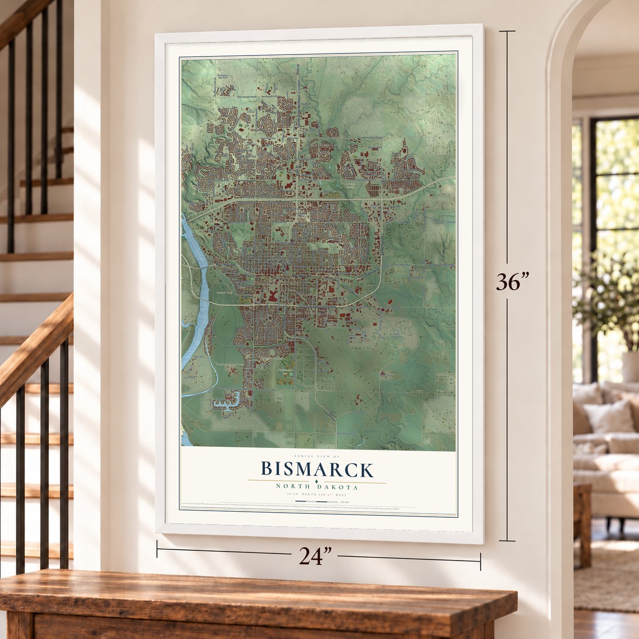
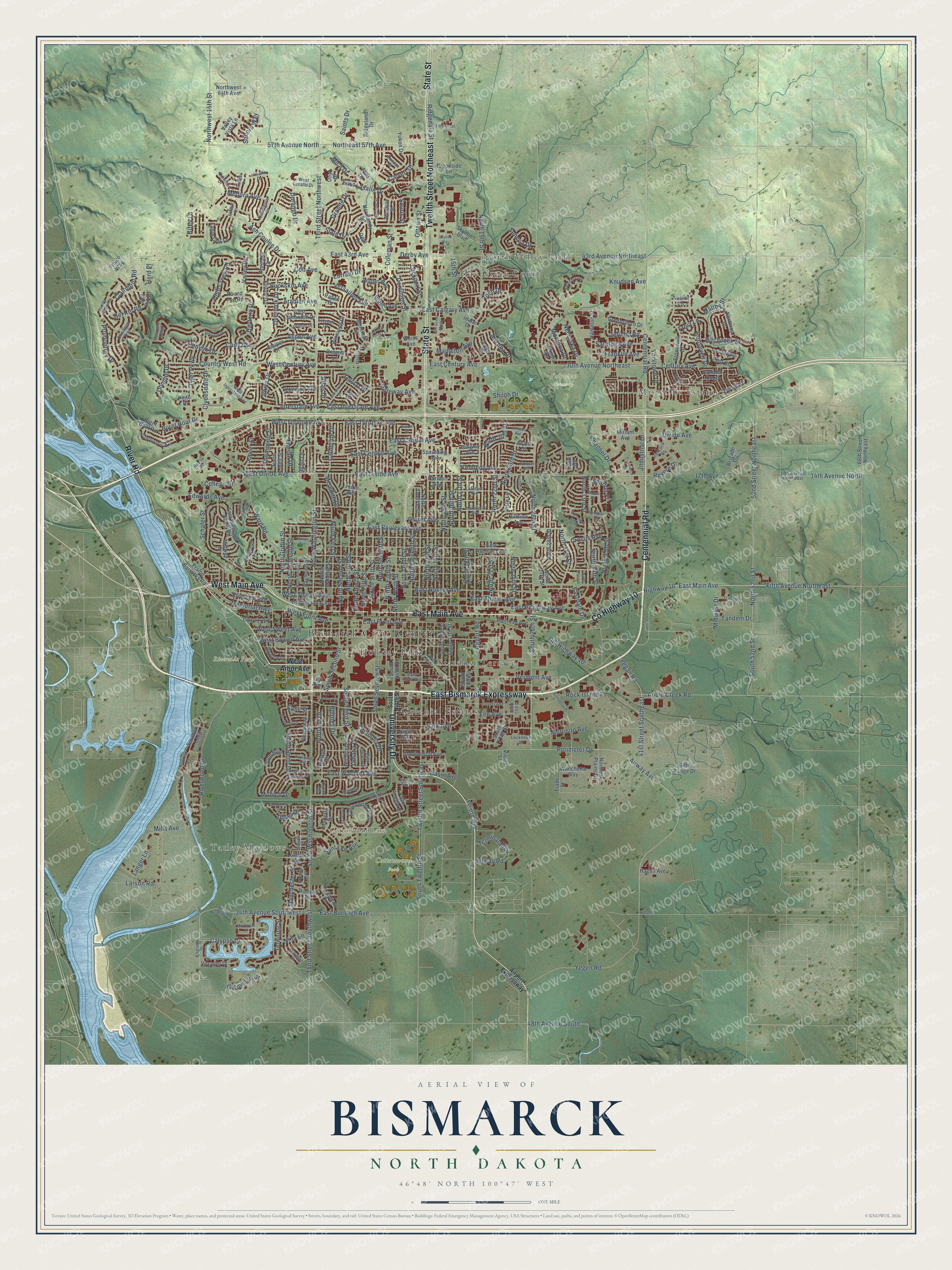
A new map of Bismarck, North Dakota, made in 2026 and printed to order on thick archival matte paper.
12" x 18" Archival Matte Print
A Map of Home. A Work of Art.
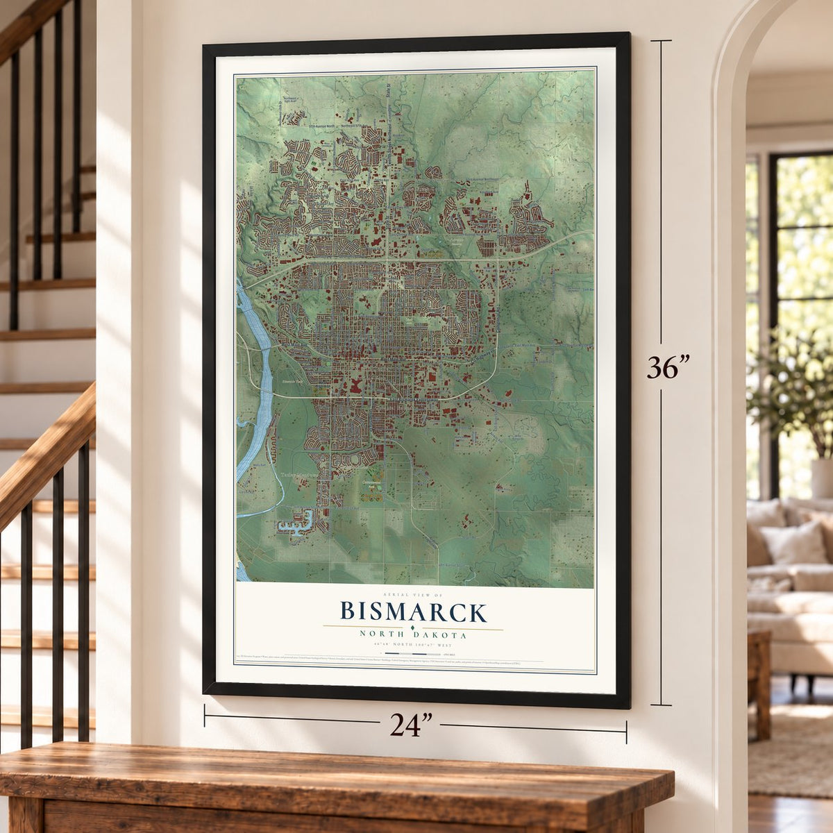
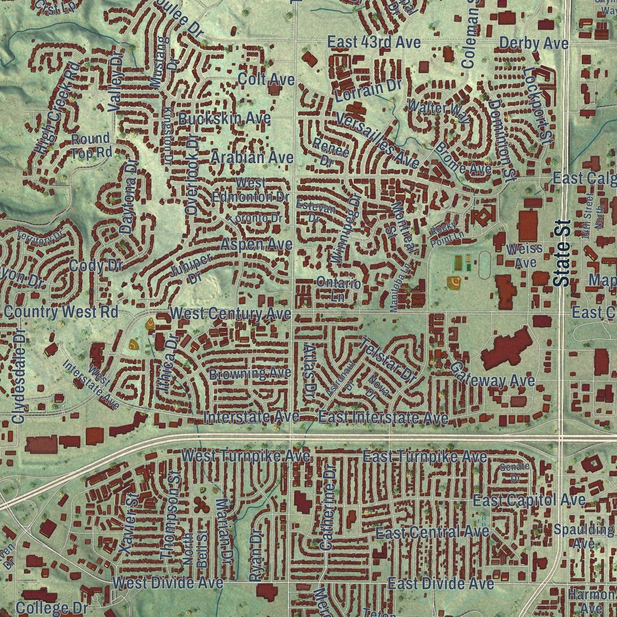
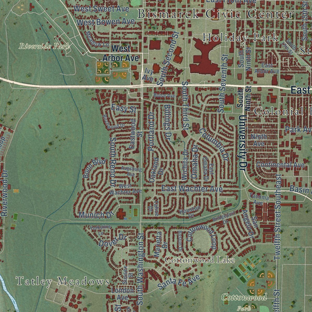
Explore Bismarck, North Dakota from a whole new perspective. Created using aerial imagery and detailed geographic data, this map captures Bismarck building by building, with labeled streets, familiar landmarks, and shaded topographical relief that highlights the natural contours of the landscape.
Combining modern data with the timeless character of a vintage atlas, this map is just as interesting up close as it is beautiful on the wall. Whether you grew up in Bismarck, spent memorable years there, or call it home today, this unique map is a great way to celebrate a place that means something to you. Zoom in on the preview to look for your street, and then order a print to put your memories on the wall.
Three ways to hang it
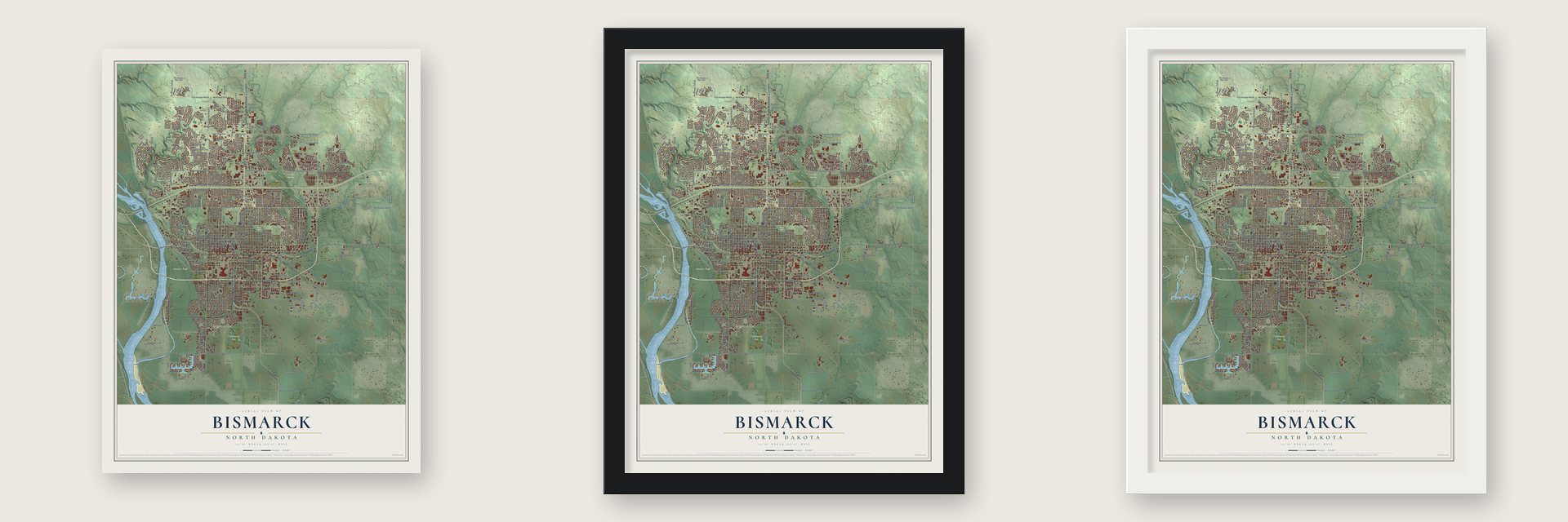
Unframed archival matte, a black wood frame or a white wood frame.
Up close
Geography Worth Displaying
This map was created using accurate cartographic data and authoritative geographic sources, including the U.S. Geological Survey and the Census Bureau. The map brings together terrain, waterways, roads, and building detail. The majority of the streets are labeled, houses are accurately depicted, and the topography is derived from government sources. Combining local data with carefully composed color and shading leads to this beautifully detailed Bismarck artwork for your wall.
Rather than simply showing street outlines, we’ve included as many of the street names as we could reasonably fit on the map while keeping their names legible. Zoom in on the high resolution preview to see exactly what’s on the map. We truly set out to create a statement piece for anyone who loves Bismarck. So whether it’s for you, or a gift for someone you love, we hope this map of Bismarck brings back fond memories.
Read the story behind this map of Bismarck, North Dakota from 2026.

About Bismarck, North Dakota
Bismarck, a city of 73,622 people, sits on the Missouri River's east bank. It serves as North Dakota's capital and as the seat of Burleigh County. The land had long been Mandan country, and the Hidatsa called it the Place of the tall willows. Settlers founded a town here in 1872 at Missouri Crossing, where the Lewis and Clark Expedition had crossed the river. It was soon renamed Edwinton for Edwin Ferry Johnson, chief engineer of the Northern Pacific Railway, whose tracks drew workers west.
In 1873 the Northern Pacific renamed the town for Otto von Bismarck, the German chancellor, hoping to bring German settlers and German money to its line. Gold turned up in the Black Hills the next year, and thousands of miners came through, pushing into land the Lakota held sacred. Bismarck grew into a freight town on the Custer Route, and in 1878 a daily stage line began running from here to the Black Hills. The town replaced Yankton as capital of Dakota Territory in 1883 and became the state capital in 1889.
- A capitol 241.75 feet tallThe first capitol burned to the ground in 1930. Its replacement, a 19-story Art Deco tower finished in 1934 during the Great Depression, stands 241.75 feet high and is still the tallest building in North Dakota.
- A Sunday school in a tentLinda W. Slaughter started a Sunday school in a tent at Camp Hancock in August 1872, and Bismarck held its first church service on June 15, 1873. The Camp Hancock Site is now on the National Register.
- The tornado of 1879The first tornado on record in North Dakota struck near Bismarck in 1879. It threw a steamship against the bank of the Missouri River and did heavy damage.
Find your street
Names on the Bismarck map
Every name below is printed on this map. Look for your street, your school, the park where you played, or the pond down the road.
Places and landmarks14
- Bismarck Civic Center
- Tatley Meadows
- Cottonwood Lake
- Cottonwood Park
- Fairview Cemetery
- Lions Park
- Pioneer Park
- Riverside Park
- Colonial Estates
- Hay Creek Court
- Holiday Park
- Mister Bs Estates
Show all 14 places
- North Valley Park
- Stardust Terrace
Streets and roads368
- East Bismarck Expressway
- Centennial Road
- East Main Avenue
- West Main Avenue
- County Highway 10
- University Drive
- State Street
- Twelfth Street Northeast
- River Road
- East Divide Avenue
- Fifth Avenue Northeast
- Tyler Parkway
- West Divide Avenue
- East Turnpike Avenue
- Catherine Drive
- South Washington Street
- North Washington Street
- South 26th Street
- Third Street Southwest
- Perimeter Drive
- Third Street Northwest
- East Boulevard Avenue
- Yegan Road
- 41st Street Southeast
- West Front Avenue
- East Front Avenue
- North Ninth Street
- Ash Coulee Drive
- Yegen Road
- East Wachter Avenue
Show all 368 streets
- Apple Creek Road
- North Griffin Street
- Old Highway 10
- West Thayer Avenue
- 52nd Street Northeast
- North 52nd Street
- Gateway Avenue
- Park Avenue
- North Seventh Street
- East Century Avenue
- North 19th Street
- 43rd Avenue Northeast
- Airway Avenue
- East Calgary Avenue
- East Rosser Avenue
- North Fourth Street
- Valley Drive
- South Twelfth Street
- West Century Avenue
- East Broadway Avenue
- East Capitol Avenue
- Riverwood Drive
- East Thayer Avenue
- South Third Street
- Highway 10
- Twelfth Street Southeast
- North 14th Street
- North Third Street
- 30th Avenue Northeast
- North 15th Street
- Airport Road
- Interstate Avenue
- North 13th Street
- North 16th Street
- North Eleventh Street
- North 26th Street
- North 23rd Street
- East 43rd Avenue
- East Lasalle Drive
- Morrison Avenue
- North Eighth Street
- North 17th Street
- Clairmont Road
- North Sixth Street
- North 20th Street
- North 35th Street
- North Fifth Street
- West Turnpike Avenue
- North 22nd Street
- North First Street
- South Seventh Street
- Langer Lane
- Nebraska Drive
- Coleman Street
- Vermont Avenue
- Roosevelt Drive
- Billings Drive
- Industrial Drive
- Memorial Highway
- North 18th Street
- Divide Avenue
- Derby Avenue
- 57th Avenue North
- East Interstate Avenue
- North 33rd Street
- 34th Avenue Southwest
- Northeast 57th Avenue
- Medora Avenue
- North Second Street
- North 21st Street
- Burnt Boat Drive
- Schafer Street
- Santa Fe Avenue
- Downing Street
- Ward Road
- Munich Drive
- Country West Road
- East Central Avenue
- Jericho Road
- Columbia Drive
- Promontory Drive
- Basin Avenue
- High Creek Road
- Calypso Drive
- West Sweet Avenue
- Edwards Avenue
- 14th Avenue North
- Portland Drive
- Channel Drive
- Terminal Boulevard
- Aspen Avenue
- Hitchcock Drive
- North 31st Street
- Saratoga Avenue
- Rock Island Place
- North Anderson Street
- Ottawa Street
- West Bowen Avenue
- Century Avenue
- South Second Street
- Daytona Drive
- Mills Avenue
- Ithica Drive
- Overlook Drive
- Cody Drive
- North Tenth Street
- Lee Avenue
- Porter Avenue
- Durango Drive
- Calvert Drive
- Ridgedale Street
- Knudsen Avenue
- East Burleigh Avenue
- 48th Avenue South
- 17th Avenue
- Yorktown Drive
- Lockport Street
- Slate Drive
- South Reno Drive
- Arizona Drive
- Versailles Avenue
- Clydesdale Drive
- Northwest 15th Street
- Manchester Street
- North 24th Street
- Franklin Avenue
- Dover Drive
- South 52nd Street
- Revere Drive
- Thompson Street
- Buckskin Avenue
- Marian Drive
- College Drive
- Koch Drive
- Granite Drive
- Xavier Street
- Kennedy Avenue
- Lorrain Drive
- Kites Lane
- Crocus Avenue
- Omaha Drive
- North 34th Street
- Frost Lane
- Domino Drive
- Telstar Drive
- Jetway Road
- Midwest Drive
- Dominion Street
- Shiloh Drive
- Canyon Drive
- Mapleton Avenue
- Arabian Avenue
- Montana Drive
- Ryan Drive
- Glenwood Drive
- Eastdale Drive
- Larson Road
- Sharloh Place
- Colt Avenue
- Tandem Drive
- Meredith Drive
- Saints Drive
- Sonora Way
- Del Rio Road
- Nina Lane
- Maltby Street
- Seneca Drive
- Easy Street
- Mica Drive
- Atlas Drive
- Herd Place
- Souris Street
- 15th Street
- West Arbor Avenue
- South Ninth Street
- Miriam Avenue
- South 18th Street
- South 16th Street
- Trenton Drive
- East Avenue East
- North Twelfth Street
- Normandy Street
- North Mandan Street
- Montreal Street
- Burnt Boat Road
- North Bell Street
- South 22nd Street
- Stonewall Drive
- Cottonwood Loop
- Hamilton Street
- Mustang Drive
- Juniper Drive
- London Avenue
- Greensboro Drive
- Grant Drive
- Oakland Drive
- North 28th Street
- San Angelo Drive
- Harmon Avenue
- Bonn Boulevard
- Skyline Boulevard
- Northern Plains Drive
- Winnipeg Drive
- Southport Loop
- Eagle Crst Lp
- Crescent Lane
- North 27th Street
- Marietta Drive
- Yukon Drive
- Eastwood Street
- East Highland Acres Road
- Rutland Drive
- Northwest 64th Avenue
- Browning Avenue
- 66th Street Northeast
- Walter Way
- Vision Street
- Wichita Drive
- Dortmund Drive
- South 15th Street
- Continental Avenue
- Riverview Avenue
- Ontario Lane
- Railroad Avenue
- Kost Drive
- Wanchena Way
- Hillview Avenue
- West Edmonton Drive
- Frisco Way
- Round Top Road
- Northrop Drive
- Ridgeland Drive
- Camden Loop
- Brookside Lane
- Del Rio Drive
- Fraine Barracks Road
- Rifle Range Drive
- Brome Avenue
- Eclipse Way
- Oregon Drive
- Raymond Street
- Lincoln Avenue
- Spaulding Avenue
- Midway Drive
- Renee Drive
- Ninth Avenue
- Voyager Drive
- Weiss Avenue
- Hagen Avenue
- Brigade Street
- Valley Vista Lane
- Idaho Drive
- Teton Avenue
- Windsor Street
- Onyx Drive
- Flint Drive
- Volk Drive
- Vista Lane
- Trade Street
- Longley Avenue
- Illinois Drive
- Tucker Lane
- Opal Drive
- Ivy Avenue
- Pinto Place
- Airport Expressway
- West Interstate Avenue
- Laforest Avenue
- 17th Avenue Northeast
- Houston Drive
- Meridian Drive
- Hanaford Avenue
- Chisholm Trail
- West Lasalle Drive
- East Arbor Avenue
- Tacoma Avenue
- West Wachter Avenue
- Transport Lane
- West Broadway Avenue
- Hancock Drive
- Cornice Drive
- Lovett Avenue
- Amberglow Drive
- East Omaha Drive
- Kingston Drive
- Fairfax Loop
- Hoover Avenue
- Meadow Lane
- Hudson Street
- Mesquite Loop
- Lockheed Drive
- England Street
- Sussex Street
- Estevan Drive
- Toronto Drive
- Nova Drive
- Bayview Court
- Duncan Drive
- Lasalle Drive
- Raven Drive
- Tahoe Drive
- West Burleigh Avenue
- Burlington Drive
- Powder Ridge Drive
- Patriot Drive
- North Hannifin Street
- Jackson Avenue
- Augsburg Avenue
- South Grandview Lane
- North 32nd Street
- Boston Drive
- South 13th Street
- Northview Lane
- Yorkshire Lane
- Territory Drive
- Warwick Loop
- Bridgeport Drive
- Birchwood Drive
- Astronaut Drive
- Knudsen Loop
- Baltus Drive
- Mason Avenue
- East Coulee Road
- Horseman Loop
- 14th Street North
- Elkhorn Drive
- Manitoba Lane
- Elbowoods Lane
- Commerce Drive
- Sunlight Drive
- South 23rd Street
- Mayflower Drive
- Shannon Drive
- Boise Avenue
- Senate Drive
- Rocky Point Lane
- Skyline Way
- Lincoln Road
Names are listed as they appear on the printed map. Zoom into the product photos to find them.
The art of mapping a place
How This Map Was Made
Real places. Remarkable detail. Discover the layers that turn geographic data into a map of home.

The view from above
Aerial imagery reveals the character of the land: woodland, open fields, and the patterns of a place.

The shape of the land
Elevation data brings hills, valleys, and subtle changes in the landscape into view.

The details of home
Roads, waterways, and building footprints come together to make the map feel unmistakably local.

Geography becomes art
Considered color, shading, and typography bring the layers together in a map made for your wall.


Process illustrated with Mendon, Massachusetts. Aerial imagery: USDA NAIP. Terrain: USGS 3D Elevation Program. Map details and finished artwork: KNOWOL.
The Details
About This Print
Choose an archival matte print, or a black or white Ayous wood frame. The archival matte print is unframed.
Select your size and finish above to see the matching product image and price.
Materials & Craftsmanship
A contemporary map with the character of a classic atlas, printed on archival matte paper. Optional frames are made from Ayous wood.
Your printed map does not include the watermark shown in the full-map preview.
Shipping & Delivery
Free shipping within the United States. Every print is made to order in the USA.
Buying a gift? Add a note in your cart and we'll include it. We never put prices in the package.
Prints ship within 2 to 3 business days. Allow 7 to 10 days total from ordering for delivery. Timing may vary during holidays or periods of high order volume.
Read our shipping policy.
Returns and damaged prints
Each print is made to order. Change-of-mind refunds are not available after production.
If your print arrives damaged, misprinted or incorrect, contact support@knowol.com within 30 days of receiving it. Include your order number, photos and a description of the issue.
Read our full refund and replacement policy. For questions about your order, email support@knowol.com.
Find your town
Looking for another city?
Find a map of home in our North Dakota collection, or any town in the country.
Nearby
Maps of towns near Bismarck
Know someone from one of these towns? Their map makes a great gift.
 Lincoln
, North Dakota
From $39.99See the map
 Mandan
, North Dakota
From $39.99See the map
 Apple Valley
, North Dakota
From $39.99See the map