
Search for another town





Free U.S. delivery 7 to 10 days after you order
Booneville, Mississippi Map Art
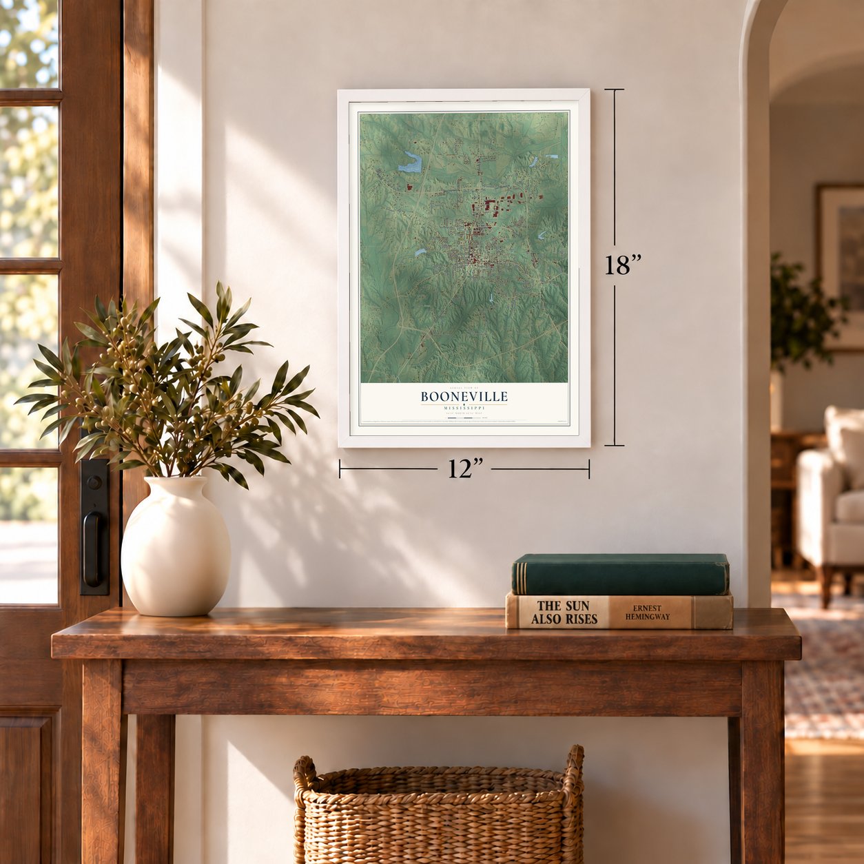
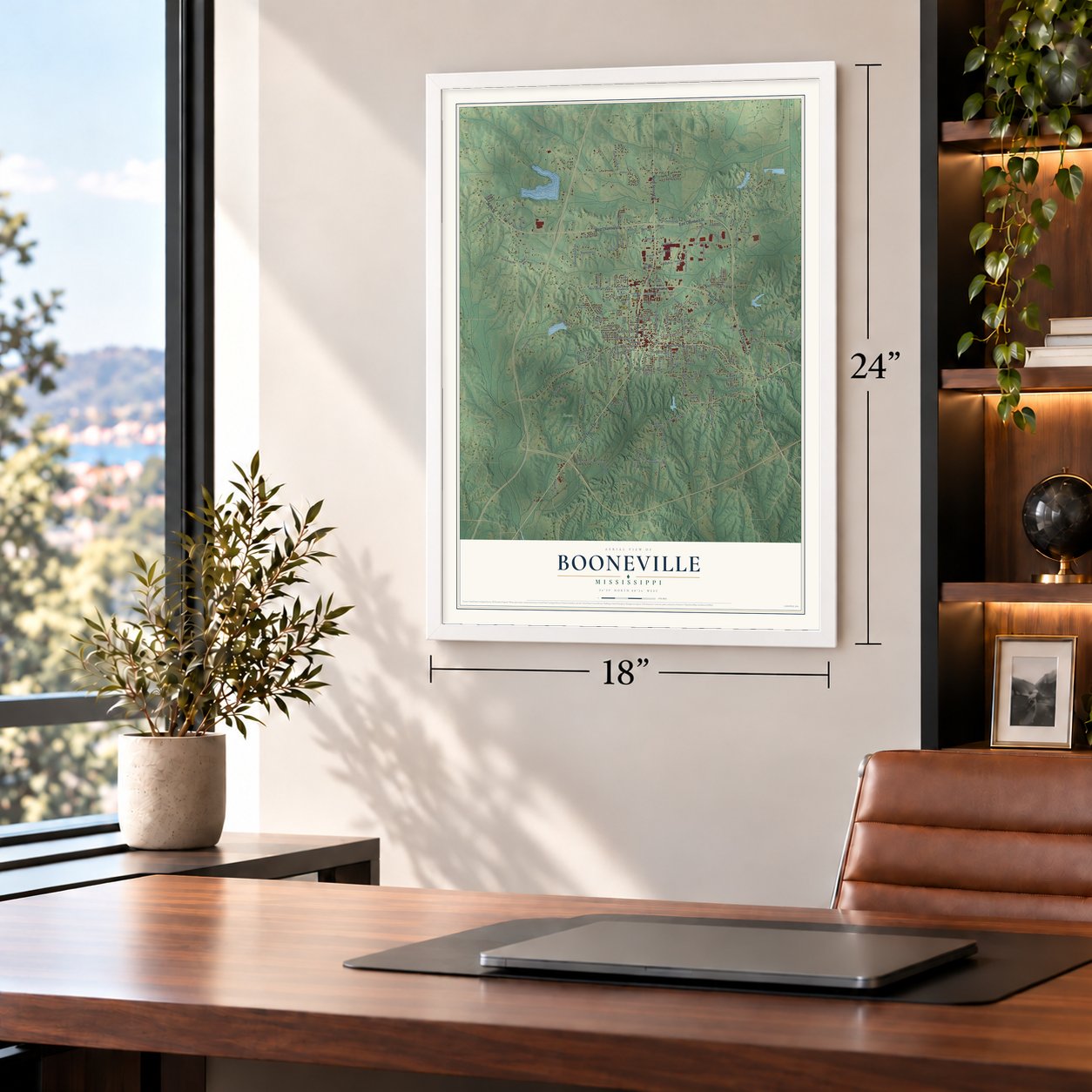
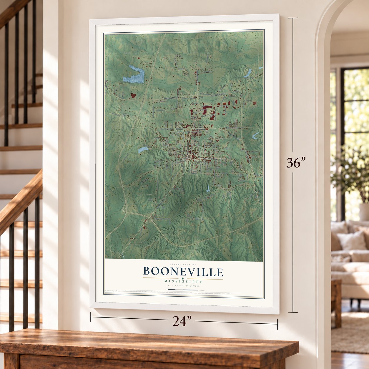
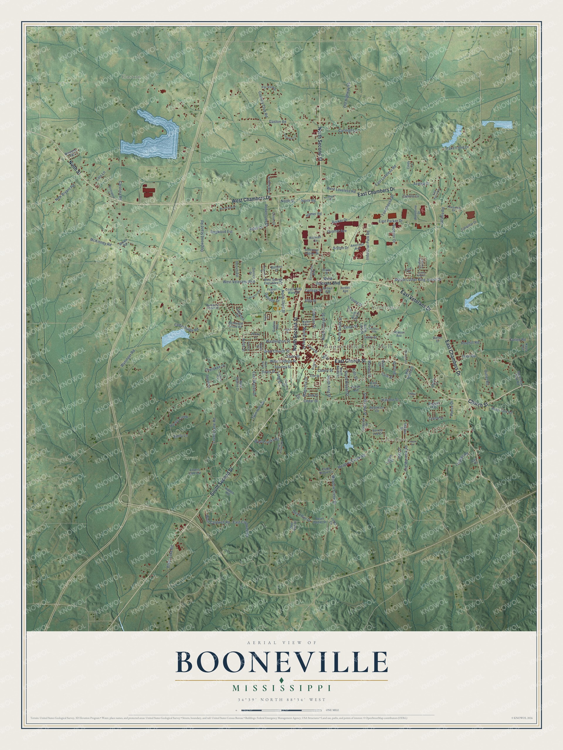
A new map of Booneville, Mississippi, made in 2026 and printed to order on thick archival matte paper.
12" x 18" Archival Matte Print
A Map of Home. A Work of Art.
Explore Booneville, Mississippi from a whole new perspective. Created using aerial imagery and detailed geographic data, this map captures Booneville building by building, with labeled streets, familiar landmarks, and shaded topographical relief that highlights the natural contours of the landscape.
Combining modern data with the timeless character of a vintage atlas, this map is just as interesting up close as it is beautiful on the wall. Whether you grew up in Booneville, spent memorable years there, or call it home today, this unique map is a great way to celebrate a place that means something to you. Zoom in on the preview to look for your street, and then order a print to put your memories on the wall.
Three ways to hang it
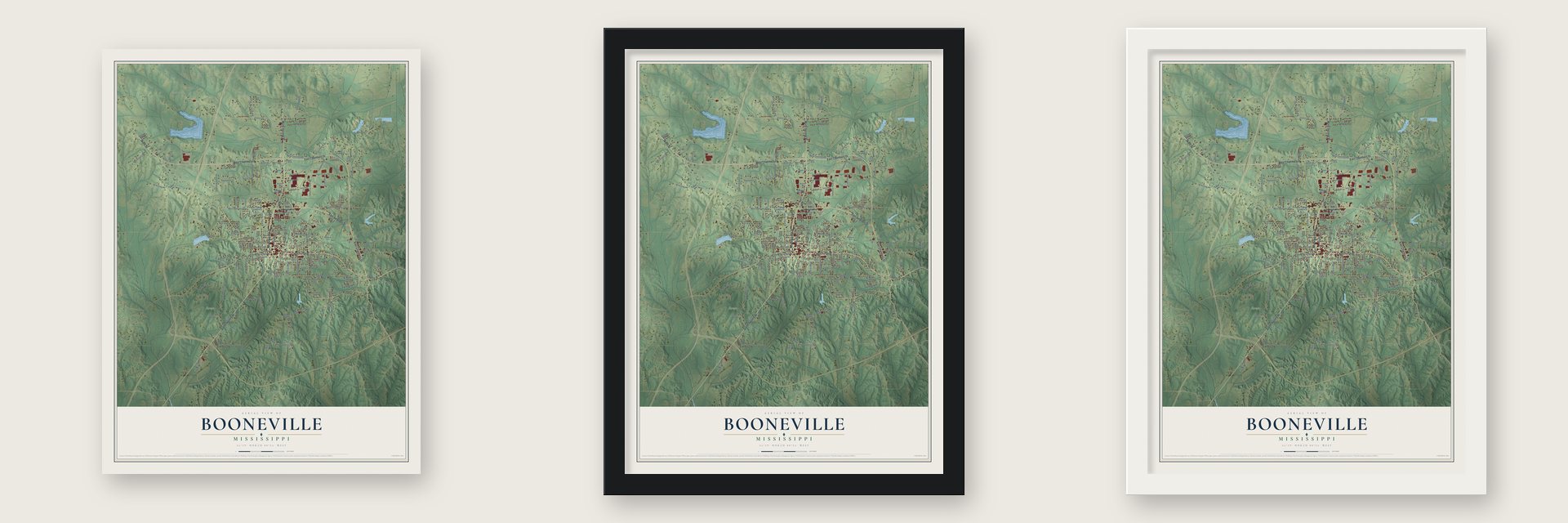
Unframed archival matte, a black wood frame or a white wood frame.
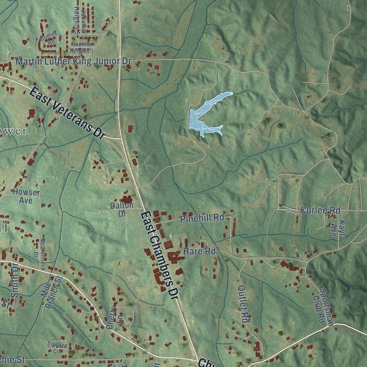
Up close
Geography Worth Displaying
This map was created using accurate cartographic data and authoritative geographic sources, including the U.S. Geological Survey and the Census Bureau. The map brings together terrain, waterways, roads, and building detail. The majority of the streets are labeled, houses are accurately depicted, and the topography is derived from government sources. Combining local data with carefully composed color and shading leads to this beautifully detailed Booneville artwork for your wall.
Rather than simply showing street outlines, we’ve included as many of the street names as we could reasonably fit on the map while keeping their names legible. Zoom in on the high resolution preview to see exactly what’s on the map. We truly set out to create a statement piece for anyone who loves Booneville. So whether it’s for you, or a gift for someone you love, we hope this map of Booneville brings back fond memories.
Read the story behind this map of Booneville, Mississippi from 2026.

About Booneville, Mississippi
Booneville is a city of 9,126 people and the county seat of Prentiss County, in the hills of North Mississippi. Three men, B.B. Boone, W.P. Curlee and G.W. Williams, bought the land from a Chickasaw man named Le-Ho-Yea, and the town took the name of Colonel Reuben Holman Boone, a settler related to Daniel Boone. It was planned in 1848 while the Mobile and Ohio Railroad was being built. The line was finished around November 1860, and the town incorporated in 1861, just as the Civil War broke out and slowed its growth.
When Prentiss County was formed in 1870, Booneville became its seat of justice. The first courthouse was finished in 1872 for about $15,000, and after it was condemned in 1904, work began on a new one costing $35,000. The town grew from 748 people in 1890 to 1,050 in 1900, and by 1906 it was estimated at 1,250, with three banks, two cotton gins, two brick and tile plants and an electric light plant.
- The depot raid of 1862The railroad made Booneville a military target. Union cavalry rode into town on May 30, 1862, in a brigade led by Col. Washington Lafayette Elliott, commander of the 2nd Iowa Cavalry. His men burned the depot and a long train full of munitions, and they took 2,000 sick and wounded Confederate soldiers prisoner.
- Sheridan holds BoonevilleCol. Philip Sheridan dug in at Booneville on June 28, 1862, after hearing Confederates meant to march from Tupelo and retake the rail junction at Corinth. Brig. Gen. James R. Chalmers attacked with 4,700 troops and drove the Union line 2 miles back toward town. Sheridan then sent the 2nd Michigan and 2nd Iowa cavalry around to strike the Confederate rear and left flank. Chalmers lost about 65 dead; the Union lost one killed, 24 wounded and 16 missing.
- The armory blast of 1950On December 22, 1950, an explosion and fire tore through the Booneville Armory. Seven Mississippi Army National Guard soldiers from Company B of the 198th Tank Battalion died. They are counted as the first casualties of the Korean War on American soil.
- A college founded in 1948Northeast Mississippi Junior College opened in Booneville in 1948, and in 1957 it offered the first associate degree in nursing in the state. Now Northeast Mississippi Community College, it enrolls more than 6,000 students a year from Prentiss, Tippah, Alcorn, Union and Tishomingo counties.
Find your street
Names on the Booneville map
Every name below is printed on this map. Look for your street, your school, the park where you played, or the pond down the road.
Places and landmarks8
- Booneville City Hall
- Gaston
- Lake City
- Sunflower
- Forest
- Swift Park
- Cherokee Park
- Sunflower Park
Streets and roads173
- South Second Street
- East Church Street
- Church Street
- Ninth Street
- West Chambers Drive
- East Chambers Drive
- North Second Street
- East Veterans Drive
- West Church Street
- Young Street
- South King Street
- North First Street
- West College Street
- Old Marietta Road
- East Caldwell Road
- Jacinto Road
- Gaston Road
- South Lake Street
- Dogwood Stand Road
- Meadow Creek Drive
- North Third Street
- Martin Luther King Junior Drive
- Lovers Lane Road
- North College Street
- Hatchie Street
- Wyninger Road
- East Loveless Road
- West Veterans Boulevard
- East Parker Drive
- Washington Street
Show all 173 streets
- Cedar Ridge Road
- North Street
- Old Highway 45
- Carolina Road
- North Road
- New Bryant Road
- South Bryant Street
- Industrial Park Road
- Hare Road
- Meadow Creek Road
- West Loveless Road
- Robert Lee Drive
- Quail Run Drive
- Jefferson Street
- Lindsey Road
- Country Club Road
- Pinehill Road
- North Smith Street
- Quartet Avenue
- Cherokee Drive
- Outlet Road
- Cedar Drive
- Azalea Drive
- West Caldwell Road
- Parker Drive
- McKinney Road
- Dogwood Est
- Lois Lane
- Twin Hills Drive
- Townhouse Drive
- Long Street
- Elder Lake Road
- Stanley Street
- East Skyline Drive
- Cherry Street
- Carleigh Lane
- Homer Road
- Curlee Road
- Lake Front Drive
- West Franks Road
- Bolton Drive
- Ellis Street
- Davis Street
- Cedar Street
- Superior Drive
- Massey Street
- Honey Creek
- Magnolia Drive
- Terry Street
- Dallison Drive
- College Street
- Pierce Drive
- State Street
- Kids Street
- Adair Drive
- Inez Drive
- Smith Drive
- Emily Lane
- Cole Street
- North Oak Street
- North Lake Street
- West George East Allen Drive
- American Avenue
- Catipillar Drive
- Calton Drive
- Sportsman Club Road
- Central Drive
- Walden Drive
- Par View Drive
- Water Tank Road
- Pearl Daniel Drive
- Clyde Moore Circle
- Miller Circle
- Lakeview Drive
- Robertson Circle
- Parkwood Grove Road
- Oakleigh Drive
- Westover Heights
- Oakhaven Circle
- Wolverine Drive
- Penny Lane
- Forrest Lee Drive
- Dorrich Est
- Pecan Avenue
- Walmart Circle
- Fraser Drive
- Hidden Hls
- Coach Billy Ward Drive
- West Skyline Drive
- Mile Branch Street
- Howser Avenue
- Chloe Cv
- Dorrich Drive
- South Smith Street
- Court Street
- Frank Street
- Lovers Lane Extension
- Camelia Cv
- Dalton Drive
- Kayla Avenue
- American Legion Street
- East Lake Street
- English Avenue
- Elm Street
- Oak Drive
- Eudora Heights
- Burress Drive
- Deer Run Place
- Jorden Avenue
- Cindy Lane
- Brown Road
- Cherry Lane
- Sixth Street
- Brown Avenue
- Jones Cv
- Cain Drive
- Mill Street
- Cunningham Boulevard
- Parkwood Garden Street
- Tuscumbia Road
- Woodridge Drive
- South Franks Road
- Walker Avenue
- Downing Drive
- Bridge Street
- East Patrick Drive
- Jacinto Heights 5
- Roy Drive
- Wickwood Drive
- Adams Street
- Ridgemont Circle
- Foster Park Street
- McClamrock Drive
- Oneal Street
- Dudley Road
- August Circle
- Towhee Circle
- Ridgecrest Drive
- Northhaven Drive
- Mockingbird Lane
- Jacinto Heights 1
- Tidwell Drive
- Eighth Street
Names are listed as they appear on the printed map. Zoom into the product photos to find them.
The art of mapping a place
How This Map Was Made
Real places. Remarkable detail. Discover the layers that turn geographic data into a map of home.

The view from above
Aerial imagery reveals the character of the land: woodland, open fields, and the patterns of a place.

The shape of the land
Elevation data brings hills, valleys, and subtle changes in the landscape into view.

The details of home
Roads, waterways, and building footprints come together to make the map feel unmistakably local.

Geography becomes art
Considered color, shading, and typography bring the layers together in a map made for your wall.


Process illustrated with Mendon, Massachusetts. Aerial imagery: USDA NAIP. Terrain: USGS 3D Elevation Program. Map details and finished artwork: KNOWOL.
The Details
About This Print
Choose an archival matte print, or a black or white Ayous wood frame. The archival matte print is unframed.
Select your size and finish above to see the matching product image and price.
Materials & Craftsmanship
A contemporary map with the character of a classic atlas, printed on archival matte paper. Optional frames are made from Ayous wood.
Your printed map does not include the watermark shown in the full-map preview.
Shipping & Delivery
Free shipping within the United States. Every print is made to order in the USA.
Buying a gift? Add a note in your cart and we'll include it. We never put prices in the package.
Prints ship within 2 to 3 business days. Allow 7 to 10 days total from ordering for delivery. Timing may vary during holidays or periods of high order volume.
Read our shipping policy.
Returns and damaged prints
Each print is made to order. Change-of-mind refunds are not available after production.
If your print arrives damaged, misprinted or incorrect, contact support@knowol.com within 30 days of receiving it. Include your order number, photos and a description of the issue.
Read our full refund and replacement policy. For questions about your order, email support@knowol.com.
Find your town
Looking for another city?
Find a map of home in our Mississippi collection, or any town in the country.
Nearby
Maps of towns near Booneville
Know someone from one of these towns? Their map makes a great gift.
 Wheeler
, Mississippi
From $39.99See the map
 Jumpertown
, Mississippi
From $39.99See the map
 Rienzi
, Mississippi
From $39.99See the map
More maps nearby: Jacinto, New Site, Baldwyn, Biggersville and Marietta.