
Search for another town


Free U.S. delivery 7 to 10 days after you order
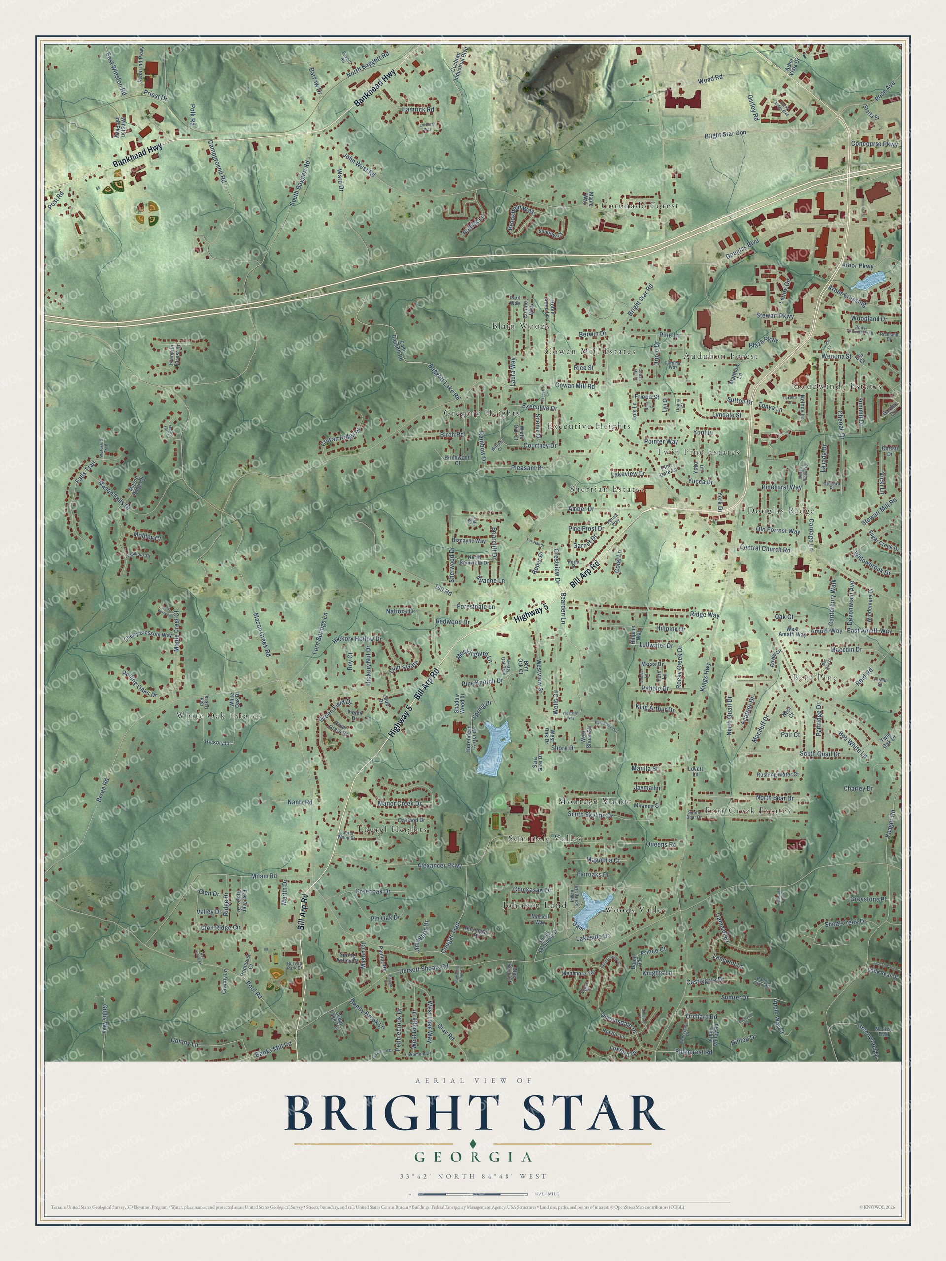
Bright Star, Georgia Map Art
Building by building, with labeled streets and shaded relief.
12" x 18" Archival Matte Print
A Map of Home. A Work of Art.
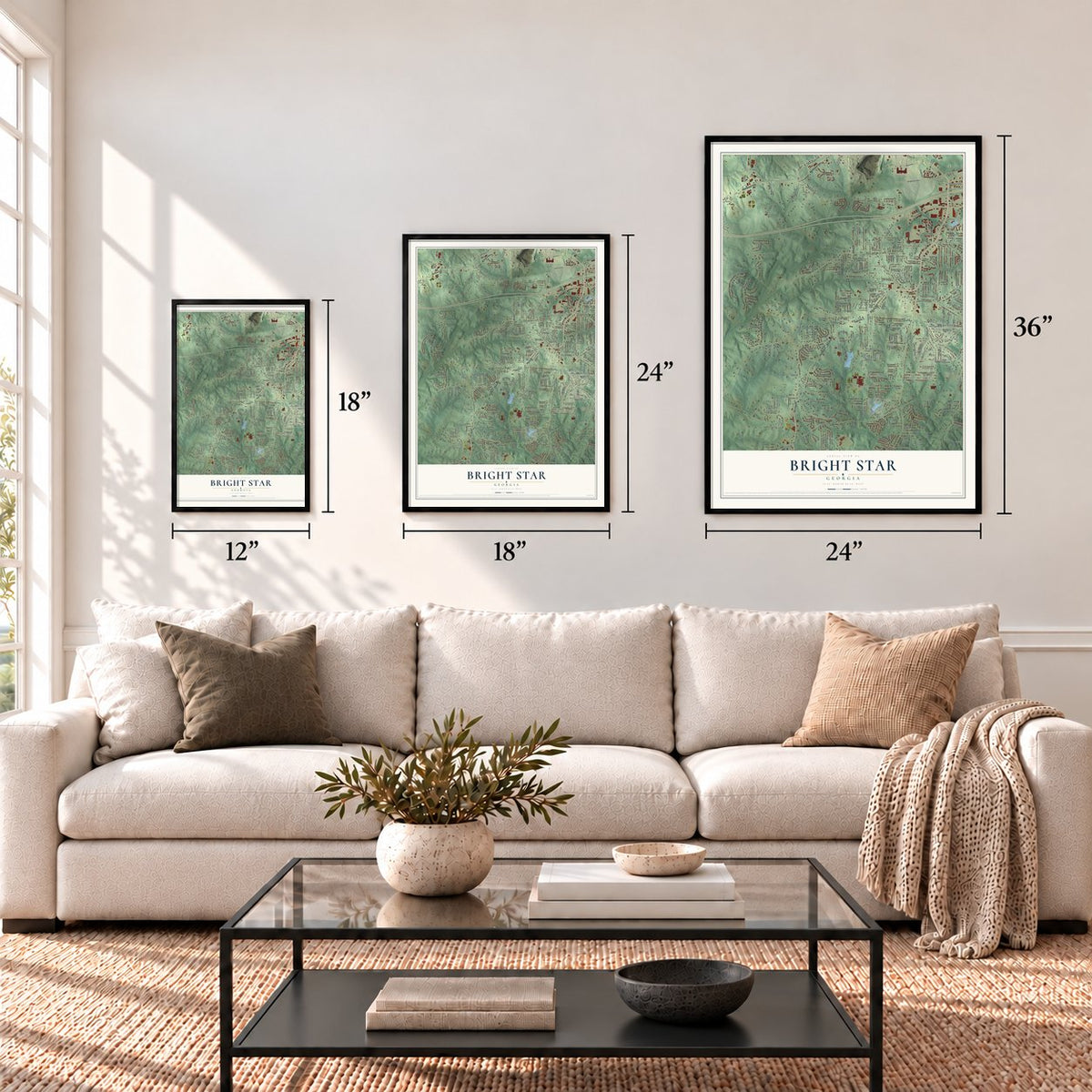
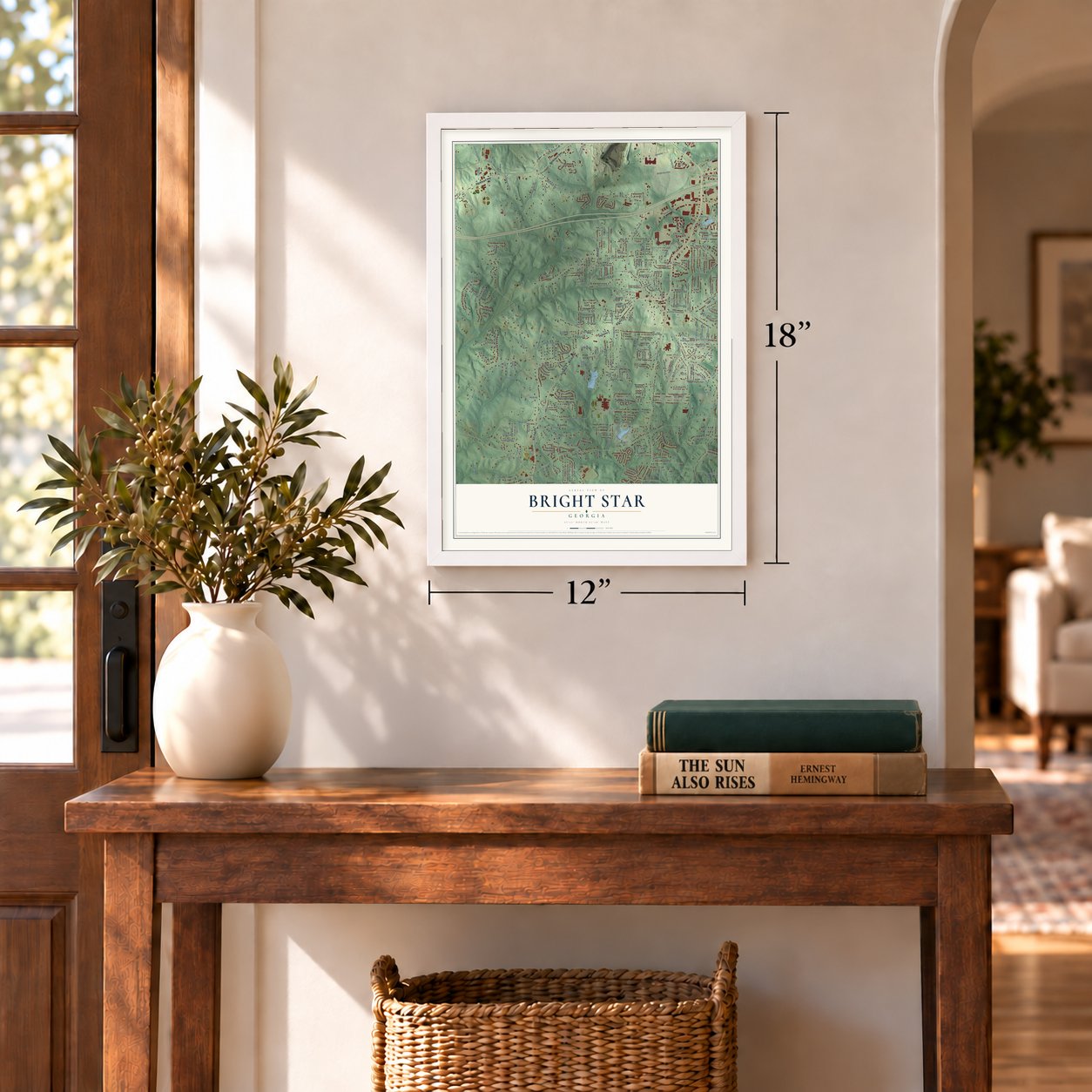
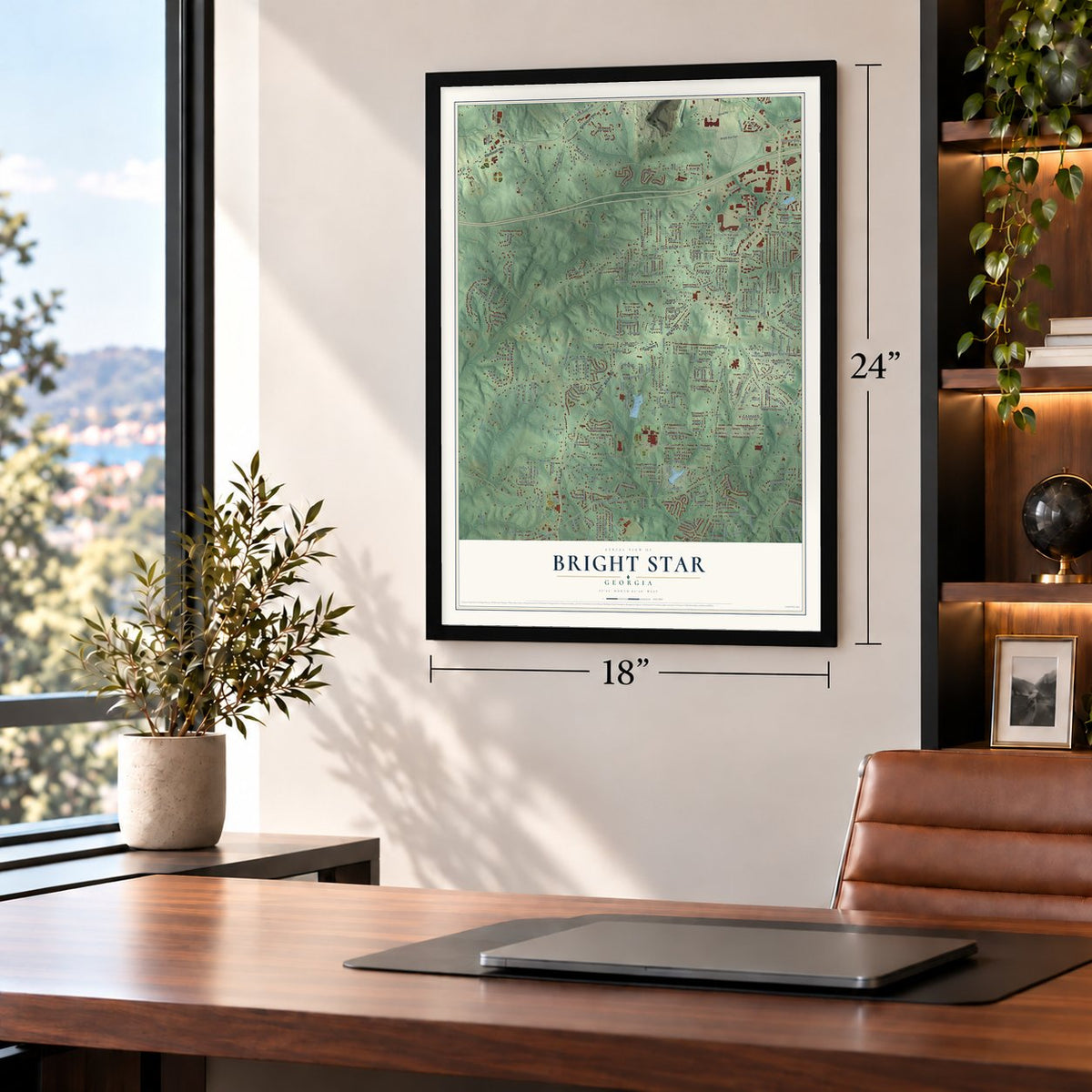
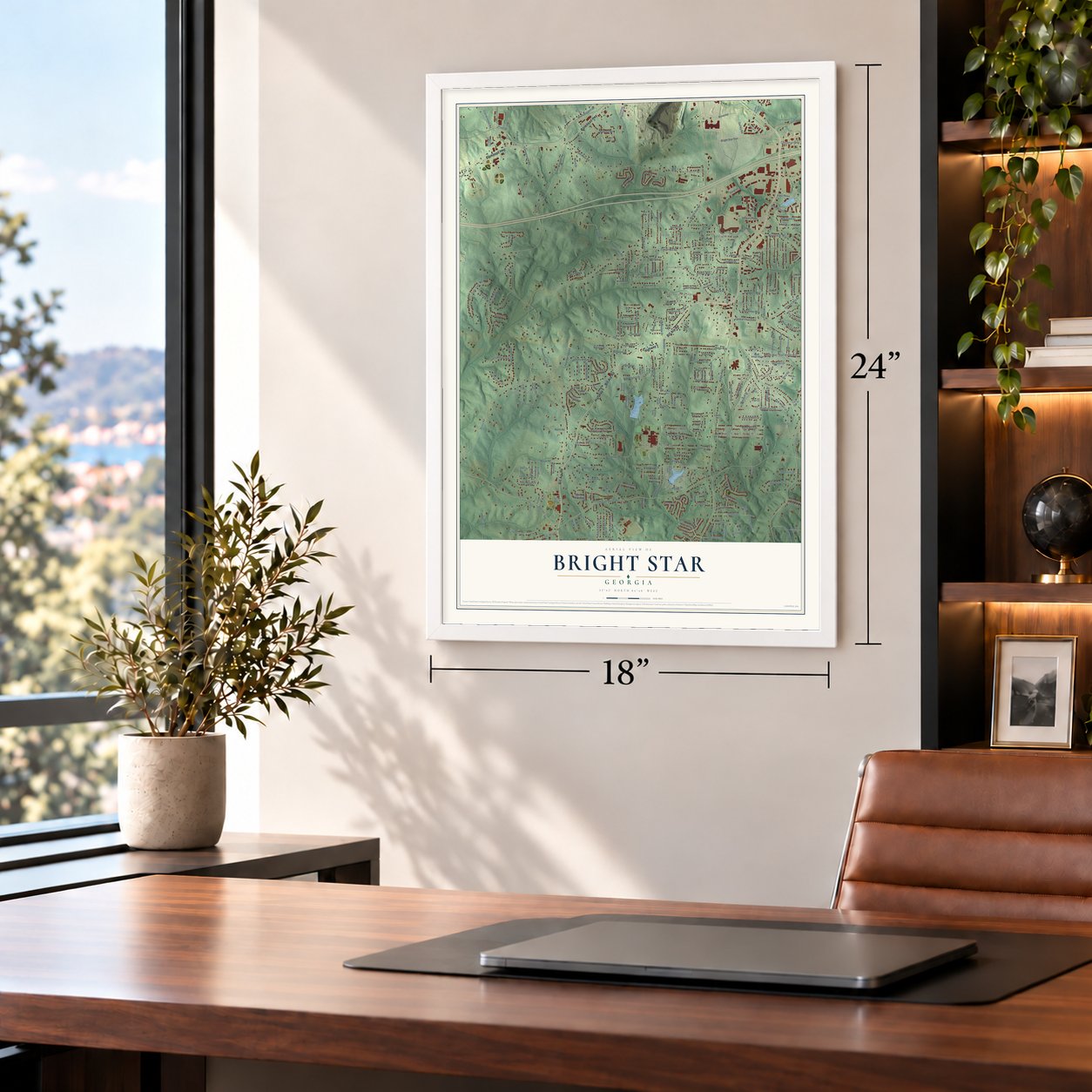
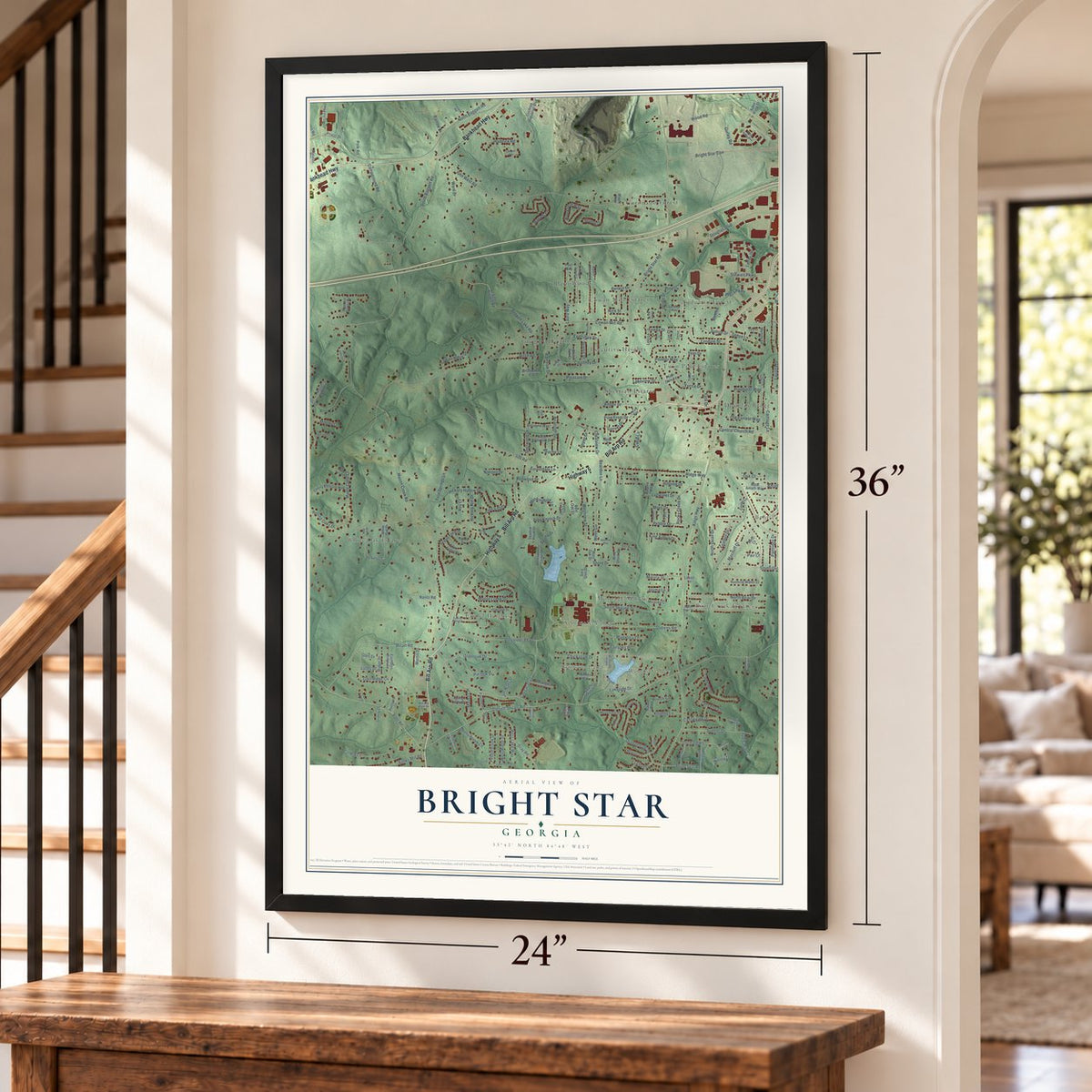
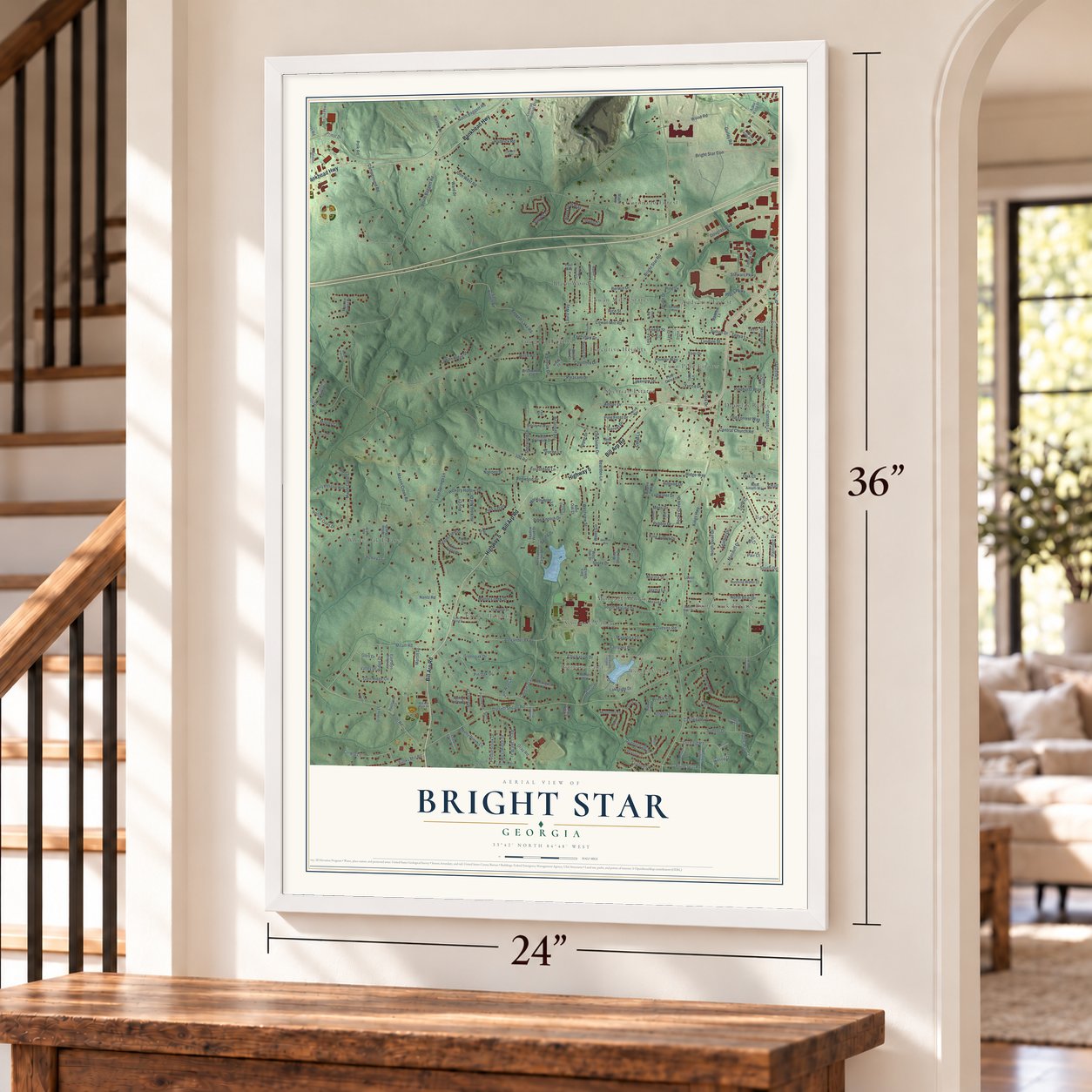
Explore Bright Star, Georgia from a whole new perspective. Created using aerial imagery and detailed geographic data, this map captures Bright Star building by building, with labeled streets, familiar landmarks, and shaded topographical relief that highlights the natural contours of the landscape.
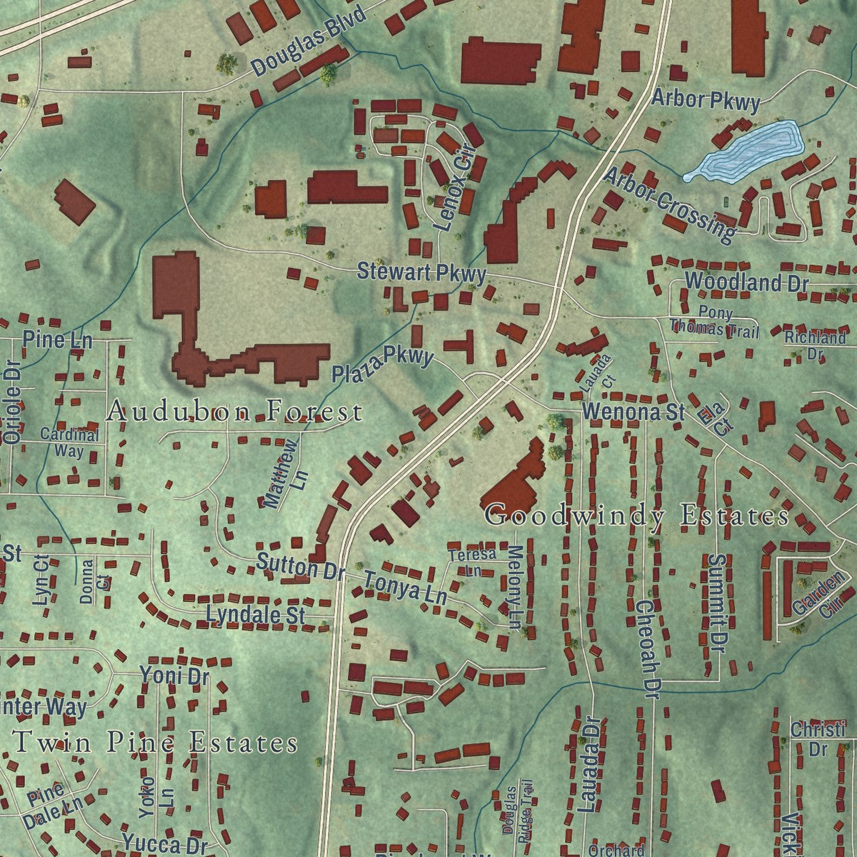
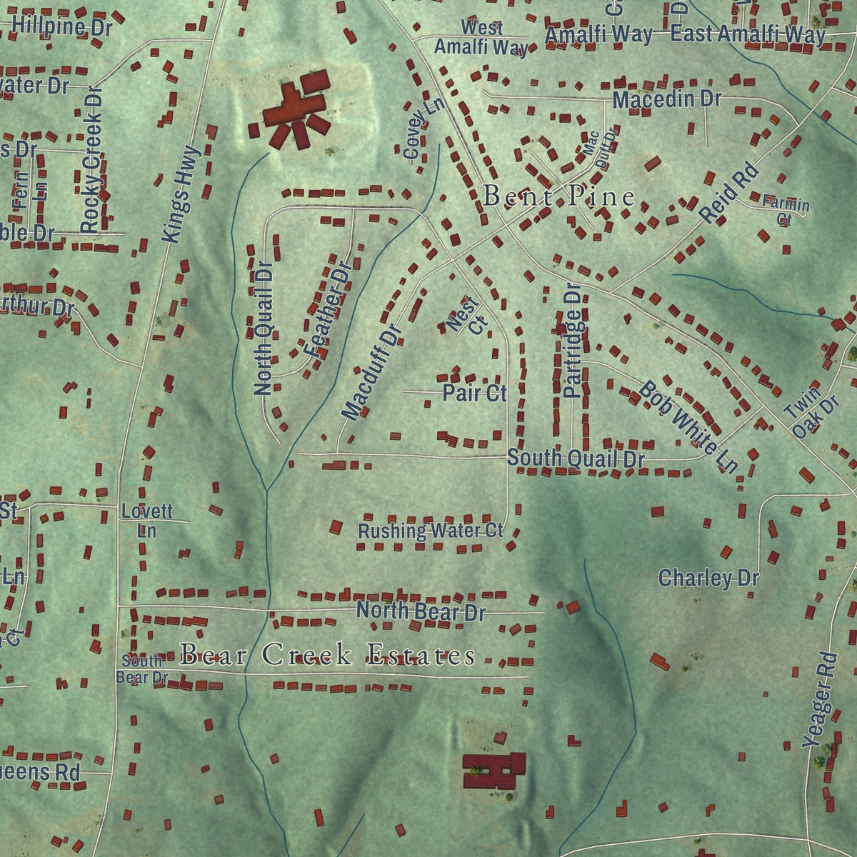
Combining modern data with the timeless character of a vintage atlas, this map is just as interesting up close as it is beautiful on the wall. Whether you grew up in Bright Star, spent memorable years there, or call it home today, this unique map is a great way to celebrate a place that means something to you. Zoom in on the preview to look for your street, and then order a print to put your memories on the wall.
Three ways to hang it

Unframed archival matte, a black wood frame or a white wood frame.
Up close
Geography Worth Displaying
This map was created using accurate cartographic data and authoritative geographic sources, including the U.S. Geological Survey and the Census Bureau. The map brings together terrain, waterways, roads, and building detail. The majority of the streets are labeled, houses are accurately depicted, and the topography is derived from government sources. Combining local data with carefully composed color and shading leads to this beautifully detailed Bright Star artwork for your wall.
Rather than simply showing street outlines, we’ve included as many of the street names as we could reasonably fit on the map while keeping their names legible. Zoom in on the high resolution preview to see exactly what’s on the map. We truly set out to create a statement piece for anyone who loves Bright Star. So whether it’s for you, or a gift for someone you love, we hope this map of Bright Star brings back fond memories.
Read the story behind this map: Detailed Map of Bright Star, Georgia.

Find your street
Names on the Bright Star map
Every name below is printed on this map. Look for your street, your school, the park where you played, or the pond down the road.
Places and landmarks18
- Bent Pine
- Johnson Land
- Goodwindy Estates
- Gregory Heights
- White Oak Estates
- Bear Creek Estates
- Douglas Ridge
- Coronado Forest
- Cowan Mill Estates
- Montage Manor
- Laurel Heights
- Sherrian Estates
Show all 18 places
- Woods Valley
- Seminole Valley
- Audubon Forest
- Twin Pine Estates
- Blain Woods
- Executive Heights
Streets and roads282
- Bill Arp Road
- Highway 5
- Bankhead Highway
- Bearden Lane
- Plaza Parkway
- Mason Creek Road
- Bright Star Road
- Dorsett Shoals Road
- Kings Highway
- Yeager Road
- Cowan Mill Road
- Berea Road
- John West Road
- Central Church Road
- South Baggett Road
- Pool Road
- Alexander Parkway
- Douglas Boulevard
- Stewart Mill Road
- Campground Road
- Lakeside Drive
- Milam Road
- North Quail Drive
- Bright Star Con
- Baggett Lake Road
- Ridge Way
- Manor Creek Drive
- Stewart Parkway
- Queensdale Drive
- South Quail Drive
Show all 282 streets
- Lauada Drive
- Cheoah Drive
- Macduff Drive
- North Baggett Road
- 100 Road
- Mason Falls Drive
- East Winston Road
- Falls Trail
- North Bear Drive
- Pleasant Drive
- Ward Drive
- Queens Road
- Hickory Hollow Drive
- Arbor Crossing
- Shoal Creek Drive
- Sherwood Drive
- Courtney Drive
- Reid Road
- Executive Drive
- Westview Street
- Briarcliff Drive
- Sumter Drive
- Nations Drive
- Gurley Road
- Yoni Drive
- Maple Crest Court
- Macedin Drive
- Hillpine Drive
- South Skyline Drive
- Wood Road
- Cougar Trail
- Shore Drive
- Colony Lane
- Wells Circle
- Brookfield Way
- Amalfi Way
- East Amalfi Way
- Mockingbird Lane
- Orchard Road
- Green Field Drive
- Amber Drive
- Priest Drive
- Lenox Circle
- Laura Way
- Rainbow Drive
- West Lake Way
- Fern Springs Lane
- Rocky Creek Drive
- Barrow Drive
- York Drive
- Greenoak Drive
- Rose Avenue
- Charley Drive
- Pine Lane
- Greenwood Drive
- Gibbs Way
- Camelot Drive
- Cowan Ridge Drive
- Pebblebrook Drive
- Pin Oak Drive
- Lyndale Street
- Lion's Gate
- Summit Drive
- Birch Road
- West Ridge Drive
- Hamrick Road
- Pine Knotch Drive
- King Arthur Drive
- Berwin Drive
- Hickory Nut Drive
- Arbor Parkway
- Woodland Drive
- Canterbury Walk
- Frieda Street
- Vicki Lane
- Banks Mill Road
- Rolling Oaks Drive
- Feather Drive
- Pebble Drive
- Chickasaw Drive
- Yucca Drive
- Carriage Lane
- Polk Road
- Gray Road
- Rolling Lane
- Bob White Lane
- Plumcrest Road
- Lancelot Lane
- Magnolia Court
- Marilla Street
- Sutton Drive
- Pine Frost Drive
- Pinehurst Way
- Roper Drive
- Wenona Street
- Willowbrook Drive
- Ridge Drive
- Devonwood Avenue
- Tonya Lane
- Castlegate Drive
- Forestdale Lane
- Partridge Drive
- Lullwater Drive
- Concourse Parkway
- Old Forrest Way
- Apple Way Court
- Lakeview Drive
- Pointer Way
- Crestview Drive
- Donny Brook Lane
- Apache Lane
- Oriole Drive
- Fairoaks Place
- Knights Lane
- Oak Court
- Glen Ridge Circle
- Moss Drive
- Nantz Road
- Greystone Place
- Mobley Court
- Spring Drive
- Post Road
- Mason Court
- Scenic Drive
- Glen Drive
- Jim Watts Drive
- Redwood Drive
- Luxford Drive
- Hilltop Drive
- Garnet Drive
- Rice Street
- Coral Lane
- Roy Court
- Pair Court
- Martin Drive
- Valley Drive
- Prince Court
- Jayma Lane
- Dam
- Arbor Vista Drive
- Garden Circle
- Hickory Lane
- East Baggett Road
- Mason Ridge Drive
- Robin Hood Lane
- South Seminole Drive
- Oakland Drive
- Biscayne Way
- Roxton Lane
- Rushing Water Court
- Shadow Wood Drive
- Cherry Blossom Way
- Connie Way
- Fields Drive
- Shadow Court
- Franklin Forest Drive
- Cochran Industrial Boulevard
- Herendeen Carter Drive
- White Oak Drive
- East Glen Ridge Circle
- Yoko Lane
- Sugar Creek Drive
- Jason Ind Parkway
- Apple Valley Road
- Winston Ind Parkway
- North Seminole Drive
- Windemere Drive
- White Oak Court
- Poolcrest Court
- Mentmore Terrace
- Harrington Place
- Little Bear Drive
- Mc Koy Trail
- Twin Oak Drive
- West Oak Drive
- Spring Valley Court
- West Amalfi Way
- Hillpine Way
- Jade Drive
- Lois Lane
- Pauline Road
- Melony Lane
- Cedar Lake Terrace
- Sara Glen Drive
- Silver Grass Court
- Miranda Court
- West Shore Circle
- Baron Road
- Pine Dale Lane
- Birchwood Court
- Michell Way
- Granny Lane
- Blue Rock Court
- Matthew Lane
- Fern Lane
- Covey Lane
- Starla Street
- Paul Way
- Lovett Lane
- Christi Drive
- Bent Oak Court
- Maple Way
- Lyn Court
- Ela Court
- Nest Court
- South Bear Drive
- Laurel Wood Drive
- Red Oak Drive
- Favors Road
- Cherrydale Drive
- Lakemont Drive
- Pony Thomas Trail
- Knotty Oak Trail
- Teresa Lane
- Cardinal Way
- Traditions Court
- Farmin Court
- Indian Springs Drive
- Hemp Street
- Patina Way
- Waterfall Trail
- Squire Place
- Richland Drive
- Orchard Place
- Cahill Farm Road
- Bill Arp Park Drive
- Donna Court
- Willow Court
- Yale Circle
- Douglas Ridge Trail
- Rocky Ridge Boulevard
- Mac Duff Drive
- Westerly Way
- Fox Hall Drive
- Knights Bridge Court
- Locklear Way
- Mason Falls Court
- Doe Trot Trail
- Lakeshore Drive
- East Shore Circle
- Boulder Lane
- Executive Lane
- Holly Berry Lane
- Hammock Lake Drive
- Almorah Court
- Lauada Court
- Rambling Brook Drive
- Oak Grove Court
- Orchard Court
- Nina Court
- Cowan Mill Court
- Panola Court
Names are listed as they appear on the printed map. Zoom into the product photos to find them.
Keep exploring Georgia
Bright Star is one of 1,042 Georgia towns we've mapped. Every dot on the map is a print of its own.
The search covers every state, Georgia first.
Near Bright Star
Order 2 or more town maps and save 10%. Shown in the size and finish you picked above, so they hang as a set.
- Winston 12" x 18" / Archival Matte Print $39.99
- Chapel Hill 12" x 18" / Archival Matte Print $39.99
- Douglasville 12" x 18" / Archival Matte Print $39.99
More maps nearby: Fairplay, Villa Rica, Beulah, Fairfield Plantation and Chattahoochee Hills.
The art of mapping a place
How This Map Was Made
Real places. Remarkable detail. Discover the layers that turn geographic data into a map of home.

The view from above
Aerial imagery reveals the character of the land: woodland, open fields, and the patterns of a place.

The shape of the land
Elevation data brings hills, valleys, and subtle changes in the landscape into view.

The details of home
Roads, waterways, and building footprints come together to make the map feel unmistakably local.

Geography becomes art
Considered color, shading, and typography bring the layers together in a map made for your wall.


Process illustrated with Mendon, Massachusetts. Aerial imagery: USDA NAIP. Terrain: USGS 3D Elevation Program. Map details and finished artwork: KNOWOL.
The Details
About This Print
Choose an archival matte print, or a black or white Ayous wood frame. The archival matte print is unframed.
Select your size and finish above to see the matching product image and price.
Materials & Craftsmanship
A contemporary map with the character of a classic atlas, printed on archival matte paper. Optional frames are made from Ayous wood.
Your printed map does not include the watermark shown in the full-map preview.
Shipping & Delivery
Free shipping within the United States. Every print is made to order in the USA.
Buying a gift? Add a note in your cart and we'll include it. We never put prices in the package.
Prints ship within 2 to 3 business days. Allow 7 to 10 days total from ordering for delivery. Timing may vary during holidays or periods of high order volume.
Read our shipping policy.
Returns and damaged prints
Each print is made to order. Change-of-mind refunds are not available after production.
If your print arrives damaged, misprinted or incorrect, contact support@knowol.com within 30 days of receiving it. Include your order number, photos and a description of the issue.
Read our full refund and replacement policy. For questions about your order, email support@knowol.com.