
Search for another town


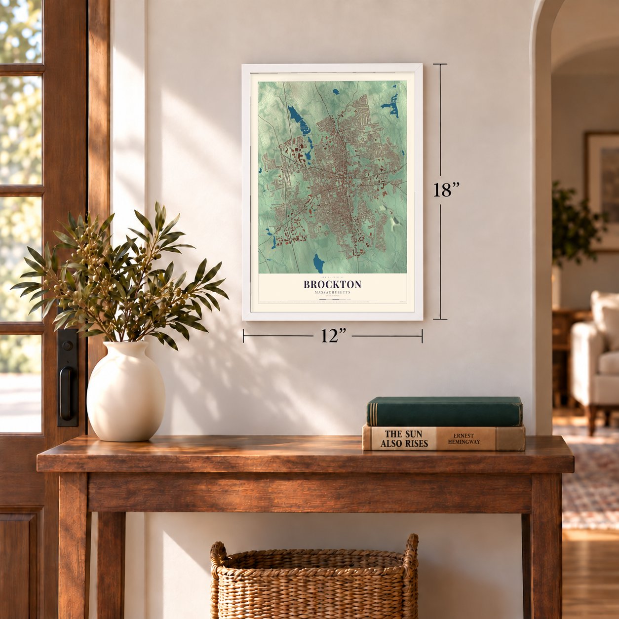

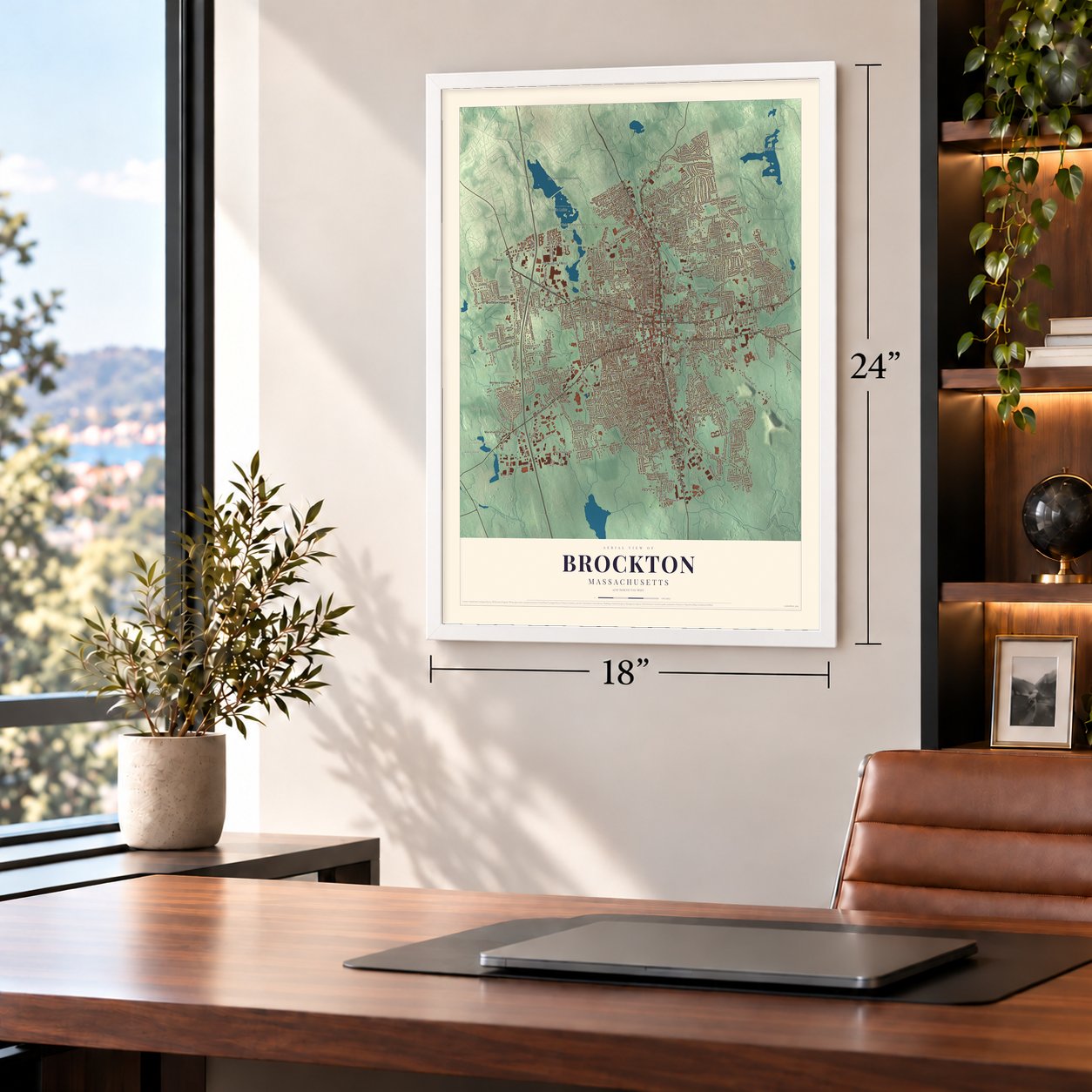

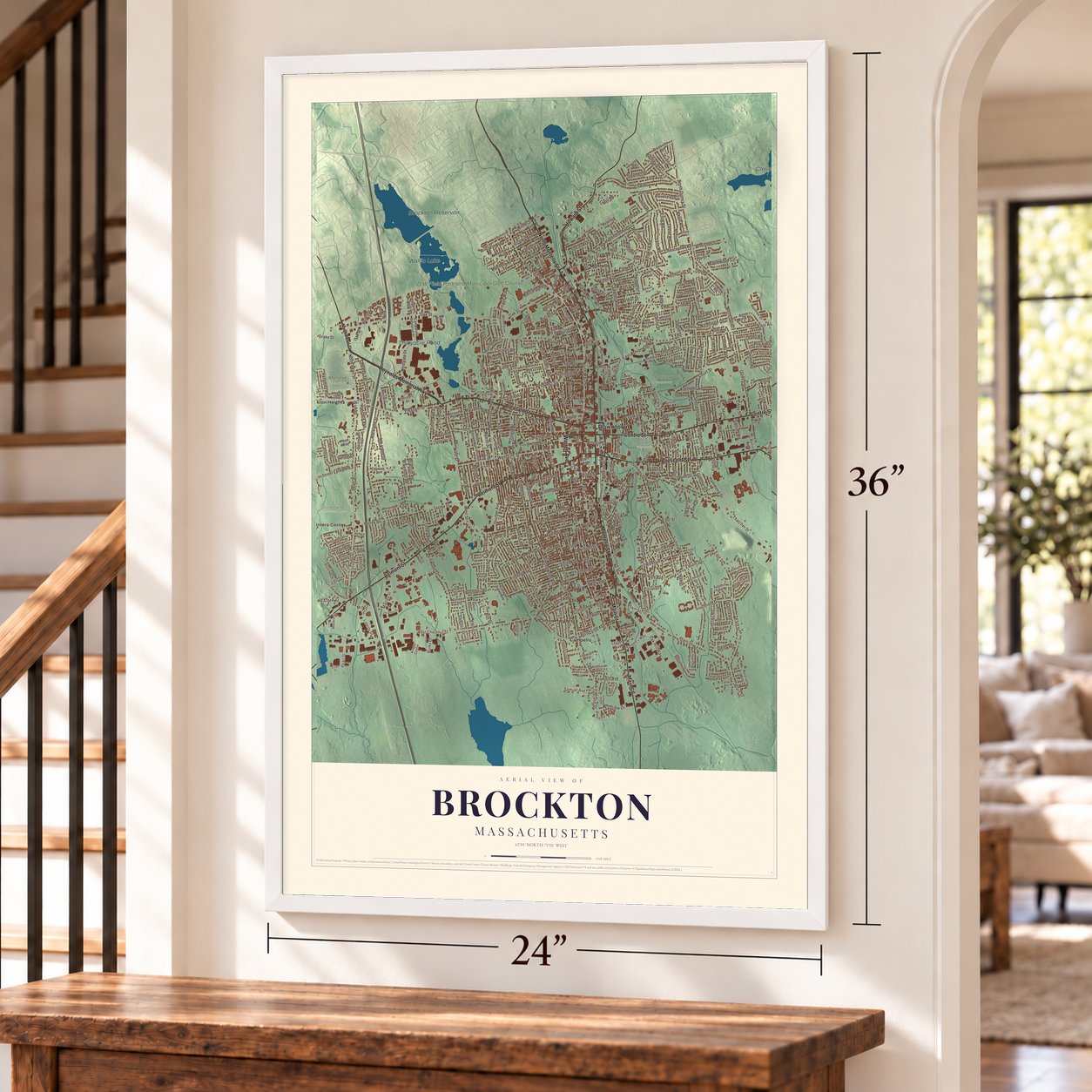

Free U.S. delivery 7 to 10 days after you order
Brockton, Massachusetts Map Art
A new map of Brockton, Massachusetts, made in 2026 and printed to order on thick archival matte paper.
18" x 24" Archival Matte Print
A Map of Home. A Work of Art.
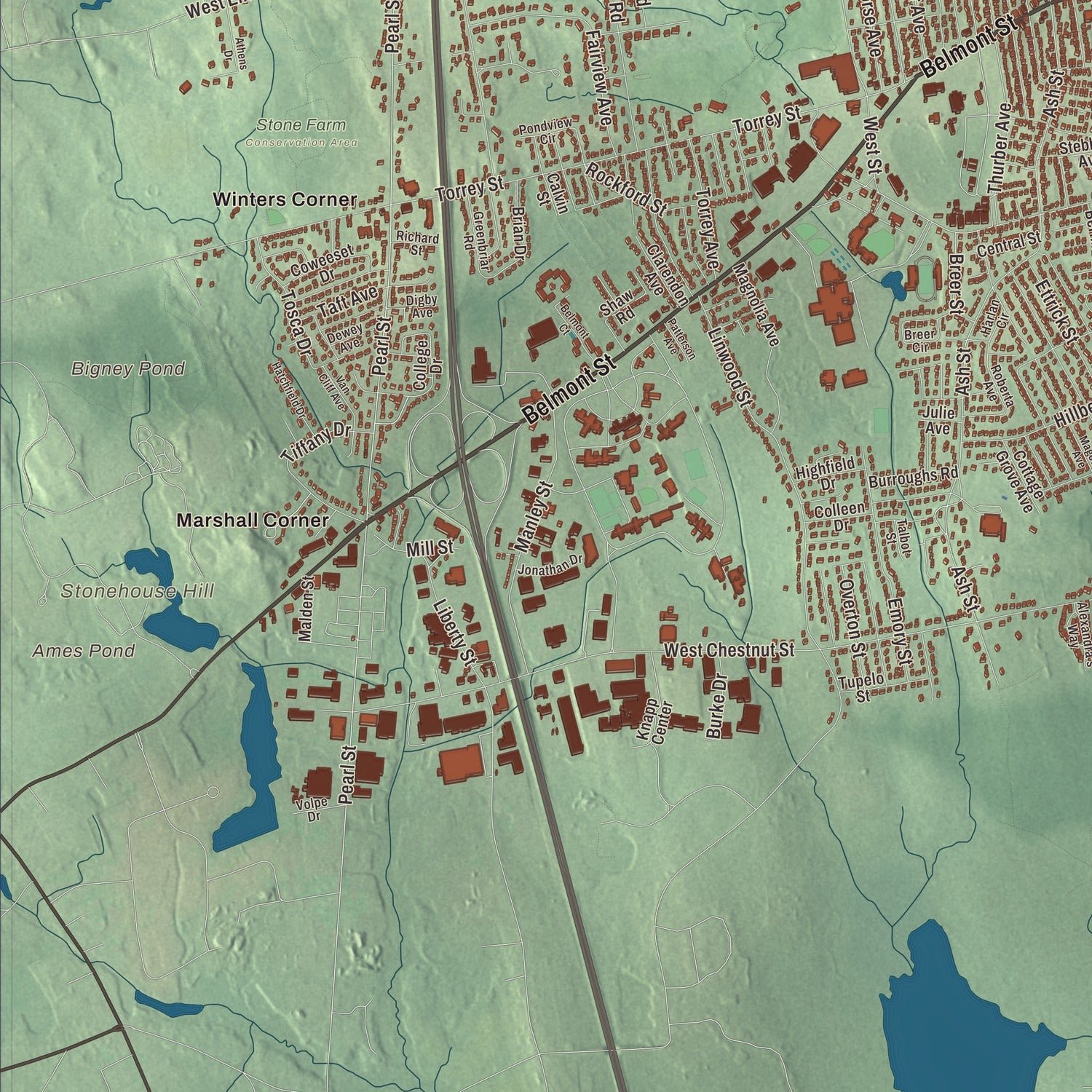
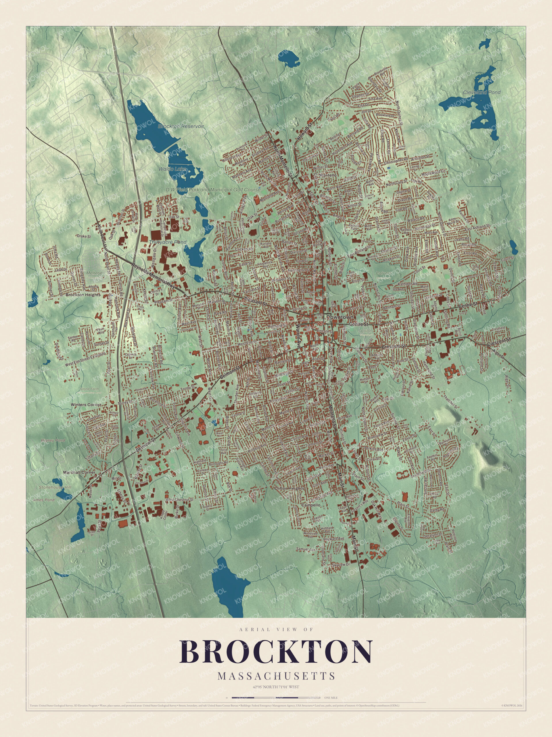
Explore Brockton, Massachusetts from a whole new perspective. Created using aerial imagery and detailed geographic data, this map captures Brockton building by building, with labeled streets, familiar landmarks, and shaded topographical relief that highlights the natural contours of the landscape.
Combining modern data with the timeless character of a vintage atlas, this map is just as interesting up close as it is beautiful on the wall. Whether you grew up in Brockton, spent memorable years there, or call it home today, this unique map is a great way to celebrate a place that means something to you. Zoom in on the preview to look for your street, and then order a print to put your memories on the wall.
Three ways to hang it
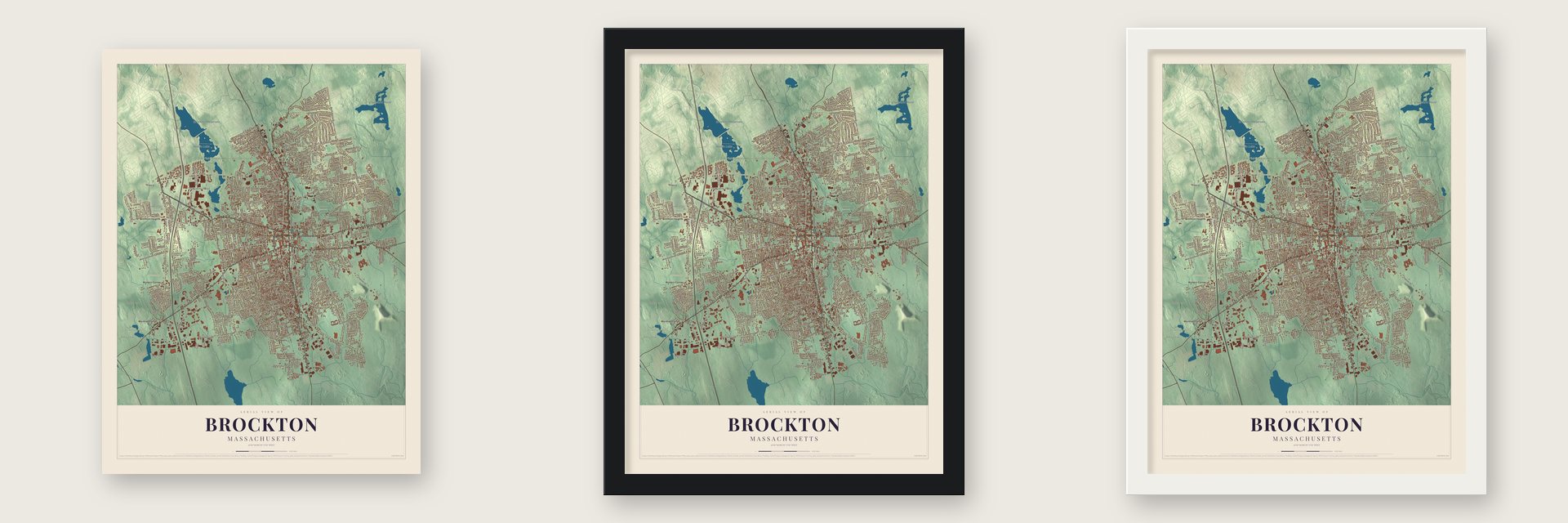
Unframed archival matte, a black wood frame or a white wood frame.
Up close
Geography Worth Displaying
This map was created using accurate cartographic data and authoritative geographic sources, including the U.S. Geological Survey (USGS) and FEMA. The map brings together terrain, waterways, roads, and building detail. The majority of the streets are labeled, houses are accurately depicted, and the topography is derived from government sources. Combining local data with carefully composed color and shading leads to this beautifully detailed Brockton artwork for your wall.
Rather than simply showing street outlines, we’ve included as many of the street names as we could reasonably fit on the map while keeping their names legible. Zoom in on the high resolution preview to see exactly what’s on the map. We truly set out to create a statement piece for anyone who loves Brockton. So whether it’s for you, or a gift for someone you love, we hope this map of Brockton brings back fond memories.
Explore the full map of Brockton, Massachusetts and read about the local places it shows.

About Brockton, Massachusetts
Brockton is a city of 105,643 people in Plymouth County, 22 miles south of Boston, and it shares the role of county seat with Plymouth. In 1649 the Wampanoag leader Ousamequin, called Massasoit, sold the land known as Saughtucket to Myles Standish, and the English gave the area the name Bridgewater. Its northern part broke away on June 15, 1821, as the town of North Bridgewater.
By 1870 many residents were tired of a long name that people kept confusing with nearby towns. A meeting in January 1871 favored Norwood, but weeks later the town asked the Legislature for Standish instead. The question dragged on until 1874, when a new law let the town choose among Brockton, Allerton and Avon. Ira Copeland had proposed Brockton after a Canadian conductor called out Brockville, Ontario, and it won 1,081 votes, about 72 percent. The new name took effect on May 5, 1874, and Brockton became a city on April 9, 1881.
“The greatest shoe city in the world.”
- Edison's week in 1883Thomas Edison spent a week in Brockton in 1883. On October 1 his plant opened with three dynamos for about 1,600 lamps, running the world's first three-wire electric system on underground wires. The city's centennial book says residents liked the buried lines because large trees shaded the main streets. For two years it was Edison's showpiece, and other cities sent visitors to study it. The Brockton Edison Electric Illuminating Company Power Station joined the National Register in 1987.
- The first electrified firehouseThe Central Fire Station on Pleasant Street, built in 1884 to 1885, opened on December 30, 1884, as the first electrically operated fire station in the country. An underground cable from the Edison plant fed it, and the wiring could light every lamp at night and free the horses when an alarm came in. The three-story brick firehouse joined the National Register in 1977.
- The Shoe CityBrockton made more shoes than any other place in America during the Civil War. Albert Poole's bird's-eye view of 1882 names 53 factories in its legend, and shoes came out of at least 45 of them. A federal report quoted in 1921 found that workers owned 90 percent of the city's homes. W. B. Mason started here in 1898 by supplying the shoe trade and still keeps its headquarters in Brockton.
- City of ChampionsRocky Marciano grew up on Brockton's south side and retired as the only heavyweight champion who never lost a pro fight. From 1943 to 1953 he lived with his family in a two-family house facing James Edgar Park, and the Rocky Marciano House joined the National Register in 2025. Marvin Hagler held the undisputed middleweight title from 1980 to 1987, and Brockton High named its teams the Boxers for them.
Find your street
Names on the Brockton map
Every name below is printed on this map. Look for your street, your school, the park where you played, or the pond down the road.
Places and landmarks20
- Downtown
- Stonehouse Hill
- Ames Pond
- Bigney Pond
- Cleveland Pond
- Brockton Reservoir
- Waldo Lake
- Thirtyacre Pond
- D W Field Park and Municipal Golf Course
- Calvary Cemetery
- Melrose Cemetery
- Stone Farm Conservation Area
Show all 20 places
- Union Cemetery
- Brockton Heights
- Campello
- Clifton Heights
- Marshall Corner
- Montello
- Winters Corner
- Beacon Park
Streets and roads453
- North Montello Street
- Montello Street
- Pleasant Street
- Main Street
- Warren Avenue
- Reynolds Memorial Highway
- Belmont Street
- Centre Street
- Crescent Street
- Howard Street
- West Elm Street
- North Pearl Street
- Clinton Street
- Perkins Street
- Curve Street
- North Main Street
- Keith Avenue
- Pearl Street
- West Street
- Court Street
- Plain Street
- Westgate Drive
- Highland Street
- Leach Avenue
- Maxim Street
- Ash Street
- Battles Street
- Healey Terrace
- Carrlyn Road
- Belmont Avenue
Show all 453 streets
- Coe Road
- Rainbow Circle
- Forest Avenue
- Manomet Street
- Leah Drive
- Rangeley Avenue
- Libby Street
- West Chestnut Street
- Oak Street
- North Quincy Street
- East Ashland Street
- North Cary Street
- Summer Street
- East Street
- Torrey Street
- Thatcher Street
- Copeland Street
- Rockland Street
- Hovendon Avenue
- Prospect Street
- Linwood Street
- Southfield Drive
- Sumner Street
- Hillberg Avenue
- Winter Street
- Quincy Street
- Spring Street
- Field Street
- North Warren Avenue
- Belair Street
- Menlo Street
- Lisa Drive
- Carl Avenue
- North Avenue
- Grove Street
- Ettrick Street
- Grafton Street
- Lynn Road
- Pine Street
- Ames Street
- Cambo Street
- Market Street
- Maplewood Circle
- Manley Street
- Elliot Street
- Falconer Avenue
- West Elm Street Extended
- Bates Road
- Elsie Road
- Dover Street
- Fairview Avenue
- Perkins Avenue
- Sawtell Avenue
- Liberty Street
- Myrtle Street
- Emory Street
- Tribou Street
- Thurber Avenue
- Braemoor Road
- Spark Street
- Keswick Road
- Candy Lane
- Winthrop Street
- Oak Hill Way
- Sinclair Road
- Newbury Street
- Riverview Street
- Cross Street
- Jon Drive
- Alger Street
- Nilsson Street
- Rockland Drive
- Kevin Road
- Royal Road
- Anawan Street
- Kathleen Road
- Mulberry Street
- Carroll Avenue
- Park Road
- Boundary Street
- Edward Street
- Forest Street
- Bourne Street
- Ardsley Circle
- Short Street
- Arthur Street
- Deanna Road
- Bartlett Street
- Brookside Avenue
- Cherry Street
- Ridge Street
- Sunset Drive
- Longwood Avenue
- Geralynn Drive
- Hammond Street
- Clifton Avenue
- Plymouth Street
- Tina Avenue
- Auburn Street
- Lester Road
- Bouve Avenue
- Briarcliff Road
- Dixon Road
- Thomas Street
- Drake Street
- Errol Road
- Malvern Road
- Tremont Street
- Ford Street
- North Leyden Street
- Hayward Avenue
- Foster Street
- Quincy Avenue
- Benham Street
- Sheridan Street
- Edson Street
- Rutland Street
- Walnut Street
- Morse Avenue
- Nicholson Drive
- Huntington Street
- Tosca Drive
- Torrey Avenue
- Bradley Avenue
- Portland Street
- Hillcrest Avenue
- Stephen Drive
- Gladstone Street
- Goldfinch Drive
- Tilton Avenue
- Lenox Street
- Drew Avenue
- Belcher Avenue
- Armiston Street
- Studley Avenue
- Samuel Avenue
- Christopher Road
- Glen Avenue
- Wilder Street
- Rockford Street
- Division Street
- Guild Road
- Manners Avenue
- Darren Drive
- Hill Street
- Skyview Drive
- Overton Street
- Sully Road
- Pine Avenue
- Otis Street
- Hancock Avenue
- Crickett Road
- Mill Street
- Waldo Street
- Kingman Street
- Bernard Road
- Annadea Road
- Keene Street
- Connell Avenue
- Earle Street
- Leahy Road
- Darby Road
- Turner Street
- Upton Street
- Martland Avenue
- Waleco Road
- Ferris Avenue
- Upland Road
- Parker Street
- Emmet Street
- Breer Street
- Bonney Street
- River Street
- Cary Street
- Taft Avenue
- Tiffany Drive
- Burke Drive
- Kame Street
- Livoli Road
- Village Way
- Amark Road
- Irma Road
- Fairfield Street
- Baker Street
- Sterling Road
- Herrod Avenue
- Oscar Avenue
- George Street
- Hopkins Road
- Granite Street
- Blendall Street
- Brett Street
- West Avenue
- Dyer Street
- Galen Street
- Coral Street
- Ellen Road
- Lincoln Street
- Allen Street
- Commercial Yard
- Union Street
- East Battles Street
- Moraine Street
- Boylston Street
- Green Street
- Country Club Lane
- Colonel Bell Drive
- Chatham West Drive
- Magnolia Avenue
- Lyman Street
- Sargent's Way
- Raintree Drive
- Dagmar Drive
- College Drive
- Christy's Drive
- Anne Marie Drive
- Mass Avenue
- Pine Grove Drive
- Baltic Avenue
- Crestfield Drive
- Electric Avenue
- Campanelli Industrial Drive
- Harvard Street
- Oakland Street
- Brian Drive
- Brookfield Drive
- Echo Street
- Appleby Street
- Parker Avenue
- Brookville Avenue
- Peterson Avenue
- Downey Road
- Fitzpatrick Avenue
- Coweeset Drive
- Woodland Avenue
- Hubbard Avenue
- Eleventh Avenue
- Carlisle Street
- Taylor Avenue
- Adams Street
- Oakdale Street
- Porter Street
- Brown Street
- Calmar Street
- Litchfield Street
- Knapp Center
- Albert Street
- Tupelo Street
- Byron Avenue
- Burroughs Road
- Vinedale Road
- Bernice Avenue
- Reservoir Street
- Elm Avenue
- Lucy Lane
- Ithica Road
- Albany Street
- Clarendon Avenue
- Montauk Road
- Marie Avenue
- Calvin Street
- Tyler Street
- Burrill Avenue
- Stebbins Avenue
- Cottage Grove Avenue
- Kurland Avenue
- Dartmouth Terrace
- Woodside Avenue
- Foothill Road
- Backlund Drive
- Addison Avenue
- Debbie Road
- Linnea Avenue
- Baldwin Road
- Highfield Drive
- Santee Road
- North Bassett Road
- Ida Avenue
- Paula Road
- Monson Street
- Central Street
- Cleveland Avenue
- Colleen Drive
- Cypress Drive
- Maple Avenue
- Malden Street
- High Street
- Holmes Street
- Freight Street
- Miller Avenue
- Martin Street
- Edgar Street
- Belding Circle
- Bates Street
- Pearl Way
- Spring Avenue
- Toby Road
- Harold Street
- Clifford Avenue
- Lawson Terrace
- Hudson Street
- Loring Street
- Park Street
- Thayer Avenue
- Shaw Road
- Broad Street
- Nye Avenue
- Auna Drive
- Julie Avenue
- Oak Lane
- Teele Street
- Irene Circle
- Lilly Avenue
- Fern Street
- East Union Street
- Battles Street Extended
- Harlan Circle
- Florence Street
- Wilson Street
- Norman Road
- Ashfield Drive
- Intervale Street
- Ellsworth Street
- Lewiston Street
- Ardsley Street
- Burkeside Avenue
- Breer Circle
- Snell Avenue
- Wyman Street
- Talbot Street
- Margery Road
- Alphonse Road
- Weston Street
- Howland Street
- Thorny Lea Terrace
- Pondview Circle
- Randolph Avenue
- Greenbriar Road
- Kennedy Drive
- North Ash Street
- Aspen Street
- Maguire Road
- Glenwood Street
- Noyes Avenue
- Haverhill Street
- Roberta Avenue
- Taber Avenue
- First Street
- Alexandra's Way
- Jonathan Drive
- Forest Road
- Chatham Road
- Stearns Avenue
- Poplar Road
- Cross Road
- Hoover Avenue
- Davids Street
- Dewey Avenue
- Juneau Road
- Hope Street
- Westland Street
- Snow Street
- Cottage Street
- Huntress Avenue
- Volpe Drive
- Hervey Street
- Fortin Drive
- Digby Avenue
- Richard Street
- Hermon Street
- Linden Street
- Bunker Avenue
- Trudy Terrace
- Snow Avenue
- Day Avenue
- Bellevue Avenue
- Battles Farm Drive
- Southland Terrace
- Magoun Avenue
- Temi Road
- Locust Street
- Van Cliff Avenue
- Gloucester Street
- Sophia Avenue
- Belmont Court
- Sherman Street
- Hatchfield Drive
- Montvale Road
- Mercedes Road
- Gerald Avenue
- Thayer Street
- Melrose Street
- Fern Avenue
- Longworth Avenue
- Milton Street
- Berglund Avenue
- Dudley Avenue
- Cappy's Way
- May Avenue
- Gladys Road
- Finny's Way
- Franklin Street
- Lyndall Avenue
- Emerson Avenue
- Dunham Street
- Patterson Avenue
- East Avenue
- Colantha Avenue
- Green Place
- Gay Street
- Rainville Street
- Doris Avenue
- Lookoff Street
- Donald Street
- Frost Street
- Owens Avenue
- Kent Street
- Athens Drive
- Sylvan Street
- Deed Circle
- Fields Avenue
- Vfw Parkway
- Roan Court
Names are listed as they appear on the printed map. Zoom into the product photos to find them.
The art of mapping a place
How This Map Was Made
Real places. Remarkable detail. Discover the layers that turn geographic data into a map of home.

The view from above
Aerial imagery reveals the character of the land: woodland, open fields, and the patterns of a place.

The shape of the land
Elevation data brings hills, valleys, and subtle changes in the landscape into view.

The details of home
Roads, waterways, and building footprints come together to make the map feel unmistakably local.

Geography becomes art
Considered color, shading, and typography bring the layers together in a map made for your wall.


Process illustrated with Mendon, Massachusetts. Aerial imagery: USDA NAIP. Terrain: USGS 3D Elevation Program. Map details and finished artwork: KNOWOL.
The Details
About This Print
Choose an archival matte print, or a black or white Ayous wood frame. The archival matte print is unframed.
Select your size and finish above to see the matching product image and price.
Materials & Craftsmanship
A contemporary map with the character of a classic atlas, printed on archival matte paper. Optional frames are made from Ayous wood.
Your printed map does not include the watermark shown in the full-map preview.
Shipping & Delivery
Free shipping within the United States. Every print is made to order in the USA.
Buying a gift? Add a note in your cart and we'll include it. We never put prices in the package.
Prints ship within 2 to 3 business days. Allow 7 to 10 days total from ordering for delivery. Timing may vary during holidays or periods of high order volume.
Read our shipping policy.
Returns and damaged prints
Each print is made to order. Change-of-mind refunds are not available after production.
If your print arrives damaged, misprinted or incorrect, contact support@knowol.com within 30 days of receiving it. Include your order number, photos and a description of the issue.
Read our full refund and replacement policy. For questions about your order, email support@knowol.com.
Find your town
Looking for another city?
Find a map of home in our Massachusetts collection, or any town in the country.
Nearby
Maps of towns near Brockton
Know someone from one of these towns? Their map makes a great gift.
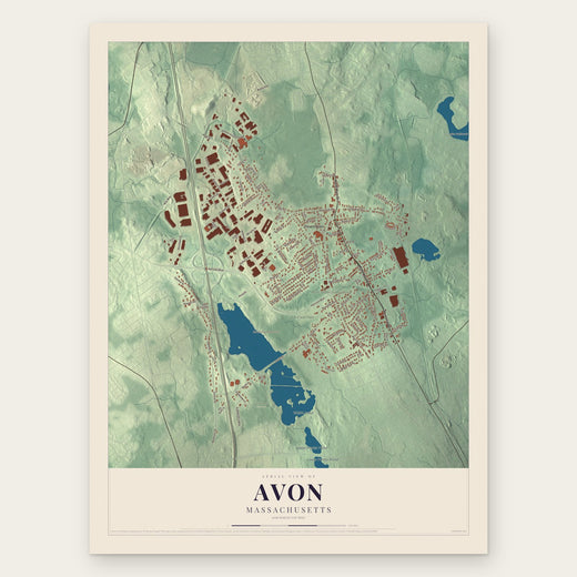 Avon
Avon, Massachusetts
From $39.99See the map
 Abington
, Massachusetts
From $39.99See the map
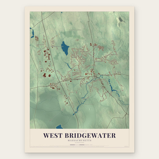 West Bridgewater
, Massachusetts
From $39.99See the map
More maps nearby: Holbrook, Whitman, Stoughton, Easton and East Bridgewater.