
Search for another town





Free U.S. delivery 7 to 10 days after you order
Brookhaven, Mississippi Map Art
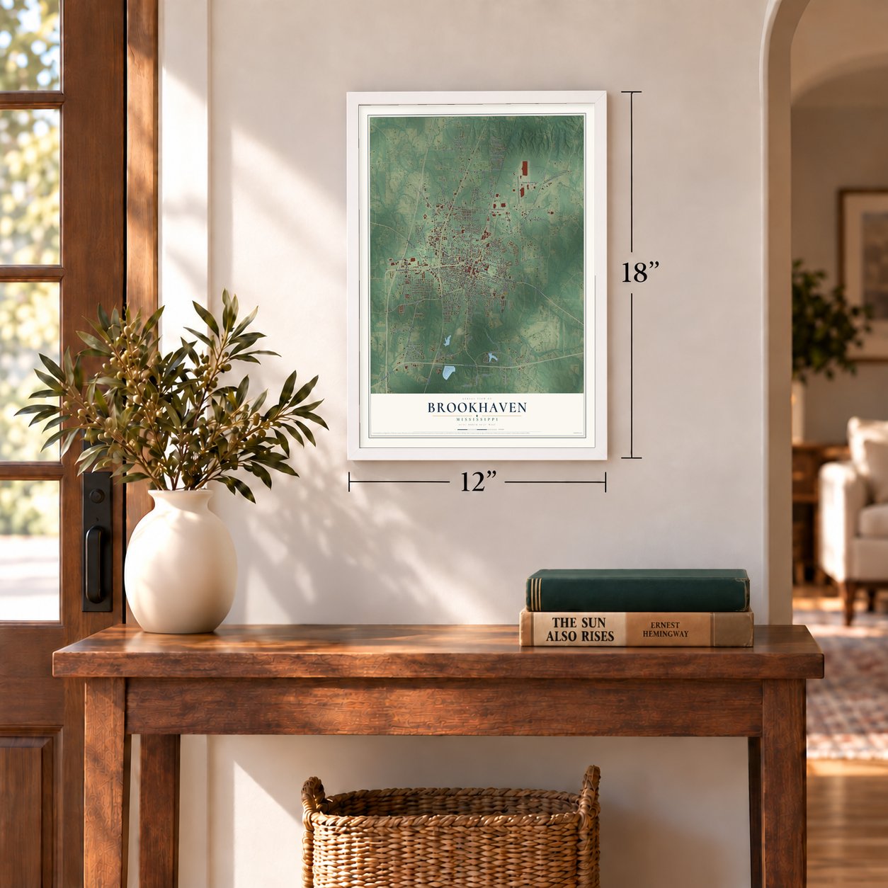
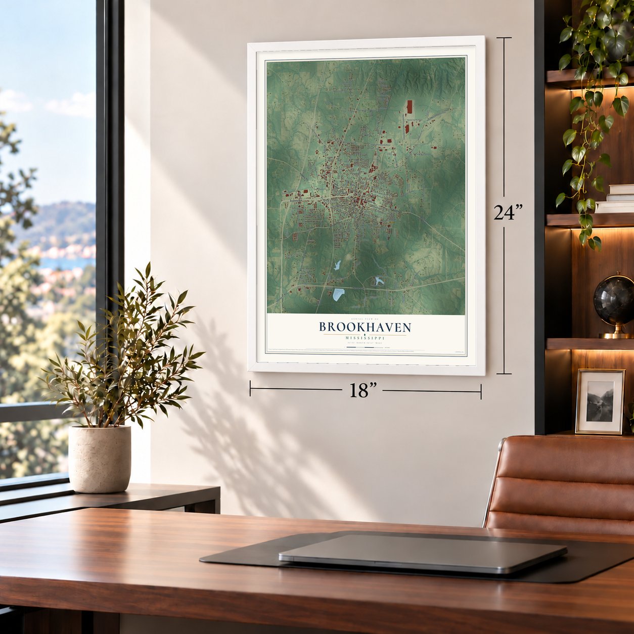
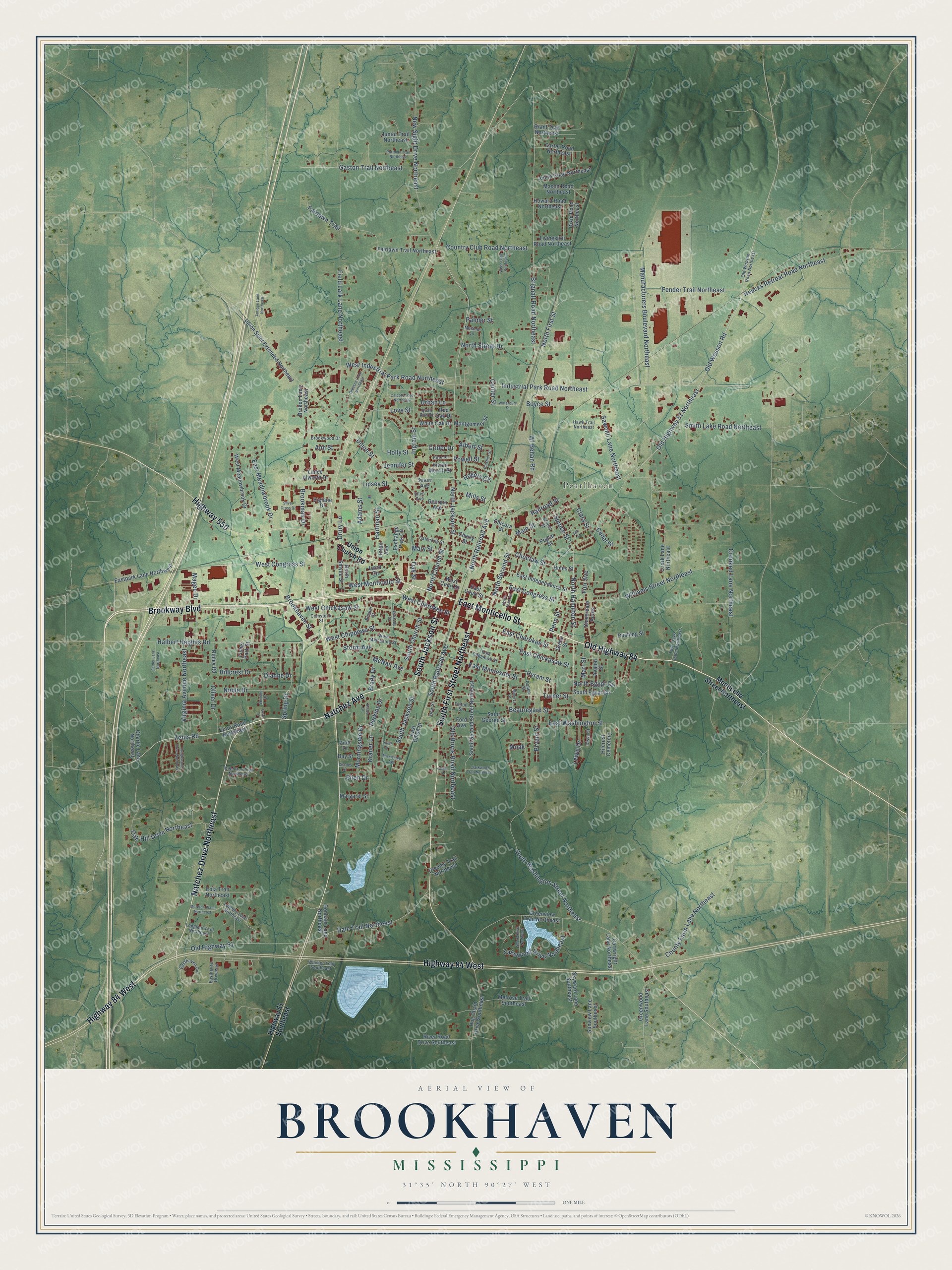
A new map of Brookhaven, Mississippi, made in 2026 and printed to order on thick archival matte paper.
12" x 18" Archival Matte Print
A Map of Home. A Work of Art.
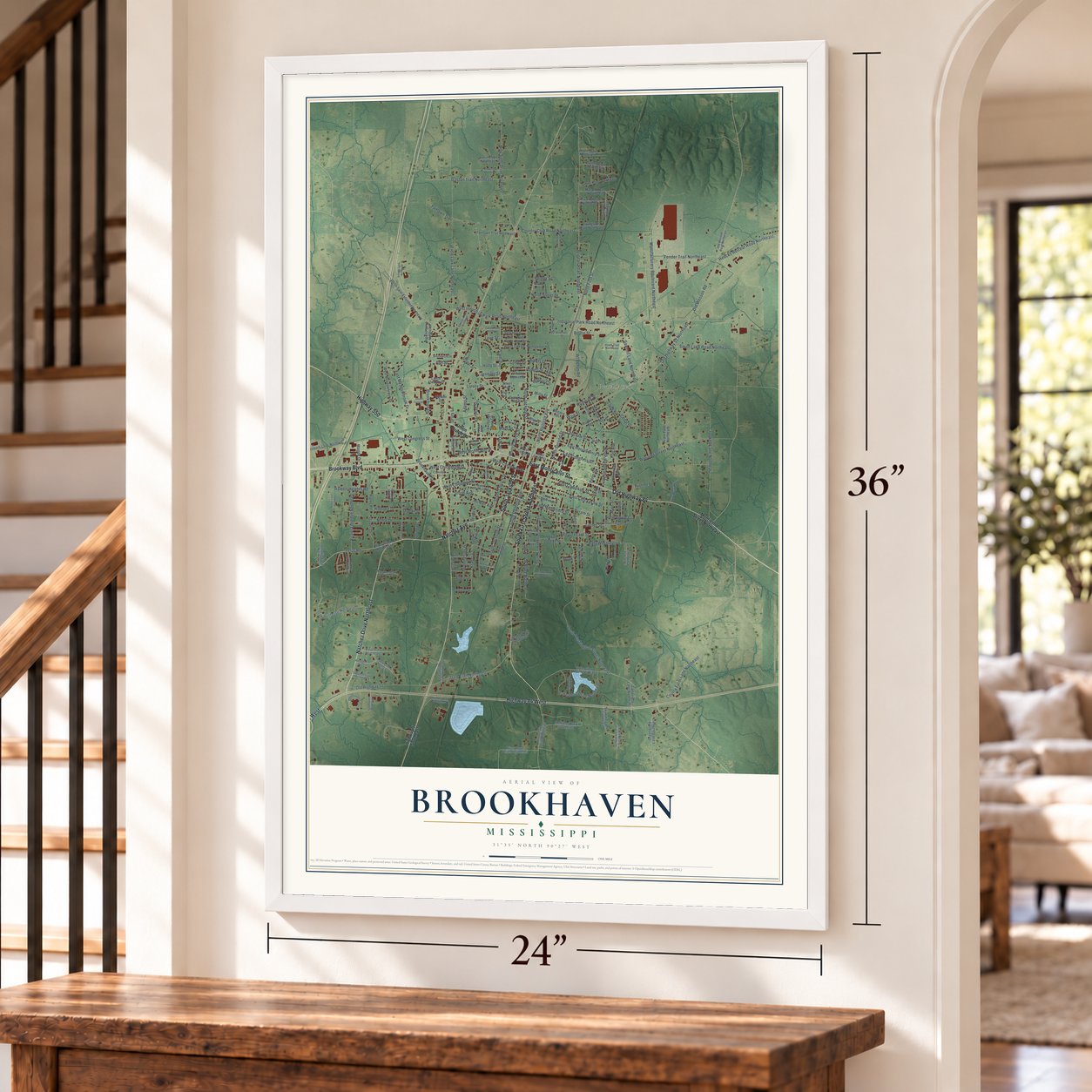
Explore Brookhaven, Mississippi from a whole new perspective. Created using aerial imagery and detailed geographic data, this map captures Brookhaven building by building, with labeled streets, familiar landmarks, and shaded topographical relief that highlights the natural contours of the landscape.
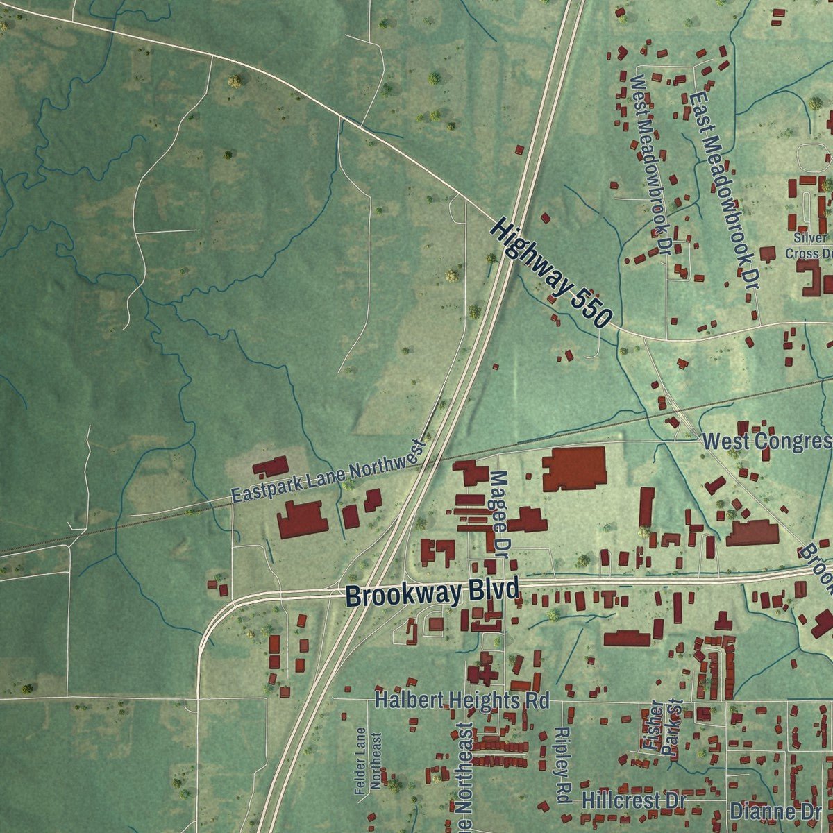
Combining modern data with the timeless character of a vintage atlas, this map is just as interesting up close as it is beautiful on the wall. Whether you grew up in Brookhaven, spent memorable years there, or call it home today, this unique map is a great way to celebrate a place that means something to you. Zoom in on the preview to look for your street, and then order a print to put your memories on the wall.
Three ways to hang it
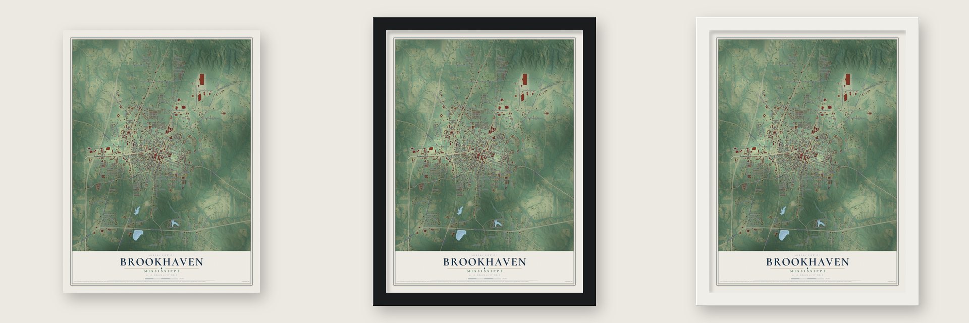
Unframed archival matte, a black wood frame or a white wood frame.
Up close
Geography Worth Displaying
This map was created using accurate cartographic data and authoritative geographic sources, including the U.S. Geological Survey and the Census Bureau. The map brings together terrain, waterways, roads, and building detail. The majority of the streets are labeled, houses are accurately depicted, and the topography is derived from government sources. Combining local data with carefully composed color and shading leads to this beautifully detailed Brookhaven artwork for your wall.
Rather than simply showing street outlines, we’ve included as many of the street names as we could reasonably fit on the map while keeping their names legible. Zoom in on the high resolution preview to see exactly what’s on the map. We truly set out to create a statement piece for anyone who loves Brookhaven. So whether it’s for you, or a gift for someone you love, we hope this map of Brookhaven brings back fond memories.
Read the story behind this map of Brookhaven, Mississippi from 2026.

About Brookhaven, Mississippi
Brookhaven is a city of 11,674 people and the seat of Lincoln County, on land that once belonged to the Choctaw. Samuel Jayne, a settler from New York, founded the town in 1818 and gave it the name of Brookhaven on Long Island. In the 1830s Indian Removal forced most of the Choctaw out of Mississippi to poorer land in Indian Territory.
The railroad from Osyka reached Brookhaven in 1857, and before the Civil War a short line carried it on to Jackson. During the war the town held a large recruiting camp until November 1864. At noon on April 29, 1863, Union cavalry under Colonel Benjamin Grierson rode in, burned public buildings and wrecked the railroad, which was rebuilt after the war. Mississippi created Lincoln County in 1870, and Brookhaven serves as its seat.
- Whitworth College, 1859Methodists opened Whitworth College in 1859, and it taught Mississippi women until 1964. Annie Coleman Peyton graduated in 1872, taught there for a short time, then worked to found the school in Columbus that is now Mississippi University for Women, the first public college in Mississippi built for women. The Mississippi School for the Arts now uses the old campus buildings.
- Mississippi's first canning clubsSusie Powell grew up in Brookhaven and studied at Whitworth College. Her work there gave Lincoln County the first canning clubs in Mississippi.
- Cotton and long leaf pineBrookhaven grew in the long leaf pine country, and by the early 1900s it had two large lumber mills, a cotton compress, a nail mill and factories for ice, brick and mattresses. It was the biggest cotton shipping point in Mississippi south of Jackson, and the city ran its own electric lights and water works. The town counted 2,678 people in 1900 and 3,652 in 1906.
- Temple B'nai Sholom, 1896Brookhaven's Jewish families built Temple B'nai Sholom in 1896 in the Moorish Revival style. The temple served Jewish residents of the area until 2009.
- The author behind PinkyCid Ricketts Sumner, born in Brookhaven in 1890, became a popular novelist in the middle of the twentieth century. Her books were made into the movies Pinky in 1949 and Tammy and the Bachelor in 1957. The author and artist Charles Henri Ford was born in the city in 1913.
Find your street
Names on the Brookhaven map
Every name below is printed on this map. Look for your street, your school, the park where you played, or the pond down the road.
Places and landmarks2
- Pearlhaven
- Hilcrest Cemetery
Streets and roads220
- East Monticello Street
- Old Highway 84
- Natchez Avenue
- South Jackson Street
- Highway 84 West
- South First Street Northeast
- Brookway Boulevard
- Highway 550
- Natchez Drive Northeast
- North Jackson Street
- Union Street
- Main Street
- North Second Street
- Gaston Trail Northeast
- Zetus Road
- Brignall Road Northeast
- West Chippewa Street
- North Hamilton Street
- Turner Street
- Old Wesson Road
- Old Highway 51 Northeast
- Center Street
- East Minnesota Street
- Industrial Park Road Northeast
- South Washington Street Northeast
- Crooked Lane Northeast
- Field Lark Lane Northeast
- Manufacturers Boulevard Northeast
- West Congress Street
- North First Street
Show all 220 streets
- Wl Behan Road
- Williams Street Northeast
- Halbert Heights Road
- South Church Street
- New Sight Drive Northeast
- West Industrial Park Road Northeast
- West Chickasaw Street
- East Cherokee Street
- Old Highway 51
- Dale Trail Northeast
- Old Brook Road Northeast
- Ingram Street
- Heucks Retreat Road Northeast
- Lakewood Drive Northeast
- Brookhaven Street
- South Railroad Avenue
- East Chickasaw Street
- Oak Hill Drive Northeast
- County Farm Lane Northeast
- Lipsey Street
- Fender Trail Northeast
- North Railroad Avenue
- Country Club Road Northeast
- Virginia Avenue Northeast
- Sawmill Lane Northeast
- Hartman Street
- Brookman Drive
- Smith Lake Road Northeast
- East Washington Street
- East Meadowbrook Drive
- North Church Street
- East Congress Street
- Noble Drive
- Magee Drive
- Boyce Street
- North Street Drive
- Kraner Lane
- Holly Street
- Adams Street
- Storm Avenue
- Railroad Street
- McNair Avenue
- Rogers Circle
- Beauregard Street
- Dianne Drive
- West Cherokee Street
- Drury Lane
- West Monticello Street
- Morningside Drive
- Oliver Drive
- Mills Street
- Love Street
- Lewis Drive
- Spruce Street
- Hyram Street
- Fairlawn Trail
- Choctaw Street
- Spring Drive
- Penn Street
- North Egypt Circle
- Hillcrest Drive
- Powell Street
- Crider Drive
- Marr Street
- Perkins Drive
- Bryant Street
- Clara Street
- Furr Avenue
- Albert Street
- Urban Lane
- Ann Street
- Brady Drive
- Jennifer Street
- Ellen Drive
- Mary Street
- Palmer Street
- Cedar Street
- Oak Street
- Moak
- Monticello Street Northeast
- Union Church Road
- Highway 51 Southeast
- Zetus Road Northeast
- Hines Street
- Greenview Trail Northeast
- South Second Street Northeast
- Fairlawn Trail Northeast
- West Meadowbrook Drive
- Melrose Trail Southeast
- Eastpark Lane Northwest
- Union Saint Extended Northeast
- Exchange Park Circle
- East Independence Street
- Grenn Street
- Hog Chain Drive Southeast
- Ozark Lane Northeast
- Rushing Street
- Howard Road Northeast
- Charlie Lane Northeast
- Biglane Drive
- River Road Drive Southeast
- Greenwood Lane Southeast
- Amite Road Northeast
- Skyward Lane Southeast
- Mason Road Northeast
- Eola Trail Northeast
- West Court Street
- North Smylie Street
- Carter Road Northeast
- Brant Trail Northeast
- Dixie Road Northeast
- Cloverdale Acres
- East Court Street
- South Egypt Circle
- Poplar Street
- Vivian Merritt Street
- White Oak Drive
- Livingston Road Northeast
- Cartwright Lane Northeast
- Montgomery Street
- Saint George Street
- Ripley Road
- Avalon Street
- Denham Lane Northeast
- Sunview Lane Southeast
- Lance Alworth Drive
- Junior Trail Northeast
- Pine Drive
- Broken Lane Northeast
- Bay Street
- Georgia Avenue
- Dreamy Trail Northeast
- Laird Circle
- Margaret Street
- Linton Avenue
- Fisher Park Street
- East Union Street
- Cherry Street
- Chicora Street
- Red Oak Drive
- Ford Avenue
- Smurr Avenue
- Brookwood Drive
- East Chippewa Street
- Old Wesson Road Northeast
- Wilcher Trail Southeast
- West Minnesota Street
- Easthaven Driveway
- Easthaven Circle
- Becker Street
- Comstock Street
- Loblolly Lane Northeast
- Twin Oaks Lane Northeast
- Hawk Trail Northeast
- Deer Run Trail Northeast
- Longleaf Trail Northeast
- School Street
- Dissa Street
- Melanie Lane
- Catherine Street
- Cohen Street
- Dow Street
- Fulton Street
- Eitel Place
- Quail Run Drive
- Ellen Avenue
- Waterbury Street
- North Third Street
- Antique Lane Northeast
- Calcote Loop Northeast
- Gleason Loop Northeast
- Cassedy Street
- Shore Drive Northeast
- Moreton Place Northeast
- Tanglewood Drive Northeast
- Felder Lane Northeast
- Charles Street
- Hardy Lane
- Portman Trail Northeast
- Clarkwood Trail Northeast
- Ash Street
- South Street
- Weed Lane Northeast
- Silver Cross Drive
- Brashier Street
- Minerva Street
- Mississippi Avenue
- Oneal Street
- Summer Drive
- Dean Drive
Names are listed as they appear on the printed map. Zoom into the product photos to find them.
The art of mapping a place
How This Map Was Made
Real places. Remarkable detail. Discover the layers that turn geographic data into a map of home.

The view from above
Aerial imagery reveals the character of the land: woodland, open fields, and the patterns of a place.

The shape of the land
Elevation data brings hills, valleys, and subtle changes in the landscape into view.

The details of home
Roads, waterways, and building footprints come together to make the map feel unmistakably local.

Geography becomes art
Considered color, shading, and typography bring the layers together in a map made for your wall.


Process illustrated with Mendon, Massachusetts. Aerial imagery: USDA NAIP. Terrain: USGS 3D Elevation Program. Map details and finished artwork: KNOWOL.
The Details
About This Print
Choose an archival matte print, or a black or white Ayous wood frame. The archival matte print is unframed.
Select your size and finish above to see the matching product image and price.
Materials & Craftsmanship
A contemporary map with the character of a classic atlas, printed on archival matte paper. Optional frames are made from Ayous wood.
Your printed map does not include the watermark shown in the full-map preview.
Shipping & Delivery
Free shipping within the United States. Every print is made to order in the USA.
Buying a gift? Add a note in your cart and we'll include it. We never put prices in the package.
Prints ship within 2 to 3 business days. Allow 7 to 10 days total from ordering for delivery. Timing may vary during holidays or periods of high order volume.
Read our shipping policy.
Returns and damaged prints
Each print is made to order. Change-of-mind refunds are not available after production.
If your print arrives damaged, misprinted or incorrect, contact support@knowol.com within 30 days of receiving it. Include your order number, photos and a description of the issue.
Read our full refund and replacement policy. For questions about your order, email support@knowol.com.
Find your town
Looking for another city?
Find a map of home in our Mississippi collection, or any town in the country.
Nearby
Maps of towns near Brookhaven
Know someone from one of these towns? Their map makes a great gift.
 Wesson
, Mississippi
From $39.99See the map
 Beauregard
, Mississippi
From $39.99See the map
 Bogue Chitto
, Lincoln County, Mississippi
From $39.99See the map
More maps nearby: Monticello, Hazlehurst, Summit, McComb and Bude.