
Search for another town





Free U.S. delivery 7 to 10 days after you order
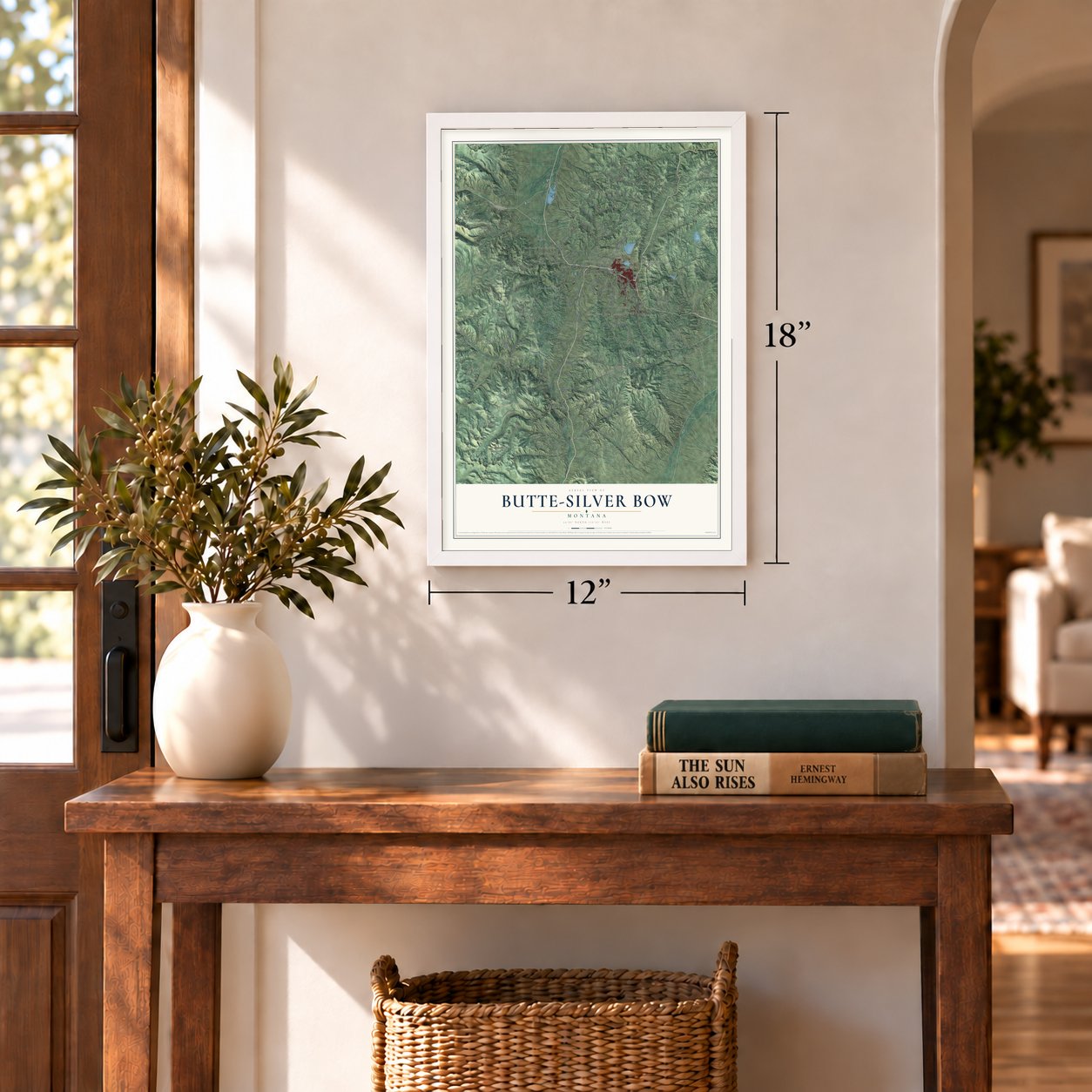
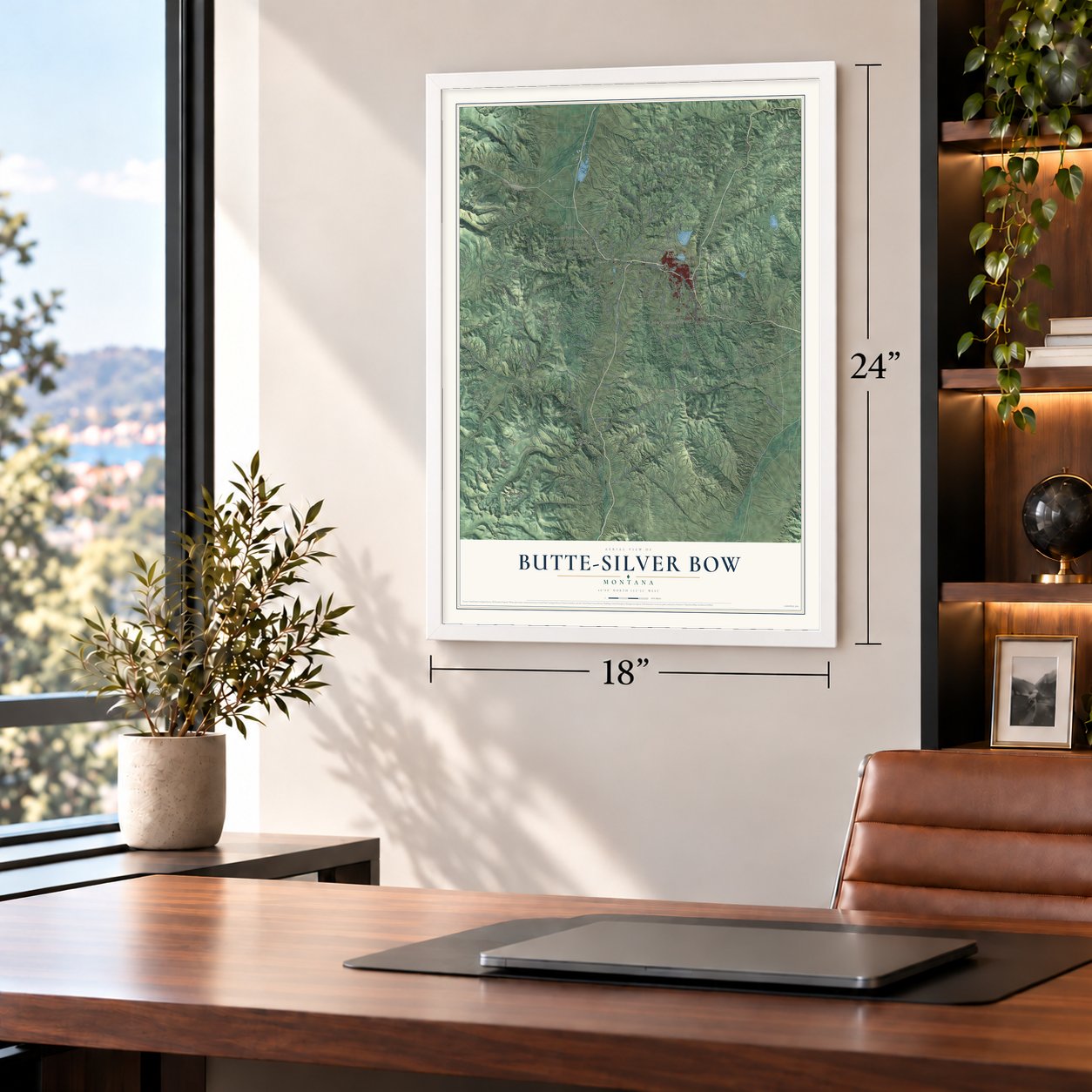
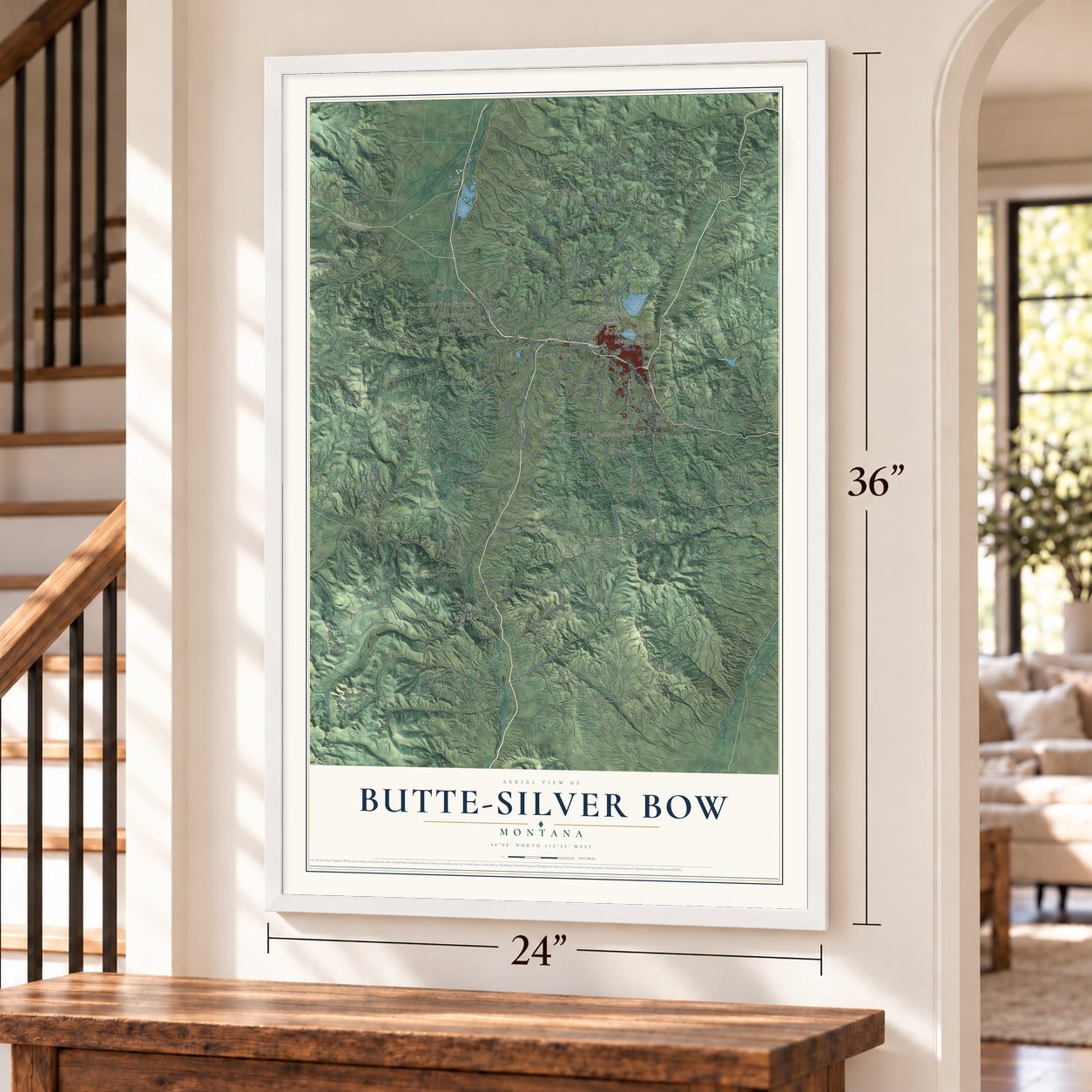
Butte-Silver Bow, Montana Map Art
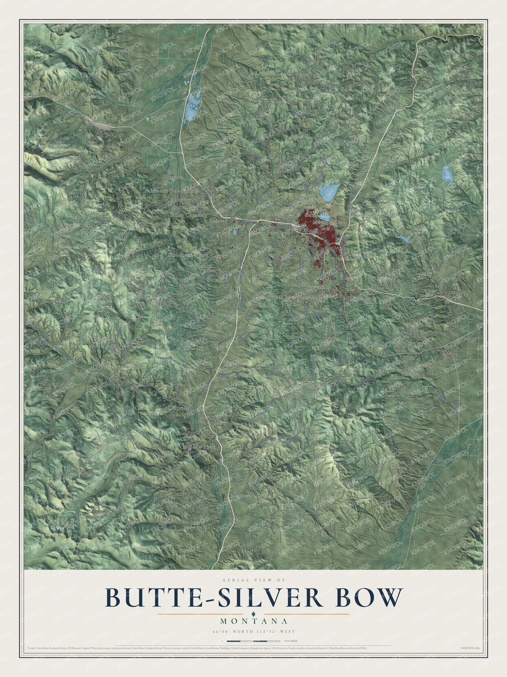
A new map of Butte-Silver Bow, Montana, made in 2026 and printed to order on thick archival matte paper.
12" x 18" Archival Matte Print
A Map of Home. A Work of Art.
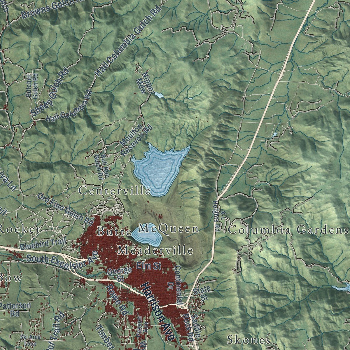
Explore Butte-Silver Bow, Montana from a whole new perspective. Created using aerial imagery and detailed geographic data, this map captures Butte-Silver Bow building by building, with labeled streets, familiar landmarks, and shaded topographical relief that highlights the natural contours of the landscape.
Combining modern data with the timeless character of a vintage atlas, this map is just as interesting up close as it is beautiful on the wall. Whether you grew up in Butte-Silver Bow, spent memorable years there, or call it home today, this unique map is a great way to celebrate a place that means something to you. Zoom in on the preview to look for your street, and then order a print to put your memories on the wall.
Three ways to hang it
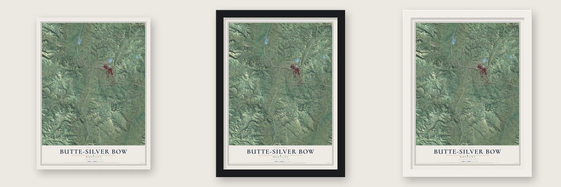
Unframed archival matte, a black wood frame or a white wood frame.
Up close
Geography Worth Displaying
This map was created using accurate cartographic data and authoritative geographic sources, including the U.S. Geological Survey and the Census Bureau. The map brings together terrain, waterways, roads, and building detail. The majority of the streets are labeled, houses are accurately depicted, and the topography is derived from government sources. Combining local data with carefully composed color and shading leads to this beautifully detailed Butte-Silver Bow artwork for your wall.
Rather than simply showing street outlines, we’ve included as many of the street names as we could reasonably fit on the map while keeping their names legible. Zoom in on the high resolution preview to see exactly what’s on the map. We truly set out to create a statement piece for anyone who loves Butte-Silver Bow. So whether it’s for you, or a gift for someone you love, we hope this map of Butte-Silver Bow brings back fond memories.
Read the story behind this map of Butte-Silver Bow, Montana from 2026.

About Butte-Silver Bow, Montana
Butte-Silver Bow is the single government that formed in 1977, when the city of Butte and Silver Bow County joined. Butte started out as a mining camp in 1864, in the Silver Bow Creek Valley, a high bowl on the Continental Divide. In 1874 William L. Farlin opened the Asteroid Mine, later called the Travona, and prospectors poured in looking for gold and silver.
Copper soon became the bigger prize, because the spread of electric power needed it. Marcus Daly managed the Alice, a silver mine in Walkerville, and spotted high-grade copper ore there. His employers, the Walker Brothers, wouldn't buy the nearby Anaconda mine, so in 1881 Daly sold his share of the Alice and bought it himself, with George Hearst taking one-fourth of the stock. His company eventually owned every mine on Butte Hill. In 1910 the district produced 284,000,000 pounds of copper, more than anywhere else in North America, and Butte became known as the Richest Hill on Earth.
“Butte, Montana, fifteen years ago a small placer-mining village clinging to the mountain side, has now risen to the rank of the first mining camp of the world... [It] is now the most populous city of Montana, numbering twenty-five thousand active, enterprising, prosperous inhabitants.”
- Ore trains on electric powerMarcus Daly built a smelter at Anaconda and created the Butte, Anaconda & Pacific Railway to haul ore there from Butte. In 1913 the BA&P began moving its freight by electricity, the first railway in the nation to do so.
- Where a miners' federation beganBy 1885 a general union in Butte had about 1,800 dues-paying members, and that year it reorganized as the Butte Miners' Union. When a violent strike broke out in Coeur d'Alene, Idaho, in 1892, the Butte miners sent thousands of dollars and then mortgaged their own buildings to send more. In May 1893 about 40 delegates from hard-rock camps met in Butte and founded the Western Federation of Miners, with the Butte union as Local Number One.
- The Speculator disaster, 1917On June 8, 1917, a fire broke out more than 2,000 feet underground in the Granite Mountain mine shaft and sent smoke and poisonous gas through tunnels connected to the Speculator Mine. Some men walled themselves off behind bulkheads and lived, but 168 died, the worst hard rock mining disaster in world history. The Granite Mountain Memorial honors them.
- Columbia Gardens, 1899Copper King W. A. Clark built his mansion in Butte between 1884 and 1888. In 1899 he bought Columbia Gardens, a small park, and turned it into an amusement park so children and families could escape the smoky mining air. He gave it a pavilion and a roller coaster, along with a lake where visitors could swim or paddle canoes.
- Chinatown fought backChinese immigrants opened businesses that grew into a Butte Chinatown, until the Chinese Exclusion Act ended new arrivals in 1882. In 1895 the chamber of commerce and the labor unions began a boycott of Chinese-owned businesses, and the owners took the unions to court and won. The Mai Wah Museum tells their story.
Find your street
Names on the Butte-Silver Bow map
Every name below is printed on this map. Look for your street, your school, the park where you played, or the pond down the road.
Places and landmarks33
- Butte
- Buxton
- Centerville
- Columbia Gardens
- Delano Place
- Divide
- Donald
- Durant
- Fairmont Hot Springs
- Feely
- Grace
- Gregson
Show all 33 places
- Hackney
- Highview
- Janney
- Johnson
- Maiden Rock
- McQueen
- Meaderville
- Melrose
- Miles Crossing
- Moose Town
- Newcomb
- Nine-mile
- Nissler
- Patterson Corner
- Quinn
- Ramsay
- Rocker
- Sciuchetti Place
- Silver Bow
- Skones
- Woodin
Streets and roads85
- Harrison Avenue
- Continental Drive
- Fleecer Mountain Road
- Sheep's Gl
- Frontage Road
- Beef Trail Road
- Buxton Road
- Spring Road
- Moose Creek Road
- Highland Road
- Camp Creek Road
- South Excelsior Avenue
- German Gulch Road
- Fish Creek Road
- Browns Gulch Road
- Hail Columbia Gulch Road
- Sheep Gulch Road
- Soap Gulch Road
- Fleecer Ridge Road
- Bossard Road
- Iris Ridge Road
- Telegraph Gulch
- Nissler Road
- Jerry Creek Road
- Lime Kiln Road
- Charcoal Gulch Road
- Prevost Trail
- Timber
- Liva Lane
- Elm Street
Show all 85 streets
- Rowe Road
- Divide Creek Road
- South Buxton Frontage Road
- Bluebird Trail
- Rocker Road
- Johnson Creek Road
- Little Basin Creek Road
- Hail Columbia Road
- Basin Creek Road
- Flume Gulch
- American 26 Gulch
- Seven Springs Road
- Rick Jones Way
- Meadow Gulch Road
- Moulton Resevoir Road
- Jimmie New Road
- Oro Fino Gulch Road
- Canyon Road
- Patterson Road
- Saddle Rock Road
- Wynne Avenue
- Herman Gulch Road
- George Street
- Tucker Creek Road
- Little Fish Creek Road
- Albany Avenue
- Roosevelt Drive
- Soap Gulch
- Haggin Vw
- Curly Gulch Road
- State Street
- Nipper Mdw
- Fleecer Road
- Cut Off Road
- Two Bit Lane
- Old RR
- Buxton Frontage Road South
- Maclean Creek Road
- X-L Heights Road
- South Rocker Road
- Blacktail Loop
- Butcher Gulch Road
- Paxson Avenue
- Flint Creek Road
- East Badger Lane
- Bull Run Gulch Road
- South Buxton Road
- North Browns Gulch Road
- Ski Area Loop
- Cradberry Road
- Lyndale Lane
- Forest Road
- Wild Rose Lane
- South River Road
- Basin Crk Road
Names are listed as they appear on the printed map. Zoom into the product photos to find them.
The art of mapping a place
How This Map Was Made
Real places. Remarkable detail. Discover the layers that turn geographic data into a map of home.

The view from above
Aerial imagery reveals the character of the land: woodland, open fields, and the patterns of a place.

The shape of the land
Elevation data brings hills, valleys, and subtle changes in the landscape into view.

The details of home
Roads, waterways, and building footprints come together to make the map feel unmistakably local.

Geography becomes art
Considered color, shading, and typography bring the layers together in a map made for your wall.


Process illustrated with Mendon, Massachusetts. Aerial imagery: USDA NAIP. Terrain: USGS 3D Elevation Program. Map details and finished artwork: KNOWOL.
The Details
About This Print
Choose an archival matte print, or a black or white Ayous wood frame. The archival matte print is unframed.
Select your size and finish above to see the matching product image and price.
Materials & Craftsmanship
A contemporary map with the character of a classic atlas, printed on archival matte paper. Optional frames are made from Ayous wood.
Your printed map does not include the watermark shown in the full-map preview.
Shipping & Delivery
Free shipping within the United States. Every print is made to order in the USA.
Buying a gift? Add a note in your cart and we'll include it. We never put prices in the package.
Prints ship within 2 to 3 business days. Allow 7 to 10 days total from ordering for delivery. Timing may vary during holidays or periods of high order volume.
Read our shipping policy.
Returns and damaged prints
Each print is made to order. Change-of-mind refunds are not available after production.
If your print arrives damaged, misprinted or incorrect, contact support@knowol.com within 30 days of receiving it. Include your order number, photos and a description of the issue.
Read our full refund and replacement policy. For questions about your order, email support@knowol.com.
Find your town
Looking for another city?
Find a map of home in our Montana collection, or any town in the country.
Nearby
Maps of towns near Butte-Silver Bow
Know someone from one of these towns? Their map makes a great gift.
 Walkerville
, Montana
From $39.99See the map
 Dewey
Dewey, Montana
From $39.99See the map
 Wise River
, Montana
From $39.99See the map
More maps nearby: Rader Creek, Silver Star, Racetrack, Anaconda-Deer Lodge County and Whitehall.