
Search for another town




Free U.S. delivery 7 to 10 days after you order
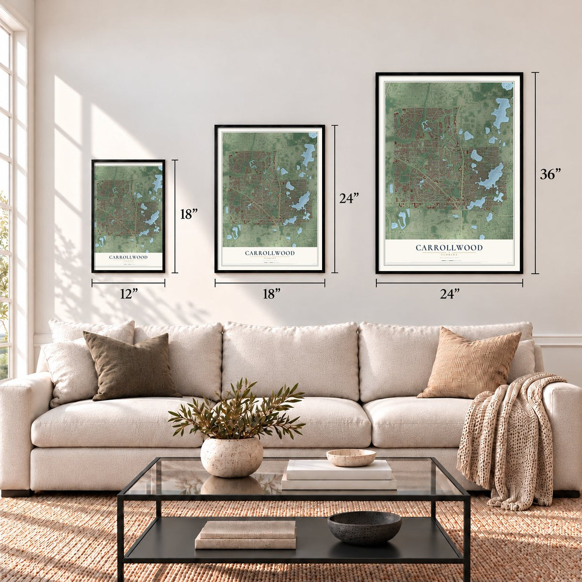
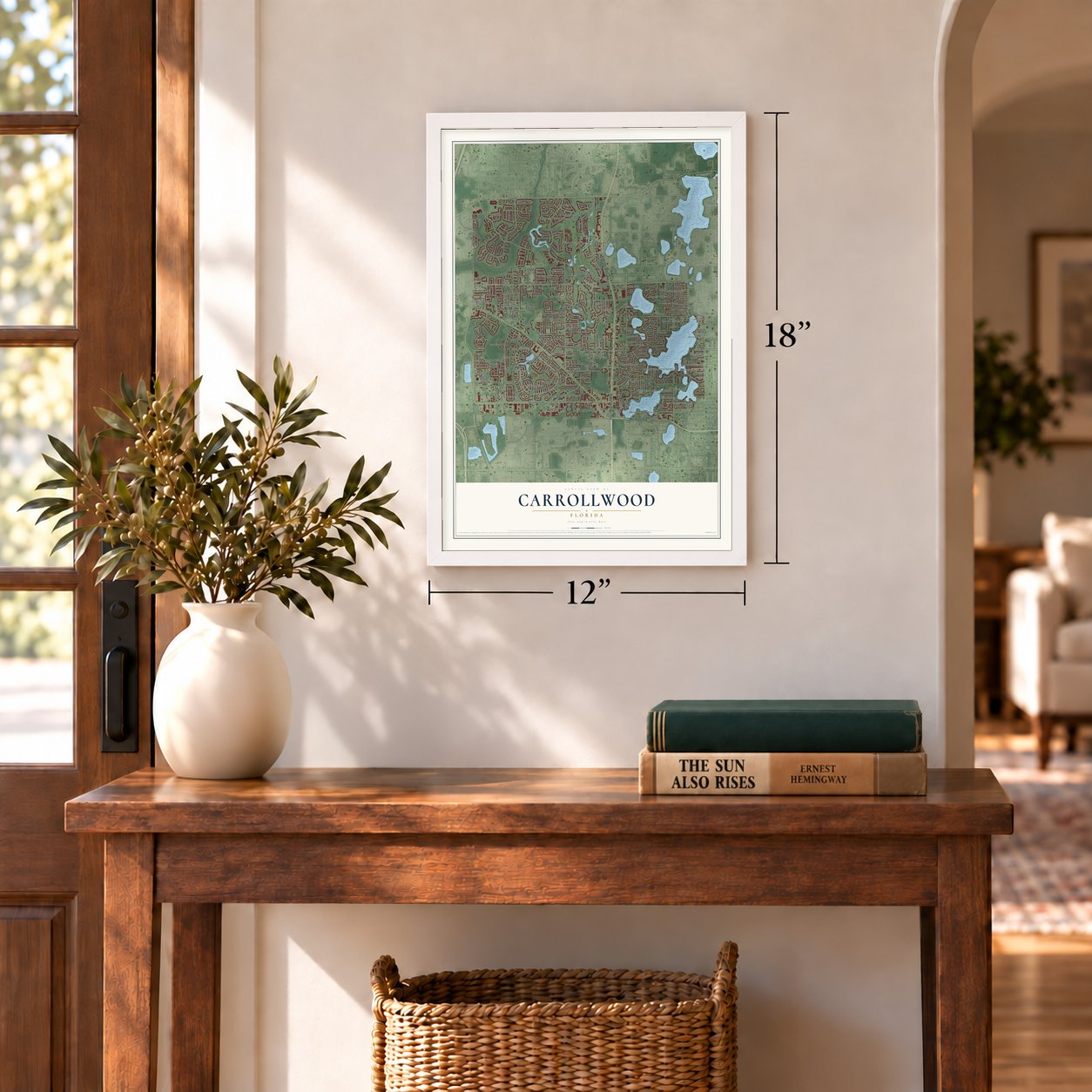
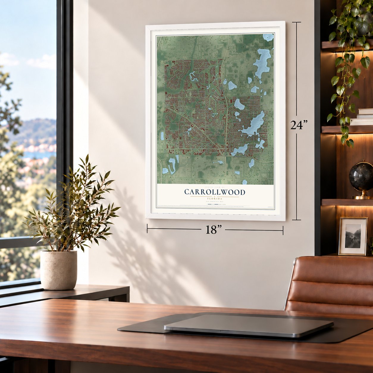
Carrollwood, Florida Map Art
Building by building, with labeled streets and shaded relief.
12" x 18" Archival Matte Print
A Map of Home. A Work of Art.
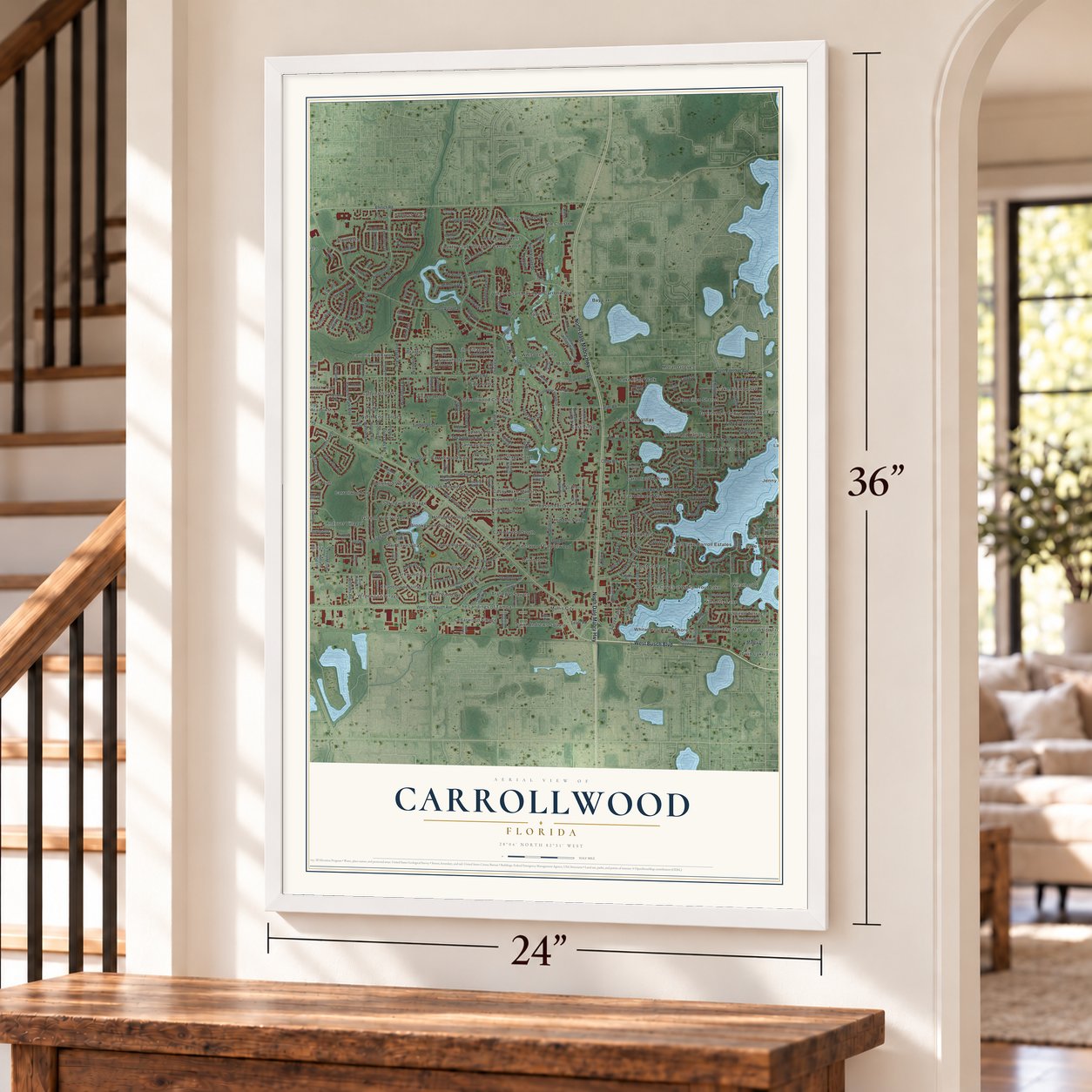
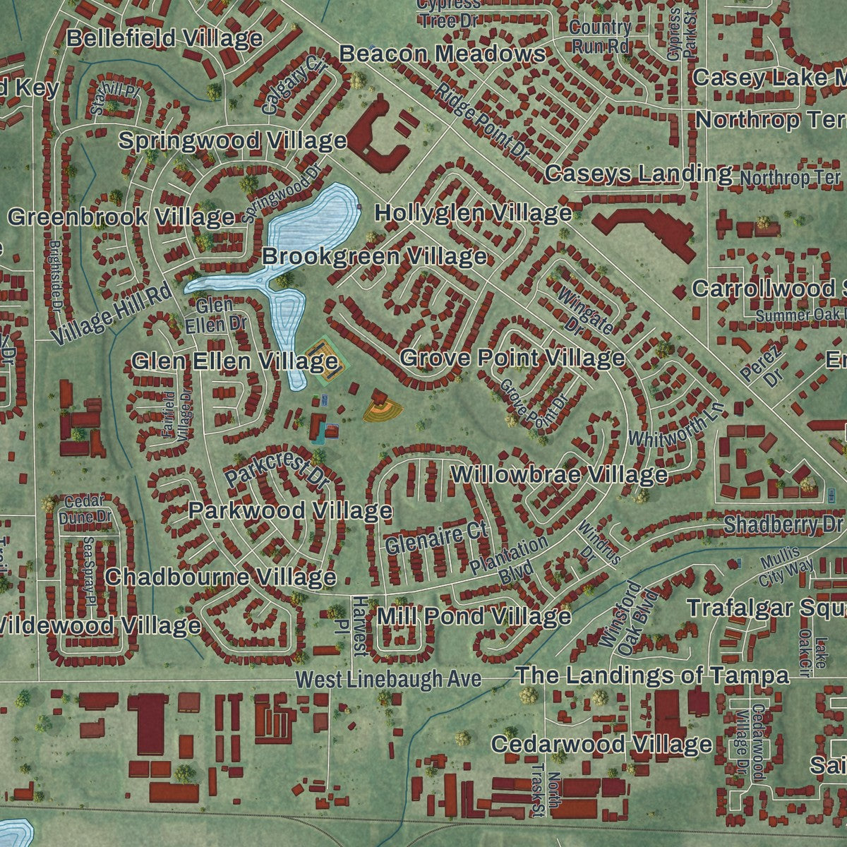
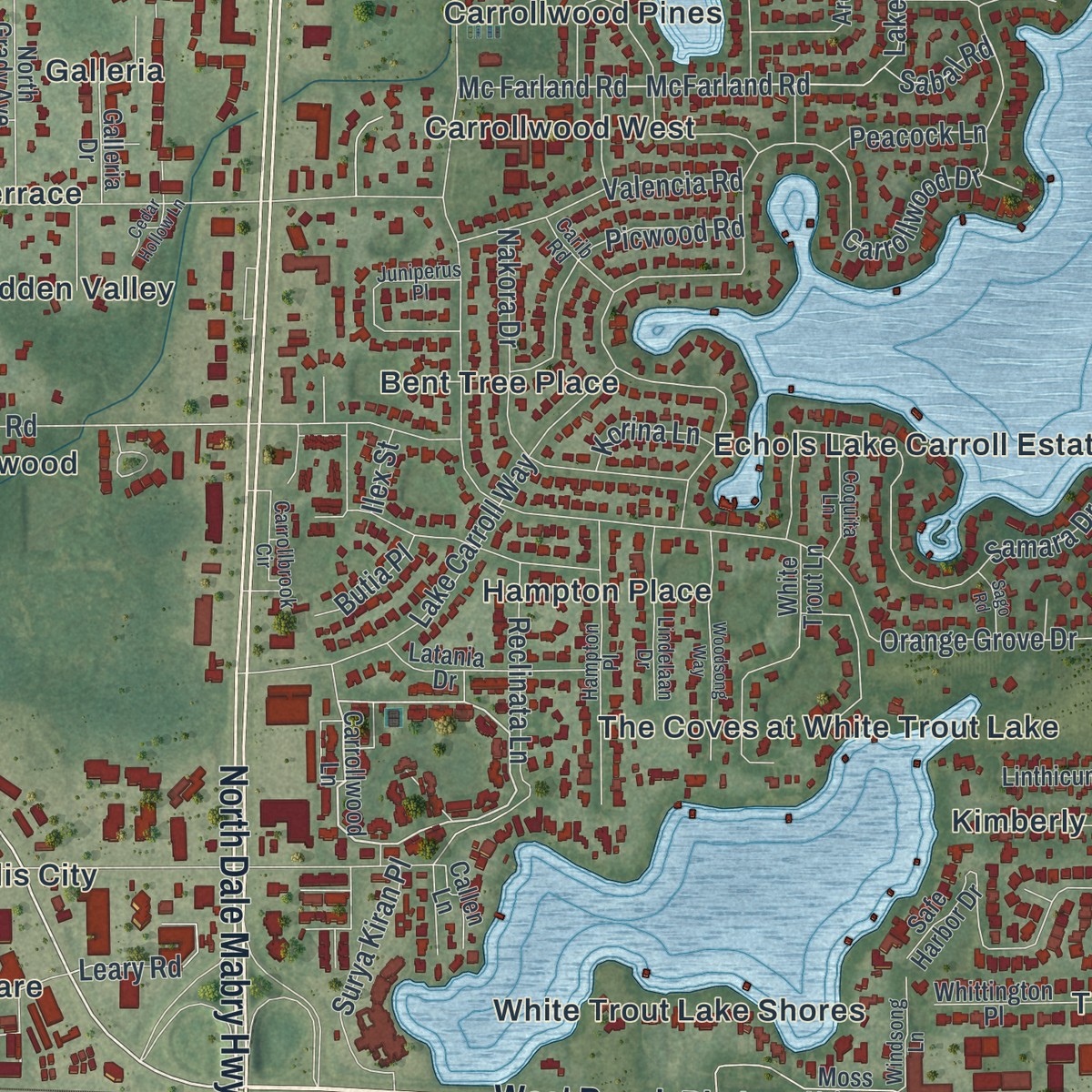
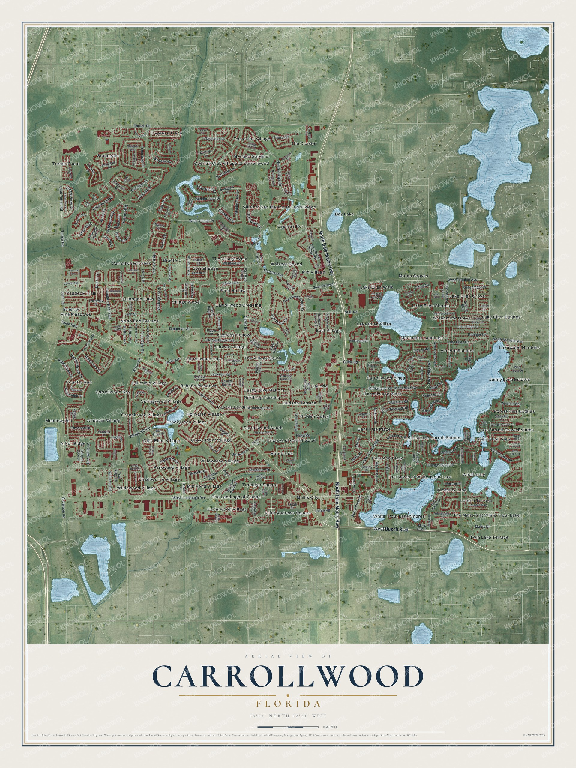
Explore Carrollwood, Florida from a whole new perspective. Created using aerial imagery and detailed geographic data, this map captures Carrollwood building by building, with labeled streets, familiar landmarks, and shaded topographical relief that highlights the natural contours of the landscape.
Combining modern data with the timeless character of a vintage atlas, this map is just as interesting up close as it is beautiful on the wall. Whether you grew up in Carrollwood, spent memorable years there, or call it home today, this unique map is a great way to celebrate a place that means something to you. Zoom in on the preview to look for your street, and then order a print to put your memories on the wall.
Three ways to hang it
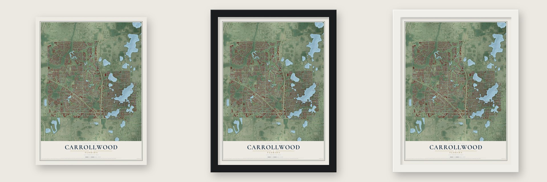
Unframed archival matte, a black wood frame or a white wood frame.
Up close
Geography Worth Displaying
This map was created using accurate cartographic data and authoritative geographic sources, including the U.S. Geological Survey and the Census Bureau. The map brings together terrain, waterways, roads, and building detail. The majority of the streets are labeled, houses are accurately depicted, and the topography is derived from government sources. Combining local data with carefully composed color and shading leads to this beautifully detailed Carrollwood artwork for your wall.
Rather than simply showing street outlines, we’ve included as many of the street names as we could reasonably fit on the map while keeping their names legible. Zoom in on the high resolution preview to see exactly what’s on the map. We truly set out to create a statement piece for anyone who loves Carrollwood. So whether it’s for you, or a gift for someone you love, we hope this map of Carrollwood brings back fond memories.
Read the story behind this map of Carrollwood, Florida from 2026.

Find your street
Names on the Carrollwood map
Every name below is printed on this map. Look for your street, your school, the park where you played, or the pond down the road.
Places and landmarks86
- Cypress Hollow
- Lakewood Gardens
- Arbor Ridge
- Top of the Village
- Twin Lake Terrace
- Saint Andrews Square
- Turner Trace
- Pine Meadows
- Lake Ellen Villas
- Lake Carroll View
- Bent Tree Place
- Hollyglen Village
Show all 86 places
- Cypress Run
- Carrollwood Creek
- The Village West
- Moran Groves
- Parkwood Village
- White Trout Lake Shores
- Cypress Trace
- Country Run
- Lynnette Estates
- Burnbrook
- Carrollwood Pines
- The Coves at White Trout Lake
- North End Terrace
- Casey Lake Manors
- Weatherby
- Wildewood Village
- Greenbrook Village
- Willowbrae Village
- Forest Hills Estates
- Carrollwood Cove
- Whisper Sound
- Stonegate
- Bay Lake
- Lake Ellen Walk
- Country Club Village at Carrollwood
- Lake Ellen Grove
- Galleria
- Bellefield Village
- Bradford
- Village Wood
- Andover Village
- East Village
- Greenmoor Grove
- Pine Hollow
- The Manors at White Trout Lake
- Jenny Lyne Estates
- Enclave of Carrollwood
- Caseys Landing
- Mullis City
- Carrollwood West
- Lorene Terrace
- Cedarwood Village
- Trafalgar Square
- Beacon Meadows
- Mid Village
- Paddock Trail
- Menendez Landings
- The Cloister
- Mill Pond Village
- Hampton Place
- The Village South
- Carrollwood Key
- Fairway Village
- Glen Ellen Village
- Stonehedge
- Carrollwood South
- Hidden Valley
- Brookgreen Village
- Meadowglen
- Chadbourne Village
- Hudson Terrace
- The Landings of Tampa
- Northrop Terrace
- Lake Ellen Estates
- Echols Lake Carroll Estates
- Grove Point Village
- Monaco Gardens
- Culbreath Oaks
- Lake Carroll Grove Estates
- Springwood Village
- Kimberly Lane
- Carrollwood Crossing
- Villas of San Marino at Carrollwood
- Lake Ellen Shores
Streets and roads254
- West Busch Boulevard
- North Dale Mabry Highway
- Gunn Highway
- North Armenia Avenue
- Four Oaks Road
- Orange Grove Drive
- West Linebaugh Avenue
- Ehrlich Road
- Lynn Turner Road
- Lynn Road
- Anderson Road
- Casey Road
- West Village Drive
- Carrollwood Drive
- Lowell Road
- West Fletcher Avenue
- Hudson Lane
- Nixon Road
- North Village Drive
- Turner Road
- Sussex Way
- Lake Ellen Drive
- Fennsbury Drive
- Pittsfield Avenue
- Samara Drive
- Foxshire Circle
- Lipsey Road
- Clarendon Drive
- Fletcher Avenue
- Timberlan Street
Show all 254 streets
- Stall Road
- Black Pine Drive
- Floyd Road
- Barrowe Drive
- Hidden Brook Drive
- Lake Carroll Way
- Clubhouse Circle
- Avista Drive
- Lake Ellen Lane
- Golf Crest Circle
- Wolcott Drive
- Mc Farland Road
- McFarland Road
- Tifton Drive
- Hampton Park Boulevard
- Jackson Road
- Nakora Drive
- Carroll Cove Place
- Golf Club Lane
- Taywood Drive
- Chestersall Drive
- Reclinata Lane
- Picwood Road
- Lake Ridge Road
- Shadberry Drive
- Dunhill Drive
- Village View Drive
- Priory Circle
- Witheridge Drive
- Old Saybrook Avenue
- Middle Lake Drive
- Valencia Road
- Parkcrest Drive
- Surya Kiran Place
- Krueger Lane
- Lake Bluff Court
- Barrett Drive
- Middle Park Drive
- Wallingford Drive
- Williams Road
- Pepperfield Drive
- Lynn Street
- Walbrooke Drive
- Southpark Drive
- Attley Place
- Leary Road
- Doc Willis Lane
- Greenmoor Place
- Village Hill Road
- Chattam Lane
- Snead Place
- Peacock Lane
- Lytton Way
- Korina Lane
- Glenaire Court
- Colby Road
- Butia Place
- Sabal Road
- Mabry Drive
- Pepper Place
- Ilex Street
- Carrollwood Lane
- South Village Drive
- Plantation Boulevard
- Carrollwood Village Drive
- Nicklaus Circle
- Carrollwood Village Run
- Burrington Drive
- Tughill Drive
- Safe Harbor Drive
- Marbrisa Drive
- North Paddock Avenue
- Cypress Tree Drive
- Lake Ellen Circle
- Ellenwood Lane
- Westford Circle
- Ridge Point Drive
- Friarsway Drive
- Darby Ridge Drive
- Water Oaks Lane
- Wingate Drive
- Waltham Avenue
- Village Chase Circle
- Holyoak Avenue
- Forest Lane Drive
- Country Run Road
- Glen Ellen Drive
- Vera Avenue
- Dartmoor Lane
- Country Oaks Drive
- White Trout Lane
- Diamond Head Drive
- Sebring Boulevard
- Stonegate Drive
- Winsford Oak Boulevard
- Trouville Drive
- Stillwater Terrace Drive
- Clubside Drive
- Fairway Circle
- Calgary Circle
- Moss Vale Lane
- Latania Drive
- Delwood Road
- Paloma Drive
- Ellesmere Drive
- Galleria Drive
- Carroll Grove Drive
- Heards Ferry Drive
- Halcyon Cove Lane
- Winthrop Way
- Whittington Place
- Halliford Drive
- Northpark Drive
- Chapel Way
- Areca Road
- North Gomez Avenue
- Pepperell Drive
- North Grady Avenue
- Cocos Road
- Whitworth Lane
- Rolling Oaks Lane
- Stratton Avenue
- Shadehill Court
- Carrollview Drive
- Hope Lane
- Peking Place
- Harvest Place
- Kemble Court
- Par Club Circle
- Linthicum Place
- Ashton Court
- Carroll Lake Drive
- Player Court
- Joyner Road
- Cinnamon Place
- Lanai Way
- Callen Lane
- Arabella Lane
- Trail Ridge Lane
- Tartan Place
- Twin Lake Lane
- Lancer Drive
- West Kyra Drive
- Perez Drive
- Leverington Street
- Grove Point Drive
- Cedar Dune Drive
- Clubhouse Drive
- Castle Hill Drive
- Village Glen Circle
- Cambridge Avenue
- Cedarwood Village Drive
- Worchester Avenue
- Northmeadow Circle
- Saint Charlotte Drive
- Cypress Park Street
- Cypress Circle
- Mullis City Way
- Springwood Drive
- Hopedale Drive
- Summer Oak Drive
- Lake Oak Circle
- Winding Willow Drive
- Anchoret Road
- Coverdale Drive
- Clendenning Drive
- Branch Hill Street
- Juniperus Place
- Phoenix Circle
- North Trask Street
- Carrollbrook Circle
- Lindelaan Drive
- Wellesley Drive
- Olen Smith Road
- Boot Lake Circle
- Trevino Place
- Windsong Lane
- Hollingfare Place
- Starhill Place
- Oakhurst Terrace
- Coquita Lane
- Waterfall Way
- Carib Road
- Whisper Bay Place
- Macbeth Court
- Hayward Place
- Cypress Terrace
- Windrus Drive
- Lacera Drive
- Sun Court
- Belmere Parkway
- Pinnacle Heights Circle
- Brightside Drive
- Holyoke Avenue
- Oakbrook Drive
- Pinelake Lane
- Woodsong Way
- Old Haven Way
- Fairfield Village Drive
- Cloverstone Drive
- Belmore Road
- Old Orchard Drive
- Village Terrace Drive
- Oak Shadow Place
- Carroll Landing Drive
- Graham Lane
- Wellesford Way
- Plumosa Road
- Farnham Way
- Kellingrew Place
- Indigo Point Place
- Sea Spray Place
- Palmer Drive
- Creekmore Lane
- Golf Crest Terrace
- Lake Stall Lane
- Cedar Hollow Lane
- Pub Place
- Stallgate Drive
- Sago Road
- Grenada Way
- Village Lake Place
- Chettle Way
- Khilani Court
Names are listed as they appear on the printed map. Zoom into the product photos to find them.
About Carrollwood, Florida
Carrollwood is an unincorporated community of 34,352 people in Hillsborough County, just west of Tampa. Matt Jetton planned it, and his company, Sun State Homes, began building it in 1959 beside Lake Carroll, a lake fed by springs. Sales were slow at first, because the new houses sat far out from the built-up parts of Tampa.
That changed in 1960, when the University of South Florida opened its doors and many of its professors and administrators bought homes here. The houses came with air conditioning and other comforts, and in 1961 the National Association of Home Builders picked Carrollwood as the Subdivision of the Year for the whole country. By 1970 builders had put up more than 900 homes around the lake.
- A school in 1963Carrollwood Elementary School was built in 1963, while Sun State Homes was still adding houses near Lake Carroll.
- Spreading westAfter the first streets filled in during the 1960s, Carrollwood kept growing westward through the 1970s and 1980s. The neighboring development of Carrollwood Village took shape to the west in the early 1970s.
- Carrollwood Country ClubAs Carrollwood Village was getting started, the Carrollwood Country Club went up in 1972. It is still a popular landmark in the community.
Keep exploring Florida
Carrollwood is one of 1,039 Florida towns we've mapped. Every dot on the map is a print of its own.
The search covers every state, Florida first.
Near Carrollwood
Order 2 or more town maps and save 10%. Shown in the size and finish you picked above, so they hang as a set.
- Lake Magdalene 12" x 18" / Archival Matte Print $39.99
- Egypt Lake-Leto 12" x 18" / Archival Matte Print $39.99
- Citrus Park 12" x 18" / Archival Matte Print $39.99


More maps nearby: Northdale, Town 'n' Country, University, Wellswood and South Seminole Heights.
The art of mapping a place
How This Map Was Made
Real places. Remarkable detail. Discover the layers that turn geographic data into a map of home.

The view from above
Aerial imagery reveals the character of the land: woodland, open fields, and the patterns of a place.

The shape of the land
Elevation data brings hills, valleys, and subtle changes in the landscape into view.

The details of home
Roads, waterways, and building footprints come together to make the map feel unmistakably local.

Geography becomes art
Considered color, shading, and typography bring the layers together in a map made for your wall.


Process illustrated with Mendon, Massachusetts. Aerial imagery: USDA NAIP. Terrain: USGS 3D Elevation Program. Map details and finished artwork: KNOWOL.
The Details
About This Print
Choose an archival matte print, or a black or white Ayous wood frame. The archival matte print is unframed.
Select your size and finish above to see the matching product image and price.
Materials & Craftsmanship
A contemporary map with the character of a classic atlas, printed on archival matte paper. Optional frames are made from Ayous wood.
Your printed map does not include the watermark shown in the full-map preview.
Shipping & Delivery
Free shipping within the United States. Every print is made to order in the USA.
Buying a gift? Add a note in your cart and we'll include it. We never put prices in the package.
Prints ship within 2 to 3 business days. Allow 7 to 10 days total from ordering for delivery. Timing may vary during holidays or periods of high order volume.
Read our shipping policy.
Returns and damaged prints
Each print is made to order. Change-of-mind refunds are not available after production.
If your print arrives damaged, misprinted or incorrect, contact support@knowol.com within 30 days of receiving it. Include your order number, photos and a description of the issue.
Read our full refund and replacement policy. For questions about your order, email support@knowol.com.