
Search for another town




Free U.S. delivery 7 to 10 days after you order
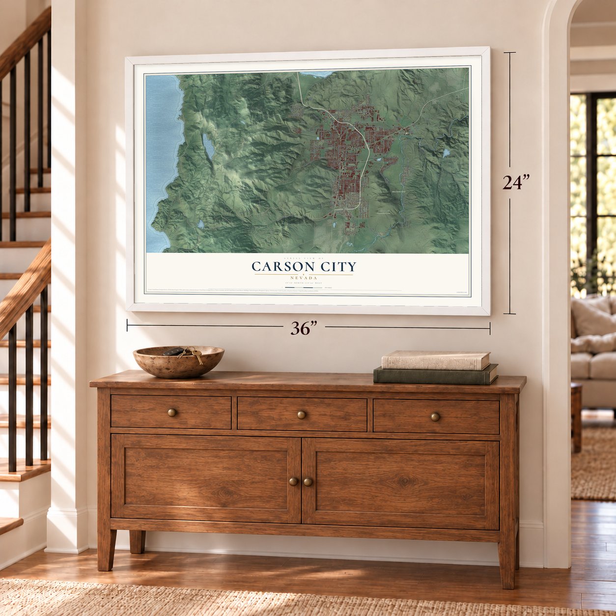
Carson City, Nevada Map Art
Building by building, with labeled streets and shaded relief.
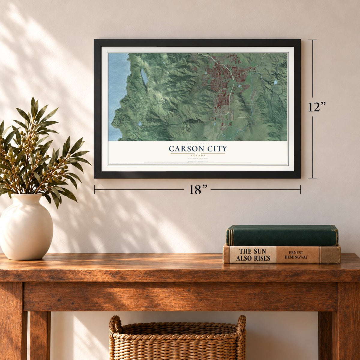
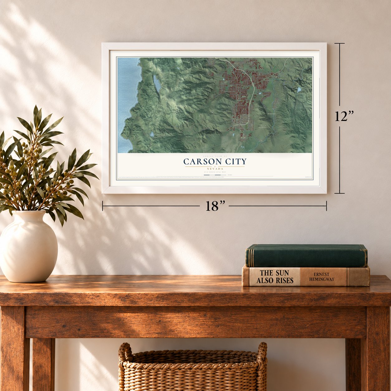
12" x 18" Archival Matte Print
A Map of Home. A Work of Art.
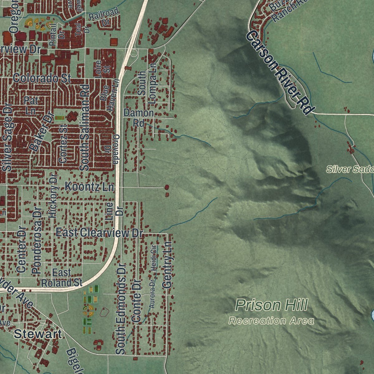
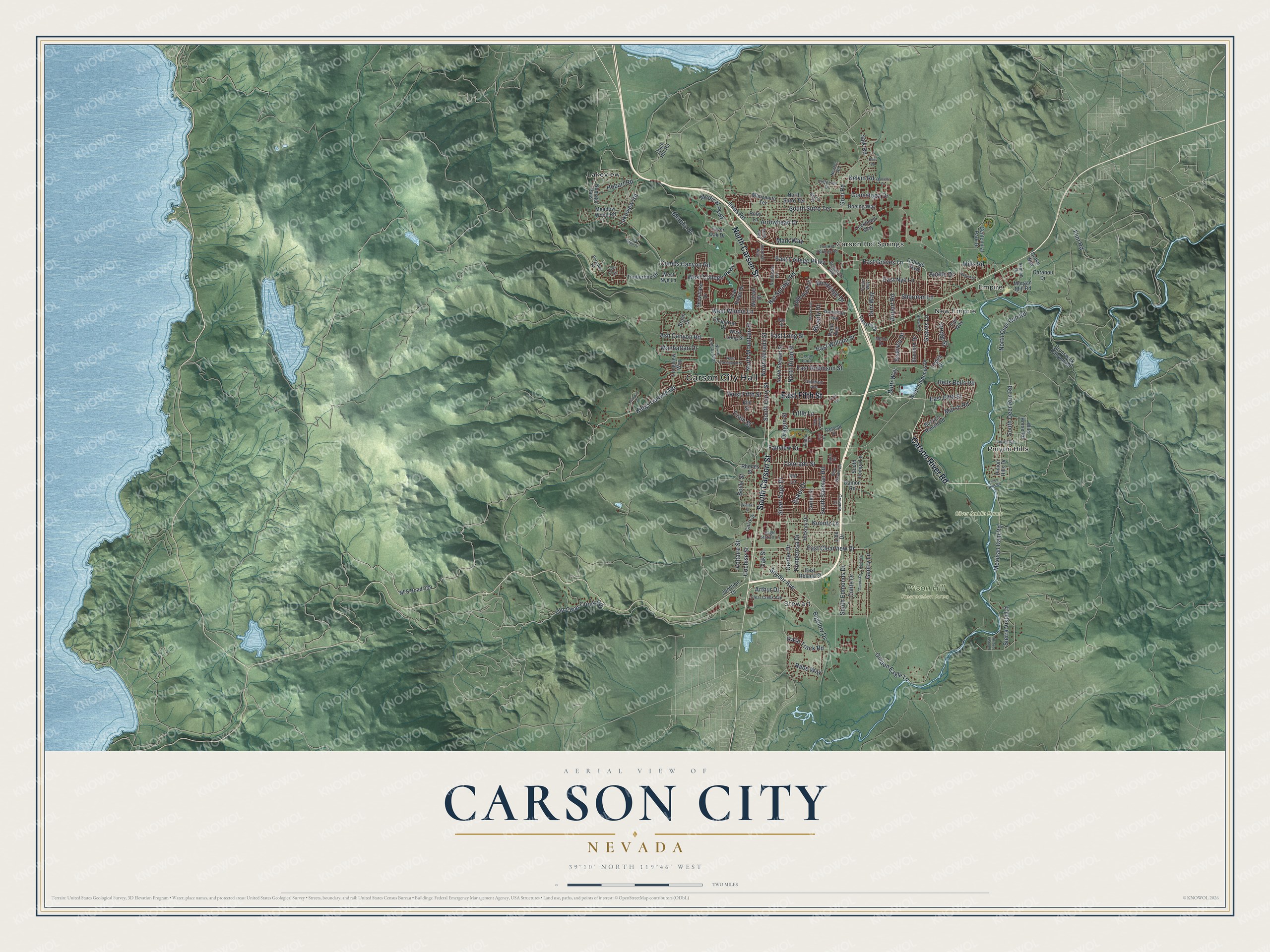
Explore Carson City, Nevada from a whole new perspective. Created using aerial imagery and detailed geographic data, this map captures Carson City building by building, with labeled streets, familiar landmarks, and shaded topographical relief that highlights the natural contours of the landscape.
Combining modern data with the timeless character of a vintage atlas, this map is just as interesting up close as it is beautiful on the wall. Whether you grew up in Carson City, spent memorable years there, or call it home today, this unique map is a great way to celebrate a place that means something to you. Zoom in on the preview to look for your street, and then order a print to put your memories on the wall.
Three ways to hang it
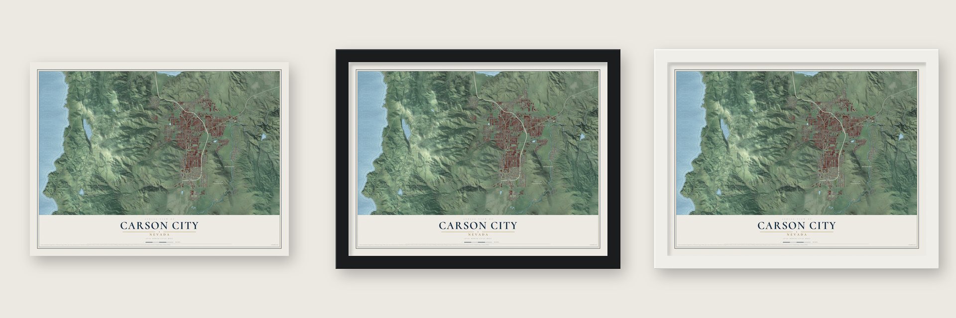
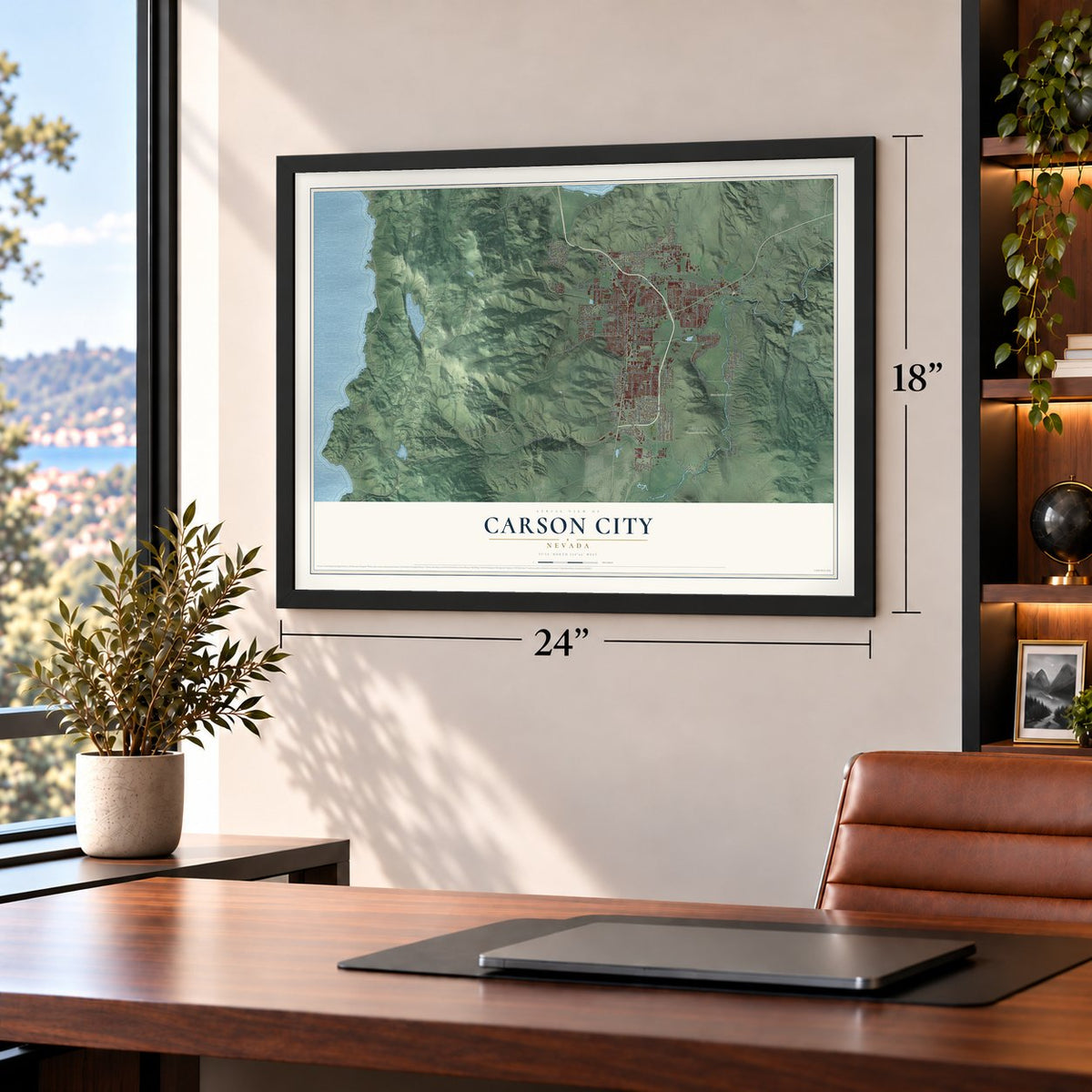
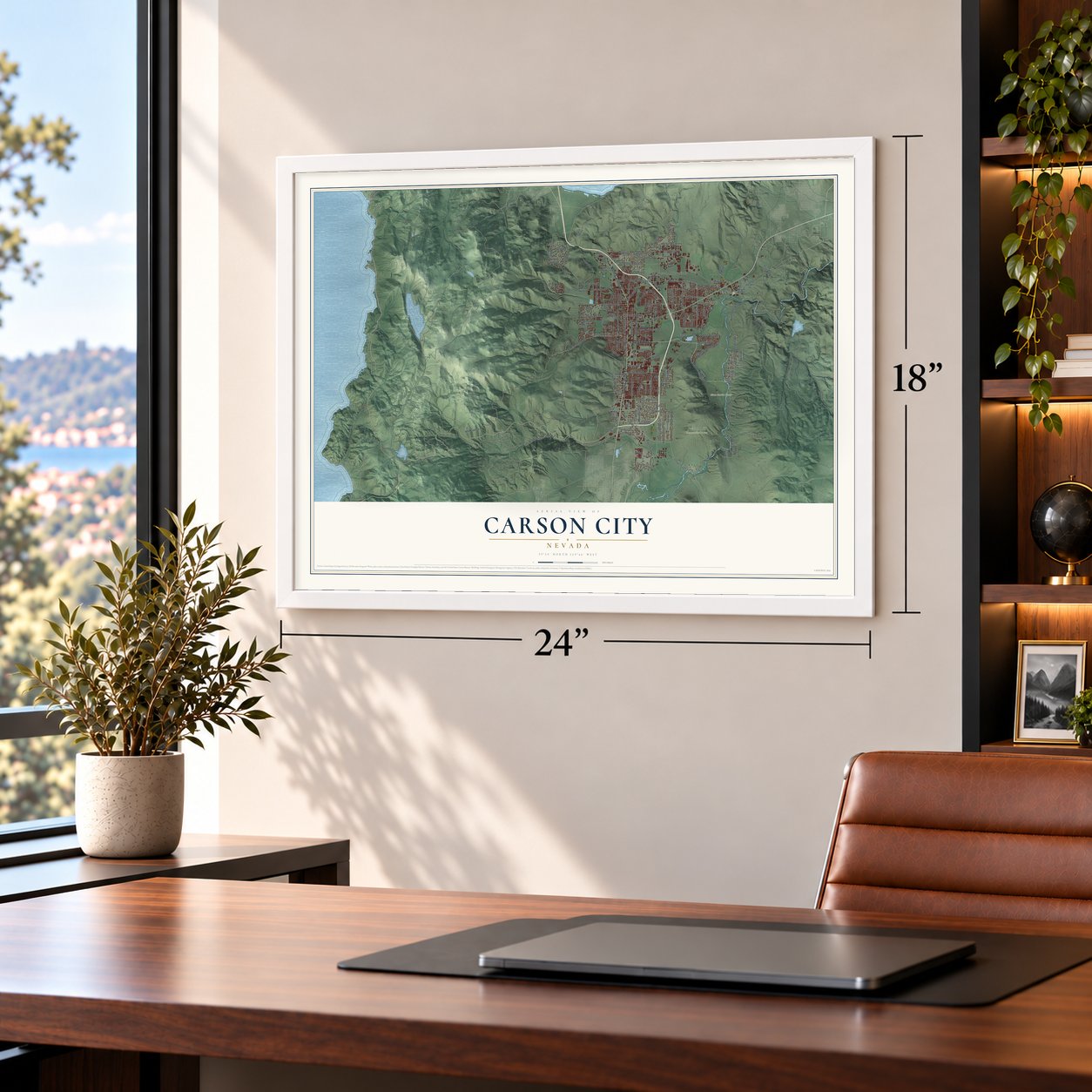
Unframed archival matte, a black wood frame or a white wood frame.
Up close
Geography Worth Displaying
This map was created using accurate cartographic data and authoritative geographic sources, including the U.S. Geological Survey and the Census Bureau. The map brings together terrain, waterways, roads, and building detail. The majority of the streets are labeled, houses are accurately depicted, and the topography is derived from government sources. Combining local data with carefully composed color and shading leads to this beautifully detailed Carson City artwork for your wall.
Rather than simply showing street outlines, we’ve included as many of the street names as we could reasonably fit on the map while keeping their names legible. Zoom in on the high resolution preview to see exactly what’s on the map. We truly set out to create a statement piece for anyone who loves Carson City. So whether it’s for you, or a gift for someone you love, we hope this map of Carson City brings back fond memories.
Read the story behind this map of Carson City, Nevada from 2026.

Find your street
Names on the Carson City map
Every name below is printed on this map. Look for your street, your school, the park where you played, or the pond down the road.
Places and landmarks9
- Carson City Hall
- Prison Hill Recreation Area
- Silver Saddle Ranch
- Carson Hot Springs
- Empire
- Lakeview
- New Empire
- Pinyon Hills
- Stewart
Streets and roads167
- South Carson Street
- North Carson Street
- East Fifth Street
- Carson River Road
- Kings Canyon Road
- South Curry Street
- Snyder Avenue
- East Clearview Drive
- Gentry Lane
- East College Parkway
- East William Street
- East Graves Lane
- Graves Lane
- Golden Eagle Lane
- Ash Canyon Road
- Cochise Street
- West Winnie Lane
- Combs Canyon Road
- Arrowhead Drive
- Goni Road
- South Edmonds Drive
- Old Clear Creek Road
- Mexican Dam Road
- Bigelow Drive
- Fairview Drive
- North Deer Run Road
- South Saliman Road
- North Roop Street
- East Nye Lane
- Silver Sage Drive
Show all 167 streets
- Koontz Lane
- Airport Road
- Conte Drive
- Conestoga Drive
- North Mountain Street
- Center Drive
- South Deer Run Road
- Sierra Vista Lane
- West College Parkway
- Hot Springs Road
- Medical Parkway
- Murphy Drive
- East Long Street
- Sherman Lane
- Colorado Street
- Lakeview Road
- Ponderosa Drive
- East Robinson Street
- North Nevada Street
- South Sutro Terrace
- Imus Road
- Baker Drive
- Hells Bells Road
- Butti Way
- Gregg Street
- Hobart Road
- Oregon Street
- Flint Road
- Beverly Drive
- Marsh Road
- Salk Road
- Little Lane
- Dori Way
- Race Track Road
- West Fifth Street
- Mills Road
- Crain Street
- Manhattan Drive
- Oak Street
- Windridge Drive
- Rabe Way
- Kelvin Road
- Apollo Drive
- Mark Way
- Arthur Drive
- Voltaire Street
- Siskiyou Drive
- Boyle Street
- Curry Street
- NFS Road 039
- Numaga Pass
- North Edmonds Drive
- North Sutro Terrace
- Brunswick Canyon Road
- Timberline Drive
- Morgan Mill Road
- Hickory Drive
- Pinion Hills Drive
- Silver Oak Drive
- Meadow Wood Road
- Centennial Park Drive
- College Parkway
- North Stewart Street
- East Roland Street
- Buzzy's Ranch Road
- Ruby Lane
- Oak Ridge Drive
- Longview Way
- Junction Drive
- West Nye Lane
- West Long Street
- Damon Road
- Lassen Drive
- Table Rock Drive
- Drako Way
- Hamilton Avenue
- Boeing Way
- South Lompa Lane
- Lockheed Way
- Manzanita Terrace
- Snowflake Drive
- Wild Horse Road
- Stanford Drive
- Chaparral Drive
- Pat Lane
- Rand Avenue
- Rhodes Street
- Lepire Drive
- Michael Drive
- Brush Drive
- Cortez Street
- Carabou Drive
- Elm Street
- Duck Hill Road
- Line Drive
- Fair Way
- North Ormsby Boulevard
- Pintail Drive
- Northgate Lane
- Old Hot Springs Road
- Clear Creek Avenue
- Imperial Way
- Asphalt Drive
- Jefferson Drive
- Poole Way
- Laurel Road
- Research Way
- Paradise Vw
- Brown Street
- Bryce Drive
- Eagle Station Lane
- Goldfield Avenue
- Oxoby Loop
- Railroad Drive
- Orovada Drive
- Blue Haven Lane
- Newton Road
- Mina Way
- Menlo Drive
- Loire Street
- Dan Street
- Via Grant Drive
- Pinion Hills Road
- West Washington Street
- Marian Avenue
- Heidi Circle
- Canyon Drive
- August Drive
- Danielle Drive
- Aurora Drive
- Lotus Circle
- Wialaki Street
- Jewell Avenue
- Arroyo Vista Lane
- Duke Road
- Teal Drive
- Bohr Road
Names are listed as they appear on the printed map. Zoom into the product photos to find them.
About Carson City, Nevada
Carson City is the capital of Nevada, an independent city of 58,639 people in Eagle Valley at the eastern foot of the Carson Range. The Washoe people have lived in this valley for about 6,000 years. John C. Frémont's exploring party reached it in January 1843, and Frémont named its river for Kit Carson, the scout he had hired. By 1851 a ranch called Eagle Station was trading with wagon trains on the Carson Branch of the California Trail. It took its name from a bald eagle that a settler shot and pinned to a wall inside the post.
In 1858 Abraham Curry bought Eagle Station, renamed it Carson City and had the valley surveyed. He was sure the town would one day be a capital, so he set aside a 10-acre plot at its center for a capitol. The Comstock Lode strike of 1859 brought a flood of newcomers, and Territorial Governor James W. Nye picked Carson City over Genoa as his capital. When Nevada became the 36th state in 1864, Carson City kept the title, and its Capitol went up from 1869 to 1871.
- Coins from Comstock silverCongress created a branch mint here in 1863, but the Civil War and slow funding held off construction until 1867. A. B. Mullett of the Treasury Department drew the plans, workers finished the U.S. Mint in 1869, and it struck its first coin in 1870. Some of the Comstock's gold and silver was sold to it, and it turned out 56,636,119 coins before its final coinage in 1893. The building now holds the Nevada State Museum.
- A hotel turned prisonCurry built the Warm Springs Hotel a mile east of town and lent it to the territorial Legislature as a place to meet. The Legislature then chose the hotel as the territorial prison and made Curry its first warden. The land is still part of the state prison.
- Hub of the Virginia and TruckeeAfter statehood, Carson City grew into a trading center tied less to the mines. The Virginia and Truckee Railroad linked it to Virginia City, and a log flume carried timber down from the Sierra Nevada. The tracks came out in 1950, but the Virginia and Truckee Railroad Depot still stands, and the Nevada State Railroad Museum keeps the Inyo locomotive.
- America's smallest capitalA Central Pacific branch line bypassed both the Virginia and Truckee and Carson City, and traffic fell away. Mining booms at Tonopah and Goldfield helped only a little, and by 1930 the town was down to just over 1,500 people. It began calling itself America's smallest capital. Growth returned after World War II, and by 1960 the city was back to the size it had been in 1880.
- City and county joined in 1969Talk of merging Ormsby County with Carson City began in the late 1940s. A statewide vote approved it in 1966, and on April 1, 1969, the two became one Consolidated Municipality. The city took in old town sites such as Empire City, a milling center on the Carson River, and with 146 square miles it could call itself one of the largest state capitals.
Keep exploring Nevada
Carson City is one of 152 Nevada towns we've mapped. Every dot on the map is a print of its own.
The search covers every state, Nevada first.
Near Carson City
Order 2 or more town maps and save 10%. Shown in the size and finish you picked above, so they hang as a set.
- Indian Hills 12" x 18" / Archival Matte Print $39.99
- Johnson Lane 12" x 18" / Archival Matte Print $39.99
- Silver City 12" x 18" / Archival Matte Print $39.99
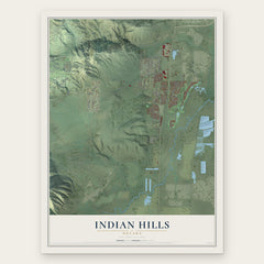


More maps nearby: Washoe Valley, Genoa, Glenbrook, Logan Creek and Virginia City.
The art of mapping a place
How This Map Was Made
Real places. Remarkable detail. Discover the layers that turn geographic data into a map of home.

The view from above
Aerial imagery reveals the character of the land: woodland, open fields, and the patterns of a place.

The shape of the land
Elevation data brings hills, valleys, and subtle changes in the landscape into view.

The details of home
Roads, waterways, and building footprints come together to make the map feel unmistakably local.

Geography becomes art
Considered color, shading, and typography bring the layers together in a map made for your wall.


Process illustrated with Mendon, Massachusetts. Aerial imagery: USDA NAIP. Terrain: USGS 3D Elevation Program. Map details and finished artwork: KNOWOL.
The Details
About This Print
Choose an archival matte print, or a black or white Ayous wood frame. The archival matte print is unframed.
Select your size and finish above to see the matching product image and price.
Materials & Craftsmanship
A contemporary map with the character of a classic atlas, printed on archival matte paper. Optional frames are made from Ayous wood.
Your printed map does not include the watermark shown in the full-map preview.
Shipping & Delivery
Free shipping within the United States. Every print is made to order in the USA.
Buying a gift? Add a note in your cart and we'll include it. We never put prices in the package.
Prints ship within 2 to 3 business days. Allow 7 to 10 days total from ordering for delivery. Timing may vary during holidays or periods of high order volume.
Read our shipping policy.
Returns and damaged prints
Each print is made to order. Change-of-mind refunds are not available after production.
If your print arrives damaged, misprinted or incorrect, contact support@knowol.com within 30 days of receiving it. Include your order number, photos and a description of the issue.
Read our full refund and replacement policy. For questions about your order, email support@knowol.com.