
Search for another town





Free U.S. delivery 7 to 10 days after you order
Carteret, New Jersey Map Art
Building by building, with labeled streets and shaded relief.
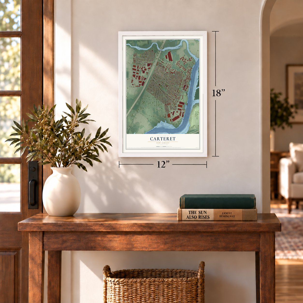
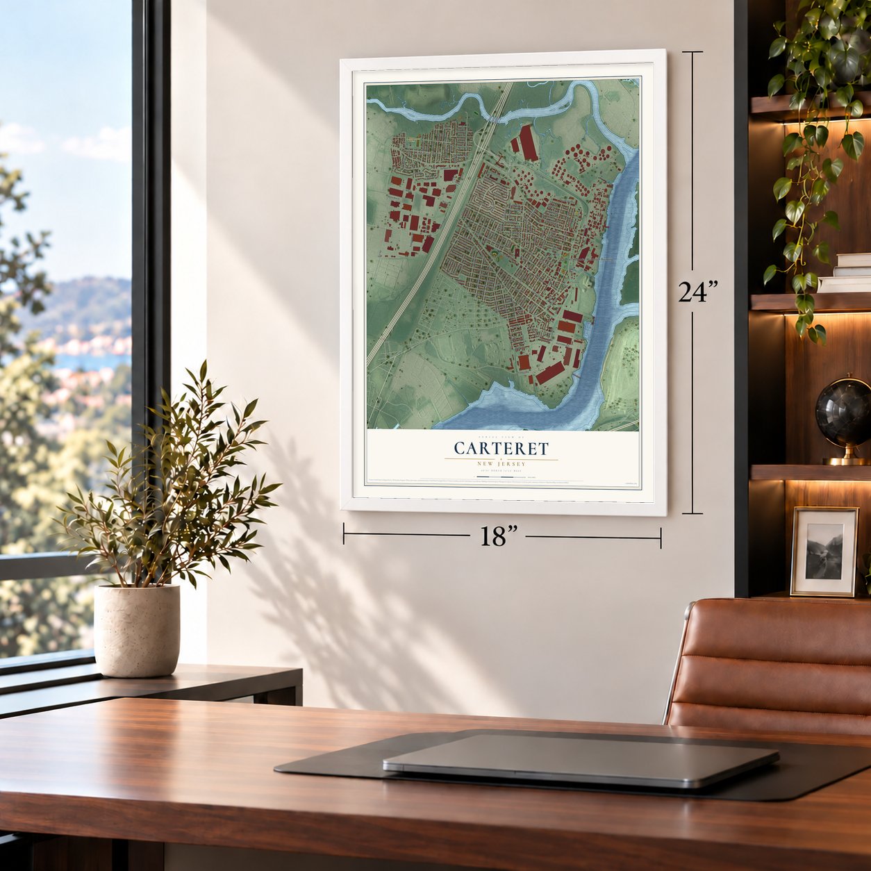
12" x 18" Archival Matte Print
A Map of Home. A Work of Art.
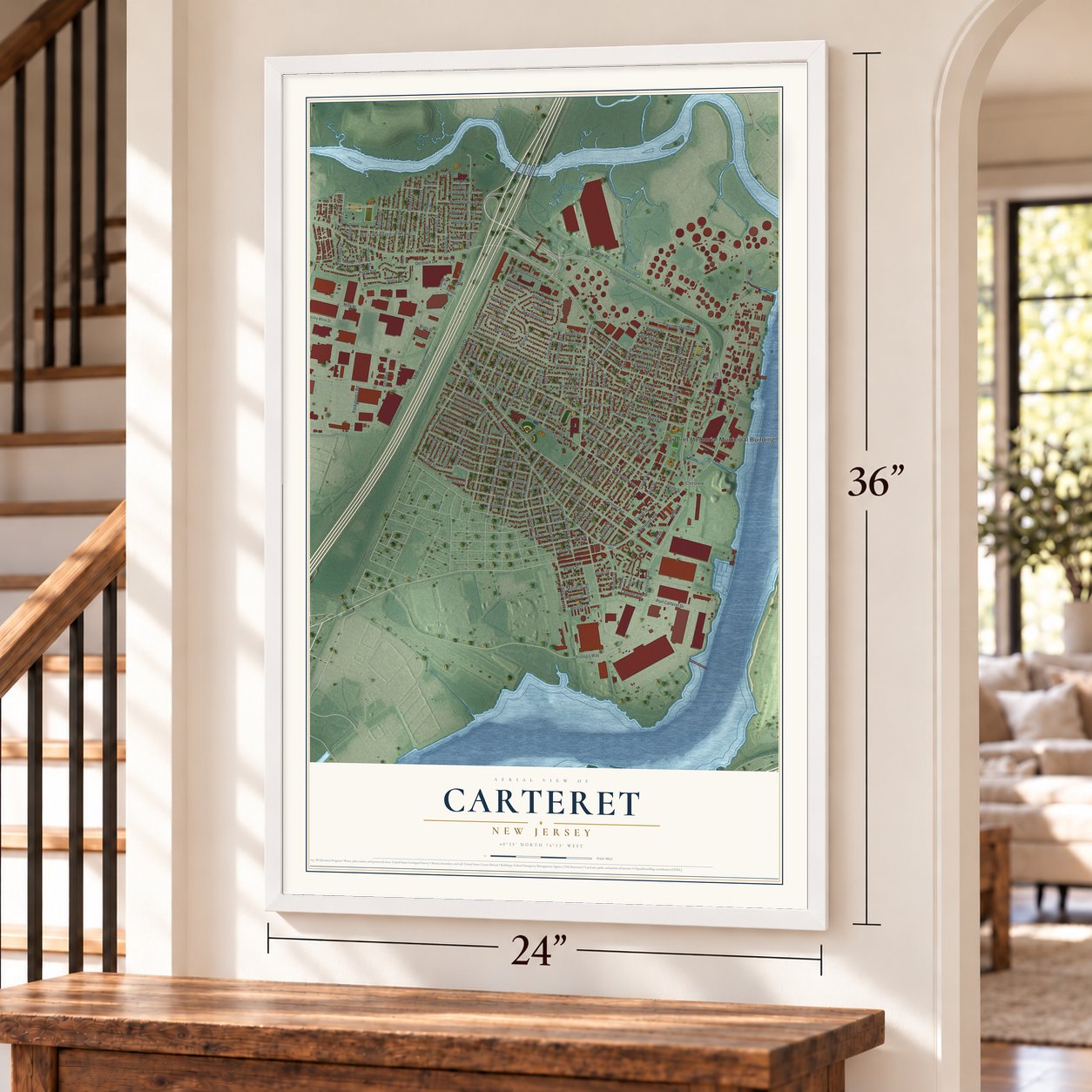
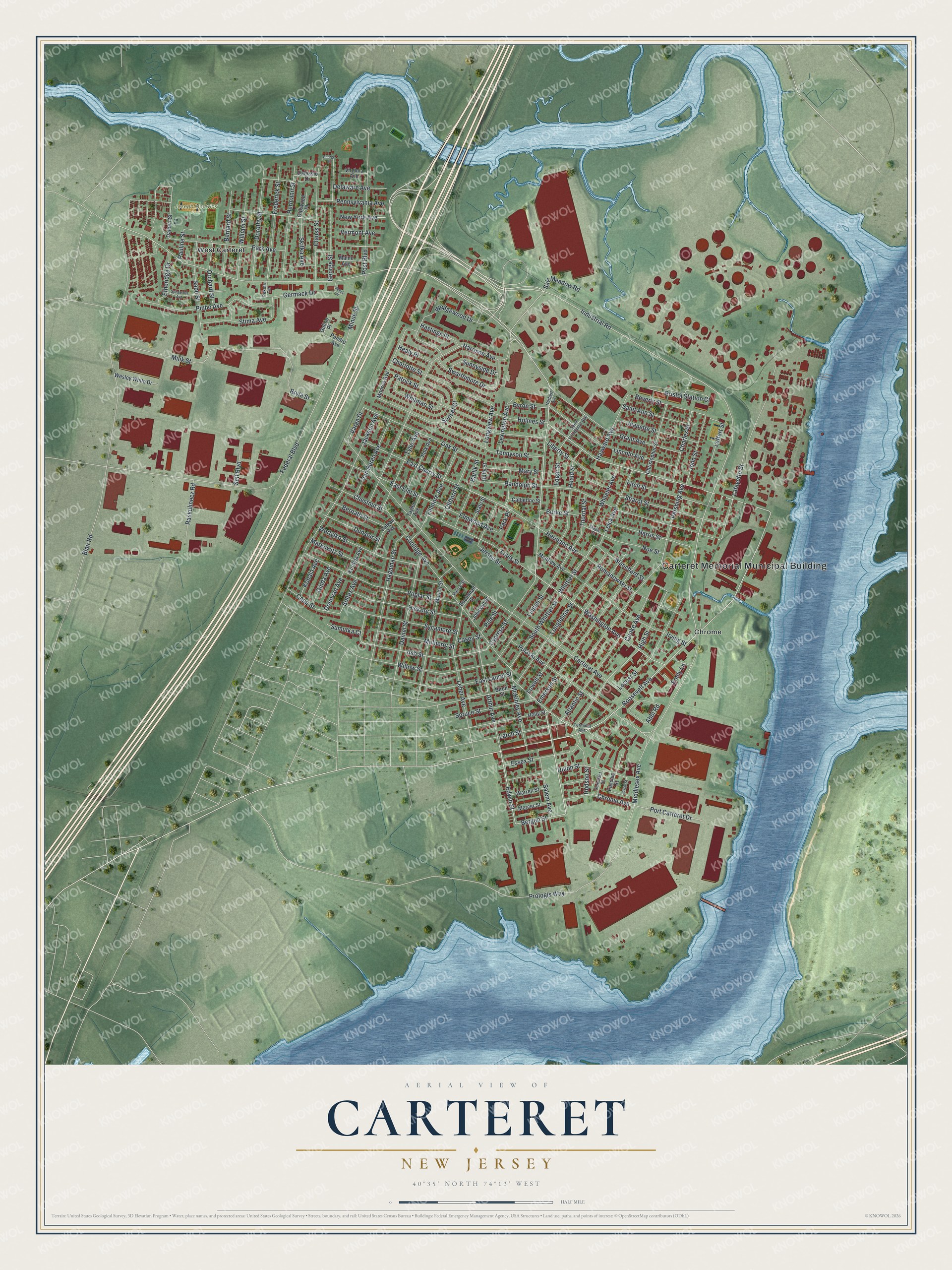
Explore Carteret, New Jersey from a whole new perspective. Created using aerial imagery and detailed geographic data, this map captures Carteret building by building, with labeled streets, familiar landmarks, and shaded topographical relief that highlights the natural contours of the landscape.
Combining modern data with the timeless character of a vintage atlas, this map is just as interesting up close as it is beautiful on the wall. Whether you grew up in Carteret, spent memorable years there, or call it home today, this unique map is a great way to celebrate a place that means something to you. Zoom in on the preview to look for your street, and then order a print to put your memories on the wall.
Three ways to hang it
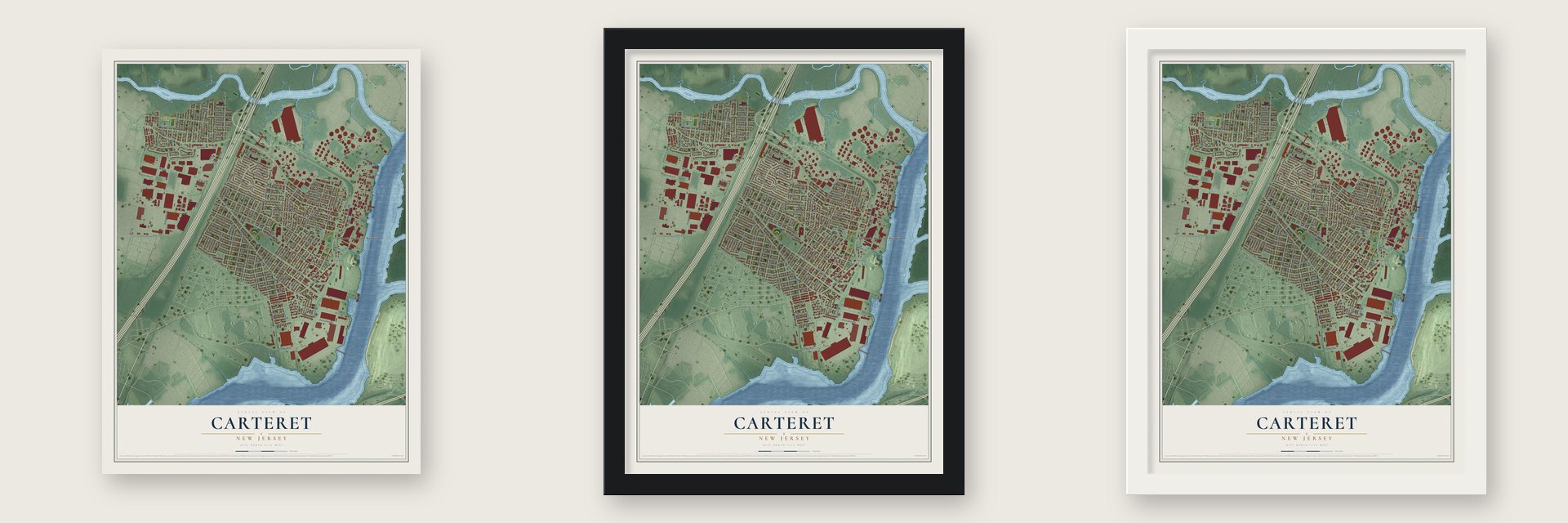
Unframed archival matte, a black wood frame or a white wood frame.
Up close
Geography Worth Displaying
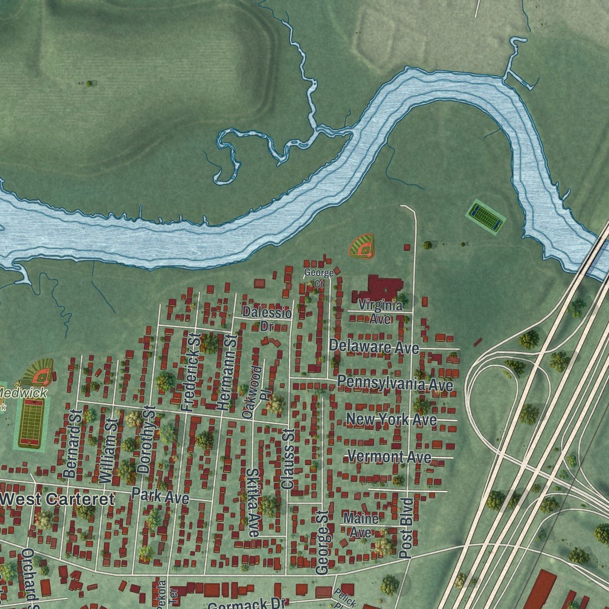
This map was created using accurate cartographic data and authoritative geographic sources, including the U.S. Geological Survey (USGS) and FEMA. The map brings together terrain, waterways, roads, and building detail. The majority of the streets are labeled, houses are accurately depicted, and the topography is derived from government sources. Combining local data with carefully composed color and shading leads to this beautifully detailed Carteret artwork for your wall.
Rather than simply showing street outlines, we’ve included as many of the street names as we could reasonably fit on the map while keeping their names legible. Zoom in on the high resolution preview to see exactly what’s on the map. We truly set out to create a statement piece for anyone who loves Carteret. So whether it’s for you, or a gift for someone you love, we hope this map of Carteret brings back fond memories.
Explore the full map of Carteret, New Jersey and read about the local places it shows.

Find your street
Names on the Carteret map
Every name below is printed on this map. Look for your street, your school, the park where you played, or the pond down the road.
Places and landmarks4
- Carteret Memorial Municipal Building
- Joseph Medwick Park
- Chrome
- West Carteret
Streets and roads180
- Roosevelt Avenue
- Edwin Street
- Bergen Street
- Pershing Avenue
- Harrison Avenue
- Industrial Road
- McKinley Avenue
- High Street
- Ash Street
- Emily Lane
- Blanchard Street
- Bryla Street
- Middlesex Avenue
- Cypress Street
- Whittier Street
- Prologis Way
- Federal Boulevard
- Oak Street
- Beverly Street
- Chrome Avenue
- Carteret Avenue
- Blair Road
- Washington Avenue
- Randolph Street
- Milik Street
- Coolidge Avenue
- Jackson Avenue
- Lafayette Street
- Tennyson Street
- Whitman Street
Show all 180 streets
- Emerson Street
- Lowell Street
- Poplar Street
- Longfellow Street
- Linden Street
- Post Boulevard
- Grant Avenue
- Bristol Station Court
- Lincoln Avenue
- Markowitz Street
- Minue Street
- Irving Street
- Sharot Street
- Hermann Avenue
- Park Avenue
- Pinho Avenue
- East Cherry Street
- Hagaman Street
- Wedgewood Drive
- Willow Street
- Pulaski Avenue
- Louis Street
- Daniel Street
- Heald Street
- Leber Avenue
- Sycamore Street
- Frederick Street
- Hermann Street
- George Street
- Hickory Street
- Charlotte Street
- Clauss Street
- Romanowski Street
- Arthur Avenue
- Locust Street
- Dorothy Street
- Union Street
- Fitch Street
- East Laurel Street
- Wortylko Street
- Jersey Street
- Patrick Street
- Atlantic Street
- Fillmore Avenue
- Essex Street
- Sabo Street
- East Elm Street
- Swarthmore Drive
- Stima Avenue
- New York Avenue
- South Whittier Street
- William Street
- Jeanette Street
- Edgar Street
- Van Buren Avenue
- Leick Avenue
- Tyler Avenue
- Bernard Street
- Harris Street
- Spruce Street
- Larch Street
- Germack Drive
- Mulberry Street
- Abbi Road
- Vermont Avenue
- Salem Avenue
- Charles Street
- Barlik Street
- Hayward Avenue
- Clifford Street
- John Street
- Leffert Street
- Port Carteret Drive
- Wheeler Avenue
- Saint Ann Street
- Orchard Street
- Pennsylvania Avenue
- Bernath Street
- Noe Street
- Cooke Avenue
- Dunster Street
- Skitka Avenue
- Liberty Street
- Capp Street
- Mary Street
- Raskulinecz Road
- Holmes Street
- Etheridge Drive
- Chestnut Street
- Lexington Avenue
- Elmwood Avenue
- Sunnyside Drive
- Delaware Avenue
- Hudson Street
- Salt Meadow Road
- Hastings Place
- Ginda Avenue
- Burke Street
- Donovan Avenue
- Longview Avenue
- Byron Street
- Kobala Avenue
- Pauline Street
- Varga Drive
- Soltes Avenue
- Thornal Street
- Healy Place
- Sumutka Court
- Self Boulevard
- Pine Street
- Sunset Court
- Casey Street
- Park Place
- Dalbert Street
- Marion Street
- Monroe Avenue
- Taylor Avenue
- Birch Street
- Holly Street
- Polk Avenue
- Christopher Street
- Warren Street
- Mercer Street
- Maine Avenue
- Wesley White Drive
- Passaic Street
- Matthew Avenue
- State Street
- Colgan Avenue
- Catherine Street
- Johnson Street
- Kurdyla Avenue
- Virginia Avenue
- Oakwood Place
- Buchanan Street
- Dalessio Drive
- Pendro Avenue
- Duffy Street
- Gulino Place
- Terminal Avenue
- Pekola Terrace
- Saint Volodymyr Avenue
- Somerset Street
- Maple Street
- Pierce Street
- Herbert Avenue
- Spoganetz Avenue
- Pelick Place
- Jessie Street
- George Court
Names are listed as they appear on the printed map. Zoom into the product photos to find them.
About Carteret, New Jersey
Carteret is a borough of 25,326 people in Middlesex County. It sits on the Arthur Kill, facing Staten Island. It was split off from Woodbridge Township on April 11, 1906, and first went by the name Roosevelt. Two places left the township together that year: the old village of Carteret and Chrome, a neighborhood named for its steel plants, among them the Chrome Steel company. Chrome's main street grew into a busy shopping district.
The borough tried the name Carteret from December 19, 1921, to January 16, 1922, then took it for good on November 7, 1922. The new name honors Sir George Carteret, among the first proprietors of New Jersey, and his son Philip, the province's first royal governor. Their family was named for the village of Carteret in Normandy, and it also held the island of Jersey, which gave the state its name.
- Triple Crown in 1937Joe "Ducky" Medwick, son of Hungarian immigrants, grew up in Carteret, playing four sports at its high school. Knute Rockne lined him up for Notre Dame football, but he picked baseball. His 1937 season, a .374 average with 31 homers and 154 RBIs, won the National League Triple Crown and MVP award; no National Leaguer has won it since. The Hall of Fame elected him in 1968, 20 years after his final game, and the riverside park bears his name.
- The Smithereens, class of 1975Jim Babjak, Dennis Diken and Mike Mesaros were classmates who graduated from Carteret High School in 1975. Diken responded to a classified ad from Pat DiNizio of Scotch Plains in 1980, and he brought his old classmates along. The band they formed took its name from a word Yosemite Sam liked to shout, and it went on to score hits with "Too Much Passion," "A Girl Like You" and "Only a Memory."
- A Medal of Honor in TunisiaDuring World War II he surrendered his sergeant's rank so he could fight as a private in a combat unit. Near Medjez El Bab, Tunisia, on April 28, 1943, he rushed an enemy machine gun nest by himself with his bayonet fixed.
- From one firefighter to fiveCarteret's first firefighter came on in the late 19th century and worked by himself until 1920. That year the borough grew its paid staff to five to run its first motorized fire truck. After the New Jersey Turnpike arrived in the 1950s with an exit in town, the department bought trucks built for highway vehicle fires.
- A fireboat in 2011In August 1990, after a jet fuel pipeline burst, Carteret firefighters helped build a temporary dike that kept the fuel out of the Arthur Kill. In 2011 a FEMA grant paid for the department's first fireboat, a 27-foot vessel that cost $297,000.
Keep exploring New Jersey
Carteret is one of 990 New Jersey towns we've mapped. Every dot on the map is a print of its own.
The search covers every state, New Jersey first.
Near Carteret
Order 2 or more town maps and save 10%. Shown in the size and finish you picked above, so they hang as a set.
- Port Reading 12" x 18" / Archival Matte Print $39.99
- Avenel 12" x 18" / Archival Matte Print $39.99
- Sewaren 12" x 18" / Archival Matte Print $39.99


More maps nearby: Linden, Rahway, Woodbridge, Colonia and Iselin.
The art of mapping a place
How This Map Was Made
Real places. Remarkable detail. Discover the layers that turn geographic data into a map of home.

The view from above
Aerial imagery reveals the character of the land: woodland, open fields, and the patterns of a place.

The shape of the land
Elevation data brings hills, valleys, and subtle changes in the landscape into view.

The details of home
Roads, waterways, and building footprints come together to make the map feel unmistakably local.

Geography becomes art
Considered color, shading, and typography bring the layers together in a map made for your wall.


Process illustrated with Mendon, Massachusetts. Aerial imagery: USDA NAIP. Terrain: USGS 3D Elevation Program. Map details and finished artwork: KNOWOL.
The Details
About This Print
Choose an archival matte print, or a black or white Ayous wood frame. The archival matte print is unframed.
Select your size and finish above to see the matching product image and price.
Materials & Craftsmanship
A contemporary map with the character of a classic atlas, printed on archival matte paper. Optional frames are made from Ayous wood.
Your printed map does not include the watermark shown in the full-map preview.
Shipping & Delivery
Free shipping within the United States. Every print is made to order in the USA.
Buying a gift? Add a note in your cart and we'll include it. We never put prices in the package.
Prints ship within 2 to 3 business days. Allow 7 to 10 days total from ordering for delivery. Timing may vary during holidays or periods of high order volume.
Read our shipping policy.
Returns and damaged prints
Each print is made to order. Change-of-mind refunds are not available after production.
If your print arrives damaged, misprinted or incorrect, contact support@knowol.com within 30 days of receiving it. Include your order number, photos and a description of the issue.
Read our full refund and replacement policy. For questions about your order, email support@knowol.com.