
Search for another town





Free U.S. delivery 7 to 10 days after you order
Central, Louisiana Map Art
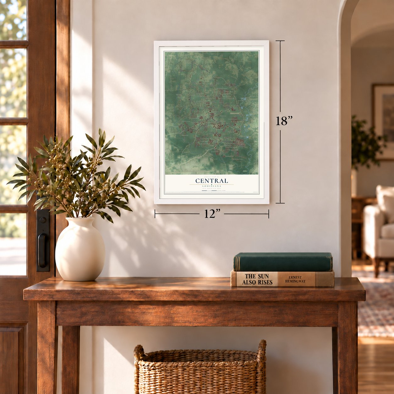
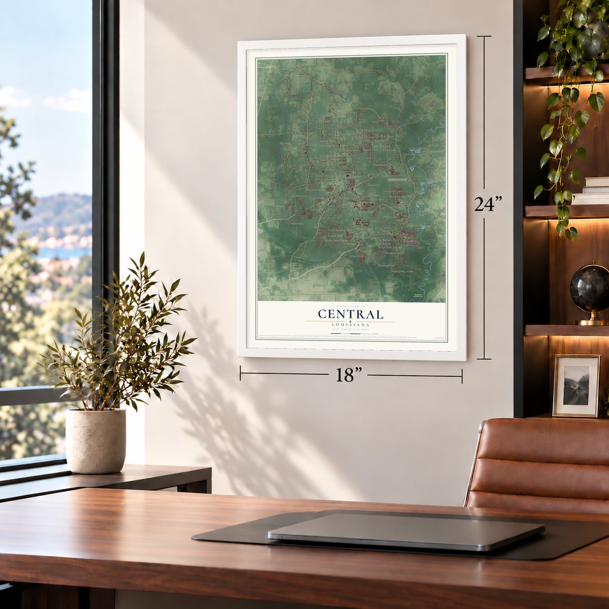
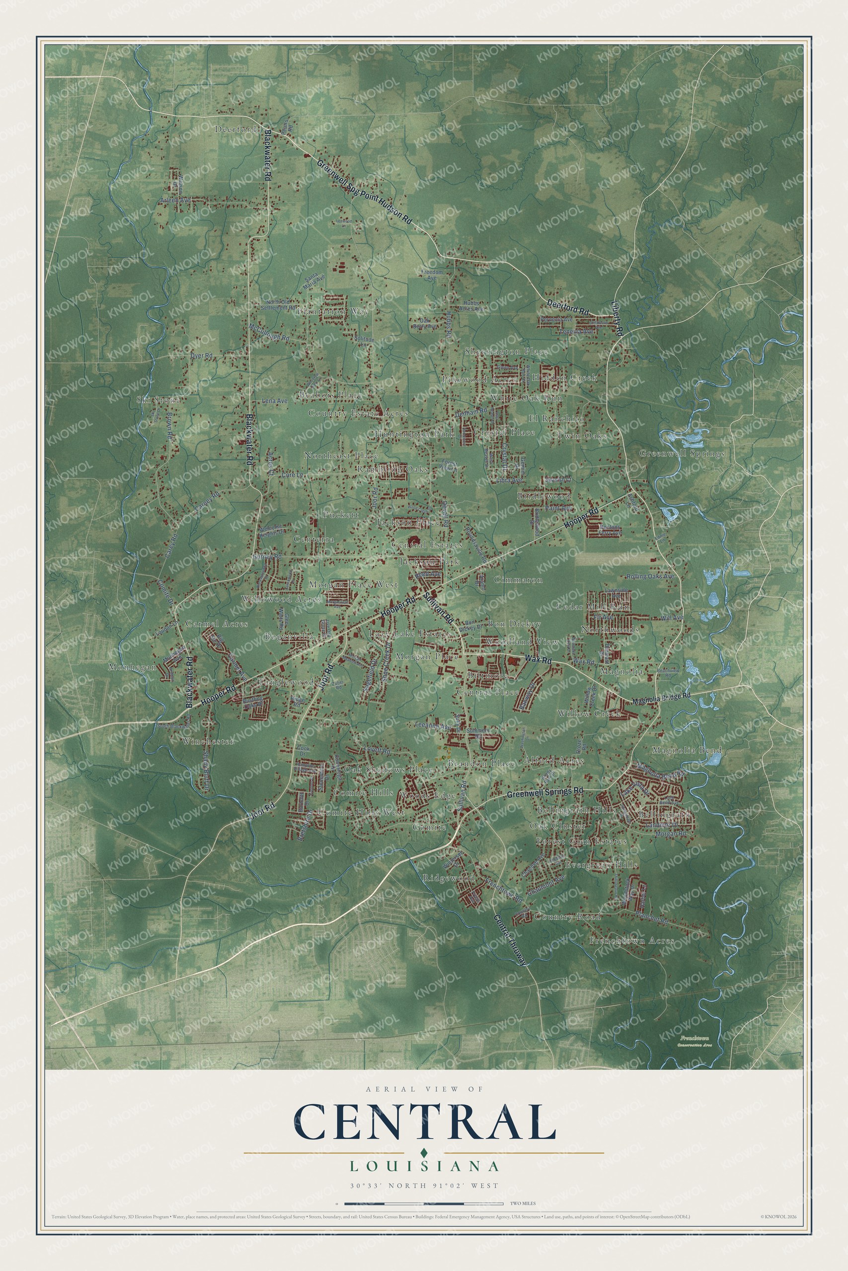
A new map of Central, Louisiana, made in 2026 and printed to order on thick archival matte paper.
12" x 18" Archival Matte Print
A Map of Home. A Work of Art.
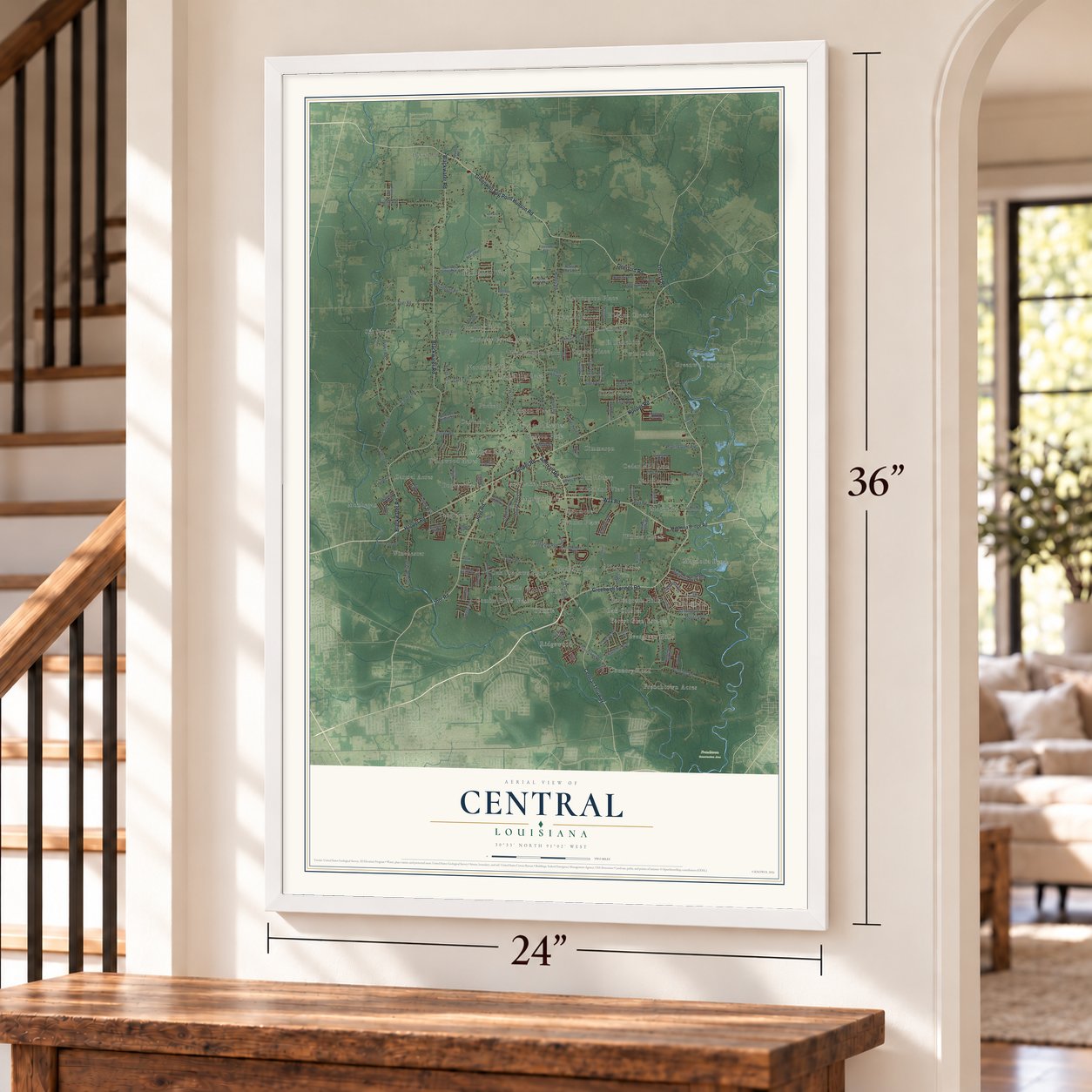
Explore Central, Louisiana from a whole new perspective. Created using aerial imagery and detailed geographic data, this map captures Central building by building, with labeled streets, familiar landmarks, and shaded topographical relief that highlights the natural contours of the landscape.
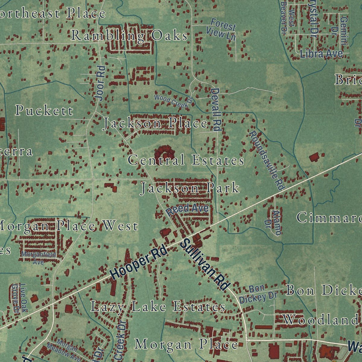
Combining modern data with the timeless character of a vintage atlas, this map is just as interesting up close as it is beautiful on the wall. Whether you grew up in Central, spent memorable years there, or call it home today, this unique map is a great way to celebrate a place that means something to you. Zoom in on the preview to look for your street, and then order a print to put your memories on the wall.
Three ways to hang it
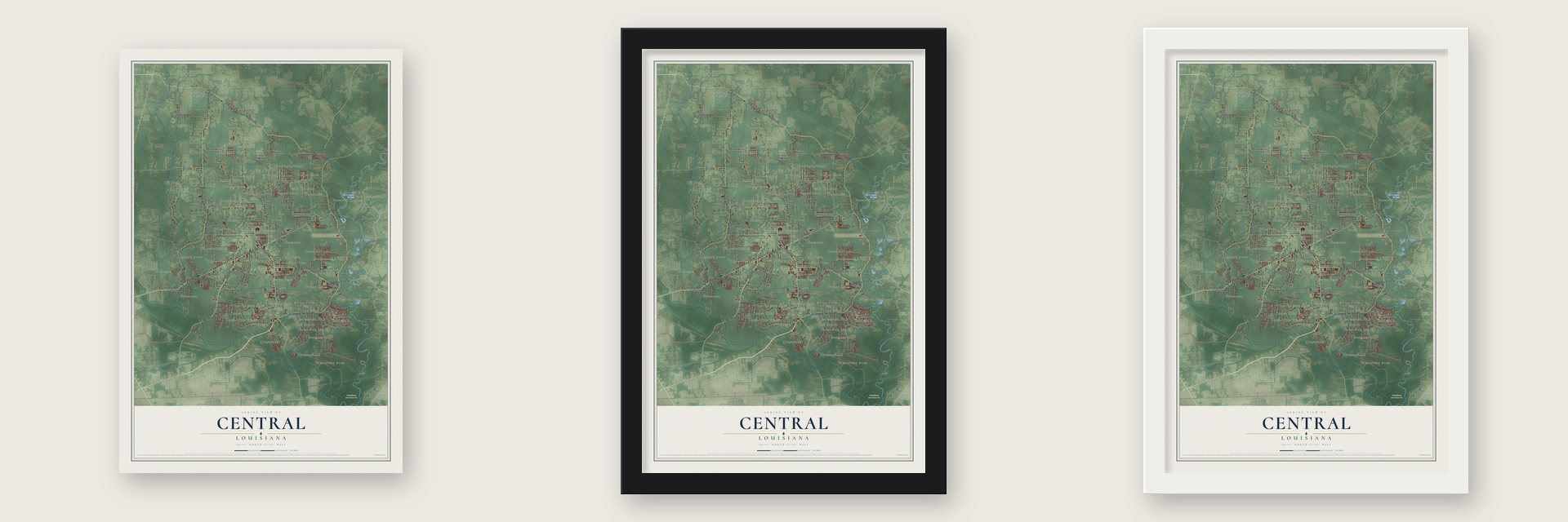
Unframed archival matte, a black wood frame or a white wood frame.
Up close
Geography Worth Displaying
This map was created using accurate cartographic data and authoritative geographic sources, including the U.S. Geological Survey and the Census Bureau. The map brings together terrain, waterways, roads, and building detail. The majority of the streets are labeled, houses are accurately depicted, and the topography is derived from government sources. Combining local data with carefully composed color and shading leads to this beautifully detailed Central artwork for your wall.
Rather than simply showing street outlines, we’ve included as many of the street names as we could reasonably fit on the map while keeping their names legible. Zoom in on the high resolution preview to see exactly what’s on the map. We truly set out to create a statement piece for anyone who loves Central. So whether it’s for you, or a gift for someone you love, we hope this map of Central brings back fond memories.
Read the story behind this map of Central, Louisiana from 2026.

About Central, Louisiana
Central is a city of 29,565 people in East Baton Rouge Parish, between the Comite River on the west and the Amite River on the east. For years it was an unincorporated suburb of Baton Rouge. Residents wanted a school system apart from the parish's, and state lawmakers would allow one only if Central became a city. Businessman Russell Starns led the push, and on April 23, 2005, voters chose to incorporate even though the parish was against it.
The new city had about 25,000 residents. Shelton "Mac" Watts, a former principal of Central High School, served as temporary mayor. In the first formal election, on April 1, 2006, he won 86 percent of the 18,000 votes cast. That November, voters across Louisiana approved a constitutional amendment that created the Central Community School District.
- Its own schools in 2007Governor Kathleen Blanco named the interim school board on January 9, 2007, and the board picked Mike Faulk as the first superintendent. The district opened on July 1, 2007. It took over five schools from the parish system: Central High School, Central Middle School, Central Intermediate, and the Tanglewood and Bellingrath Hills elementary schools.
- A library begun in a storeCentral's first library opened in 1940 inside the W.R. Edwards Store. It shut down in 1944 when the store had to grow, then reopened in a permanent building the next year. It moved into a leased building of 2,604 square feet on April 10, 1972, and bought that building in 1982. Today's branch, with 18,263 square feet, opened in June 2002.
- The 2016 floodsCentral was hit by serious flooding during the 2016 Louisiana floods. Mayor Jr. Shelton said that 25,000 people living in the city were affected.
- First City Hall in 2025For about 20 years Central governed itself without a city hall of its own. In 2025 Mayor Wade Evans led the groundbreaking for the city's first one, joined by current and former elected officials.
Find your street
Names on the Central map
Every name below is printed on this map. Look for your street, your school, the park where you played, or the pond down the road.
Places and landmarks57
- Frenchtown Conservation Area
- Alford Acres
- Beabois Place
- Bellingrath
- Bellingrath Hills
- Biltmore
- Boganvilla
- Bon Dickey
- Brandon Place
- Bridlewood
- Carmel Acres
- Cedar Mill Run
Show all 57 places
- Centerra
- Central Estates
- Central Place
- Cimmaron
- Comite
- Comite Hills
- Comite Hills West
- Country Estate Acres
- Country Road
- Crystal Place
- Deerford
- El Ranchito
- Evergreen Hills
- Forest Glen Estates
- Frenchtown Acres
- Greenwell Springs
- Hidden Creek
- Huntington Park
- Jackson Park
- Jackson Place
- Lazy Lake Estates
- Magnolia
- Magnolia Bend
- Monhegan
- Morgan Place
- Morgan Place West
- Northeast Place
- Northwoods
- Oak Cluster
- Oak Shadows Place
- Pinewood Acres
- Plantation Way
- Puckett
- Rambling Oaks
- Ridgewood
- Sherrington Place
- Ski Stone
- Tanglewood
- Twin Oaks
- White Oak Run
- Willow Creek
- Willowood Acres
- Winchester
- Woodland View
- Woods Edge
Streets and roads117
- Greenwell Springs Road
- Wax Road
- Greenwell Spg Point Hudson Road
- Sullivan Road
- Deerford Road
- Blackwater Road
- Hooper Road
- Joor Road
- Central Thruway
- Liberty Road
- Brown Road
- Frenchtown Road
- Lovett Road
- Denham Road
- Devall Road
- Hubbs Road
- Gurney Road
- McCullough Road
- Planchet Road
- Core Lane
- Morgan Road
- Arleen Avenue
- Landmor Drive
- Shoe Creek Drive
- Dyer Road
- Shady Bluff Drive
- Crystal Drive
- Carey Road
- Carmel Avenue
- Magnolia Bend Road
Show all 117 streets
- Carney Road
- Banway Drive
- Comite Drive
- Sagefield Drive
- Rolling Oaks Avenue
- Chaumont Avenue
- Paint Avenue
- Leeanne Avenue
- Lake Vista Drive
- Lena Avenue
- Teneiya Avenue
- Bretshire Drive
- Libra Avenue
- Will Avenue
- Fir Avenue
- Acres Court
- Reed Avenue
- Magnolia Bridge Road
- Droze Road
- Glen Watts Road
- Willow Creek Drive
- North Old Settlement Road
- Pernecia Avenue
- Durmast Drive
- Stoneshire Drive
- Conestoga Drive
- Chanove Avenue
- Watson Drive
- Woodstock Way Drive
- Roundsaville Road
- Oak Berry Avenue
- Hubbs Acres Avenue
- Welcome Heights Drive
- Bentons Ferry Avenue
- Bridlewood Drive
- Freedom Avenue
- Solitude Lane
- Harbor Lane
- Ridge Road
- Santa Maria Avenue
- Forest View Lane
- Lawnside Avenue
- Bon Dickey Drive
- Big Sur Drive
- Spanish Court
- Winterset Drive
- Loudon Lane
- Monhegan Avenue
- Summers Road
- Rustling Oaks Drive
- Gemini Drive
- Ashford Lane
- Burtcliff Drive
- Peairs Road
- Sully Drive
- Alamo Drive
- Cook Drive
- South Blackwater Road
- West Beaver Drive
- Shady Park Drive
- White Oak Run Drive
- Hampton Village Avenue
- Zuber Road
- Glenn Avenue
- Beachview Road
- Live Oak Grove Drive
- Loch Bend Avenue
- Ardoon Drive
- Fryers Avenue
- Ednie Lane
- Thibodeaux Road
- Morgan Meadow Avenue
- Washington Lane
- East Beaver Drive
- Hampshire Drive
- Chickasaw Avenue
- Pheasantwood Drive
- Wood Creek Drive
- Morganfield Avenue
- Woodrow Kerr Lane
- Chevernt Avenue
- Thelmadale Drive
- Ski Stone Drive
- Woodland View Drive
- Brennen Drive
- Lancewood Drive
- Lenwood Lane
Names are listed as they appear on the printed map. Zoom into the product photos to find them.
The art of mapping a place
How This Map Was Made
Real places. Remarkable detail. Discover the layers that turn geographic data into a map of home.

The view from above
Aerial imagery reveals the character of the land: woodland, open fields, and the patterns of a place.

The shape of the land
Elevation data brings hills, valleys, and subtle changes in the landscape into view.

The details of home
Roads, waterways, and building footprints come together to make the map feel unmistakably local.

Geography becomes art
Considered color, shading, and typography bring the layers together in a map made for your wall.


Process illustrated with Mendon, Massachusetts. Aerial imagery: USDA NAIP. Terrain: USGS 3D Elevation Program. Map details and finished artwork: KNOWOL.
The Details
About This Print
Choose an archival matte print, or a black or white Ayous wood frame. The archival matte print is unframed.
Select your size and finish above to see the matching product image and price.
Materials & Craftsmanship
A contemporary map with the character of a classic atlas, printed on archival matte paper. Optional frames are made from Ayous wood.
Your printed map does not include the watermark shown in the full-map preview.
Shipping & Delivery
Free shipping within the United States. Every print is made to order in the USA.
Buying a gift? Add a note in your cart and we'll include it. We never put prices in the package.
Prints ship within 2 to 3 business days. Allow 7 to 10 days total from ordering for delivery. Timing may vary during holidays or periods of high order volume.
Read our shipping policy.
Returns and damaged prints
Each print is made to order. Change-of-mind refunds are not available after production.
If your print arrives damaged, misprinted or incorrect, contact support@knowol.com within 30 days of receiving it. Include your order number, photos and a description of the issue.
Read our full refund and replacement policy. For questions about your order, email support@knowol.com.
Find your town
Looking for another city?
Find a map of home in our Louisiana collection, or any town in the country.
Nearby
Maps of towns near Central
Know someone from one of these towns? Their map makes a great gift.
 Monticello
, Louisiana
From $39.99See the map
 Watson
, Louisiana
From $39.99See the map
 Brownfields
, Louisiana
From $39.99See the map
More maps nearby: Merrydale, Denham Springs, Baker, Baton Rouge and Zachary.