


Search for another town





Free U.S. delivery 7 to 10 days after you order
Ceres, California Map Art
Building by building, with labeled streets and shaded relief.
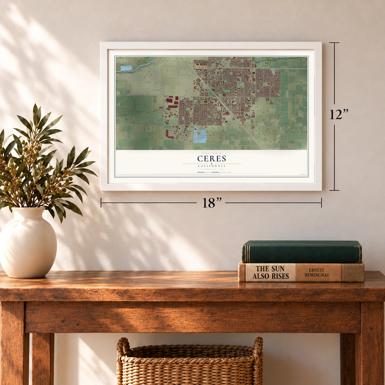
12" x 18" Archival Matte Print
A Map of Home. A Work of Art.
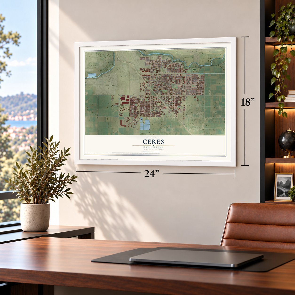
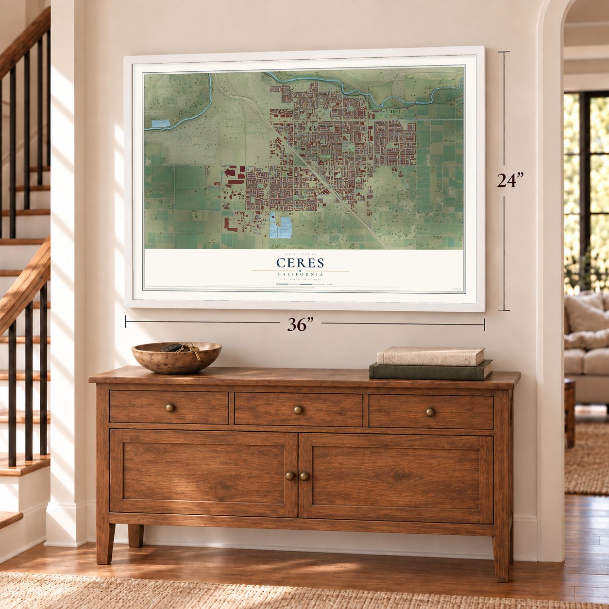
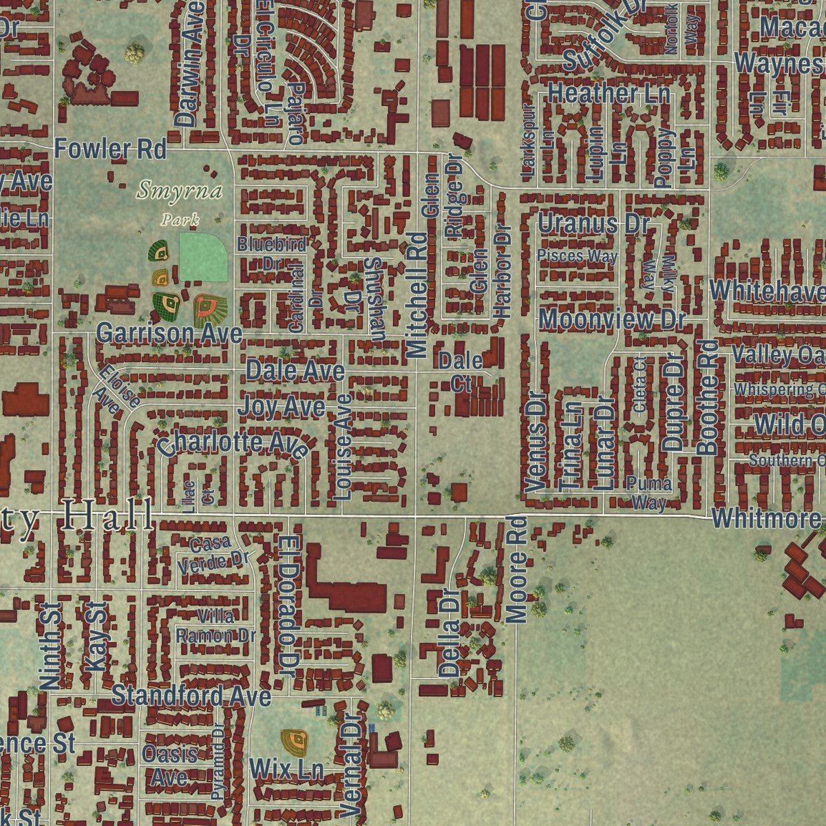
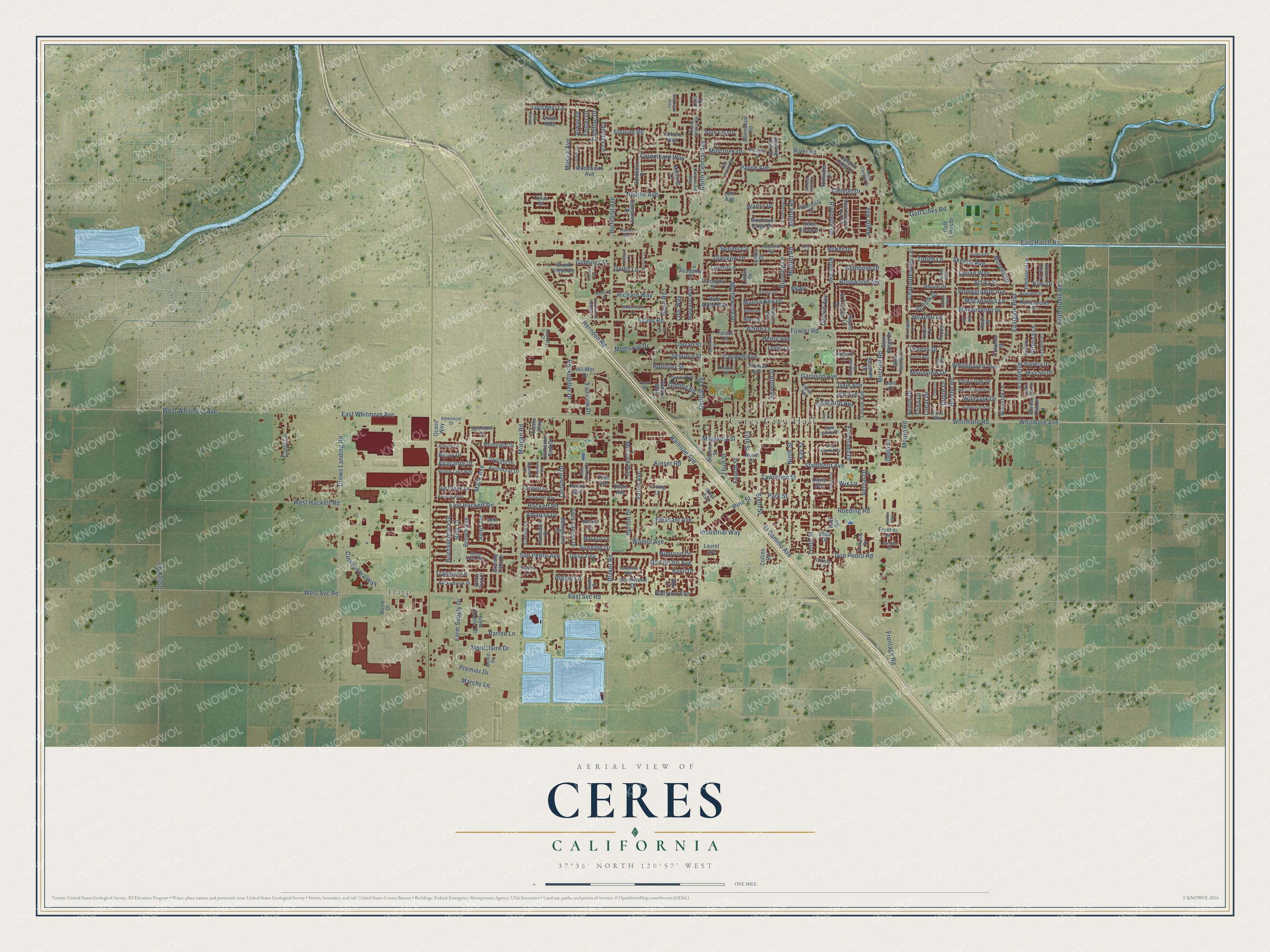
Explore Ceres, California from a whole new perspective. Created using aerial imagery and detailed geographic data, this map captures Ceres building by building, with labeled streets, familiar landmarks, and shaded topographical relief that highlights the natural contours of the landscape.
Combining modern data with the timeless character of a vintage atlas, this map is just as interesting up close as it is beautiful on the wall. Whether you grew up in Ceres, spent memorable years there, or call it home today, this unique map is a great way to celebrate a place that means something to you. Zoom in on the preview to look for your street, and then order a print to put your memories on the wall.
Three ways to hang it
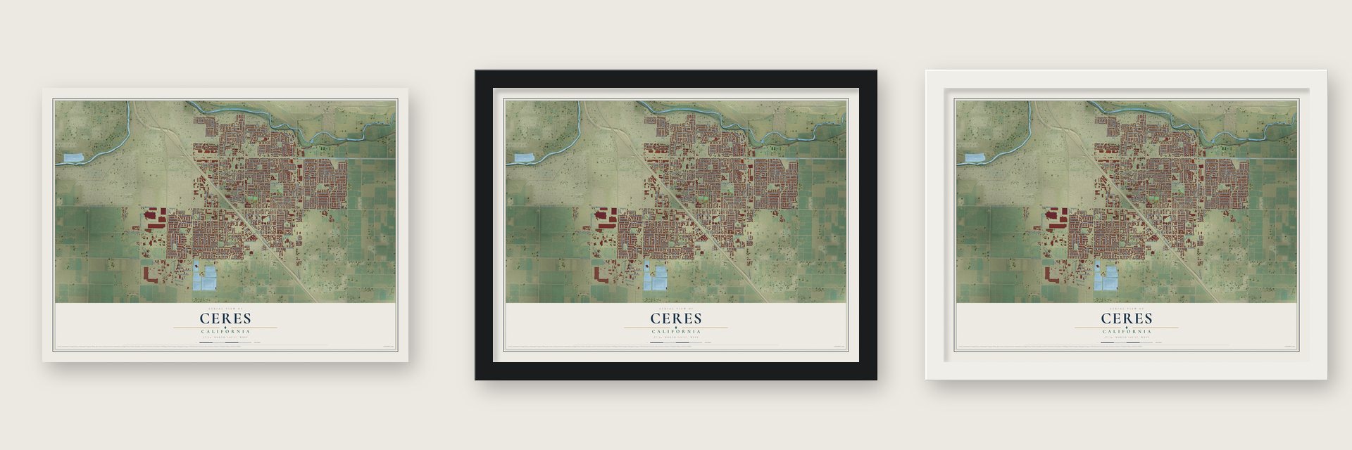
Unframed archival matte, a black wood frame or a white wood frame.
Up close
Geography Worth Displaying
This map was created using accurate cartographic data and authoritative geographic sources, including the U.S. Geological Survey and the Census Bureau. The map brings together terrain, waterways, roads, and building detail. The majority of the streets are labeled, houses are accurately depicted, and the topography is derived from government sources. Combining local data with carefully composed color and shading leads to this beautifully detailed Ceres artwork for your wall.
Rather than simply showing street outlines, we’ve included as many of the street names as we could reasonably fit on the map while keeping their names legible. Zoom in on the high resolution preview to see exactly what’s on the map. We truly set out to create a statement piece for anyone who loves Ceres. So whether it’s for you, or a gift for someone you love, we hope this map of Ceres brings back fond memories.
Read the story behind this map of Ceres, California from 2026.

Find your street
Names on the Ceres map
Every name below is printed on this map. Look for your street, your school, the park where you played, or the pond down the road.
Places and landmarks3
- Ceres City Hall
- Harp
- Smyrna Park
Streets and roads306
- Whitmore Avenue
- Whitmore Road
- North Central Avenue
- Memorial Drive
- Sequoia Street
- East Whitmore Avenue
- Central Avenue
- Fantasy Lane
- Attika Street
- Glenda Road
- Herndon Road
- Fowler Road
- Nimrood Drive
- Morello Drive
- East Hatch Road
- Mitchell Road
- East Svc Road
- Morgan Road
- East Hackett Road
- Don Pedro Road
- Rose Avenue
- Hackett Road
- Blaker Road
- Moffett Road
- Crows Landing Road
- Moore Road
- Eastgate Boulevard
- Richland Avenue
- River Road
- El Camino Avenue
Show all 306 streets
- Sixth Street
- Nadine Avenue
- Boothe Road
- Faith Home Road
- Ustick Road
- West Whitmore Avenue
- West Svc Road
- Kinser Road
- Railroad Avenue
- Fifth Street
- Glasgow Drive
- Magnolia Street
- Stonum Road
- Roeding Road
- West Hackett Road
- Tenth Street
- Ninth Street
- Rockefeller Drive
- Canyon Drive
- Evans Road
- Dale Avenue
- Don Pedro Avenue
- Tranquil Lane
- Fourth Street
- Babylon Avenue
- San Pedro Avenue
- Joy Avenue
- Malik Avenue
- Wild Oak Drive
- Brown Avenue
- Richard Way
- Garrison Avenue
- Walnut Avenue
- Caswell Avenue
- Myrtlewood Drive
- Lawrence Street
- Payne Avenue
- Waynesboro Drive
- Farm Supply Drive
- Seventh Street
- Rosewood Avenue
- Colombard Way
- Lunar Drive
- Farris Avenue
- Standford Avenue
- Third Street
- Moffet Road
- Musick Avenue
- Cornucopia Way
- Lavon Lane
- Lucchesi Lane
- Lois Way
- Charlotte Avenue
- Venus Drive
- Marchy Lane
- Partee Lane
- Montclaire Drive
- Cadillac Drive
- Ariano Lane
- Pine Street
- Golf Links Road
- Charlottesville Lane
- Buenaventura Drive
- Burton Drive
- Acorn Lane
- Industrial Way
- Pomegranite Avenue
- Kay Street
- Millcreek Drive
- Frontage Road
- Larian Way
- Suffolk Drive
- Senimi Circle
- Hollister Street
- Mauna Kea Drive
- Whitehaven Avenue
- Macadamia Lane
- Skeena Avenue
- Carol Lane
- Fairview Drive
- Vernal Drive
- Pleasant Avenue
- El Dorado Drive
- Darwin Avenue
- Running Lane
- Moonview Drive
- Zurich Lane
- Alphonse Drive
- Della Drive
- McCord Way
- Darrah Street
- Park Street
- Kiwi Drive
- Henry Avenue
- Giddings Street
- Sungate Drive
- Gene Road
- Larrynell Drive
- Riverette Drive
- Allacante Drive
- Angie Avenue
- Dupre Drive
- Premier Drive
- Amanda Drive
- Darby Lane
- Heather Lane
- Altessa Lane
- Uranus Drive
- Trina Lane
- Alcoy Drive
- Alway Drive
- Foster Drive
- Billy Court
- Ridlon Lane
- Walter Drive
- Bavil Drive
- Wix Lane
- Parkway
- Park East Drive
- McNeil Drive
- Doyle Avenue
- El Circulo Drive
- Calcagno Street
- Georgeann Place
- Shushan Drive
- Second Street
- Moonlight Drive
- Mira Sol Drive
- Woodworth Avenue
- North Street
- Aristocrat Drive
- Southwood Drive
- Louise Avenue
- Lynley Drive
- Brew Master Drive
- Thomas Avenue
- Riverpark Drive
- Rhone Drive
- River Creek Drive
- Glen Ridge Drive
- Soda Canyon Drive
- Canyon Falls Drive
- Valley Oak Drive
- Big Creek Lane
- Bordeaux Drive
- Riesling Drive
- Podocarpus Drive
- Grand View Avenue
- Fiddleleaf Lane
- Hil-Mor Drive
- Golf Links Drive
- Margaret Way
- Granite Falls Drive
- Wise Oak Lane
- Sunburst Drive
- Twilight Drive
- Glen Harbor Drive
- Belleza Drive
- Mountain Ridge Drive
- Jordanolo Drive
- Cassie Lane
- Hale Aloha Way
- Tarboro Way
- Sausalito Drive
- Marazzi Lane
- Openshaw Road
- Fannell Drive
- Stillwater Lane
- Daisy Tree
- Cameron Park Drive
- Alexis Avenue
- Posho Avenue
- Yolanda Street
- Collins Road
- Poppy Lane
- Lupin Lane
- Leslie Lane
- Ficus Street
- Winter Oak Lane
- Academy Place
- Panero Way
- Fiesta Way
- Forest Lane
- Water Lily Lane
- Boyle Drive
- Frontier Drive
- Veda Drive
- Arving Lane
- West Avenue
- Rolling Oak Court
- Tyrus Street
- Oasis Avenue
- Laurel Avenue
- Dale Court
- Hilo Lane
- Pajaro Lane
- East Lane
- Pink Avenue
- Vlach Way
- Linden Drive
- Inland Lane
- Lehi Avenue
- Ocaso Way
- Ator Lane
- Lars Court
- Fir Lane
- Donna Way
- Fruitridge Drive
- Columbard Way
- Wallace Avenue
- West Voyagers Cove Circle
- Villa Ramon Drive
- Rocky Brook Drive
- Willow Lake Way
- Moon River Way
- Puma Way
- North Canyon Drive
- Grand Central Drive
- Taramea Lane
- Hyacinth Drive
- Avenue Real
- Valera Drive
- Casa Verde Drive
- United Drive
- Oak Grove Road
- Christy Lane
- Amanecer Drive
- Eloise Avenue
- Larkspur Lane
- Archcliff Drive
- Toscana Lane
- Azores Lane
- Willow Pond Court
- Cardinal Drive
- Tartarian Way
- Tirano Way
- Kona Lane
- Park Royal Drive
- Agresti Drive
- Bluebird Drive
- Thomas Street
- Edith Court
- Foundry Court
- Serene Lane
- Donner Drive
- Giant Oak Lane
- Wade Drive
- Southern Oak Drive
- Thomasnell Way
- Whispering Oak Drive
- Milky Way
- Peltola Street
- Weathervane Lane
- Pyramid Drive
- Larsen Lane
- Marguerite Way
- Douglas Drive
- Shadow Ridge Drive
- Northwood Heights Lane
- Pisces Way
- Glenwood Drive
- Bernice Drive
- Peter John Way
- Winthrop Lane
- Monica Lane
- Millcreek Court
- Wesley Drive
- Valentina Way
- Gail Court
- Cleta Court
- Truckee Way
- Norfolk Way
- Mullen Way
- Ploutz Road
- Lilac Court
- Coty Court
Names are listed as they appear on the printed map. Zoom into the product photos to find them.
About Ceres, California
Ceres is a city of 49,302 people in Stanislaus County, in the San Joaquin Valley south of Modesto. Daniel Whitmore owned thousands of acres of farmland here, and in the autumn of 1867 he settled on it with his wife and three sons. His house was the first one built where the city now stands.
John G. Annear opened a blacksmith shop in June 1872 and worked for farmers for miles around. When the Southern Pacific ran its main line down the valley, it set up a flag station on the spot, and a depot followed in 1874, with Cyrus Lee as its first agent. So much wheat grew on the plains nearby that the station was named for Ceres, the Roman goddess of farming. Bradley & Reed started the first store in 1877. Whitmore put a clause in every deed for a town lot that banned making, selling or giving away liquor there, so Ceres was dry from the start.
- The Whitmore HouseDaniel Whitmore built his home at 2928 5th Street in 1870. The city and the Ceres Historical Society restored it, and it joined the National Register in 1989. The city also owns the Clinton Whitmore Mansion, built in 1903.
- A school from 1870Mrs. Aurelia Chapin taught the first school in the Ceres district in 1870. She stayed on as its teacher for nine years. Her one-room schoolhouse was painted white with green shutters. By 1921 the town had a brick grammar school and a brick high school with an auto shop, with twenty-five teachers and about 700 pupils.
- A church rebuilt after fireTwelve members organized the Baptist church, the town's first, in October 1879. Their first building was dedicated in 1881-1882, but it burned one night in 1890, after its insurance had lapsed by mistake. The members built again anyway, and the new church was dedicated in 1891. By 1921 it had more than 200 members.
- Train robbers in the 1890sIn the early 1890s, the outlaws Chris Evans and John Sontag held up several Southern Pacific trains at Ceres and at other places in the area.
- Home of the Calimyrna figBy 1921 Ceres was an incorporated city of about 1,000 people, at the center of a farm population of about 17,000. Smyrna Park was the home of the Calimyrna fig, and nearby growers raised olives, peaches, pears, apricots, berries, grapes, beans, melons and alfalfa.
Keep exploring California
Ceres is one of 1,990 California towns we've mapped. Every dot on the map is a print of its own.
The search covers every state, California first.
Near Ceres
Order 2 or more town maps and save 10%. Shown in the size and finish you picked above, so they hang as a set.
- Parklawn 12" x 18" / Archival Matte Print $39.99
- Bystrom 12" x 18" / Archival Matte Print $39.99
- Bret Harte 12" x 18" / Archival Matte Print $39.99


More maps nearby: Airport, Rouse, Cowan, Modesto and West Modesto.
The art of mapping a place
How This Map Was Made
Real places. Remarkable detail. Discover the layers that turn geographic data into a map of home.

The view from above
Aerial imagery reveals the character of the land: woodland, open fields, and the patterns of a place.

The shape of the land
Elevation data brings hills, valleys, and subtle changes in the landscape into view.

The details of home
Roads, waterways, and building footprints come together to make the map feel unmistakably local.

Geography becomes art
Considered color, shading, and typography bring the layers together in a map made for your wall.


Process illustrated with Mendon, Massachusetts. Aerial imagery: USDA NAIP. Terrain: USGS 3D Elevation Program. Map details and finished artwork: KNOWOL.
The Details
About This Print
Choose an archival matte print, or a black or white Ayous wood frame. The archival matte print is unframed.
Select your size and finish above to see the matching product image and price.
Materials & Craftsmanship
A contemporary map with the character of a classic atlas, printed on archival matte paper. Optional frames are made from Ayous wood.
Your printed map does not include the watermark shown in the full-map preview.
Shipping & Delivery
Free shipping within the United States. Every print is made to order in the USA.
Buying a gift? Add a note in your cart and we'll include it. We never put prices in the package.
Prints ship within 2 to 3 business days. Allow 7 to 10 days total from ordering for delivery. Timing may vary during holidays or periods of high order volume.
Read our shipping policy.
Returns and damaged prints
Each print is made to order. Change-of-mind refunds are not available after production.
If your print arrives damaged, misprinted or incorrect, contact support@knowol.com within 30 days of receiving it. Include your order number, photos and a description of the issue.
Read our full refund and replacement policy. For questions about your order, email support@knowol.com.