
Search for another town





Free U.S. delivery 7 to 10 days after you order
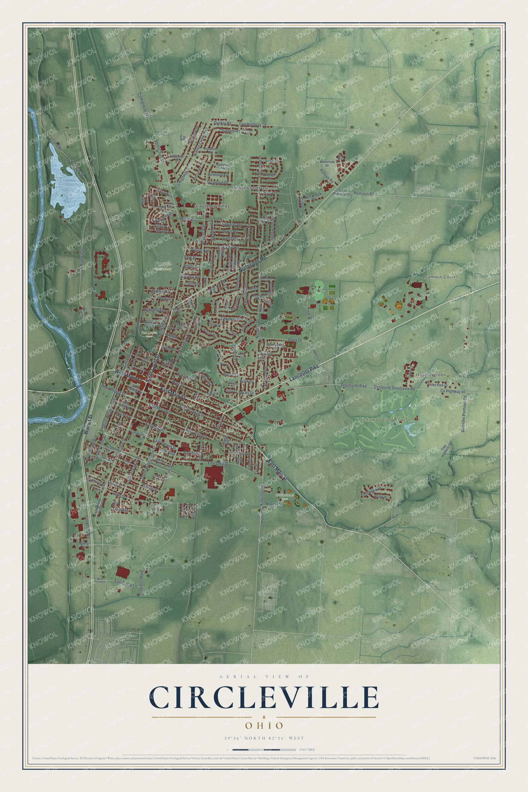
Circleville, Ohio Map Art
Building by building, with labeled streets and shaded relief.
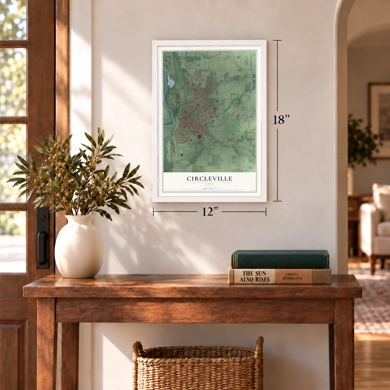
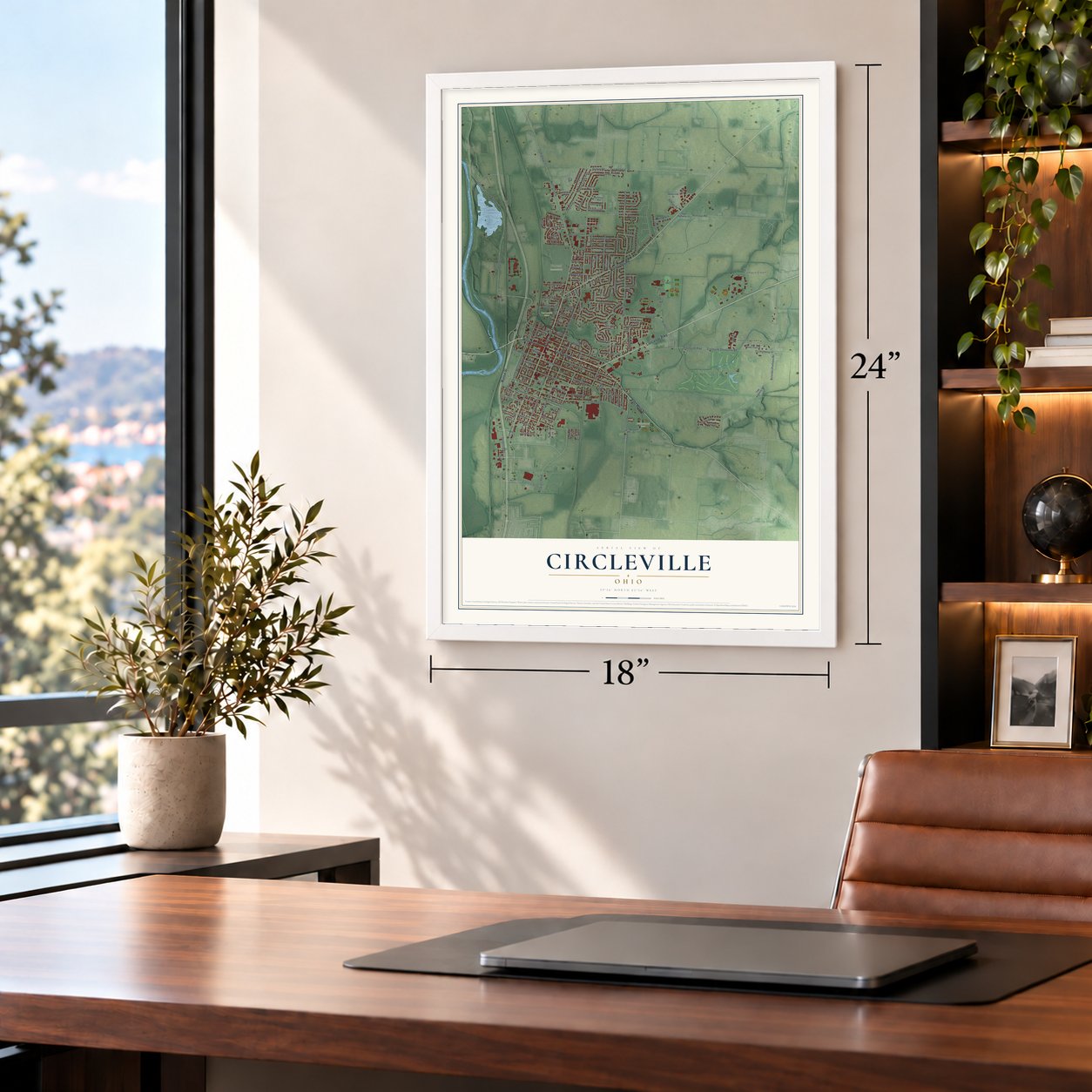
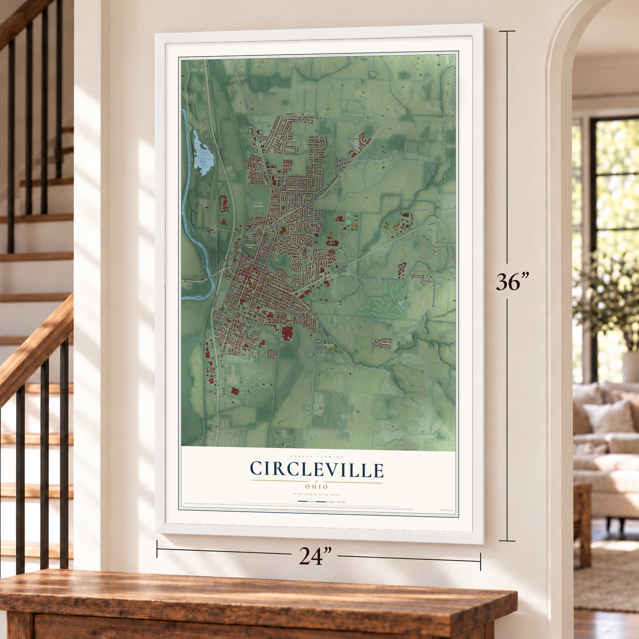
12" x 18" Archival Matte Print
A Map of Home. A Work of Art.
Explore Circleville, Ohio from a whole new perspective. Created using aerial imagery and detailed geographic data, this map captures Circleville building by building, with labeled streets, familiar landmarks, and shaded topographical relief that highlights the natural contours of the landscape.
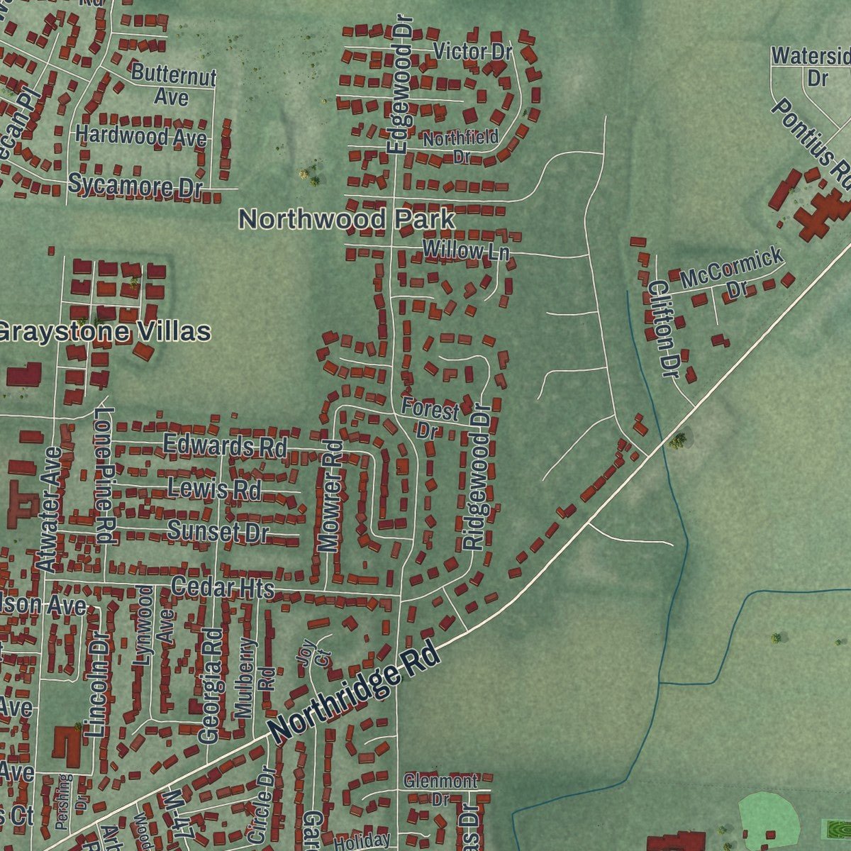
Combining modern data with the timeless character of a vintage atlas, this map is just as interesting up close as it is beautiful on the wall. Whether you grew up in Circleville, spent memorable years there, or call it home today, this unique map is a great way to celebrate a place that means something to you. Zoom in on the preview to look for your street, and then order a print to put your memories on the wall.
Three ways to hang it
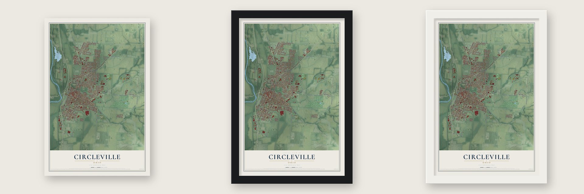
Unframed archival matte, a black wood frame or a white wood frame.
Up close
Geography Worth Displaying
This map was created using accurate cartographic data and authoritative geographic sources, including the U.S. Geological Survey and the Census Bureau. The map brings together terrain, waterways, roads, and building detail. The majority of the streets are labeled, houses are accurately depicted, and the topography is derived from government sources. Combining local data with carefully composed color and shading leads to this beautifully detailed Circleville artwork for your wall.
Rather than simply showing street outlines, we’ve included as many of the street names as we could reasonably fit on the map while keeping their names legible. Zoom in on the high resolution preview to see exactly what’s on the map. We truly set out to create a statement piece for anyone who loves Circleville. So whether it’s for you, or a gift for someone you love, we hope this map of Circleville brings back fond memories.
Read the story behind this map of Circleville, Ohio from 2026.

Find your street
Names on the Circleville map
Every name below is printed on this map. Look for your street, your school, the park where you played, or the pond down the road.
Places and landmarks8
- Campus Court
- Heathergreen
- Northwood Park
- Barthelmas Park
- Forest Cemetery
- Ted Lewis Park
- Graystone Villas
- Pickaway Golf Course
Streets and roads188
- North Court Street
- West Main Street
- Lancaster Pike
- Northridge Road
- East Main Street
- Walnut Street
- South Court Street
- South Pickaway Street
- Wilson Avenue
- Mingo Street
- North Pickaway Street
- Lincoln Drive
- East Union Street
- Town Street
- Highland Avenue
- South Western Avenue
- Dunkle Road
- Twp Highway 79
- Corwin Street
- West Mound Street
- East Mill Street
- Rustic Drive
- Stihl Avenue
- East Franklin Street
- Island Road
- County Highway 4
- County Highway 511
- Circleville Stoutsville Road
- County Highway 40
- Stoutsville Pike
Show all 188 streets
- Atwater Avenue
- East Ohio Street
- Nicholas Drive
- Goodchild Road
- Bolender Pontious Road
- South Washington Street
- East Mound Street
- Clark Drive
- Edgewood Drive
- South Scioto Street
- Watt Street
- Walnut Creek Pike
- Canal Street
- Sycamore Drive
- Clinton Street
- Kingston Pike
- Pontious Lane
- Edwards Road
- Pontious Road
- Villa Drive
- Logan Street
- Cedar Heights
- Twp Highway 38
- Ridgewood Drive
- County Highway 7
- Georgia Road
- Meadow Drive
- Garden Parkway
- East High Street
- Chatham Road
- Sunset Drive
- Tiger Drive
- Mowrer Road
- Fairview Boulevard
- Parklawn Drive
- Stella Avenue
- Meadow Lane
- East Circle Lane
- Morris Road
- Eastwood Drive
- East Corwin Street
- Pontius Road
- Maplewood Avenue
- Lawnwood Drive
- Hayward Street
- Brokaw Avenue
- Lewis Road
- Elm Avenue
- North Scioto Street
- Progress Parkway
- Lone Pine Road
- Avon Drive
- Douglas Drive
- Lincoln Avenue
- Collins Court
- Clifton Drive
- Eva Drive
- Pecan Place
- John Street
- York Street
- Half Avenue
- Third Avenue
- Seyfert Avenue
- Reber Avenue
- Park Street
- Brink Drive
- Moats Drive
- M-47
- County Highway 512
- Beverly Road
- Brookhill Lane
- Arbor Road
- Twp Highway 66
- Twp Highway 75
- Hillcrest Drive
- Circle Drive
- Victor Drive
- Lynwood Avenue
- Rosewood Avenue
- Willow Lane
- McGuire Drive
- West Mill Street
- Ridge Drive
- Sylvan Circle
- Mulberry Road
- West Union Street
- Brooke Park Drive
- Bolens Avenue
- Claire Court
- Hardwood Avenue
- Long Alley
- Faye Avenue
- McCormick Drive
- County Highway 9
- Harwich Road
- Pleasant Street
- Lewis Avenue
- Dunmore Road
- East Water Street
- West Franklin Street
- Butternut Avenue
- Renick Avenue
- Waterside Drive
- Sunnyview Drive
- Juhl Road
- Sumpter Avenue
- Gumm Place
- Turner Drive
- Lowery Lane
- Forest Drive
- Folsom Avenue
- Alma Avenue
- Mace Drive
- Sperry Drive
- Gale Court
- Hassle Drive
- Pacer Court
- Plum Street
- Glenmont Drive
- Barry Drive
- Huston Street
- Northfield Drive
- Timberline Drive
- Barnes Avenue
- West High Street
- Remle Road
- Harrison Street
- Montclair Avenue
- Edison Avenue
- Ray Avenue
- Plaza Drive
- West Circle Lane
- Chatham Court
- Forestview Court
- Williams Drive
- Norfolk Avenue
- South Street
- Holiday Lane
- Joy Court
- Park Place
- McCrea Avenue
- Hayes Court
- Tower Court
- Maize Court
- Rustic Court
- Recreation Drive
- Brown Street
- Ridgedale Drive
- Springhollow Road
- Westwood Drive
- Pinckney Street
- Brookhaven Place
- Wood Lane
- Caroline Court
- Lawnwood Court
- Weldon Avenue
- Greenacre Court
- Pershing Drive
Names are listed as they appear on the printed map. Zoom into the product photos to find them.
About Circleville, Ohio
Circleville is a city of 13,927 people and the seat of Pickaway County, on the east bank of the Scioto River. The Ohio General Assembly created the county on January 12, 1810, and on February 19 it named David Bradford, George Jackson and John Pollock to find a county seat. They toured the county and picked the ground inside a Hopewell earthwork. Daniel Dreisbach then bought 200 acres from Jacob Zeiger, Zeiger Jr. and Samuel Watt and laid out the lots in rings, with the courthouse at the very center.
Over the years many residents came to dislike the round plan. Lots were odd shapes, and farmers tied their horses around the courthouse, which drew hogs into town. In 1837 the legislature allowed a change if every owner in the circle agreed, but nothing happened, so in 1838 it let each quarter decide for itself. The Circleville Squaring Company redid the southeast quarter that March and the northwest that September, the northeast in 1849 and the southwest in 1856. Only a patch of raised ground at Pickaway and Franklin streets is left of the earthwork.
- Built inside a giant circleHopewell people built the earthwork that gave the town its name during the first centuries of the Common Era. According to the state historical marker on East Franklin Street, it was a ring roughly 1,100 feet wide, linked to a square that measured 900 feet. The minister David Jones wrote about it in a Boston magazine in 1772, decades before the town was built inside it.
- Brick town of 1827The first lot sale ended with a barbecue, and a cheese wheel weighing several hundred pounds arrived on a sled. Circleville was incorporated as a town in 1814. By 1827 it had 725 people, 102 houses, nine stores, three pharmacies, a market house and one church, and every building was brick except the stone jail. It became a city on March 25, 1853.
- Caleb Atwater's mound bookCaleb Atwater settled in Circleville around 1814 and began studying the ancient earthworks around him. In 1820 he published a book that brought the old sites of the Ohio and Mississippi valleys together for the first time. He is also remembered as Ohio's first historian and as the father of its public school system.
- Ted Lewis and his top hatTheodore Leopold Friedman was born in Circleville and left for New York in 1915. As Ted Lewis he played clarinet on stage with a cane and a beat-up top hat, and his "Me and My Shadow" act made him the best-paid entertainer of the 1920s. The town named Ted Lewis Park for him and keeps a museum in his honor.
- Christopher Gist at MaguckLenape people pushed out of Pennsylvania settled a small village called Maguck on the Scioto before 1750, just south of where Circleville stands. On January 20, 1751, the frontier explorer Christopher Gist reached it, the first European on record in the area. He found about 10 families there and stayed four days.
Keep exploring Ohio
Circleville is one of 1,389 Ohio towns we've mapped. Every dot on the map is a print of its own.
The search covers every state, Ohio first.
Near Circleville
Order 2 or more town maps and save 10%. Shown in the size and finish you picked above, so they hang as a set.
- Logan Elm Village 12" x 18" / Archival Matte Print $39.99
- Stoutsville 12" x 18" / Archival Matte Print $39.99
- South Bloomfield 12" x 18" / Archival Matte Print $39.99
More maps nearby: Ashville, Tarlton, Kingston, Walnut and Williamsport.
The art of mapping a place
How This Map Was Made
Real places. Remarkable detail. Discover the layers that turn geographic data into a map of home.

The view from above
Aerial imagery reveals the character of the land: woodland, open fields, and the patterns of a place.

The shape of the land
Elevation data brings hills, valleys, and subtle changes in the landscape into view.

The details of home
Roads, waterways, and building footprints come together to make the map feel unmistakably local.

Geography becomes art
Considered color, shading, and typography bring the layers together in a map made for your wall.


Process illustrated with Mendon, Massachusetts. Aerial imagery: USDA NAIP. Terrain: USGS 3D Elevation Program. Map details and finished artwork: KNOWOL.
The Details
About This Print
Choose an archival matte print, or a black or white Ayous wood frame. The archival matte print is unframed.
Select your size and finish above to see the matching product image and price.
Materials & Craftsmanship
A contemporary map with the character of a classic atlas, printed on archival matte paper. Optional frames are made from Ayous wood.
Your printed map does not include the watermark shown in the full-map preview.
Shipping & Delivery
Free shipping within the United States. Every print is made to order in the USA.
Buying a gift? Add a note in your cart and we'll include it. We never put prices in the package.
Prints ship within 2 to 3 business days. Allow 7 to 10 days total from ordering for delivery. Timing may vary during holidays or periods of high order volume.
Read our shipping policy.
Returns and damaged prints
Each print is made to order. Change-of-mind refunds are not available after production.
If your print arrives damaged, misprinted or incorrect, contact support@knowol.com within 30 days of receiving it. Include your order number, photos and a description of the issue.
Read our full refund and replacement policy. For questions about your order, email support@knowol.com.