
Search for another town





Free U.S. delivery 7 to 10 days after you order
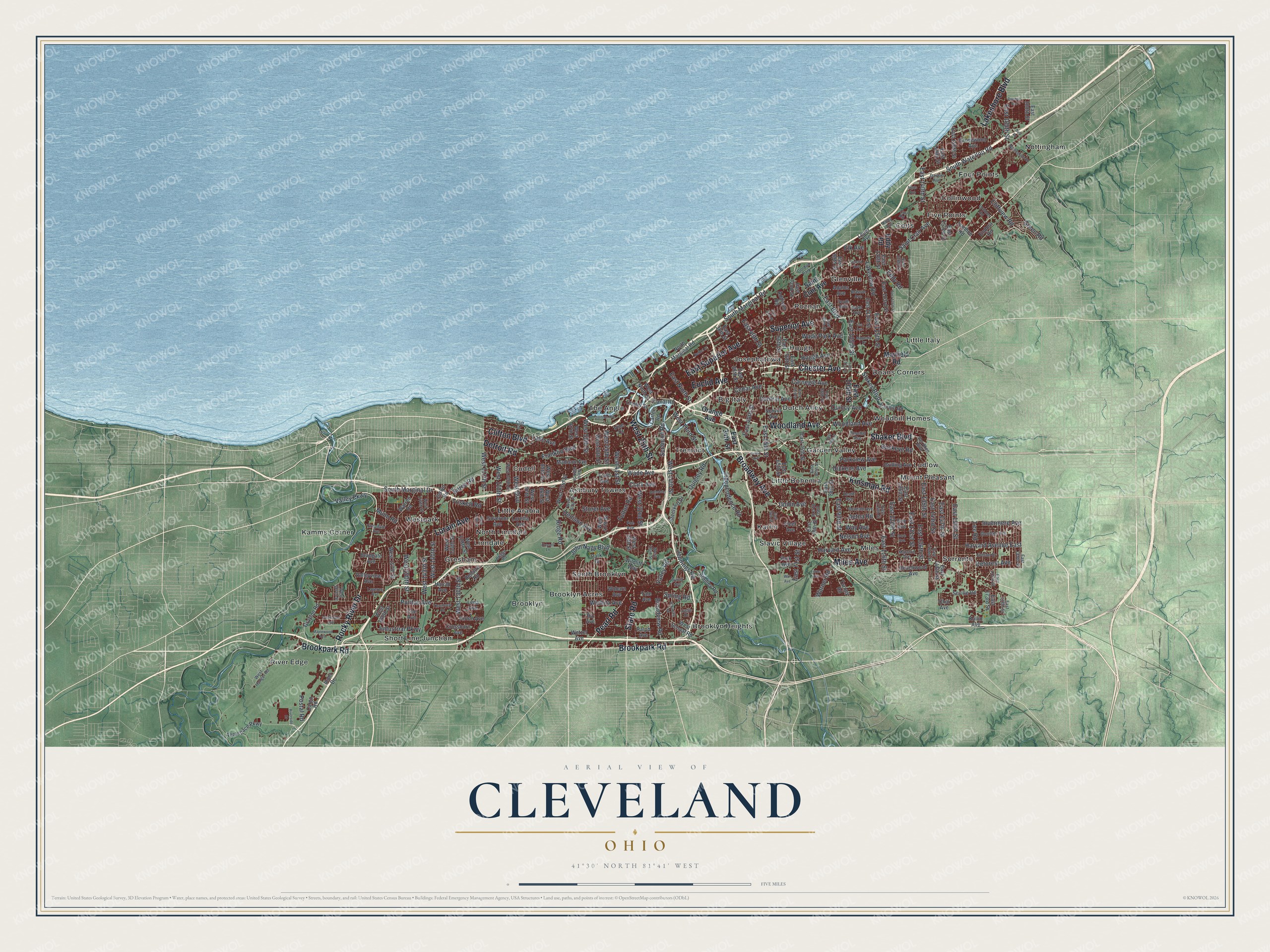
Cleveland, Ohio Map Art
Building by building, with labeled streets and shaded relief.
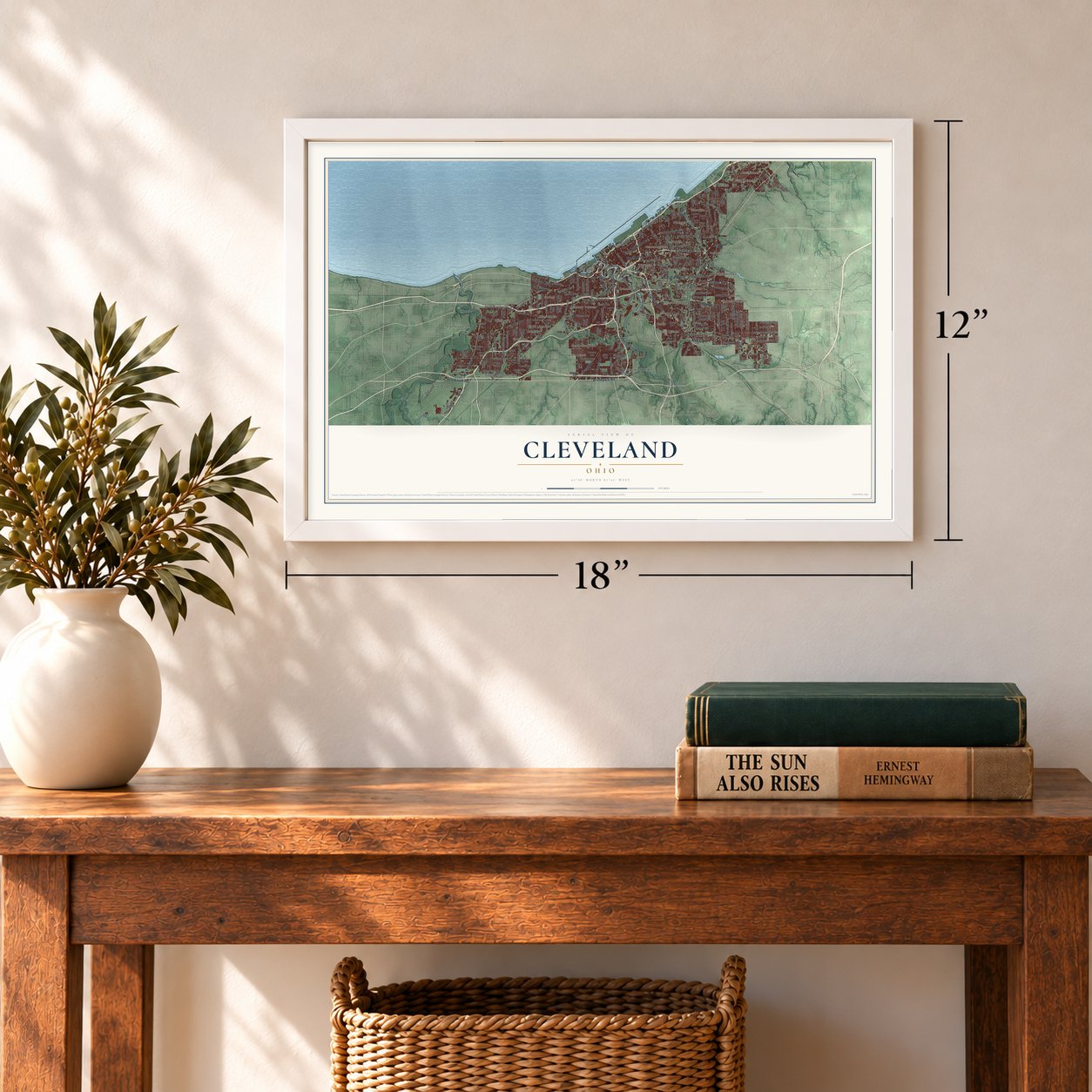
12" x 18" Archival Matte Print
A Map of Home. A Work of Art.
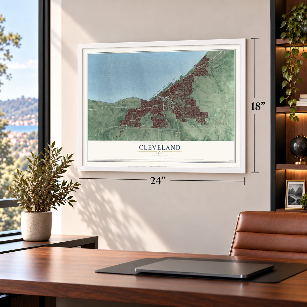
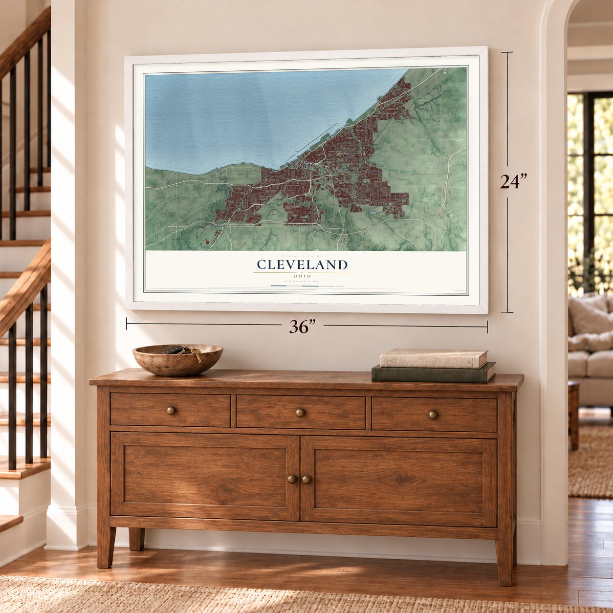
Explore Cleveland, Ohio from a whole new perspective. Created using aerial imagery and detailed geographic data, this map captures Cleveland building by building, with labeled streets, familiar landmarks, and shaded topographical relief that highlights the natural contours of the landscape.
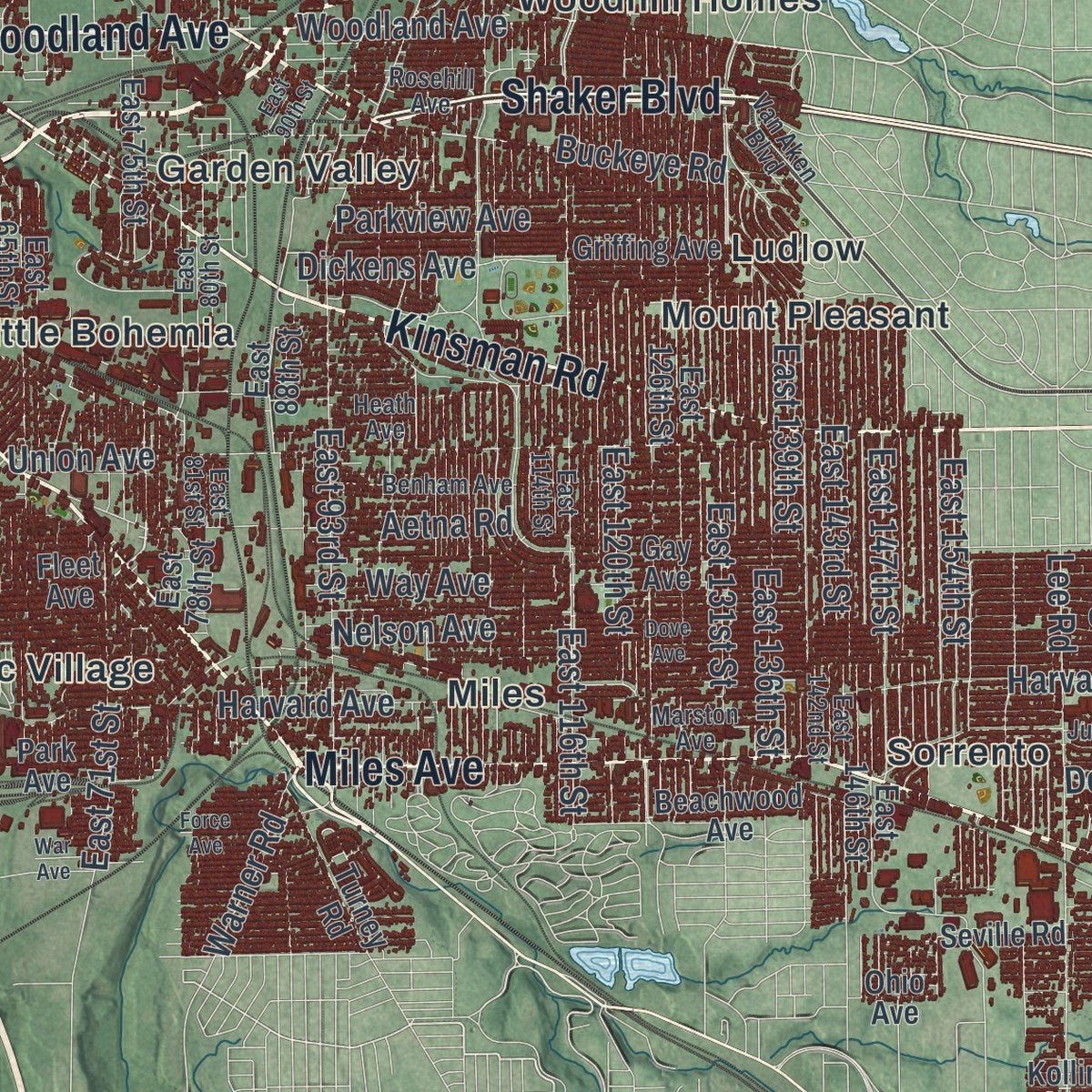
Combining modern data with the timeless character of a vintage atlas, this map is just as interesting up close as it is beautiful on the wall. Whether you grew up in Cleveland, spent memorable years there, or call it home today, this unique map is a great way to celebrate a place that means something to you. Zoom in on the preview to look for your street, and then order a print to put your memories on the wall.
Three ways to hang it
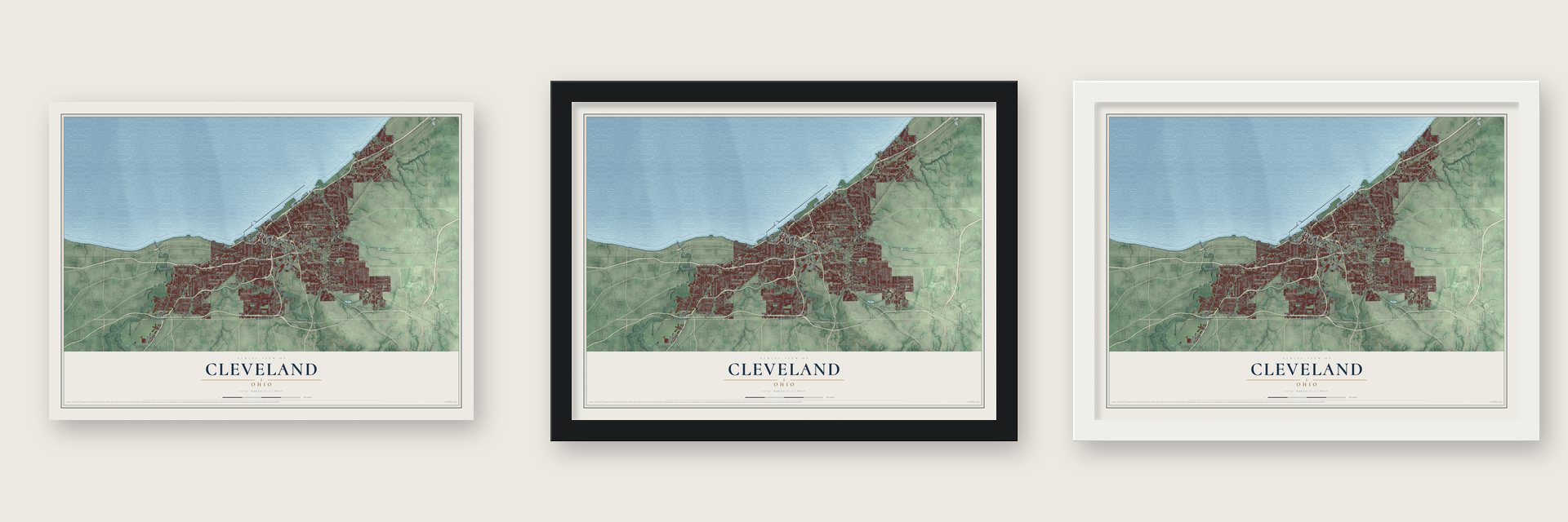
Unframed archival matte, a black wood frame or a white wood frame.
Up close
Geography Worth Displaying
This map was created using accurate cartographic data and authoritative geographic sources, including the U.S. Geological Survey and the Census Bureau. The map brings together terrain, waterways, roads, and building detail. The majority of the streets are labeled, houses are accurately depicted, and the topography is derived from government sources. Combining local data with carefully composed color and shading leads to this beautifully detailed Cleveland artwork for your wall.
Rather than simply showing street outlines, we’ve included as many of the street names as we could reasonably fit on the map while keeping their names legible. Zoom in on the high resolution preview to see exactly what’s on the map. We truly set out to create a statement piece for anyone who loves Cleveland. So whether it’s for you, or a gift for someone you love, we hope this map of Cleveland brings back fond memories.
Read the story behind this map of Cleveland, Ohio from 2026.

Find your street
Names on the Cleveland map
Every name below is printed on this map. Look for your street, your school, the park where you played, or the pond down the road.
Places and landmarks39
- Ashbury Towers
- Big Italy
- Brooklyn
- Brooklyn Acres
- Brooklyn Heights
- Coits
- Collinwood
- Cudell
- Doans Corners
- Dutch Alley
- Five Points
- Four Points
Show all 39 places
- Garden Valley
- Glenville
- Gresham
- Hough
- Josephatowa
- Kamms Corner
- Karlin
- Linndale
- Little Arabia
- Little Bohemia
- Little Italy
- Ludlow
- Miles
- Mount Pleasant
- North Linndale
- Nottingham
- Poznan
- River Edge
- Short Line Junction
- Slavic Village
- Sorrento
- South Brooklyn
- The Angle
- Tremont
- Westpark
- Woodhill Homes
- Gordon Park
Streets and roads254
- Chester Avenue
- Broadway Avenue
- Brookpark Road
- Miles Avenue
- Detroit Road
- Shaker Boulevard
- Woodland Avenue
- East Superior Avenue
- Clifton Boulevard
- Superior Avenue
- West 25th Street
- Euclid Avenue
- Lorain Avenue
- Kinsman Road
- Rocky River Drive
- Pearl Road
- Lakeshore Boulevard
- State Road
- Carnegie Avenue
- South Waterloo Road
- Valley Parkway
- Stokes Boulevard
- Fulton Road
- East Boulevard
- Buckeye Road
- West Boulevard
- Industrial Parkway
- East 93rd Street
- East 55th Street
- Saint Clair Avenue
Show all 254 streets
- East 71st Street
- Denison Avenue
- East 116th Street
- West 58th Street
- Cedar Avenue
- South Marginal Road
- Clark Avenue
- East 105th Street
- Puritas Avenue
- West 117th Street
- East 143rd Street
- East 147th Street
- West 130th Street
- Union Avenue
- West Third Street
- East 140th Street
- Harvard Avenue East
- East 131st Street
- East 120th Street
- Wade Park Avenue
- West 140th Street
- East 40th Street
- Scranton Road
- West 150th Street
- Harvard Avenue
- East 49th Street
- West 32nd Street
- Central Avenue
- Franklin Boulevard
- Triskett Road
- Quincy Avenue
- Berea Road
- West 41st Street
- Lee Road
- West 14th Street
- Independence Road
- West 45th Street
- East 115th Street
- East 185th Street
- Broadview Road
- Hough Avenue
- East 154th Street
- Lakeview Road
- Aetna Road
- West 110th Street
- Ridge Road
- West 143rd Street
- East Ninth Street
- Lake Avenue
- South Marginal Drive
- East 139th Street
- Jennings Road
- Invermere Avenue
- Storer Avenue
- East 136th Street
- Parkview Avenue
- Quigley Road
- Green Road
- Dickens Avenue
- John Nagy Boulevard
- Spring Road
- Nelson Avenue
- Valley Road
- Wichita Avenue
- Deforest Avenue
- Eddy Road
- Cliffview Road
- Warner Road
- Postal Road
- Way Avenue
- Wade Avenue
- Elk Avenue
- Munn Road
- Orange Avenue
- East 34th Street
- Mayfield Road
- East 75th Street
- Fleet Avenue
- Cargo Road
- East 123rd Street
- East 65th Street
- East 146th Street
- North Marginal Road
- East 126th Street
- East 118th Street
- East 72nd Street
- East 66th Street
- West 50th Street
- East 70th Street
- West 47th Street
- East 149th Street
- Madison Avenue
- Bellaire Road
- East 78th Street
- East 152nd Street
- Train Avenue
- East 173rd Street
- East 99th Street
- East 111th Street
- East 36th Street
- Grayton Road
- East 88th Street
- West 157th Street
- West 73rd Street
- East 38th Street
- East 156th Street
- West 160th Street
- Addison Road
- Warren Road
- West 134th Street
- Wetzel Avenue
- West 128th Street
- Woburn Avenue
- West 97th Street
- West Schaaf Road
- West 85th Street
- Canal Road
- Grovewood Avenue
- Steelyard Drive
- Aerospace Parkway
- Carter Road
- West 36th Street
- Bradley Road
- Inner Drive
- Kirton Avenue
- Gay Avenue
- Wildlife Way
- Valleyview Avenue
- Park Drive
- West 67th Street
- Park Avenue
- Fairhill Road
- West Ninth Street
- Turney Road
- Crossburn Avenue
- Ivanhoe Road
- Beachwood Avenue
- Ralph Avenue
- Center Street
- Governor Avenue
- Griffing Avenue
- East 200th Street
- West 86th Street
- Bradgate Avenue
- Tate Avenue
- Ira Avenue
- Scovill Avenue
- Harold Avenue
- Vine Court
- Lena Avenue
- Seville Road
- Endora Road
- Loretta Avenue
- Adams Avenue
- Leuer Avenue
- Joslyn Road
- Ohio Avenue
- Kollin Avenue
- Coe Avenue
- East 86th Street
- East 114th Street
- East 81st Street
- East 128th Street
- East 89th Street
- Glendale Avenue
- West 65th Street
- East 142nd Street
- West 105th Street
- East 80th Street
- Benham Avenue
- East 175th Street
- Judson Drive
- West Hanger Road
- West 144th Street
- Coit Road
- East 189th Street
- Cliff Drive
- Van Aken Boulevard
- East 178th Street
- West 23rd Street
- London Road
- Olivet Avenue
- Poe Avenue
- West 67th Place
- Kirby Avenue
- Laverne Avenue
- Marston Avenue
- Darwin Avenue
- Ernadale Avenue
- Rosehill Avenue
- West 187th Street
- Briggs Road
- Heath Avenue
- South Boulevard
- Massie Avenue
- Judie Drive
- Irving Avenue
- East 61st Street
- East 125th Street
- East 90th Street
- East 73rd Street
- East 59th Street
- Parkmount Avenue
- East 101st Street
- Neff Road
- Nottingham Road
- Dove Avenue
- Broadale Road
- Magnolia Drive
- Division Avenue
- Holmden Avenue
- Bethel Court
- Maplewood Avenue
- Riverside Drive
- West 119th Street
- Force Avenue
- Pawnee Avenue
- Thornhope Road
- Russell Lane
- Argus Avenue
- Lee Avenue
- Helena Avenue
- War Avenue
- Praha Avenue
Names are listed as they appear on the printed map. Zoom into the product photos to find them.
About Cleveland, Ohio
Cleveland is a city in Cuyahoga County, Ohio. The 2020 census recorded 372,624 residents. Cleveland was founded in 1796.
- 372,624 peopleThe Census Bureau recorded this population in 2020.
- Cuyahoga CountyCleveland is a city in this Ohio county.
- Founded in 1796Cleveland was founded in 1796.
- 82.47 square milesThe Census Bureau reports this total area for the community.
Keep exploring Ohio
Cleveland is one of 1,389 Ohio towns we've mapped. Every dot on the map is a print of its own.
The search covers every state, Ohio first.
Near Cleveland
Order 2 or more town maps and save 10%. Shown in the size and finish you picked above, so they hang as a set.
- Tremont 12" x 18" / Archival Matte Print $39.99
- Central 12" x 18" / Archival Matte Print $39.99
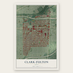
- Clark-Fulton 12" x 18" / Archival Matte Print $39.99
More maps nearby: Ohio City, Newburgh Heights, Brooklyn Centre, Kinsman and Detroit Shoreway.
The art of mapping a place
How This Map Was Made
Real places. Remarkable detail. Discover the layers that turn geographic data into a map of home.

The view from above
Aerial imagery reveals the character of the land: woodland, open fields, and the patterns of a place.

The shape of the land
Elevation data brings hills, valleys, and subtle changes in the landscape into view.

The details of home
Roads, waterways, and building footprints come together to make the map feel unmistakably local.

Geography becomes art
Considered color, shading, and typography bring the layers together in a map made for your wall.


Process illustrated with Mendon, Massachusetts. Aerial imagery: USDA NAIP. Terrain: USGS 3D Elevation Program. Map details and finished artwork: KNOWOL.
The Details
About This Print
Choose an archival matte print, or a black or white Ayous wood frame. The archival matte print is unframed.
Select your size and finish above to see the matching product image and price.
Materials & Craftsmanship
A contemporary map with the character of a classic atlas, printed on archival matte paper. Optional frames are made from Ayous wood.
Your printed map does not include the watermark shown in the full-map preview.
Shipping & Delivery
Free shipping within the United States. Every print is made to order in the USA.
Buying a gift? Add a note in your cart and we'll include it. We never put prices in the package.
Prints ship within 2 to 3 business days. Allow 7 to 10 days total from ordering for delivery. Timing may vary during holidays or periods of high order volume.
Read our shipping policy.
Returns and damaged prints
Each print is made to order. Change-of-mind refunds are not available after production.
If your print arrives damaged, misprinted or incorrect, contact support@knowol.com within 30 days of receiving it. Include your order number, photos and a description of the issue.
Read our full refund and replacement policy. For questions about your order, email support@knowol.com.