
Search for another town





Free U.S. delivery 7 to 10 days after you order
Columbia, Missouri Map Art
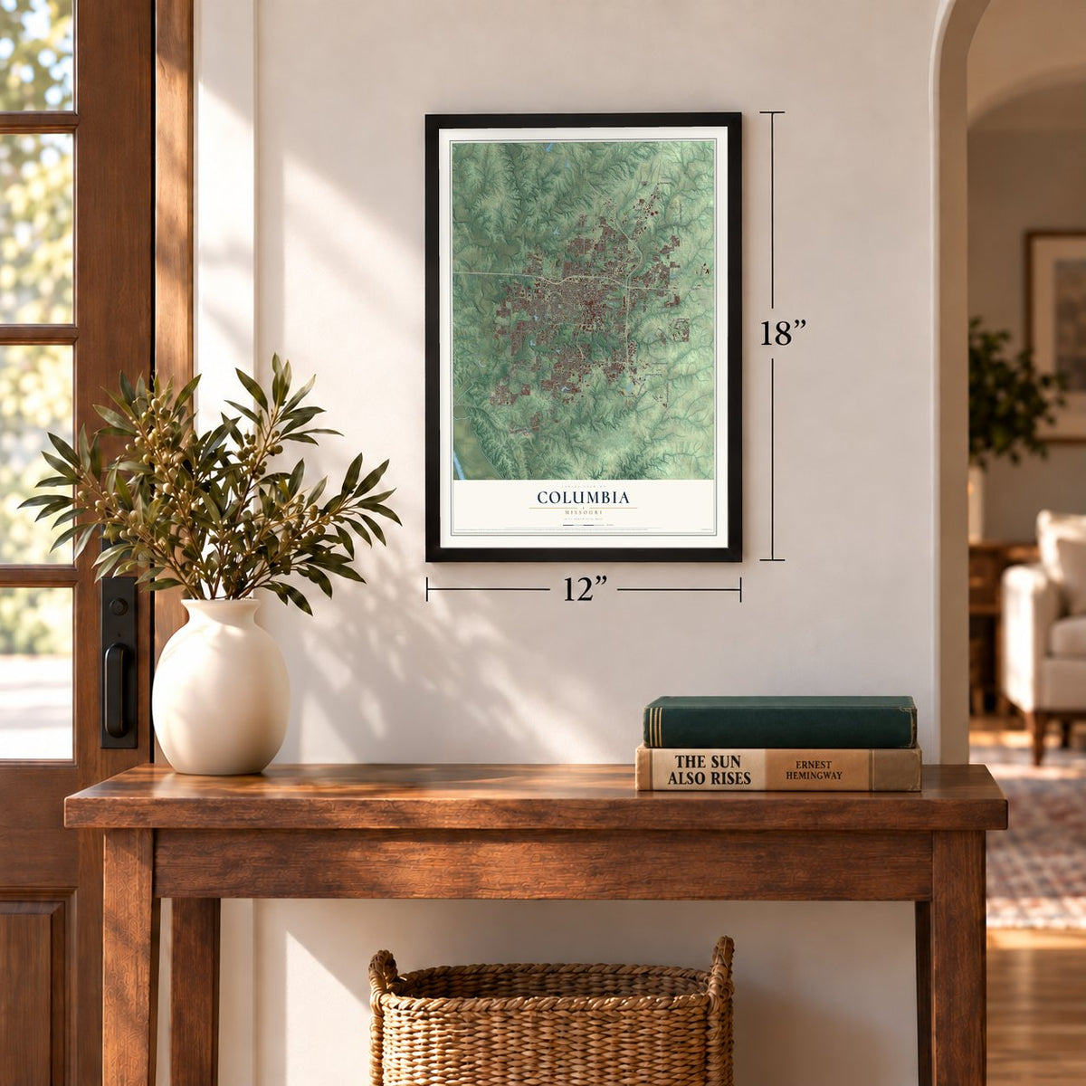
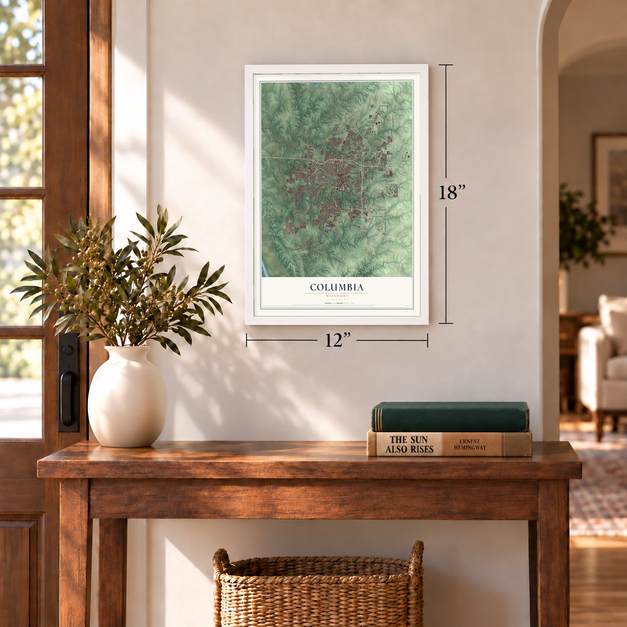
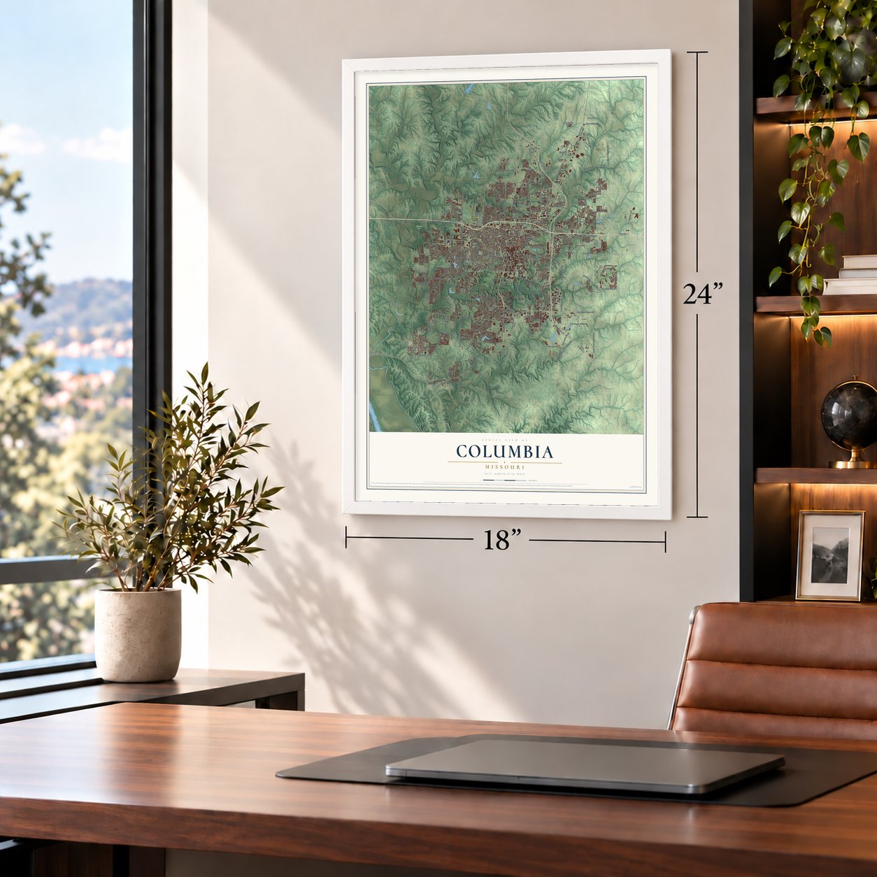
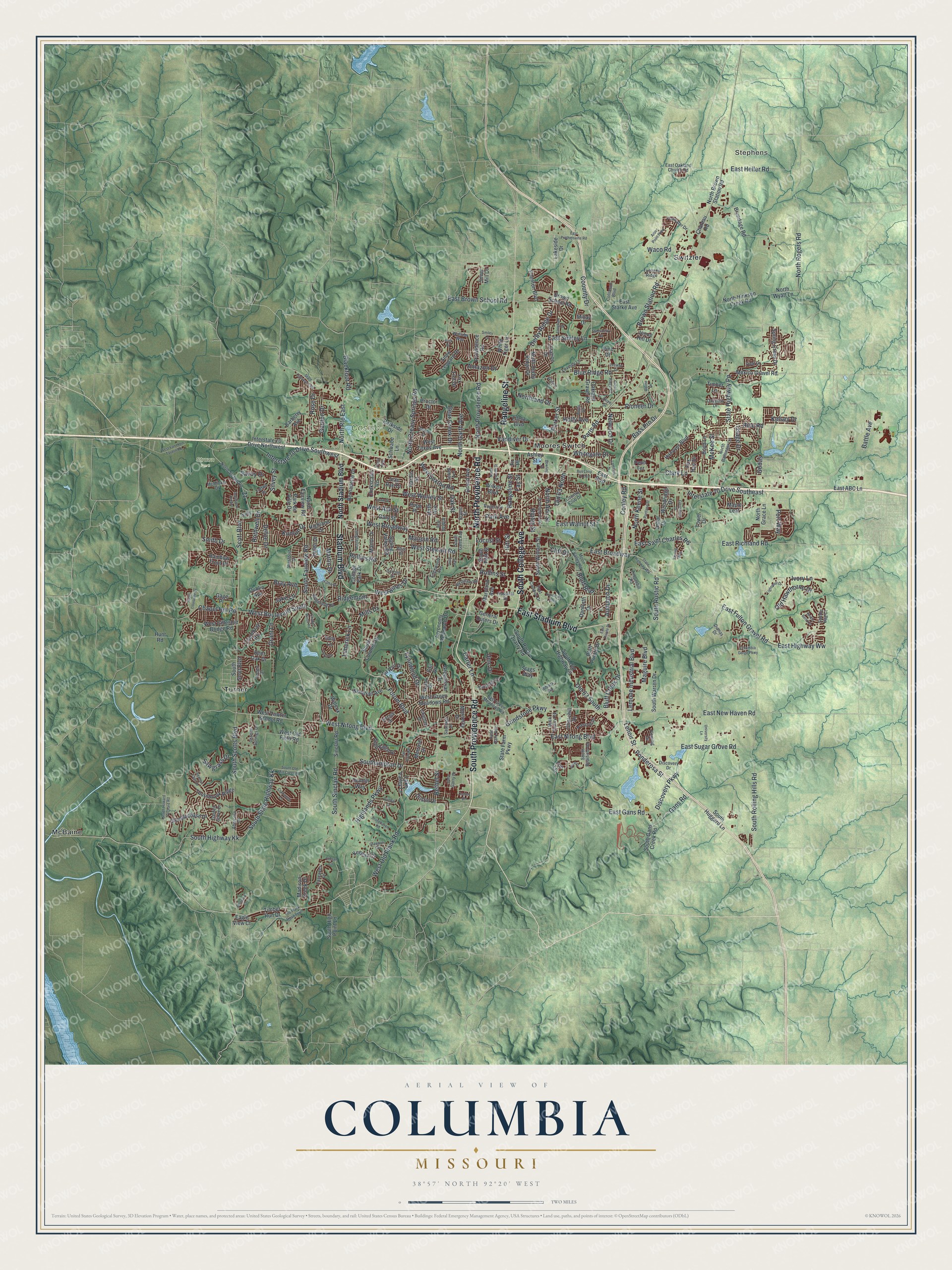
A new map of Columbia, Missouri, made in 2026 and printed to order on thick archival matte paper.
12" x 18" Archival Matte Print
A Map of Home. A Work of Art.
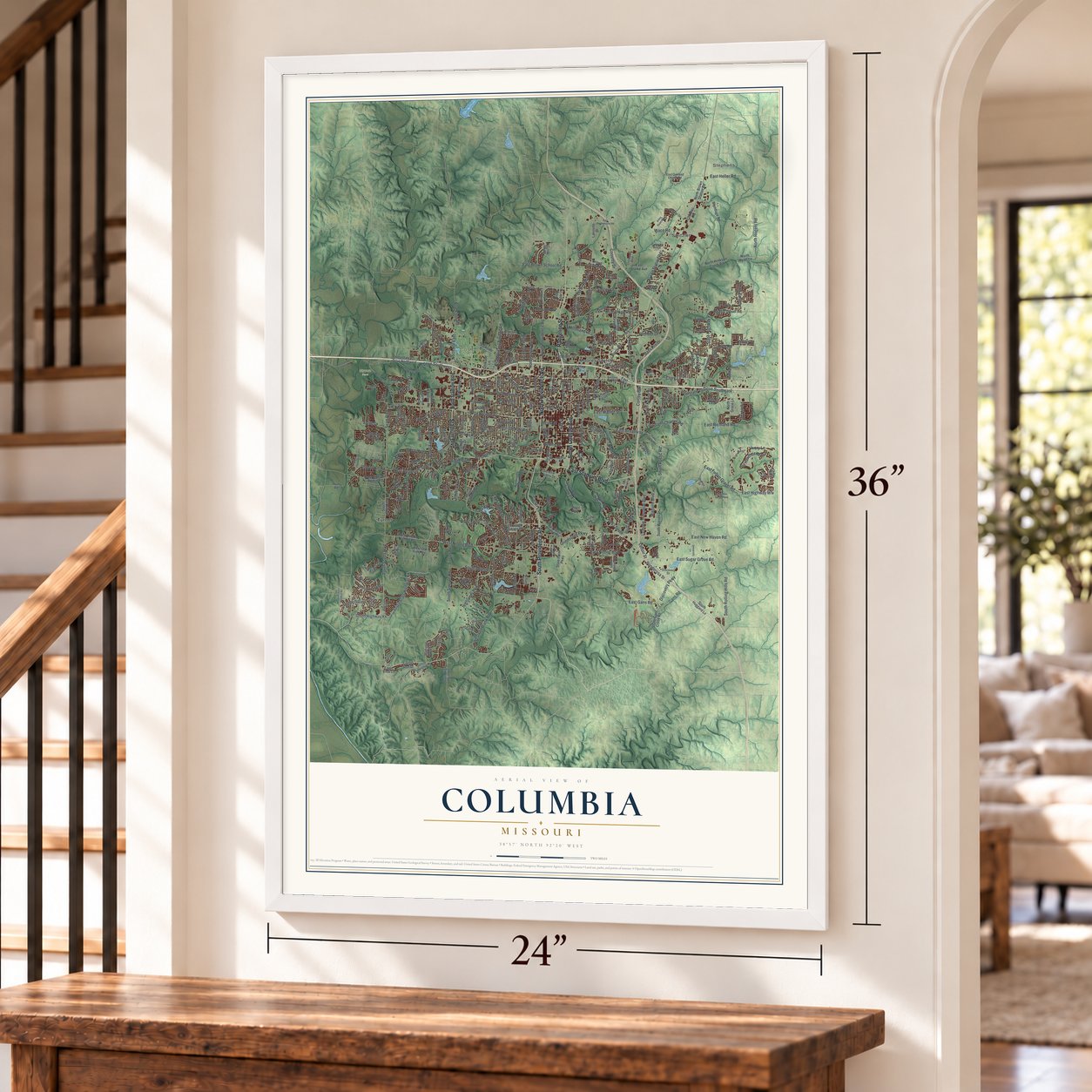
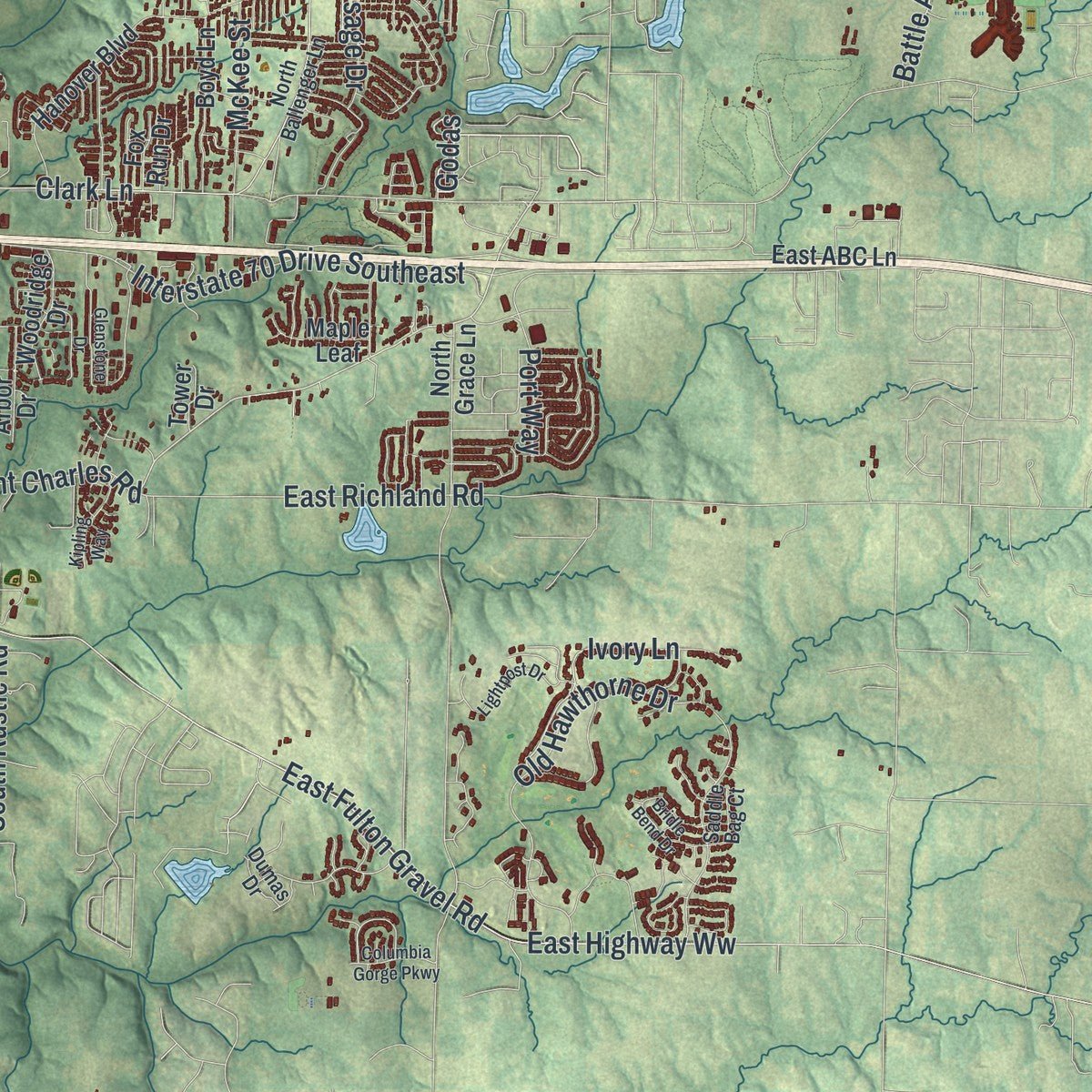
Explore Columbia, Missouri from a whole new perspective. Created using aerial imagery and detailed geographic data, this map captures Columbia building by building, with labeled streets, familiar landmarks, and shaded topographical relief that highlights the natural contours of the landscape.
Combining modern data with the timeless character of a vintage atlas, this map is just as interesting up close as it is beautiful on the wall. Whether you grew up in Columbia, spent memorable years there, or call it home today, this unique map is a great way to celebrate a place that means something to you. Zoom in on the preview to look for your street, and then order a print to put your memories on the wall.
Three ways to hang it
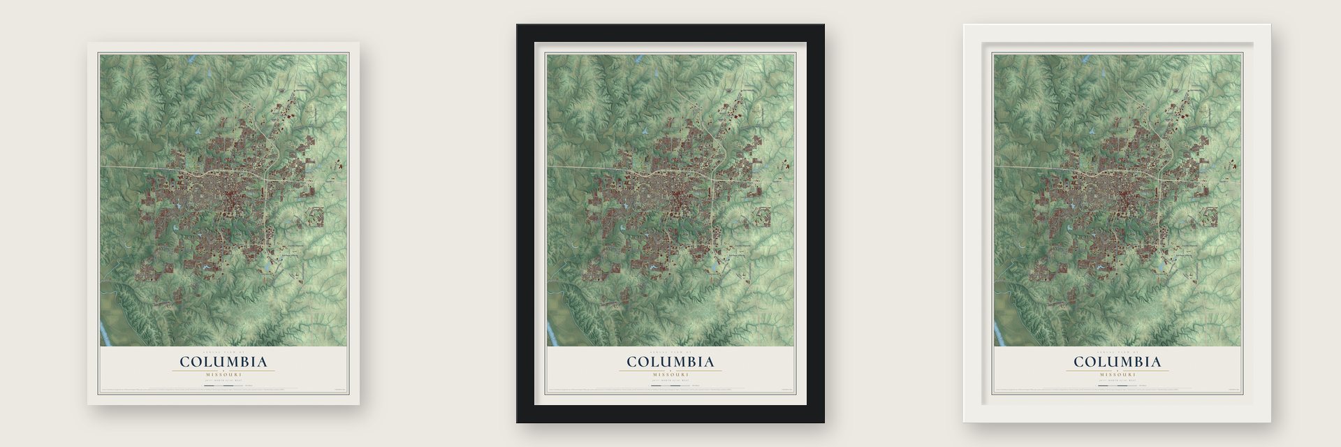
Unframed archival matte, a black wood frame or a white wood frame.
Up close
Geography Worth Displaying
This map was created using accurate cartographic data and authoritative geographic sources, including the U.S. Geological Survey and the Census Bureau. The map brings together terrain, waterways, roads, and building detail. The majority of the streets are labeled, houses are accurately depicted, and the topography is derived from government sources. Combining local data with carefully composed color and shading leads to this beautifully detailed Columbia artwork for your wall.
Rather than simply showing street outlines, we’ve included as many of the street names as we could reasonably fit on the map while keeping their names legible. Zoom in on the high resolution preview to see exactly what’s on the map. We truly set out to create a statement piece for anyone who loves Columbia. So whether it’s for you, or a gift for someone you love, we hope this map of Columbia brings back fond memories.
Read the story behind this map of Columbia, Missouri from 2026.

About Columbia, Missouri
Columbia is a city of 126,254 people and the county seat of Boone County, in the middle of Missouri. Pioneers from Kentucky and Virginia poured into the Boonslick after the War of 1812, traveling the Boone's Lick Road, and many brought enslaved African Americans with them. Expecting a new county and a county seat, the Smithton Land Company bought more than 2,000 acres and started the village of Smithton, near today's Walnut and Garth. By 1819 it was a few log cabins among old oak and hickory trees.
Smithton never grew past 20 people, and the bedrock made wells hard to dig. When springs turned up on the far side of Flat Branch Creek, Columbia was laid out there in the spring of 1821, and Smithton's residents moved their cabins over. That same year Columbia was picked as the seat of Boone County, which had been formed in 1820 and named for Daniel Boone, and the Boone's Lick Road was rerouted down Broadway.
- The first house, 1820Thomas Duly built Columbia's first house in 1820, at the spot that became Fifth and Broadway. Richard Gentry, a trustee of the Smithton Company whose cabin was the main one in the old village, went on to serve as Columbia's first mayor.
- Winning the state universityThe town's first plans set aside land for a state university. Columbia College, founded in 1839, later became the University of Missouri. When the legislature went looking for a site for its new university, the town's offer was three times bigger than any other city's, and James S. Rollins gave the land that is now the Francis Quadrangle.
- Missouri's first theater, 1832William Jewell opened Columbia's first hospital in 1822. A newspaper followed in 1830, the first theater in Missouri in 1832, and the state's first agricultural fair in 1835. Stagecoaches on the Santa Fe and Oregon Trails stopped here, and by 1839 only St. Louis County, which then held the city of St. Louis, topped Boone County's 13,000 people and its wealth.
- Colleges for womenColumbia Baptist Female College opened in 1833 and later became Stephens College. Christian Female College, the earliest women's college west of the Mississippi, grew into today's Columbia College.
- A Civil War Union baseMost of Columbia sided with the Union, while the farms of Boone County around it leaned Confederate. Union troops used the University of Missouri as a base, and their presence kept Confederate guerrillas away, so no battle was fought in the city. The big fights came nearby, at Boonville and Centralia.
Find your street
Names on the Columbia map
Every name below is printed on this map. Look for your street, your school, the park where you played, or the pond down the road.
Places and landmarks7
- Stephens
- Cosmo Park
- Strawn Park
- McBaine
- Moores Switch
- Switzler
- Turner
Streets and roads329
- South Providence Road
- North Providence Road
- Rangeline Street
- South College Avenue
- Stadium Boulevard
- East Stadium Boulevard
- East Nifong Boulevard
- West Nifong Boulevard
- Grindstone Parkway
- East New Haven Road
- Bethel Street
- East Smiley Lane
- Godas
- Grant Lane
- South Scotts Boulevard
- East Saint Charles Road
- Cliff Drive
- Ivory Lane
- Conley Road
- Paris Road
- West Boulevard South
- East Broadway
- Forum Boulevard
- Brown Station Road
- Interstate 70 Drive Southeast
- South Rolling Hills Road
- West Broadway
- Clark Lane
- Vandiver Drive
- Interstate 70 Drive Southwest
Show all 329 streets
- State Highway Pp
- Chapel Hill Road
- West Worley Street
- Old 63 South
- Rollins Road
- West Ash Street
- Blue Ridge Road
- South Sinclair Road
- Old Hawthorne Drive
- East Fulton Gravel Road
- East Walnut Street
- North Garth Avenue
- Southampton Drive
- Scott Boulevard
- East Richland Road
- North Route East
- East Highway Ww
- South Highway Kk
- South State Highway Kk
- Ponderosa Street
- North Creasy Springs Road
- North Rogers Road
- South Fairview Road
- Rice Road
- East Sugar Grove Road
- Derby Ridge Drive
- West Old Plank Road
- Highlands Parkway
- East Gans Road
- Maguire Boulevard
- Waco Road
- Lemone Industrial Boulevard
- Hitt Street
- Old 63 North
- Northland Drive
- East Brown School Road
- Bluff Creek Drive
- East Heller Road
- West Stewart Road
- Lynnwood Drive
- Smith Drive
- North Keene Street
- South Rustic Road
- Parker Street
- Rollins Street
- Park Avenue
- Bass Pro Drive
- Limerick Lane
- Silvey Street
- Defoe Drive
- Westwinds Drive
- Garden Drive
- Discovery Parkway
- Ridgemont
- Blackfoot Road
- West Sexton Road
- Rose Drive
- Locust Street
- Audubon Drive
- McKee Street
- Carter Lane
- Battle Avenue
- Sawgrass Drive
- Coounty Drive
- Mills Drive
- Nelwood Drive
- Bluff Boulevard
- North Ann Street
- Bear Creek Drive
- Whitegate Drive
- Lenoir Street
- Maupin Road
- Fay Street
- Holly Avenue
- Bray Avenue
- Kunlun Drive
- Jake Lane
- Kelsey Drive
- Rothwell Drive
- Oak Street
- Port Way
- Amazon Drive
- Osage Drive
- Pioneer Drive
- Gans Road
- Martin Drive
- Ripley Street
- Savoy Drive
- Umc Drive
- North Stadium Boulevard
- West Vawter School Road
- South Scott Boulevard
- Providence Road
- White Tiger Lane
- Snow Leopard Drive
- Silver Mill Drive
- Brown School Road
- Lakeside Drive
- Timber Run Drive
- South Rock Quarry Road
- Mexico Gravel Road
- North Hinkson Creek Road
- Interstate 70 Drive Northwest
- Oakland Gravel Road
- Bernadette Drive
- North Derby Ridge Drive
- South Gans Creek Road
- Clinkscales Road
- South Old Highway 63
- West Green Meadows Road
- West Gillespie Bridge Road
- Wilkes Boulevard
- North Fairview Road
- North Wyatt Lane
- Steeplechase Drive
- Proctor Drive
- Barberry Avenue
- Hulen Drive
- Katy Lane
- West Texas Avenue
- East Starke Avenue
- General Outers Drive
- Sinclair Road
- Chambray Road
- Thornbrook Ridge
- College Park Drive
- Hanover Boulevard
- Spring Cress Drive
- Churchill Drive
- South Fifth Street
- State Farm Parkway
- Glen Eagle Drive
- Agronomy Research Drive
- Parkside Drive
- Hardin Street
- South High Point Lane
- Brundage Road
- South Warren Drive
- South William Street
- Danforth Drive
- Maryland Avenue
- Woodrail Avenue
- North Brown Station Road
- Rainbow Trout Drive
- Hirth Avenue
- Lake Valley Lane
- Grand Avenue
- Edenton Boulevard
- Spring Valley Road
- South Colonial Drive
- Manor Drive
- Monterey Drive
- La Rail Drive
- Melrose Drive
- West Old Field Road
- Bluff Pointe Drive
- Highland Drive
- Woodridge Drive
- Keegan Court
- Madison Creek Drive
- East ABC Lane
- Schwabe Lane
- Boyd Lane
- Greenbriar Drive
- South Huggard Lane
- Arbor Drive
- Walcox Drive
- Elleta Boulevard
- North Grace Lane
- Dublin Avenue
- Gary Street
- Bent Oak Drive
- Citation Drive
- Jenne Hill Drive
- Park de Ville Drive
- Dustin Drive
- Chateau Road
- Eagle View Court
- Timber Lane
- Ashley Street
- Fox Trot Drive
- Jean Rae Drive
- Dunhill Way
- Hunt Road
- Fox Run Drive
- Penn Terrace
- Stags Way
- Gage Place
- Millay Drive
- Tower Drive
- Maple Leaf
- East Boulevard
- Pine Drive
- Hope Place
- Fir Place
- Vail Drive
- Zoe Lane
- East Green Meadows Road
- Cascades Drive
- Wallaby Way
- North Ballenger Lane
- South Bearfield Road
- North Strawn Road
- Sunset Drive
- Edgewood Avenue
- Rogers Street
- Ridgefield Road
- Rock Quarry Road
- Granite Springs Drive
- Timberhill Road
- East Campus Drive
- Longfellow Lane
- Country Club Drive
- Moon Valley Road
- Chatham Drive
- Hospital Drive
- Prescott Drive
- Garden Grove Drive
- South Garth Avenue
- Hunt Avenue
- East Oakland Church Road
- Huntridge Drive
- Flatwater Drive
- Bingham Road
- Skylark Drive
- Discovery Drive
- Lovejoy Lane
- Oakview Drive
- Abercorn Drive
- Coliseum Boulevard
- Jewell Avenue
- Andy Drive
- McMickle Drive
- Tuscany Ridge
- Santiago Drive
- Vintage Drive
- Westport Drive
- Fleming Drive
- Hyde Park Avenue
- Trefoil Drive
- Saddle Bag Court
- Rodeo Drive
- John Garry Drive
- Opal Drive
- Aldeah Avenue
- Dumas Drive
- Riback Road
- Bryant Street
- Olive Street
- Smiley Lane
- South Old Mill Creek Road
- State Highway East
- South Louisville Drive
- East Prathersville Road
- Jackson Street
- North Seventh Street
- North William Street
- Old Plank Road South
- South Howard Orchard Road
- State Highway Ww
- Arbor Point Parkway
- Crabapple Lane
- Stonehaven Road
- Reedsport Ridge
- Dunbar Drive
- Glenstone Drive
- Portland Street
- Lightpost Drive
- West Van Horn Tavern Road
- Ridge Road
- Langham Drive
- Green Ridge Road
- Fall River Drive
- University Lane
- Mace Drive
- Kipling Way
- Bowling Street
- Lloyd Drive
- Beacon Falls Drive
- East Pointe Drive
- Columbia Gorge Parkway
- Thornberry Drive
- Bridle Bend Drive
- Lambeth Drive
- Bus Loop 70 East
- Glasgow Drive
- Chapel Wood Road
- East Park Loop
- Chelan Circle
- Lowe Street
- Montauk Court
- Yuma Drive
- Leeway Drive
- Thilly Avenue
- Skylane Drive
- Center Drive
- Wales
- Alpine Drive
- Joey Drive
Names are listed as they appear on the printed map. Zoom into the product photos to find them.
The art of mapping a place
How This Map Was Made
Real places. Remarkable detail. Discover the layers that turn geographic data into a map of home.

The view from above
Aerial imagery reveals the character of the land: woodland, open fields, and the patterns of a place.

The shape of the land
Elevation data brings hills, valleys, and subtle changes in the landscape into view.

The details of home
Roads, waterways, and building footprints come together to make the map feel unmistakably local.

Geography becomes art
Considered color, shading, and typography bring the layers together in a map made for your wall.


Process illustrated with Mendon, Massachusetts. Aerial imagery: USDA NAIP. Terrain: USGS 3D Elevation Program. Map details and finished artwork: KNOWOL.
The Details
About This Print
Choose an archival matte print, or a black or white Ayous wood frame. The archival matte print is unframed.
Select your size and finish above to see the matching product image and price.
Materials & Craftsmanship
A contemporary map with the character of a classic atlas, printed on archival matte paper. Optional frames are made from Ayous wood.
Your printed map does not include the watermark shown in the full-map preview.
Shipping & Delivery
Free shipping within the United States. Every print is made to order in the USA.
Buying a gift? Add a note in your cart and we'll include it. We never put prices in the package.
Prints ship within 2 to 3 business days. Allow 7 to 10 days total from ordering for delivery. Timing may vary during holidays or periods of high order volume.
Read our shipping policy.
Returns and damaged prints
Each print is made to order. Change-of-mind refunds are not available after production.
If your print arrives damaged, misprinted or incorrect, contact support@knowol.com within 30 days of receiving it. Include your order number, photos and a description of the issue.
Read our full refund and replacement policy. For questions about your order, email support@knowol.com.
Find your town
Looking for another city?
Find a map of home in our Missouri collection, or any town in the country.
Nearby
Maps of towns near Columbia
Know someone from one of these towns? Their map makes a great gift.
 Pierpont
, Missouri
From $39.99See the map
 McBaine
, Missouri
From $39.99See the map
 Huntsdale
, Missouri
From $39.99See the map
More maps nearby: Lupus, Ashland, Wooldridge, Rocheport and Hallsville.