
Search for another town


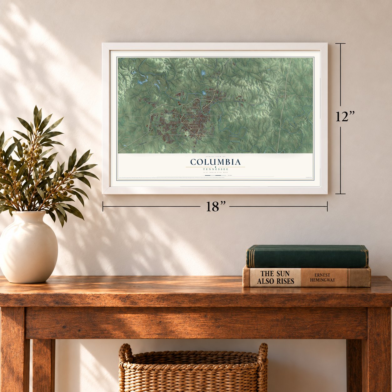

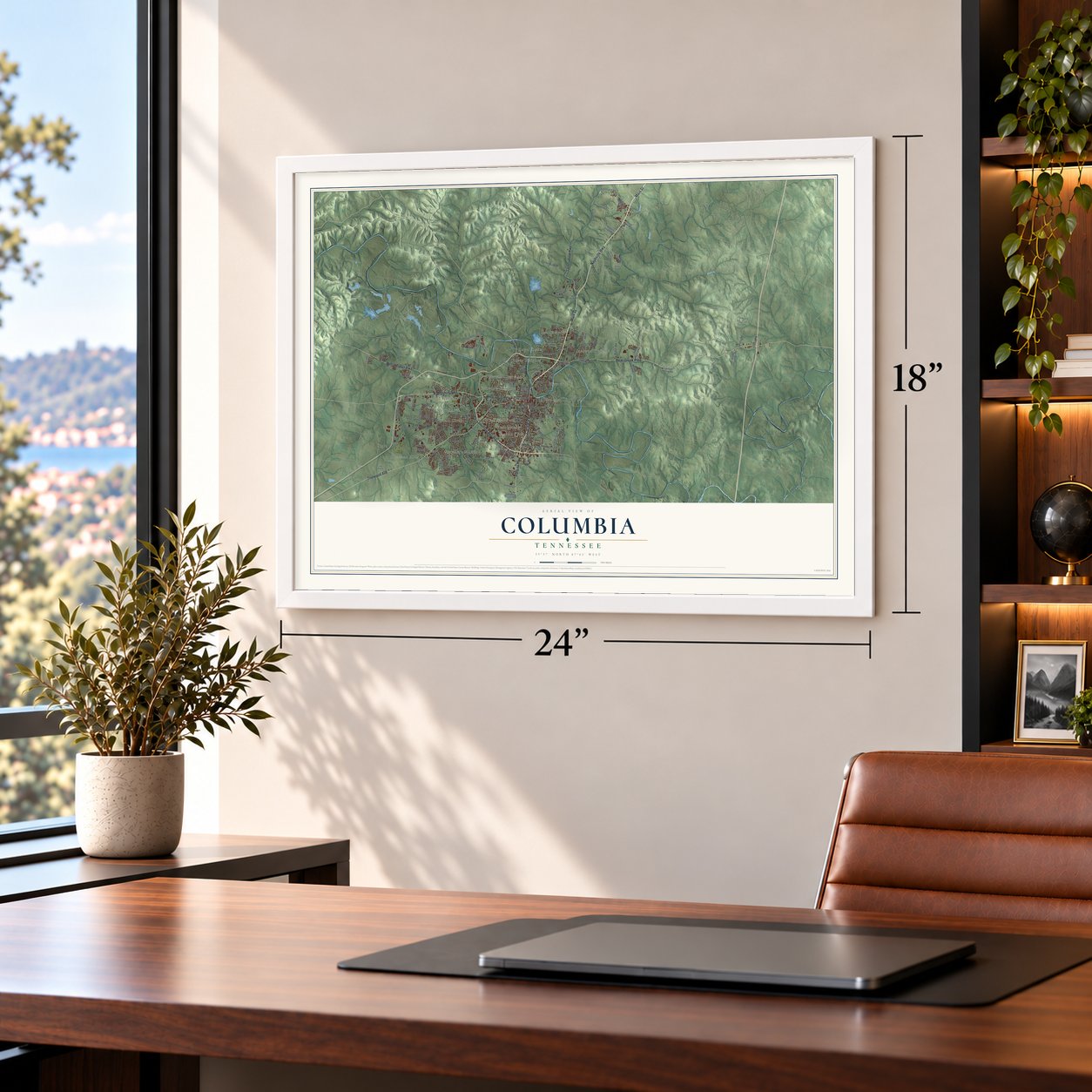

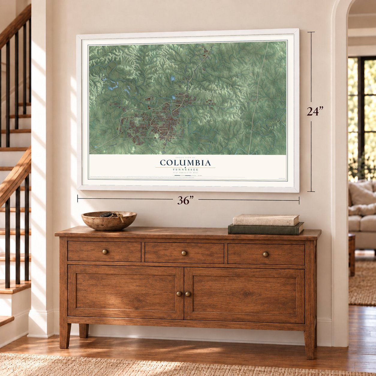

Free U.S. delivery 7 to 10 days after you order
Columbia, Tennessee Map Art
A new map of Columbia, Tennessee, made in 2026 and printed to order on thick archival matte paper.
12" x 18" Archival Matte Print
A Map of Home. A Work of Art.
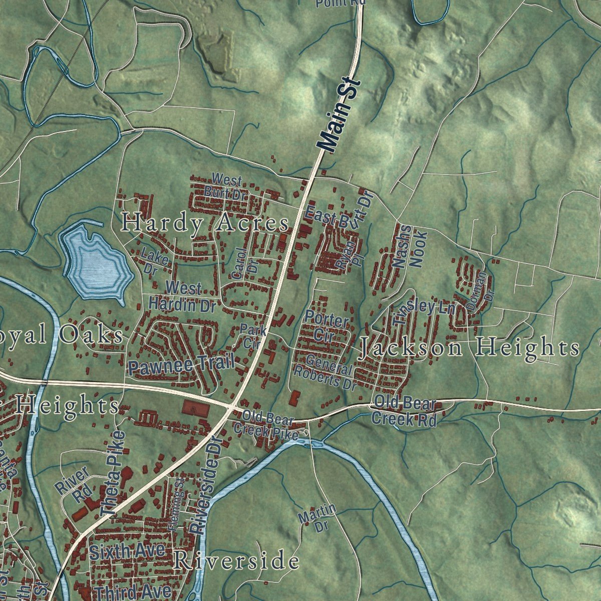
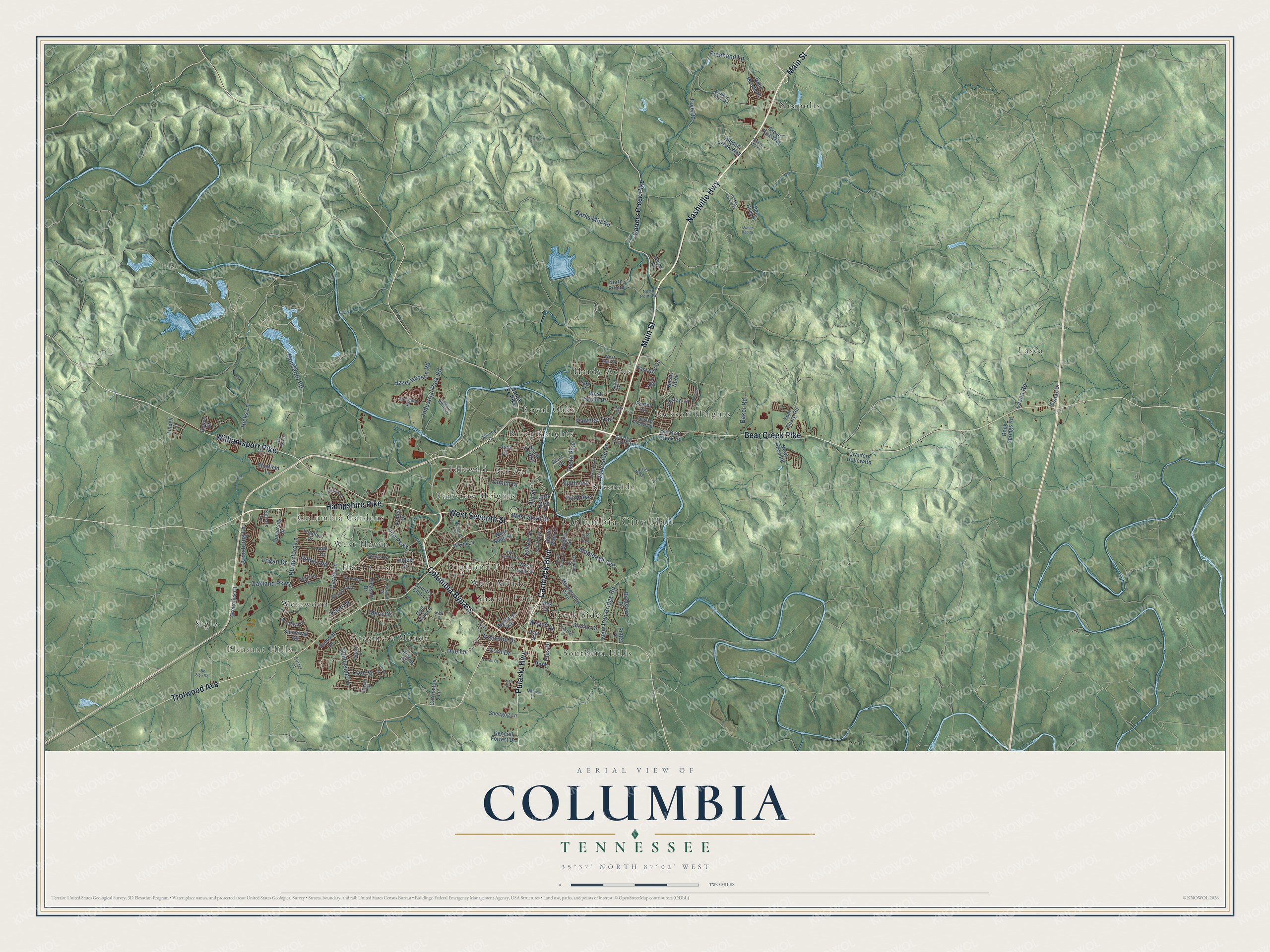
Explore Columbia, Tennessee from a whole new perspective. Created using aerial imagery and detailed geographic data, this map captures Columbia building by building, with labeled streets, familiar landmarks, and shaded topographical relief that highlights the natural contours of the landscape.
Combining modern data with the timeless character of a vintage atlas, this map is just as interesting up close as it is beautiful on the wall. Whether you grew up in Columbia, spent memorable years there, or call it home today, this unique map is a great way to celebrate a place that means something to you. Zoom in on the preview to look for your street, and then order a print to put your memories on the wall.
Three ways to hang it
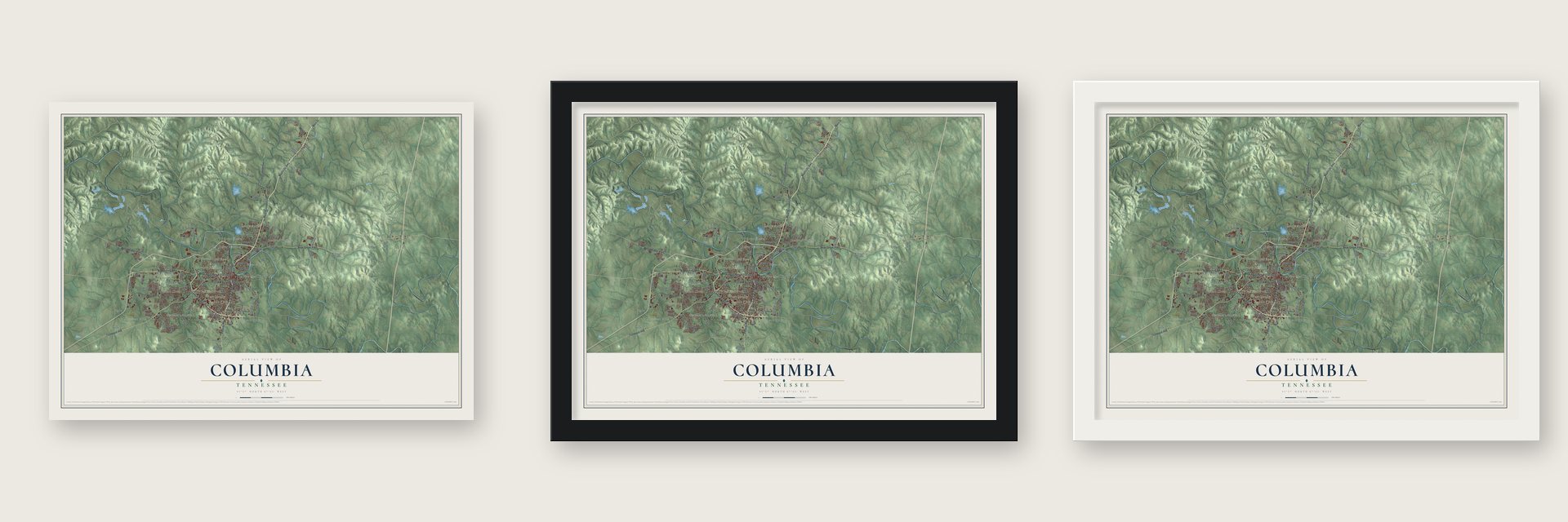
Unframed archival matte, a black wood frame or a white wood frame.
Up close
Geography Worth Displaying
This map was created using accurate cartographic data and authoritative geographic sources, including the U.S. Geological Survey and the Census Bureau. The map brings together terrain, waterways, roads, and building detail. The majority of the streets are labeled, houses are accurately depicted, and the topography is derived from government sources. Combining local data with carefully composed color and shading leads to this beautifully detailed Columbia artwork for your wall.
Rather than simply showing street outlines, we’ve included as many of the street names as we could reasonably fit on the map while keeping their names legible. Zoom in on the high resolution preview to see exactly what’s on the map. We truly set out to create a statement piece for anyone who loves Columbia. So whether it’s for you, or a gift for someone you love, we hope this map of Columbia brings back fond memories.
Read the story behind this map of Columbia, Tennessee from 2026.

About Columbia, Tennessee
Columbia is a city of 41,690 people and the county seat of Maury County, on the Duck River near the southern edge of the Nashville Basin. Maury County was organized in 1807, and a year later surveyors laid out Columbia and sold its first lots. The original town covered just four blocks on the river's south bank, and it was incorporated in 1817.
Jackson College opened here in 1837. During the Civil War, Union troops burned the college along with most of Columbia. The town recovered, and by the 1940 census it had 10,579 people, more than 3,000 of them African American. During World War II, phosphate mining and chemical plants grew quickly in Columbia to supply the war effort.
- The 1946 Columbia Race RiotOn February 25, 1946, James Stephenson, a Black Navy veteran, fought back when a white apprentice hit him. As a white mob gathered, Black residents armed themselves to guard the Bottom, their business district. The Highway Patrol raided it and rounded up more than 100 Black residents. Thurgood Marshall led the defense; an all-white Lawrenceburg jury acquitted all but two men, whose charges were then dropped.
- Mule Day every AprilColumbia calls itself the mule capital of the world and holds Mule Day each April. No other Tennessee county has as many antebellum houses as Maury County.
- A college first in 1966In 1966, Columbia State Community College became the state's first community college. President Lyndon B. Johnson and Lady Bird Johnson dedicated its new campus on March 15, 1967, and the President stopped briefly at the Polk home during the visit.
Find your street
Names on the Columbia map
Every name below is printed on this map. Look for your street, your school, the park where you played, or the pond down the road.
Places and landmarks23
- Columbia City Hall
- Pleasant Hills
- Bel Air
- Columbia Gardens
- Creek Side
- Fairview Heights
- Field Crest
- Graymere Manor
- Hardy Acres
- Highland Park
- Idlewild
- Jackson Heights
Show all 23 places
- Lasea
- Neapolis
- River Heights
- Riverside
- Royal Oaks
- Sharon Park
- Siglo
- Southern Hills
- West Haven
- West Meade
- Westwood
Streets and roads142
- Nashville Highway
- Hampshire Pike
- Carmack Boulevard
- West Seventh Street
- Columbia Bypass
- Trotwood Avenue
- Main Street
- Bear Creek Pike
- Williamsport Pike
- Pulaski Highway
- Freehand Lane
- Monsanto Road
- Lion Parkway
- Ashwood Drive
- New Iron Bridge Road
- Cayce Lane
- Theta Pike
- Rutherford Lane
- Industrial Park Road
- Baker Road
- Riverside Drive
- Sunnyside Lane
- Mapleash Avenue
- Armstrong Lane
- Oakland Parkway
- Lasea Road
- West Sixth Street
- Hicks Lane
- Frye Road
- Hazel Hanson Road
Show all 142 streets
- Robert Road
- Darks Mill Road
- Park Plus Drive
- School Street
- Due Lane
- Pawnee Trail
- Lyon Street
- Hill Street
- Cord Drive
- Sixth Avenue
- Mere Drive
- Logan Drive
- Third Avenue
- Knud Drive
- Clinch Drive
- Wayne Street
- Carters Creek Pike
- Polk Drive
- Country Club Lane
- South Main Street
- Mooresville Pike
- Highland Avenue
- Potter Drive
- River Road
- Santa Fe Pike
- West Ninth Street
- Pleasant Drive
- Hilltop Drive
- Bee Hive Drive
- University Drive
- Tom Sharp Road
- Carrington Lane
- Antrim Circle
- Wkrm Lane
- North High Street
- Cranford Hollow Road
- Stonewall Road
- East Burt Drive
- Tinsley Lane
- Grove Park Way
- Bradshaw Drive
- Greenlick Court
- West 14th Street
- Porter Circle
- Hidden Creek Way
- Rock Springs Road
- Golf Club Lane
- London Drive
- Sheegog Lane
- Bridge Street
- Newt Hood Road
- Nashs Nook
- Old Bear Creek Road
- Spears Lane
- Dyer Street
- General Forrest Drive
- West Hardin Drive
- Azalea Drive
- Skyline Drive
- Halifax Drive
- Belle Meade Place
- Sheffield Lane
- Tindell Lane
- Camelot Drive
- Joel Drive
- Lenox Drive
- Rodeo Drive
- North Pointe
- Avra Court
- Old Bear Creek Pike
- Woods Drive
- Martin Drive
- Lawson White Drive
- South High Street
- Carters Creek Road
- Aberdeen Court
- West Burt Drive
- General Roberts Drive
- Winning Drive
- North Point Road
- Jewell Drive
- Carol Drive
- Oakview Drive
- Westwood Drive
- Westfield Drive
- Cowan Street
- Walnut Drive
- Graham Street
- Park Circle
- Ryan Place
- Lake Drive
- Foster Lane
- Pillow Drive
- Honey Farm Way
- East End Street
- West Twelfth Street
- South Glade Street
- Fleming Street
- Leah Drive
- Academy Lane
- Skyview Drive
- Greens Mill Road
- Windsor Drive
- Morrow Lane
- Chestnut Drive
- Queen Bee Drive
- Old Zion Road
- Oak Park Drive
- Crowe Street
- Lovell Court
- Dorman Drive
- Aster Drive
Names are listed as they appear on the printed map. Zoom into the product photos to find them.
The art of mapping a place
How This Map Was Made
Real places. Remarkable detail. Discover the layers that turn geographic data into a map of home.

The view from above
Aerial imagery reveals the character of the land: woodland, open fields, and the patterns of a place.

The shape of the land
Elevation data brings hills, valleys, and subtle changes in the landscape into view.

The details of home
Roads, waterways, and building footprints come together to make the map feel unmistakably local.

Geography becomes art
Considered color, shading, and typography bring the layers together in a map made for your wall.


Process illustrated with Mendon, Massachusetts. Aerial imagery: USDA NAIP. Terrain: USGS 3D Elevation Program. Map details and finished artwork: KNOWOL.
The Details
About This Print
Choose an archival matte print, or a black or white Ayous wood frame. The archival matte print is unframed.
Select your size and finish above to see the matching product image and price.
Materials & Craftsmanship
A contemporary map with the character of a classic atlas, printed on archival matte paper. Optional frames are made from Ayous wood.
Your printed map does not include the watermark shown in the full-map preview.
Shipping & Delivery
Free shipping within the United States. Every print is made to order in the USA.
Buying a gift? Add a note in your cart and we'll include it. We never put prices in the package.
Prints ship within 2 to 3 business days. Allow 7 to 10 days total from ordering for delivery. Timing may vary during holidays or periods of high order volume.
Read our shipping policy.
Returns and damaged prints
Each print is made to order. Change-of-mind refunds are not available after production.
If your print arrives damaged, misprinted or incorrect, contact support@knowol.com within 30 days of receiving it. Include your order number, photos and a description of the issue.
Read our full refund and replacement policy. For questions about your order, email support@knowol.com.
Find your town
Looking for another city?
Find a map of home in our Tennessee collection, or any town in the country.
Nearby
Maps of towns near Columbia
Know someone from one of these towns? Their map makes a great gift.
 Mount Pleasant
, Tennessee
From $39.99See the map
 Spring Hill
, Tennessee
From $39.99See the map
 Thompson's Station
, Tennessee
From $39.99See the map
More maps nearby: Lynnville, Lewisburg, Chapel Hill, Summertown and Cornersville.