
Search for another town




Free U.S. delivery 7 to 10 days after you order
Converse, Texas Map Art
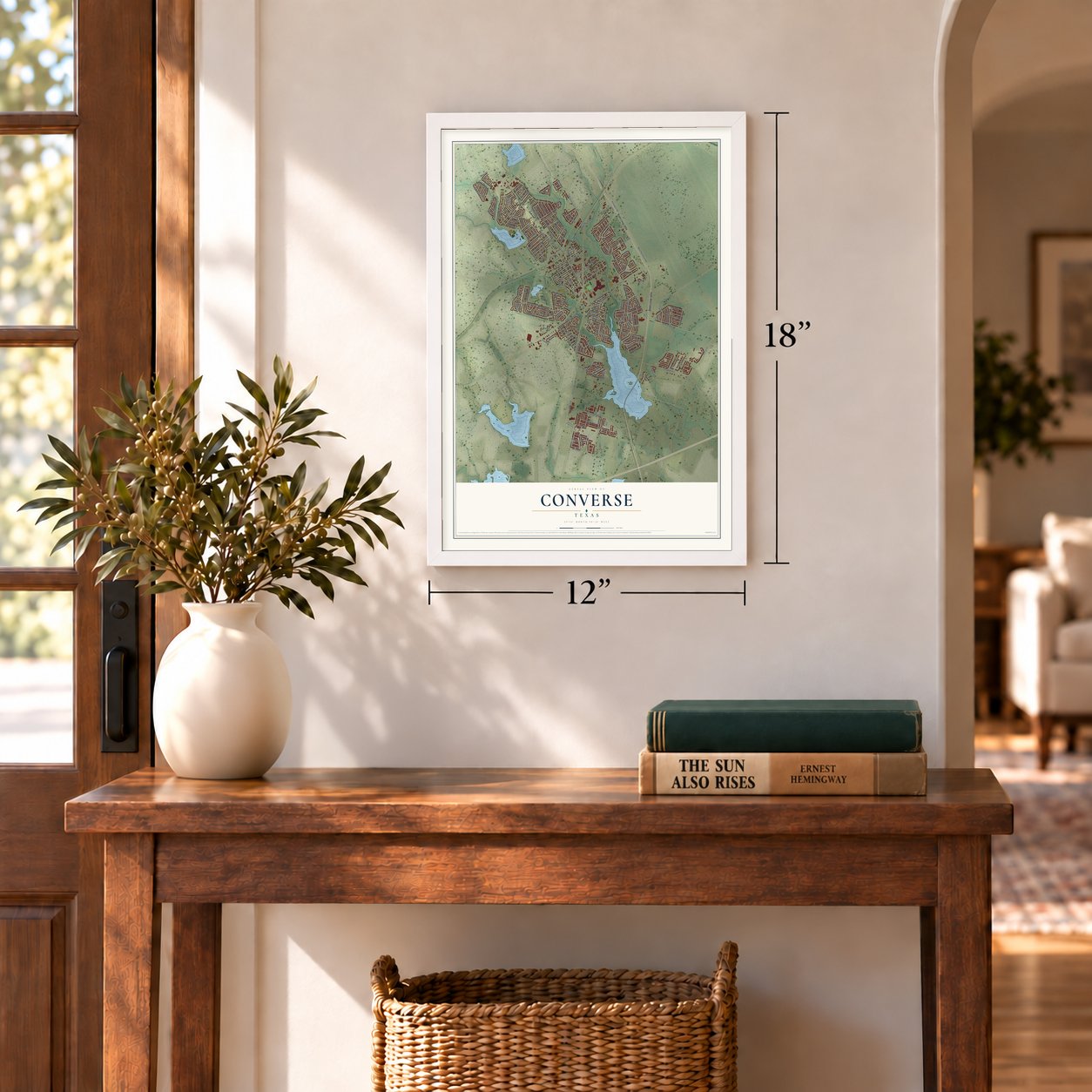
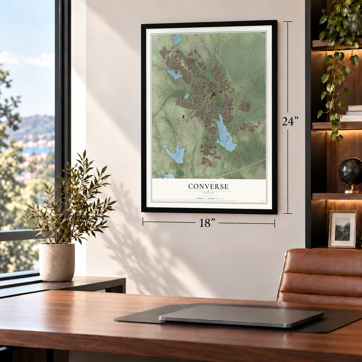
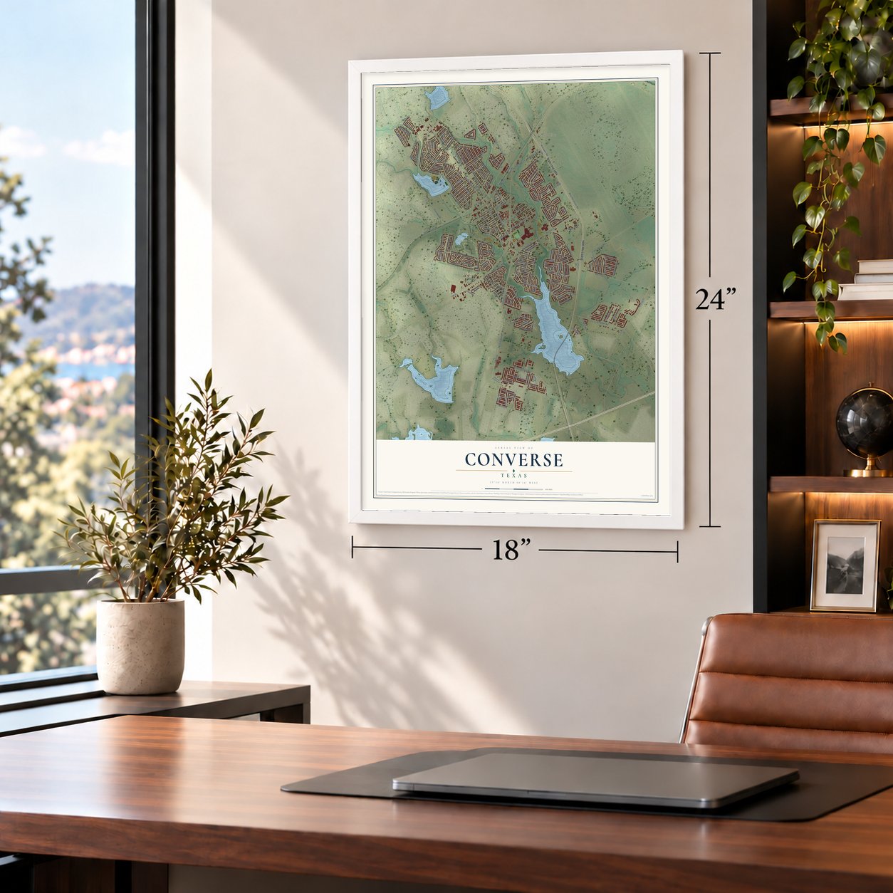
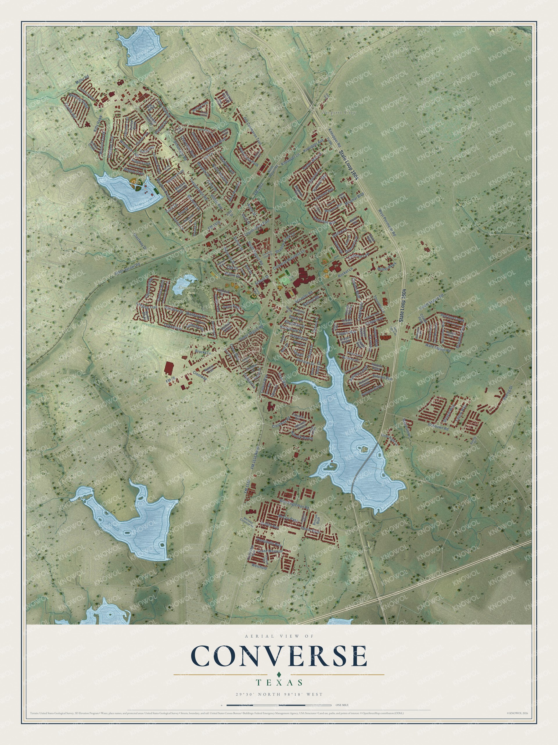
A new map of Converse, Texas, made in 2026 and printed to order on thick archival matte paper.
12" x 18" Archival Matte Print
A Map of Home. A Work of Art.
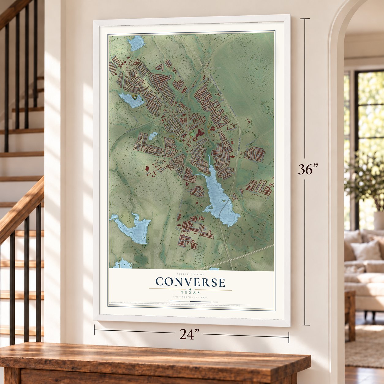
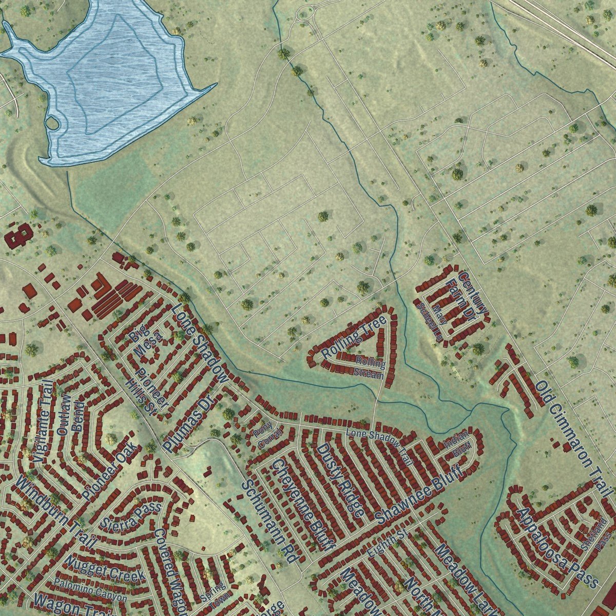
This beautifully detailed map of Converse, Texas was created in 2026 using aerial imagery combined with modern topographical, census, street and landmark data. It's a modern aerial view of Converse in Bexar County, Texas, that combines modern data with a vintage aesthetic. Zoom in on the preview and look for your block.
Three ways to hang it
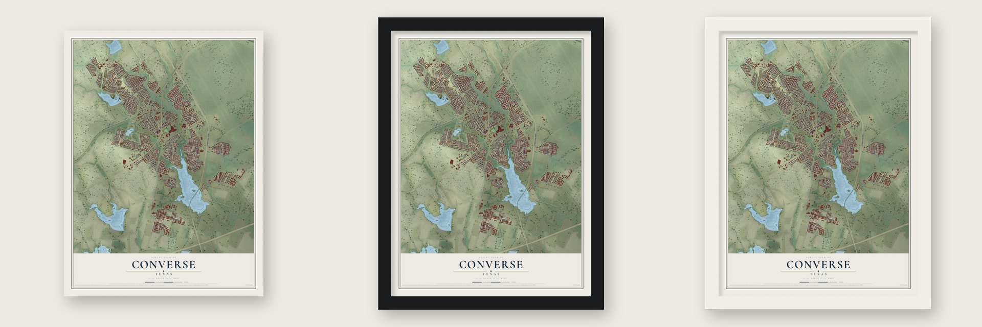
Unframed archival matte, a black wood frame or a white wood frame.
Up close
Real geography. Art worth displaying.
This map was created using accurate cartographic data and authoritative geographic sources, including the U.S. Geological Survey and the Census Bureau. The map brings together terrain, waterways, roads, and building detail. The majority of the streets are labeled, houses are accurately depicted, and the topography is derived from government sources. Combining local data with carefully composed color and shading leads to this beautifully detailed Converse artwork for your wall.
Rather than simply showing street outlines, we’ve included as many of the street names as we could reasonably fit on the map while keeping their names legible. Zoom in on the high resolution preview to see exactly what’s on the map. We truly set out to create a statement piece for anyone who loves Converse. So whether it’s for you, or a gift for someone you love, we hope this map of Converse brings back fond memories.
Read the story behind this map of Converse, Texas from 2026.

About Converse, Texas
Converse is a city in Bexar County, northeast of downtown San Antonio. Its name recalls Major Converse, a Southern Pacific Railroad chief engineer who purchased land containing the townsite in 1877. From a community associated with German farmers, Converse grew into a San Antonio suburb with 27,466 residents counted in 2020.
- Early Post OfficeA post office began serving Converse in 1878, and the reported population reached 30 by 1885.
- Town CommerceBy 1896, local businesses included one saloon, two cotton gins, and a grocery.
- Cultural TraditionsThe Salatrillo Liederkranz singing society remained active for many years, while Converse reportedly had Texas's oldest 4-H Club in 1990.
- Population GrowthThe population rose from 8,887 in 1990 to 11,508 in 2000, when 390 businesses were recorded.
Find your street
Names on the Converse map
Every name below is printed on this map. Look for your street, your school, the park where you played, or the pond down the road.
Places and landmarks6
- Airport City
- Converse City Park
- Cambridge Park
- Gander Park
- Thackes Park
- Bismarck Lake
Streets and roads206
- State Loop 1604
- FM 1516
- South Seguin Road
- Kneupper Road
- FM 3502
- Talkenhorn
- Cherry Glade
- Kneupper Avenue
- Kneupper Lane
- Anderson Way
- Copper Cv
- Tranquil Lane
- Copper Mist
- FM 78
- FM 1516 North
- Hanover Cv
- Stearin Way
- Moffet Parkway
- Flatland Trail
- Hanover Sky
- Jeanette Drive
- Oak Drive
- FM 1976
- Toepperwein Road
- Gibbs Sprawl Road
- Ware Seguin Road
- West Perimeter Road
- Lower Seguin Road
- Windburn Trail
- Crestway Drive
Show all 206 streets
- Graytown Road
- Red Iron Creek
- Coppergate
- Old Cimmaron Trail
- Kitty Hawk
- Boenig Drive
- Manderly Place
- Meadow Lark
- Schaefer Road
- Lone Shadow
- Thornton Lane
- Autumn Run
- Crestway Road
- Rocket Lane
- Binz-Engleman Road
- Donalan Drive
- Station Street
- Schumann Road
- Shawnee Bluff
- Copperway
- Hilltop Avenue
- Converse Business Lane
- Patsy Drive
- Mustang Ridge
- Mesquite Street
- Meadow Branch
- Willow Drive
- Upper Seguin Road
- Weichold
- Janice Lane
- Cantura Mills
- Michelle Drive
- Diana Drive
- Harbor Mist Lane
- Wagon Train
- Devils River
- Shadow Creek Lane
- Meadow Drive
- Miller Road
- Mission Creek
- Justice Lane
- Dolly Drive
- North Meadow
- Legion Drive East
- Grand Western
- Common Law
- Titan Way
- Discovery Drive
- Coyote Hill
- Kingsman Street
- Lookover Bay
- Appaloosa Pass
- Brigadier Pass
- Donshire Drive
- Kerrybrook Drive
- McCoy Pass
- Tallow Way
- Royal Drive
- Dana Drive
- Portobello Way
- Coers Boulevard
- Griffith Run
- Autumn Ledge
- Dusty Ridge
- Brucks Lane
- Cetera Way
- Cheyenne Bluff
- Waverunner
- Copper Bluff
- Erna Drive
- Nubuck Ranch
- Grimchester
- North Street
- Ralston Road
- Miramar Boulevard
- Autumn Arbor
- Plumas Drive
- Longing Trail
- Parry Path
- Autumn Place
- Copper Mdw
- Opus Lane
- Ash Drive
- Gavel Drive
- Crestway
- Ann Drive
- School Street
- Abigail
- Copper Rock
- Tuttle
- Nature Trail
- Gavel Gate
- North Seguin Road
- Slumber Street
- Autumn Dawn
- Copper Sands
- Boatman Pier
- Macarthur Way
- Pioneer Oak
- Citadel Peak
- Vigilante Trail
- Laurel Creek
- Outlaw Bend
- Covered Wagon
- Bennett Forest
- Cold Mountain
- Meadow Forge
- Autumn Valley
- Reba
- Deborah Drive
- Misty Meadows
- Meadow Burst Drive
- Pioneer Hills Street
- Mediator Run
- Quiet Night Lane
- Nugget Creek
- Sleepy Street
- Rolling Tree
- Gateway Street
- Renee Drive
- Big Mesa
- Copper Kettle
- Sierra Pass
- Copper Brook
- Belmede Court
- Jaybrook Drive
- Brenda Drive
- Daulton Ridge
- Scenic Creek
- Wolff Vis
- Briscoe Bluff
- Krier Court
- South Street
- Myrtle Glade
- Copper Estate
- Century Farm Drive
- First Street
- Chestnut Manor Drive
- Copper Palm
- Brisbane
- Avenue East
- Martinez Converse Road
- Eighth Street
- Coppercreek
- Brisbane Bend
- Espadrille Run
- Longhorn River
- Bulwark Peak
- Copper Rose
- Thorpe Hollow
- Stout Way
- Vivian Drive
- Downing Street
- Elm Drive
- Boeing Drive
- Voir Dire
- Shetland Pass
- Lone Shadow Trail
- Palomino Canyon
- Colina Way
- Dakota River
- Autumn Acres
- Pensive Drive
- Spring Town
- Converse Center Street
- Rolling Stream
- Lucille
- Anderson Court
- Mary Scheel Lane
- Ware Sequin Road
- Indian Bluff
- Mayfair Drive
- Dennis Jupe
- Krier Vw
- Pony Corral
- Kelly Avenue
Names are listed as they appear on the printed map. Zoom into the product photos to find them.
The art of mapping a place
How This Map Was Made
Real places. Remarkable detail. Discover the layers that turn geographic data into a map of home.

The view from above
Aerial imagery reveals the character of the land: woodland, open fields, and the patterns of a place.

The shape of the land
Elevation data brings hills, valleys, and subtle changes in the landscape into view.

The details of home
Roads, waterways, and building footprints come together to make the map feel unmistakably local.

Geography becomes art
Considered color, shading, and typography bring the layers together in a map made for your wall.


Process illustrated with Mendon, Massachusetts. Aerial imagery: USDA NAIP. Terrain: USGS 3D Elevation Program. Map details and finished artwork: KNOWOL.
The Details
About This Print
Choose an archival matte print, or a black or white Ayous wood frame. The archival matte print is unframed.
Select your size and finish above to see the matching product image and price.
Materials & Craftsmanship
A contemporary map with the character of a classic atlas, printed on archival matte paper. Optional frames are made from Ayous wood.
Your printed map does not include the watermark shown in the full-map preview.
Shipping & Delivery
Free shipping within the United States. Every print is made to order in the USA.
Buying a gift? Add a note in your cart and we'll include it. We never put prices in the package.
Prints ship within 2 to 3 business days. Allow 7 to 10 days total from ordering for delivery. Timing may vary during holidays or periods of high order volume.
Read our shipping policy.
Returns and damaged prints
Each print is made to order. Change-of-mind refunds are not available after production.
If your print arrives damaged, misprinted or incorrect, contact support@knowol.com within 30 days of receiving it. Include your order number, photos and a description of the issue.
Read our full refund and replacement policy. For questions about your order, email support@knowol.com.
Find your town
Looking for another city?
Find a map of home in our Texas collection.
Nearby
Maps of towns near Converse
Know someone from one of these towns? Their map makes a great gift.
 Randolph AFB
, Texas
From $39.99See the map
 Universal City
, Texas
From $39.99See the map
 Live Oak
, Texas
From $39.99See the map
More maps nearby: Windcrest, Schertz, Selma, Kirby and Cibolo.