
Search for another town





Free U.S. delivery 7 to 10 days after you order
Conway, Arkansas Map Art
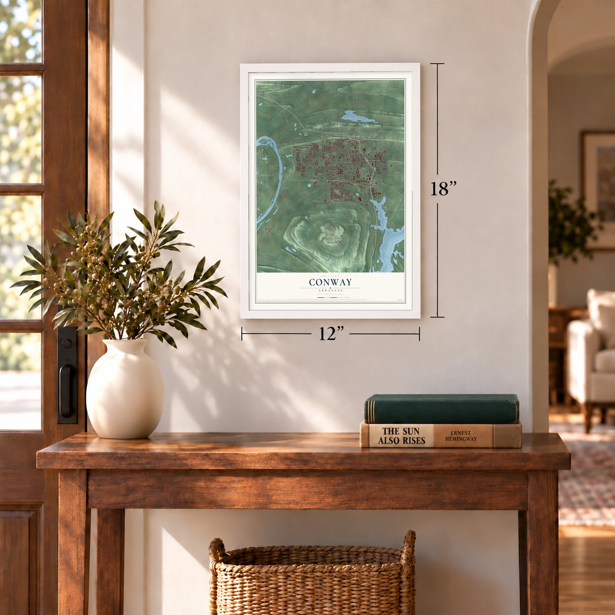
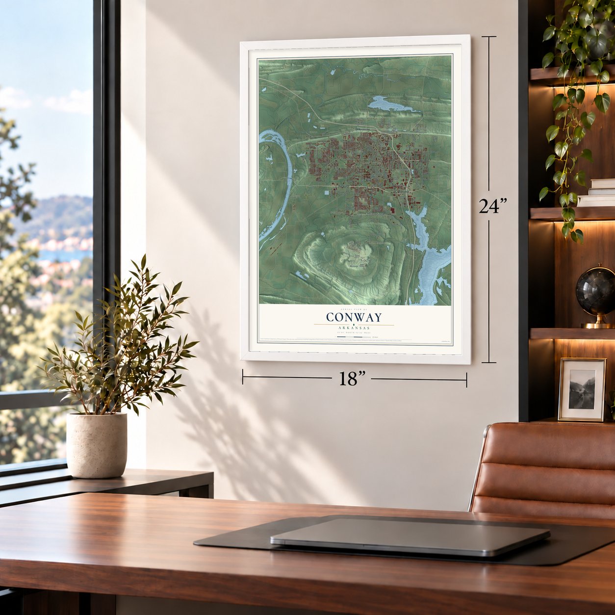
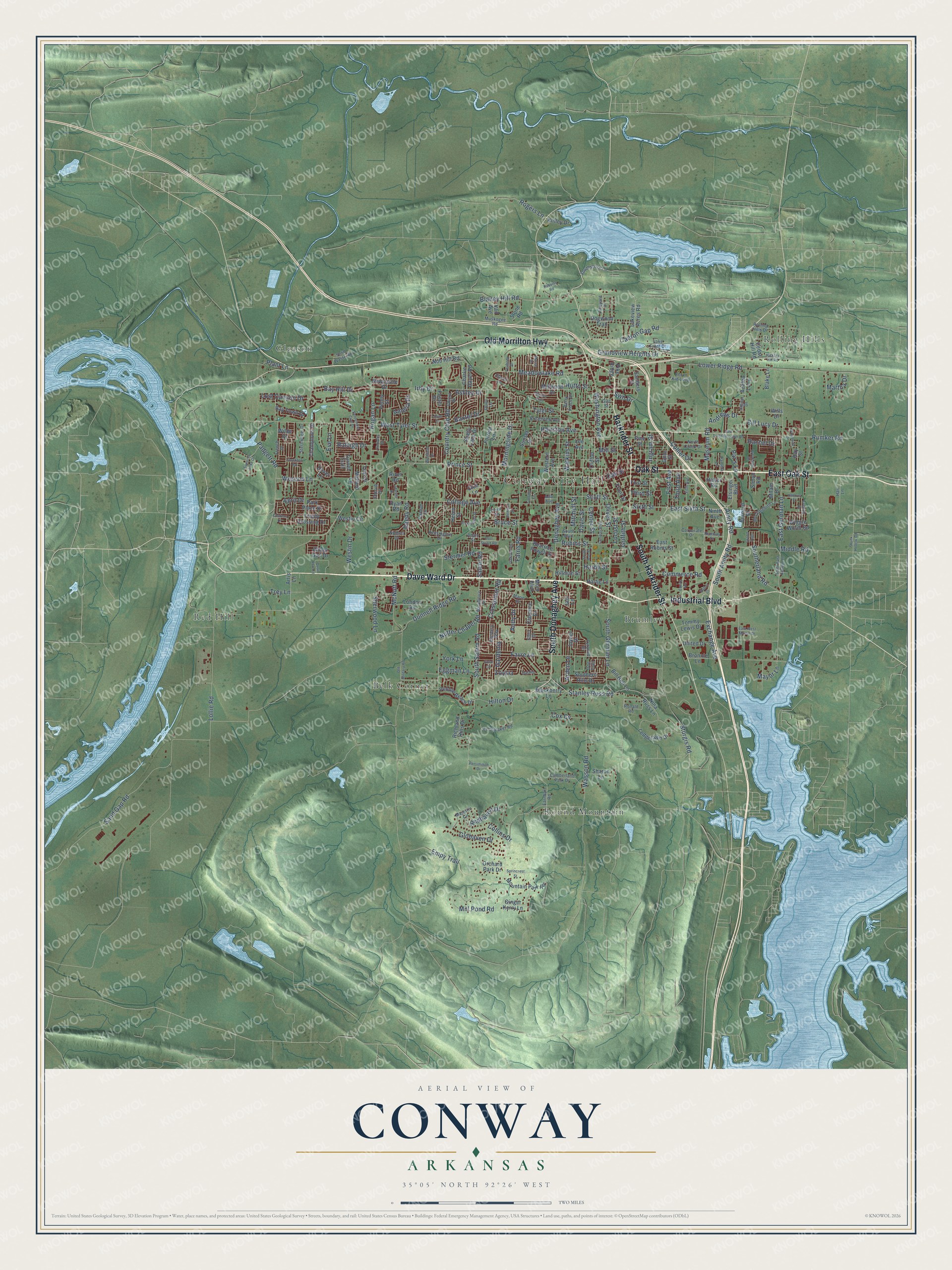
A new map of Conway, Arkansas, made in 2026 and printed to order on thick archival matte paper.
12" x 18" Archival Matte Print
A Map of Home. A Work of Art.
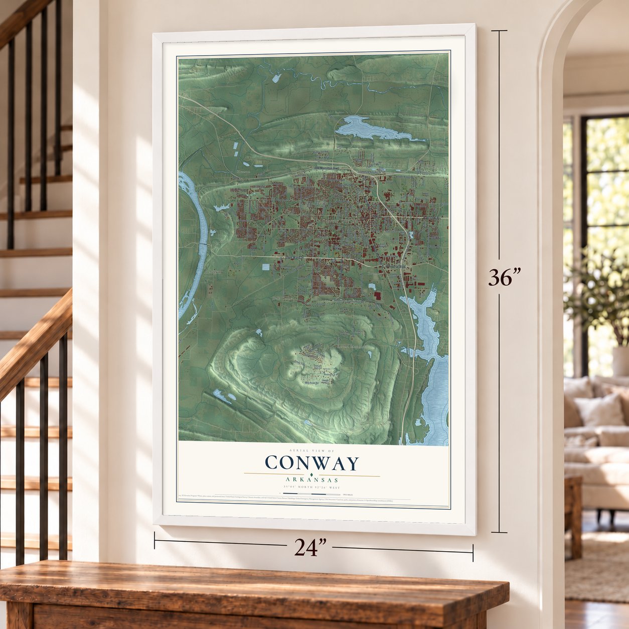
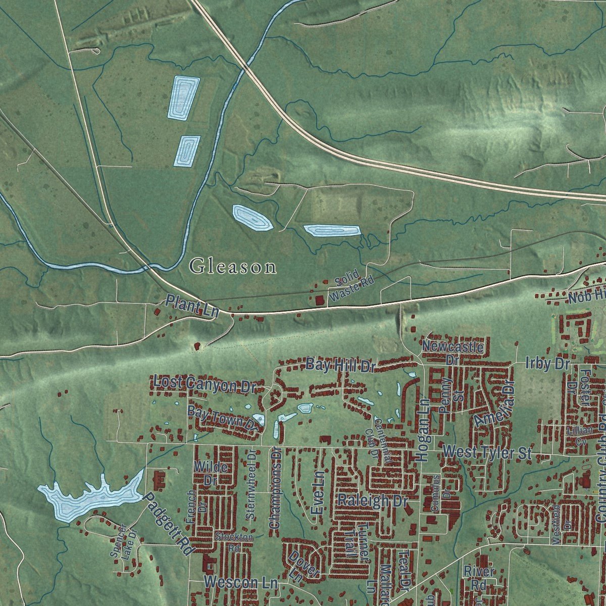
Explore Conway, Arkansas from a whole new perspective. Created using aerial imagery and detailed geographic data, this map captures Conway building by building, with labeled streets, familiar landmarks, and shaded topographical relief that highlights the natural contours of the landscape.
Combining modern data with the timeless character of a vintage atlas, this map is just as interesting up close as it is beautiful on the wall. Whether you grew up in Conway, spent memorable years there, or call it home today, this unique map is a great way to celebrate a place that means something to you. Zoom in on the preview to look for your street, and then order a print to put your memories on the wall.
Three ways to hang it
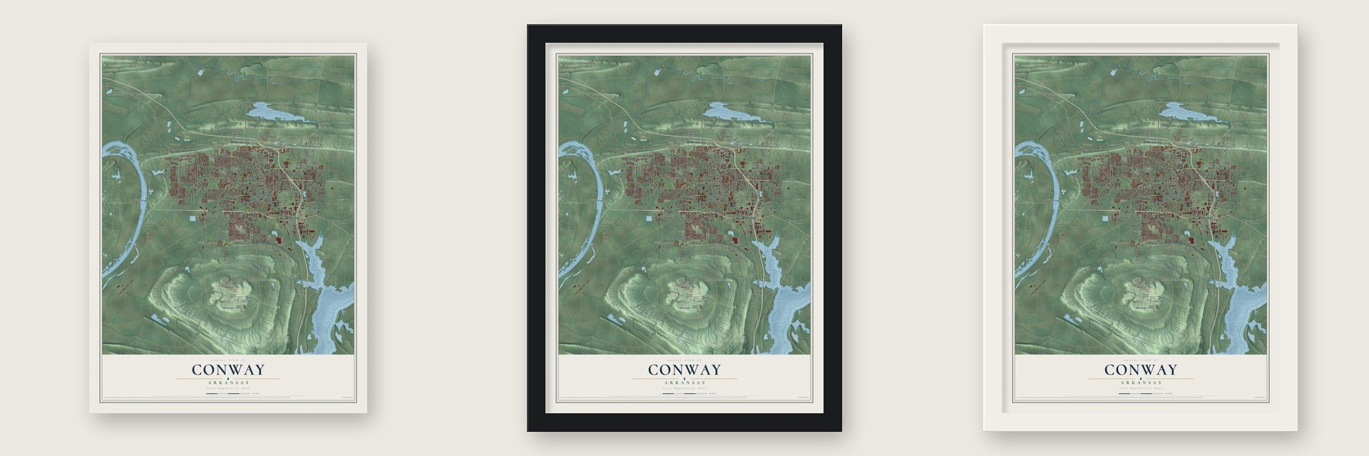
Unframed archival matte, a black wood frame or a white wood frame.
Up close
Geography Worth Displaying
This map was created using accurate cartographic data and authoritative geographic sources, including the U.S. Geological Survey and the Census Bureau. The map brings together terrain, waterways, roads, and building detail. The majority of the streets are labeled, houses are accurately depicted, and the topography is derived from government sources. Combining local data with carefully composed color and shading leads to this beautifully detailed Conway artwork for your wall.
Rather than simply showing street outlines, we’ve included as many of the street names as we could reasonably fit on the map while keeping their names legible. Zoom in on the high resolution preview to see exactly what’s on the map. We truly set out to create a statement piece for anyone who loves Conway. So whether it’s for you, or a gift for someone you love, we hope this map of Conway brings back fond memories.
Read the story behind this map of Conway, Arkansas from 2026.
About Conway, Arkansas
From the CALS Encyclopedia of Arkansas: "Eventually, the town and Faulkner County became home to large German and Irish populations. A fire in 1878 destroyed a large part of the town. Involved in rebuilding Conway was George Washington Donaghey, later the twenty-second governor of Arkansas."
From the CALS Encyclopedia of Arkansas: "Two later newspapers, the Conway Democrat, founded by Colonel George Washington Bruce in 1878, and the Log Cabin by Able F. Livingston in 1879, merged in 1901 and became the current Log Cabin Democrat."
Find your street
Names on the Conway map
Every name below is printed on this map. Look for your street, your school, the park where you played, or the pond down the road.
Places and landmarks7
- Conway City Hall
- Belk Corner
- Brumley
- Gleason
- Red Hill
- Rolling Hills
- Round Mountain
Streets and roads257
- Dave Ward Drive
- East Oak Street
- Oak Street
- Old Morrilton Highway
- Harkrider Street
- Industrial Boulevard
- South Donaghey Avenue
- South Harkrider Street
- Prince Street
- Amity Road
- Middle Road
- Exchange Avenue
- First Avenue
- Center Street
- Ashley Drive
- Lollie Road
- College Avenue
- Mill Pond Road
- Salem Road
- East German Lane
- Hogan Lane
- Donaghey Avenue
- Nutter Chapel Road
- West Tyler Street
- Tyler Street
- Lower Ridge Road
- Sand Gap Road
- Donnell Ridge Road
- Bruce Street
- South Salem Road
Show all 257 streets
- South German Lane
- Irby Drive
- Country Club Road
- Sturgis Road
- South Amity Road
- Favre Lane
- Davis Street
- Museum Road
- Stanley Russ Road
- Farris Road
- Reedy Road
- Wasson Road
- East Sixth Street
- Mitchell Street
- Robins Street
- Blaney Hill Road
- Meadowlake Road
- Ingram Street
- Bay Hill Drive
- Padgett Road
- Grandview Heights Drive
- Rumker Road
- Cadron Gap Road
- Watkins Street
- Mill Street
- Collins Drive
- Locust Street
- Washington Avenue
- Wescon Lane
- Trey Lane
- Eve Lane
- Crosspoint Road
- Southerland Road
- Rogers Lane
- Hairston Avenue
- McNutt Road
- Westin Drive
- Hilton Drive
- Cox Cv
- York Lane
- Lost Canyon Drive
- Empy Trail
- Scott Street
- Commerce Road
- Collier Drive
- Gardenia
- Oliver Street
- Glohaven Drive
- Sherwood Lane
- Morningside Drive
- Redhaven Drive
- Amelia Drive
- Arden Lane
- Sixth Street
- Hutto Street
- Andrews Drive
- Stermer Road
- Third Avenue
- Bill Lucy Drive
- Eggman Lane
- Griffith Street
- Mayor Lane
- Rachel Drive
- Raleigh Drive
- Plant Lane
- Martha Drive
- April Drive
- Baxter Drive
- Hardy Street
- Pat's Lane
- Zoysia
- Third Street
- Andy Drive
- Swn Drive
- Trinity Crossing Drive
- Western Avenue
- Dogwood Trail
- Ninth Avenue
- Ledgelawn Drive
- Clifton Street
- Front Street
- Richland Hills Drive
- Azalea Loop
- Nob Hill Road
- Sanders Street
- Mountain Park Road
- Club Lane
- Lee Avenue
- Pebble Beach Drive
- Pike Ridge
- Mallard Lane
- Shady Lane Drive
- London Road
- Elsinger Boulevard
- Southern Hills Drive
- Pine Street
- Champions Drive
- Park Place Drive
- East Robins Street
- Lakeview Acres Road
- Blackberry Lane
- Millwood Drive
- Charlie Dayer Road
- Cedar Hill Road
- Tommy Lewis Drive
- Bill Bell Lane
- Wilde Drive
- Nina Russ Lane
- Moix Boulevard
- Bay Town Drive
- United Drive
- Milam Drive
- Beatrice Powell Street
- River Road
- Wiggle Worm Road
- Bronnie Lane
- Sharon Lane
- Kinley Drive
- Stone Road
- Westin Circle
- Newcastle Drive
- Orchard Park Drive
- Hillman Street
- Foster Drive
- Gum Street
- Ginger Kerry Lane
- Vail Avenue
- Hartje Lane
- Bernard Drive
- Dover Lane
- Penny Street
- Clarence Drive
- Sunset Drive
- Simon Road
- Blake Lane
- Forrest Lane
- Abbey Gail Drive
- Helen Street
- Joyner Drive
- First Street
- Artis Lane
- Teal Drive
- Turner Trail
- Wills Drive
- Ryan Road
- Halter Road
- Ray Street
- Jaci Lane
- Ed Speaker Road
- Rolling Hills Drive
- Kensington Drive
- Majestic Circle
- Acorn Kid Loop
- South Boulevard
- Mockingbird Lane
- Broadview Avenue
- Cumberland Park Drive
- North Creek Drive
- Sternwheel Drive
- Pyramid Drive
- Southshore Lane
- Lake Front Drive
- Solid Waste Road
- Chicot Drive
- Ronald Road
- Blustery Way
- Wineberry Drive
- Muskogee Road
- Vineyard Drive
- Corporate Drive
- Marie Drive
- French Drive
- Berry Place Drive
- Pamela Lane
- Earnhart Road
- Runway Drive
- Jaguar Drive
- Hannah Drive
- Noblett Drive
- Cherub Drive
- Gist Street
- Floyd Drive
- Adam Street
- Clover Lane
- Ada Avenue
- Dahlia
- Doe Trail
- Story Drive
- Drury Lane
- Hart Lane
- South East German Lane
- Carl Stuart Road
- Old Military Road
- Centennial Club Drive
- Jeanna Drive
- East Siebenmorgan Road
- Persimmon Drive
- Brookside Drive
- Stockton Road
- Woodside Drive
- Quail Run Circle
- Equity Avenue
- South Ash Street
- Pickwicket Drive
- Conway Boulevard
- Fifth Avenue
- Nabco Drive
- Spencer Lake Drive
- Hickory Hill Road
- Roberts Road
- Oaklawn Drive
- Nature Trail
- Sklar Circle
- Hallous Street
- Sprincrest Street
- East West Martin Drive
- Denison Street
- Skunk Hollow Road
- Chateau Drive
- Timothy Lane
- Westfield Drive
- Morse Drive
- Grand Falls
- Lillian Cv
- Cumulus Drive
- Evening Drive
- Peabody Drive
Names are listed as they appear on the printed map. Zoom into the product photos to find them.
The art of mapping a place
How This Map Was Made
Real places. Remarkable detail. Discover the layers that turn geographic data into a map of home.

The view from above
Aerial imagery reveals the character of the land: woodland, open fields, and the patterns of a place.

The shape of the land
Elevation data brings hills, valleys, and subtle changes in the landscape into view.

The details of home
Roads, waterways, and building footprints come together to make the map feel unmistakably local.

Geography becomes art
Considered color, shading, and typography bring the layers together in a map made for your wall.


Process illustrated with Mendon, Massachusetts. Aerial imagery: USDA NAIP. Terrain: USGS 3D Elevation Program. Map details and finished artwork: KNOWOL.
The Details
About This Print
Choose an archival matte print, or a black or white Ayous wood frame. The archival matte print is unframed.
Select your size and finish above to see the matching product image and price.
Materials & Craftsmanship
A contemporary map with the character of a classic atlas, printed on archival matte paper. Optional frames are made from Ayous wood.
Your printed map does not include the watermark shown in the full-map preview.
Shipping & Delivery
Free shipping within the United States. Every print is made to order in the USA.
Buying a gift? Add a note in your cart and we'll include it. We never put prices in the package.
Prints ship within 2 to 3 business days. Allow 7 to 10 days total from ordering for delivery. Timing may vary during holidays or periods of high order volume.
Read our shipping policy.
Returns and damaged prints
Each print is made to order. Change-of-mind refunds are not available after production.
If your print arrives damaged, misprinted or incorrect, contact support@knowol.com within 30 days of receiving it. Include your order number, photos and a description of the issue.
Read our full refund and replacement policy. For questions about your order, email support@knowol.com.
Find your town
Looking for another city?
Find a map of home in our Arkansas collection, or any town in the country.
Nearby
Maps of towns near Conway
Know someone from one of these towns? Their map makes a great gift.
 Menifee
, Arkansas
From $39.99See the map
 Mayflower
, Arkansas
From $39.99See the map
 Wooster
, Arkansas
From $39.99See the map
More maps nearby: Fourche, Bigelow, Plumerville, Greenbrier and Roland.