
Search for another town



Free U.S. delivery 7 to 10 days after you order
Corinth, Mississippi Map Art
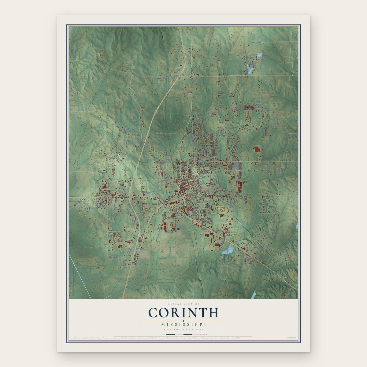
A new map of Corinth, Mississippi, made in 2026 and printed to order on thick archival matte paper.
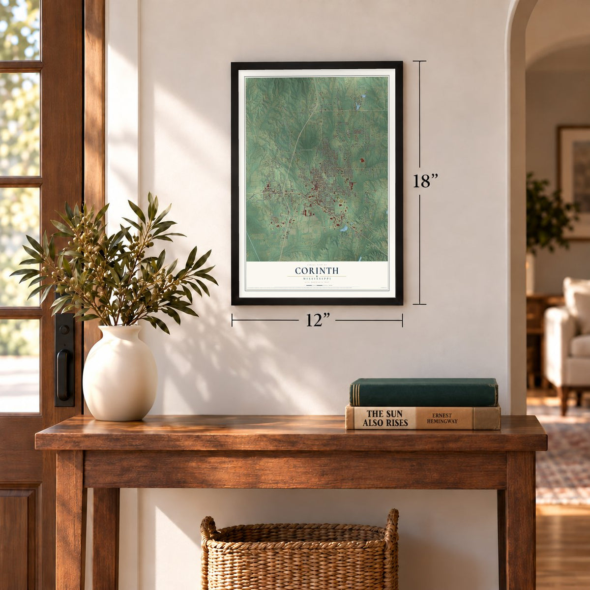
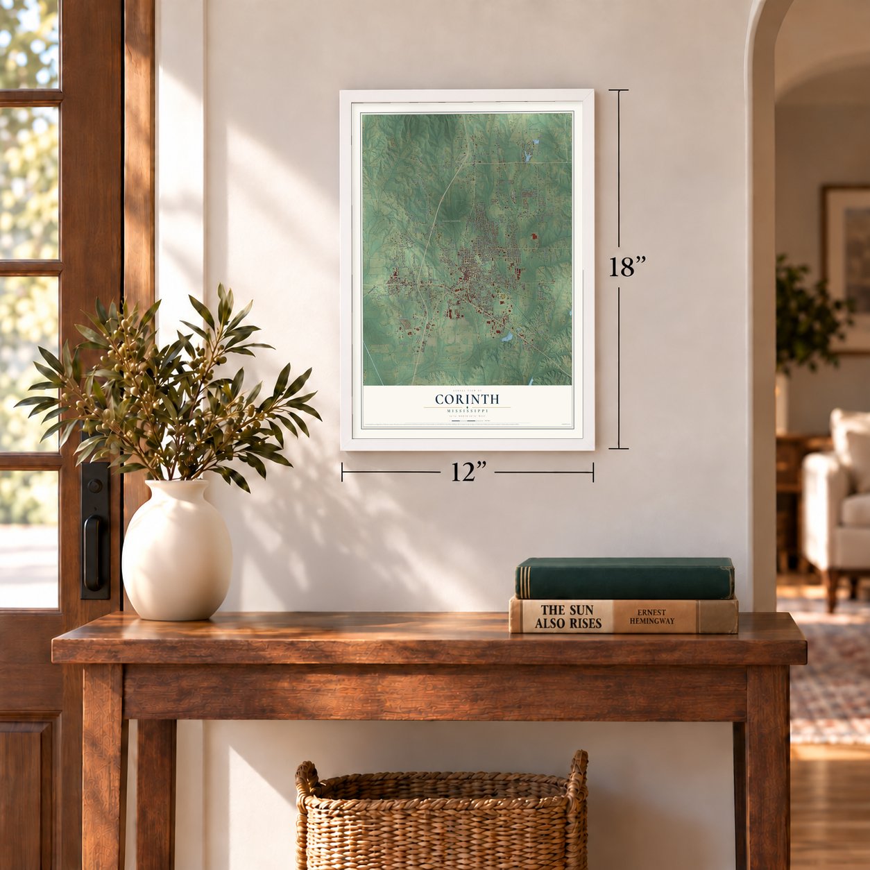
12" x 18" Archival Matte Print
A Map of Home. A Work of Art.
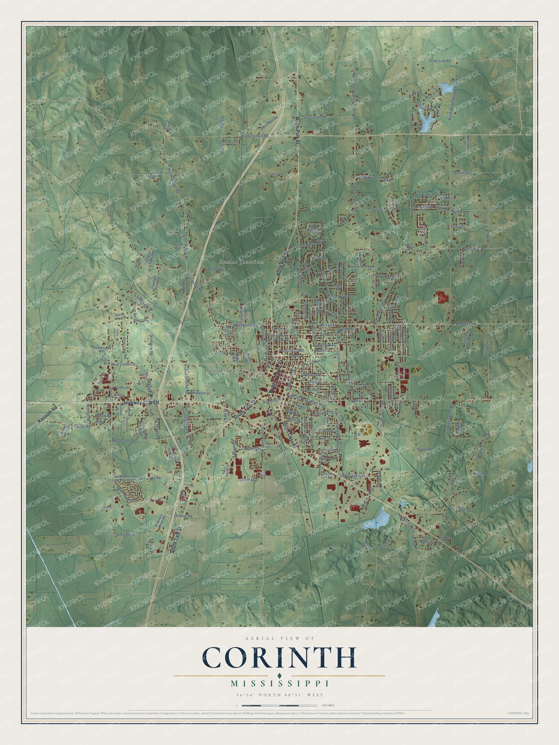
Explore Corinth, Mississippi from a whole new perspective. Created using aerial imagery and detailed geographic data, this map captures Corinth building by building, with labeled streets, familiar landmarks, and shaded topographical relief that highlights the natural contours of the landscape.
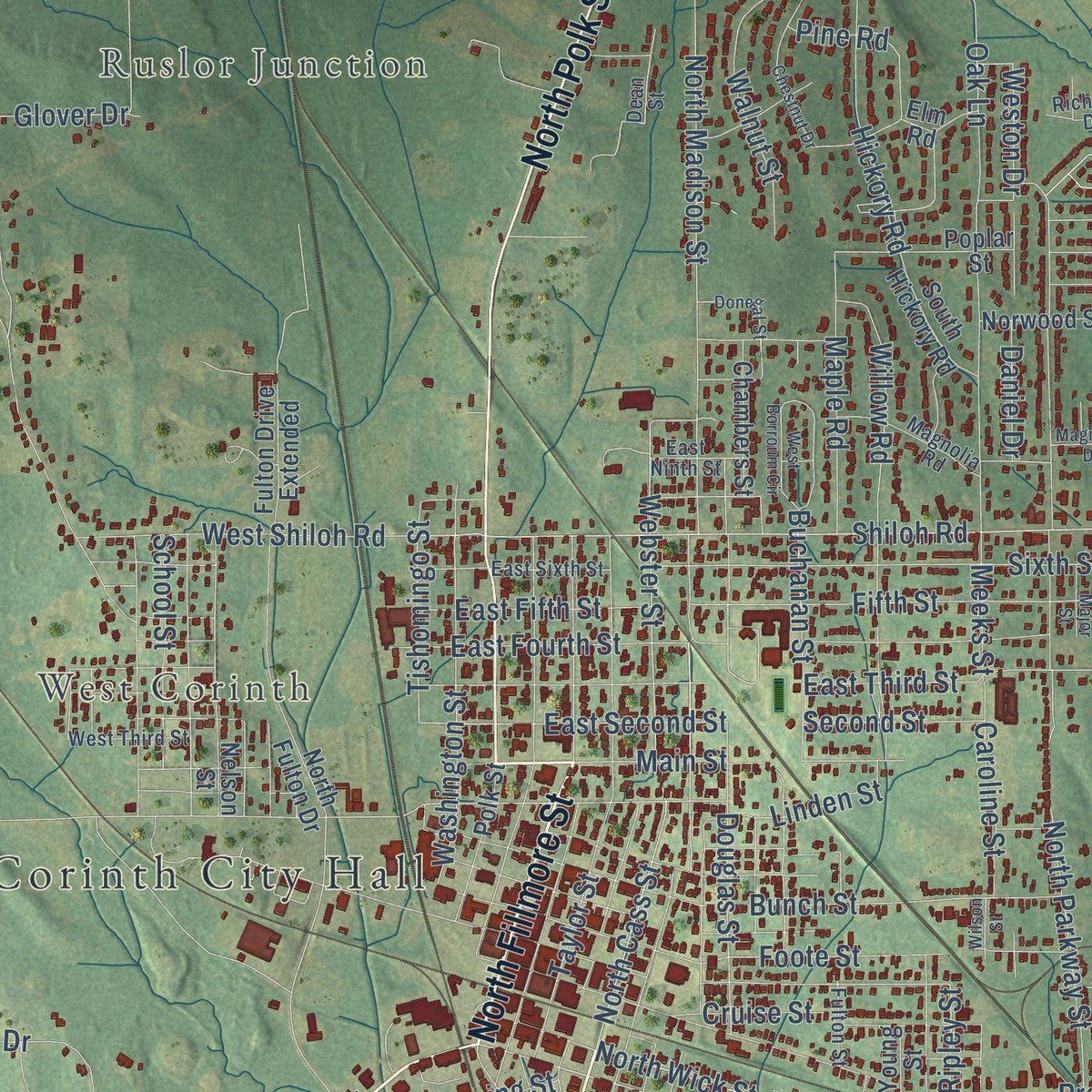
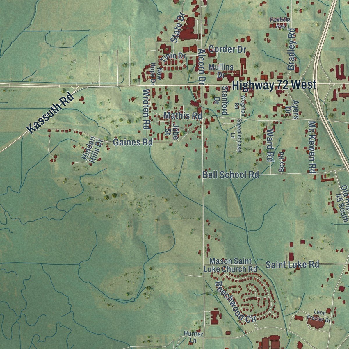
Combining modern data with the timeless character of a vintage atlas, this map is just as interesting up close as it is beautiful on the wall. Whether you grew up in Corinth, spent memorable years there, or call it home today, this unique map is a great way to celebrate a place that means something to you. Zoom in on the preview to look for your street, and then order a print to put your memories on the wall.
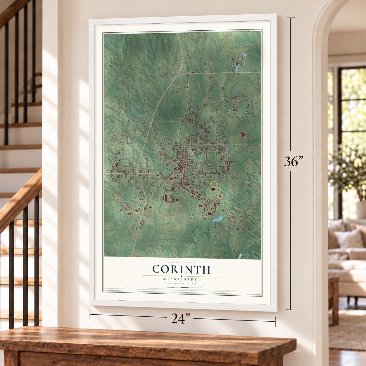
Three ways to hang it
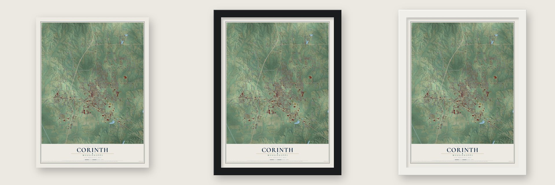
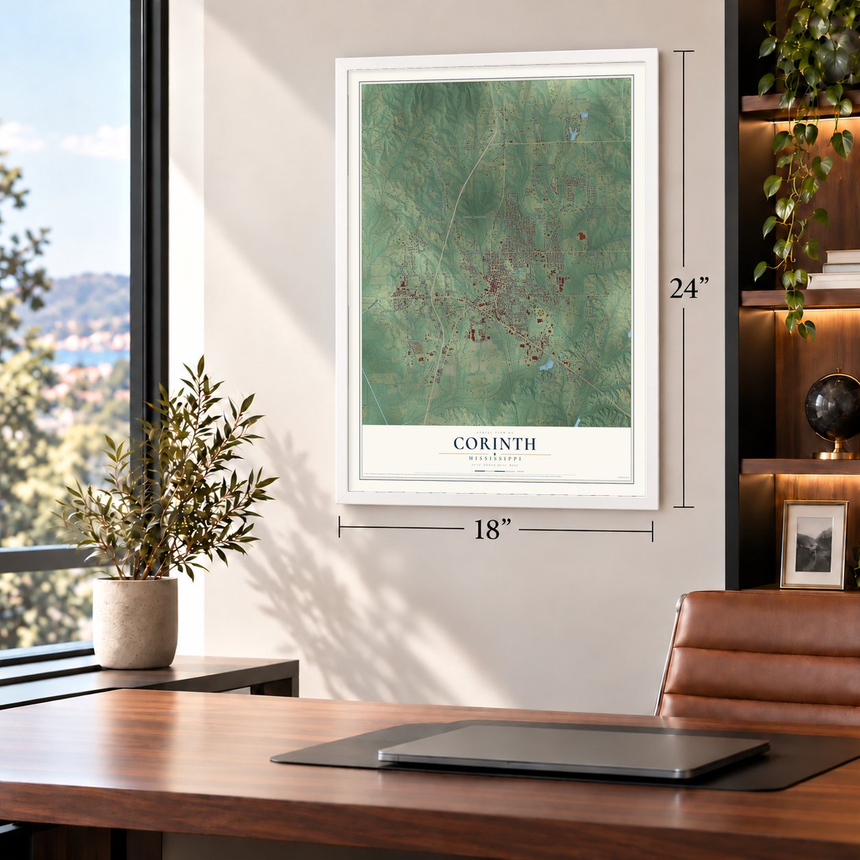
Unframed archival matte, a black wood frame or a white wood frame.
Up close
Geography Worth Displaying
This map was created using accurate cartographic data and authoritative geographic sources, including the U.S. Geological Survey and the Census Bureau. The map brings together terrain, waterways, roads, and building detail. The majority of the streets are labeled, houses are accurately depicted, and the topography is derived from government sources. Combining local data with carefully composed color and shading leads to this beautifully detailed Corinth artwork for your wall.
Rather than simply showing street outlines, we’ve included as many of the street names as we could reasonably fit on the map while keeping their names legible. Zoom in on the high resolution preview to see exactly what’s on the map. We truly set out to create a statement piece for anyone who loves Corinth. So whether it’s for you, or a gift for someone you love, we hope this map of Corinth brings back fond memories.
Read the story behind this map of Corinth, Mississippi from 2026.

About Corinth, Mississippi
Corinth is a city of 14,622 people and the county seat of Alcorn County, on the Tennessee state line. It was founded in 1853 where the Mobile & Ohio and the Memphis & Charleston railroads crossed, so its first name was Cross City. It soon took the name Corinth, after the ancient Greek city that also stood at a crossroads.
Those rail lines made Corinth a prize in the Civil War. After the Battle of Shiloh in April 1862, Confederate General P. G. T. Beauregard fell back to Corinth. Union Major General Henry W. Halleck followed so slowly, entrenching at every halt, that his advance became known as the Siege of Corinth. Beauregard pulled out on May 29, and Union troops took the town. Earl Van Dorn tried to win it back on October 3 and 4, 1862, against forces under Ulysses S. Grant. The fighting cost more than eight hundred soldiers their lives, and Union troops held Corinth until 1864.
- Generals at the Veranda HouseThe Veranda House, also called the Curlee House, was built in 1857. During the Battle of Corinth, Confederate generals used it as their headquarters. It joined the National Register in 1975.
- A model campDuring the Union occupation, people escaping slavery, then called contrabands, came to Corinth, and their camp was widely seen as a model for others. The town was also a major hospital center for wounded Confederates. Corinth National Cemetery holds Civil War soldiers from fifteen states.
- Corona College, 1857Corona College opened in Corinth in 1857. It was one of the first colleges in the South to admit women as students.
- Engines, boilers and woolensBy 1900 Corinth ranked among Mississippi's leading manufacturing towns. That year's census counted 30 manufacturers with 476 wage earners and products worth $759,543. The largest were the Alcorn woolen mills, the W. T. Adams Machine Company, and the Corinth Engine and Boiler Works. The Corinthian had been printed as a daily paper since 1897.
- The five-cent slugburgerDuring the Depression, Corinth residents are said to have created the slugburger. It was a hamburger stretched with cheaper fillers that weren't meat, so it could sell for five cents. The town now holds a Slugburger Festival every year.
Find your street
Names on the Corinth map
Every name below is printed on this map. Look for your street, your school, the park where you played, or the pond down the road.
Places and landmarks5
- Corinth City Hall
- Ruslor Junction
- West Corinth
- Corinth City Park
- Beauregard Park
Streets and roads233
- South Tate Street
- North Fillmore Street
- South Cass Street
- North Polk Street
- Highway 72 West
- Kassuth Road
- North Harper Road
- South Harper Road
- Levee Road
- Kendrick Road
- Bridle Path
- Pinecrest Street
- North Shiloh Road
- Shiloh Road
- North Cass Street
- Oakland School Road
- South Fulton Drive
- Webster Street
- Tate Street
- North Wick Street
- East Second Street
- Norman Road
- North Harper Road Extended
- Westview Drive
- South Gaylean Road
- Tishomingo Street
- Gaines Road
- Proper Street
- Wenasoga Road
- North Madison Street
Show all 233 streets
- Forest School Road
- Forrest School Road
- West Linden Street
- Droke Road
- Alcorn Drive
- East Third Street
- North Parkway Street
- South Parkway Street
- Purdy School Road
- Oak Lane
- Quail Run Road
- Bell School Road
- Henson Road
- Bunch Street
- Foote Street
- East Fourth Street
- Box Chapel Road
- North Shiloh Road Extended
- Cantrell Road
- Glover Drive
- Taylor Street
- Sawyer Road
- Cruise Street
- Beechwood Circle
- Douglas Street
- South Johns Street
- Cardinal Drive
- Farris Lane
- Saint Luke Road
- Buchanan Street
- Kimberly Road
- Sixth Street
- Wick Street
- Meigg Street
- State Line Road
- Little Zion Road
- Barnstable Road
- Fifth Street
- Washington Street
- Pine Lake Road
- Pine Road
- Salem Road
- Hickory Road
- West Shiloh Road
- Allen Street
- Liddon Lake Road
- Main Street
- Henderson Road
- Afton Drive
- South Cemetery Street
- Patrick Drive
- Walnut Street
- Crater Street
- Bradley Road
- Gardner Road
- Shaw Road
- Galyean Road
- Minor Road
- Maple Road
- Davis Drive
- Horton Street
- Lyon Street
- Spring Forest Road
- Waukomis Lake Road
- Ross Street
- East Fifth Street
- Willow Road
- Linden Street
- Edgewood Drive
- Dunbar Avenue
- Mathis Road
- Orchard Lane
- State Drive
- School Street
- Caroline Street
- Garden Lane
- Miller Road
- Clay Drive
- Weston Drive
- Fairway Drive
- White Street
- Creekwood Drive
- Second Street
- Wroten Road
- Howell Drive
- Mc Kewen Road
- Ward Road
- Cox Street
- Bitner Road
- Clifton Drive
- Red Bird Lane
- Corder Drive
- Burns Road
- Arbor Lane
- Bynum Drive
- Meeks Street
- Golding Road
- Daniel Drive
- Fleming Street
- Sara Lane
- Ripley Street
- Lee Street
- Dale Street
- Old Highway 45 South
- North Fulton Drive
- Mason Saint Luke Church Road
- Ridgeview Drive
- Saint Andrews Circle
- Fieldstone Farms Road
- Park Drive
- Fulton Drive Extended
- Shiloh Ridge Road
- Nelson Street
- West Clover Lane
- Martin Luther King Drive
- Tinin Drive
- Sunny Wood Lane
- Hidden Hills Drive
- Thornwood Trail
- John Carter Road
- Scenic Lake Drive
- Elm Road
- Pleasant Grove Road
- Tennessee Street
- North Hills Boulevard
- Poplar Street
- Whitmore Levee Road
- Meadowood Lane
- Forrest Road
- Polk Street
- Liddon Hill
- Franklin Drive
- Chambers Street
- East Clover Lane
- Lake Heights Drive
- Northaven Drive
- South Hickory Road
- Smithbridge Road
- Norwood Street
- Old Oak Road
- Highland Drive
- Wynbrook Drive
- Shadowood Lane
- Frazier Drive
- Knighton Road
- Northtowne Drive
- Northwood Street
- Clark Street
- East Melody Lane
- Ayers Drive
- Young Street
- Hinton Road
- Dennis Town Road
- Cedar Creek Drive
- Mullins Drive
- Lauren Drive
- Skylark Drive
- Stanford Drive
- Boyd Drive
- Forest School
- Jobe Street
- Village Drive
- Follin Drive
- Fulton Drive
- Ivy Lane
- Dean Street
- Gaylean Road
- City Park Drive
- Magnolia Road
- Fulton Street
- East Sixth Street
- Crossover Road
- Jumper Lane
- West Sawyer Road
- New Hope Drive
- Meadows Drive
- Cedar Lane Cv
- West Third Street
- Hillcrest Road
- Lilac Street
- Johnson Drive
- Richman Drive
- East Ninth Street
- East Harris Circle
- Lucille Lane
- Box Road
- Hunter Lane
- Fish Pond Lane
- Chestnut Drive
- Howell Road
- Glenmoore Street
- South Young Street
- Donegal Street
- West Borroum Circle
- Wilson Street
- Steeplechase Lane
- Wegman Road
- Fox Chase Road
- Leon Frazier Drive
- Magnolia Drive
- Major Street
- Fawkers Avenue
- North Lane
Names are listed as they appear on the printed map. Zoom into the product photos to find them.
The art of mapping a place
How This Map Was Made
Real places. Remarkable detail. Discover the layers that turn geographic data into a map of home.

The view from above
Aerial imagery reveals the character of the land: woodland, open fields, and the patterns of a place.

The shape of the land
Elevation data brings hills, valleys, and subtle changes in the landscape into view.

The details of home
Roads, waterways, and building footprints come together to make the map feel unmistakably local.

Geography becomes art
Considered color, shading, and typography bring the layers together in a map made for your wall.


Process illustrated with Mendon, Massachusetts. Aerial imagery: USDA NAIP. Terrain: USGS 3D Elevation Program. Map details and finished artwork: KNOWOL.
The Details
About This Print
Choose an archival matte print, or a black or white Ayous wood frame. The archival matte print is unframed.
Select your size and finish above to see the matching product image and price.
Materials & Craftsmanship
A contemporary map with the character of a classic atlas, printed on archival matte paper. Optional frames are made from Ayous wood.
Your printed map does not include the watermark shown in the full-map preview.
Shipping & Delivery
Free shipping within the United States. Every print is made to order in the USA.
Buying a gift? Add a note in your cart and we'll include it. We never put prices in the package.
Prints ship within 2 to 3 business days. Allow 7 to 10 days total from ordering for delivery. Timing may vary during holidays or periods of high order volume.
Read our shipping policy.
Returns and damaged prints
Each print is made to order. Change-of-mind refunds are not available after production.
If your print arrives damaged, misprinted or incorrect, contact support@knowol.com within 30 days of receiving it. Include your order number, photos and a description of the issue.
Read our full refund and replacement policy. For questions about your order, email support@knowol.com.
Find your town
Looking for another city?
Find a map of home in our Mississippi collection, or any town in the country.
Nearby
Maps of towns near Corinth
Know someone from one of these towns? Their map makes a great gift.
 Farmington
, Mississippi
From $39.99See the map
 Biggersville
, Mississippi
From $39.99See the map
 Glen
Glen, Mississippi
From $39.99See the map
More maps nearby: Kossuth, Rienzi, Burnsville, Jacinto and Jumpertown.