
Search for another town





Free U.S. delivery 7 to 10 days after you order
Covington, Virginia Map Art
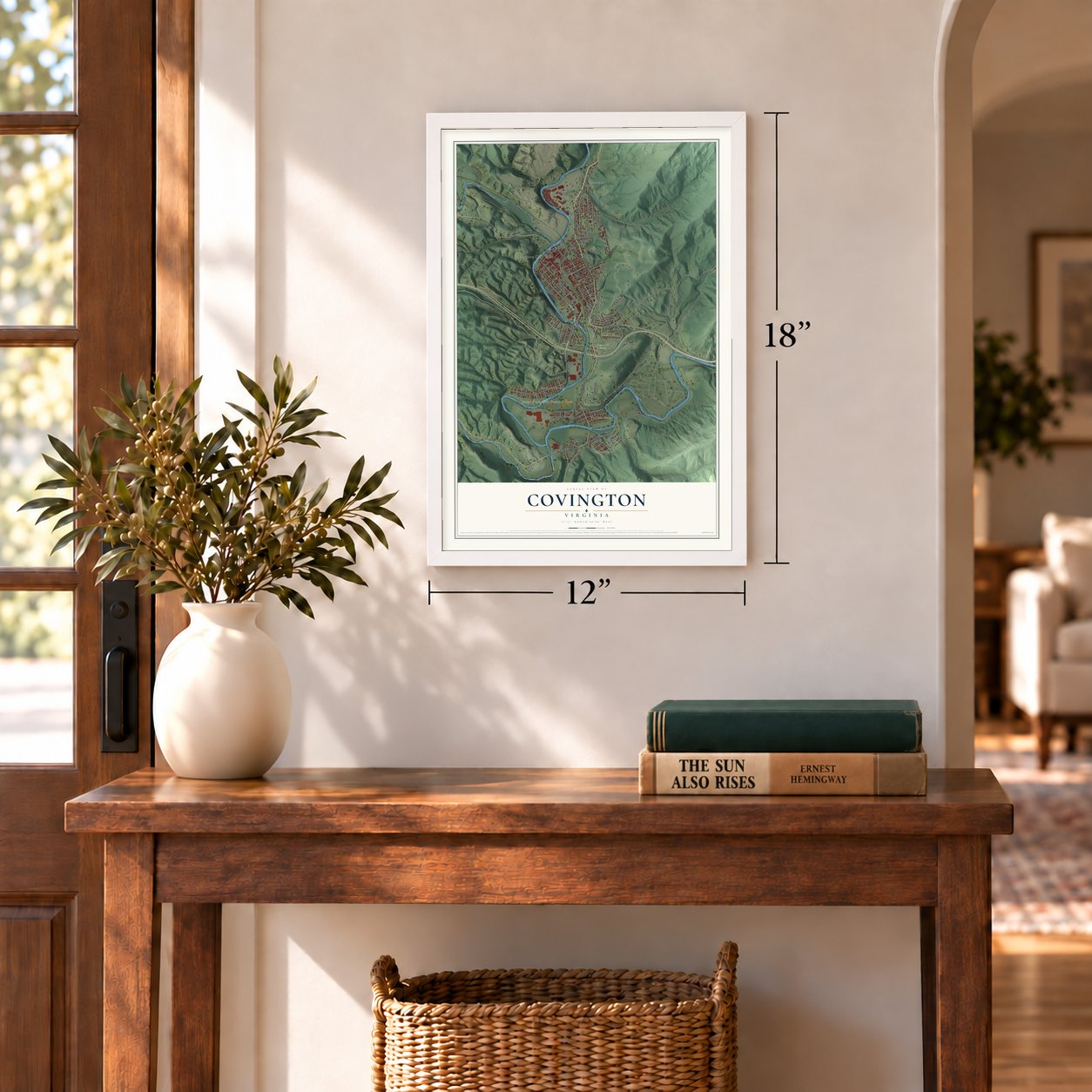
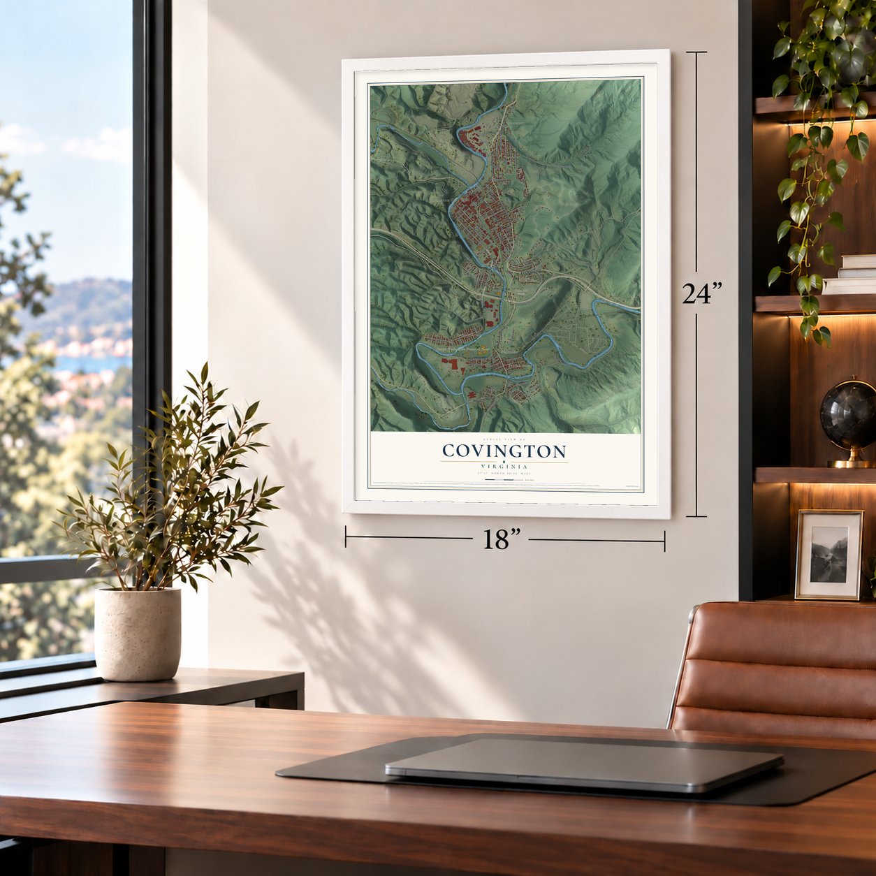
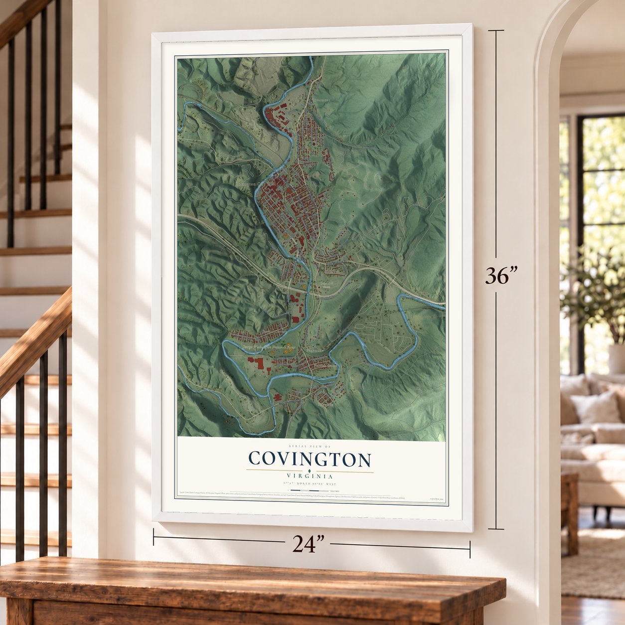
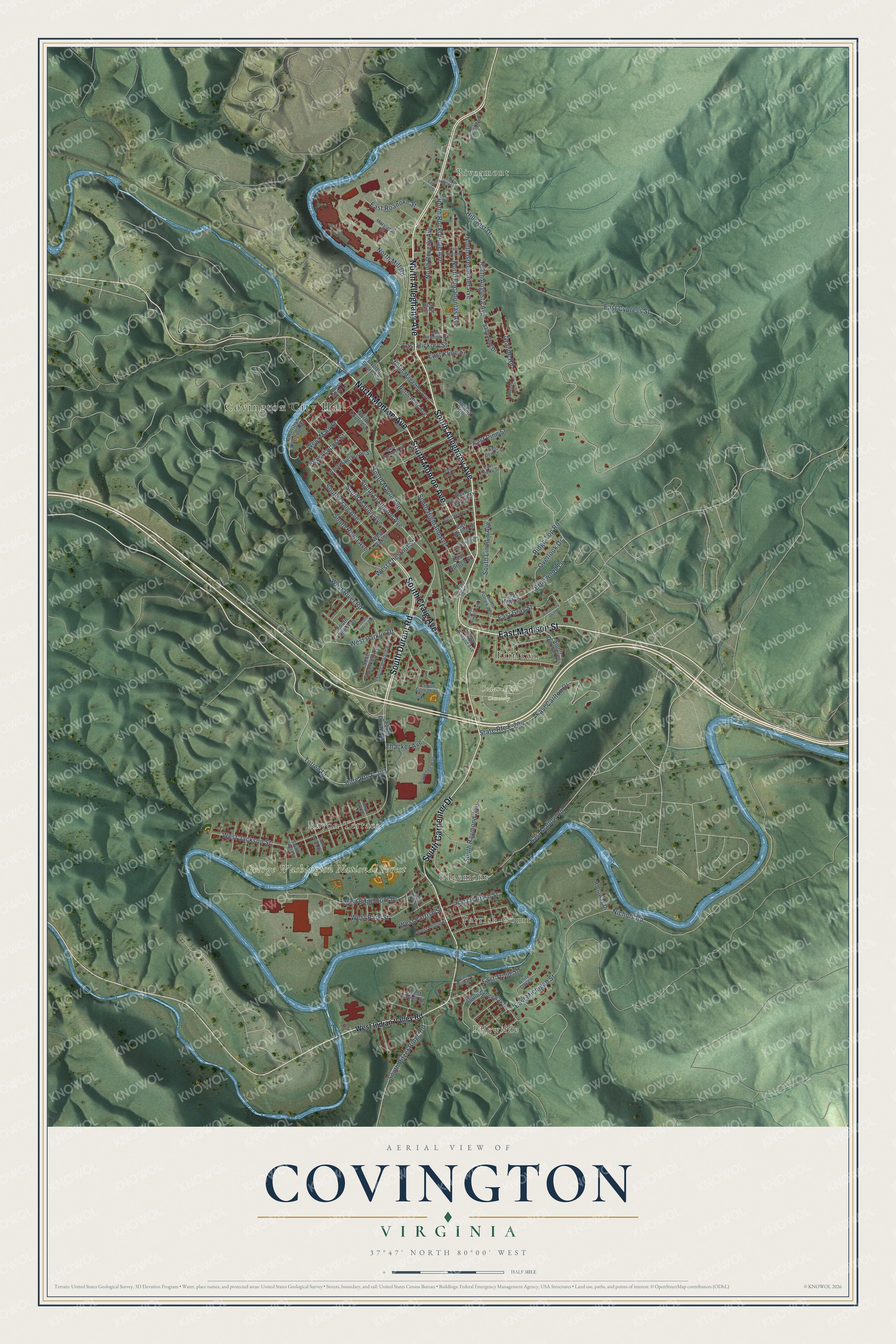
A new map of Covington, Virginia, made in 2026 and printed to order on thick archival matte paper.
12" x 18" Archival Matte Print
A Map of Home. A Work of Art.
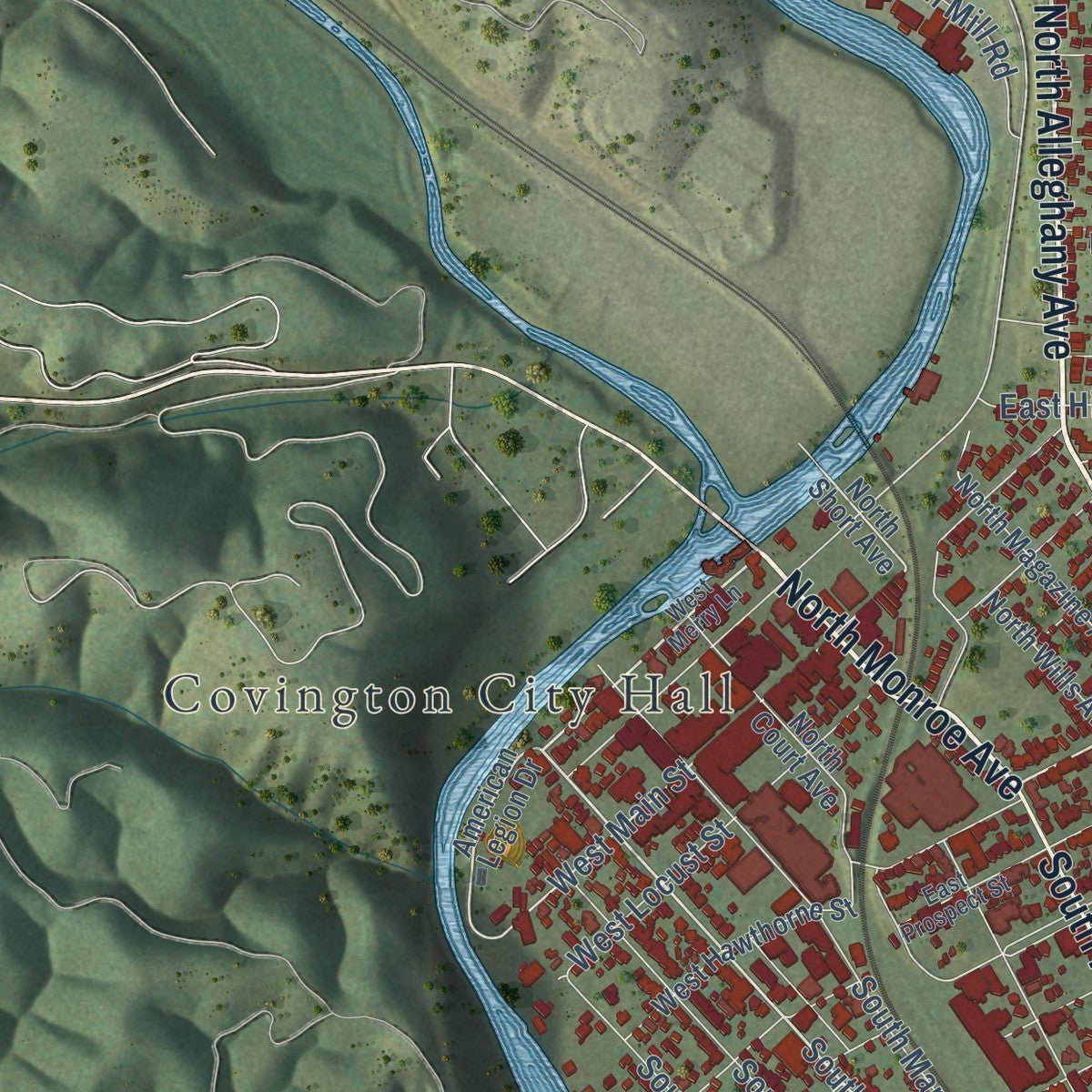
Explore Covington, Virginia from a whole new perspective. Created using aerial imagery and detailed geographic data, this map captures Covington building by building, with labeled streets, familiar landmarks, and shaded topographical relief that highlights the natural contours of the landscape.
Combining modern data with the timeless character of a vintage atlas, this map is just as interesting up close as it is beautiful on the wall. Whether you grew up in Covington, spent memorable years there, or call it home today, this unique map is a great way to celebrate a place that means something to you. Zoom in on the preview to look for your street, and then order a print to put your memories on the wall.
Three ways to hang it
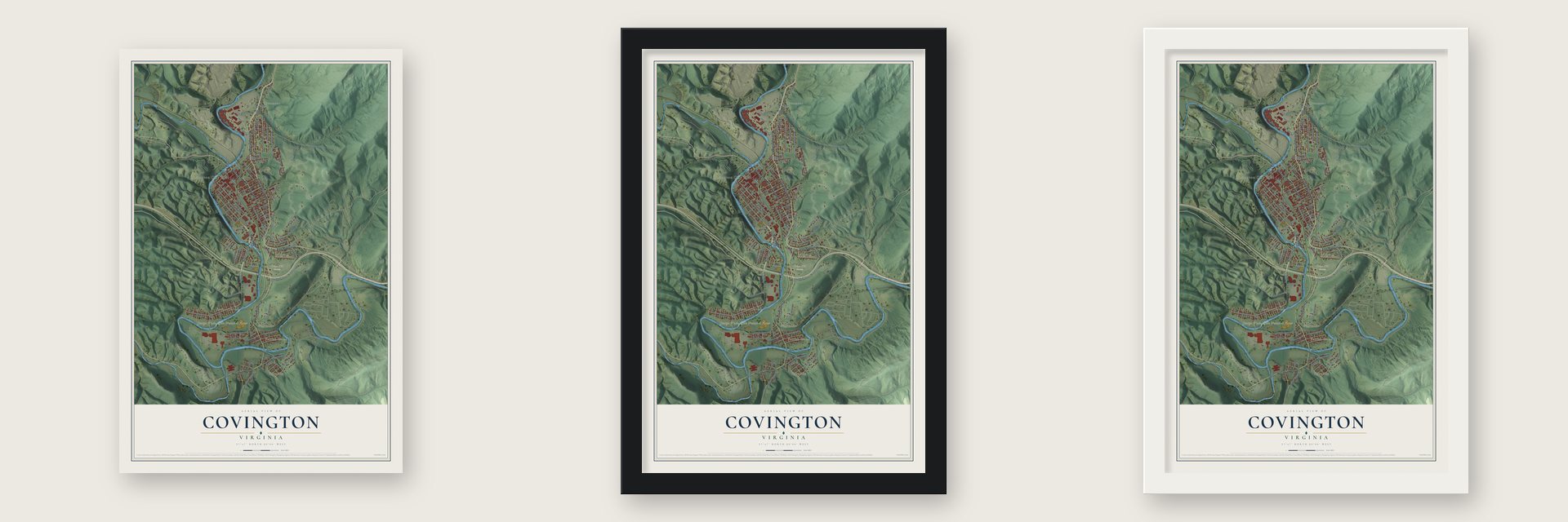
Unframed archival matte, a black wood frame or a white wood frame.
Up close
Geography Worth Displaying
This map was created using accurate cartographic data and authoritative geographic sources, including the U.S. Geological Survey and the Census Bureau. The map brings together terrain, waterways, roads, and building detail. The majority of the streets are labeled, houses are accurately depicted, and the topography is derived from government sources. Combining local data with carefully composed color and shading leads to this beautifully detailed Covington artwork for your wall.
Rather than simply showing street outlines, we’ve included as many of the street names as we could reasonably fit on the map while keeping their names legible. Zoom in on the high resolution preview to see exactly what’s on the map. We truly set out to create a statement piece for anyone who loves Covington. So whether it’s for you, or a gift for someone you love, we hope this map of Covington brings back fond memories.
Read the story behind this map of Covington, Virginia from 2026.
About Covington, Virginia
Covington is a city of 5,737 people where Dunlap Creek meets the Jackson River, and it is the county seat of Alleghany County, which surrounds it. White settlers first came here in 1745, when the land was part of Augusta County. In August 1818 Dr. James Merry began selling lots on 25 acres he owned at a spot people called the Mouth of the Dunlap. In 1819 the new town was named Covington, honoring General Leonard Covington, a War of 1812 hero who counted Thomas Jefferson and James Madison among his friends.
Three years later, on January 5, 1822, the Virginia General Assembly carved Alleghany County out of parts of Bath, Botetourt and Monroe counties, and Covington became part of the new county. The legislature incorporated the town in 1833. By 1855 it had two streets and 43 houses, and its stores served the farmers and stock raisers around it. Hemp was the main crop, grown for the ships of eastern Virginia, until the Virginia Central Railroad reached town in 1867 and opened the way for industry.
- An industrial boom from 1891The Covington Iron Furnace opened in 1891 and turned out 110 tons of pig iron a day. The Deford Tannery followed in 1892, along with flour mills, two brick companies and machine shops that built coke extractors for steelmaking. The Chesapeake and Ohio Railway put its fourth largest freight paying station here, after Chicago, Cincinnati and Richmond, and fourteen passenger trains stopped each day. Covington grew from 704 people in 1890 to 5,632 in 1920.
- The paper mill since 1899In 1899 A. Adams McAllister sold land at a bargain price to persuade the West Virginia Pulp and Paper Company to build in Covington. The mill, later called Westvaco and then WestRock, became the town's largest employer. After a 2024 merger it became part of Smurfit Westrock, and it still employs about 1300 workers making bleached paper and paperboard for packaging.
- County seat in 1902The General Assembly made Covington the seat of Alleghany County in 1902. As the town grew, it pushed its limits outward several times, and in 1952 it became an independent city. Industry later thinned out: Lear Corporation closed its plant in December 2005, and AET shut down in March 2008.
- A church organized in 1870First Baptist Church of Covington was organized in 1870, and over the years it grew into the largest African American congregation in the city. The church is listed on the National Register of Historic Places.
- Volunteers since 1902The Covington Fire Department received its charter on March 4, 1902. The Covington Rescue Squad followed in 1933, and it ranks as the third oldest volunteer rescue squad in Virginia. Both are still run by volunteers.
Find your street
Names on the Covington map
Every name below is printed on this map. Look for your street, your school, the park where you played, or the pond down the road.
Places and landmarks9
- Covington City Hall
- Idlewilde
- Rivermont
- Parrish Court
- Edgemont
- Cedar Hill Cemetery
- George Washington National Forest
- Fairlawn
- Rayon Terrace
Streets and roads103
- North Alleghany Avenue
- North Monroe Avenue
- South Durant Road
- South Alleghany Avenue
- East Madison Street
- South Carpenter Drive
- South Monroe Avenue
- South Craig Avenue
- South Lexington Avenue
- West Main Street
- Overlook Drive
- Briarwood Lane
- State Route F-203
- Totten Drive
- West Parklin Drive
- West Edgemont Drive
- East Cypress Street
- West Jackson Street
- East Mallow Road
- East Carlton Drive
- State Route F-204
- East Michigan Street
- South Highland Avenue
- North Rockbridge Avenue
- North Pocahontas Avenue
- North Beverly Avenue
- East Pine Street
- Nichols Road
- South Marion Avenue
- Hillcrest Drive
Show all 103 streets
- North Greenbrier Avenue
- West Locust Street
- East Gray Street
- West Park Street
- Grande Road
- South Pitzer Ridge Road
- East Trout Street
- North Augusta Avenue
- West River Road
- South Lincoln Avenue
- West Chestnut Street
- South Maple Avenue
- South Raymond Avenue
- East Roanoke Street
- Ridge Top Road
- South Royal Avenue
- East Parrish Street
- North Mill Road
- East Hickory Street
- East Kline Street
- West Parrish Street
- Thacker Avenue
- West Indian Valley Road
- American Legion Drive
- North Short Avenue
- South Carlton Drive
- East Beech Street
- Sunset Hill
- South Greenway Drive
- North Court Avenue
- West Hawthorne Street
- East Walnut Street
- North Magazine Avenue
- West Oak Street
- South Franklin Avenue
- South Dee Avenue
- East Fir Street
- North Wills Avenue
- East Hugh Street
- Sally Ann Drive
- East Spruce Street
- Holloway Drive
- West Wood Street
- West Merry Lane
- East Cherry Street
- East Prospect Street
- Applebee Way
- South Howard Avenue
- South Patrick Avenue
- South Conrad Avenue
- East Holly Street
- White Oak Lane
- South Ashland Avenue
- West Phillip Street
- East Hemlock Street
- East Dewey Street
- South Kadel Avenue
- Maryland Street
- South Tank Street
- East Dolly Ann Drive
- East Foch Street
- East Cedar Street
- East Chestnut Street
- East Oak Street
- South Arden Avenue
- South Crowder Avenue
- North Princeton Drive
- South Byrd Avenue
- South David Avenue
- East Marshall Street
- East Hillcrest Drive
- South Payne Avenue
- Whitney Road
Names are listed as they appear on the printed map. Zoom into the product photos to find them.
The art of mapping a place
How This Map Was Made
Real places. Remarkable detail. Discover the layers that turn geographic data into a map of home.

The view from above
Aerial imagery reveals the character of the land: woodland, open fields, and the patterns of a place.

The shape of the land
Elevation data brings hills, valleys, and subtle changes in the landscape into view.

The details of home
Roads, waterways, and building footprints come together to make the map feel unmistakably local.

Geography becomes art
Considered color, shading, and typography bring the layers together in a map made for your wall.


Process illustrated with Mendon, Massachusetts. Aerial imagery: USDA NAIP. Terrain: USGS 3D Elevation Program. Map details and finished artwork: KNOWOL.
The Details
About This Print
Choose an archival matte print, or a black or white Ayous wood frame. The archival matte print is unframed.
Select your size and finish above to see the matching product image and price.
Materials & Craftsmanship
A contemporary map with the character of a classic atlas, printed on archival matte paper. Optional frames are made from Ayous wood.
Your printed map does not include the watermark shown in the full-map preview.
Shipping & Delivery
Free shipping within the United States. Every print is made to order in the USA.
Buying a gift? Add a note in your cart and we'll include it. We never put prices in the package.
Prints ship within 2 to 3 business days. Allow 7 to 10 days total from ordering for delivery. Timing may vary during holidays or periods of high order volume.
Read our shipping policy.
Returns and damaged prints
Each print is made to order. Change-of-mind refunds are not available after production.
If your print arrives damaged, misprinted or incorrect, contact support@knowol.com within 30 days of receiving it. Include your order number, photos and a description of the issue.
Read our full refund and replacement policy. For questions about your order, email support@knowol.com.
Find your town
Looking for another city?
Find a map of home in our Virginia collection, or any town in the country.
Nearby
Maps of towns near Covington
Know someone from one of these towns? Their map makes a great gift.
 Mallow
, Virginia
From $39.99See the map
 Callaghan
, Virginia
From $39.99See the map
 Low Moor
, Virginia
From $39.99See the map
More maps nearby: Selma, Glen Wilton, Clifton Forge, Cliftondale Park and Iron Gate.