
Search for another town





Free U.S. delivery 7 to 10 days after you order
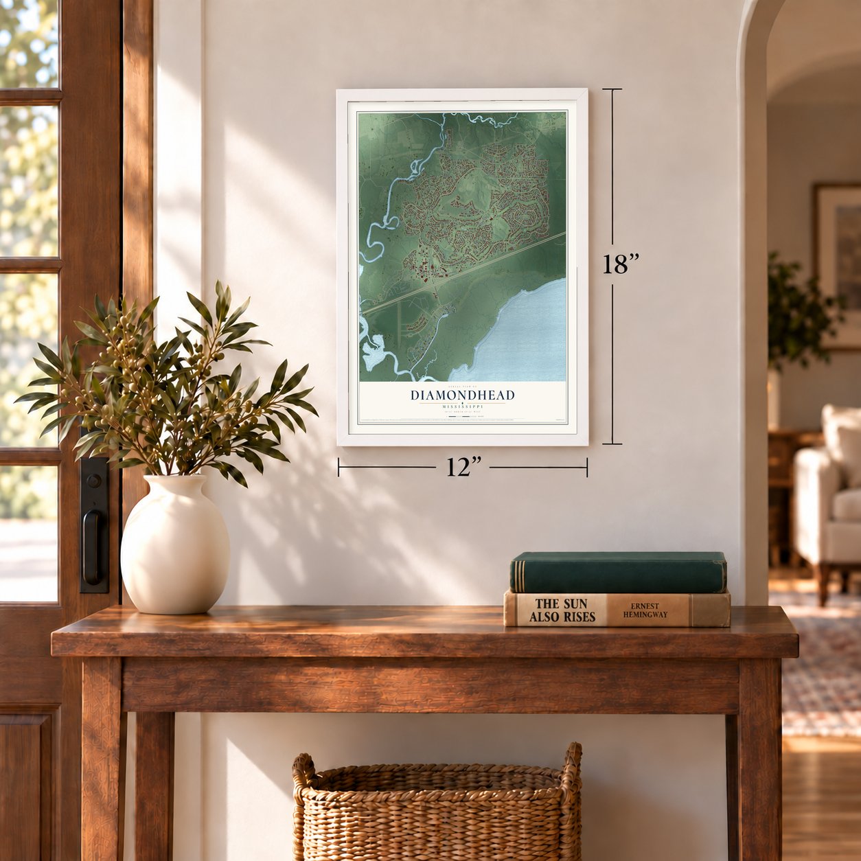
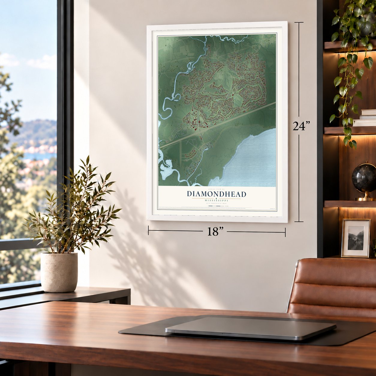
Diamondhead, Mississippi Map Art
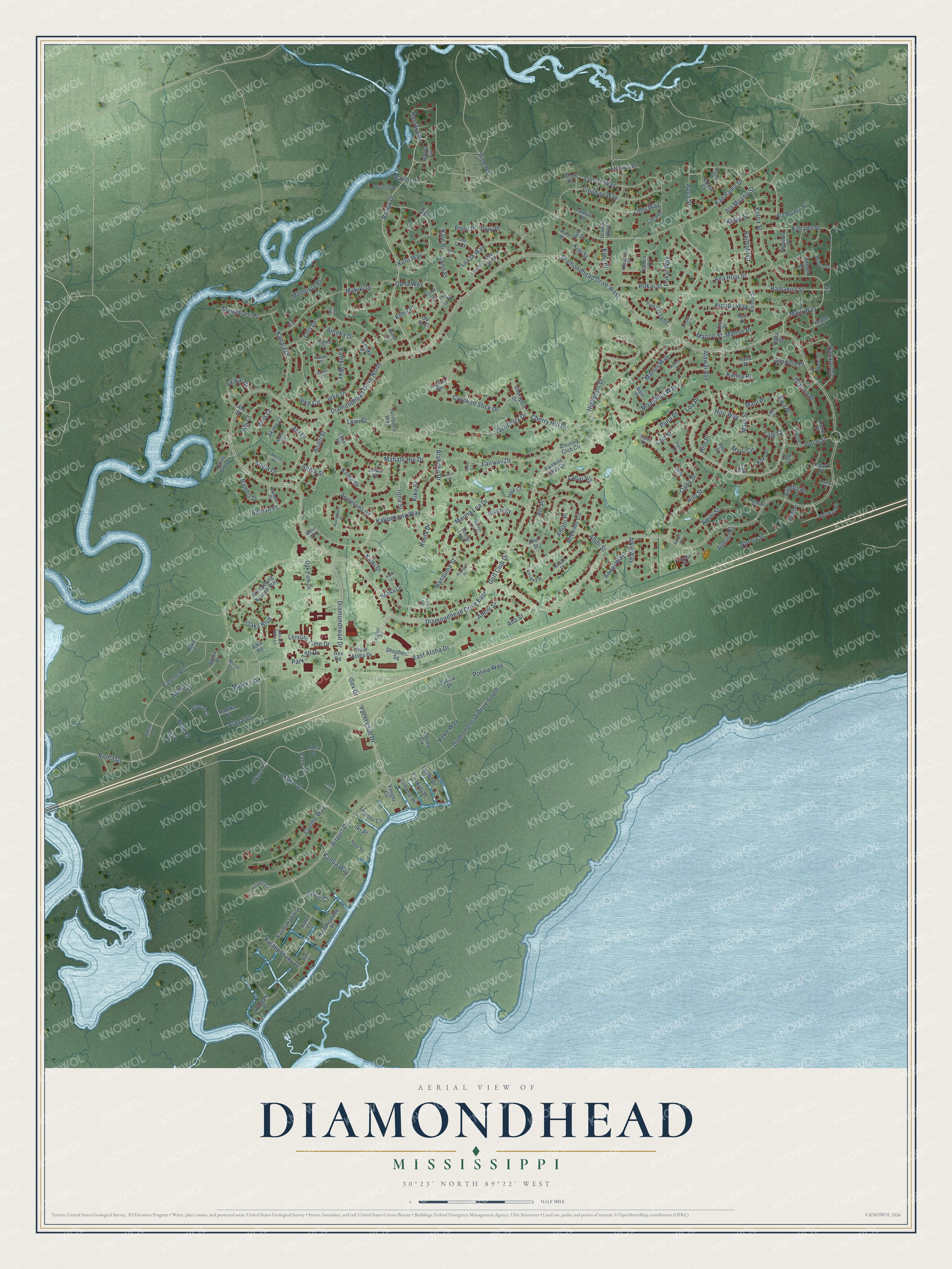
A new map of Diamondhead, Mississippi, made in 2026 and printed to order on thick archival matte paper.
12" x 18" Archival Matte Print
A Map of Home. A Work of Art.
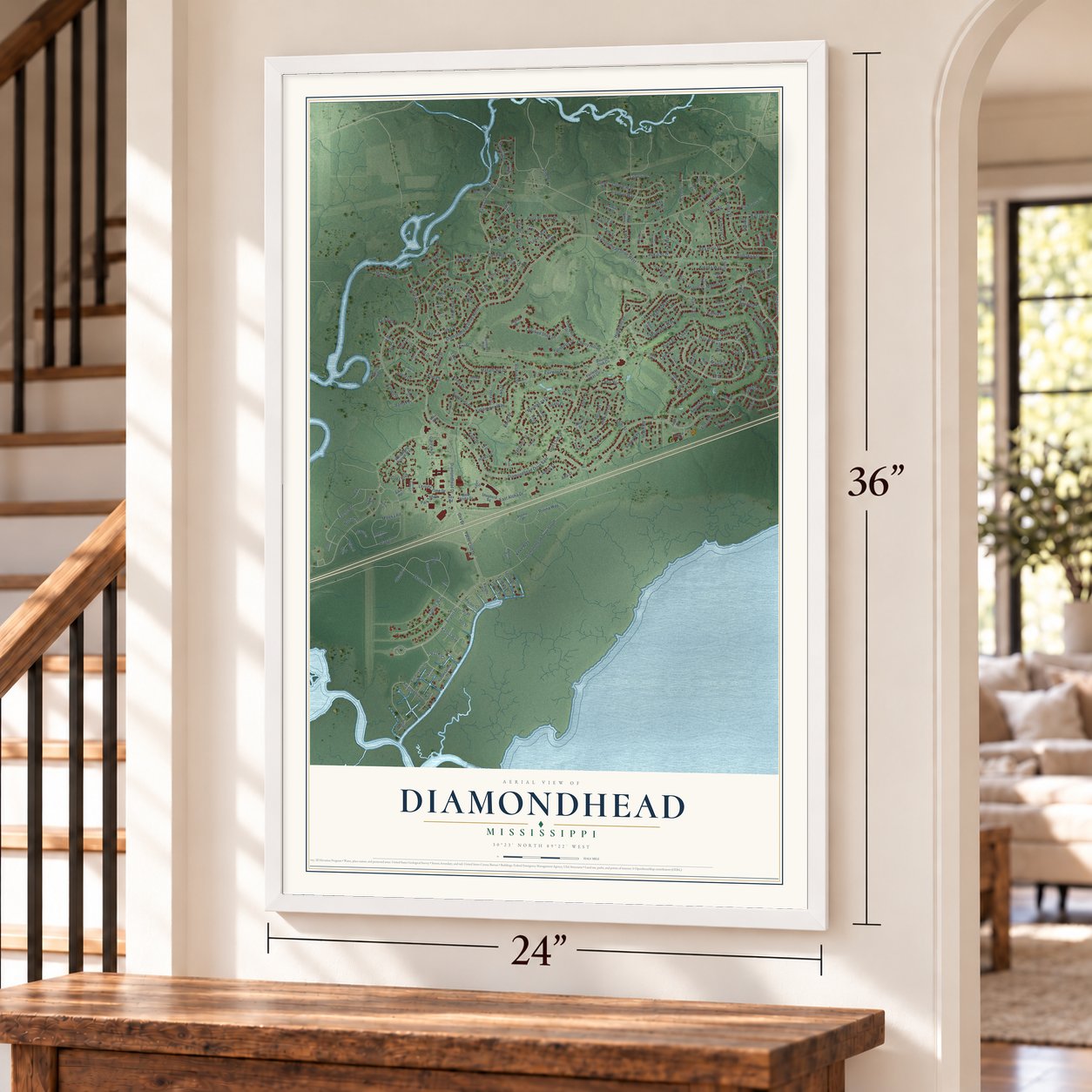
Explore Diamondhead, Mississippi from a whole new perspective. Created using aerial imagery and detailed geographic data, this map captures Diamondhead building by building, with labeled streets, familiar landmarks, and shaded topographical relief that highlights the natural contours of the landscape.
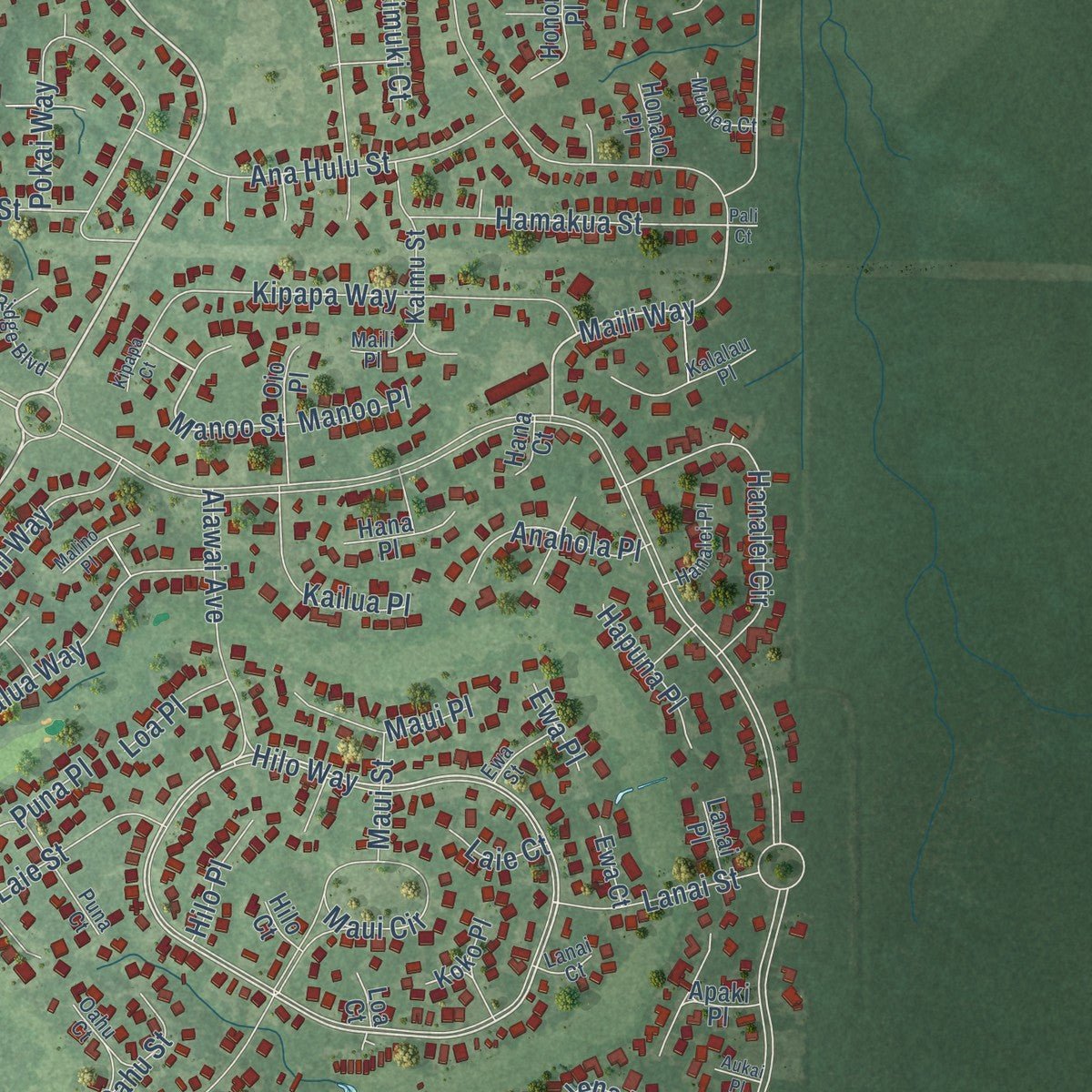
Combining modern data with the timeless character of a vintage atlas, this map is just as interesting up close as it is beautiful on the wall. Whether you grew up in Diamondhead, spent memorable years there, or call it home today, this unique map is a great way to celebrate a place that means something to you. Zoom in on the preview to look for your street, and then order a print to put your memories on the wall.
Three ways to hang it
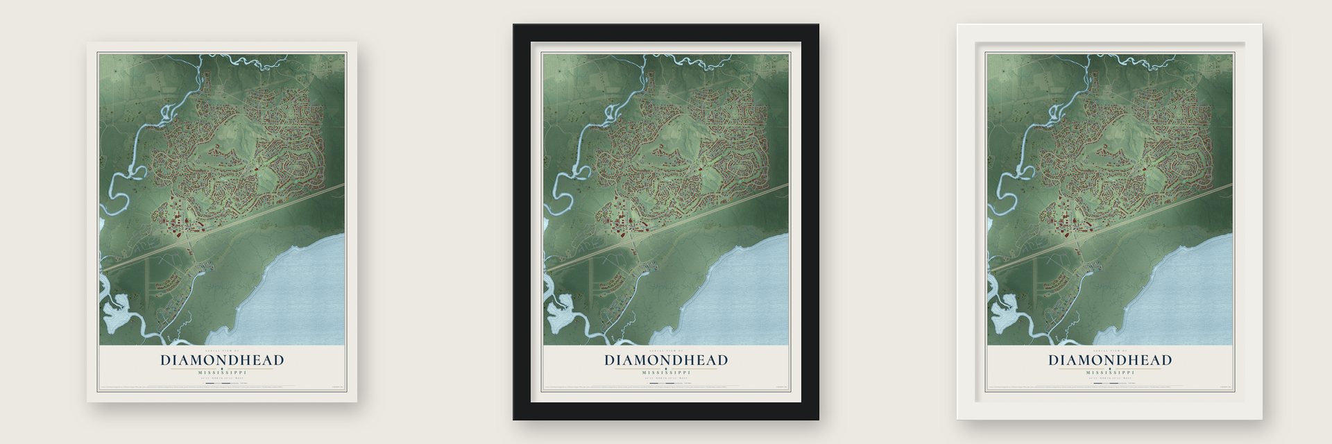
Unframed archival matte, a black wood frame or a white wood frame.
Up close
Geography Worth Displaying
This map was created using accurate cartographic data and authoritative geographic sources, including the U.S. Geological Survey and the Census Bureau. The map brings together terrain, waterways, roads, and building detail. The majority of the streets are labeled, houses are accurately depicted, and the topography is derived from government sources. Combining local data with carefully composed color and shading leads to this beautifully detailed Diamondhead artwork for your wall.
Rather than simply showing street outlines, we’ve included as many of the street names as we could reasonably fit on the map while keeping their names legible. Zoom in on the high resolution preview to see exactly what’s on the map. We truly set out to create a statement piece for anyone who loves Diamondhead. So whether it’s for you, or a gift for someone you love, we hope this map of Diamondhead brings back fond memories.
Read the story behind this map of Diamondhead, Mississippi from 2026.

About Diamondhead, Mississippi
From the City of Diamondhead: "The first project was called Diamondhead because the land is the highest point of elevation on the Gulf Coast in Mississippi, named after the volcanic cone in Hawaii."
Find your street
Names on the Diamondhead map
Every name below is printed on this map. Look for your street, your school, the park where you played, or the pond down the road.
Streets and roads249
- Golf Club Drive
- Bayou Drive
- Highpoint Drive
- Fairway Drive
- Hilo Way
- Maili Way
- Diamondhead Drive East
- Manoo Street
- Pane Drive
- Noma Drive
- Diamondhead Drive North
- Diamondhead Drive West
- Kapalama Drive
- Airport Drive
- Akoko Street
- Diamondhead Drive South
- Koloa Street
- Alapai Drive
- Op la Way
- Turnberry Drive
- Polina Way
- Ala Moana Street
- Alakoko Drive
- Ahekolo Circle
- Analii Street
- Coelho Way
- Kalipekona Way
- Mahalo Hui Drive
- Hilo Street
- Gex Drive
Show all 249 streets
- Lola Drive
- Kahana Street
- Linohau Way
- Kaiki Drive
- Mauna Loa Drive
- Palene Road
- Kalaepohuku Drive
- Oaks Boulevard
- Yacht Club Drive
- Moanalua Way
- Kome Drive
- Makiki Drive
- Amoka Drive
- Laa la Way
- Lanai Vlg
- Pokai Way
- Lilinoe Way
- Crooked Stick Drive
- Kipapa Way
- Kolo Way
- Anela Drive
- Limu Way
- Ieke Drive
- Alkii Way
- Kahala Drive
- Ana Hulu Street
- Diamondhead Drive
- Aila Street
- Manini Way
- Kanoa Way
- Ahi Drive
- Kiko Street
- Cherry Hill Drive
- Hanalei Circle
- Maleka Road
- Koula Drive
- Pokai Street
- Alawai Avenue
- Hamakua Street
- East Aloha Drive
- Park Ten Drive
- Iona Street
- Maui Circle
- Maunalani Place
- Kaleki Way
- Ahoni Street
- Akikai Drive
- Leisure Time Drive
- Kalae Street
- Keke Way
- Apona Street
- Kailua Place
- Haleiwa Place
- Awini Street
- Anahola Place
- Bambo Street
- Ahihi Street
- Laie Street
- Alii Place
- Lanai Street
- Apua Street
- Ieke Circle
- Maui Place
- Anela Street
- Bayou Place
- Banian Place
- Anoai Way
- Mohonua Place
- Oahu Street
- Hapuna Place
- Luawai Place
- Kini Street
- Loulu Place
- Hanauma Street
- Pine Road
- Kaimuki Court
- Hilo Place
- Paani Court
- Puna Place
- Aulena Place
- Luakini Place
- Nele Place
- Maui Street
- Kino Place
- Manoo Place
- Loa Place
- Lono Place
- Noma Court
- Ahiahi Place
- Aupuni Place
- Kale Place
- Laie Court
- Ahia Court
- Akoni Court
- Iki Place
- Pono Place
- Ahi Court
- Iolani Court
- Lewi Street
- Poni Place
- Ewa Place
- Kimo Place
- Akaka Court
- Apelehama Road
- Kaumakapili Street
- Cherryhill Drive
- Country Club Circle
- Luawai Way
- Shepherd Square
- Devils Elbow
- Harbor Circle
- Apuwai Place
- Vaught Circle
- Apaki Place
- Ahui Street
- Noma Place
- Bayou Circle
- Ahuli Place
- Fairway Villas Circle
- Gex Road
- Hana Place
- Kaimu Street
- Kimo Court
- Whispering Branch Way
- Kino Street
- Nola Court
- Hanakealoha Place
- Oak Park Drive
- Laie Place
- Oio Place
- Lualini Place
- West Aloha Drive
- Honomu Place
- Puunani Place
- Ala Moana Place
- Turnberry Way
- Hau Street
- Lumahai Place
- Kaena Place
- Lilinoe Place
- Limu Place
- Hoaka Lane
- Laa la Court
- Alapai Court
- Nele Court
- Amoka Place
- Polina Place
- Maleka Place
- Koko Place
- Auiki Place
- Koloa Court
- Laa la Place
- Oliwa Place
- Ewa Court
- Honalo Place
- Kini Place
- Hale Court
- Kono Place
- Lanai Place
- Polina Circle
- Op la Court
- Alika Court
- Op la Place
- Kalo Court
- Hana Court
- Leke Place
- Hilo Court
- Ahi Street
- Loa Court
- Aika Road
- Lae Court
- Kalani Drive
- Banyan Place
- Kalalau Place
- Ahuawa Place
- Airport Circle
- Pine Ridge Boulevard
- Poki Place
- Oahu Court
- Anela Place
- Kapalama Court
- Augusta Way
- Anuaea Street
- Mauna Loa Place
- Hanalei Place
- Malahini Place
- Muolea Court
- Anela Court
- Puna Court
- Malie Place
- Ewa Street
- Noma Circle
- Aumoae Court
- Leisure Time Lane
- Haena Court
- Maili Place
- Amoka Court
- Palene Place
- Lanai Court
- Kaleki Place
- Auahi Place
- Make Way
- Pain Place
- Lola Court
- Kui Place
- Malino Place
- Laala Place
- Mauna Loa Court
- Kale Street
- Apelehama Place
- Alakoko Place
- Koula Place
- Kipapa Court
- Kaleki Court
- Tahiti Circle
- Aukai Place
- Kaiki Circle
- Kaiki Court
- Pali Court
Names are listed as they appear on the printed map. Zoom into the product photos to find them.
The art of mapping a place
How This Map Was Made
Real places. Remarkable detail. Discover the layers that turn geographic data into a map of home.

The view from above
Aerial imagery reveals the character of the land: woodland, open fields, and the patterns of a place.

The shape of the land
Elevation data brings hills, valleys, and subtle changes in the landscape into view.

The details of home
Roads, waterways, and building footprints come together to make the map feel unmistakably local.

Geography becomes art
Considered color, shading, and typography bring the layers together in a map made for your wall.


Process illustrated with Mendon, Massachusetts. Aerial imagery: USDA NAIP. Terrain: USGS 3D Elevation Program. Map details and finished artwork: KNOWOL.
The Details
About This Print
Choose an archival matte print, or a black or white Ayous wood frame. The archival matte print is unframed.
Select your size and finish above to see the matching product image and price.
Materials & Craftsmanship
A contemporary map with the character of a classic atlas, printed on archival matte paper. Optional frames are made from Ayous wood.
Your printed map does not include the watermark shown in the full-map preview.
Shipping & Delivery
Free shipping within the United States. Every print is made to order in the USA.
Buying a gift? Add a note in your cart and we'll include it. We never put prices in the package.
Prints ship within 2 to 3 business days. Allow 7 to 10 days total from ordering for delivery. Timing may vary during holidays or periods of high order volume.
Read our shipping policy.
Returns and damaged prints
Each print is made to order. Change-of-mind refunds are not available after production.
If your print arrives damaged, misprinted or incorrect, contact support@knowol.com within 30 days of receiving it. Include your order number, photos and a description of the issue.
Read our full refund and replacement policy. For questions about your order, email support@knowol.com.
Find your town
Looking for another city?
Find a map of home in our Mississippi collection, or any town in the country.
Nearby
Maps of towns near Diamondhead
Know someone from one of these towns? Their map makes a great gift.
 Bay St. Louis
, Mississippi
From $39.99See the map
 DeLisle
, Mississippi
From $39.99See the map
 Kiln
Kiln, Mississippi
From $39.99See the map
More maps nearby: Henderson Point, Waveland, Pass Christian, Long Beach and Lyman.