
Search for another town




Free U.S. delivery 7 to 10 days after you order
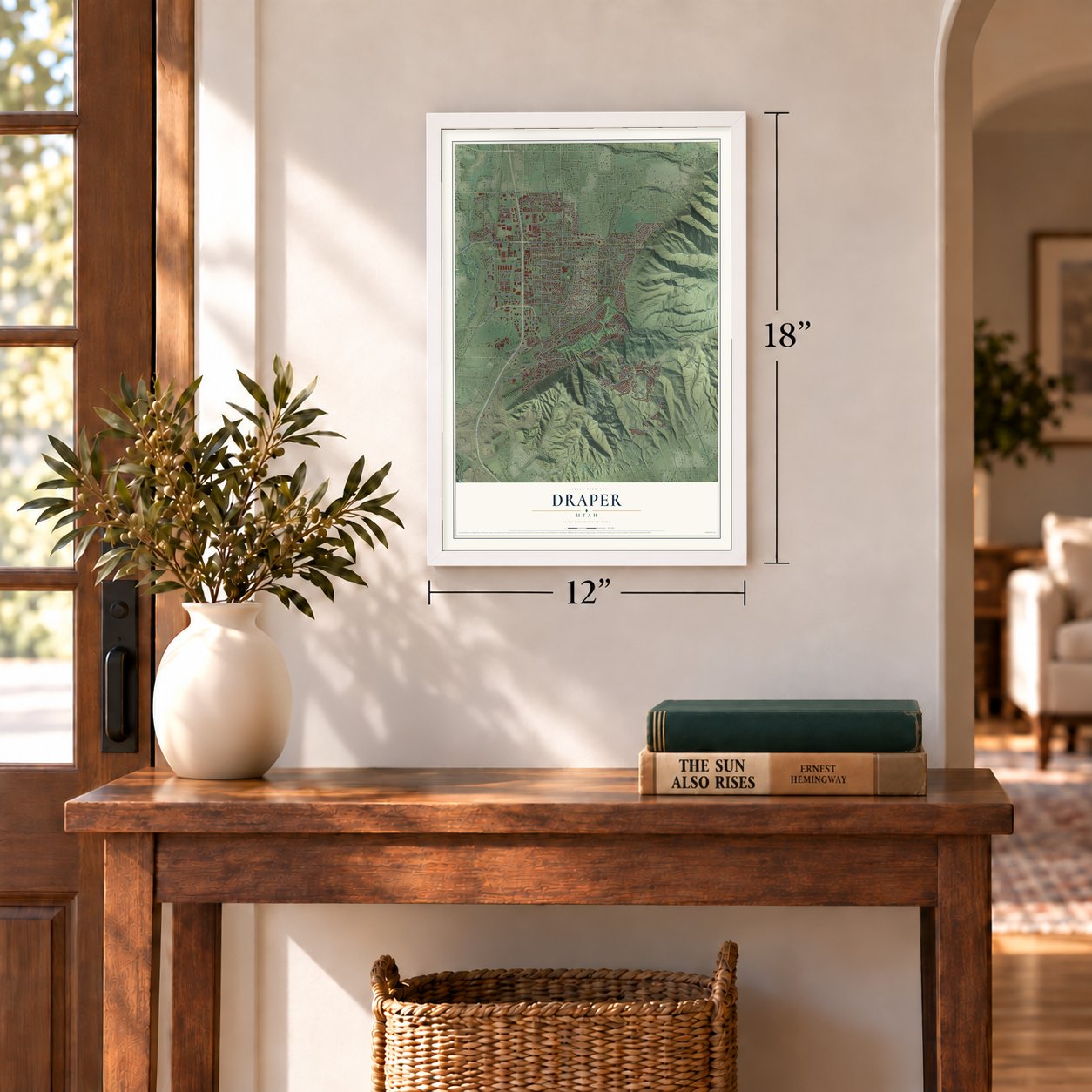
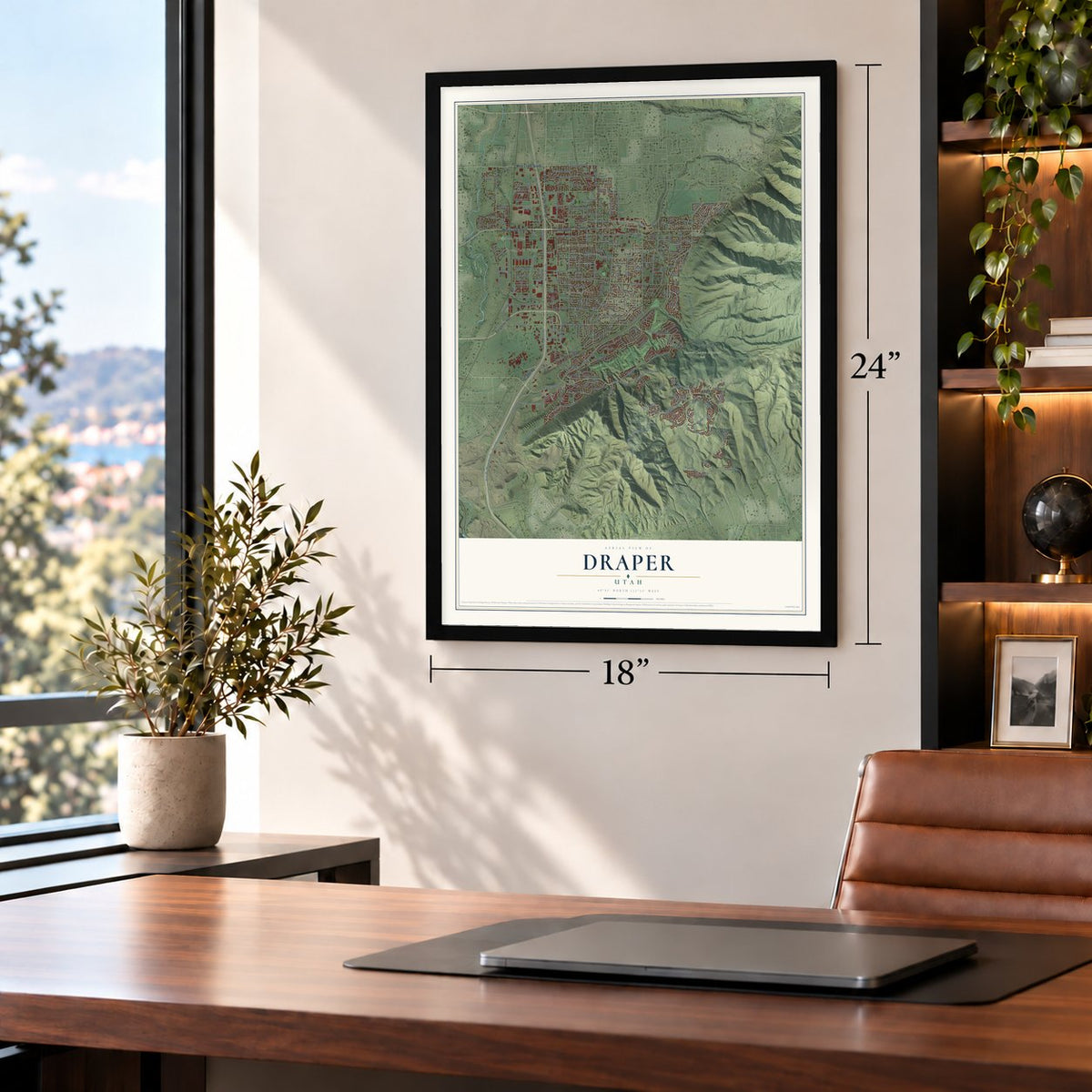
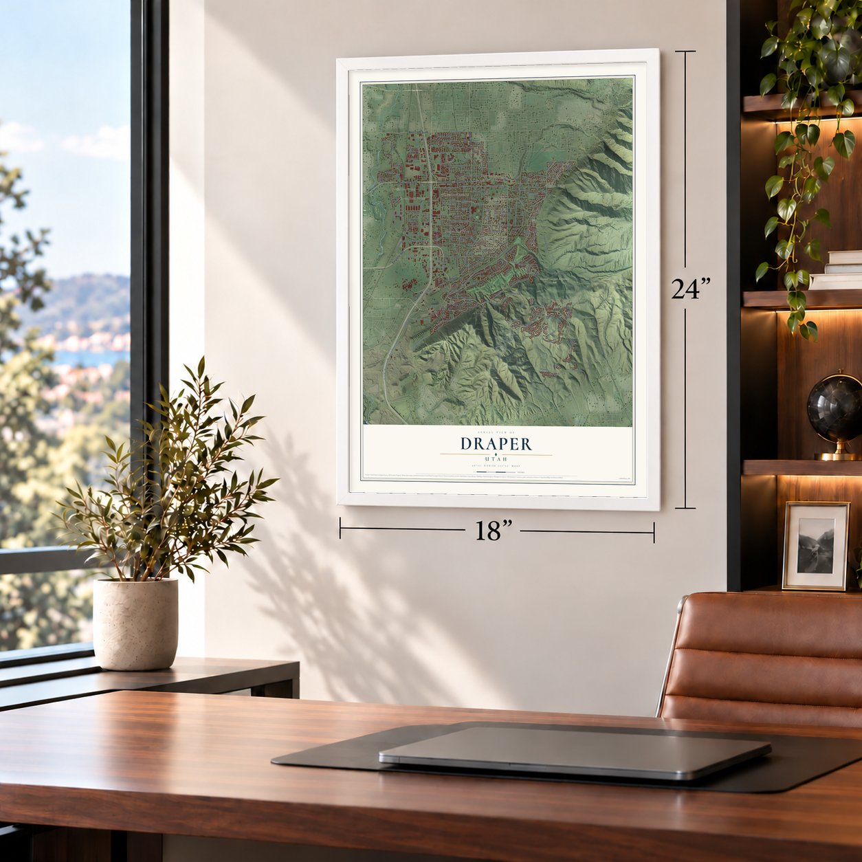
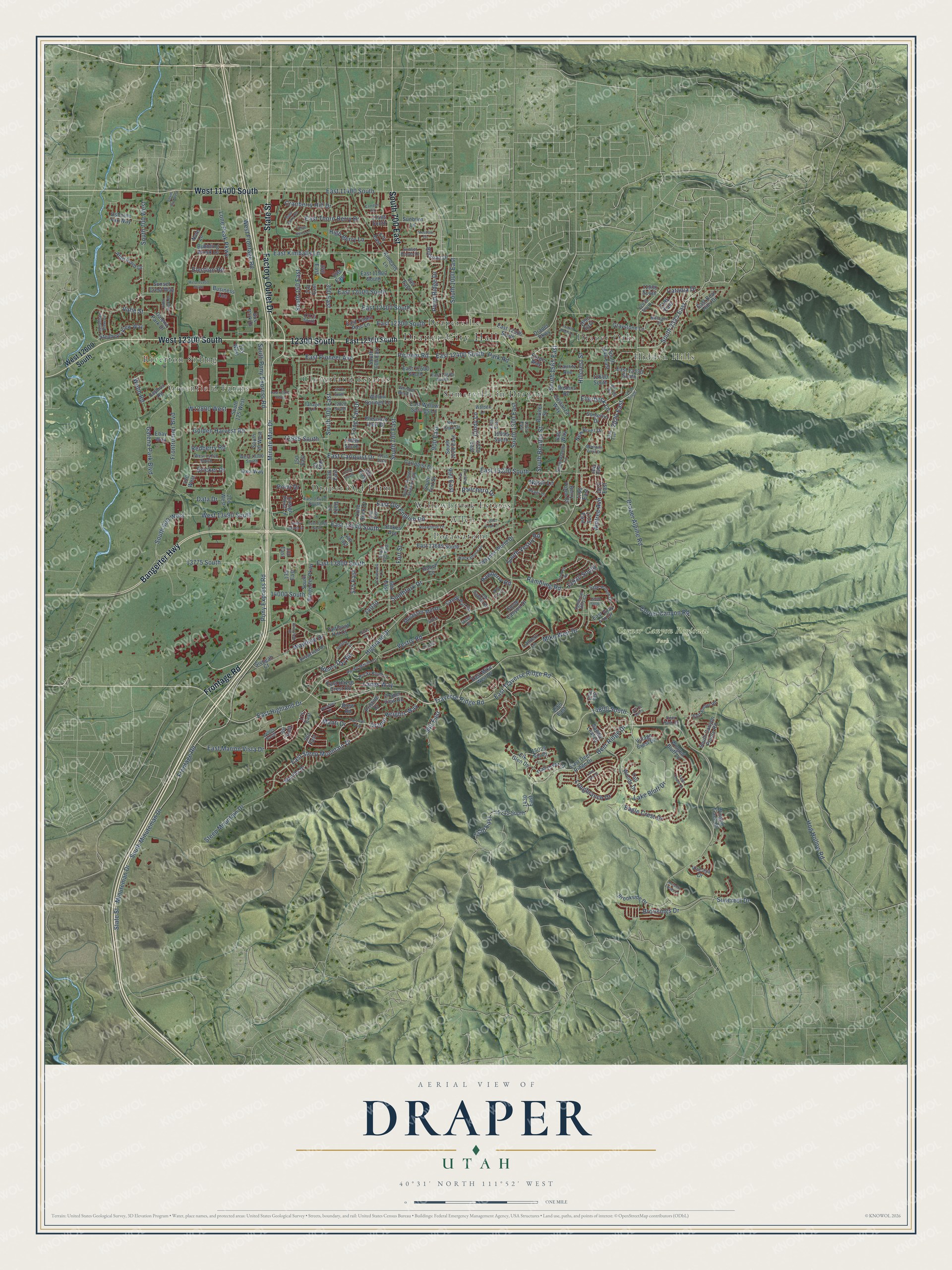
Draper, Utah Map Art
A new map of Draper, Utah, made in 2026 and printed to order on thick archival matte paper.
12" x 18" Archival Matte Print
A Map of Home. A Work of Art.
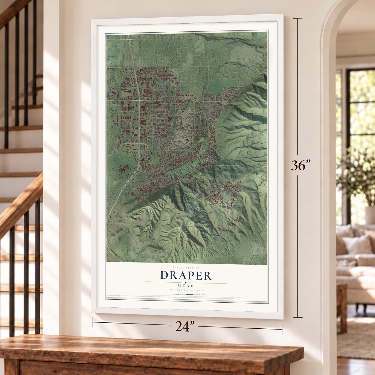
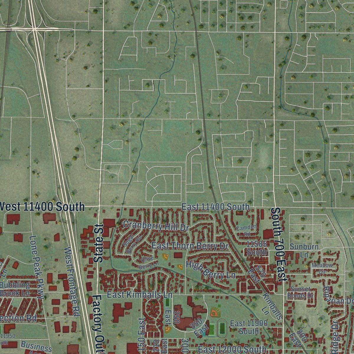
This beautifully detailed map of Draper, Utah was created in 2026 using aerial imagery combined with modern topographical, census, street and landmark data. It's a modern aerial view of Draper in Salt Lake County, Utah, that combines modern data with a vintage aesthetic. Zoom in on the preview and look for your block.
Three ways to hang it
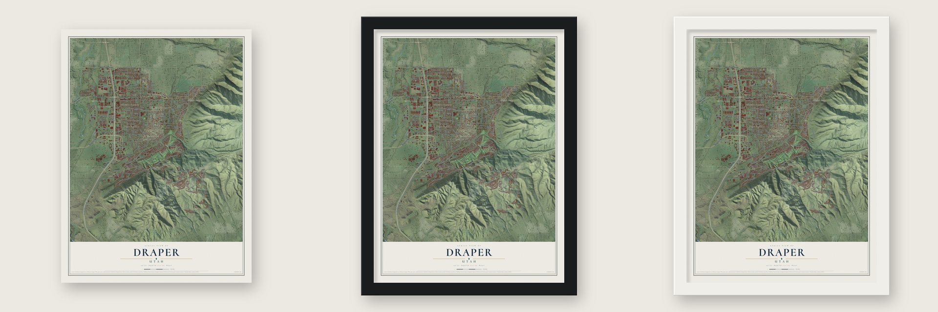
Unframed archival matte, a black wood frame or a white wood frame.
Up close
Real geography. Art worth displaying.
This map was created using accurate cartographic data and authoritative geographic sources, including the U.S. Geological Survey and the Census Bureau. The map brings together terrain, waterways, roads, and building detail. The majority of the streets are labeled, houses are accurately depicted, and the topography is derived from government sources. Combining local data with carefully composed color and shading leads to this beautifully detailed Draper artwork for your wall.
Rather than simply showing street outlines, we’ve included as many of the street names as we could reasonably fit on the map while keeping their names legible. Zoom in on the high resolution preview to see exactly what’s on the map. We truly set out to create a statement piece for anyone who loves Draper. So whether it’s for you, or a gift for someone you love, we hope this map of Draper brings back fond memories.

Find your street
Names on the Draper map
Every name below is printed on this map. Look for your street, your school, the park where you played, or the pond down the road.
Places and landmarks13
- Draper City Hall
- Corner Canyon Regional Park
- Allen
- Cloverland Estates
- Draper Oaks
- Draper Old Farm
- Draperville
- Greenfield Farms
- Hidden Hills
- Potawatomi
- Riverton Siding
- Somerville in Draper
Show all 13 places
- Willowbrook Estates
Streets and roads280
- West 12300 South
- 12300 South
- Factory Outlet Drive
- Frontage Road
- Bangerter Highway
- West 11400 South
- State Street
- South 700 East
- Highland Drive
- Traverse Ridge Road
- Pioneer Road
- East Traverse Ridge Road
- Deer Ridge Drive
- East Highland Drive
- East 12400 South
- South 2325 East
- East Pioneer Avenue
- Draper Heights Way
- Manti Drive
- East 11400 South
- Suncrest Drive
- Longbranch Drive
- South Minuteman Drive
- East Steep Mountain Drive
- Minuteman Drive
- Minute Man Drive
- Southfork Drive
- Lanes Way
- East 13800 South
- Eagle Crest Drive
Show all 280 streets
- South Vestry Road
- South Pony Express Road
- 13775 South
- 14800 South
- South 600 West
- Vestry Road
- Lone Peak Parkway
- East Kimballs Lane
- 940 East
- 1150 East
- Pony Express Road
- East Old English Road
- Galena Park Boulevard
- East Carlquist Drive
- Henry Day Road
- Long Tail Drive
- 2020 East
- 900 East
- West 13490 South
- Redberry Road
- East 12200 South
- South Boulter Street
- South 300 East
- Draper Alpine Road
- Steep Mountain Drive
- South 1300 East
- Hog Hollow Road
- Fort Street
- South 150 East
- Corner Canyon Road
- East 13200 South
- Rambling Road
- Aintree Avenue
- South 700 West
- Mike Weir Drive
- South 1565 East
- East 12000 South
- East 12100 South
- Vahe Street
- Frontrunner Boulevard
- East Thorn Berry Drive
- South 1000 East
- East 13540 South
- Brookings Drive
- Lake Bluff Drive
- Golden Harvest Road
- East Marion Vista Drive
- Cranberry Hill Drive
- Election Road
- Pond Ridge Drive
- Hawberry Road
- 12985 South
- Ellerbeck Lane
- 300 East
- Nashi Lane
- West Frontage Road
- Data Drive
- Catania Drive
- Wayfield Drive
- High Berry Lane
- Ranchero Drive
- Hillcrest Street
- Point Drive
- 13930 South
- 14000 South
- Bricker Drive
- Webb Road
- 575 East
- 990 East
- Cindy Lane
- Park Road
- East 12300 South
- West 12600 South
- East Deer Ridge Drive
- 1775 East
- South Bangerter Parkway
- Manilla Drive
- 260 East
- East Haven Crest Road
- 600 East
- South Canyon Pointe Road
- Winged Bluff Lane
- Lone Rock Drive
- 1565 East
- Tall Woods Drive
- Pheasant View Drive
- 420 West
- Carlquist Drive
- East Willow Springs Lane
- 15215 South
- 11980 South
- 90 East
- 12600 South
- Willow Springs Lane
- East Gray Fox Drive
- Sunset Crest Way
- Molasses Mill Drive
- Galena Park Drive
- 250 East
- 505 East
- Nate Lane
- South 1840 East
- East Mike Weir Drive
- Ikea Way
- 200 West
- South Fort Street
- South 125 West
- Draper Parkway
- Business Acc
- East 13685 South
- East 12500 South
- South 600 East
- Stokes Avenue
- Boulter Street
- Winged Trace Court
- Graystone Lane
- Brookside Drive
- East 12530 South
- Stephens View Way
- Stone Canyon Drive
- 125 West
- East 11900 South
- Waynes World Drive
- Elk Glen Drive
- 175 East
- 15025 South
- Bubbling Brook Lane
- Draper View Road
- 350 East
- Bus Park Drive
- Somerlin Drive
- Ensign Point Lane
- Riparian Drive
- Sunburn Lane
- Osborne Fox Way
- Candy Pull Drive
- Trail Crest Court
- Berry Patch Court
- South 1020 East
- East Tilden Parc Lane
- Alan Point Drive
- New River Drive
- Cephus Road
- Village Crest Drive
- 440 East
- Richins Road
- 1870 East
- Pristine Drive
- 135 East
- 330 East
- Costanza Way
- Dairy Lane
- Lantern Lane
- East Bear Hills Drive
- Forge Way
- Lauritz Avenue
- Kimballs Lane
- Fairmont Hill Court
- 2195 East
- Viscaya Drive
- Sivogah Court
- Ebay Way
- 100 East
- 570 East
- Saddle Leaf Court
- 1765 East
- 210 East
- 1690 East
- South 40 West
- 12995 South
- Ranch Circle
- 1430 East
- 13065 South
- 11585 South
- 800 East
- 150 East
- Brew Road
- 1120 East
- Salz Way
- Day Court
- 12075 South
- Rocky Mouth Lane
- East Ember Road
- Tanager Lane
- East 13400 South
- Rosefield Lane
- 12175 South
- 1845 East
- Old Saddle Road
- 12820 South
- East 12600 South
- Rocky Knoll Lane
- Hackamore Drive
- Akagi Lane
- Bridgefield Drive
- Walden Lane
- Sage Hollow Drive
- Montane Drive
- Whisper Bend Drive
- South Sunset Stream Way
- West 13130 South
- Shadowlands Lane
- West 13300 South
- Jonathan View Lane
- New Hope Drive
- Somerset Hills Court
- 14905 South
- 1800 East
- Sunset Bonds Drive
- Cromwell Lane
- Deer Park Lane
- Selina Lane
- South 625 East
- 1205 East
- 585 East
- 1365 East
- Parowan Way
- 12745 South
- Lone Oak Drive
- Eagle Chase Drive
- Sugar Berry Road
- 13250 South
- Lone Peak Lane
- 13145 South
- Timoney Road
- Indian Wells Lane
- Olive Berry Lane
- Aiden Ridge Drive
- West 11950 South
- East 13560 South
- Bella Monte Drive
- Camden Road
- Skyler Drive
- Daisyfield Drive
- Mountain Crest Drive
- Trail Rider Circle
- Kaseys Circle
- East 12675 South
- Nechatel Drive
- South 540 West
- Wild Hay Lane
- Wilding Way
- Ports Cv
- Autumn Fields Lane
- 12700 South
- Meadow Circle
- 1935 East
- 14030 South
- Spiers Lane
- 14775 South
Names are listed as they appear on the printed map. Zoom into the product photos to find them.
The art of mapping a place
How This Map Was Made
Real places. Remarkable detail. Discover the layers that turn geographic data into a map of home.

The view from above
Aerial imagery reveals the character of the land: woodland, open fields, and the patterns of a place.

The shape of the land
Elevation data brings hills, valleys, and subtle changes in the landscape into view.

The details of home
Roads, waterways, and building footprints come together to make the map feel unmistakably local.

Geography becomes art
Considered color, shading, and typography bring the layers together in a map made for your wall.


Process illustrated with Mendon, Massachusetts. Aerial imagery: USDA NAIP. Terrain: USGS 3D Elevation Program. Map details and finished artwork: KNOWOL.
The Details
About This Print
Choose an archival matte print, or a black or white Ayous wood frame. The archival matte print is unframed.
Select your size and finish above to see the matching product image and price.
Materials & Craftsmanship
A contemporary map with the character of a classic atlas, printed on archival matte paper. Optional frames are made from Ayous wood.
Your printed map does not include the watermark shown in the full-map preview.
Shipping & Delivery
Free shipping within the United States. Every print is made to order in the USA.
Buying a gift? Add a note in your cart and we'll include it. We never put prices in the package.
Prints ship within 2 to 3 business days. Allow 7 to 10 days total from ordering for delivery. Timing may vary during holidays or periods of high order volume.
Read our shipping policy.
Returns and damaged prints
Each print is made to order. Change-of-mind refunds are not available after production.
If your print arrives damaged, misprinted or incorrect, contact support@knowol.com within 30 days of receiving it. Include your order number, photos and a description of the issue.
Read our full refund and replacement policy. For questions about your order, email support@knowol.com.
Find your town
Looking for another city?
Find a map of home in our Utah collection.
Nearby
Maps of towns near Draper
Know someone from one of these towns? Their map makes a great gift.
 Bluffdale
, Utah
From $39.99See the map
 White City
, Utah
From $39.99See the map
 Sandy
Sandy, Utah
From $39.99See the map
More maps nearby: Riverton, Alpine, Lehi, Highland and Granite.