
Search for another town





Free U.S. delivery 7 to 10 days after you order
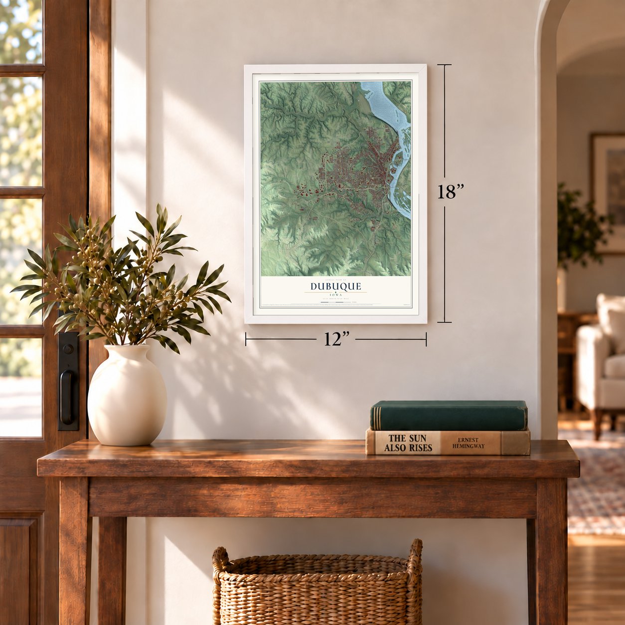
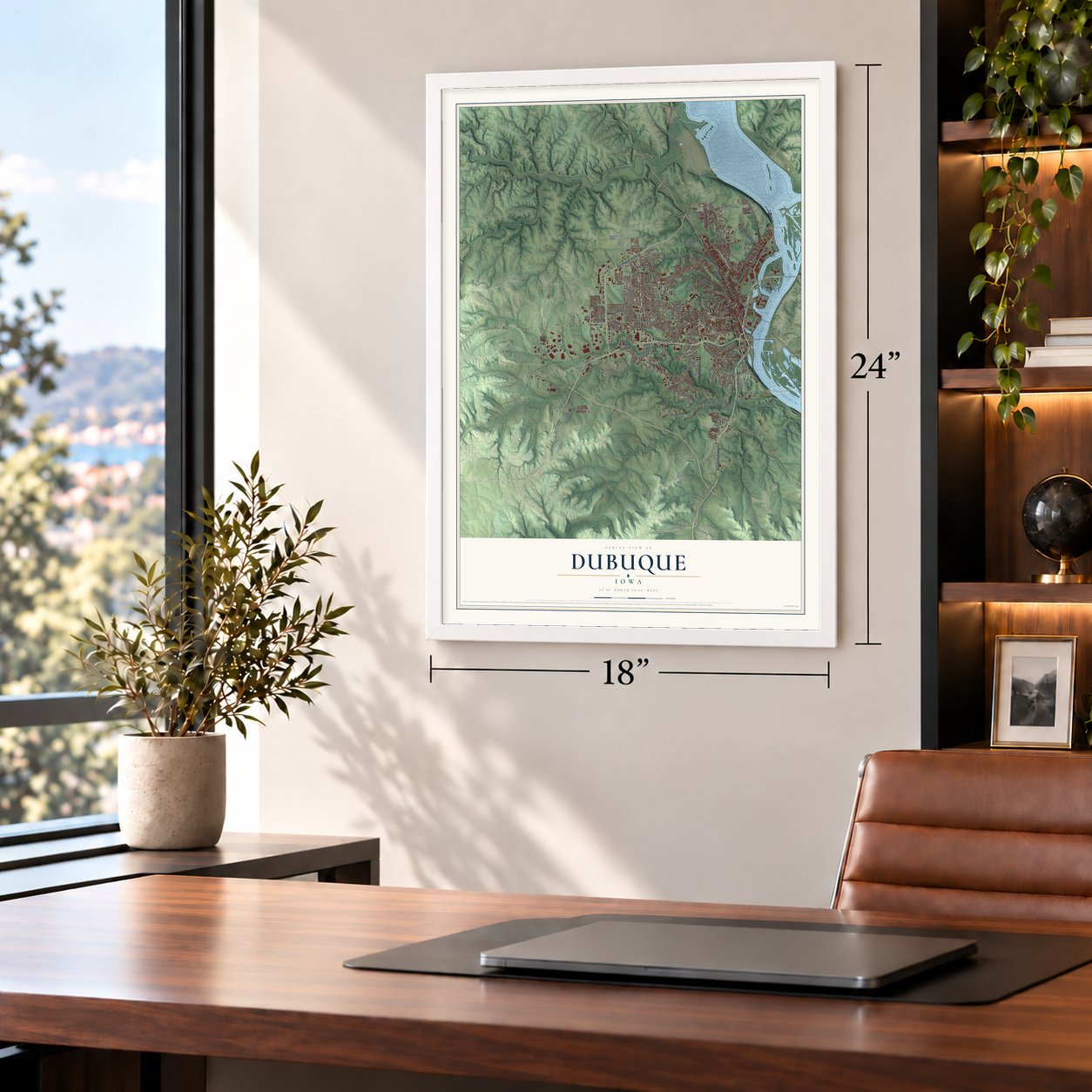
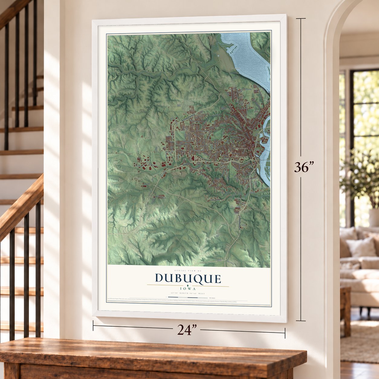
Dubuque, Iowa Map Art
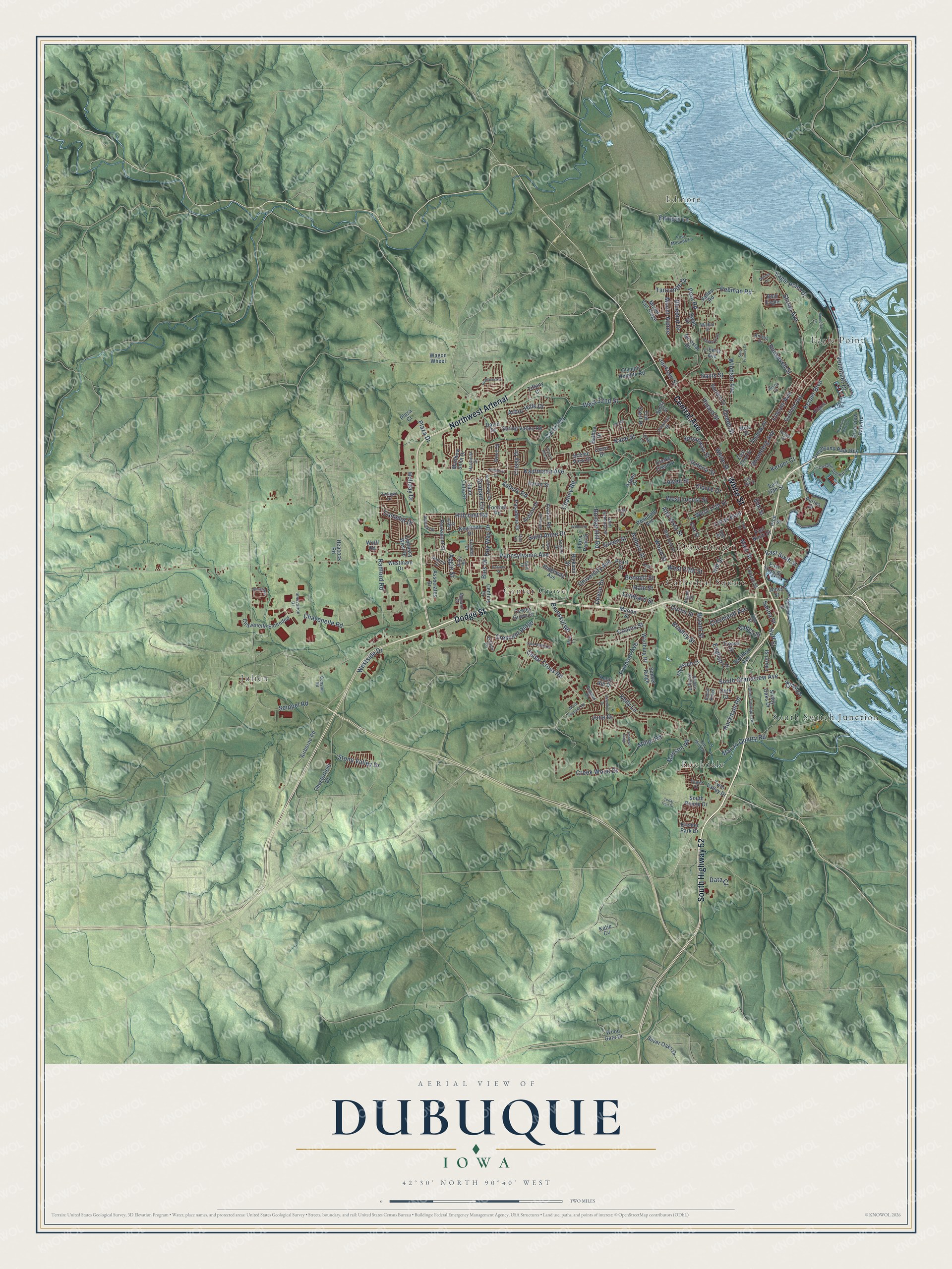
A new map of Dubuque, Iowa, made in 2026 and printed to order on thick archival matte paper.
12" x 18" Archival Matte Print
A Map of Home. A Work of Art.
Explore Dubuque, Iowa from a whole new perspective. Created using aerial imagery and detailed geographic data, this map captures Dubuque building by building, with labeled streets, familiar landmarks, and shaded topographical relief that highlights the natural contours of the landscape.
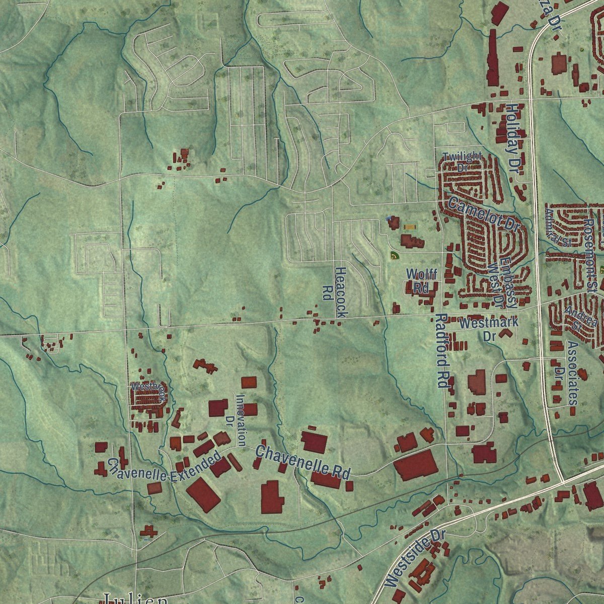
Combining modern data with the timeless character of a vintage atlas, this map is just as interesting up close as it is beautiful on the wall. Whether you grew up in Dubuque, spent memorable years there, or call it home today, this unique map is a great way to celebrate a place that means something to you. Zoom in on the preview to look for your street, and then order a print to put your memories on the wall.
Three ways to hang it
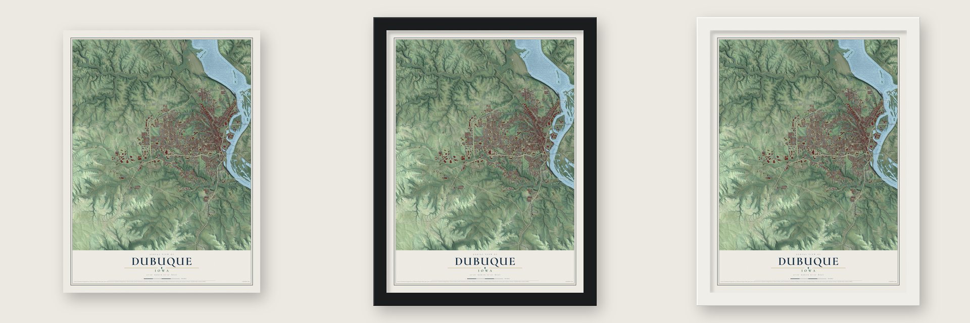
Unframed archival matte, a black wood frame or a white wood frame.
Up close
Geography Worth Displaying
This map was created using accurate cartographic data and authoritative geographic sources, including the U.S. Geological Survey and the Census Bureau. The map brings together terrain, waterways, roads, and building detail. The majority of the streets are labeled, houses are accurately depicted, and the topography is derived from government sources. Combining local data with carefully composed color and shading leads to this beautifully detailed Dubuque artwork for your wall.
Rather than simply showing street outlines, we’ve included as many of the street names as we could reasonably fit on the map while keeping their names legible. Zoom in on the high resolution preview to see exactly what’s on the map. We truly set out to create a statement piece for anyone who loves Dubuque. So whether it’s for you, or a gift for someone you love, we hope this map of Dubuque brings back fond memories.

About Dubuque, Iowa
Dubuque stands on the Mississippi River where Iowa, Illinois, and Wisconsin meet. Settled in 1788 and chartered in 1833, it is Iowa's oldest city, with a history shaped by lead mining, timber, boat building, brewing, railroads, and manufacturing. The 2020 census recorded 59,667 residents.
- Oldest Iowa CityDubuque was settled in 1788, chartered in 1833, and named for French Canadian trader and miner Julien Dubuque.
- Lead Mining OriginsIn 1788, Julien Dubuque received permission from Spanish authorities and local Meskwaki people to mine the area's lead deposits.
- Three State SettingThe city lies where the borders of Iowa, Illinois, and Wisconsin converge, an area locally called the Tri-State Area.
- Driftless TerrainDubuque belongs to the Driftless Area, where the absence of Wisconsin glaciation helped preserve a hilly landscape unusual in much of the Midwest.
- Historic FunicularThe present Fenelon Place Elevator was built in 1893 and carries passengers along one of Dubuque's bluffs.
Find your street
Names on the Dubuque map
Every name below is printed on this map. Look for your street, your school, the park where you played, or the pond down the road.
Places and landmarks8
- Downtown
- Edmore
- Cathedral Square
- Center Grove
- Eagle Point
- Julien
- Rockdale
- South Switch Junction
Streets and roads227
- White Street
- Central Avenue
- Northwest Arterial
- Dodge Street
- South Highway 52
- South Grandview Avenue
- Lincoln Avenue
- Fremont Avenue
- Cedar Cross Road
- East Sixth Street
- Bennett Street
- Lombard Street
- West Fifth Street
- Hill Street
- Kaufmann Avenue
- University Avenue
- Main Street
- Bluebird Drive
- Chavenelle Road
- Radford Road
- Pennsylvania Avenue
- Asbury Road
- Kerper Boulevard
- West 32nd Street
- Jackson Street
- Seippel Road
- Creek Wood Drive
- Carter Road
- Roosevelt Street
- Peru Road
Show all 227 streets
- Rhomberg Avenue
- Hillcrest Road
- Rockdale Road
- Kane Street
- Clarke Drive
- Windsor Avenue
- Loras Boulevard
- Shiras Avenue
- Kelly Lane
- Elm Street
- Chaney Road
- West Locust Street
- Volunteer Drive
- Crescent Ridge
- Alta Vista Street
- Key Way Drive
- Manson Road
- Camelot Drive
- Brunskill Road
- Westside Drive
- Pebman Road
- Saint Anne Drive
- Miller Road
- Stone Valley Drive
- Pinard Street
- Graham Circle
- Queen Street
- Davis Street
- Mar Jo Quarry Road
- Mount Alpine
- Bunker Hill Road
- Lowell Street
- Cleveland Avenue
- Eagle Point Drive
- Plaza Drive
- Broadway Street
- West 17th Street
- Green Street
- Arbor Hills Drive
- Bradley Street
- Auburn Street
- Wood Street
- Coates Street
- Bryant Street
- Holiday Drive
- Carmel Drive
- Edmore Lane
- Crissy Drive
- Tanzanite Drive
- Valley Street
- Valeria Street
- English Lane
- Hale Street
- Curtis Street
- Devon Drive
- Salina Street
- Aggie Street
- Kerper Court
- June Drive
- Bies Drive
- Data Court
- Huff Street
- Jones Street
- Wartburg Place
- East 22nd Street
- East Third Street
- Hickson Street
- Thomas Place
- Ridgeway Avenue
- Southern Avenue
- Garfield Avenue
- Airborne Road
- Locust Street
- Chesterfield Drive
- Valley Road
- East 16th Street
- Rosedale Avenue
- Chavenelle Extended
- Greyhound Park Road
- Avalon Road
- Clarke Crest Drive
- Embassy West Drive
- Riverview Park Road
- Mount Vail Ridge
- Knob Hill Drive
- Burden Street
- Spring Valley Road
- Associates Drive
- Olympic Heights Road
- Shady Oaks Drive
- Silver Oaks Drive
- Cox Street
- Century Drive
- Westmark Drive
- Matthew John Drive
- Saint Celia Street
- Pasadena Drive
- Rosemont Street
- Scenic View Drive
- Oak Crest Drive
- Wood Gate Drive
- South Pointe Drive
- Dove Street
- Keystone Drive
- Pearl Street
- Marion Street
- Plymouth Court
- Swan Drive
- Balboa Drive
- Judson Drive
- Flora Park Drive
- Pine Street
- Aerostar Drive
- Laurel Street
- Stoltz Street
- Sunset Ridge
- Center Grove Drive
- Tressa Street
- Liberty Avenue
- Tiffany Court
- East Ninth Street
- Wolff Road
- Aspen Drive
- Twin Valley Drive
- Heacock Road
- Karen Street
- Foothill Road
- Merz Street
- Purina Drive
- Kremer Park Drive
- Oeth Court
- Cerro Drive
- Plaza Court
- David Drive
- Katie Cv
- Wagon Wheel
- Bald Eagle
- Julien Dubuque Drive
- Glen Oak Street
- Chaplin Schmitt Drive
- Four Mounds Lane
- Alpine Street
- Justin Lane
- Eclipse Circle
- Old Mill Road
- Hacienda Drive
- Admiral Street
- Terminal Street
- Prince Phillip Drive
- Saint Ambrose Street
- Vizaleea Drive
- Southway Drive
- Amelia Drive
- Menard Court
- Twilight Drive
- Primrose Street
- Innovation Drive
- Indian Ridge
- Cousins Road
- Villa Street
- Tower Drive
- Bristol Drive
- Lagen Street
- Walker Street
- Kilgore Street
- Duggan Drive
- Dell Street
- Andrea Street
- Earl Drive
- Riley Drive
- Doe Court
- Lobo Lane
- North Cascade Road
- Memorial Lane
- Iowa Street
- Valentine Drive
- Lake Ridge Drive
- Saint Francis Drive
- Riverview Park Drive
- Westbrook
- Delhi Street
- Honeysuckle
- Fengler Street
- Jeffrey Drive
- Hawkeye Drive
- Wilbricht Lane
- Kimberly Drive
- East 19th Street
- Cedar Trail Drive
- Daniels Street
- Shady Lane
- Hickory Hill Street
- Hunters Ridge
- Eden Lane
- Delicia Drive
- Tyler Road
- Ungs Street
Names are listed as they appear on the printed map. Zoom into the product photos to find them.
The art of mapping a place
How This Map Was Made
Real places. Remarkable detail. Discover the layers that turn geographic data into a map of home.

The view from above
Aerial imagery reveals the character of the land: woodland, open fields, and the patterns of a place.

The shape of the land
Elevation data brings hills, valleys, and subtle changes in the landscape into view.

The details of home
Roads, waterways, and building footprints come together to make the map feel unmistakably local.

Geography becomes art
Considered color, shading, and typography bring the layers together in a map made for your wall.


Process illustrated with Mendon, Massachusetts. Aerial imagery: USDA NAIP. Terrain: USGS 3D Elevation Program. Map details and finished artwork: KNOWOL.
The Details
About This Print
Choose an archival matte print, or a black or white Ayous wood frame. The archival matte print is unframed.
Select your size and finish above to see the matching product image and price.
Materials & Craftsmanship
A contemporary map with the character of a classic atlas, printed on archival matte paper. Optional frames are made from Ayous wood.
Your printed map does not include the watermark shown in the full-map preview.
Shipping & Delivery
Free shipping within the United States. Every print is made to order in the USA.
Buying a gift? Add a note in your cart and we'll include it. We never put prices in the package.
Prints ship within 2 to 3 business days. Allow 7 to 10 days total from ordering for delivery. Timing may vary during holidays or periods of high order volume.
Read our shipping policy.
Returns and damaged prints
Each print is made to order. Change-of-mind refunds are not available after production.
If your print arrives damaged, misprinted or incorrect, contact support@knowol.com within 30 days of receiving it. Include your order number, photos and a description of the issue.
Read our full refund and replacement policy. For questions about your order, email support@knowol.com.
Find your town
Looking for another city?
Find a map of home in our Iowa collection, or any town in the country.
Nearby
Maps of towns near Dubuque
Know someone from one of these towns? Their map makes a great gift.
 Washington Neighborhood
, Iowa
From $39.99See the map
 Sageville
, Iowa
From $39.99See the map
 Asbury
, Iowa
From $39.99See the map
More maps nearby: Durango, Centralia, Peosta, Sherrill and Graf.