
Search for another town



Free U.S. delivery 7 to 10 days after you order
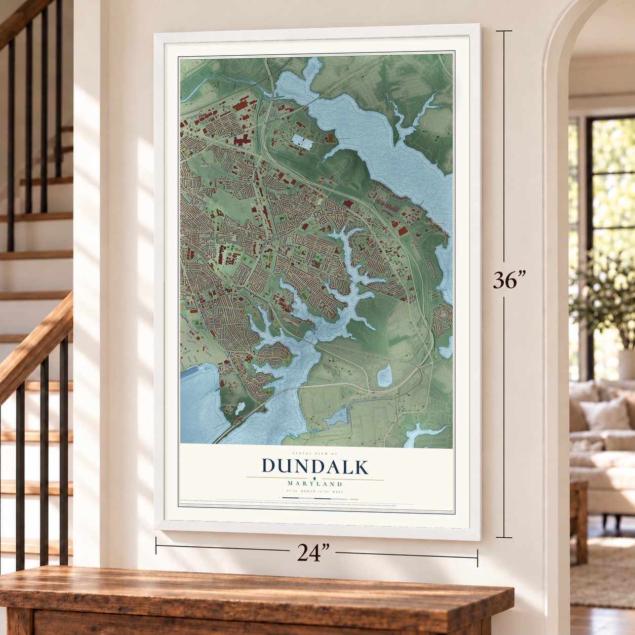
Dundalk, Maryland Map Art
Building by building, with labeled streets and shaded relief.
12" x 18" Archival Matte Print
A Map of Home. A Work of Art.
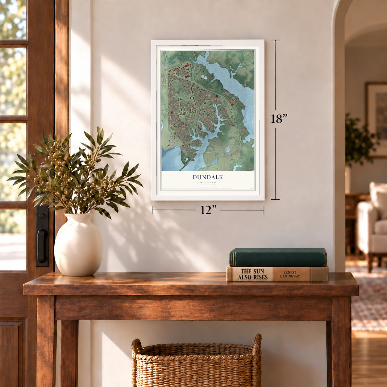
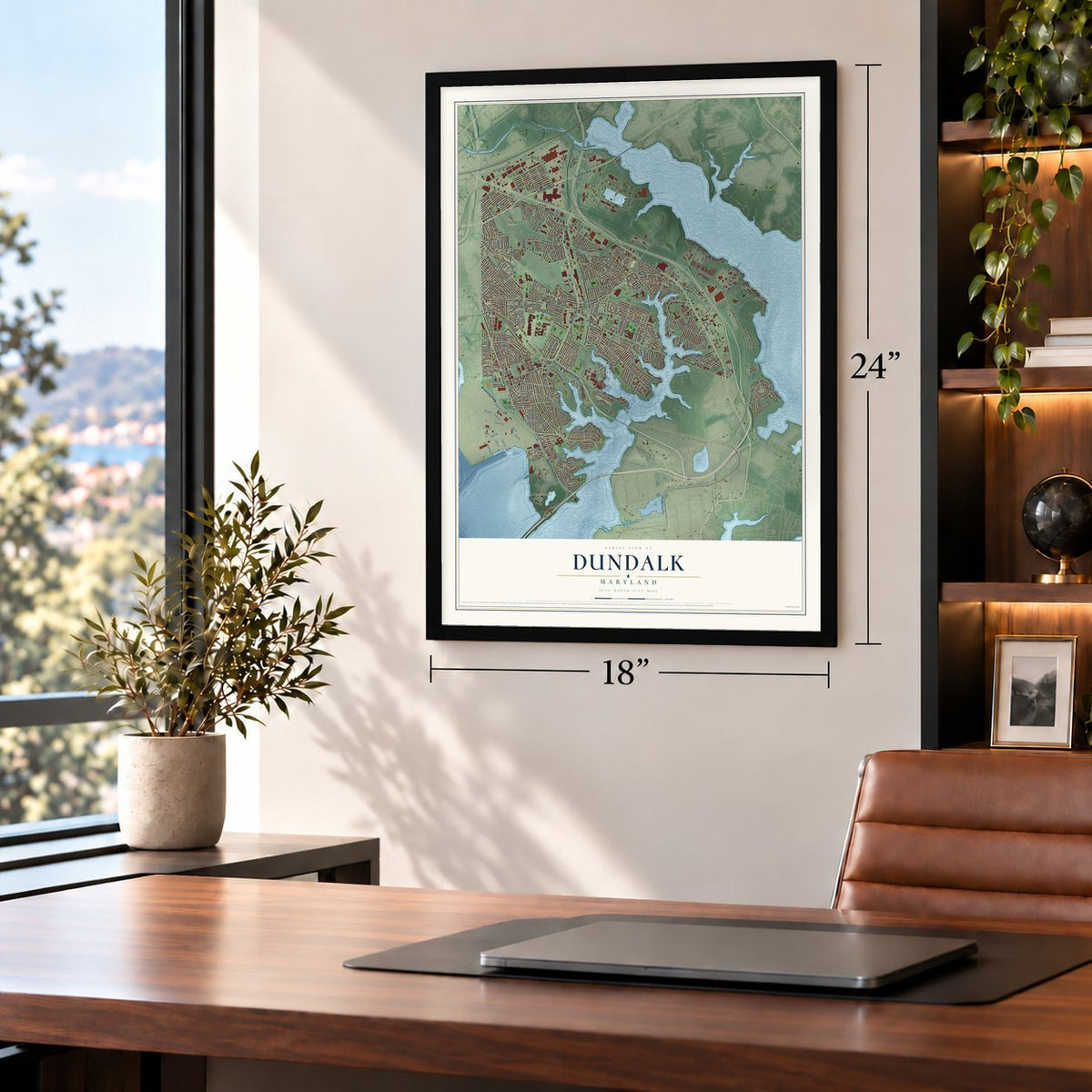
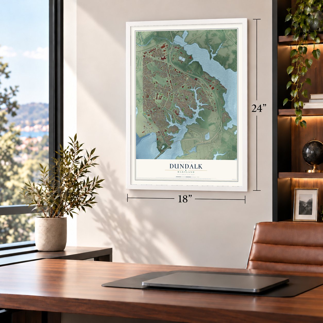
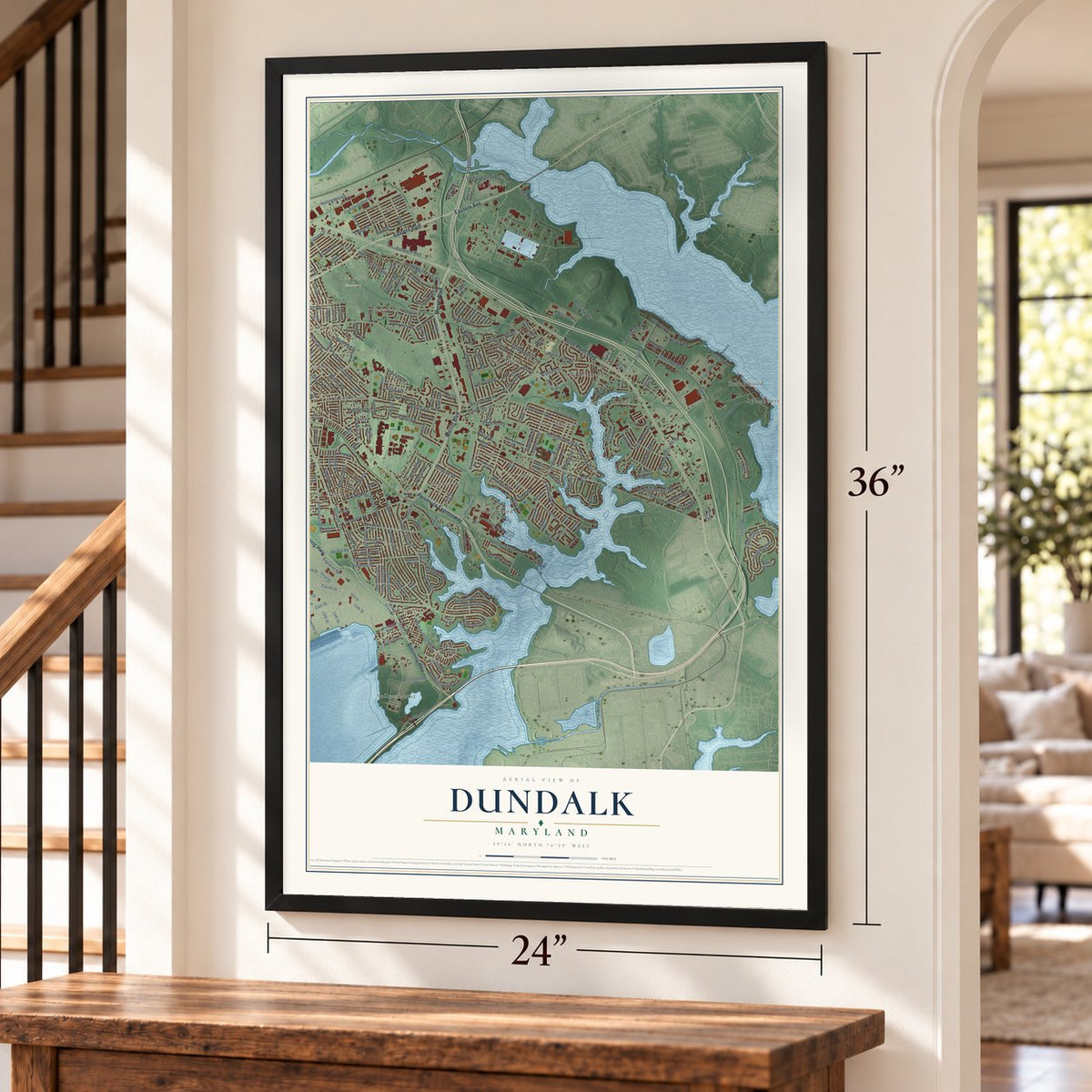
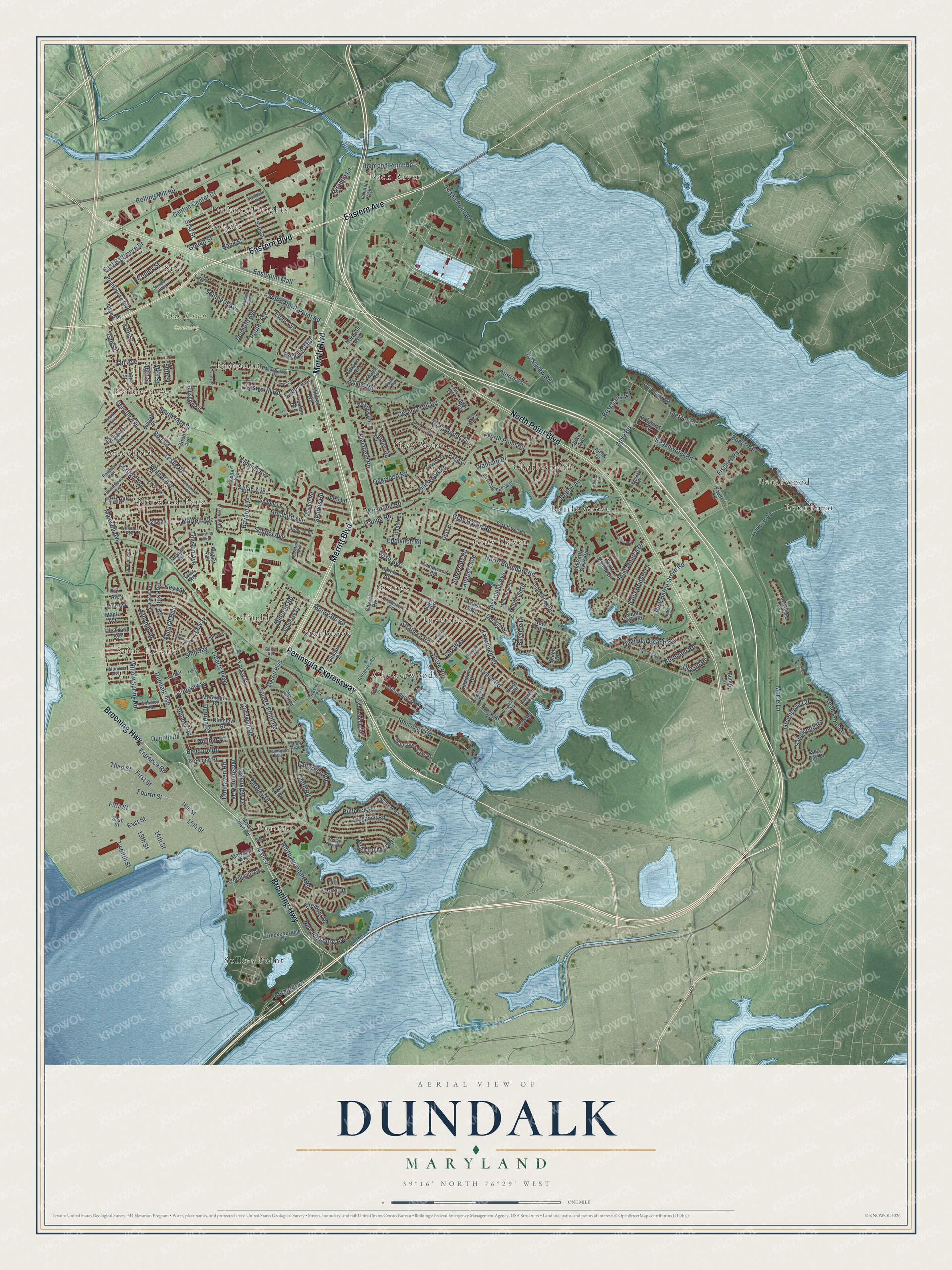
Explore Dundalk, Maryland from a whole new perspective. Created using aerial imagery and detailed geographic data, this map captures Dundalk building by building, with labeled streets, familiar landmarks, and shaded topographical relief that highlights the natural contours of the landscape.
Combining modern data with the timeless character of a vintage atlas, this map is just as interesting up close as it is beautiful on the wall. Whether you grew up in Dundalk, spent memorable years there, or call it home today, this unique map is a great way to celebrate a place that means something to you. Zoom in on the preview to look for your street, and then order a print to put your memories on the wall.
Three ways to hang it
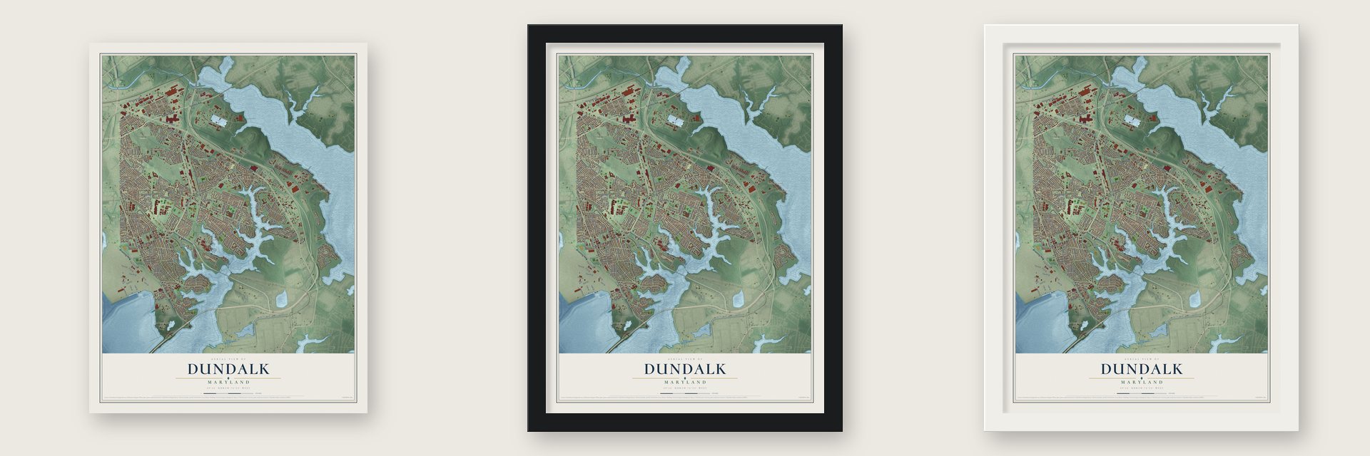
Unframed archival matte, a black wood frame or a white wood frame.
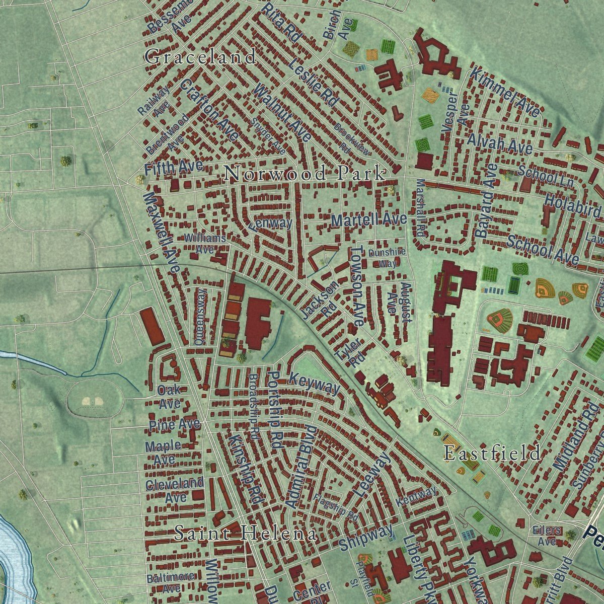
Up close
Geography Worth Displaying
This map was created using accurate cartographic data and authoritative geographic sources, including the U.S. Geological Survey and the Census Bureau. The map brings together terrain, waterways, roads, and building detail. The majority of the streets are labeled, houses are accurately depicted, and the topography is derived from government sources. Combining local data with carefully composed color and shading leads to this beautifully detailed Dundalk artwork for your wall.
Rather than simply showing street outlines, we’ve included as many of the street names as we could reasonably fit on the map while keeping their names legible. Zoom in on the high resolution preview to see exactly what’s on the map. We truly set out to create a statement piece for anyone who loves Dundalk. So whether it’s for you, or a gift for someone you love, we hope this map of Dundalk brings back fond memories.
Read the story behind this map of Dundalk, Maryland from 2026.
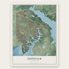
Find your street
Names on the Dundalk map
Every name below is printed on this map. Look for your street, your school, the park where you played, or the pond down the road.
Places and landmarks23
- Oak Lawn Cemetery
- Back River
- Battle Grove
- Beachwood
- Charlesmont
- Chesterwood
- Colgate
- Defense Heights
- Eastfield
- Eastpoint
- Graceland
- Grange
Show all 23 places
- Gray Haven
- Gray Manor
- Harborview
- Inverness
- Lynnhurst
- Norwood Park
- Saint Helena
- Sollers Point
- Stab
- Stanbrook
- Turner
Streets and roads263
- Peninsula Expressway
- Merritt Boulevard
- Broening Highway
- Eastern Avenue
- Eastern Boulevard
- North Point Boulevard
- Diamond Point Road
- Willow Spring Road
- Dundalk Avenue
- Belclare Road
- Alvah Avenue
- Kimmel Avenue
- Main Street
- Morse Lane
- First Street
- Plainfield Road
- Dunhill Road
- Fischer Road
- Third Street
- North Point Road
- Sollers Point Road
- Wise Avenue
- German Hill Road
- Liberty Parkway
- Yorkway
- Lynch Road
- Delvale Avenue
- Trappe Road
- Holabird Avenue
- Rolling Mill Road
Show all 263 streets
- South North Point Road
- Cornwall Road
- Kavanagh Road
- Beachwood Road
- Dunmanway
- Eastpoint Mall
- East Baltimore Street
- Greencove Circle
- Gough Street
- Stansbury Road
- Searles Road
- Cove Road
- North Boundary Road
- Bullneck Road
- Island Point Road
- Shore Road
- Kinship Road
- Bletzer Road
- Westfield Road
- Bayside Drive
- Portship Road
- 48th Street
- Gray Haven Road
- North Avondale Road
- Loganview Drive
- Authority Drive
- Walnut Avenue
- Norris Lane
- Entrance Road
- Willow Road
- Dunran Road
- Todd Point Lane
- New Pittsburg Avenue
- Oakwood Road
- Leslie Road
- Pinewood Road
- Martell Avenue
- Wallford Drive
- Rosebank Avenue
- Bank Street
- Oakleigh Beach Road
- Berkshire Road
- McShane Way
- Saint Monica Drive
- Inverness Avenue
- 47th Street
- Canton Center Drive
- Fourth Street
- East Street
- South 48th Street
- Fairgreen Road
- Shipway
- Gray Manor Terrace
- Sandwood Road
- New Battle Grove Road
- Fait Avenue
- Admiral Boulevard
- School Avenue
- Maxwell Avenue
- Roseview Road
- Saint Bridget Lane
- Bayard Avenue
- Southern Avenue
- Keyway
- 51st Street
- Stratman Road
- Fifth Avenue
- Poplar Avenue
- Rita Road
- Towson Avenue
- Midland Road
- Crafton Avenue
- Belmont Avenue
- Elton Avenue
- Fleming Drive
- Yardley Drive
- Burnham Road
- Conley Street
- Guy Way
- Moorgate Road
- Drexel Road
- Louth Road
- Dunbar Road
- Deboy Avenue
- Dunhaven Road
- Mirabile Lane
- Edsworth Road
- Dunleer Road
- Leeway
- Fifth Street
- 15th Street
- Ambler Road
- Langport Avenue
- Stokesley Road
- Eddlynch Road
- 45th Street
- Rabon Avenue
- Ives Lane
- Beach Road
- 14th Street
- 13th Street
- Twelfth Street
- 49th Street
- 50th Street
- Flora Drive
- Pine Avenue
- Vesper Avenue
- Maryland Avenue
- Sixth Street
- Lynhurst Road
- Breckenbridge Drive
- Old Battle Grove Road
- Mornington Road
- Mount Olive Road
- Church Road
- Stansbury Lake Drive
- Longpoint Road
- Dunglow Road
- Jasmine Road
- 46th Street
- Bear Creek Drive
- 54th Street
- Secluded Cove Lane
- Sunberry Road
- Denbury Drive
- Jackson Road
- Center Place
- Pembrooke Boulevard
- Birch Avenue
- Peach Orchard Road
- Avalon Avenue
- Townview Road
- School Lane
- Larkhall Road
- Broening Road
- Oriole Avenue
- Vista Mobile Drive
- Page Drive
- Delvale Place
- Tyler Road
- Beach Drive
- Bessemer Avenue
- Diehlwood Road
- South Bend Road
- Woodland Avenue
- Barry Road
- Harold Road
- Glenhurst Road
- Adams Place
- 16th Street
- Quentin Road
- Mildred Avenue
- Woodland Drive
- Hillshire Road
- Manor Road
- Meadow Road
- Ranch Lane
- Dukie Avenue
- Spruce Road
- Robwood Road
- Gray Place
- Norbush Avenue
- Loalan Avenue
- Del Rio Road
- Cleveland Avenue
- New Deal Place
- Maple Avenue
- Delk Court
- Maple Road
- August Avenue
- Pirog Drive
- Faust Road
- Tace Road
- Oak Avenue
- Sea Bay Court
- Fenway
- Bunny Lane
- Oxley Road
- York Drive
- Williams Avenue
- Park Haven Road
- Eastdale Road
- Manchester Road
- Railway Avenue
- Melbourne Road
- East Collingham Drive
- Broadship Road
- Marshall Road
- Seaside Road
- Baltimore Avenue
- Hydrangea Road
- Inverton Road
- Riversedge Way
- Carson Avenue
- Brentwood Avenue
- Northview Road
- Stratton Way
- Eder Road
- Martini Avenue
- Rockbourne Road
- Merritt Point Road
- Woodley Road
- Lawrence Road
- Eastfield Road
- Duluth Avenue
- Queensway
- Waymouth Way
- Raymond Avenue
- Paulette Road
- Kentway
- Saffa Road
- Poplar Road
- Eilers Avenue
- Brookview Road
- McComas Avenue
- Ashwood Road
- Snyder Avenue
- Town View Drive
- Oak Street
- Meadow Avenue
- Playfield Street
- Ewald Avenue
- Murray Point Road
- Fairview Avenue
- Flagship Road
- Durwood Road
- Dunshire Way
- Beverly Road
- North Point Terrace
- Matthai Road
- Graves Court
- Beal Drive
- Libs Lane
Names are listed as they appear on the printed map. Zoom into the product photos to find them.
Keep exploring Maryland
Dundalk is one of 874 Maryland towns we've mapped. Every dot on the map is a print of its own.
The search covers every state, Maryland first.
Near Dundalk
Order 2 or more town maps and save 10%. Shown in the size and finish you picked above, so they hang as a set.
- Saint Helena 12" x 18" / Archival Matte Print $39.99
- Holabird Industrial Park 12" x 18" / Archival Matte Print $39.99
- Graceland Park 12" x 18" / Archival Matte Print $39.99


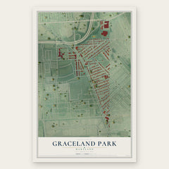
More maps nearby: Broening Manor, O'Donnell Heights, Dundalk Marine Terminal, Eastwood and Medford.
The art of mapping a place
How This Map Was Made
Real places. Remarkable detail. Discover the layers that turn geographic data into a map of home.

The view from above
Aerial imagery reveals the character of the land: woodland, open fields, and the patterns of a place.

The shape of the land
Elevation data brings hills, valleys, and subtle changes in the landscape into view.

The details of home
Roads, waterways, and building footprints come together to make the map feel unmistakably local.

Geography becomes art
Considered color, shading, and typography bring the layers together in a map made for your wall.


Process illustrated with Mendon, Massachusetts. Aerial imagery: USDA NAIP. Terrain: USGS 3D Elevation Program. Map details and finished artwork: KNOWOL.
The Details
About This Print
Choose an archival matte print, or a black or white Ayous wood frame. The archival matte print is unframed.
Select your size and finish above to see the matching product image and price.
Materials & Craftsmanship
A contemporary map with the character of a classic atlas, printed on archival matte paper. Optional frames are made from Ayous wood.
Your printed map does not include the watermark shown in the full-map preview.
Shipping & Delivery
Free shipping within the United States. Every print is made to order in the USA.
Buying a gift? Add a note in your cart and we'll include it. We never put prices in the package.
Prints ship within 2 to 3 business days. Allow 7 to 10 days total from ordering for delivery. Timing may vary during holidays or periods of high order volume.
Read our shipping policy.
Returns and damaged prints
Each print is made to order. Change-of-mind refunds are not available after production.
If your print arrives damaged, misprinted or incorrect, contact support@knowol.com within 30 days of receiving it. Include your order number, photos and a description of the issue.
Read our full refund and replacement policy. For questions about your order, email support@knowol.com.