
Search for another town




Free U.S. delivery 7 to 10 days after you order
Dyersburg, Tennessee Map Art
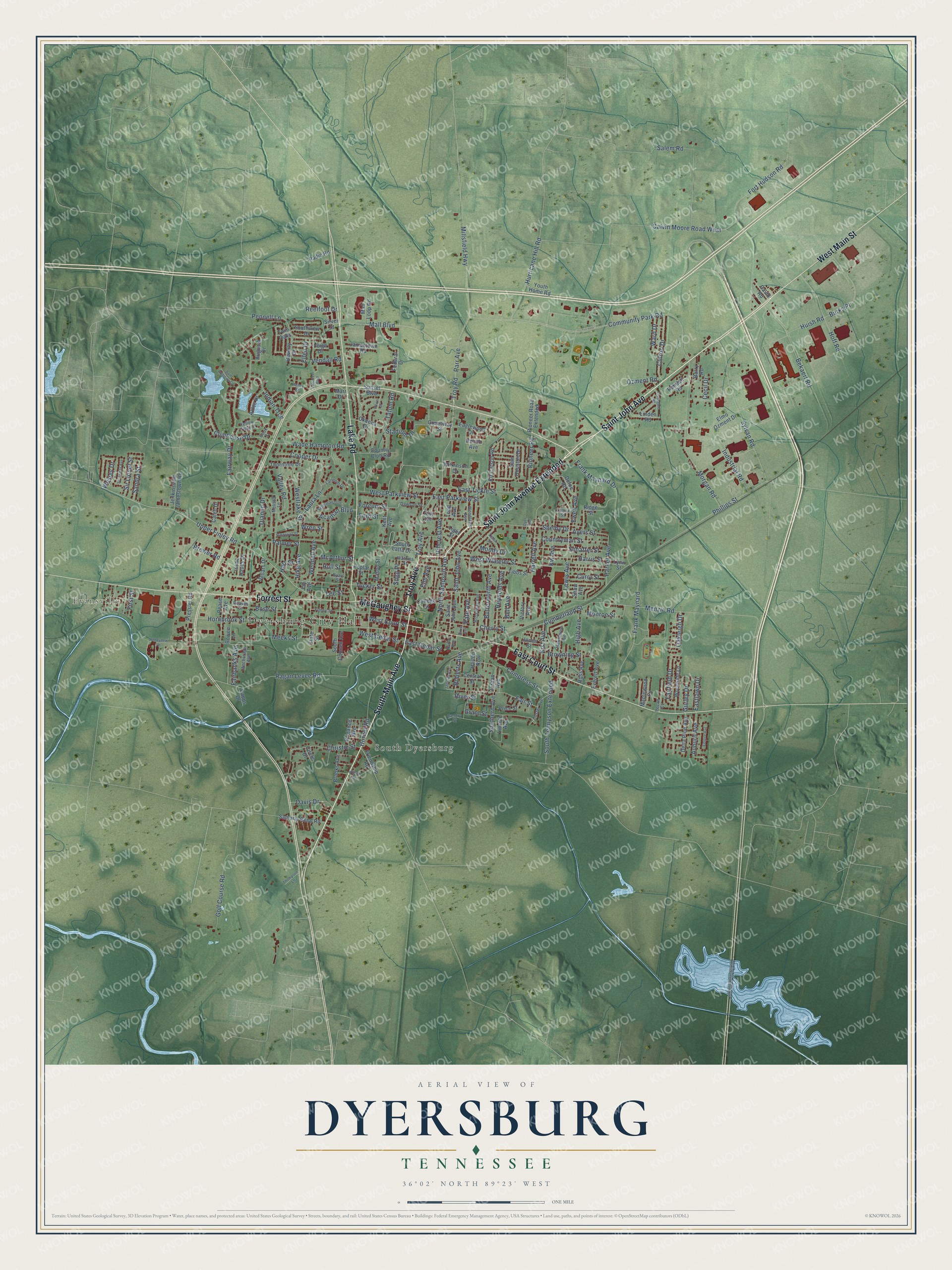
A new map of Dyersburg, Tennessee, made in 2026 and printed to order on thick archival matte paper.
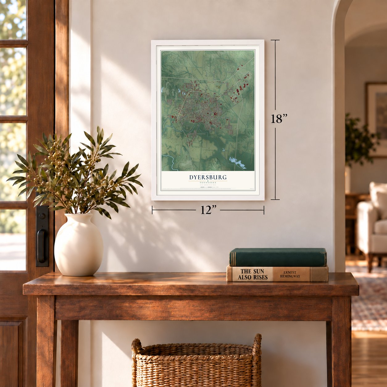
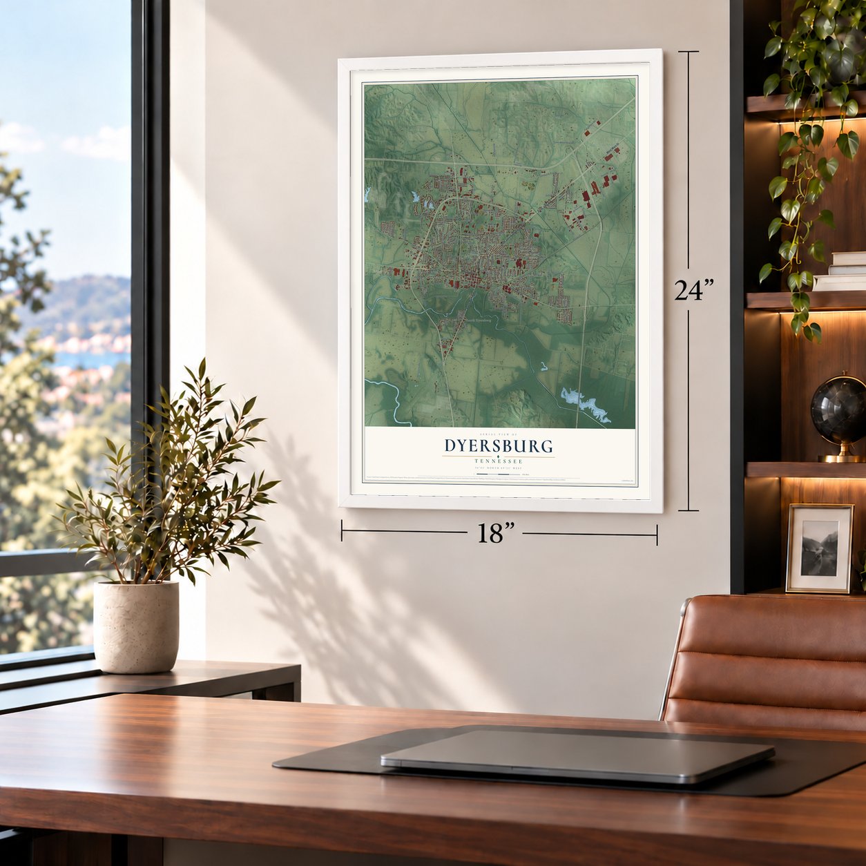
12" x 18" Archival Matte Print
A Map of Home. A Work of Art.
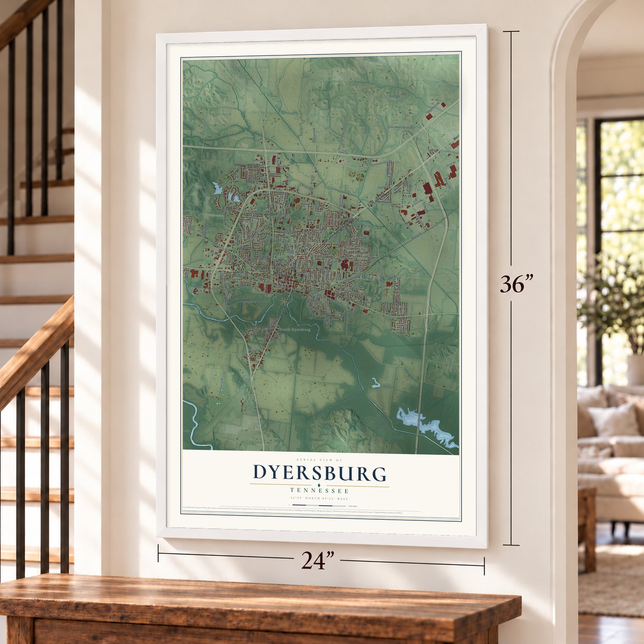
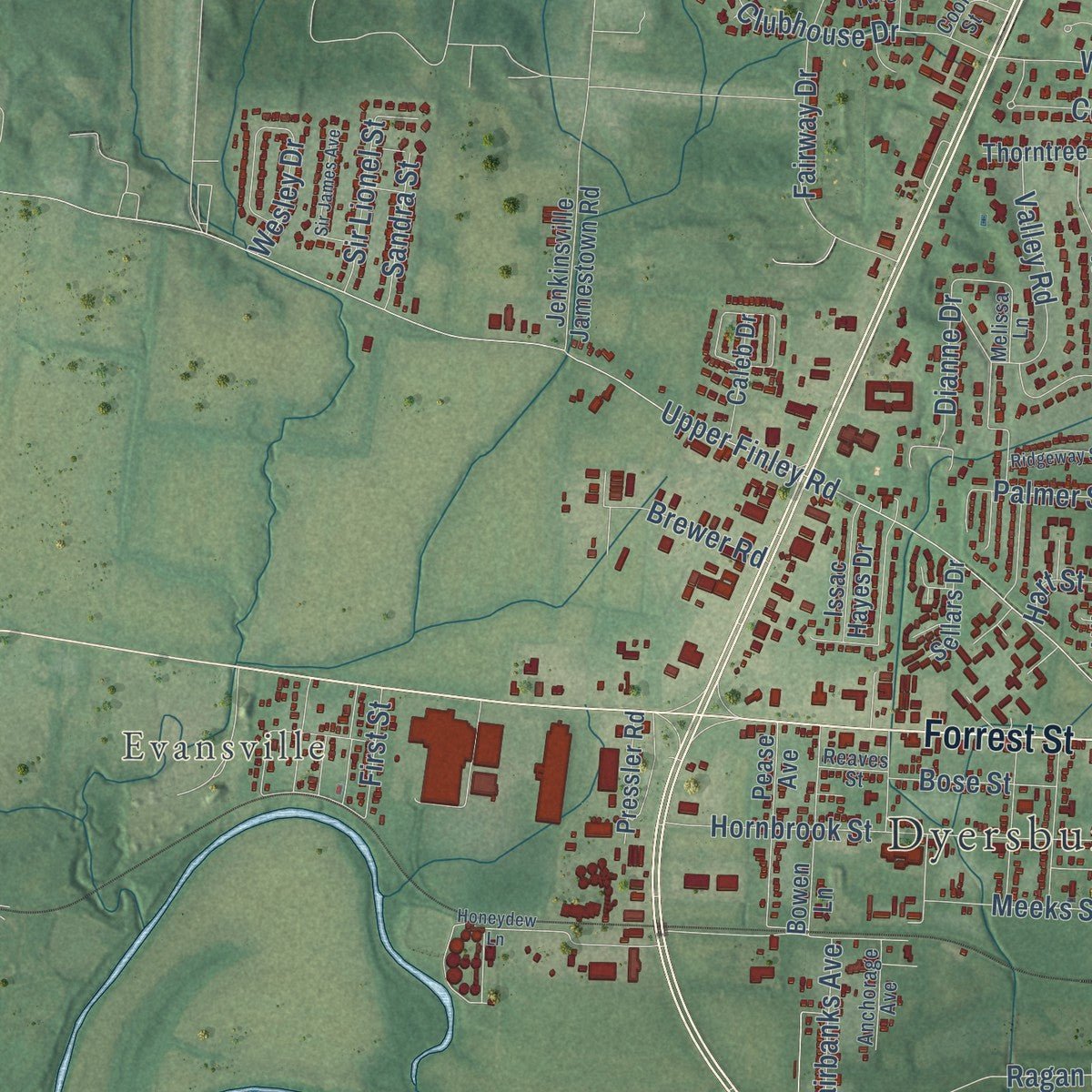
Explore Dyersburg, Tennessee from a whole new perspective. Created using aerial imagery and detailed geographic data, this map captures Dyersburg building by building, with labeled streets, familiar landmarks, and shaded topographical relief that highlights the natural contours of the landscape.
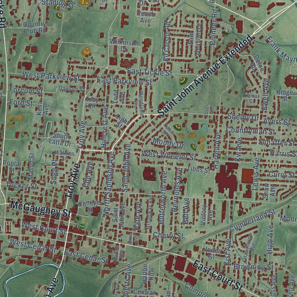
Combining modern data with the timeless character of a vintage atlas, this map is just as interesting up close as it is beautiful on the wall. Whether you grew up in Dyersburg, spent memorable years there, or call it home today, this unique map is a great way to celebrate a place that means something to you. Zoom in on the preview to look for your street, and then order a print to put your memories on the wall.
Three ways to hang it
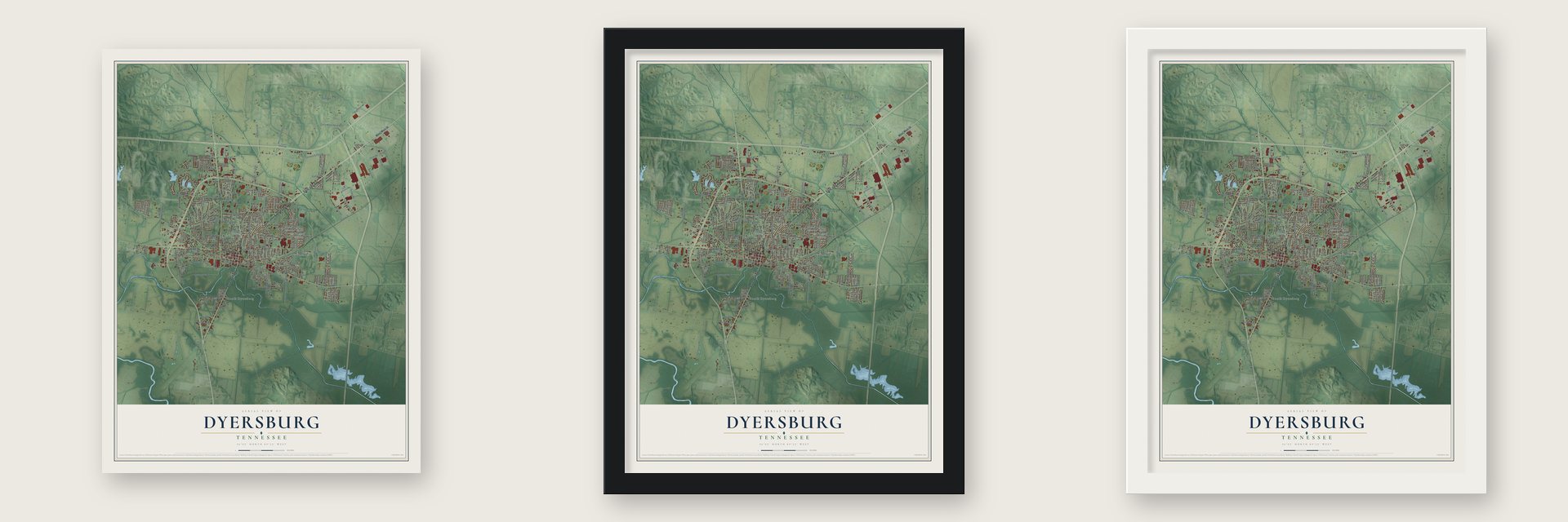
Unframed archival matte, a black wood frame or a white wood frame.
Up close
Geography Worth Displaying
This map was created using accurate cartographic data and authoritative geographic sources, including the U.S. Geological Survey and the Census Bureau. The map brings together terrain, waterways, roads, and building detail. The majority of the streets are labeled, houses are accurately depicted, and the topography is derived from government sources. Combining local data with carefully composed color and shading leads to this beautifully detailed Dyersburg artwork for your wall.
Rather than simply showing street outlines, we’ve included as many of the street names as we could reasonably fit on the map while keeping their names legible. Zoom in on the high resolution preview to see exactly what’s on the map. We truly set out to create a statement piece for anyone who loves Dyersburg. So whether it’s for you, or a gift for someone you love, we hope this map of Dyersburg brings back fond memories.
Read the story behind this map of Dyersburg, Tennessee from 2026.
About Dyersburg, Tennessee
Dyersburg is a city of 16,164 people and the county seat of Dyer County, on the Forked Deer River in northwest Tennessee. The Chickasaw gave up their claims to West Tennessee in the Treaty of Tuscaloosa in 1818, and settlers from the East began arriving around 1819. When the state created Dyer County in 1823, John McIver and Joel H. Dyer gave 60 acres for a county seat on a rise called McIver's Bluff. Dyer surveyed the town in 1825 and drew 86 lots. Both town and county were named for his father, Col. Robert Henry Dyer, who became the first postmaster.
The town sat at the head of steamboat travel on the Forked Deer, and the Grey Eagle's first successful trip in 1836 made it a river town. Timber brought its first boom. In 1879 the A. M. Stevens Lumber Company began sending timber by steamboat to St. Louis, and a large sawmill followed in 1880 and a planing mill in 1885. Railroads came in the 1880s, and by 1914 Dyersburg was the meeting point of three lines, led by the Illinois Central.
- Courthouse number five, 1911Dyer County's first courthouse was a two-story log cabin on the square, built in 1827. A one-story frame building replaced it in 1836. A brick courthouse from 1850 burned during the Civil War. The fifth was finished in 1911 to a design by local architect Asa Biggs. It has three stories of brick under a white dome, with a clock face on each of its four sides.
- A midnight rout in 1863On January 30, 1863, Confederates from Dawson's Guerrilla Band traded fire all day with the Third Michigan Cavalry near the Forked Deer River bridge downtown. Near midnight, Union troops under Colonel Oliver Wood of the 22nd Ohio Infantry found the rebels holed up in a house by the bridge. They killed 2, wounded 4 and took 17 prisoners. That August, Nathan Bedford Forrest and Robert V. Richardson held the town until Colonel Edward Hatch arrived and they pulled back.
- Bank of Dyersburg, 1880The Bank of Dyersburg opened in 1880, the same year as the big sawmill, and it joined the National Register in 1983. The Latta House was listed in 1978 and the Edward Moody King House in 1990.
- Back-to-back pennantsFrom 1923 to 1925 Dyersburg had a minor league baseball team, the Forked Deers, renamed the Deers in its last season. The club finished first in the Kentucky-Illinois-Tennessee League in 1923 and took the title again in 1924.
- Weary Willie and MatplotlibEmmett Kelly Jr., the clown known as Weary Willie, came from Dyersburg. So did John D. Hunter, the neurobiologist who first wrote the Matplotlib software. Another native, James A. Gardner, was awarded the Medal of Honor after his death for his actions in Operation Van Buren in Vietnam.
Find your street
Names on the Dyersburg map
Every name below is printed on this map. Look for your street, your school, the park where you played, or the pond down the road.
Places and landmarks3
- Dyersburg City Hall
- Evansville
- South Dyersburg
Streets and roads225
- Saint John Avenue
- Saint John Avenue Extended
- South Main Avenue
- McGaughey Street
- Lake Road
- East Court Street
- Forrest Street
- West Main Street
- Troy Avenue
- East Tickle Street
- Parr Avenue
- West Court Street
- Mall Boulevard
- Tucker Street
- West Wheeler Street
- North Sampson Avenue
- Cherry Street
- Clubhouse Drive
- Pennell Lane
- Dianne Drive
- Fair Street
- Southern Avenue
- Phillips Street
- Upper Finley Road
- Community Park Road
- Millsfield Highway
- Fort Hudson Road
- Cumberland Street
- Ragan Levee Road
- Fairway Drive
Show all 225 streets
- Morgan Road
- Sylvan Road
- Harrell Avenue
- Hornbrook Street
- Frank Maynard Drive
- Frank Maynard
- Lewis Avenue
- Salem Road
- Christie Street
- Bekaert Road
- Industrial Road
- Hurricane Hill Road
- Compress Street
- South Tennyson Extended
- Horner Road
- Butterworth Avenue
- Calvin Moore Road West
- Hoff Road
- Shelby Drive
- Fairfield Drive
- Wade Hampton Road
- Menzie Road
- Cooper Drive
- Reynolds Avenue
- Harris Street
- Schaffer Street
- Countryman Street
- Grant Street
- Ozment Road
- Clifton Drive
- East Parkview Street
- Indian Trce
- Laura Lane
- Golf Course Road
- West Parkview Street
- Hike Avenue
- Kist Avenue
- Burks Place
- Hillcrest Avenue
- Auburn Avenue
- Troy Road
- Westlake Street
- East Cedar Street
- Meeks Street
- Valley Road
- Pioneer Road
- Kw Avenue
- Sir Lionel Street
- Parker Avenue
- West Cedar Street
- Stadium Drive
- Browning Street
- Brewer Road
- Elm Avenue
- Davis Drive
- Huish Road
- High Avenue
- Forcum Street
- Ewell Avenue
- Acadian Boulevard
- Ward Drive
- Pate Avenue
- Wendell Avenue
- McArthur Street
- Fairbanks Avenue
- Curry Street
- Ayers Street
- Vendall Road
- Roberts Avenue
- Bose Street
- Tatum Road
- Sandra Street
- Monroe Street
- Eastlawn Drive
- Oakleigh Drive
- Reelfoot Drive
- Gurley Drive
- Lee Street
- Ford Street
- Moody Drive
- First Street
- Wesley Drive
- Sugg Place
- Palmer Street
- Hull Street
- Cecil Drive
- Wren Street
- Ellen Drive
- Bell Avenue
- Hart Street
- River Street
- Twin Oaks
- Jenkinsville Jamestown Road
- Tibbs Street
- Okeena Drive
- Sam Houston Drive
- Federal Drive
- South Connell Avenue
- Thorntree Drive
- Woodside Lane
- Bowen Lane
- Samaria Bend Road
- Pease Avenue
- South Latta Drive
- Country Club Road
- Peach Avenue
- Jamestown Road
- Delta Pine Avenue
- Defoe Road
- Kit Carson Road
- Everett Avenue
- Linden Road
- Augusta Drive
- Brooks Avenue
- Sunset Boulevard
- Pioneer Road Extended
- Price Street
- Circle Drive
- Kent Avenue
- Friendship Road
- Eaglewood Drive
- Issac Hayes Drive
- Elmo Ozment Drive
- Pressler Road
- Southview Drive
- Todd Avenue
- Caleb Drive
- Aztec Drive
- Maplewood Cv
- Ross Avenue
- Youth Home Road
- Central Street
- Greenway Street
- Mason Street
- Brigance Avenue
- Mall Loop Road
- Harton Row
- Wilkinson Drive
- Sellars Drive
- Jordan Avenue
- College Street
- Radio Road
- Randall Road
- Beverly Drive
- Victory Avenue
- Light Street
- Jones Street
- Capps Drive
- Ridge Street
- State Street
- Lincoln Avenue
- David Road
- Lynn Street
- Shaw Avenue
- Poplar Street
- Silver Street
- Troy Circle
- Leigh Drive
- Barry Road
- Marr Drive
- Jay Avenue
- Melissa Lane
- Finley Street
- Woodlawn Avenue
- Gentry Street
- Hawthorne Avenue
- Watkins Street
- Broadway Avenue
- Custer Avenue
- Lannom Drive
- Anchorage Avenue
- Yellow Twig Lane
- Dawson Street
- Henry Street
- Reaves Street
- Harton Avenue
- Lamar Street
- Byars Street
- Cook Street
- Pecan Cv
- Volunteer Boulevard
- Honeydew Lane
- Scotsman Trce
- Sir James Avenue
- Crossgate Road
- Saint Andrews Cv
- Wilson Drive
- Ridgeway Street
- Thomas Avenue
- Empire Avenue
- Tipton Street
- Dawn Drive
- Thompson Lane
- Dixie Avenue
- Dyer Avenue
Names are listed as they appear on the printed map. Zoom into the product photos to find them.
The art of mapping a place
How This Map Was Made
Real places. Remarkable detail. Discover the layers that turn geographic data into a map of home.

The view from above
Aerial imagery reveals the character of the land: woodland, open fields, and the patterns of a place.

The shape of the land
Elevation data brings hills, valleys, and subtle changes in the landscape into view.

The details of home
Roads, waterways, and building footprints come together to make the map feel unmistakably local.

Geography becomes art
Considered color, shading, and typography bring the layers together in a map made for your wall.


Process illustrated with Mendon, Massachusetts. Aerial imagery: USDA NAIP. Terrain: USGS 3D Elevation Program. Map details and finished artwork: KNOWOL.
The Details
About This Print
Choose an archival matte print, or a black or white Ayous wood frame. The archival matte print is unframed.
Select your size and finish above to see the matching product image and price.
Materials & Craftsmanship
A contemporary map with the character of a classic atlas, printed on archival matte paper. Optional frames are made from Ayous wood.
Your printed map does not include the watermark shown in the full-map preview.
Shipping & Delivery
Free shipping within the United States. Every print is made to order in the USA.
Buying a gift? Add a note in your cart and we'll include it. We never put prices in the package.
Prints ship within 2 to 3 business days. Allow 7 to 10 days total from ordering for delivery. Timing may vary during holidays or periods of high order volume.
Read our shipping policy.
Returns and damaged prints
Each print is made to order. Change-of-mind refunds are not available after production.
If your print arrives damaged, misprinted or incorrect, contact support@knowol.com within 30 days of receiving it. Include your order number, photos and a description of the issue.
Read our full refund and replacement policy. For questions about your order, email support@knowol.com.
Find your town
Looking for another city?
Find a map of home in our Tennessee collection, or any town in the country.
Nearby
Maps of towns near Dyersburg
Know someone from one of these towns? Their map makes a great gift.
 Fowlkes
, Tennessee
From $39.99See the map
 Finley
, Tennessee
From $39.99See the map
 Lenox
Lenox, Tennessee
From $39.99See the map
More maps nearby: Newbern, Bogota, Miston, Halls and Friendship.