
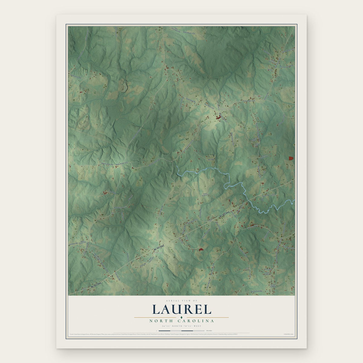


Search for another town





Free U.S. delivery 7 to 10 days after you order
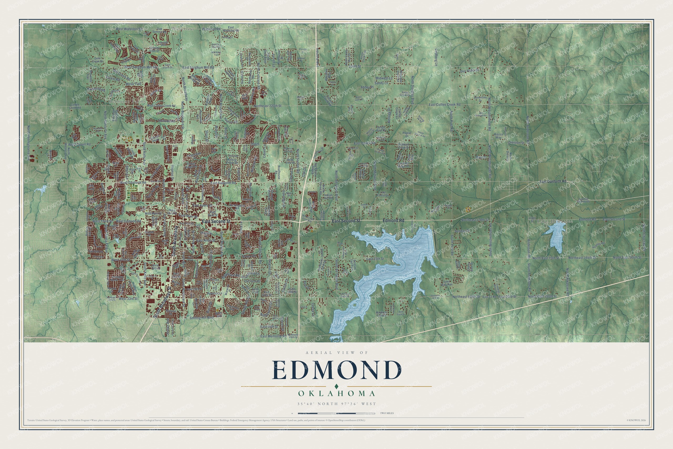
Edmond, Oklahoma Map Art
Building by building, with labeled streets and shaded relief.
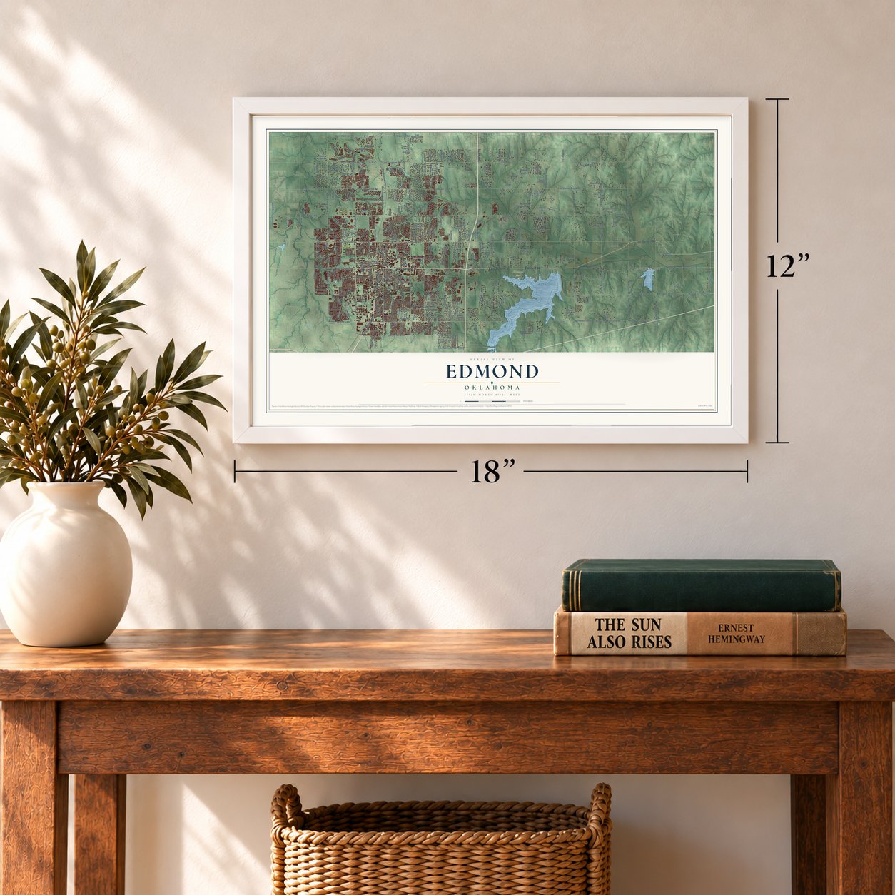
12" x 18" Archival Matte Print
A Map of Home. A Work of Art.
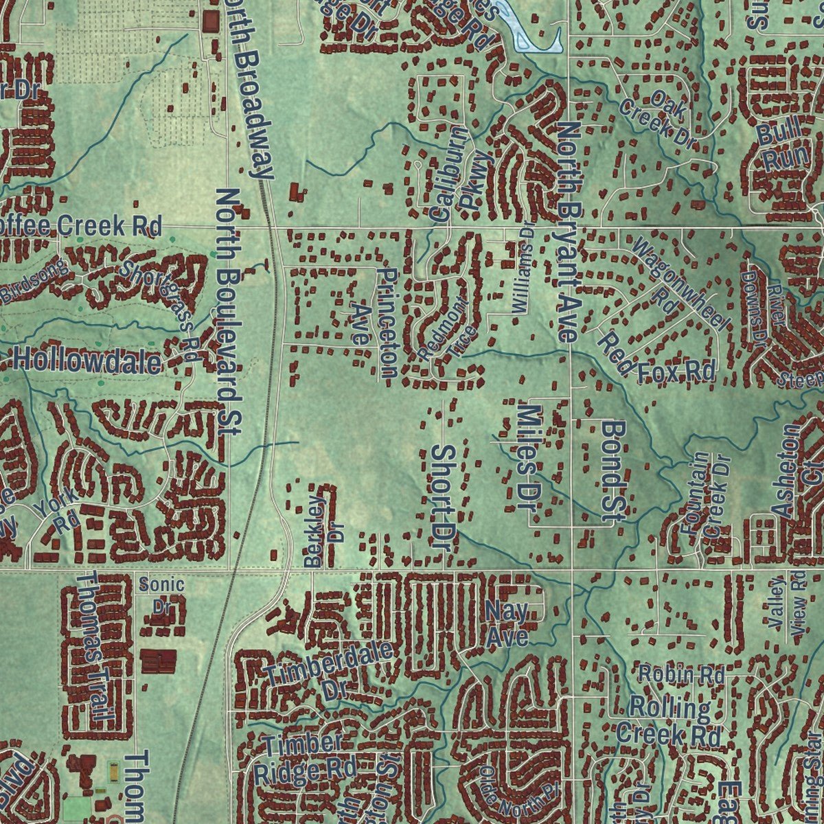
Explore Edmond, Oklahoma from a whole new perspective. Created using aerial imagery and detailed geographic data, this map captures Edmond building by building, with labeled streets, familiar landmarks, and shaded topographical relief that highlights the natural contours of the landscape.
Combining modern data with the timeless character of a vintage atlas, this map is just as interesting up close as it is beautiful on the wall. Whether you grew up in Edmond, spent memorable years there, or call it home today, this unique map is a great way to celebrate a place that means something to you. Zoom in on the preview to look for your street, and then order a print to put your memories on the wall.
Three ways to hang it
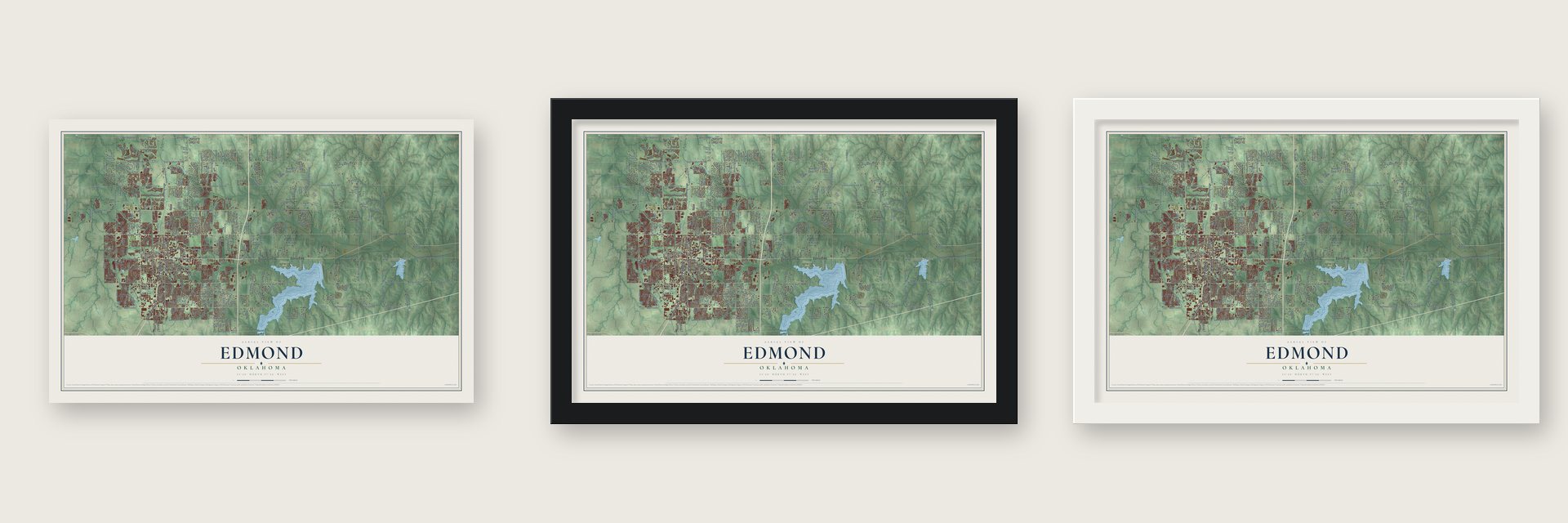
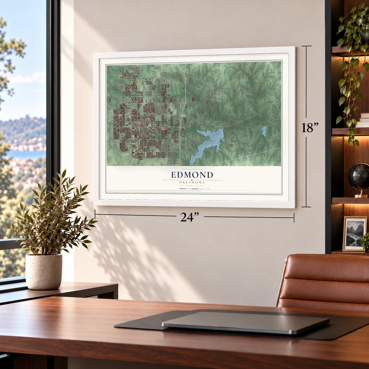
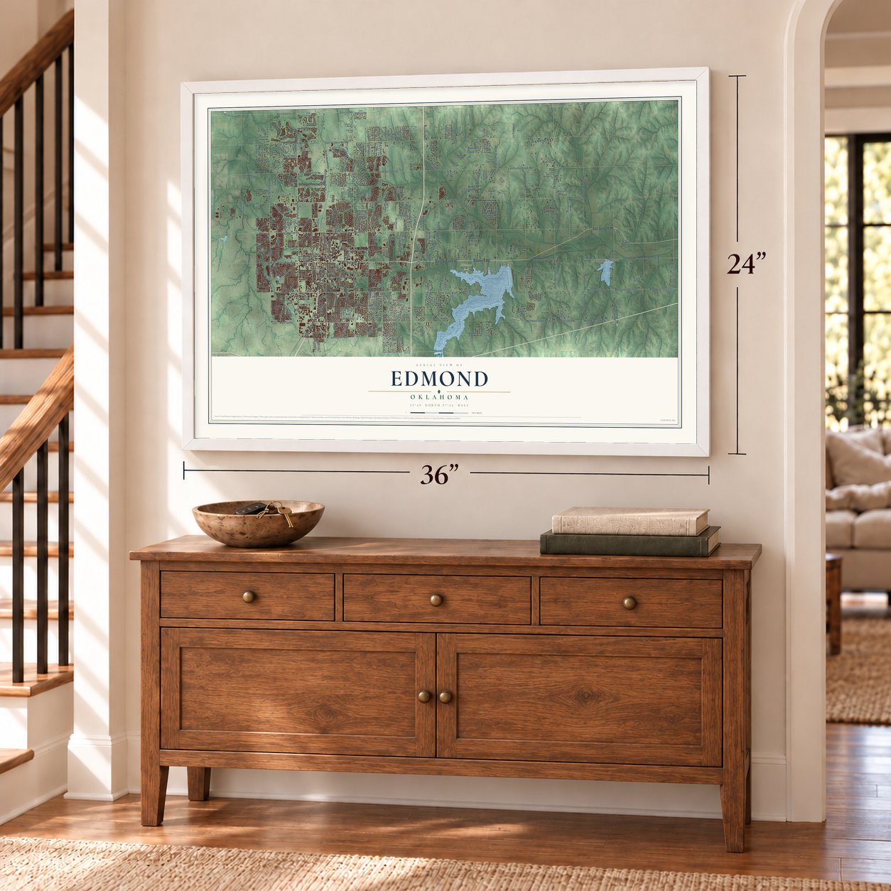
Unframed archival matte, a black wood frame or a white wood frame.
Up close
Geography Worth Displaying
This map was created using accurate cartographic data and authoritative geographic sources, including the U.S. Geological Survey and the Census Bureau. The map brings together terrain, waterways, roads, and building detail. The majority of the streets are labeled, houses are accurately depicted, and the topography is derived from government sources. Combining local data with carefully composed color and shading leads to this beautifully detailed Edmond artwork for your wall.
Rather than simply showing street outlines, we’ve included as many of the street names as we could reasonably fit on the map while keeping their names legible. Zoom in on the high resolution preview to see exactly what’s on the map. We truly set out to create a statement piece for anyone who loves Edmond. So whether it’s for you, or a gift for someone you love, we hope this map of Edmond brings back fond memories.
Read the story behind this map of Edmond, Oklahoma from 2026.

Find your street
Names on the Edmond map
Every name below is printed on this map. Look for your street, your school, the park where you played, or the pond down the road.
Places and landmarks6
- Waterloo
- Belmont Farms
- Edmond Park
- Mitch Park
- Lake Hiwassee
- Scissor Tail Park
Streets and roads380
- East Second Street
- Edmond Road
- South Broadway Street
- South Broadway
- East Danforth Road
- North Westminster Road
- North Broadway
- North Westminister Road
- West Edmond Road
- North Boulevard
- West Danforth Road
- West Third Street
- South Fretz Avenue
- East Main Street
- Northeast 164th Street
- North East 164th Street
- North Kelly Avenue
- South Westminster Road
- North Choctaw Road
- North Fretz Avenue
- East 15th Street
- South Anderson Road
- North East 15th Street
- Miles Drive
- North Bryant Avenue
- South Post Road
- Anderson Road
- Ridgecrest Road
- Mission Road
- East Coffee Creek Road
Show all 380 streets
- Northeast 220th Street
- East 33rd Street
- 234th Street
- East Sorghum Mill Road
- East Covell Road
- North Santa Fe Avenue
- North Midwest Boulevard
- North Post Road
- North Hiwassee Road
- North Coltrane Road
- North Douglas Boulevard
- North Sooner Road
- North Air Depot Boulevard
- Northeast 150th Street
- West Covell Road
- North East 150th Street
- North Anderson Road
- West Waterloo Road
- North Boulevard Street
- West 15th Street
- Northeast 178th Street
- South Coltrane Road
- South Kelly Avenue
- South Bryant Avenue
- West Sorghum Mill Road
- Waterloo Road
- South Rankin Street
- South Air Depot Boulevard
- West 33rd Street
- South Boulevard Street
- South Boulevard
- Pine Oak Drive
- East Memorial Road
- East Ninth Street
- East Ayers Street
- Quo Vadis Drive
- Mesa Trail
- South Santa Fe Avenue
- Smiling Hill Boulevard
- North Pennsylvania Avenue
- Thomas Drive
- Hollowdale
- Division Street
- 206th
- Deason Drive
- Oakridge Drive
- Mill Creek Road
- Riva Drive
- Ridgewood Drive
- Eagle Drive
- East 44th Street
- Cactus Drive
- Holly Hill Road
- Spring Hill Drive
- Covell Lane
- Rosewood Lane
- Sunday Drive
- Craig Boulevard
- Baird Drive
- Steven Drive
- Short Drive
- Leesa Lane
- Rambling Road
- Jordan Avenue
- Midwest Lane
- Kellogg Drive
- Forest Road
- Sherry Lane
- Lindberg Lane
- Abbey Place
- Bond Street
- Jarrell Lane
- Vista Lane
- Sandy Lane
- Oak Drive
- West Main Street
- South State Street
- Blue Ridge Drive
- Simon Avenue
- Cumberland Drive
- Roundup Road
- Spyglass Hill Road
- Foxfire Road
- West Coffee Creek Road
- East 33 Road
- East Waterloo Road
- North Western Avenue
- Bobwhite Trail
- Country Club Drive
- Chowning Avenue
- Irvine Drive
- 178th Street
- Kickingbird Road
- Shades Bridge Road
- Oak Tree Drive
- North Division
- Meadow Lane
- Hardy Drive
- Henney Road
- Summit Drive
- Jessie James Drive
- Leawood Drive
- Canaan Creek Road
- Oak Forest Road
- West Hurd Street
- East 32nd Street
- North Washington Street
- Horse Shoe Bend
- Lost Forest Drive
- East Drive
- Hidden Prairie Way
- Timber Ridge Road
- Newport Bridge Drive
- Saratoga Crossing
- Coffee Creek Road
- Covell Village Drive
- Edgewood Drive
- South Jackson Street
- Oak Tree Road
- Lake Way Run
- Brixton Road
- Northwood Drive
- East Hurd Street
- Kelly Park Road
- Highlands Landing
- Julie's Trail
- Perth Drive
- Southbend Road
- North Covey Run Drive
- North Saints Boulevard
- Sleepy Hollow Road
- Old Farm Lane
- Rocky Point Drive
- Fairfield Drive
- Hidden Lake Drive
- Industrial Boulevard
- East 29th Street
- Kelly Lakes Drive
- Bristol Park Boulevard
- Thomas Trail
- Redbud Creek Drive
- Caliburn Parkway
- Richmond Road
- Northcreek Drive
- Princeton Avenue
- Oak Summit Road
- Tangle Vine Drive
- Brook Forest Road
- Tracys Terrace
- Old Farm Road
- Kings Road
- Deer Creek Drive
- Wheatley Way
- Timberdale Drive
- Bayliner Launch
- Cardinal Ridge Drive
- Butte Road
- Scott Drive
- Warwick Place
- Stepping Stone Trail
- Pheasant Crest Road
- Paddock Lane
- Boathouse Road
- Red Fox Road
- Shadow Wood Drive
- Sims Avenue
- Sorentino Drive
- Village Parkway
- Early Dawn Drive
- Vance Drive
- West 18th Street
- Rolling Hill Terrace
- Bradford Place
- Wynstone Drive
- Willment Place
- Flint Ridge Road
- East 30th Street
- Burton Place
- Locust Lane
- Coffee Creek Lane
- Sunset Drive
- Indian Hill Road
- Belmar Drive
- Garrett Drive
- Enz Drive
- Maria Circle
- Asheton Court
- Creek Bend Road
- Bent Tree Drive
- Kiley Way
- Kimberly Drive
- East 21st Street
- Piazza Way
- Rolling Creek Road
- Aurora Drive
- Jills Trail
- Bretton Lane
- Fox Hill Drive
- Lilac Drive
- Smoky Hill Trail
- Raquel Road
- Prairie Avenue
- Cherry Glen Drive
- Bonaire Drive
- Nay Avenue
- Dena Drive
- Filly Lane
- Teal Place
- Poplar Drive
- Echo Trail
- High Street
- Lil Lane
- Brad Street
- Allie Drive
- Bull Run
- Lakeshire Ridge Way
- Firelane Road
- Shortgrass Road
- Northeast 136th Street
- Wagonwheel Road
- Fox Lake Lane
- Copperfield Drive
- Countrywood Lane
- North Jackson Street
- Persimmon Creek Drive
- Morning Star
- Valley Creek Road
- Homestead Boulevard
- Woods and Sons Avenue
- Woodhill Road
- Heritage Boulevard
- Old Timbers Drive
- Mountain View Road
- Karen Drive
- North Canary Drive
- Harris Drive
- Oak Creek Drive
- Harper Creek Trail
- East Third Street
- Fountain Creek Drive
- Thunderbird Boulevard
- Hidden Valley Road
- Sorghum Run
- Freeman Manor Drive
- Bent Trail Road
- Huntwick Drive
- East Old Highway 66
- Ridge Creek Road
- Timberlake Avenue
- Deborah Lane
- Del Norte Drive
- Villas Creek Drive
- Settlers Drive
- Oxnard Street
- Robin Road
- Hunter Crest Drive
- Shirley Lane
- York Road
- Kristy Drive
- Braxton Way
- El Cajon Street
- Saint Claire Drive
- Doctor Tom Road
- Fretz Drive
- Pruett Drive
- Park Place
- Gray Fox Drive
- Rosa Lane
- Rolling Pk Road
- Brook Bank Drive
- Berkley Drive
- Mason Lane
- Nora Drive
- Cedar Vw
- Napol Avenue
- Divino Court
- Martin Drive
- Devon Drive
- Kerry Lane
- Sara Hill
- October Drive
- Four Winns Strait
- South Littler Avenue
- Northwest 150th Street
- Lakeshore Drive
- Steeplechase Road
- Redmont Trce
- Kelley Pointe Parkway
- East 40th Street
- Whispering Creek Drive
- Wild Rose Trail
- Rhode Island Avenue
- Cedar Meadow Lane
- Newport Drive
- East Oak Place
- Shore Drive
- Williams Drive
- Pennington Avenue
- River Downs Drive
- North Cooke Trail
- North Sugar Hill Drive
- Old Windmill Road
- South Douglas Boulevard
- Olde North Place
- Lakewood Ridge Road
- Cherry Blossom Road
- Red Bud Place
- East 14th Street
- Enterprise Drive
- Little Timber
- Duxsford Court
- Huntsman Road
- Big Cedar Avenue
- Tredington Way
- Fisher Road
- Barrett Place
- Novara Drive
- Thunder Canyon Avenue
- Nimrod Road
- Corridor Drive
- Skipping Stone Drive
- Red Deer Crossing
- Southeast 33rd Street
- Burning Wood Road
- Rankin Terrace
- Lexington Way
- Preserve Place
- Forest Creek Drive
- Saddle Road
- Mystic Valley Drive
- Doe Trail
- Center Lane
- Rockport Road
- Walnut Cove Road
- Bald Eagle Drive
- Legacy Drive
- East 27th Place
- Valley View Road
- Birdsong
- Midway Court
- Wilson Drive
- Natchez Road
- Janson Drive
- Live Oak Drive
- Fairfax Boulevard
- Wind Call Lane
- Arbor Chase
- Depot Drive
- Sonic Drive
- Apian Way
Names are listed as they appear on the printed map. Zoom into the product photos to find them.
Keep exploring Oklahoma
Edmond is one of 887 Oklahoma towns we've mapped. Every dot on the map is a print of its own.
The search covers every state, Oklahoma first.
Near Edmond
Order 2 or more town maps and save 10%. Shown in the size and finish you picked above, so they hang as a set.
- Arcadia 12" x 18" / Archival Matte Print $39.99
- Seward 12" x 18" / Archival Matte Print $39.99
- Lake Aluma 12" x 18" / Archival Matte Print $39.99



More maps nearby: Jones, The Village, Nichols Hills, Forest Park and Spencer.
The art of mapping a place
How This Map Was Made
Real places. Remarkable detail. Discover the layers that turn geographic data into a map of home.

The view from above
Aerial imagery reveals the character of the land: woodland, open fields, and the patterns of a place.

The shape of the land
Elevation data brings hills, valleys, and subtle changes in the landscape into view.

The details of home
Roads, waterways, and building footprints come together to make the map feel unmistakably local.

Geography becomes art
Considered color, shading, and typography bring the layers together in a map made for your wall.


Process illustrated with Mendon, Massachusetts. Aerial imagery: USDA NAIP. Terrain: USGS 3D Elevation Program. Map details and finished artwork: KNOWOL.
The Details
About This Print
Choose an archival matte print, or a black or white Ayous wood frame. The archival matte print is unframed.
Select your size and finish above to see the matching product image and price.
Materials & Craftsmanship
A contemporary map with the character of a classic atlas, printed on archival matte paper. Optional frames are made from Ayous wood.
Your printed map does not include the watermark shown in the full-map preview.
Shipping & Delivery
Free shipping within the United States. Every print is made to order in the USA.
Buying a gift? Add a note in your cart and we'll include it. We never put prices in the package.
Prints ship within 2 to 3 business days. Allow 7 to 10 days total from ordering for delivery. Timing may vary during holidays or periods of high order volume.
Read our shipping policy.
Returns and damaged prints
Each print is made to order. Change-of-mind refunds are not available after production.
If your print arrives damaged, misprinted or incorrect, contact support@knowol.com within 30 days of receiving it. Include your order number, photos and a description of the issue.
Read our full refund and replacement policy. For questions about your order, email support@knowol.com.