
Search for another town





Free U.S. delivery 7 to 10 days after you order
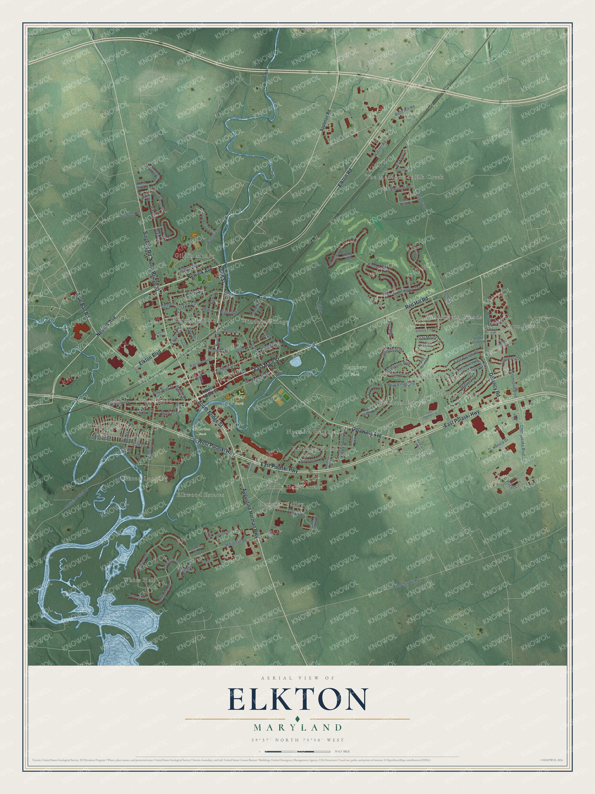
Elkton, Maryland Map Art
Building by building, with labeled streets and shaded relief.
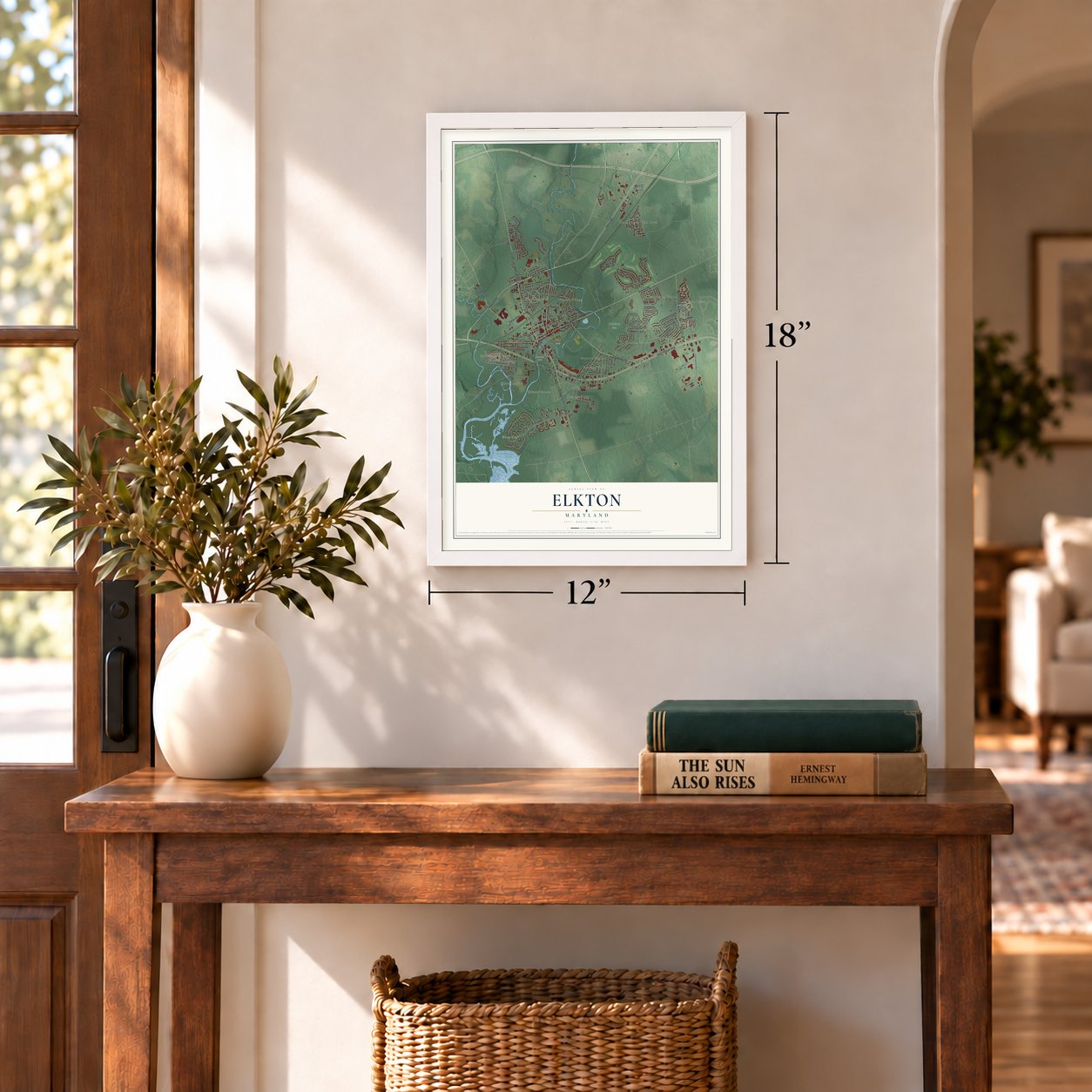
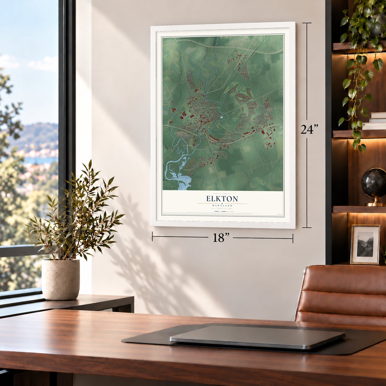
12" x 18" Archival Matte Print
A Map of Home. A Work of Art.
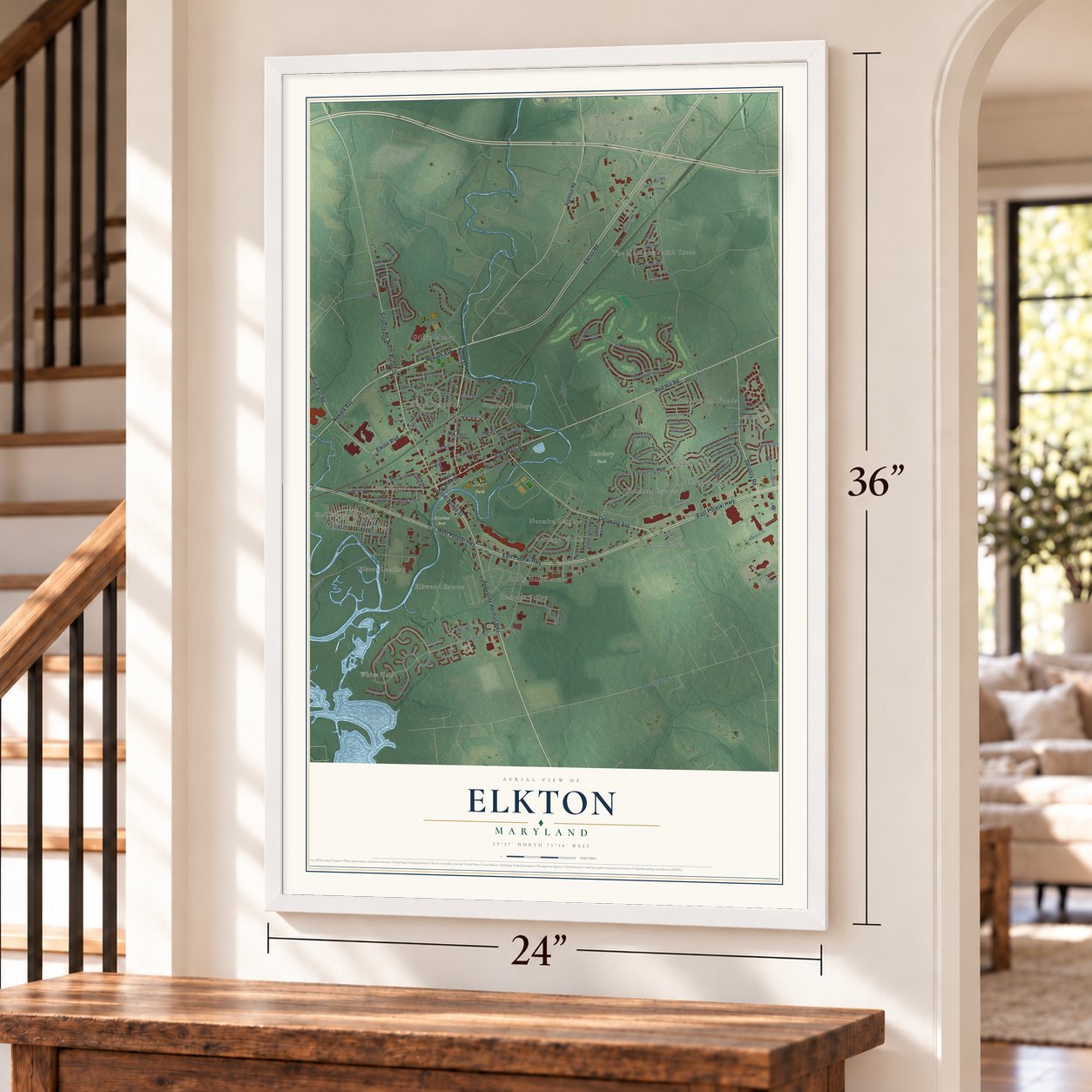
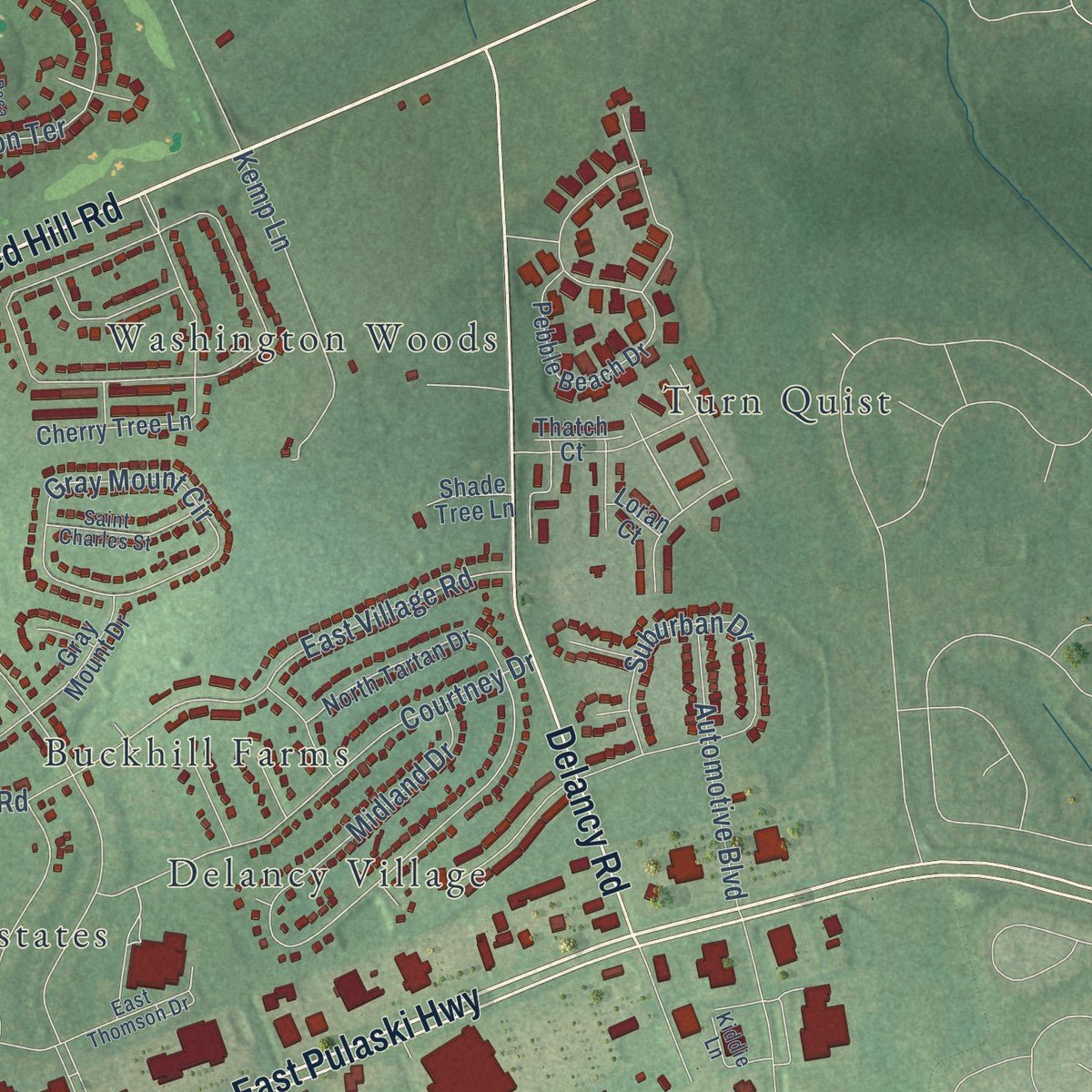
Explore Elkton, Maryland from a whole new perspective. Created using aerial imagery and detailed geographic data, this map captures Elkton building by building, with labeled streets, familiar landmarks, and shaded topographical relief that highlights the natural contours of the landscape.
Combining modern data with the timeless character of a vintage atlas, this map is just as interesting up close as it is beautiful on the wall. Whether you grew up in Elkton, spent memorable years there, or call it home today, this unique map is a great way to celebrate a place that means something to you. Zoom in on the preview to look for your street, and then order a print to put your memories on the wall.
Three ways to hang it
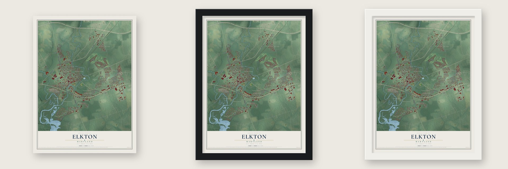
Unframed archival matte, a black wood frame or a white wood frame.
Up close
Geography Worth Displaying
This map was created using accurate cartographic data and authoritative geographic sources, including the U.S. Geological Survey and the Census Bureau. The map brings together terrain, waterways, roads, and building detail. The majority of the streets are labeled, houses are accurately depicted, and the topography is derived from government sources. Combining local data with carefully composed color and shading leads to this beautifully detailed Elkton artwork for your wall.
Rather than simply showing street outlines, we’ve included as many of the street names as we could reasonably fit on the map while keeping their names legible. Zoom in on the high resolution preview to see exactly what’s on the map. We truly set out to create a statement piece for anyone who loves Elkton. So whether it’s for you, or a gift for someone you love, we hope this map of Elkton brings back fond memories.
Read the story behind this map of Elkton, Maryland from 2026.

Find your street
Names on the Elkton map
Every name below is printed on this map. Look for your street, your school, the park where you played, or the pond down the road.
Places and landmarks22
- White Hall
- Eder Park
- Hatchery Park
- Marina Park
- Buckhill Farms
- Delancy Village
- Elkton Heights
- Elkton Landing
- Elkwood Estates
- Gilpin Manor
- Heritage Valley
- Heritage Woods
Show all 22 places
- Hollingsworth Manor
- Holly Hall Terrace
- Little Elkton
- Normira Heights
- North Gate
- The Meadows at Elk Creek
- Thomson Estates
- Turn Quist
- Washington Woods
- Windsor Village
Streets and roads128
- Elkton Road
- North Street
- South Bridge Street
- Newark Avenue
- East Main Street
- East Pulaski Highway
- Red Hill Road
- North Bridge Street
- Delaware Avenue
- Elkton Boulevard
- West Pulaski Highway
- Augustine Herman Highway
- Delancy Road
- Singerly Road
- Blue Ball Road
- Highland Drive
- Milhollan Drive
- Winfield Drive
- Bow Street
- Mike Drive
- Whitehall Road
- Frenchtown Road
- Muddy Lane
- Belle Hill Road
- Thomas Jefferson Terrace
- Patriots Way
- Chesapeake Boulevard
- Landing Lane
- West Main Street
- Oldfield Point Road
Show all 128 streets
- East Park Circle
- Melbourne Boulevard
- Howard Street
- Suburban Drive
- Gray Mount Circle
- Locust Lane
- West High Street
- Cow Lane
- East Village Road
- Courtney Drive
- Hickory Lane
- Warner Road
- Continental Drive
- Booth Street
- East High Street
- Kemp Lane
- Gilpen Avenue
- Automotive Boulevard
- Midland Drive
- Thyme Street
- Walnut Lane
- Hermitage Drive
- Konica Drive
- Vince Drive
- Patton Way
- Elkwood Road
- Railroad Avenue
- West Village Road
- Brown Street
- Dogwood Road
- Mackall Street
- Washington Avenue
- Curtis Avenue
- Pintail Circle
- Ben Boulevard
- Maple Avenue
- South Street
- Stockton Street
- Parkway
- Road 5
- Maffitt Street
- Mike Court
- King Street
- Appleton Road
- Thatch Court
- Biddeford Drive
- Pebble Beach Drive
- Friendship Road
- Park Towne Drive
- Cherry Tree Lane
- Maryland Avenue
- Jesse Boyd Circle
- Hearth Stone Drive
- Elk Chase Drive
- Normira Avenue
- Saint Louis Drive
- Gina Marie Lane
- North Tartan Drive
- Singerly Avenue
- Lafayette Drive
- Bonnie Marie Court
- Road 12
- Road 14
- Gray Mount Drive
- Henry Way
- Radcliffe Court
- Keithley Lane
- Lincoln Avenue
- Road 3
- Heather Court
- Bethel Street
- Kina Court
- Shade Tree Lane
- Loran Court
- Clark Street
- Quail Court
- Bratton Road
- Glen Creek Circle
- Deerfield Road
- Buttonwoods Road
- Road 6
- John Adams Lane
- Saint Charles Street
- East Thomson Drive
- Kiddie Lane
- Kentmere Avenue
- Bonnie Marie Lane
- Osage Street
- Laurel Drive
- Radke Lane
- Price Drive
- Bridgewell Parkway
- South Stream Drive
- Constitution Terrace
- Maloney Road
- William Street
- Norman Allen Street
- Paca Place
Names are listed as they appear on the printed map. Zoom into the product photos to find them.
About Elkton, Maryland
Elkton is a town of 15,807 people and the county seat of Cecil County, at the point where boats on the Elk River could go no farther upstream. Fishermen and mariners from the Swedish post at Fort Casimir settled here in 1694 and named the place Head of Elk for that spot on the river. The settlement was incorporated as Elkton in 1787, and by 1880 it had 1,752 people.
The Revolution passed through Head of Elk more than once. On August 25, 1777, Sir William Howe's army of 13,000 British and 5,000 German soldiers came ashore on the Elk River and marched the 11 miles up to the town. From there Howe won at Brandywine and went on to take Philadelphia. Lafayette loaded his troops onto boats here on March 8, 1781, hoping to catch Benedict Arnold, and he came back on April 9 to start his march to Virginia. That September 6 and 7, Washington and Rochambeau stopped in Elkton with their combined armies on the road to Yorktown.
- The elopement capitalEarly in the 20th century, northern states made marriage harder, but Maryland did not. Elkton was the state's northeasternmost county seat, the closest to Philadelphia, New York and New England, so couples came by the thousands each year in the 1920s and 1930s. Maryland added a 48-hour waiting period in 1938, yet ministers found ways around it, and the last commercial wedding chapel did not close until 2017.
- 16,054 licenses in a yearIn the year before the waiting period began, Elkton's marriage bureau issued 16,054 licenses, though the town had only about 3,300 residents. The number fell to 4,532 in 1939, but in 1942 Elkton still saw about 14,000 marriages. Debbie Reynolds, Joan Fontaine, Cornel Wilde, Willie Mays, Pat Robertson, Martha Raye, and John and Martha Mitchell all came here to wed.
- Pan Am Flight 214On December 8, 1963, lightning hit Pan Am Flight 214, and the Boeing 707 came down in a cornfield at the town's eastern edge, killing 81 people. It remains the deadliest accident in Maryland, and the 2005 Guinness World Records listed it for the worst death toll from a lightning strike. A granite memorial has stood at Delancy Road and Wheelhouse Drive since 1994, in what is now a housing development.
- Holly HallJames Sewall built Holly Hall in the 1810s, and the house soon became a place where important visitors gathered and where the region's local politics played out. It joined the National Register in 1976.
Keep exploring Maryland
Elkton is one of 881 Maryland towns we've mapped. Every dot on the map is a print of its own.
The search covers every state, Maryland first.
Near Elkton
Order 2 or more town maps and save 10%. Shown in the size and finish you picked above, so they hang as a set.
- Thomson Estates 12" x 18" / Archival Matte Print $39.99
- Elk 12" x 18" / Archival Matte Print $39.99
- Cherry Hill 12" x 18" / Archival Matte Print $39.99


More maps nearby: Cecil Manor, Chesapeake City, Leeds, North East and Kenmore.
The art of mapping a place
How This Map Was Made
Real places. Remarkable detail. Discover the layers that turn geographic data into a map of home.

The view from above
Aerial imagery reveals the character of the land: woodland, open fields, and the patterns of a place.

The shape of the land
Elevation data brings hills, valleys, and subtle changes in the landscape into view.

The details of home
Roads, waterways, and building footprints come together to make the map feel unmistakably local.

Geography becomes art
Considered color, shading, and typography bring the layers together in a map made for your wall.


Process illustrated with Mendon, Massachusetts. Aerial imagery: USDA NAIP. Terrain: USGS 3D Elevation Program. Map details and finished artwork: KNOWOL.
The Details
About This Print
Choose an archival matte print, or a black or white Ayous wood frame. The archival matte print is unframed.
Select your size and finish above to see the matching product image and price.
Materials & Craftsmanship
A contemporary map with the character of a classic atlas, printed on archival matte paper. Optional frames are made from Ayous wood.
Your printed map does not include the watermark shown in the full-map preview.
Shipping & Delivery
Free shipping within the United States. Every print is made to order in the USA.
Buying a gift? Add a note in your cart and we'll include it. We never put prices in the package.
Prints ship within 2 to 3 business days. Allow 7 to 10 days total from ordering for delivery. Timing may vary during holidays or periods of high order volume.
Read our shipping policy.
Returns and damaged prints
Each print is made to order. Change-of-mind refunds are not available after production.
If your print arrives damaged, misprinted or incorrect, contact support@knowol.com within 30 days of receiving it. Include your order number, photos and a description of the issue.
Read our full refund and replacement policy. For questions about your order, email support@knowol.com.