
Search for another town





Free U.S. delivery 7 to 10 days after you order
Ellensburg, Washington Map Art
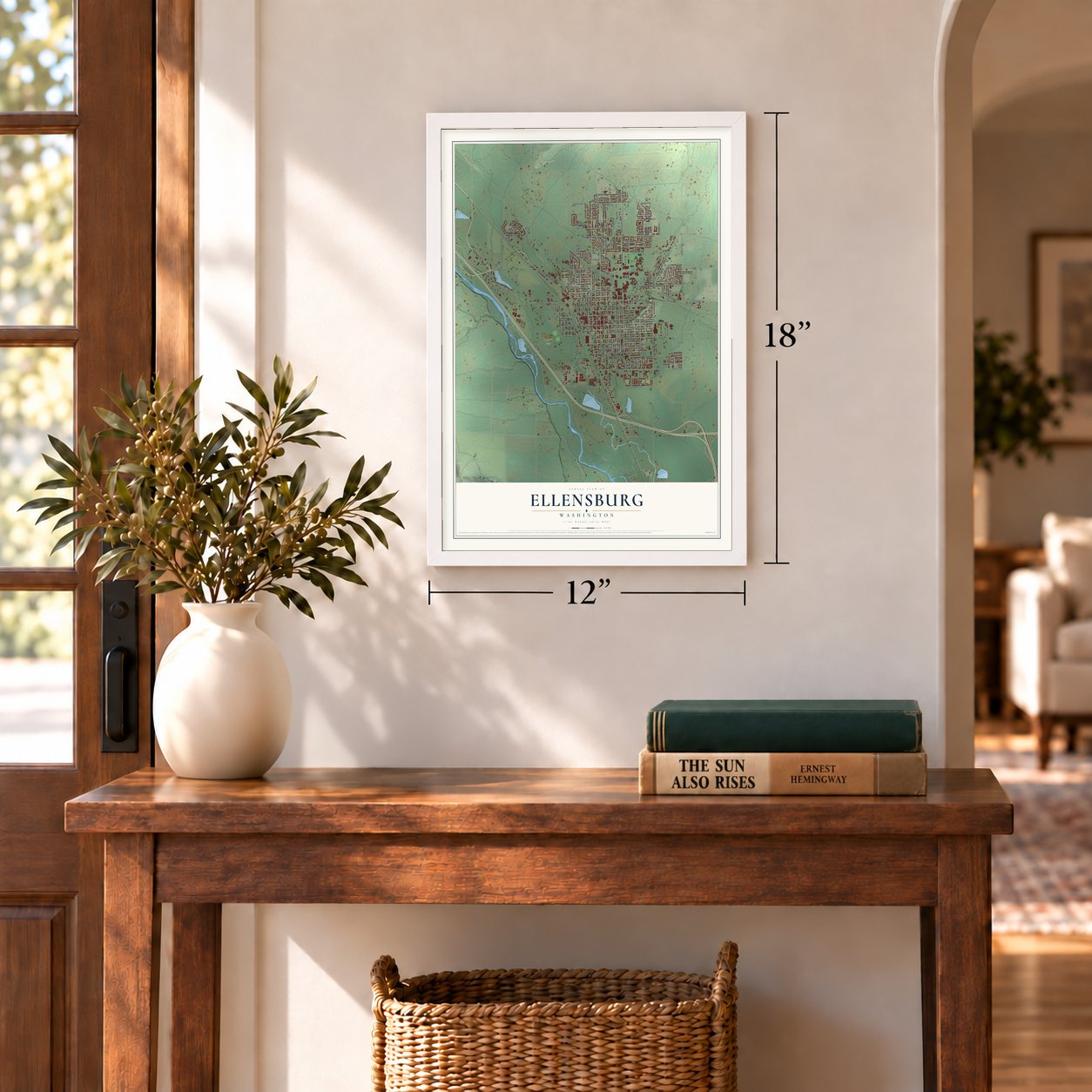
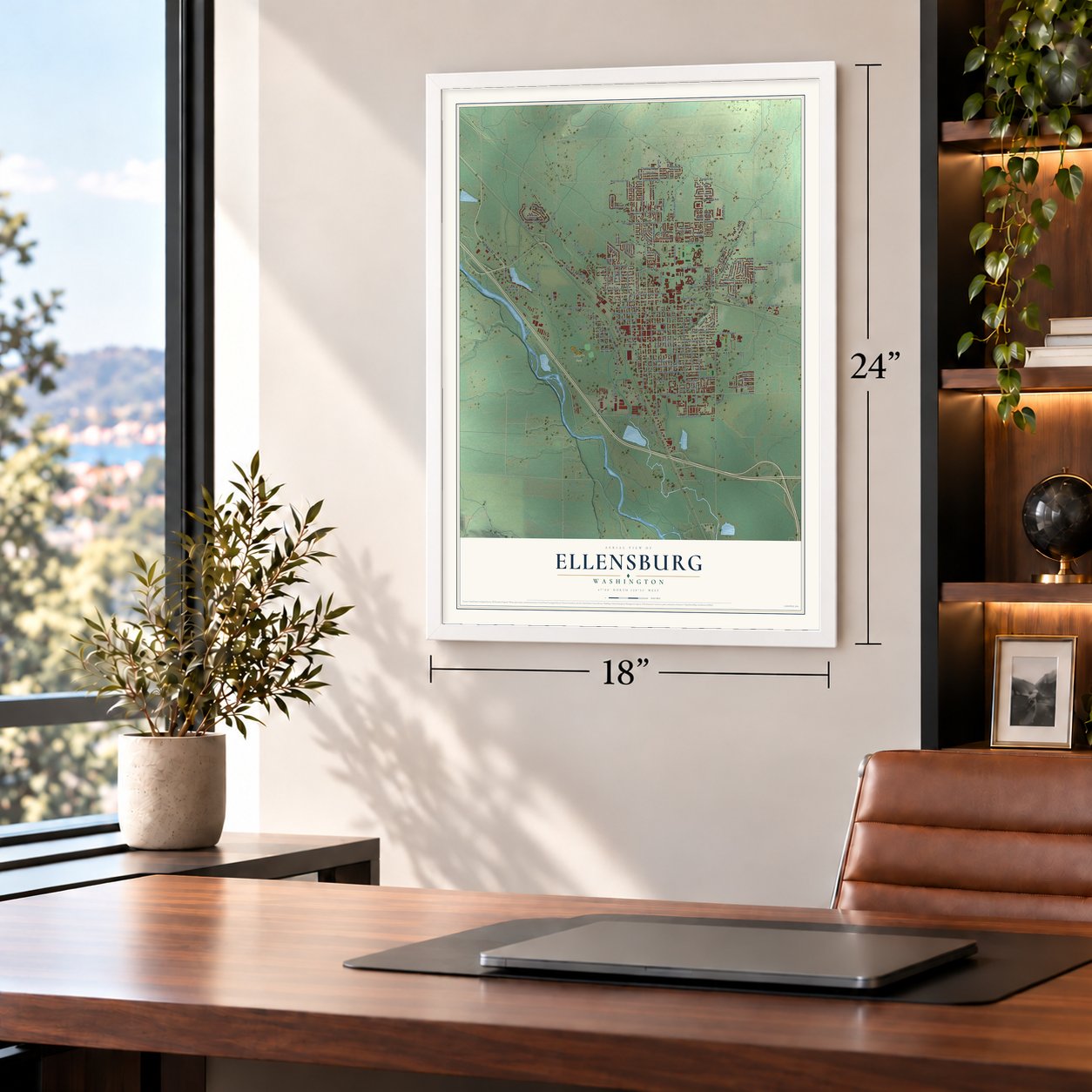
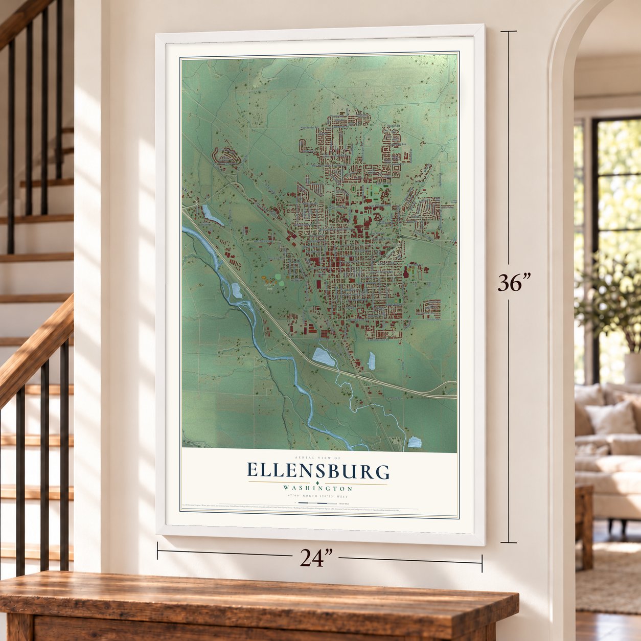
A new map of Ellensburg, Washington, made in 2026 and printed to order on thick archival matte paper.
12" x 18" Archival Matte Print
A Map of Home. A Work of Art.
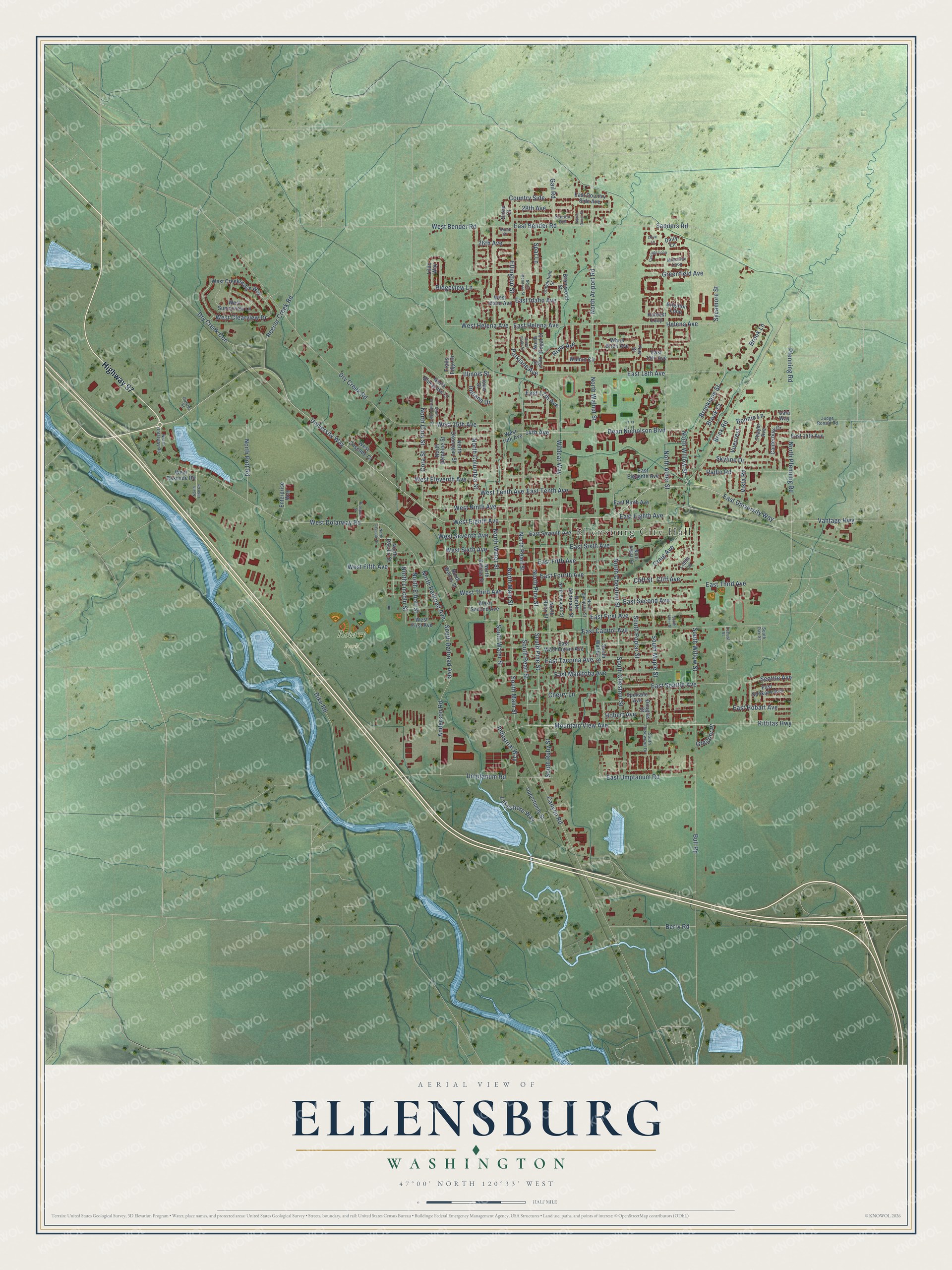
Explore Ellensburg, Washington from a whole new perspective. Created using aerial imagery and detailed geographic data, this map captures Ellensburg building by building, with labeled streets, familiar landmarks, and shaded topographical relief that highlights the natural contours of the landscape.
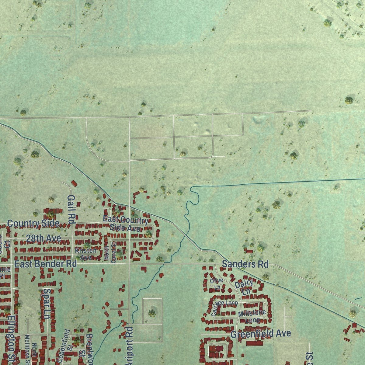
Combining modern data with the timeless character of a vintage atlas, this map is just as interesting up close as it is beautiful on the wall. Whether you grew up in Ellensburg, spent memorable years there, or call it home today, this unique map is a great way to celebrate a place that means something to you. Zoom in on the preview to look for your street, and then order a print to put your memories on the wall.
Three ways to hang it
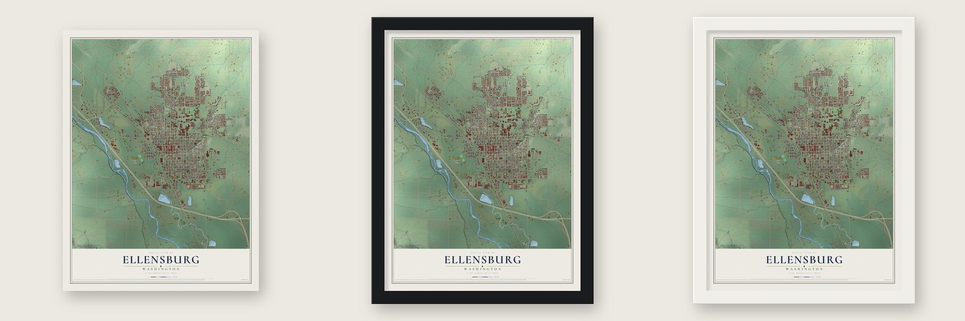
Unframed archival matte, a black wood frame or a white wood frame.
Up close
Geography Worth Displaying
This map was created using accurate cartographic data and authoritative geographic sources, including the U.S. Geological Survey and the Census Bureau. The map brings together terrain, waterways, roads, and building detail. The majority of the streets are labeled, houses are accurately depicted, and the topography is derived from government sources. Combining local data with carefully composed color and shading leads to this beautifully detailed Ellensburg artwork for your wall.
Rather than simply showing street outlines, we’ve included as many of the street names as we could reasonably fit on the map while keeping their names legible. Zoom in on the high resolution preview to see exactly what’s on the map. We truly set out to create a statement piece for anyone who loves Ellensburg. So whether it’s for you, or a gift for someone you love, we hope this map of Ellensburg brings back fond memories.
Read the story behind this map of Ellensburg, Washington from 2026.

About Ellensburg, Washington
Ellensburg is a city of 18,666 people and the county seat of Kittitas County, near the geographic center of Washington. The Kittitas band of the Yakama and other plateau tribes met here to dig camas and kous, race horses and feast. In 1867 William Wilson put up a cabin on the creek that took his name. In 1870 A. J. Splawn and Ben Burch paid Martin Davern to haul it to what is now East 3rd Avenue, where it became the valley's first store, called Robber's Roost. John and Mary Ellen Shoudy came from Seattle in 1871. John bought the store's goods, and Splawn then gave him his 160-acre squatter's claim.
Shoudy laid out the streets in 1875 and named the town Ellensburgh for his wife. The Post Office dropped the final h in 1894. Growth sped up in 1883, when the new Kittitas County made the town its seat, and in 1886 the Northern Pacific opened a depot on land the settlers had given it. By 1889 more than 2,500 people lived here, and the town hoped to become the state capital. On the evening of July 4, 1889, a fire that likely began in J. S. Anthony's grocery destroyed 10 brick blocks and up to 200 houses, yet no one was killed. Residents rebuilt, but in 1890 voters chose Olympia as the capital.
“He seems to have been simply a renegade, consorting with the Indians and finally losing his life in connection with too close an attachment to some other man's horses”
- A mission in 1848Father Charles Pandosy, an Oblate priest, built a small mission he called Immaculate Conception on Manastash Creek, at the edge of the future town, in July 1848. It was the first home a non-Indian made here. He stayed until September 1849 and won few converts among the Kittitas and Yakama.
- The state's first city powerIn 1890 the city took over a lighting system that John Shoudy had developed, and the Ellensburg Light Department became the first lighting system in Washington that a city owned and ran itself. The Bonneville Power Administration began supplying power in 1941, and by 1951 its power had replaced the city's own generator.
- A teachers' school since 1891Governor Elisha Ferry signed the bill creating the Washington State Normal School in Ellensburg on March 28, 1890, and the school was chartered in 1891 to train teachers. It grew into Central Washington University, which enrolled 8,509 students in 2024.
- Rodeo since 1923The Kittitas County Fair began in 1885 and moved to its present grounds in 1923, the same year the Ellensburg Rodeo started. The two are held together over Labor Day weekend, and the rodeo, a stop on the PRCA circuit, is the largest in Washington.
Find your street
Names on the Ellensburg map
Every name below is printed on this map. Look for your street, your school, the park where you played, or the pond down the road.
Places and landmarks2
- Ellensburg City Hall
- Rotary Park
Streets and roads180
- Highway 97
- University Way
- North Willow Street
- Dean Nicholson Boulevard
- South Pearl Street
- North Pearl Street
- West Eighth Avenue
- 14th Avenue
- Parklane Avenue
- Vantage Highway
- Mountain View Avenue
- South Water Street
- East Helena Avenue
- North Railroad Avenue
- West Ninth Avenue
- East Capitol Avenue
- East 18th Avenue
- Sanders Road
- Brooklane Street
- Helena Avenue
- West Dolarway Road
- North Ariport Road
- South Main Street
- East Bender Road
- East Idaho Avenue
- North Water Street
- North Alder Street
- East University Way
- Dike Road
- East Third Avenue
Show all 180 streets
- Kittitas Highway
- North Walnut Street
- Dry Creek Road
- Canyon Road
- Bull Road
- Umptanum Road
- South Chestnut Street
- Brick Road
- Brook Lane
- North Chestnut Street
- North Main Street
- West Fifth Avenue
- East Second Avenue
- East First Avenue
- East Fourth Avenue
- South Ruby Street
- East Seattle Avenue
- Seattle Avenue
- Pfenning Road
- Reecer Creek Road
- East Manitoba Avenue
- Wildcat Way
- North Columbia Street
- East Tacoma Avenue
- North Cora Street
- North Pfenning Road
- East Umptanum Road
- East Sixth Avenue
- East Fifth Avenue
- West Third Avenue
- South Maple Street
- Greenfield Avenue
- South Pine Street
- West Seventh Avenue
- West Sixth Avenue
- Ellington Street
- West Tenth Avenue
- Radio Road
- North Pine Street
- Anderson Road
- West Eleventh Avenue
- South Willow Street
- West 15th Avenue
- West Helena Avenue
- Berry Road
- Vista Road
- West Bender Road
- Cliff Avenue
- Dry Creek Con
- North Pott Road
- Ridgeview Lane
- Country Side
- Lakeshore Way
- South Poplar Street
- West Clearview Drive
- East Tenth Avenue
- 28th Avenue
- East Hobart Avenue
- Cora Street
- Skyline Drive
- South Railroad Avenue
- Gail Road
- Craig Avenue
- Spar Lane
- North Elliott Street
- North Lincoln Street
- Industrial Way
- Hobert Avenue
- 26th Avenue
- East Eighth Avenue
- East 17th Avenue
- Illinois Street
- River Avenue
- Cherry Lane
- Bonnie Lane
- Brook Court
- Sycamore Street
- Indiana Drive
- Vuecrest
- Gregory Place
- Cliff Street
- East 14th Avenue
- West Creeksedge Way
- North Delphine Street
- Yew Street
- East Seventh Avenue
- East Country Side Avenue
- East Washington Avenue
- North Kittitas Street
- North Ruby Street
- North Anderson Street
- North Okanogan Street
- West Second Avenue
- West 14th Avenue
- East Eleventh Avenue
- North Wenas Street
- Spokane Avenue
- East Ninth Avenue
- West First Avenue
- North Bluegrass Lane
- Opportunity Street
- Canterbury Drive
- West Sunnyview Lane
- North Pacific Street
- South Walnut Street
- Walnut Circle
- Harvest Loop
- Brighton Loop
- Thayer Avenue
- West Cascade Court
- East Spokane Avenue
- Enterprise Way
- Lilac Way
- White Birch Avenue
- West Idaho Avenue
- North Regal Street
- West Cascade Road
- Brentwood Street
- Douglas Street
- Iowa Street
- Trails Edge Drive
- Linda Lane
- East 19th Avenue
- Susie Court
- Dairy Lane
- Gala Way
- Regal Street
- North Poplar Street
- North Sprague Street
- North Sampson Street
- Kristen Avenue
- Cobblefield Street
- Millstone Loop
- North Dolarway Road
- South Rosewood Drive
- Judge Ronald Road
- Currier Street
- South Oak Street
- Locust Street
- Annie Place
- South Alder Street
- Carriage Loop
- Green Parks Drive
- North Stonebridge Street
- North McIntosh Street
- North Hibb Road
- North Canal Street
- Prospect Street
- North Cascade Street
- Olive Lane
Names are listed as they appear on the printed map. Zoom into the product photos to find them.
The art of mapping a place
How This Map Was Made
Real places. Remarkable detail. Discover the layers that turn geographic data into a map of home.

The view from above
Aerial imagery reveals the character of the land: woodland, open fields, and the patterns of a place.

The shape of the land
Elevation data brings hills, valleys, and subtle changes in the landscape into view.

The details of home
Roads, waterways, and building footprints come together to make the map feel unmistakably local.

Geography becomes art
Considered color, shading, and typography bring the layers together in a map made for your wall.


Process illustrated with Mendon, Massachusetts. Aerial imagery: USDA NAIP. Terrain: USGS 3D Elevation Program. Map details and finished artwork: KNOWOL.
The Details
About This Print
Choose an archival matte print, or a black or white Ayous wood frame. The archival matte print is unframed.
Select your size and finish above to see the matching product image and price.
Materials & Craftsmanship
A contemporary map with the character of a classic atlas, printed on archival matte paper. Optional frames are made from Ayous wood.
Your printed map does not include the watermark shown in the full-map preview.
Shipping & Delivery
Free shipping within the United States. Every print is made to order in the USA.
Buying a gift? Add a note in your cart and we'll include it. We never put prices in the package.
Prints ship within 2 to 3 business days. Allow 7 to 10 days total from ordering for delivery. Timing may vary during holidays or periods of high order volume.
Read our shipping policy.
Returns and damaged prints
Each print is made to order. Change-of-mind refunds are not available after production.
If your print arrives damaged, misprinted or incorrect, contact support@knowol.com within 30 days of receiving it. Include your order number, photos and a description of the issue.
Read our full refund and replacement policy. For questions about your order, email support@knowol.com.
Find your town
Looking for another city?
Find a map of home in our Washington collection, or any town in the country.
Nearby
Maps of towns near Ellensburg
Know someone from one of these towns? Their map makes a great gift.
 Kittitas
, Washington
From $39.99See the map
 Thorp
Thorp, Washington
From $39.99See the map
 Naches
, Washington
From $39.99See the map
More maps nearby: Nile, Tieton, South Cle Elum, Cle Elum and Eschbach.