
Search for another town




Free U.S. delivery 7 to 10 days after you order
Erie, Pennsylvania Map Art
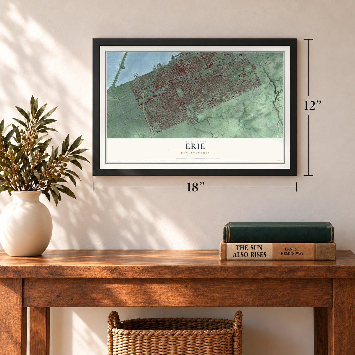
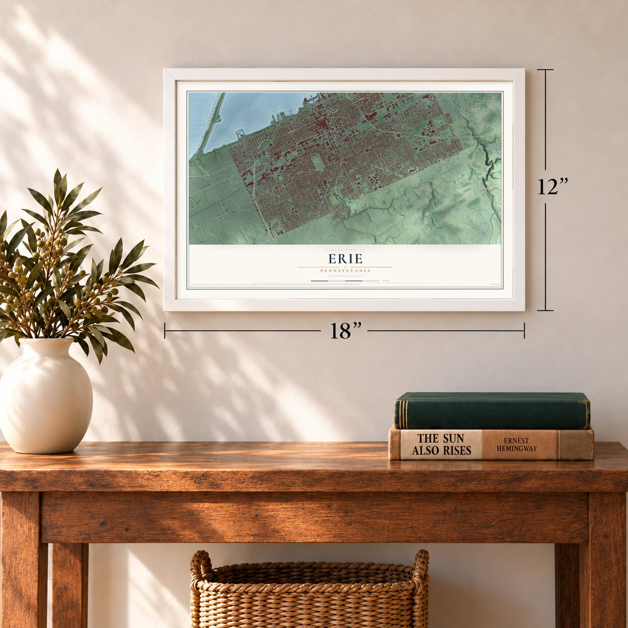
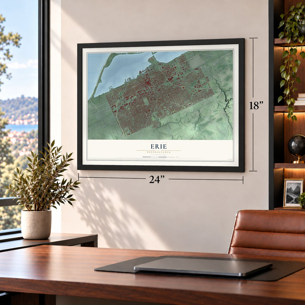
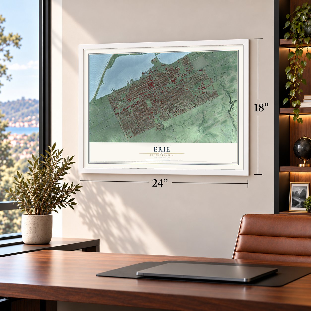
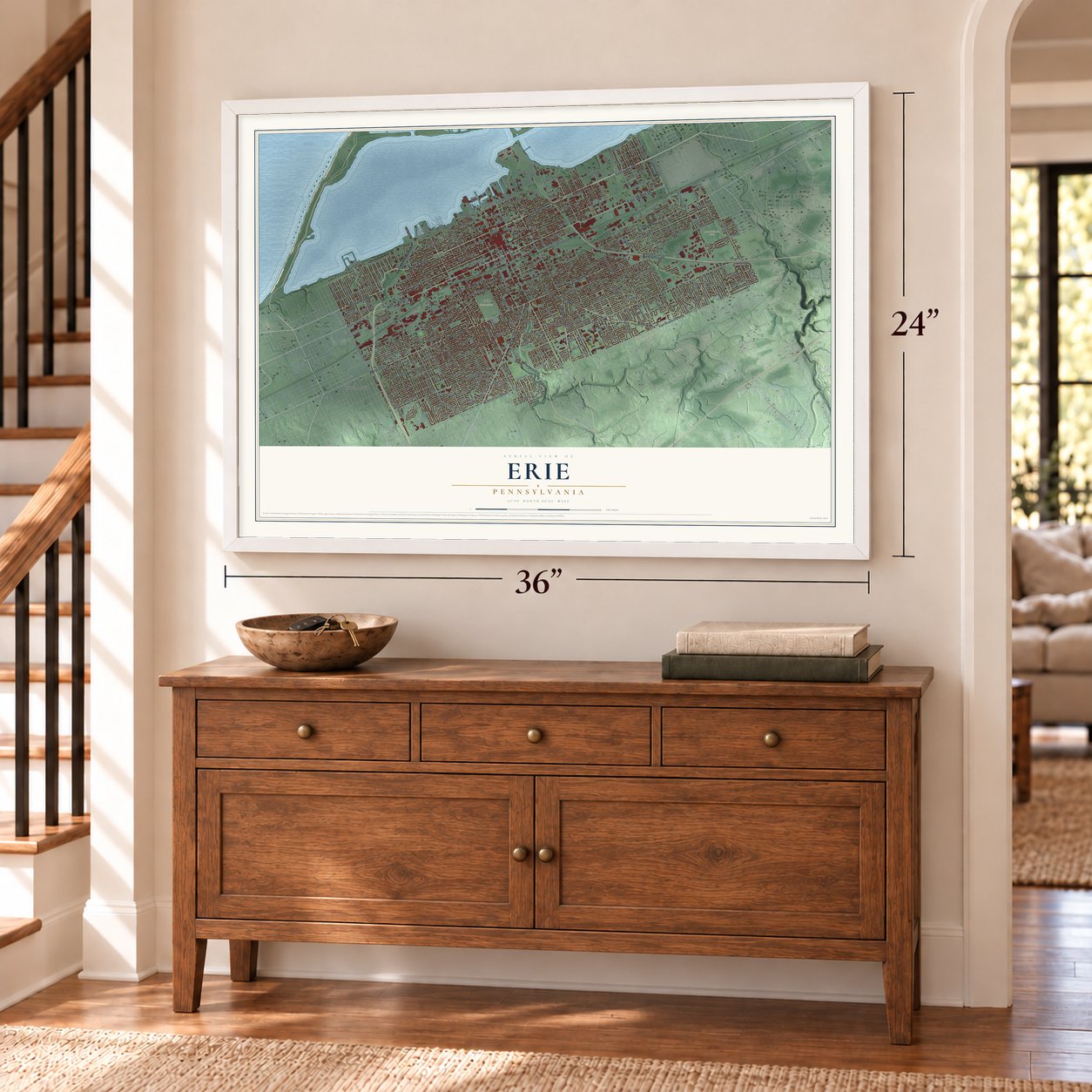
A new map of Erie, Pennsylvania, made in 2026 and printed to order on thick archival matte paper.
12" x 18" Archival Matte Print
A Map of Home. A Work of Art.
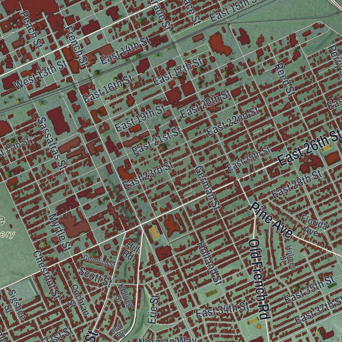
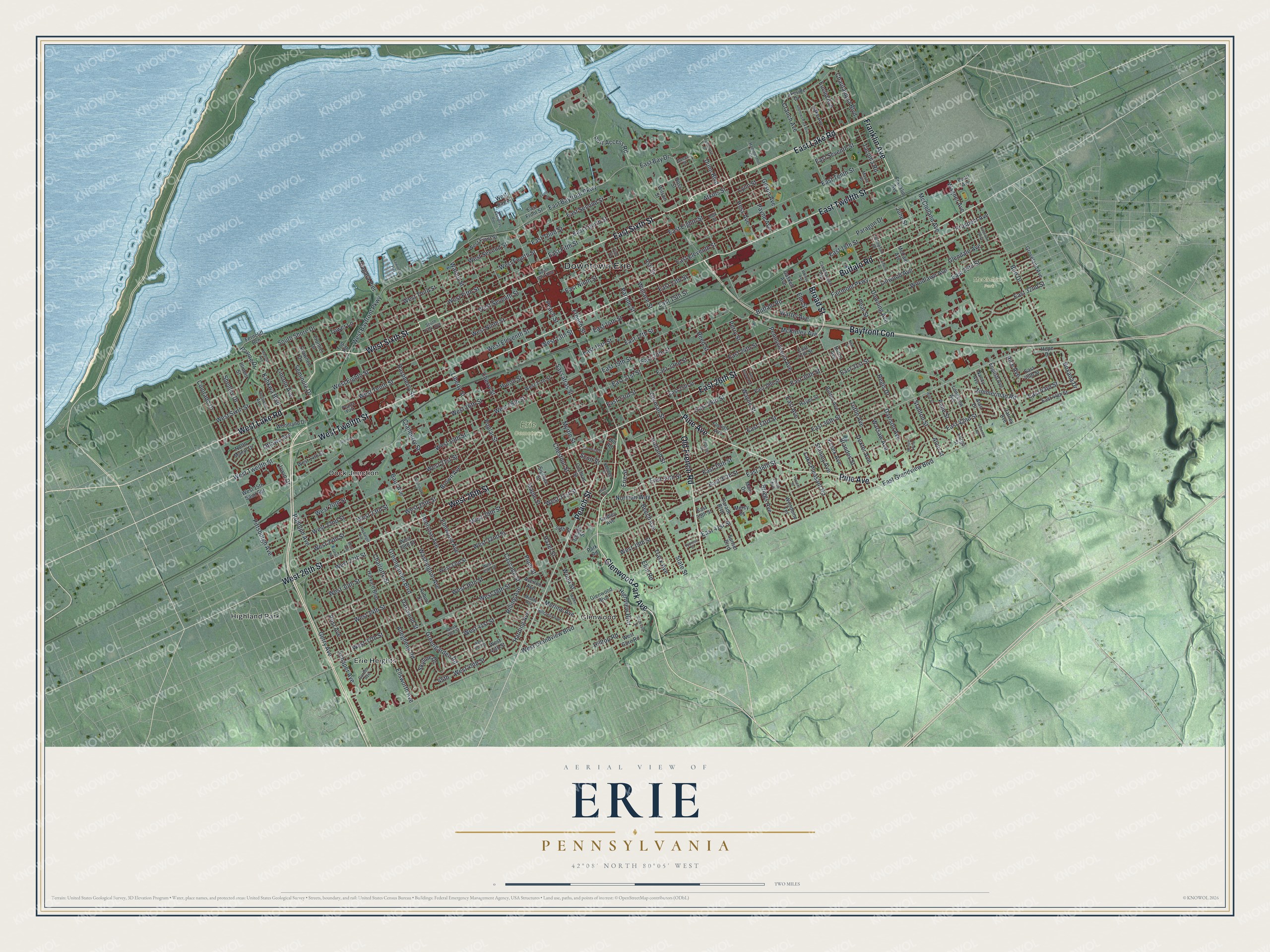
This beautifully detailed map of Erie, Pennsylvania was created in 2026 using aerial imagery combined with modern topographical, census, street and landmark data. It's a modern aerial view of Erie in Erie County, Pennsylvania, that combines modern data with a vintage aesthetic. Zoom in on the preview and look for your block.
Three ways to hang it
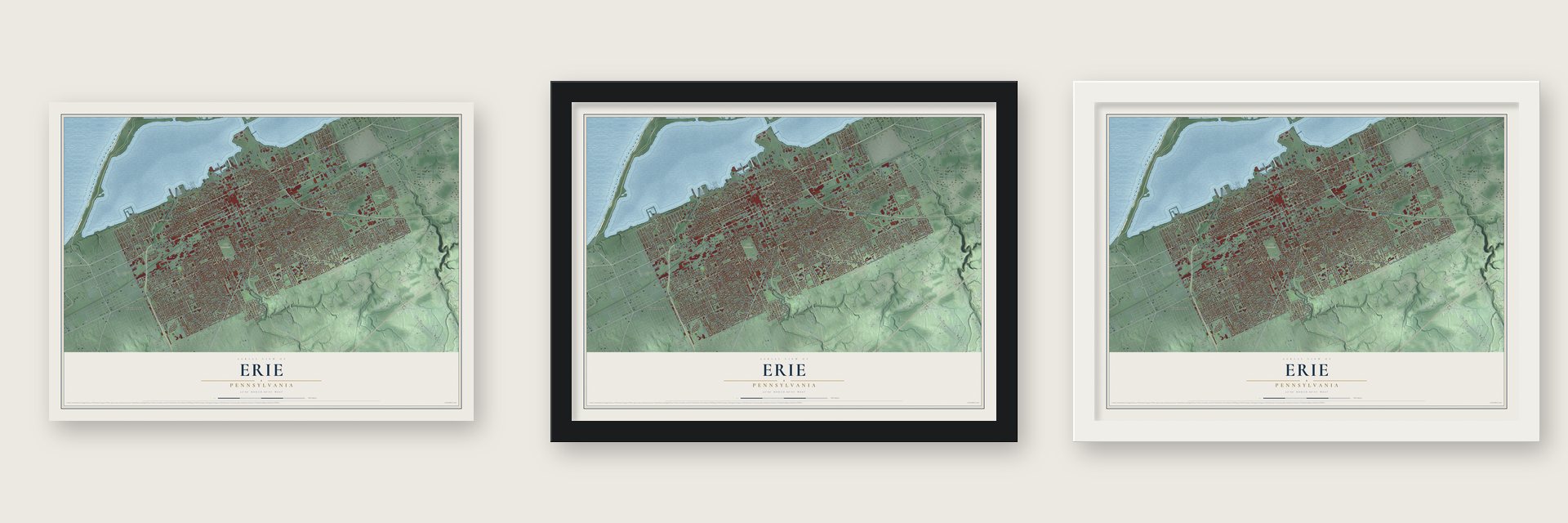
Unframed archival matte, a black wood frame or a white wood frame.
Up close
Real geography. Art worth displaying.
This map was created using accurate cartographic data and authoritative geographic sources, including the U.S. Geological Survey and the Census Bureau. The map brings together terrain, waterways, roads, and building detail. The majority of the streets are labeled, houses are accurately depicted, and the topography is derived from government sources. Combining local data with carefully composed color and shading leads to this beautifully detailed Erie artwork for your wall.
Rather than simply showing street outlines, we’ve included as many of the street names as we could reasonably fit on the map while keeping their names legible. Zoom in on the high resolution preview to see exactly what’s on the map. We truly set out to create a statement piece for anyone who loves Erie. So whether it’s for you, or a gift for someone you love, we hope this map of Erie brings back fond memories.
Read the story behind this map of Erie, Pennsylvania from 2026.

About Erie, Pennsylvania
Erie is a city of 94,831 people and the county seat of Erie County, on the south shore of Lake Erie. It takes its name from the Erie people, who lived here until the mid-17th century. In 1753 the French built Fort Presque Isle nearby to guard New France against the British. They gave it up in 1760, and British troops moved into the fort that same year.
After the Revolution, New York, Pennsylvania, Connecticut and Massachusetts all claimed this corner of land, known as the Erie Triangle. On January 9, 1789, Iroquois leaders signed away their claim, and in return Pennsylvania paid them $2,000 while the federal government added $1,200. The other states then sold their rights to Pennsylvania, and the land became part of the state on March 3, 1792. Andrew Ellicott came in June 1795 to survey it and lay out the city. That same year, Lt. Colonel Seth Reed's family arrived from Geneva, New York, and became Erie's first European-American settlers.
“The first industry established in what is now Erie was a sawmill, built at the mouth of Mill Creek in 1796, by Capt. Russell Bissell of the United States Army. The mill supplied lumber for barracks which were built to house troops sent here to protect the settlers.”
- Perry's flagship NiagaraDuring the War of 1812, President James Madison had a fleet built to fight the British for the Great Lakes. Erie shipbuilder Daniel Dobbins and Noah Brown of Boston built four gunboats and two brigs here. Commodore Oliver Hazard Perry then led the squadron to victory in the Battle of Lake Erie. The U.S.S. Niagara, Perry's flagship, now makes its home in Erie, which gave the city its nickname, the Flagship City.
- The Mill Creek flood of 1915On August 3, 1915, heavy rain backed up a four-block pond behind a Mill Creek culvert clogged with debris. When the culvert collapsed, the water destroyed 225 houses and killed 36 people. Afterward, Mayor Miles Brown Kitts had the creek moved into a larger culvert. It runs under more than 2 miles of the city before it empties into Presque Isle Bay.
- 53 inches in two daysOn December 24 and 25, 2017, Erie got 53 inches of snow, the most ever to fall in two days anywhere in Pennsylvania. By the end of that winter the city had 198.5 inches, its snowiest season on record. The old record, 149.1 inches from the winter of 2000 to 2001, fell by a wide margin.
Find your street
Names on the Erie map
Every name below is printed on this map. Look for your street, your school, the park where you played, or the pond down the road.
Places and landmarks8
- Downtown Erie
- Erie Cemetery
- McClelland Park
- Dock Junction
- Erie Heights
- Glenwood
- Highland Park
- Pearce Park
Streets and roads297
- Peach Street
- East 26th Street
- West Sixth Street
- Pine Avenue
- East Sixth Street
- Old French Road
- Broad Street
- East Lake Road
- Franklin Avenue
- West 26th Street
- West Lake Road
- Glenwood Park Avenue
- Bayfront Con
- West Twelfth Street
- East Twelfth Street
- Buffalo Road
- State Street
- East 38th Street
- West 38th Street
- French Street
- East Avenue
- West 41st Street
- East 18th Street
- Poplar Street
- McKinley Avenue
- Fairmont Parkway
- West Eighth Street
- East Second Street
- West Tenth Street
- West 34th Street
Show all 297 streets
- West 30th Street
- Zimmerman Road
- East 17th Street
- East 16th Street
- West 45th Street
- Cherry Street
- Liberty Street
- East 33rd Street
- Wayne Street
- East Tenth Street
- Sassafras Street
- Ash Street
- West 29th Street
- West 21st Street
- East 28th Street
- West Grandview Boulevard
- Raspberry Street
- Pittsburgh Avenue
- East Grandview Boulevard
- East 19th Street
- Cascade Street
- Holland Street
- Myrtle Street
- Plum Street
- East 30th Street
- West 32nd Street
- East 35th Street
- West Fourth Street
- West 24th Street
- West 22nd Street
- East 20th Street
- East 31st Street
- East 36th Street
- East 32nd Street
- East 41st Street
- East 34th Street
- West 36th Street
- West Eleventh Street
- Reed Street
- West 23rd Street
- German Street
- East Seventh Street
- Chestnut Street
- Brandes Street
- East Eighth Street
- Pennsylvania Avenue
- West Bayfront Parkway
- South Shore Drive
- West 16th Street
- Wallace Street
- East Bayfront Parkway
- West 25th Street
- East 37th Street
- McClelland Avenue
- West Ninth Street
- East Eleventh Street
- West 20th Street
- Cranberry Street
- East Ninth Street
- Greengarden Road
- East Third Street
- Parade Street
- Greengarden Boulevard
- Perry Street
- East Fourth Street
- West 18th Street
- West 31st Street
- Bird Drive
- West Seventh Street
- West Fifth Street
- West 39th Street
- East 42nd Street
- East 21st Street
- East 23rd Street
- East 24th Street
- Downing Avenue
- West 37th Street
- East Fifth Street
- West 19th Street
- West 27th Street
- Walnut Street
- East 22nd Street
- Prospect Avenue
- Schaper Avenue
- Washington Avenue
- West Third Street
- Woodlawn Avenue
- Ellsworth Avenue
- Glendale Avenue
- East 43rd Street
- Kahkwa Boulevard
- Shenley Drive
- Linwood Avenue
- Melrose Avenue
- West Second Street
- Elmwood Avenue
- Davison Avenue
- Lincoln Avenue
- East 13th Street
- East 14th Street
- Brown Avenue
- Hess Avenue
- Allegheny Road
- Wagner Avenue
- Port Access Road
- Seminole Drive
- Tuttle Avenue
- Rudolph Avenue
- Oakwood Street
- Charlotte Street
- Hazel Street
- Wood Street
- Maple Street
- Stanton Street
- Eliot Road
- Post Avenue
- Hilltop Road
- June Street
- Page Street
- Beech Avenue
- Niagara Pier
- Atkins Street
- Euclid Avenue
- West 13th Street
- Briggs Avenue
- East 15th Street
- Payne Avenue
- Lake Pleasant Road
- Pear Street
- Norman Way
- Dexter Avenue
- Colorado Drive
- Trask Avenue
- Warfel Avenue
- Paragon Drive
- Dunn Boulevard
- Tacoma Road
- Rice Avenue
- Baur Avenue
- Harding Avenue
- Chautauqua Boulevard
- Elm Street
- Stanley Avenue
- Regis Drive
- Roxana Drive
- Highview Boulevard
- Cranch Avenue
- Rilling Avenue
- Essex Avenue
- East Bay Drive
- Gerry Avenue
- Gilson Avenue
- Skyline Drive
- Warsaw Avenue
- Lynn Street
- Erie Street
- Merline Avenue
- Huron Street
- Ravine Drive
- Ottawa Avenue
- Tower Lane
- Irwin Drive
- Alvin Street
- 45th
- Scott Street
- West Front Street
- East 29th Street
- East 27th Street
- East 25th Street
- Parade Boulevard
- West 33rd Street
- West 17th Street
- Burton Avenue
- West 28th Street
- Sunset Boulevard
- East 40th Street
- McCain Avenue
- Harvard Boulevard
- East Front Street
- Shawnee Drive
- Auburn Street
- Cochran Street
- East 44th Street
- West 14th Street
- Fargo Street
- Lakeside Drive
- West 44th Street
- English Avenue
- Carney Avenue
- Glenwood Boulevard
- East 39th Street
- Frontier Drive
- Longview Avenue
- West Gore Road
- Lake Avenue
- Groveland Avenue
- Nancy Avenue
- West 15th Saint Spr
- Woodland Drive
- Florida Avenue
- Chapin Street
- Woodbine Terrace
- Alan Drive
- North Manor Drive
- Top Road
- Hayes Street
- Ferncliff Bch
- Gaskell Avenue
- Averlon Avenue
- Mercy Drive
- Sigsbee Street
- Gridley Avenue
- Hope Drive
- Pearl Avenue
- Main Drive
- Burns Avenue
- Park Road
- Wilson Street
- Ross Street
- 34th Street
- Illinois Street
- West Bay Drive
- Hill Road
- Delaware Avenue
- West 40th Street
- West 35th Street
- Camphausen Avenue
- Garden Avenue
- Hillcrest Avenue
- Marne Road
- Thompson Street
- Hammermill Drive
- Holmes Street
- Meade Avenue
- Lewis Avenue
- South Park Avenue
- South Park Row
- Kellogg Street
- Polk Street
- Queen Street
- Vine Street
- Washington Place
- Andrews Park Boulevard
- Walker Boulevard
- Haybarger Avenue
- Genesee Avenue
- Berst Avenue
- Cameron Street
- Lighthouse Street
- Geist Road
- Eastlawn Parkway
- Hoyt Street
- Front Street
- West 43rd Street
- Lawrence Pier
- Wood Hills Drive
- Madison Avenue
- Sassafras Pier
- Goodrich Street
- Whitley Avenue
- Edgevale Drive
- Van Buren Avenue
- Grimm Drive
- Cypress Street
- Hoover Street
- Bluff Road
- New Street
Names are listed as they appear on the printed map. Zoom into the product photos to find them.
The art of mapping a place
How This Map Was Made
Real places. Remarkable detail. Discover the layers that turn geographic data into a map of home.

The view from above
Aerial imagery reveals the character of the land: woodland, open fields, and the patterns of a place.

The shape of the land
Elevation data brings hills, valleys, and subtle changes in the landscape into view.

The details of home
Roads, waterways, and building footprints come together to make the map feel unmistakably local.

Geography becomes art
Considered color, shading, and typography bring the layers together in a map made for your wall.


Process illustrated with Mendon, Massachusetts. Aerial imagery: USDA NAIP. Terrain: USGS 3D Elevation Program. Map details and finished artwork: KNOWOL.
The Details
About This Print
Choose an archival matte print, or a black or white Ayous wood frame. The archival matte print is unframed.
Select your size and finish above to see the matching product image and price.
Materials & Craftsmanship
A contemporary map with the character of a classic atlas, printed on archival matte paper. Optional frames are made from Ayous wood.
Your printed map does not include the watermark shown in the full-map preview.
Shipping & Delivery
Free shipping within the United States. Every print is made to order in the USA.
Buying a gift? Add a note in your cart and we'll include it. We never put prices in the package.
Prints ship within 2 to 3 business days. Allow 7 to 10 days total from ordering for delivery. Timing may vary during holidays or periods of high order volume.
Read our shipping policy.
Returns and damaged prints
Each print is made to order. Change-of-mind refunds are not available after production.
If your print arrives damaged, misprinted or incorrect, contact support@knowol.com within 30 days of receiving it. Include your order number, photos and a description of the issue.
Read our full refund and replacement policy. For questions about your order, email support@knowol.com.
Find your town
Looking for another city?
Find a map of home in our Pennsylvania collection.
Nearby
Maps of towns near Erie
Know someone from one of these towns? Their map makes a great gift.
 Millcreek
, Erie County, Pennsylvania
From $39.99See the map
 Wesleyville
, Pennsylvania
From $39.99See the map
 Lawrence Park
, Pennsylvania
From $39.99See the map
More maps nearby: Penn State Behrend, Northwest Harborcreek, Summit, Harborcreek and Greene.