


Search for another town


Free U.S. delivery 7 to 10 days after you order
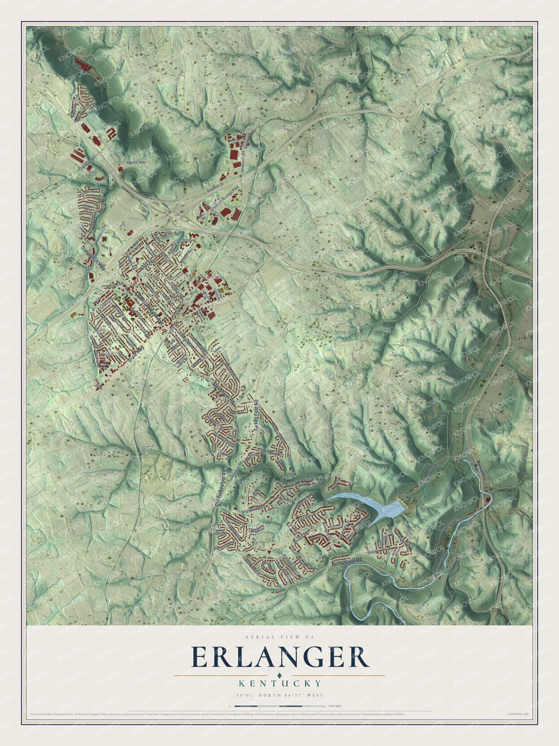
Erlanger, Kentucky Map Art
Building by building, with labeled streets and shaded relief.
12" x 18" Archival Matte Print
A Map of Home. A Work of Art.
Explore Erlanger, Kentucky from a whole new perspective. Created using aerial imagery and detailed geographic data, this map captures Erlanger building by building, with labeled streets, familiar landmarks, and shaded topographical relief that highlights the natural contours of the landscape.
Combining modern data with the timeless character of a vintage atlas, this map is just as interesting up close as it is beautiful on the wall. Whether you grew up in Erlanger, spent memorable years there, or call it home today, this unique map is a great way to celebrate a place that means something to you. Zoom in on the preview to look for your street, and then order a print to put your memories on the wall.
Three ways to hang it

Unframed archival matte, a black wood frame or a white wood frame.
Up close
Geography Worth Displaying
This map was created using accurate cartographic data and authoritative geographic sources, including the U.S. Geological Survey and the Census Bureau. The map brings together terrain, waterways, roads, and building detail. The majority of the streets are labeled, houses are accurately depicted, and the topography is derived from government sources. Combining local data with carefully composed color and shading leads to this beautifully detailed Erlanger artwork for your wall.
Rather than simply showing street outlines, we’ve included as many of the street names as we could reasonably fit on the map while keeping their names legible. Zoom in on the high resolution preview to see exactly what’s on the map. We truly set out to create a statement piece for anyone who loves Erlanger. So whether it’s for you, or a gift for someone you love, we hope this map of Erlanger brings back fond memories.
Read the story behind this map of Erlanger, Kentucky from 2026.

Find your street
Names on the Erlanger map
Every name below is printed on this map. Look for your street, your school, the park where you played, or the pond down the road.
Places and landmarks1
- Erlanger Municipal Center
Streets and roads129
- Commonwealth Avenue
- Donaldson Highway
- Dixie Highway
- Richardson Road
- Stevenson Road
- Turkey Foot Road
- Old Turkeyfoot Road
- Hulbert Avenue
- Crescent Springs Pike
- Anderson Road
- Riggs Avenue
- Dolwick Drive
- Erlanger Road
- Narrows Road
- Hallam Avenue
- Sherbourne Drive
- Brightleaf Boulevard
- Bullock Pen Road
- Madison Pike
- Riggs Road
- Pleasure Isle Drive
- Pacific Avenue
- McAlpin Avenue
- Misty Creek Drive
- Lakemont Drive
- Ridgewood Drive
- Forest Avenue
- Crescent Avenue
- Concord Drive
- Sunset Avenue
Show all 129 streets
- Circlewood Drive
- Perimeter Drive
- Turkeyfoot Road
- Lori Drive
- Hartman Road
- Woodlyn Hills Drive
- Division Street
- Doeridge Drive
- Nelson Road
- Bartlett Avenue
- Twinridge Way
- Center Street
- Carriage Hill Drive
- Dry Creek Road
- Locust Street
- Turfway Road
- Ashmont Drive
- Cherry Tree Lane
- Deerchase Drive
- Lindenwood Drive
- Deertrail Drive
- Appomattox Street
- Mary Street
- Watson Road
- James Avenue
- Delphi Drive
- Birch Drive
- Alice Street
- Holly Avenue
- Price Avenue
- Viox Drive
- Fir Tree Lane
- Terrace Drive
- Viola Lane
- Hope Lane
- Mesa Drive
- Kruer Court
- Kenton Lands Road
- Crescent Springs Road
- Timberlake Avenue
- Graves Street
- Spring Valley Drive
- Cave Run Drive
- Greenfield Lane
- Cedar Tree Lane
- Woodsedge Drive
- Shirepeak Way
- Bottomwood Drive
- North Talbot Drive
- Lafayette Court
- Linwood Avenue
- Raymonde Lane
- Rosary Drive
- Oxford Court
- Buckhill Drive
- Susan Lewis Drive
- Kincaid Drive
- Clover Avenue
- Jenny Lane
- Atlas Drive
- Arbor Drive
- Montgomery Street
- Jacqueline Drive
- Clay Street
- Woodchase Drive
- Robert East Lee Drive
- Olympic Boulevard
- Lexington Drive
- Enterprise Drive
- Sycamore Tree Lane
- Rainbow Terrace
- Parkplace Drive
- Ashridge Court
- Westwood Drive
- Skye Drive
- Crosswinds Drive
- Liberty Street
- Barkley Drive
- Whitecliff Way
- Grand Ledge Court
- Rodeo Drive
- Shade Lane
- Zora Lane
- Sagebrush Lane
- Silverlake Street
- Eagle Creek Drive
- Thomas Street
- Old Madison Pike
- Baker Street
- Sigma Drive
- Southway Ridge
- Rosebud Avenue
- Mitten Drive
- Kingsburg Court
- Lakerun Lane
- Country Road
- Peach Tree Lane
- Kentaboo Drive
- Pinoak Lane
Names are listed as they appear on the printed map. Zoom into the product photos to find them.
About Erlanger, Kentucky
Erlanger is a city of 19,611 people in Kenton County, just south of Cincinnati. It was founded in the 1880s and named for Emile Erlanger & Co., a family bank in Paris, and for its founder, Baron Frédéric Émile d'Erlanger, whose money helped pay for the young town's early growth.
Locals say the name the American way, with no French or German accent. The town's name spread to its neighbor too, since the city of Elsmere was first known as South Erlanger.
- A depot saved in 1990The railroad depot served Erlanger for more than 100 years. When Norfolk Southern planned to close the building and tear it down, the Erlanger Historical Society stepped in and saved it, and it opened as a museum in 1990.
- Home of U.S. Playing CardThe United States Playing Card Company has its corporate headquarters in Erlanger. Toyota Boshoku, the Italian candy maker Perfetti Van Melle, Total Quality Logistics and a Pitney Bowes global shipping center also do business here.
- Amazon's air hub in 2017In January 2017, Amazon said it would build a Prime Air hub in Erlanger. The company expected the hub to bring about 2,000 new jobs, on top of the 10,000 it already had in Kentucky.
Keep exploring Kentucky
Erlanger is one of 659 Kentucky towns we've mapped. Every dot on the map is a print of its own.
The search covers every state, Kentucky first.
Near Erlanger
Order 2 or more town maps and save 10%. Shown in the size and finish you picked above, so they hang as a set.
- Crescent Springs 12" x 18" / Archival Matte Print $39.99
- Villa Hills 12" x 18" / Archival Matte Print $39.99
- Lakeside Park 12" x 18" / Archival Matte Print $39.99

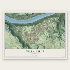
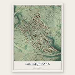
More maps nearby: Crestview Hills, Fort Mitchell, Edgewood, Elsmere and Bromley.
The art of mapping a place
How This Map Was Made
Real places. Remarkable detail. Discover the layers that turn geographic data into a map of home.

The view from above
Aerial imagery reveals the character of the land: woodland, open fields, and the patterns of a place.

The shape of the land
Elevation data brings hills, valleys, and subtle changes in the landscape into view.

The details of home
Roads, waterways, and building footprints come together to make the map feel unmistakably local.

Geography becomes art
Considered color, shading, and typography bring the layers together in a map made for your wall.


Process illustrated with Mendon, Massachusetts. Aerial imagery: USDA NAIP. Terrain: USGS 3D Elevation Program. Map details and finished artwork: KNOWOL.
The Details
About This Print
Choose an archival matte print, or a black or white Ayous wood frame. The archival matte print is unframed.
Select your size and finish above to see the matching product image and price.
Materials & Craftsmanship
A contemporary map with the character of a classic atlas, printed on archival matte paper. Optional frames are made from Ayous wood.
Your printed map does not include the watermark shown in the full-map preview.
Shipping & Delivery
Free shipping within the United States. Every print is made to order in the USA.
Buying a gift? Add a note in your cart and we'll include it. We never put prices in the package.
Prints ship within 2 to 3 business days. Allow 7 to 10 days total from ordering for delivery. Timing may vary during holidays or periods of high order volume.
Read our shipping policy.
Returns and damaged prints
Each print is made to order. Change-of-mind refunds are not available after production.
If your print arrives damaged, misprinted or incorrect, contact support@knowol.com within 30 days of receiving it. Include your order number, photos and a description of the issue.
Read our full refund and replacement policy. For questions about your order, email support@knowol.com.