
Search for another town




Free U.S. delivery 7 to 10 days after you order
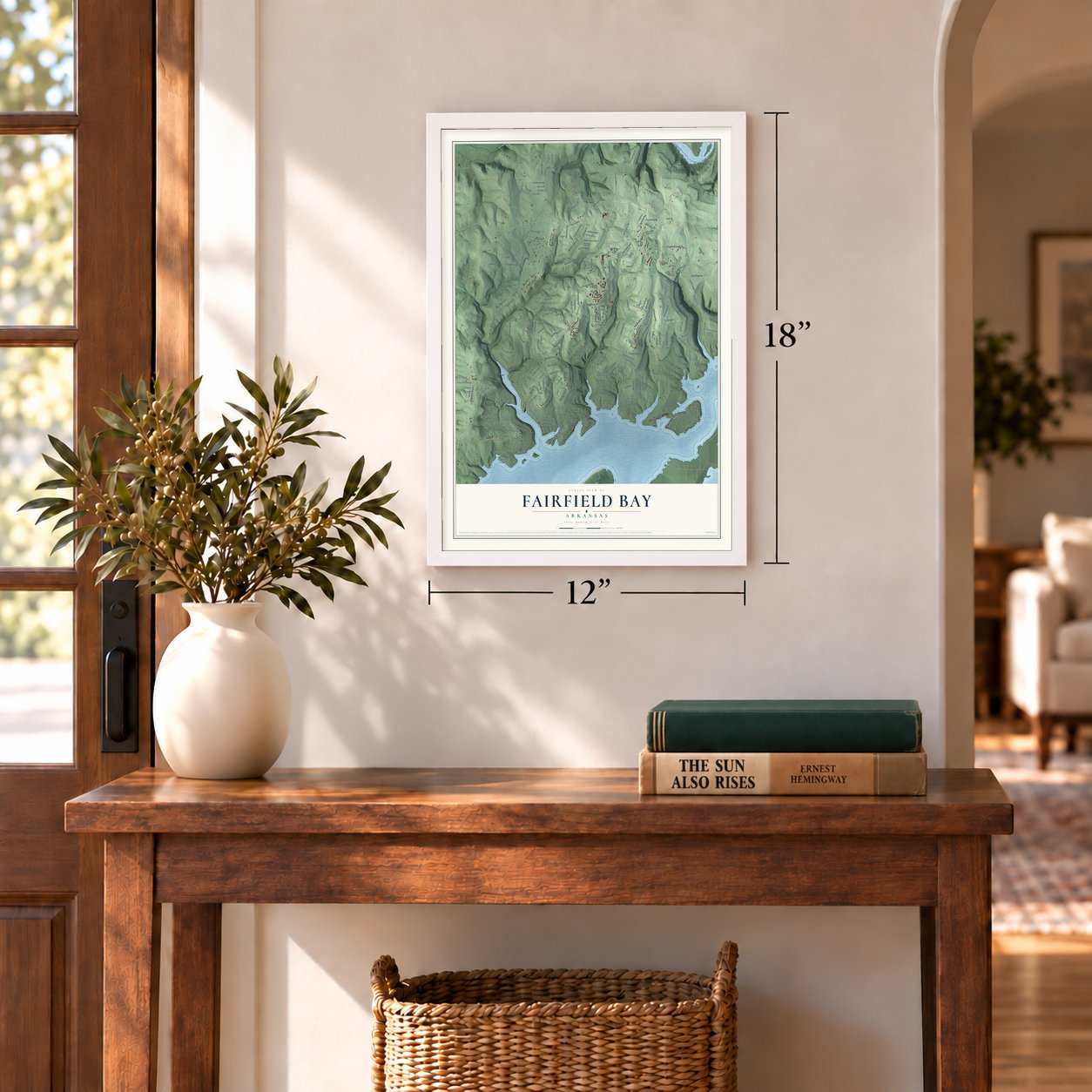
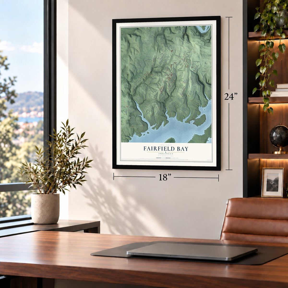
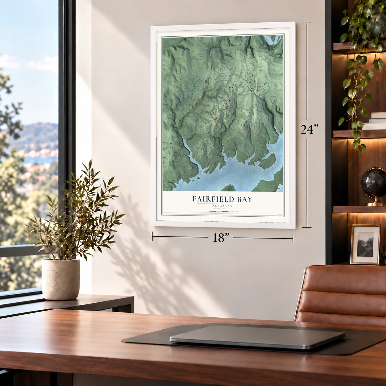
Fairfield Bay, Arkansas Map Art
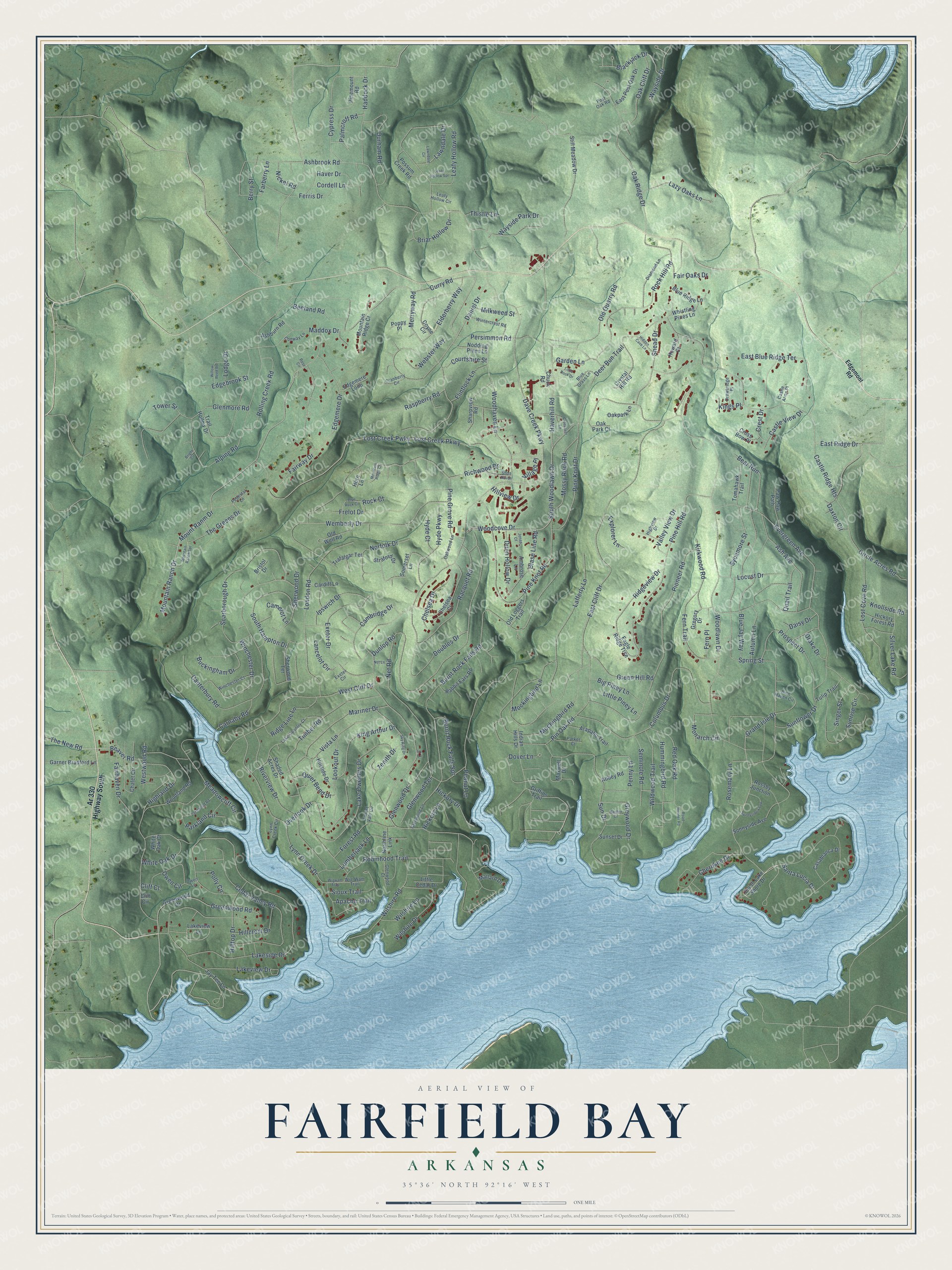
A new map of Fairfield Bay, Arkansas, made in 2026 and printed to order on thick archival matte paper.
12" x 18" Archival Matte Print
A Map of Home. A Work of Art.
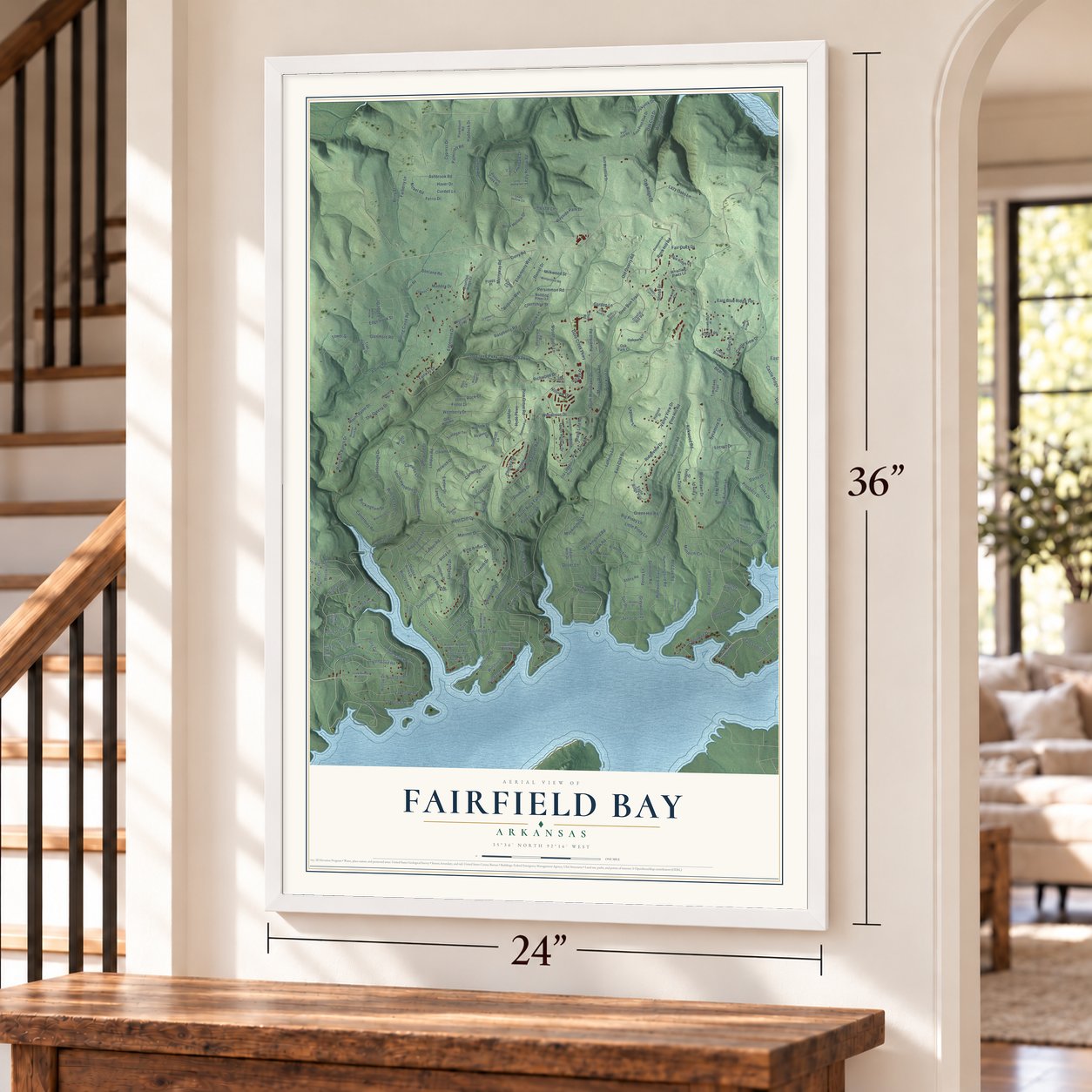
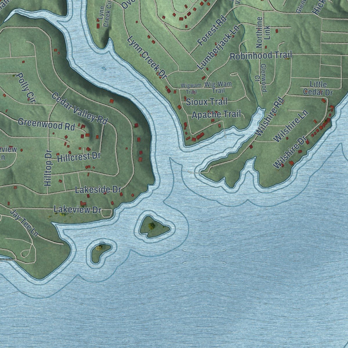
Explore Fairfield Bay, Arkansas from a whole new perspective. Created using aerial imagery and detailed geographic data, this map captures Fairfield Bay building by building, with labeled streets, familiar landmarks, and shaded topographical relief that highlights the natural contours of the landscape.
Combining modern data with the timeless character of a vintage atlas, this map is just as interesting up close as it is beautiful on the wall. Whether you grew up in Fairfield Bay, spent memorable years there, or call it home today, this unique map is a great way to celebrate a place that means something to you. Zoom in on the preview to look for your street, and then order a print to put your memories on the wall.
Three ways to hang it
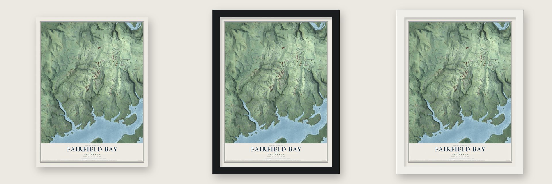
Unframed archival matte, a black wood frame or a white wood frame.
Up close
Geography Worth Displaying
This map was created using accurate cartographic data and authoritative geographic sources, including the U.S. Geological Survey and the Census Bureau. The map brings together terrain, waterways, roads, and building detail. The majority of the streets are labeled, houses are accurately depicted, and the topography is derived from government sources. Combining local data with carefully composed color and shading leads to this beautifully detailed Fairfield Bay artwork for your wall.
Rather than simply showing street outlines, we’ve included as many of the street names as we could reasonably fit on the map while keeping their names legible. Zoom in on the high resolution preview to see exactly what’s on the map. We truly set out to create a statement piece for anyone who loves Fairfield Bay. So whether it’s for you, or a gift for someone you love, we hope this map of Fairfield Bay brings back fond memories.
Read the story behind this map of Fairfield Bay, Arkansas from 2026.

About Fairfield Bay, Arkansas
From the CALS Encyclopedia of Arkansas: "Fairfield Bay, located in north-central Arkansas on the north shore of Greers Ferry Lake, was created with the goal of becoming a recreational and retirement resort."
Find your street
Names on the Fairfield Bay map
Every name below is printed on this map. Look for your street, your school, the park where you played, or the pond down the road.
Streets and roads299
- Grand Isle Drive
- Mount Ranm Drive
- Mountain Ranch Drive
- Maddox Drive
- Hickory Drive
- Rock Hill Road
- Deer Run Trail
- Haverhill Road
- Richwood Drive
- Lynn Creek Drive
- South Woodlawn Drive
- Curry Road
- Dave Creek Parkway
- Woodlawn Drive
- East Cliff Drive
- West Cliff Drive
- Lost Creek Parkway
- Lakeside Drive
- Spring Street
- Alpine Road
- Ashbrook Road
- Burnt Rock Falls Road
- Castle Ridge Heights
- Dunlop Road
- Canterbury Road
- Evergreen Avenue
- Timber Road
- Pine Grove Road
- Pioneer Road
- Wemberly Drive
Show all 299 streets
- Lakeview Drive
- Leafy Hollow Road
- Mockingbird Road
- Snead Drive
- Columbus Drive
- Lost Creek Pwky
- Daniel Drive
- Cedar Valley Road
- Persimmon Road
- Merryway Road
- Sherwood Drive
- Pin Oak Road
- London Road
- Pine Knot Road
- Scarborough Drive
- Circle Acres Road
- Pine Hill Road
- Oak Ridge Drive
- Riverview Drive
- Fairway Drive
- Frelot Drive
- Sunflower Drive
- Lafferty Lane
- Sunrise Circle
- Lake Dwellers Drive
- Sun Drive
- Woodhaven Lane
- Glenmore Road
- Doubles Drive
- East Blue Ridge Terrace
- Exeter Drive
- Lookout Drive
- Overlook Drive
- Mariner Drive
- Lost Cove Road
- Wayside Park Drive
- Blue Jay Way
- Greenwood Road
- Racquet Road
- Pine Knot Drive
- South Hampton Drive
- Old Quarry Road
- Wildwood Trail
- Ash Avenue
- Wilshire Road
- Edgemere Drive
- Prospect Drive
- Winchester Drive
- Cherokee Drive
- Lumberjack Lane
- Hummingbird Road
- Autumn Lane
- Durham Road
- Dunn Hollow Drive
- Cambridge Drive
- Penny Lane
- Beaver Road
- Fern Trail
- Rolling Creek Road
- Wilshire Drive
- Haddock Drive
- Dover Lane
- Hyde Parkway
- The Greens Drive
- King Arthur Drive
- Crest Drive
- White Oak Drive
- Owen Circle
- Norfolk Drive
- Red Oak Road
- Highland Drive
- Mossy Rock Road
- Lazy Oaks Lane
- Kirkwood Road
- Ridgeview Drive
- Cypress Drive
- Briar Hollow Drive
- Hilltop Drive
- Robinhood Trail
- Ferris Drive
- Oak Cliff Drive
- Blackjack Drive
- Zenith Drive
- Silver Lake Road
- Forest Road
- Fairhaven Drive
- Elderberry Way
- Sioux Trail
- Ridge Line Lane
- Sycamore Street
- Chelsea Drive
- Locust Drive
- Green Hill Road
- Rosemary Lane
- Seminole Road
- Cordell Lane
- Raspberry Road
- Bear Run
- Ipswich Drive
- Glenwood Drive
- Burnt Rock Falls Spr
- Monarch Circle
- Valley View Drive
- Parkland Circle
- Greywood Drive
- Wayside Drive
- Buckingham Drive
- Beeland Road
- Hillcrest Drive
- Big Piney Lane
- Woodcove Drive
- Carnaby Road
- Singer Street
- Little Piney Lane
- Webster Way
- Glenwood Terrace
- Lawndale Drive
- Flintlock Lane
- Palmcroff Road
- Haver Drive
- Quiet Bend Drive
- Net Road
- Edgebrook Street
- Meadowcliff Circle
- Castle View Drive
- Daxton Circle
- Garden Lane
- Courtshire Street
- East Ridge Drive
- Hickory Lane
- The New Road
- Wilshire Lane
- Berry Street
- Westwood Road
- Hillview Drive
- Quail Trail
- Milkweed Street
- Knollside Road
- Lancelot Circle
- Lodge Drive
- Vista Lane
- Mockingbird Lane
- Apache Trail
- Explorer Lane
- Santa Lucia Drive
- Blase Line Road
- Polly Circle
- Daisy Drive
- Tower Street
- Fair Oaks Drive
- Nickel Road
- Thistle Lane
- Hyde Court
- Drake Drive
- Farberry Lane
- Village Place
- Camelot Lane
- Peanut Lane
- Kings Place
- Fern Place
- Cliff Court
- Rock Court
- Ar 330 Highway South
- South Lake Shore Drive
- Eagle Ridge Trce
- Sunnyside Avenue
- Still Meadow Drive
- Trail Hollow Drive
- Greenwood Drive
- Lakeview Lane
- Somerset Lane
- Indian Hills Drive
- Chalet Circle
- Chelsea Court
- Coyne Circle
- Woodland Road
- Sharpview Road
- Maxwell Drive
- Sherwood Terrace
- East Post Oak Drive
- Rabbit Ears Road
- Casablanca Drive
- Old Well Road
- Crystal Hill Road
- Pinemount Road
- Garner Bradford Lane
- Arapaho Trail
- Possum Creek Road
- Tomahawk Trail
- Paw Paw Path
- Mallard Drive
- Abbey Road
- Straford Drive
- Shaded Acres Drive
- Old Loggers Trail
- Whistling Pines Lane
- Tulip Trail
- Hillside Drive
- Nodding Pines Lane
- Mountain Ridge Cr
- Blue Ridge Lane
- Rossby Junction
- Hickory Forest Road
- Trafalgar Terrace
- Griffins Trail
- Ashburn Road
- Northline Link
- Cardiff Lane
- Edgemere Loop
- Oakpark Lane
- Chuck Road
- Sunset Drive
- Cross Bow Place
- Bristol Drive
- Little Cedar Drive
- Howard Court
- Jay Tee Lane
- Ambrose Lane
- Gregory Drive
- Horn Lane
- Poppy Place
- Oak Park Court
- White Oak Court
- Cliff Circle
- Edgemont Road
- Lake Country Court
- Diamond Lane
- Glenwood Lane
- Wintercrest Road
- Rich Haven Circle
- Winchester Court
- Drawbridge Place
- Oakwood Lane
- Glenwood Court
- Highview Drive
- Blue Grass Lane
- Parker Court
- Cranberry Circle
- Conway Lane
- Leafy Hollow Circle
- Forest Vale Circle
- Wig-Wam Trail
- Lynn Creek Circle
- Castle Arms Place
- Pedestal Lane
- Post Oak Road
- Exeter Circle
- Owen Lane
- Wigwam Trail
- Sky King Drive
- Blue Rock Circle
- Crossover Lane
- Sunnyside Loop
- Lakewood Road
- Mountain Ranch Spr
- Road Runner Road
- Willow Reed Road
- Leafy Hollow Spr
- Short Haven
- Harden Drive
- Hidden Cave Lane
- Mountain Ridge Court
- Little Rock Drive
- Jonas Court
- Lawndale Circle
- Net Lane
- Bright Circle
- Rose Circle
- Ivy Lane
Names are listed as they appear on the printed map. Zoom into the product photos to find them.
The art of mapping a place
How This Map Was Made
Real places. Remarkable detail. Discover the layers that turn geographic data into a map of home.

The view from above
Aerial imagery reveals the character of the land: woodland, open fields, and the patterns of a place.

The shape of the land
Elevation data brings hills, valleys, and subtle changes in the landscape into view.

The details of home
Roads, waterways, and building footprints come together to make the map feel unmistakably local.

Geography becomes art
Considered color, shading, and typography bring the layers together in a map made for your wall.


Process illustrated with Mendon, Massachusetts. Aerial imagery: USDA NAIP. Terrain: USGS 3D Elevation Program. Map details and finished artwork: KNOWOL.
The Details
About This Print
Choose an archival matte print, or a black or white Ayous wood frame. The archival matte print is unframed.
Select your size and finish above to see the matching product image and price.
Materials & Craftsmanship
A contemporary map with the character of a classic atlas, printed on archival matte paper. Optional frames are made from Ayous wood.
Your printed map does not include the watermark shown in the full-map preview.
Shipping & Delivery
Free shipping within the United States. Every print is made to order in the USA.
Buying a gift? Add a note in your cart and we'll include it. We never put prices in the package.
Prints ship within 2 to 3 business days. Allow 7 to 10 days total from ordering for delivery. Timing may vary during holidays or periods of high order volume.
Read our shipping policy.
Returns and damaged prints
Each print is made to order. Change-of-mind refunds are not available after production.
If your print arrives damaged, misprinted or incorrect, contact support@knowol.com within 30 days of receiving it. Include your order number, photos and a description of the issue.
Read our full refund and replacement policy. For questions about your order, email support@knowol.com.
Find your town
Looking for another city?
Find a map of home in our Arkansas collection, or any town in the country.
Nearby
Maps of towns near Fairfield Bay
Know someone from one of these towns? Their map makes a great gift.
 Edgemont
, Arkansas
From $39.99See the map
 Shirley
, Arkansas
From $39.99See the map
 Higden
, Arkansas
From $39.99See the map
More maps nearby: Greers Ferry, Clinton, Bee Branch, Fox and Heber Springs.