
Search for another town





Free U.S. delivery 7 to 10 days after you order
Farmville, Virginia Map Art
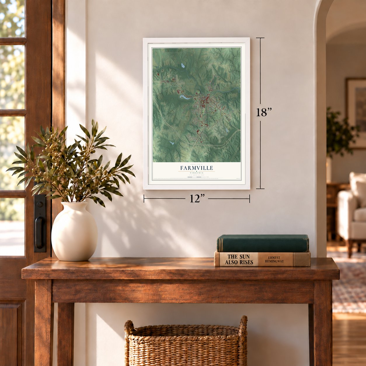
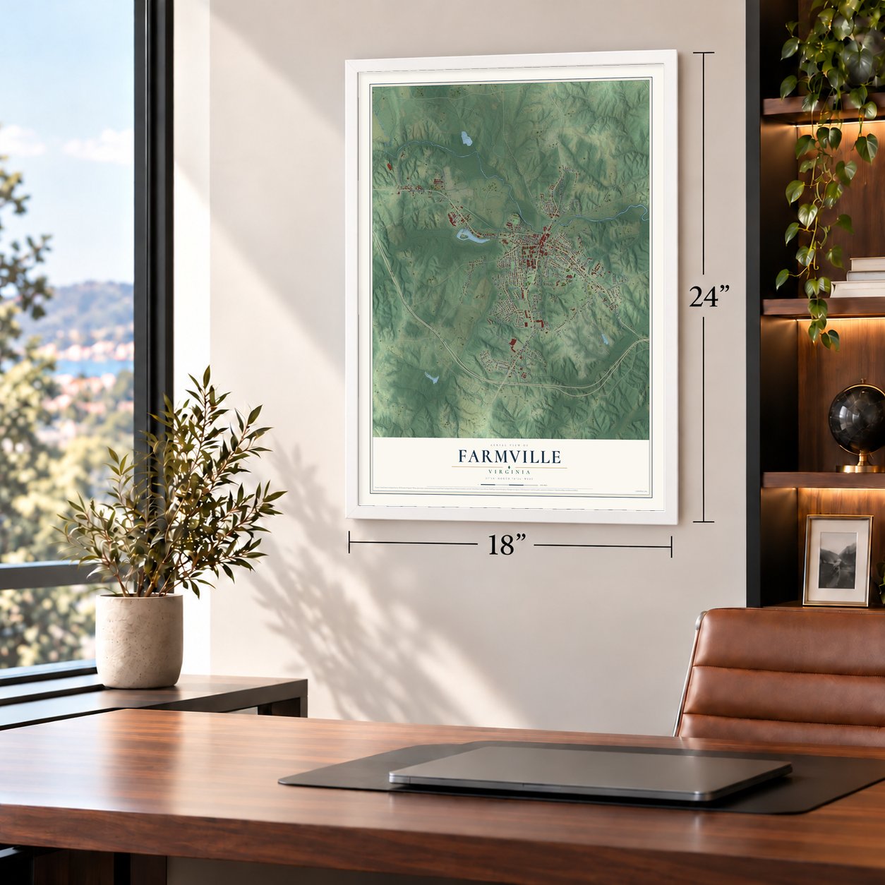
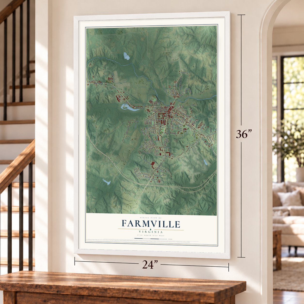
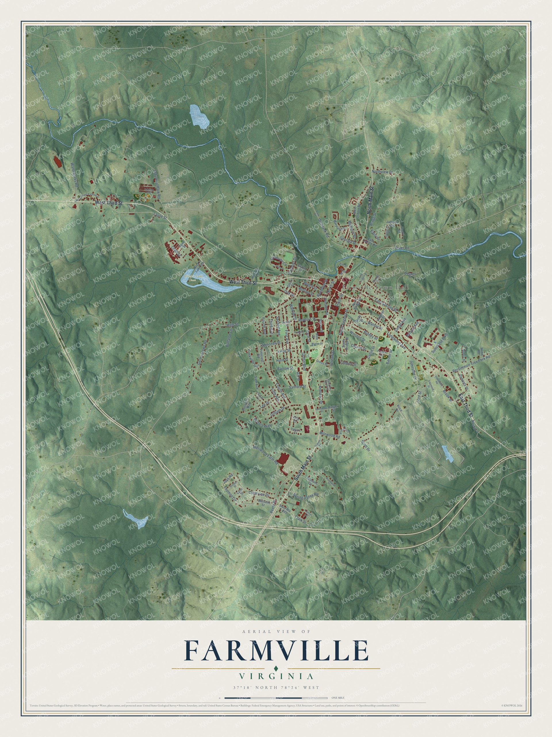
A new map of Farmville, Virginia, made in 2026 and printed to order on thick archival matte paper.
12" x 18" Archival Matte Print
A Map of Home. A Work of Art.
Explore Farmville, Virginia from a whole new perspective. Created using aerial imagery and detailed geographic data, this map captures Farmville building by building, with labeled streets, familiar landmarks, and shaded topographical relief that highlights the natural contours of the landscape.
Combining modern data with the timeless character of a vintage atlas, this map is just as interesting up close as it is beautiful on the wall. Whether you grew up in Farmville, spent memorable years there, or call it home today, this unique map is a great way to celebrate a place that means something to you. Zoom in on the preview to look for your street, and then order a print to put your memories on the wall.
Three ways to hang it
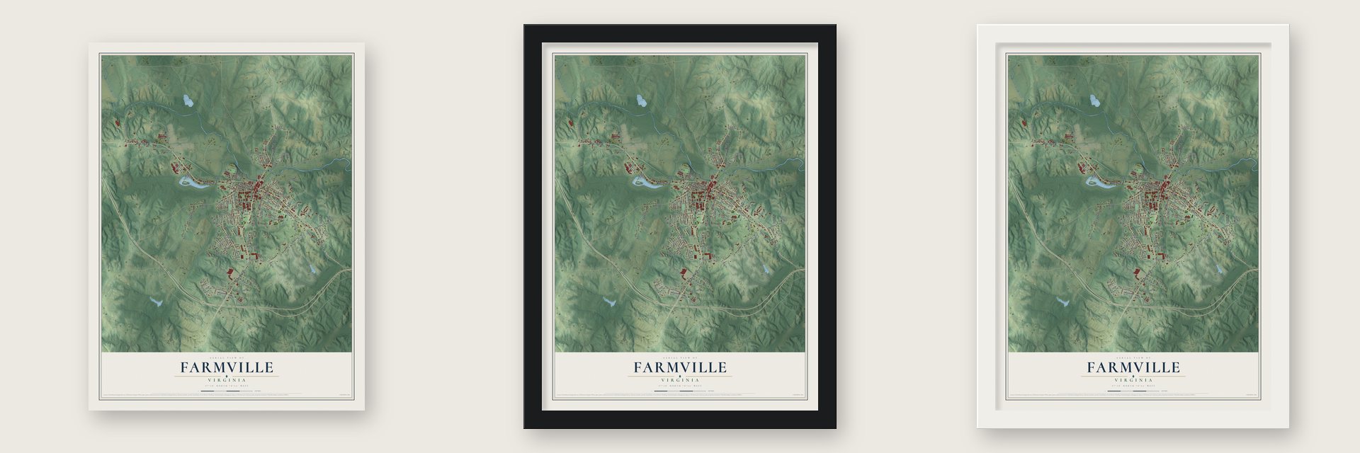
Unframed archival matte, a black wood frame or a white wood frame.
Up close
Geography Worth Displaying
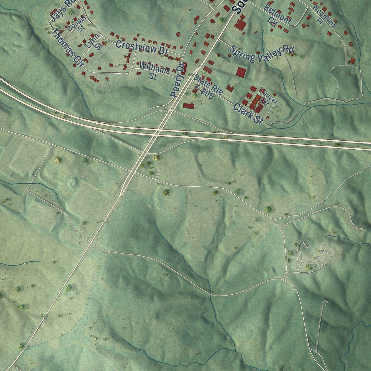
This map was created using accurate cartographic data and authoritative geographic sources, including the U.S. Geological Survey and the Census Bureau. The map brings together terrain, waterways, roads, and building detail. The majority of the streets are labeled, houses are accurately depicted, and the topography is derived from government sources. Combining local data with carefully composed color and shading leads to this beautifully detailed Farmville artwork for your wall.
Rather than simply showing street outlines, we’ve included as many of the street names as we could reasonably fit on the map while keeping their names legible. Zoom in on the high resolution preview to see exactly what’s on the map. We truly set out to create a statement piece for anyone who loves Farmville. So whether it’s for you, or a gift for someone you love, we hope this map of Farmville brings back fond memories.
Read the story behind this map of Farmville, Virginia from 2026.

About Farmville, Virginia
Farmville is a town of 7,473 people near the headwaters of the Appomattox River, and it serves as the county seat of Prince Edward County. The town was formed in 1798, and from 1795 to 1890 it marked the western end of the Upper Appomattox Canal Navigation System. Enslaved African Americans built that canal, and bateaux then carried tobacco and farm goods downriver to Petersburg until railroads took over the trade.
The Southside Railroad between Petersburg and Lynchburg reached Farmville in the 1850s, partly paid for by money the town contributed. To get there the line had to cross the Appomattox just downstream on the costly High Bridge, which is now part of High Bridge Trail State Park. In 1871 Prince Edward County moved its seat from Worsham to Farmville, and the town was incorporated in 1912.
“The family of early settler Hercules White bought and sold real estate in Farmville and joined with white citizens to found the town's first Baptist church in 1836.”
- Lee's last hope for rationsIn the final days of the Civil War, Robert E. Lee's retreating army pushed toward Farmville to reach food for its hungry soldiers. A quartermaster had turned back a supply train meant for Danville so it would stop here. Union cavalry under Gen. Philip Sheridan and two infantry divisions arrived and blocked the Confederates. Lee's army was soon surrounded, and on April 9, 1865, Lee gave up at Appomattox Court House.
- Students who sued for schoolsBlack students at Farmville's all-black high school protested a building lacking a gym, a cafeteria and enough desks, with some classes held in a parked school bus. Their suit, Davis v. County School Board, ran from 1952 to 1954 and joined Brown v. Board of Education, the only Brown case born of a student protest. The county closed every public school in 1959, and they stayed shut until reopening fully integrated in 1964.
- Israel HillMany of the bateau boatmen working near Farmville were free people of color from Israel Hill, a 350-acre community of farmers, craftsmen and laborers freed between the Revolutionary War and about 1810. Black and white residents there earned equal pay, built a church together and could go to court. Because its families owned their land, Israel Hill stayed steadier than other Black neighborhoods.
- Bricks and bottled springsIn 1874 M.R. Murkland built a kiln and shaped bricks by hand from the clay of the Farmville Basin, turning out around 600,000 a year. Just north of the river, Farmville Lithia Springs bottled its mineral water from 1884 to 1901. Its investors chose shipping over building a resort, and the water went to buyers at home and overseas who used it for water cures.
- A national debate in 2016In September 2015 the Commission on Presidential Debates picked Farmville to host the vice-presidential debate. It took place at Longwood University on October 4, 2016.
Find your street
Names on the Farmville map
Every name below is printed on this map. Look for your street, your school, the park where you played, or the pond down the road.
Places and landmarks2
- Farmville Town Hall
- Wilck's Lake Park
Streets and roads130
- West Third Street
- East Third Street
- North Main Street
- South Main Street
- South Virginia Street
- Old Plank Road
- Hill Street
- Redford Street
- Andrews Drive
- Milnwood Road
- High Street
- Longwood Avenue
- Germantown Road
- Gilliam Drive
- Fourth Avenue
- Griffin Boulevard
- Catlin Street
- East Second Street
- Meriwood Farm Road
- Northview Drive
- Layne Street
- Peery Drive
- Buffalo Street
- First Avenue
- Waterworks Road
- Lee Drive
- Industrial Park Road
- River Road
- Church Street
- Vernon Street
Show all 130 streets
- Barrow Street
- Putney Street
- Second Avenue
- Crestview Drive
- Thomas Circle
- Persimmon Tree Fork Road
- Winston Street
- Edmonds Street
- Hurd Street
- Third Avenue
- Sanford Street
- South Street
- Race Street
- Cedar Avenue
- Cormier Drive
- Irving Street
- Johnston Drive
- Clark Street
- North Street
- Spring Valley Road
- Jesse's Way
- Scott Drive
- Sunchase Boulevard
- Landon Street
- Cobb Street
- Oak Street
- Barber Street
- Hylawn Avenue
- Bizzarre Street
- Brook Street
- Fifth Avenue
- Buffaloe Lane
- Early Street
- Roberts Street
- Georgia Street
- Bragg Street
- Venable Street
- Randolph Street
- Watkins Street
- Beech Street
- Walnut Street
- Ford Street
- Jays Road
- Clubhouse Circle
- Pine Street
- West Osborn Road
- Belmont Circle
- Doswell Street
- Sixth Avenue
- North Bridge Street
- South Bridge Street
- Jackson Avenue
- State Route F-895
- Creekwood Trail
- Wilck's Lake Isle
- Grove Street
- Newby Lane
- Grace Street
- Maryland Street
- Russell's Way
- Noblin Drive
- Agee Street
- Vaughan Street
- Williams Street
- Fuqua Drive
- Pinecrest Road
- East Osborn Road
- Gross Street
- Hudson Lane
- Spruce Street
- First Street
- Lynn Street
- Stuart Road
- Burger Street
- Webb Road
- Holly Street
- Allie Court
- Price Drive
- Layne Street Extended
- Lancer Circle
- School Street
- Franklin Street
- Woodland Place
- Parkview Gardens
- Wynne Drive
- Cooper Street
- Serpell Street
- Cabell's Court
- Elm Street
- North Virginia Street
- Plank Road
- Spotswood Drive
- Seventh Avenue
- Graham Road
- Greenhouse Road
- Woodland Court
- Healy Street
- Longstreet Road
- Callaway Lanes
- Edgewood Drive
Names are listed as they appear on the printed map. Zoom into the product photos to find them.
The art of mapping a place
How This Map Was Made
Real places. Remarkable detail. Discover the layers that turn geographic data into a map of home.

The view from above
Aerial imagery reveals the character of the land: woodland, open fields, and the patterns of a place.

The shape of the land
Elevation data brings hills, valleys, and subtle changes in the landscape into view.

The details of home
Roads, waterways, and building footprints come together to make the map feel unmistakably local.

Geography becomes art
Considered color, shading, and typography bring the layers together in a map made for your wall.


Process illustrated with Mendon, Massachusetts. Aerial imagery: USDA NAIP. Terrain: USGS 3D Elevation Program. Map details and finished artwork: KNOWOL.
The Details
About This Print
Choose an archival matte print, or a black or white Ayous wood frame. The archival matte print is unframed.
Select your size and finish above to see the matching product image and price.
Materials & Craftsmanship
A contemporary map with the character of a classic atlas, printed on archival matte paper. Optional frames are made from Ayous wood.
Your printed map does not include the watermark shown in the full-map preview.
Shipping & Delivery
Free shipping within the United States. Every print is made to order in the USA.
Buying a gift? Add a note in your cart and we'll include it. We never put prices in the package.
Prints ship within 2 to 3 business days. Allow 7 to 10 days total from ordering for delivery. Timing may vary during holidays or periods of high order volume.
Read our shipping policy.
Returns and damaged prints
Each print is made to order. Change-of-mind refunds are not available after production.
If your print arrives damaged, misprinted or incorrect, contact support@knowol.com within 30 days of receiving it. Include your order number, photos and a description of the issue.
Read our full refund and replacement policy. For questions about your order, email support@knowol.com.
Find your town
Looking for another city?
Find a map of home in our Virginia collection, or any town in the country.
Nearby
Maps of towns near Farmville
Know someone from one of these towns? Their map makes a great gift.
 Hampden-Sydney
, Virginia
From $39.99See the map
 Burkeville
, Virginia
From $39.99See the map
 Pamplin City
, Virginia
From $39.99See the map
More maps nearby: Cumberland, Crewe, Dillwyn, Keysville and Buckingham Courthouse.