
Search for another town





Free U.S. delivery 7 to 10 days after you order
Forney, Texas Map Art
Building by building, with labeled streets and shaded relief.
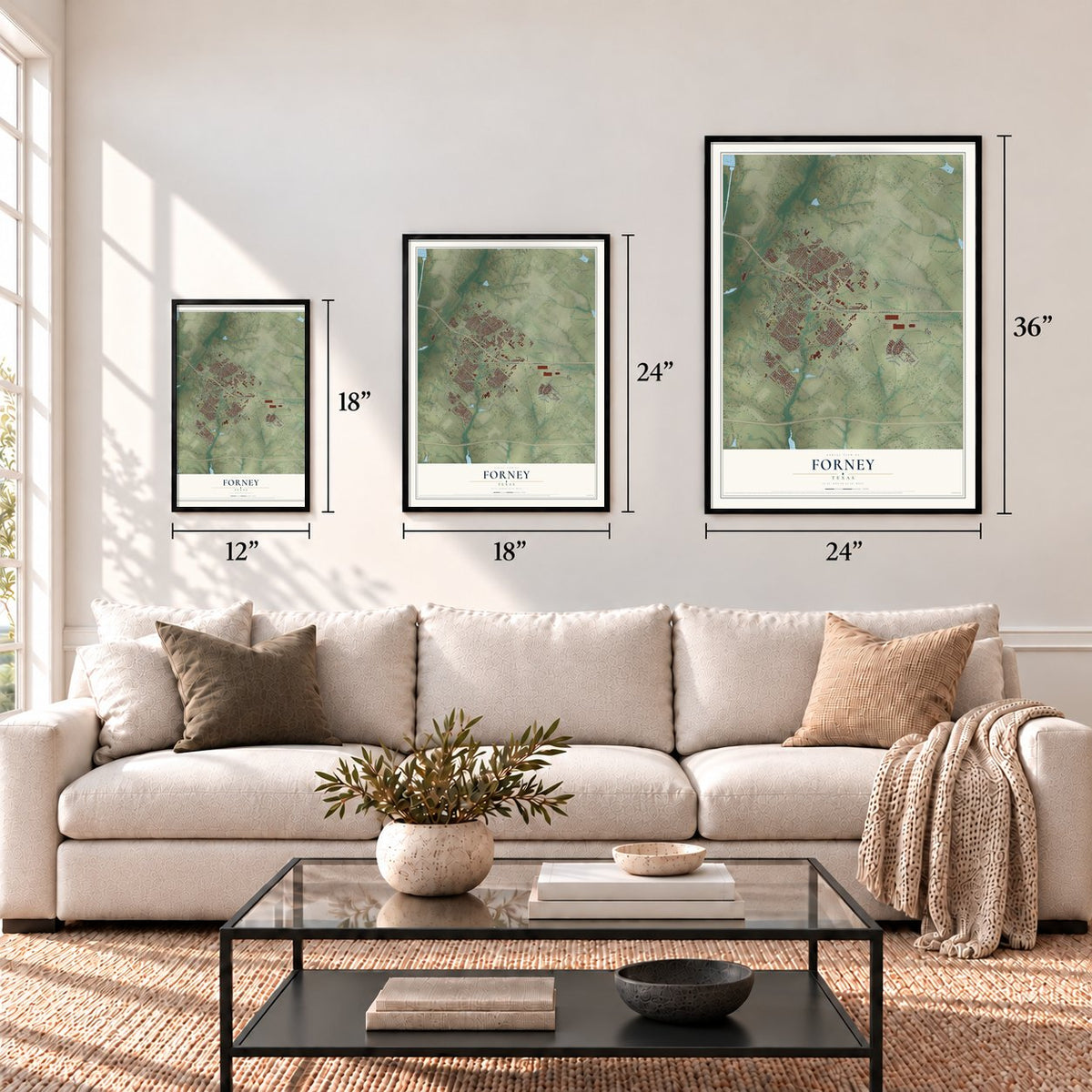
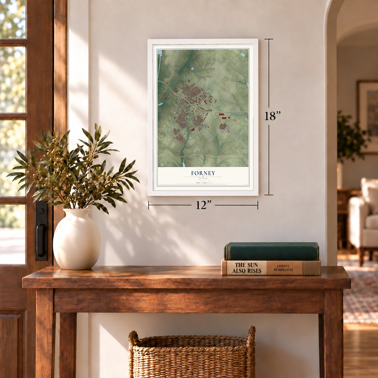
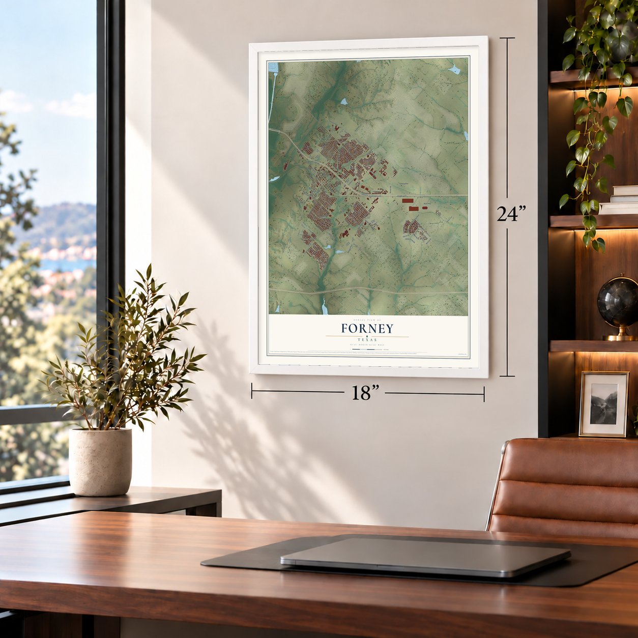
12" x 18" Archival Matte Print
A Map of Home. A Work of Art.
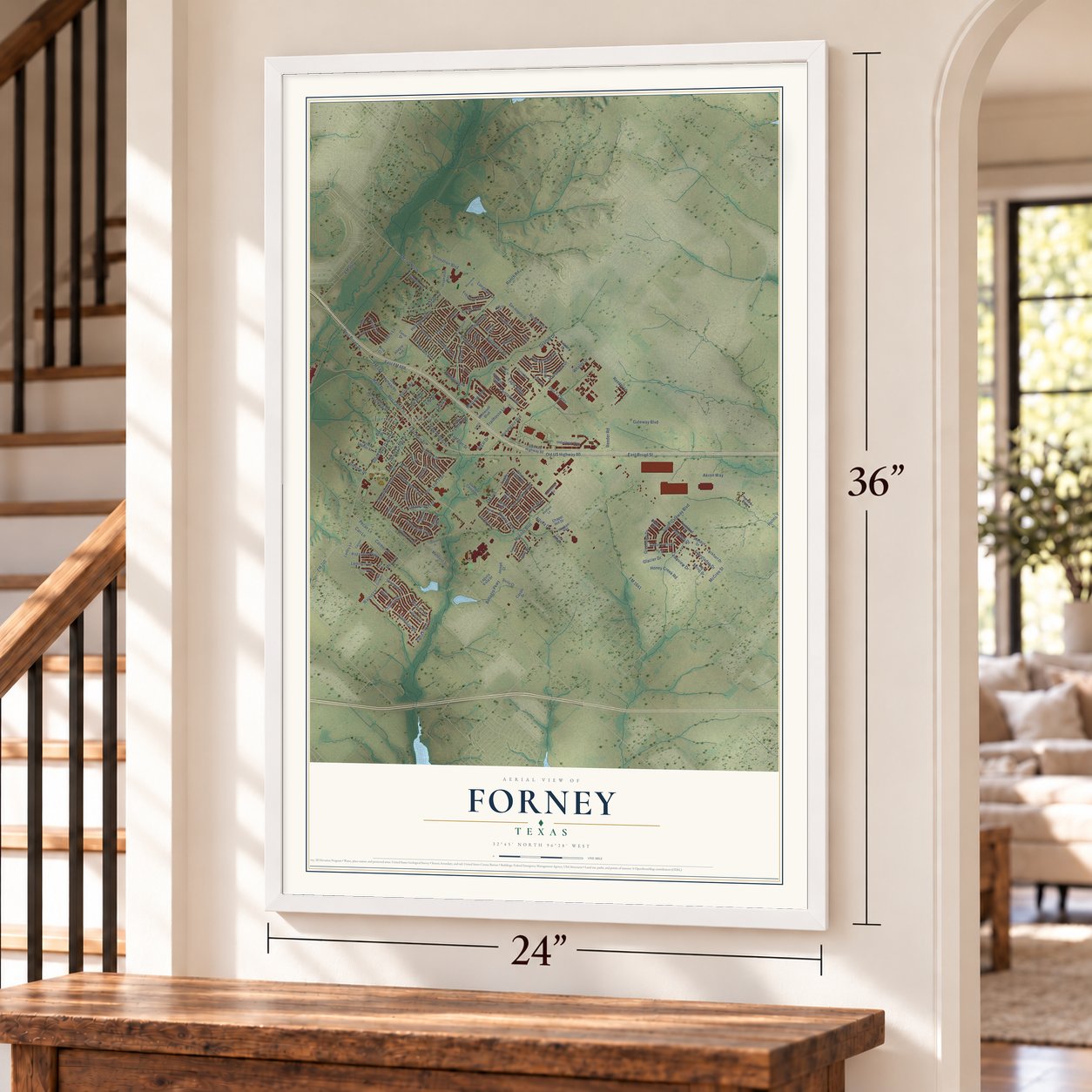
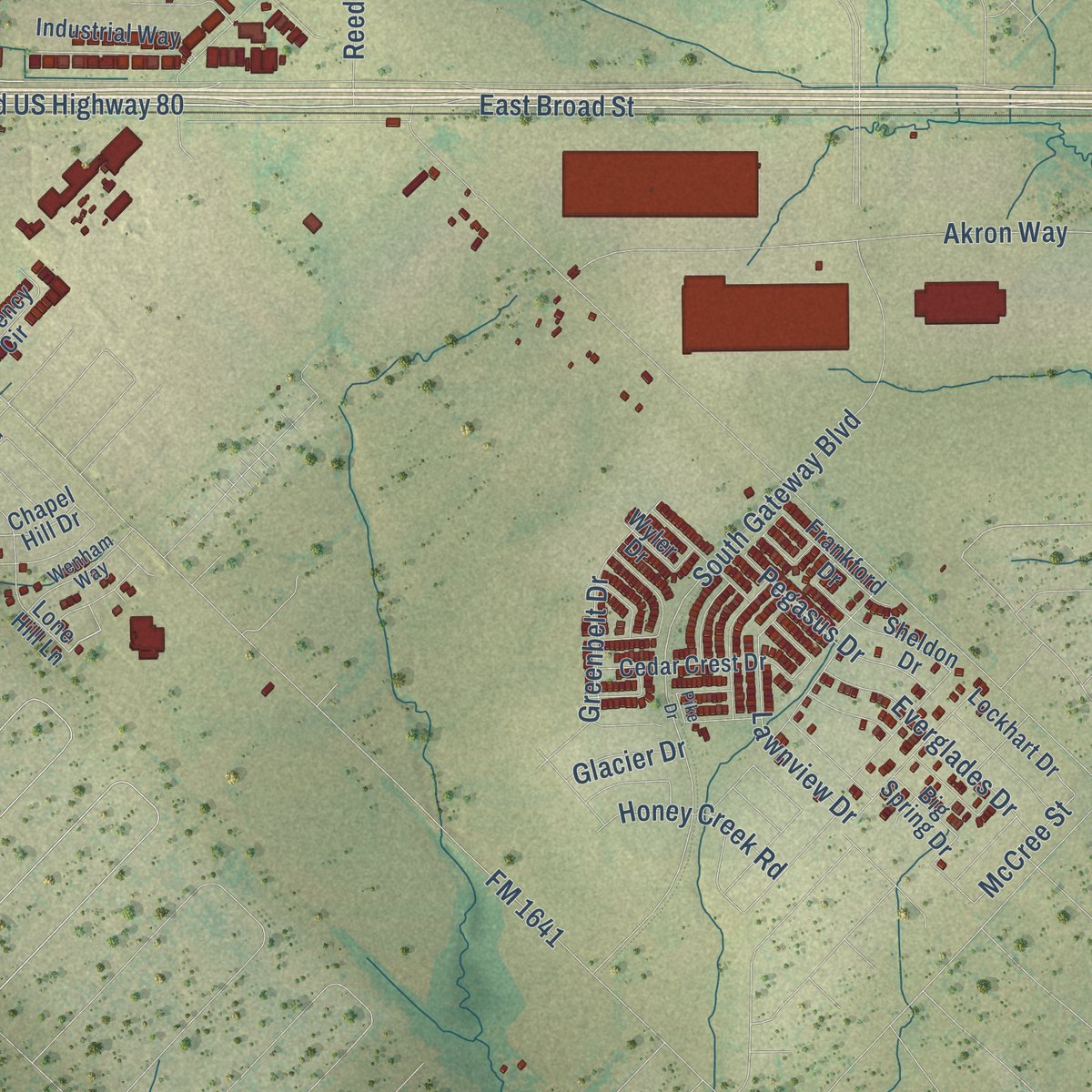
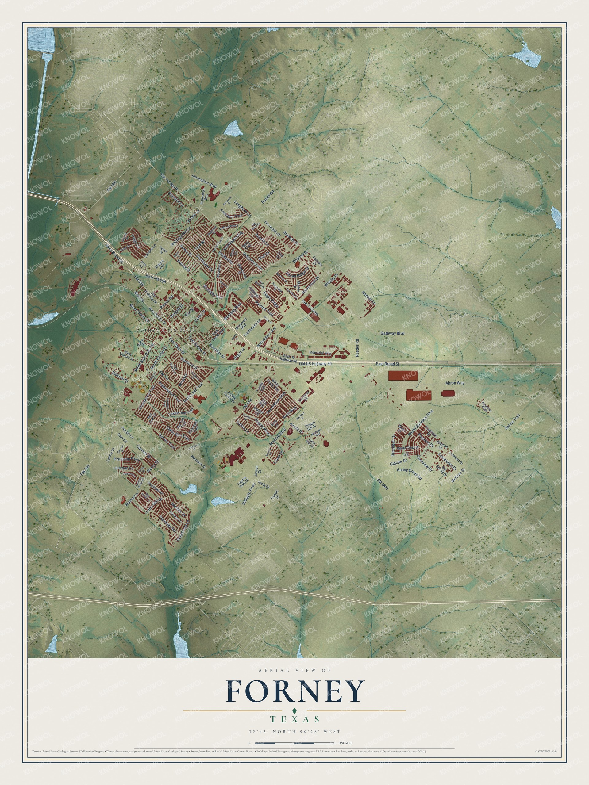
Explore Forney, Texas from a whole new perspective. Created using aerial imagery and detailed geographic data, this map captures Forney building by building, with labeled streets, familiar landmarks, and shaded topographical relief that highlights the natural contours of the landscape.
Combining modern data with the timeless character of a vintage atlas, this map is just as interesting up close as it is beautiful on the wall. Whether you grew up in Forney, spent memorable years there, or call it home today, this unique map is a great way to celebrate a place that means something to you. Zoom in on the preview to look for your street, and then order a print to put your memories on the wall.
Three ways to hang it
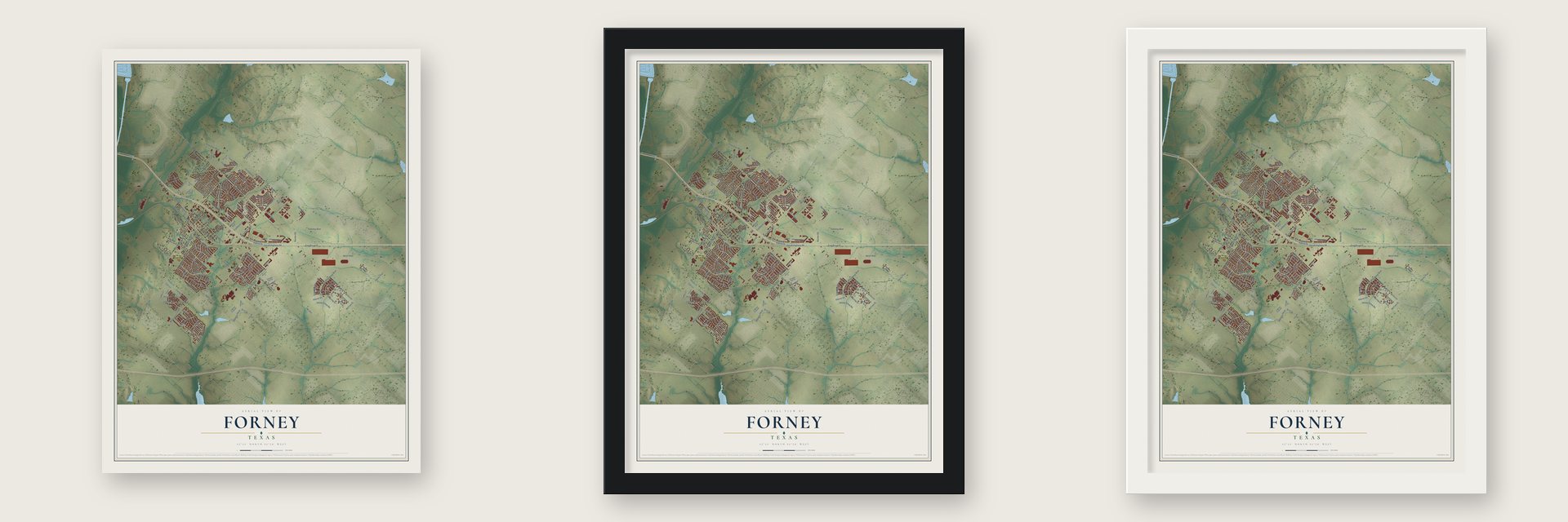
Unframed archival matte, a black wood frame or a white wood frame.
Up close
Geography Worth Displaying
This map was created using accurate cartographic data and authoritative geographic sources, including the U.S. Geological Survey and the Census Bureau. The map brings together terrain, waterways, roads, and building detail. The majority of the streets are labeled, houses are accurately depicted, and the topography is derived from government sources. Combining local data with carefully composed color and shading leads to this beautifully detailed Forney artwork for your wall.
Rather than simply showing street outlines, we’ve included as many of the street names as we could reasonably fit on the map while keeping their names legible. Zoom in on the high resolution preview to see exactly what’s on the map. We truly set out to create a statement piece for anyone who loves Forney. So whether it’s for you, or a gift for someone you love, we hope this map of Forney brings back fond memories.

Find your street
Names on the Forney map
Every name below is printed on this map. Look for your street, your school, the park where you played, or the pond down the road.
Places and landmarks2
- Forney City Hall
- Mulberry Park
Streets and roads172
- FM 688
- Old US Highway 80
- East Broad Street
- Ridgecrest Road
- South Bois D'Arc Street
- Walnut Lane
- West Broad Street
- Pinson Road
- Main Street
- Gold Finch Lane
- Lufkin Lane
- Pecan Lane
- Chinaberry Trail
- FM 740
- Gateway Boulevard
- FM 548
- FM 741
- FM 1641
- FM 740 North
- Longhorn Lane
- Akron Way
- South Gateway Boulevard
- West Trinity Street
- Reeder Road
- Redbud Drive
- Bowie Street
- Lovers Lane
- Innovation Boulevard
- Heritage Hill Drive
- Monitor Boulevard
Show all 172 streets
- Helms Trail
- Ranch Road
- Little Gull Drive
- Holly Leaf Trail
- Spruce Trail
- Rogers Parkway
- East Main Street
- Flamingo Road
- Reeder Lane
- Lemmon Lane
- East FM 688
- Elm Street
- Kaufman Street
- East Aimee Street
- Deacon Drive
- Bellagio Parkway
- Painted Trail
- Acadia Lane
- Greenbelt Drive
- FM 460
- Southlake Drive
- Trailhouse Lane
- Aspenwood Trail
- Pegasus Drive
- Stanford Street
- Fox Hollow Boulevard
- Everglades Drive
- Cedar Street
- Warbler Drive
- Lawnview Drive
- South Center Street
- Estate Lane
- Eagle Ridge
- York Street
- Havenrock Drive
- Wolf Drive
- Altuda Drive
- Tumbleweed Drive
- Cedar Elm Trail
- Cari Lane
- Honey Creek Road
- Mustang Boulevard
- Brazos Street
- Llano Drive
- Lakewood Trail
- Paige Lane
- Freedom Trail
- Bonham Drive
- Pistachio Parkway
- Pecan Ridge Drive
- Don T-Cates
- Windsor
- Dalview Drive
- Carmen Street
- Burgett Street
- Regal Drive
- Wrangler Avenue
- Brandon Lane
- Whaley Drive
- Mercy Street
- McCree Street
- Anns Way
- Glacier Drive
- Old Highway 80
- East US Highway 80
- Cavalli Drive
- Ellis Way
- Inspiration Way
- West Shands Street
- Grayhawk Drive
- Meadow Lane
- West Pacific Street
- Lone Hill Lane
- Cedar Crest Drive
- Marketplace Boulevard
- Wildwood Boulevard
- Giddings Trail
- Wandering Drive
- Big Spring Drive
- Justice Center Drive
- Ranger Road
- Park Creek Avenue
- Industrial Way
- Kelli Drive
- Sheldon Drive
- Chapel Hill Drive
- Landry Lane
- San Angelo Drive
- Lockhart Drive
- Tuscany Drive
- Frankford Drive
- Canary Lane
- Marlee Drive
- Currency Circle
- Patriot Parkway
- Mandarin Street
- Laguna Vista Drive
- Trophy Trail
- White Porch Avenue
- Sicily Court
- Wyler Drive
- Boxwood Trail
- Tenor Drive
- Berry Trail
- Bur Oak Trail
- Pinto Lane
- Red Oak Court
- Joseph Court
- Allegro Avenue
- Baker Street
- Katy Lane
- Zion Lane
- Aria Court
- Chestnut Trail
- East Church Street
- Hillside Drive
- Hondo Lane
- Van Buren Drive
- FM 740 South
- Magnolia Drive
- Amherst Drive
- Wenham Way
- Redford Lane
- Sparrow Drive
- Garden Grove Lane
- Red Hawk Lane
- Pennridge Drive
- Cardinal Drive
- Plantation Ridge
- Carson Drive
- Big Bend Drive
- Kroger Drive
- Cashew Way
- Bastrop Road
- Mulberry Street
- Monument Drive
- Alpine Street
- Pike Drive
- Maverick Lane
- Lavender Street
- Gentry Lane
- Guava Court
Names are listed as they appear on the printed map. Zoom into the product photos to find them.
About Forney, Texas
Forney is a city in northwestern Kaufman County, situated along U.S. Highway 80, Buffalo Creek, Mustang Creek, and the Missouri Pacific Railroad. Settlers knew the community as Brooklyn by 1870, before adopting Forney in 1873 as the railway arrived. Fertile prairie and rail access helped shape a farm center that later added manufacturing, while the 2020 census recorded 23,455 residents.
- Brooklyn BeginningsBy 1870, settlers including storekeeper John C. McKellar called the settlement Brooklyn, reportedly for nearby springs that joined to form a brook.
- New Name in 1873Residents renamed Brooklyn on December 29, 1873, honoring Texas and Pacific director John Wien Forney while seeking approval for a post office.
- City GovernmentForney incorporated in 1884 and soon established a mayor-alderman form of government.
- Farm and FactoryThe town developed as an agricultural center and, beginning in 1936, hosted factories producing goods including cottonseed oil, paper products, and plastics.
- 2020 PopulationThe 2020 census counted 23,455 residents in Forney.
Keep exploring Texas
Forney is one of 2,049 Texas towns we've mapped. Every dot on the map is a print of its own.
The search covers every state, Texas first.
Near Forney
Order 2 or more town maps and save 10%. Shown in the size and finish you picked above, so they hang as a set.
- Travis Ranch 12" x 18" / Archival Matte Print $39.99
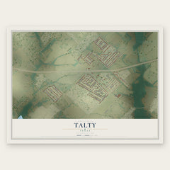
- Talty 12" x 18" / Archival Matte Print $39.99
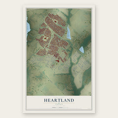
- Heartland 12" x 18" / Archival Matte Print $39.99
More maps nearby: Sunnyvale, Crandall, Heath, Mesquite and McLendon-Chisholm.
The art of mapping a place
How This Map Was Made
Real places. Remarkable detail. Discover the layers that turn geographic data into a map of home.

The view from above
Aerial imagery reveals the character of the land: woodland, open fields, and the patterns of a place.

The shape of the land
Elevation data brings hills, valleys, and subtle changes in the landscape into view.

The details of home
Roads, waterways, and building footprints come together to make the map feel unmistakably local.

Geography becomes art
Considered color, shading, and typography bring the layers together in a map made for your wall.


Process illustrated with Mendon, Massachusetts. Aerial imagery: USDA NAIP. Terrain: USGS 3D Elevation Program. Map details and finished artwork: KNOWOL.
The Details
About This Print
Choose an archival matte print, or a black or white Ayous wood frame. The archival matte print is unframed.
Select your size and finish above to see the matching product image and price.
Materials & Craftsmanship
A contemporary map with the character of a classic atlas, printed on archival matte paper. Optional frames are made from Ayous wood.
Your printed map does not include the watermark shown in the full-map preview.
Shipping & Delivery
Free shipping within the United States. Every print is made to order in the USA.
Buying a gift? Add a note in your cart and we'll include it. We never put prices in the package.
Prints ship within 2 to 3 business days. Allow 7 to 10 days total from ordering for delivery. Timing may vary during holidays or periods of high order volume.
Read our shipping policy.
Returns and damaged prints
Each print is made to order. Change-of-mind refunds are not available after production.
If your print arrives damaged, misprinted or incorrect, contact support@knowol.com within 30 days of receiving it. Include your order number, photos and a description of the issue.
Read our full refund and replacement policy. For questions about your order, email support@knowol.com.