
Search for another town





Free U.S. delivery 7 to 10 days after you order
Frankfort, Kentucky Map Art
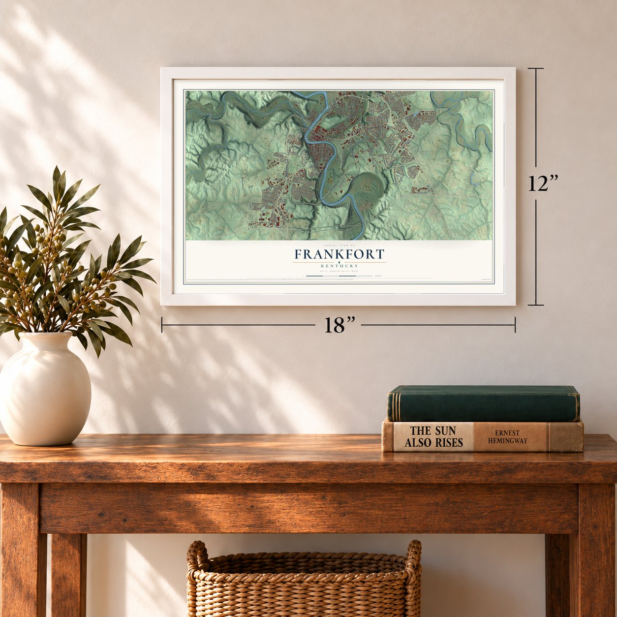
A new map of Frankfort, Kentucky, made in 2026 and printed to order on thick archival matte paper.
12" x 18" Archival Matte Print
A Map of Home. A Work of Art.
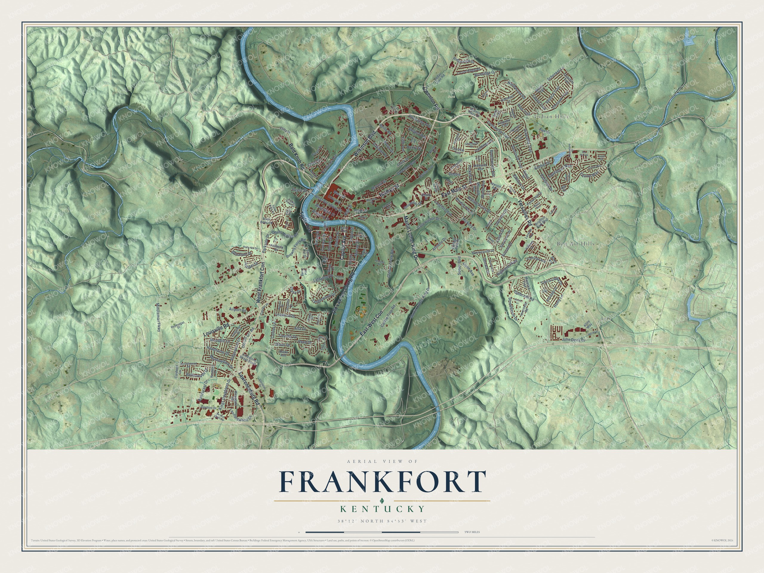
This beautifully detailed map of Frankfort, Kentucky was created in 2026 using aerial imagery combined with modern topographical, census, street and landmark data. It's a modern aerial view of Frankfort in Franklin County, Kentucky, that combines modern data with a vintage aesthetic. Zoom in on the preview and look for your block.
Three ways to hang it
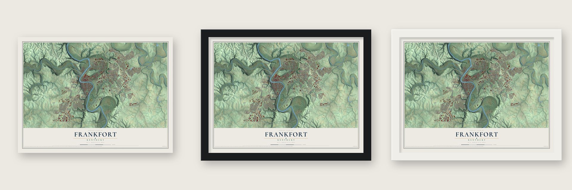
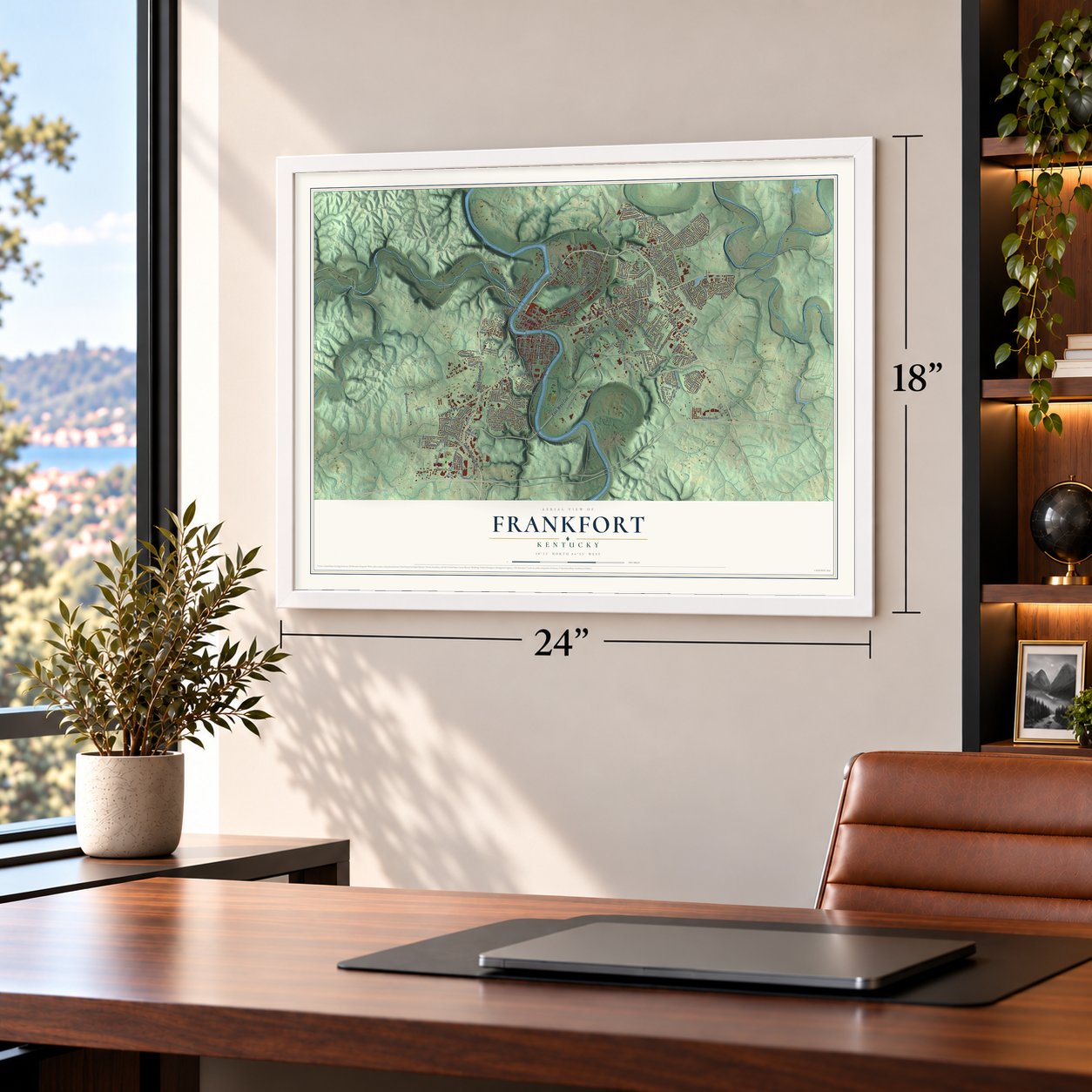
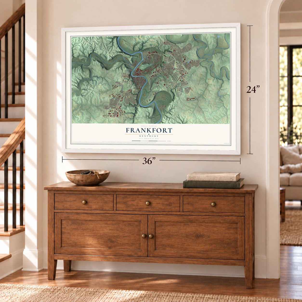
Unframed archival matte, a black wood frame or a white wood frame.
Up close
Real geography. Art worth displaying.
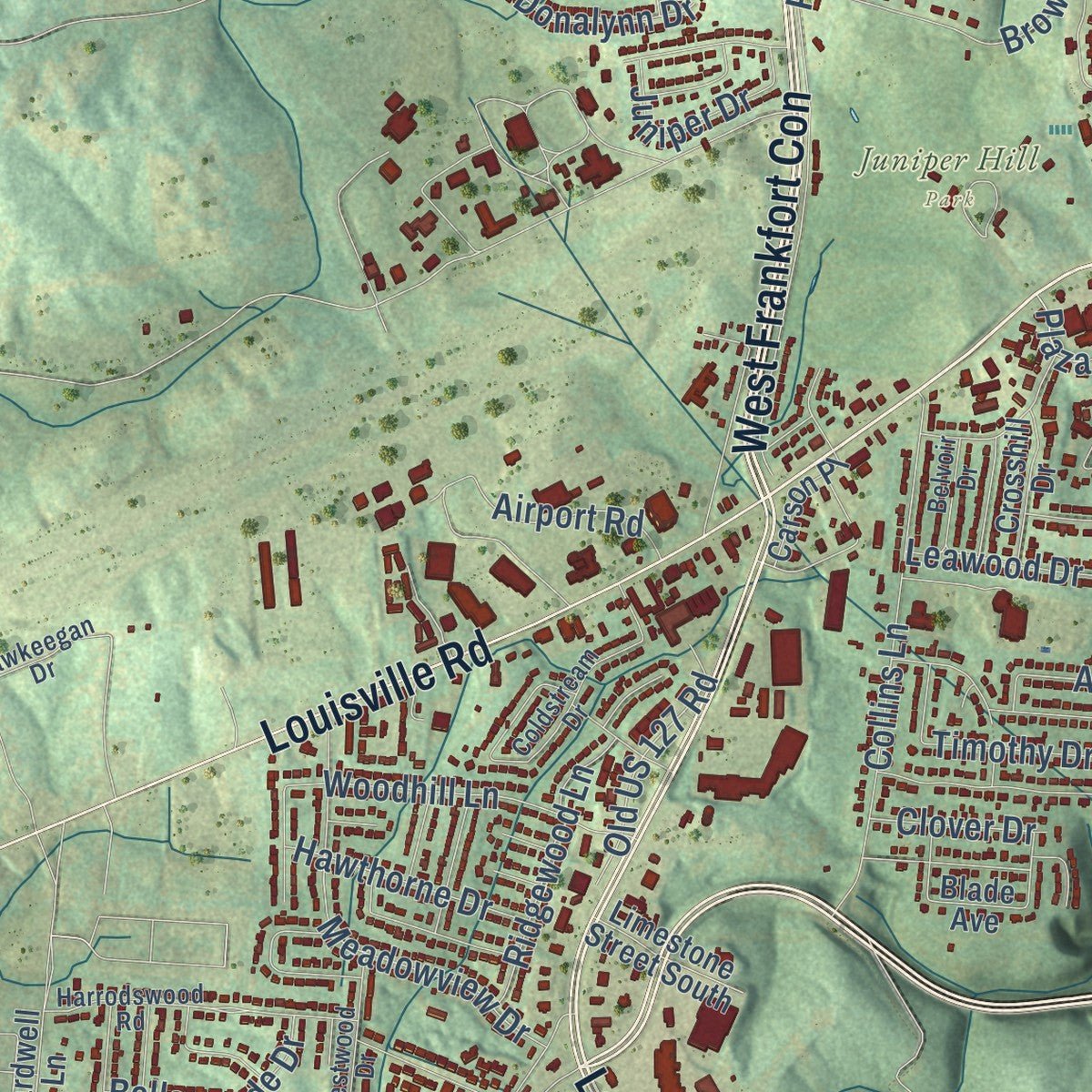
This map was created using accurate cartographic data and authoritative geographic sources, including the U.S. Geological Survey and the Census Bureau. The map brings together terrain, waterways, roads, and building detail. The majority of the streets are labeled, houses are accurately depicted, and the topography is derived from government sources. Combining local data with carefully composed color and shading leads to this beautifully detailed Frankfort artwork for your wall.
Rather than simply showing street outlines, we’ve included as many of the street names as we could reasonably fit on the map while keeping their names legible. Zoom in on the high resolution preview to see exactly what’s on the map. We truly set out to create a statement piece for anyone who loves Frankfort. So whether it’s for you, or a gift for someone you love, we hope this map of Frankfort brings back fond memories.
Read the story behind this map of Frankfort, Kentucky from 2026.

About Frankfort, Kentucky
Frankfort is the capital of Kentucky and the seat of Franklin County, a city of 28,602 people on the Kentucky River. A buffalo trail once crossed the river here at a shallow ford. In 1780 a party of settlers from Bryan Station was attacked there on its way to make salt at Mann's Lick, and the pioneer Stephen Frank was killed. Settlers called the crossing Frank's Ford, and in time the name ran together into Frankfort.
In 1786 James Wilkinson bought 260 acres on the north bank, the ground that became downtown, and the Virginia legislature set aside 100 acres as the town of Frankfort. Wilkinson saw it as a river port that could ship farm goods toward New Orleans. Kentucky became the 15th state in 1792, and on June 20 five commissioners were named to choose a capital. Frankfort won. Its offer included Andrew Holmes' log house as the capitol for seven years, town lots, 10 boxes of glass, 1,500 pounds of nails and $3,000 in gold.
“The vast timberlands of the upper Kentucky River and its tributaries made Frankfort a leading sawmill town during the period 1865-1900.”
- A governor's house from 1796In 1796 the General Assembly paid for a house for the governor, and it was finished two years later. Now called the Old Governor's Mansion, it is said to be the oldest official home of a governor in the country that still serves that purpose.
- Shryock's Old CapitolIn 1829 the architect Gideon Shryock designed Kentucky's third capitol in the Greek Revival style. State government met there from 1830 until 1910.
- A capital taken in 1862During the Civil War, Union troops built forts on the hill above town, now called Fort Hill. On September 3, 1862, the Confederate army moved in and held Frankfort for a short time, the only time Confederate forces controlled a Union state capital. Leslie Morris Park on Fort Hill now keeps the battlefield and its forts.
- Mayo-Underwood rememberedThe Mayo-Underwood School taught the city's African American students from 1929 to 1964. Urban renewal then tore it down to clear ground for the Capital Plaza, whose office tower opened in 1972 as the tallest building in town. The neglected tower came down on March 11, 2018, and the smaller state office building that replaced it in 2019 carries the old school's name.
Find your street
Names on the Frankfort map
Every name below is printed on this map. Look for your street, your school, the park where you played, or the pond down the road.
Places and landmarks5
- Cove Spring Park
- Juniper Hill Park
- Bon Air Hills
- Indian Hills
- Jett
Streets and roads207
- Wilkinson Boulevard
- East Main Street
- Versailles Road
- Capitol Avenue
- Taylor Avenue
- West Frankfort Con
- Holmes Street
- East-West Con
- Owenton Road
- Lawrenceburg Road
- Louisville Road
- Martin Luther King Drive
- Old Lawrenceburg Road
- Bald Knob Road
- Mero Street
- High Street
- Minuteman Parkway
- Leawood Drive
- University Drive
- Schenkel Lane
- Glenns Creek Road
- Ridgeview Drive
- Lyons Drive
- Cold Harbor Drive
- Parkside Drive
- Hanly Lane
- Coffee Tree Road
- Shelby Street
- Kentucky Avenue
- West Broadway Street
Show all 207 streets
- Hiawatha Trail
- Leonardwood Drive
- Collins Lane
- Blueridge Drive
- Rouse Avenue
- Devils Hollow Road
- Equine Way
- Galbraith Road
- Chinook Trail
- Kings Daughters Drive
- Hickory Drive
- Browns Ferry Road
- Owenton Avenue
- Meadowview Drive
- Bondurant Drive
- Rolling Acres Drive
- Myrtle Avenue
- Seminole Trail
- Reed Drive
- Reilly Road
- Tanglewood Drive
- Equestrian Way
- Sunset Drive
- Northwood Road
- Timothy Drive
- Logan Street
- Woodhill Lane
- Hopi Trail
- John Davis Drive
- Jackson Drive
- Athletic Drive
- Seneca Trail
- Fifth Avenue
- Tierra Linda Drive
- Ridgewood Lane
- Senate Drive
- Comanche Trail
- Steele Street
- West Main Street
- Murray Street
- Alfa Drive
- Langford Avenue
- Old Dailey Avenue
- Landings Drive
- Old US 127 Road
- Eastover Drive
- Airport Road
- Plaza Drive
- Hawthorne Drive
- Cline Street
- Beechwood Avenue
- Bellemeade Drive
- Highland Parkway
- Juniper Drive
- Stonehaven Drive
- Debbie
- Elkhorn Drive
- Swigert Avenue
- Oaklawn Drive
- Payne Street
- Sower Boulevard
- Donalynn Drive
- Lafayette Drive
- Tatato Trail
- Wapping Street
- Henry Street
- Kimbel Drive
- Pickett Avenue
- Conway Street
- Clover Drive
- Flynn Avenue
- Ewing Street
- Belair Drive
- Murrell Street
- Blade Avenue
- Colonial Trce
- Clinton Street
- Brighton Park Boulevard
- Berry Hill Drive
- River Bend Road
- Locust Ridge Road
- Pulliam Drive
- Oakmont Lane
- Winding Way Drive
- Maverick Trail
- Regan Street
- Atwood Avenue
- Inverness Road
- Woodgate Road
- Stanley Street
- Forest Hill Drive
- Bypass Plaza Drive
- Stevenson Drive
- Arbolado Drive
- Bonnycastle Drive
- Cardwell Lane
- Flamingo Avenue
- Quachita Trail
- Doctors Drive
- Meredith Avenue
- Park Drive
- Fowler Street
- Limestone Street South
- College Park Drive
- Teton Trail
- Kimberly Drive
- Miami Trail
- Hillwood Avenue
- Crosshill Drive
- Allen Way
- Carson Place
- Berry Hill
- Cheek Street
- Shaw Lane
- Rouse Court
- Arapaho Trail
- Clifty Drive
- Forest Street
- Butler Street
- Cedar Cove Road
- Laralan Avenue
- Silway Street
- Wren Avenue
- Clay Street
- Jeff Court
- Harrodswood Road
- Corral Way
- Crown Point Drive
- Centennial Drive
- Warsaw Street
- Keeneland Court
- Holly Hill Drive
- Commodore Drive
- Coldstream Drive
- Westwood Drive
- Benson Avenue
- Algonquin Trail
- Montclair Road
- Graham Avenue
- Lago Drive
- Hawkeegan Drive
- Dewey Court
- Tuscany Lane
- Valley View Drive
- Belvoir Drive
- Battle Alley
- Vandalay Drive
- Jeremy Drive
- Service Road
- Jett Boulevard
- Bridge Street
- Smith Avenue
- Pawnee Trail
- Thistle Road
- Sickle Court
- Excel Court
- Willis Avenue
- Silver Lake Boulevard
- Meadow Lane
- Leslie Avenue
- Westland Drive
- Allnutt Drive
- East Second Street
- Springhill Road
- Airdrie Lane
- Pinnacle Court
- Pueblo Trail
- Lewis Ferry Road
- Sea Hero Road
- Laurel Street
- Lee Drive
- Medical Heights Drive
- Signal Ridge Road
- Edgemont Drive
- Lindsey Avenue
- Ivy Avenue
- River Bluff
Names are listed as they appear on the printed map. Zoom into the product photos to find them.
The art of mapping a place
How This Map Was Made
Real places. Remarkable detail. Discover the layers that turn geographic data into a map of home.

The view from above
Aerial imagery reveals the character of the land: woodland, open fields, and the patterns of a place.

The shape of the land
Elevation data brings hills, valleys, and subtle changes in the landscape into view.

The details of home
Roads, waterways, and building footprints come together to make the map feel unmistakably local.

Geography becomes art
Considered color, shading, and typography bring the layers together in a map made for your wall.


Process illustrated with Mendon, Massachusetts. Aerial imagery: USDA NAIP. Terrain: USGS 3D Elevation Program. Map details and finished artwork: KNOWOL.
The Details
About This Print
Choose an archival matte print, or a black or white Ayous wood frame. The archival matte print is unframed.
Select your size and finish above to see the matching product image and price.
Materials & Craftsmanship
A contemporary map with the character of a classic atlas, printed on archival matte paper. Optional frames are made from Ayous wood.
Your printed map does not include the watermark shown in the full-map preview.
Shipping & Delivery
Free shipping within the United States. Every print is made to order in the USA.
Buying a gift? Add a note in your cart and we'll include it. We never put prices in the package.
Prints ship within 2 to 3 business days. Allow 7 to 10 days total from ordering for delivery. Timing may vary during holidays or periods of high order volume.
Read our shipping policy.
Returns and damaged prints
Each print is made to order. Change-of-mind refunds are not available after production.
If your print arrives damaged, misprinted or incorrect, contact support@knowol.com within 30 days of receiving it. Include your order number, photos and a description of the issue.
Read our full refund and replacement policy. For questions about your order, email support@knowol.com.
Find your town
Looking for another city?
Find a map of home in our Kentucky collection.
Nearby
Maps of towns near Frankfort
Know someone from one of these towns? Their map makes a great gift.
 Midway
, Kentucky
From $39.99See the map
 Lawrenceburg
, Kentucky
From $39.99See the map
 Stamping Ground
, Kentucky
From $39.99See the map
More maps nearby: Versailles, Monterey, Pleasureville, Georgetown and Salvisa.