
Search for another town



Free U.S. delivery 7 to 10 days after you order
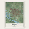
Fremont, Nebraska Map Art
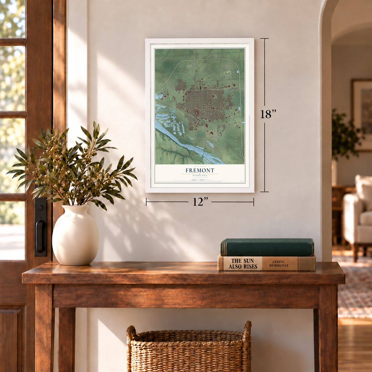
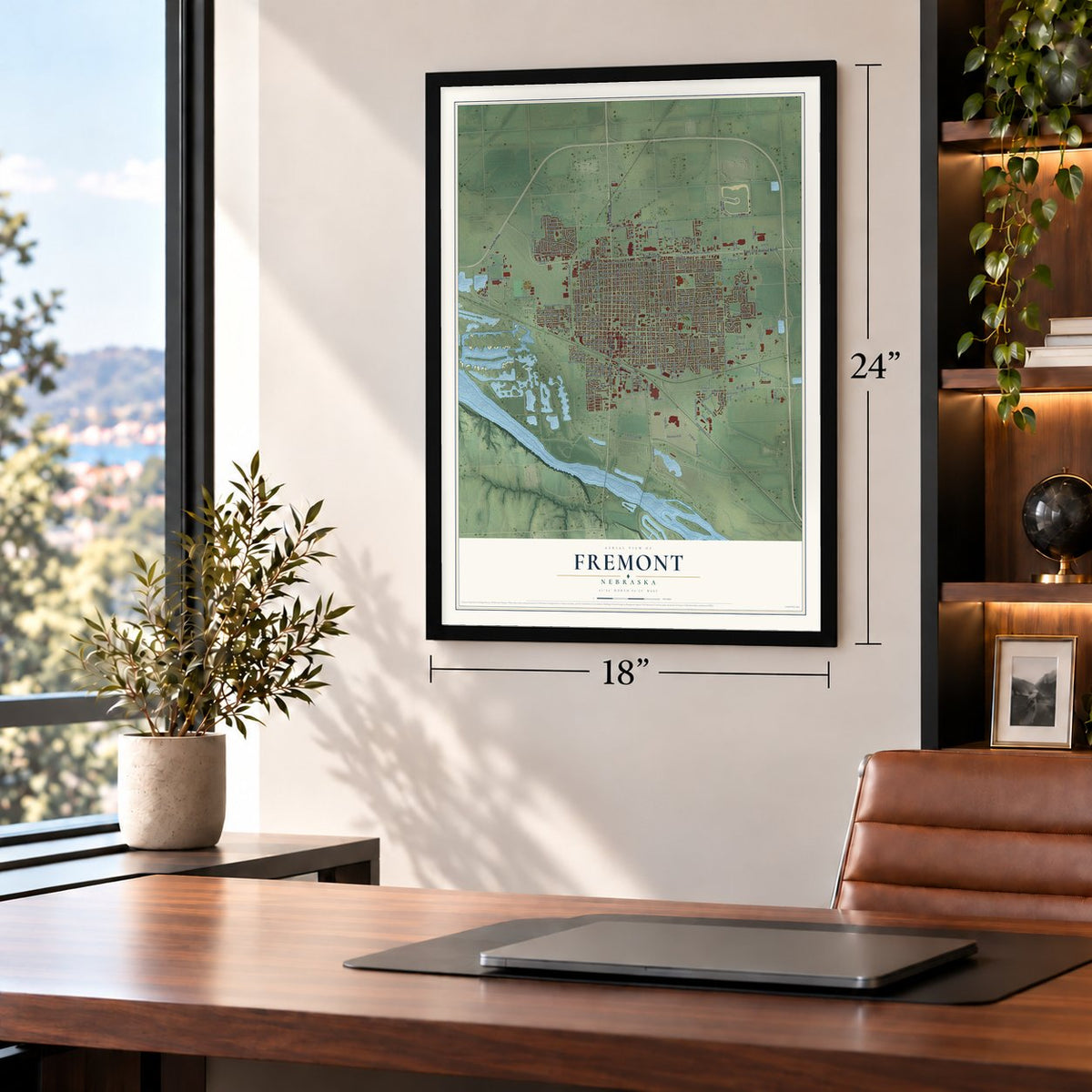
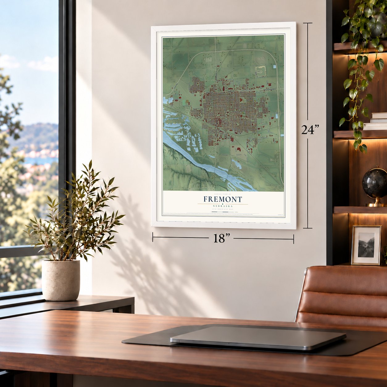
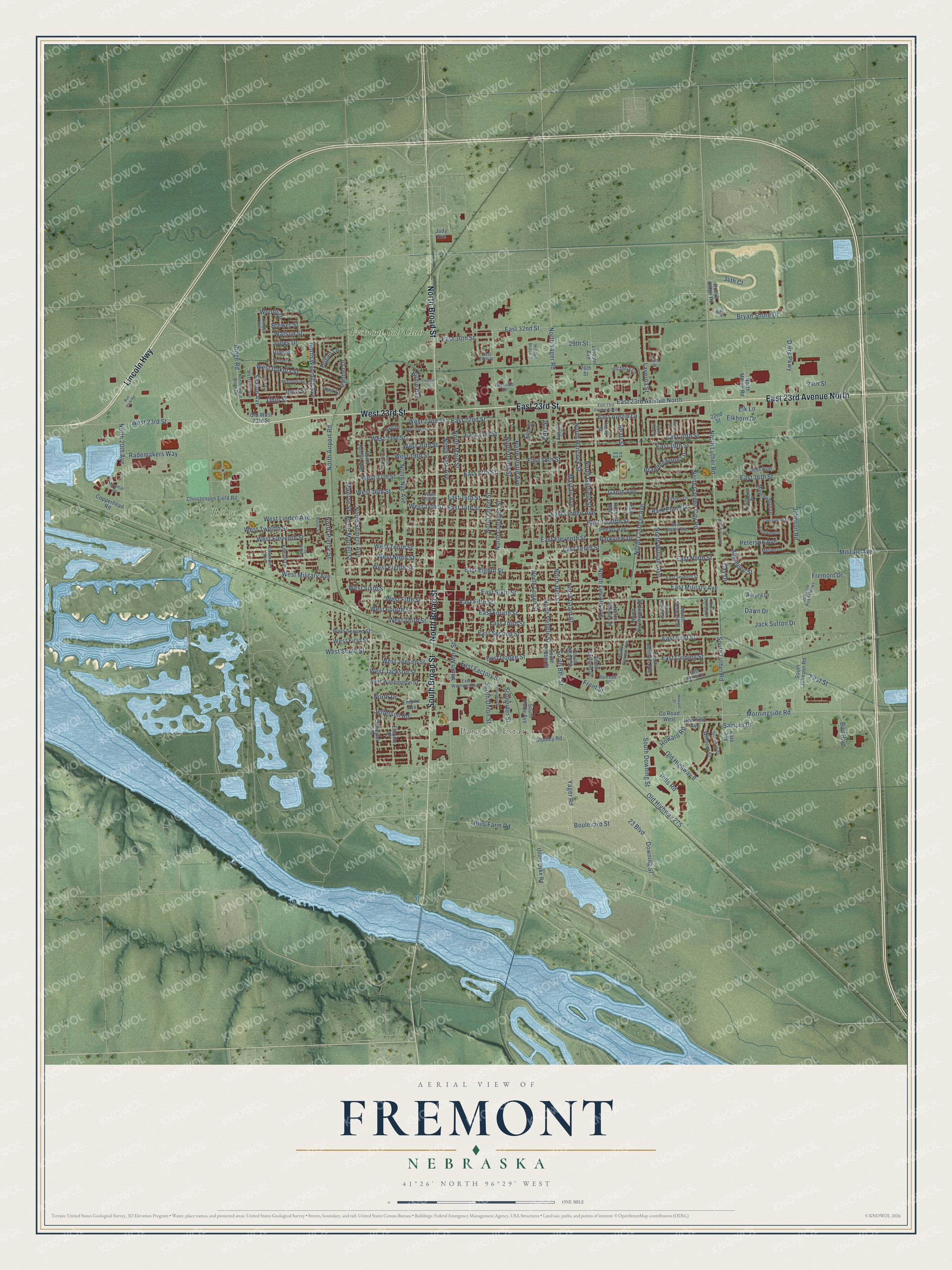
A new map of Fremont, Nebraska, made in 2026 and printed to order on thick archival matte paper.
12" x 18" Archival Matte Print
A Map of Home. A Work of Art.
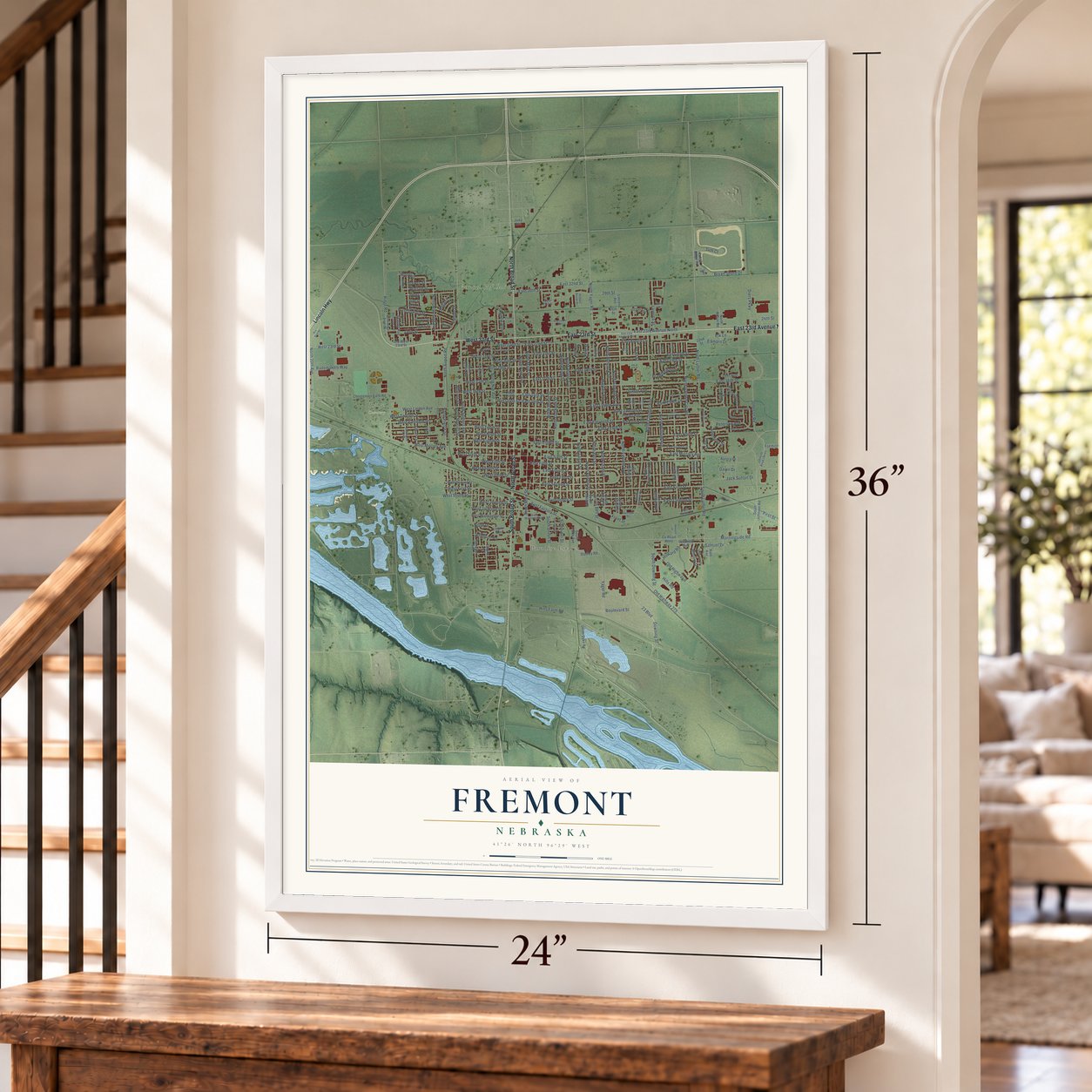
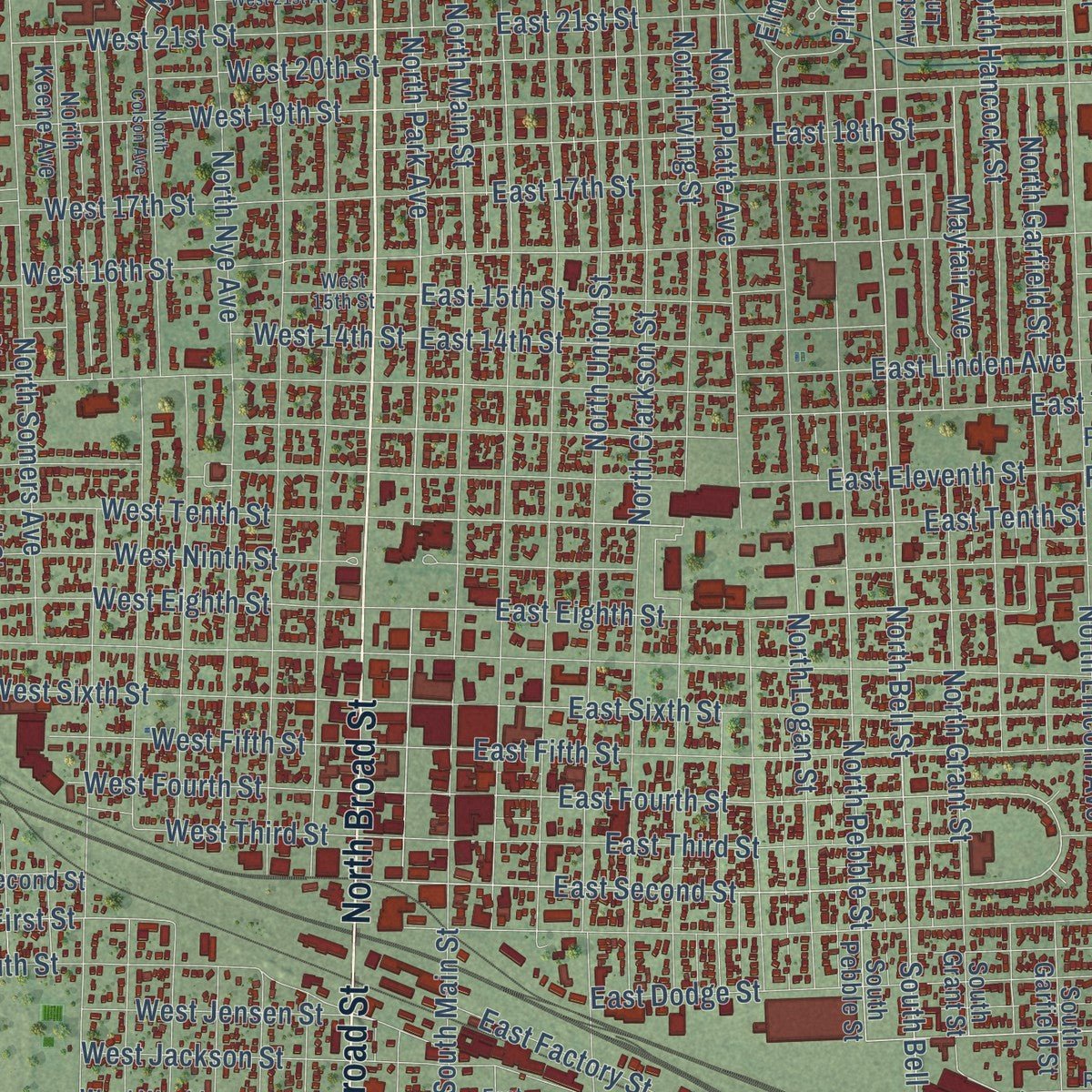
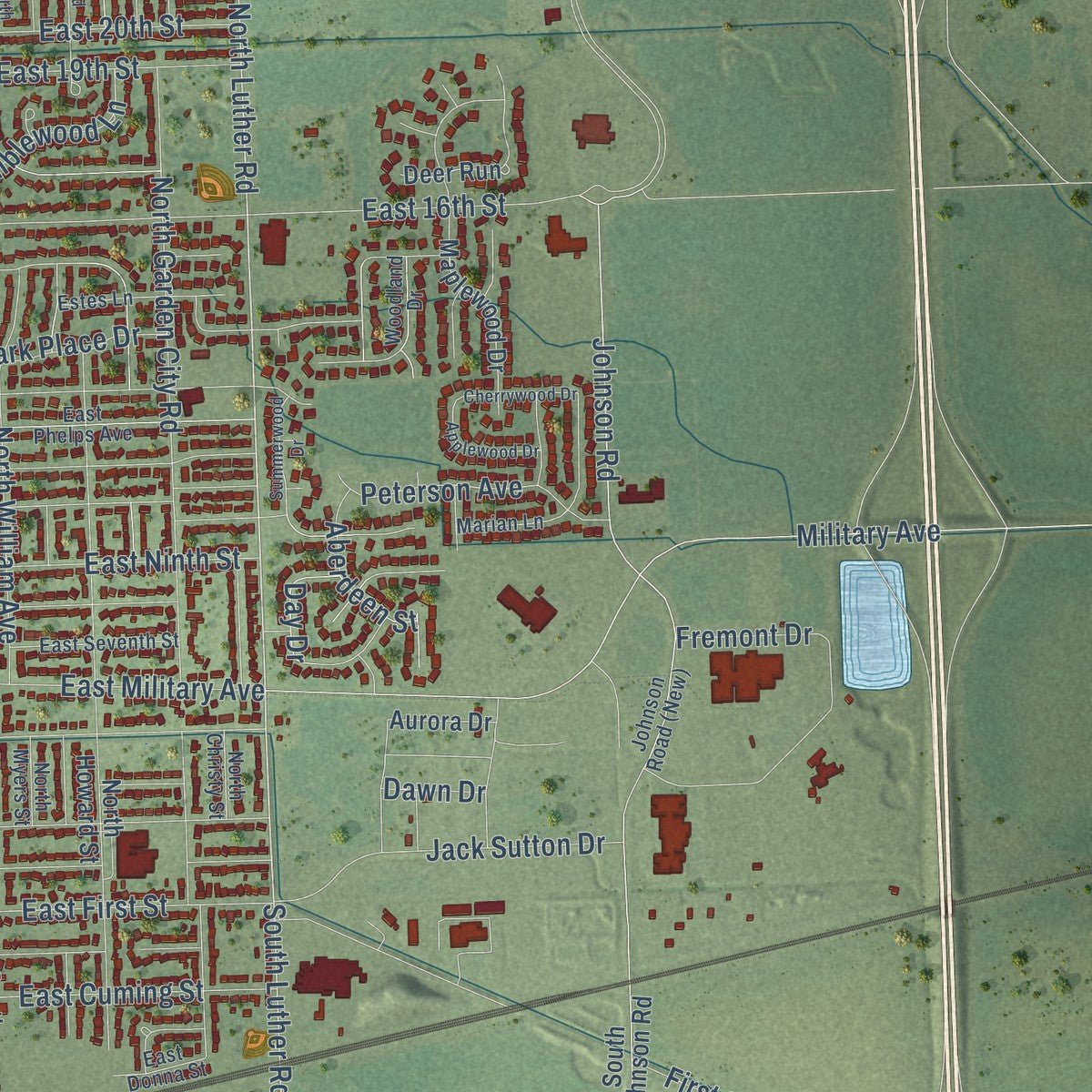
Explore Fremont, Nebraska from a whole new perspective. Created using aerial imagery and detailed geographic data, this map captures Fremont building by building, with labeled streets, familiar landmarks, and shaded topographical relief that highlights the natural contours of the landscape.
Combining modern data with the timeless character of a vintage atlas, this map is just as interesting up close as it is beautiful on the wall. Whether you grew up in Fremont, spent memorable years there, or call it home today, this unique map is a great way to celebrate a place that means something to you. Zoom in on the preview to look for your street, and then order a print to put your memories on the wall.
Three ways to hang it
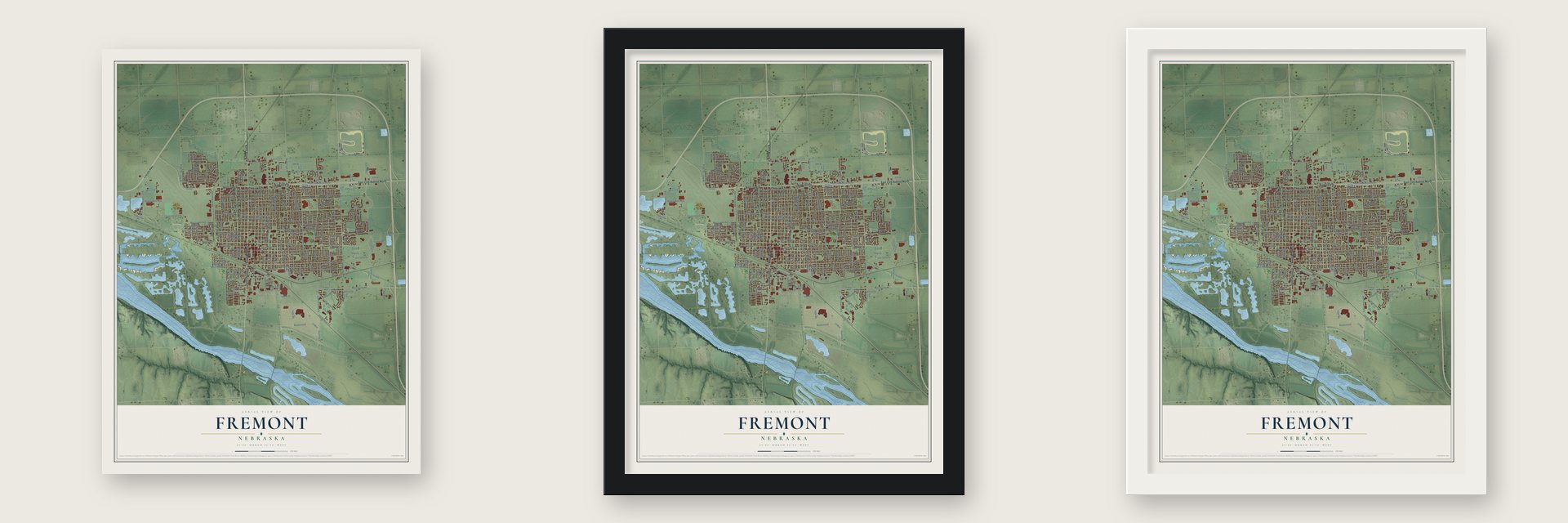
Unframed archival matte, a black wood frame or a white wood frame.
Up close
Geography Worth Displaying
This map was created using accurate cartographic data and authoritative geographic sources, including the U.S. Geological Survey and the Census Bureau. The map brings together terrain, waterways, roads, and building detail. The majority of the streets are labeled, houses are accurately depicted, and the topography is derived from government sources. Combining local data with carefully composed color and shading leads to this beautifully detailed Fremont artwork for your wall.
Rather than simply showing street outlines, we’ve included as many of the street names as we could reasonably fit on the map while keeping their names legible. Zoom in on the high resolution preview to see exactly what’s on the map. We truly set out to create a statement piece for anyone who loves Fremont. So whether it’s for you, or a gift for someone you love, we hope this map of Fremont brings back fond memories.
Read the story behind this map of Fremont, Nebraska from 2026.
About Fremont, Nebraska
Fremont is a city of 27,141 people and the county seat of Dodge County, on the Platte River. Before the town existed, the Mormon Trail ran along the north bank of the Platte, and a ferry carried travelers across the nearby Elkhorn River. On August 23, 1856, E. H. Barnard and John A. Kuntz claimed the townsite for their company, Barnard, Kuntz & Co. They laid it out in hopes that a railroad would come, and they named it for General John C. Frémont, the explorer. By 1857 Fremont had 13 log houses.
The bet paid off. The telegraph line that crossed the country came through in 1861. In December 1865 the Union Pacific became the first railroad to reach Fremont, and the Sioux City and Pacific followed in 1868. The Elkhorn Valley line arrived in 1869, and the town grew into a rail hub. In 1913 the Lincoln Highway came through as well, and stretches of its old brick road still lie east of town toward Omaha.
- Love-Larson Opera House, 1888The opera house on Broad Street opened in 1888. In later years it held apartments and a grocery store. A nonprofit group brought it back as a theater in the 1970s, and the Fremont High Drama Club restored it again in 2003. It joined the National Register in 1974.
- The first mayor's homeTheron Nye, Fremont's first mayor, built a Victorian house in 1874. Today it holds the Louis E. May Historical Museum. A log cabin on the grounds shows the kind of home the earliest pioneers lived in.
- The Pathfinder Hotel blastOn January 10, 1976, natural gas leaking in the basement blew up the Pathfinder Hotel downtown. The building had become apartments, and most of the tenants were older people. The blast broke windows all over the city, and the fire that followed killed 20 people and wiped out most of the block.
- Seattle's Fremont neighborhoodLuther H. Griffith and Edward Blewett, two men from Fremont, Nebraska, settled a neighborhood in Seattle and named it Fremont after their hometown.
- John C. Fremont DaysEach July, in the second week of the month, the city celebrates its past with a parade, a Chautauqua, a rodeo, a classic car show and handmade crafts.
Find your street
Names on the Fremont map
Every name below is printed on this map. Look for your street, your school, the park where you played, or the pond down the road.
Places and landmarks3
- Paradise Estates
- Ridge Cemetery
- Fremont Golf Club
Streets and roads224
- Lincoln Highway
- East 23rd Avenue North
- East 23rd Street
- North Broad Street
- West 23rd Street
- South Broad Street
- Old Highway 275
- North Bell Street
- South Bell Street
- Hills Farm Road
- Morningside Road
- North Pierce Street
- North Airport Road
- North Park Avenue
- East Second Street
- East Cuming Street
- North Luther Road
- East Tenth Street
- East 22nd Street
- South Luther Road
- North Platte Avenue
- East Eighth Street
- Ridge Road
- East Fourth Street
- Yager Road
- North Wyoming Avenue
- Watson Street
- Front Street
- Johnson Road
- North Pebble Street
Show all 224 streets
- Ohio Street
- West First Street
- North Drive
- East 17th Street
- East 16th Street
- East First Street
- North Clarkson Street
- North Main Street
- East Twelfth Street
- North Lincoln Avenue
- East Fifth Street
- East Military Avenue
- East 19th Street
- North Somers Avenue
- Diers Parkway
- North Nye Avenue
- West Military Avenue
- East Third Street
- North Clarmar Avenue
- East 20th Street
- North Union Street
- Military Avenue
- West Linden Avenue
- North Logan Street
- North Garden City Road
- North Yager Road
- East Linden Avenue
- East Ninth Street
- East Dodge Street
- West 16th Street
- North Hancock Street
- West Tenth Street
- North William Avenue
- North Grant Street
- West Eleventh Street
- East Sixth Street
- West 21st Street
- West Ninth Street
- East Eleventh Street
- 29th Street
- North Irving Street
- West Eighth Street
- North Garfield Street
- East 18th Street
- South Main Street
- Parkview Drive
- West Twelfth Street
- East 14th Street
- West 17th Street
- Bryan Shore Drive
- Fremont Drive
- Elk Lane
- South Downing Street
- East 21st Street
- West Sixth Street
- Boulevard Street
- 23 Boulevard
- Downing Street
- West 19th Street
- West Dakota Street
- Rademakers Way
- East Factory Street
- East 15th Street
- Jack Sutton Drive
- West South Street
- Park Place Drive
- North Morrell Street
- Hills Road
- Peterson Avenue
- West Fifth Street
- South Union Street
- Gaeth Avenue
- Jefferson Road
- North 20th Avenue
- Laverna Street
- West Fourth Street
- East 32nd Street
- Jones Drive
- Old Highway 8
- West Jackson Street
- Elkhorn Drive
- Palmer Drive
- West Jensen Street
- East 30th Street
- Mayfair Avenue
- First Street
- West Third Street
- East Austin Lane
- West 20th Street
- Iowa Street
- Bramblewood Lane
- West 14th Street
- Seaton Avenue
- Aberdeen Street
- Elm Street
- West 22nd Street
- Howard Road
- Schneider Street
- 24th Street
- 34th Court
- Pine Street
- Bud Boulevard
- Woods Drive
- Brewer Street
- Day Drive
- Samuel Drive
- Birdie Avenue
- Pearl Street
- Hogan Lane
- Monroe Street
- Dawn Drive
- South Pebble Street
- 22nd Street
- Old West 23rd Street
- Maplewood Drive
- South Johnson Road
- Deer Run
- North Howard Street
- Phelps Avenue
- Christensen Field Road
- North Keene Avenue
- South Platte Avenue
- West Washington Street
- Empire Avenue
- Empire Drive
- Wilmont Street
- Edearl Lane
- Schuyler Avenue
- Austin Lane
- North Birchwood Drive
- Union Dyke Road
- North Thomas Street
- Lincoln Avenue
- South Garfield Street
- Deerfield Avenue
- West Second Street
- South William Avenue
- Studley Road
- County Road West
- Copperhead Road
- North Milton Road
- Victoria Lane
- Kate Avenue
- South Grant Street
- Aurora Drive
- Robyn Ridge Road
- Nye Drive
- Irene Street
- Ruth Avenue
- Judy Avenue
- Iowa Court
- Utah Street
- 26th Street
- North Ridge Road Drive
- Martin Avenue
- East Phelps Avenue
- North Christy Street
- Nelson Lane
- Davenport Avenue
- West 15th Street
- East Washington Street
- East Seventh Street
- Estes Lane
- Railroad Street
- East Donna Street
- Sheridan Street
- Missouri Avenue
- Westside Avenue
- Miramar Drive
- East 28th Street
- South Clarmar Avenue
- Marian Lane
- Ritz Place
- Armour Avenue
- Woodland Drive
- North Myers Street
- Reynolds Road
- 27th Street
- Hidden Brook Drive
- Roxe Street
- East 23rd Avenue South
- North Colson Avenue
- North Cedar Street
- Michael Street
- Country Lane
- West 21st Avenue
- Schurman Street
- Applewood Drive
- Cherrywood Drive
- Summerwood Drive
- Donald Street
- Idaho Avenue
- Howard Court
- Bus Park Road
Names are listed as they appear on the printed map. Zoom into the product photos to find them.
The art of mapping a place
How This Map Was Made
Real places. Remarkable detail. Discover the layers that turn geographic data into a map of home.

The view from above
Aerial imagery reveals the character of the land: woodland, open fields, and the patterns of a place.

The shape of the land
Elevation data brings hills, valleys, and subtle changes in the landscape into view.

The details of home
Roads, waterways, and building footprints come together to make the map feel unmistakably local.

Geography becomes art
Considered color, shading, and typography bring the layers together in a map made for your wall.


Process illustrated with Mendon, Massachusetts. Aerial imagery: USDA NAIP. Terrain: USGS 3D Elevation Program. Map details and finished artwork: KNOWOL.
The Details
About This Print
Choose an archival matte print, or a black or white Ayous wood frame. The archival matte print is unframed.
Select your size and finish above to see the matching product image and price.
Materials & Craftsmanship
A contemporary map with the character of a classic atlas, printed on archival matte paper. Optional frames are made from Ayous wood.
Your printed map does not include the watermark shown in the full-map preview.
Shipping & Delivery
Free shipping within the United States. Every print is made to order in the USA.
Buying a gift? Add a note in your cart and we'll include it. We never put prices in the package.
Prints ship within 2 to 3 business days. Allow 7 to 10 days total from ordering for delivery. Timing may vary during holidays or periods of high order volume.
Read our shipping policy.
Returns and damaged prints
Each print is made to order. Change-of-mind refunds are not available after production.
If your print arrives damaged, misprinted or incorrect, contact support@knowol.com within 30 days of receiving it. Include your order number, photos and a description of the issue.
Read our full refund and replacement policy. For questions about your order, email support@knowol.com.
Find your town
Looking for another city?
Find a map of home in our Nebraska collection, or any town in the country.
Nearby
Maps of towns near Fremont
Know someone from one of these towns? Their map makes a great gift.
 Inglewood
, Nebraska
From $39.99See the map
 Nickerson
, Nebraska
From $39.99See the map
 Arlington
, Nebraska
From $39.99See the map
More maps nearby: Cedar Bluffs, Ames, Fontanelle, Leshara and Valley.