
Search for another town





Free U.S. delivery 7 to 10 days after you order
Gainesville, Georgia Map Art
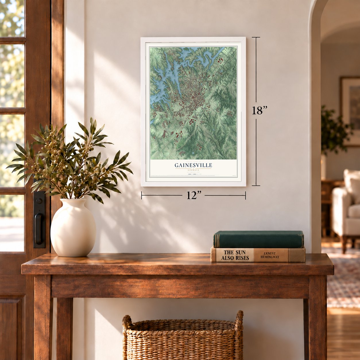
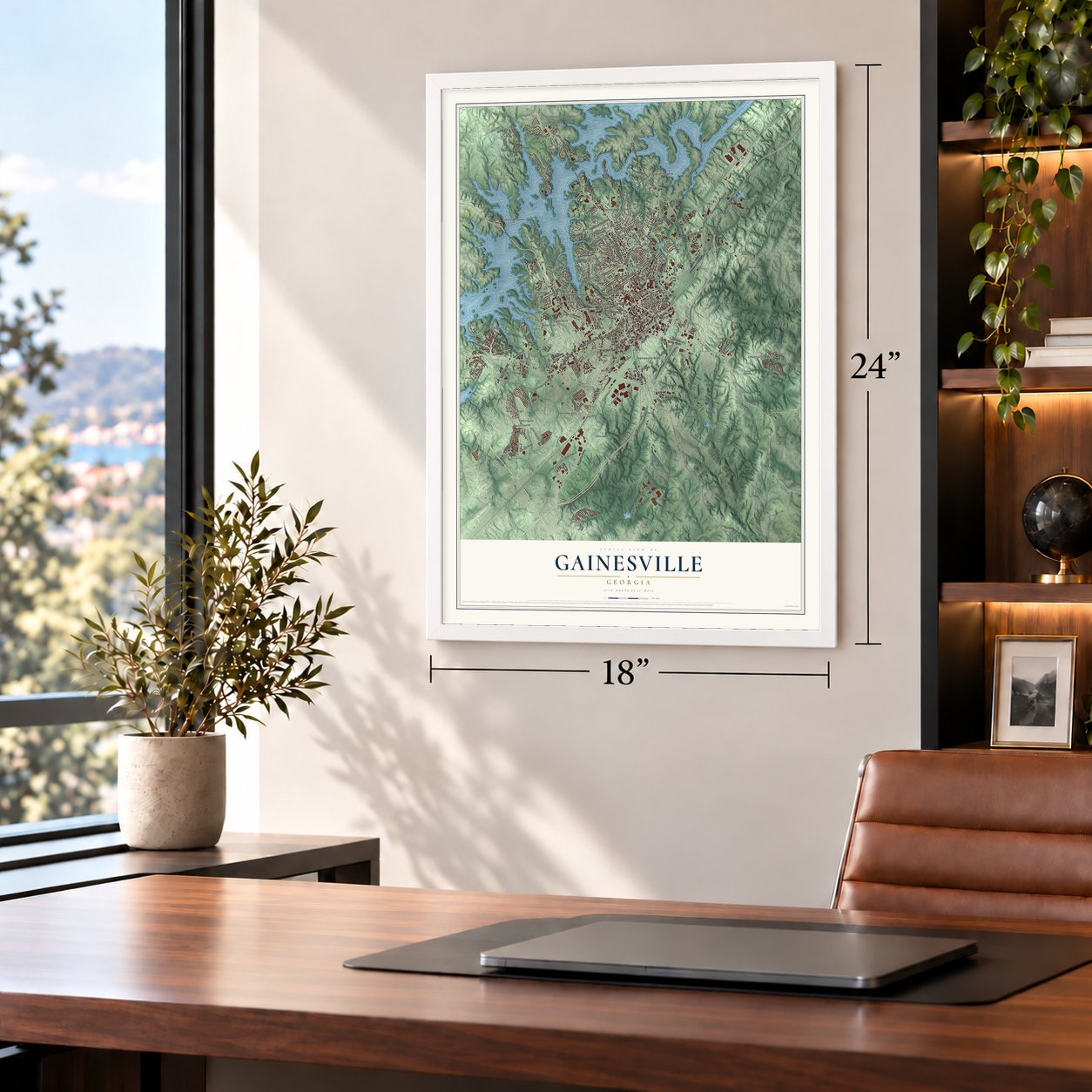
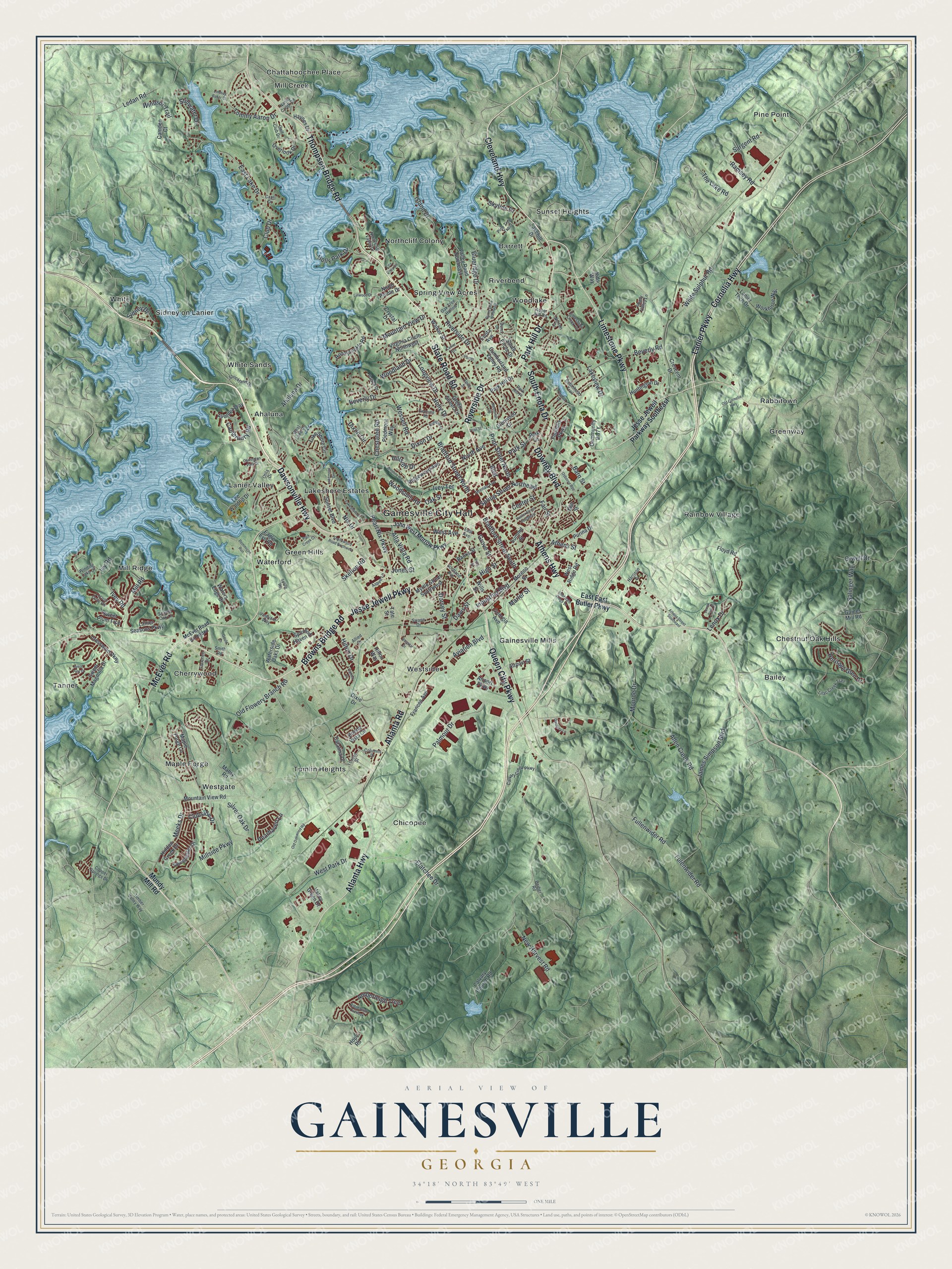
A new map of Gainesville, Georgia, made in 2026 and printed to order on thick archival matte paper.
12" x 18" Archival Matte Print
A Map of Home. A Work of Art.
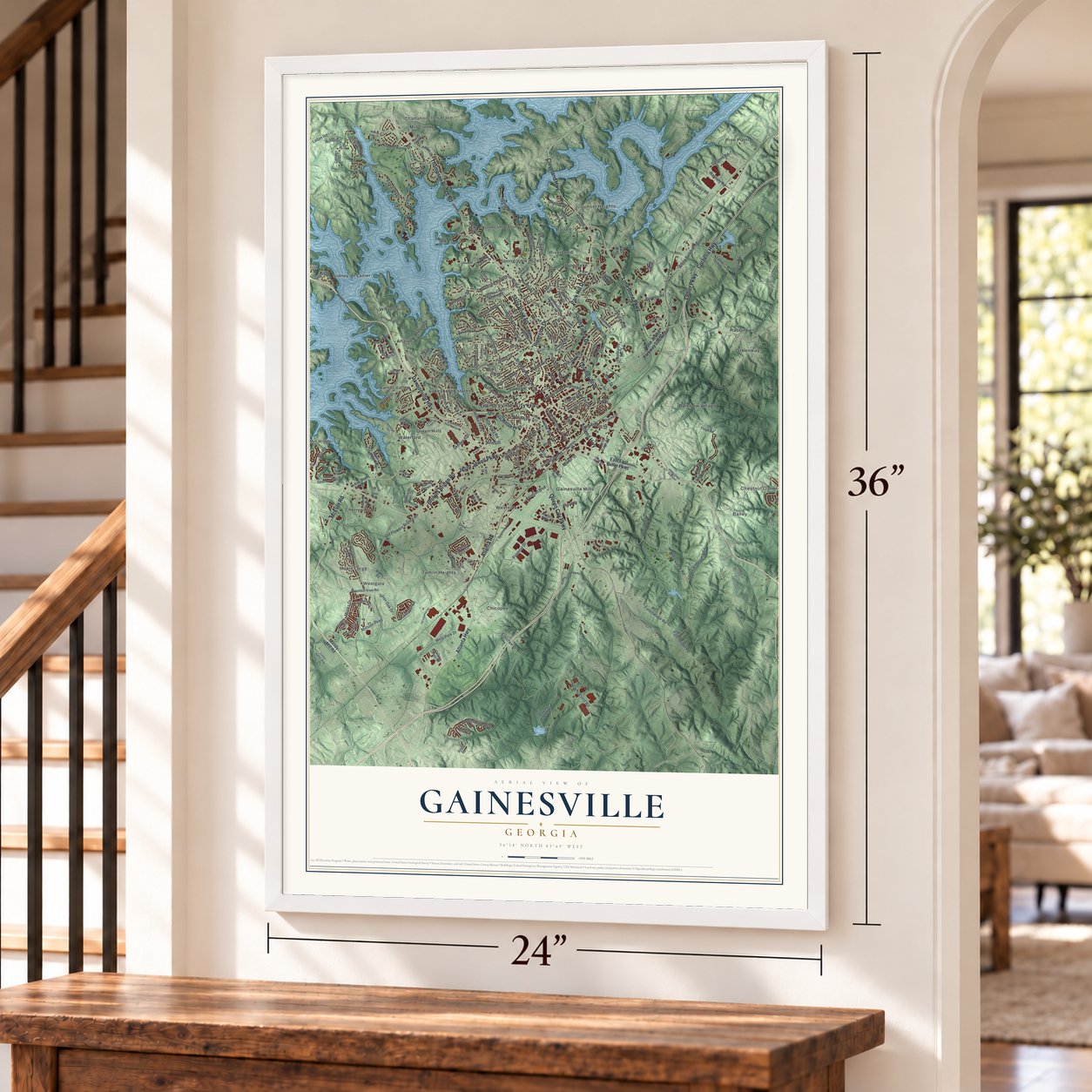
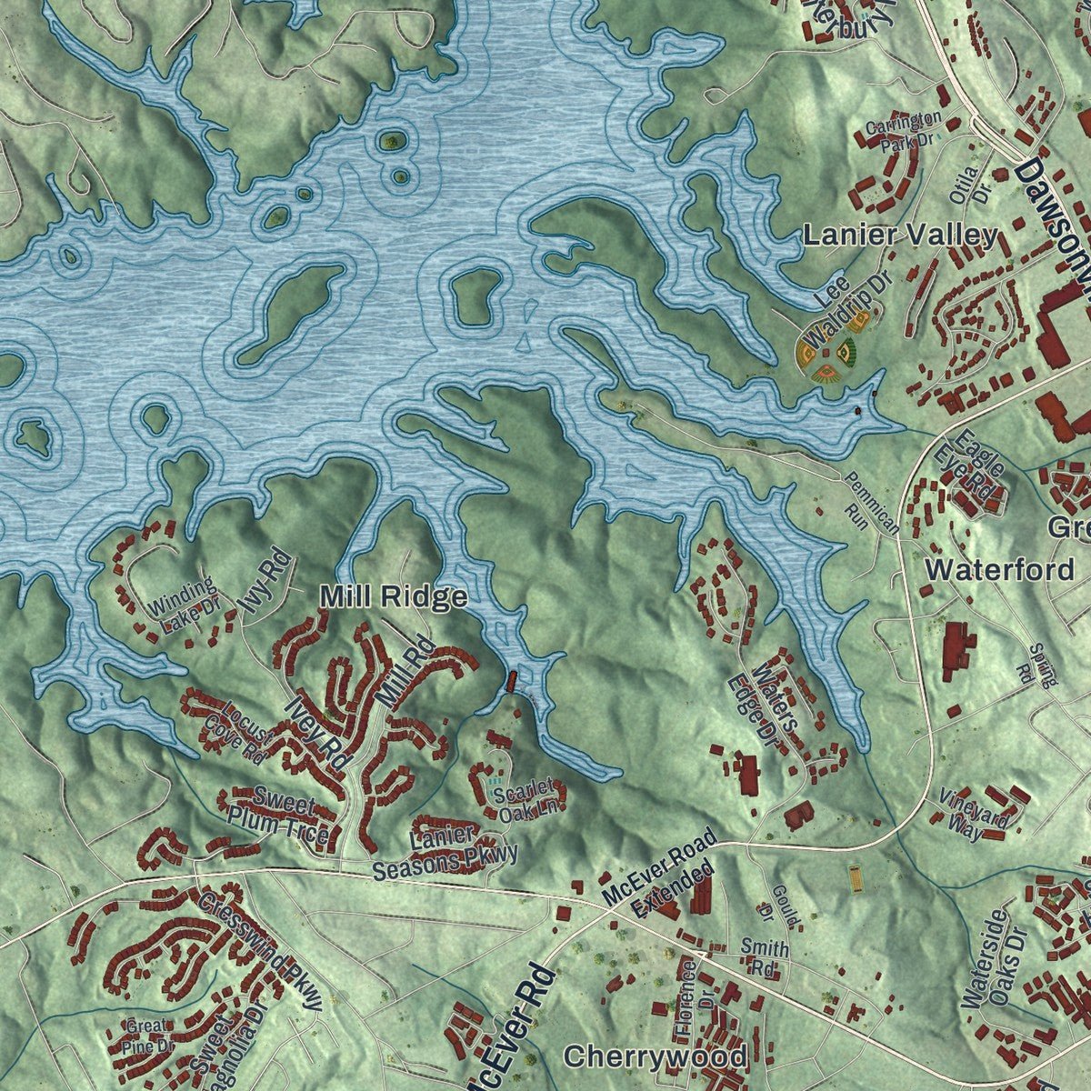
Explore Gainesville, Georgia from a whole new perspective. Created using aerial imagery and detailed geographic data, this map captures Gainesville building by building, with labeled streets, familiar landmarks, and shaded topographical relief that highlights the natural contours of the landscape.
Combining modern data with the timeless character of a vintage atlas, this map is just as interesting up close as it is beautiful on the wall. Whether you grew up in Gainesville, spent memorable years there, or call it home today, this unique map is a great way to celebrate a place that means something to you. Zoom in on the preview to look for your street, and then order a print to put your memories on the wall.
Three ways to hang it
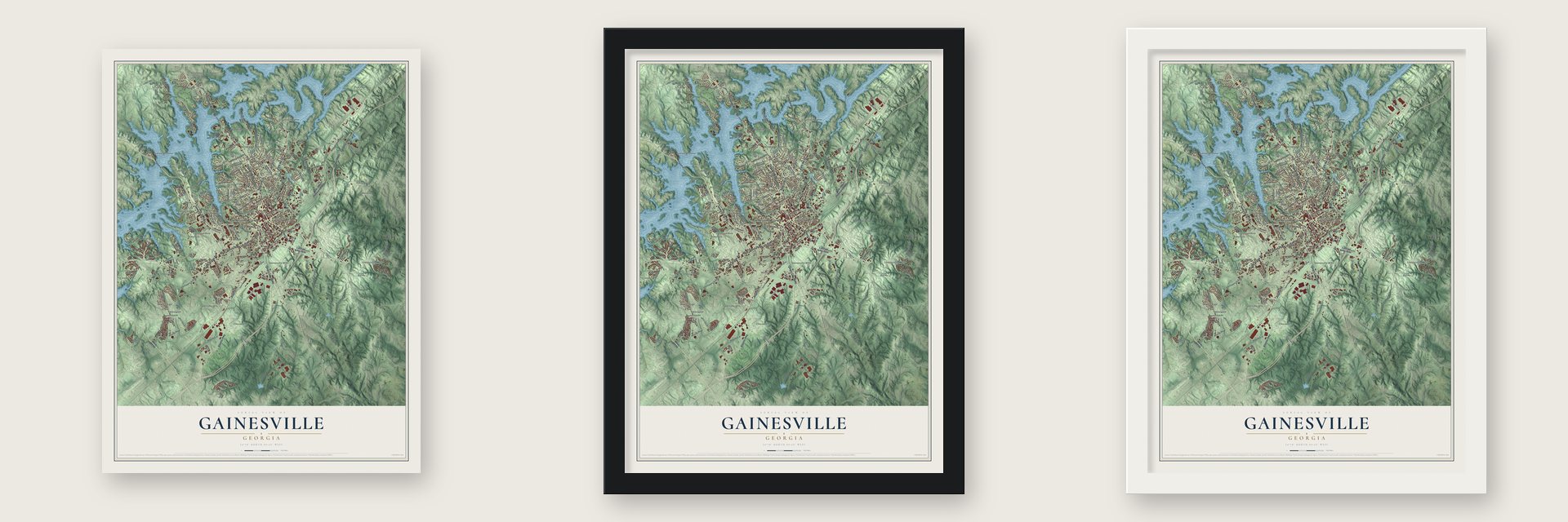
Unframed archival matte, a black wood frame or a white wood frame.
Up close
Geography Worth Displaying
This map was created using accurate cartographic data and authoritative geographic sources, including the U.S. Geological Survey (USGS) and FEMA. The map brings together terrain, waterways, roads, and building detail. The majority of the streets are labeled, houses are accurately depicted, and the topography is derived from government sources. Combining local data with carefully composed color and shading leads to this beautifully detailed Gainesville artwork for your wall.
Rather than simply showing street outlines, we’ve included as many of the street names as we could reasonably fit on the map while keeping their names legible. Zoom in on the high resolution preview to see exactly what’s on the map. We truly set out to create a statement piece for anyone who loves Gainesville. So whether it’s for you, or a gift for someone you love, we hope this map of Gainesville brings back fond memories.
Explore the full map of Gainesville, Georgia and read about the local places it shows.

About Gainesville, Georgia
Gainesville is a city of 42,296 people and the county seat of Hall County, in the foothills of the Blue Ridge Mountains. European-American settlers started it in the early 1800s as Mule Camp Springs. Hall County was organized on December 15, 1818, and on April 21, 1821, the settlement took the name Gainesville to honor General Edmund P. Gaines, a War of 1812 hero who also surveyed land and built roads for the army. On November 30, 1821, the Georgia General Assembly chartered it and made it the seat of the county.
A gold rush in neighboring Lumpkin County during the 1830s drew more settlers, and a business district began to form. Visitors came for the springs, and by 1849 Gainesville had become a resort town, but a fire in 1851 burned much of it. Growth returned after the Civil War. Trains on the Atlanta and Richmond Air-Line Railway began stopping here in 1871, and the town grew from 1,000 people in 1870 to over 5,000 by 1900.
- Street lamps in 1902By 1898 textile mills drove the local economy, with trains hauling in raw cotton and carrying out the finished goods. The money from the mills paid for street lamps in 1902, and no city south of Baltimore had them before Gainesville. Free mail delivery followed in 1905, and the Jackson Building, the city's first high-rise, held its formal opening on December 22, 1915.
- A $1.00 airport leaseIn 1943, during World War II, the city leased its airport to the U.S. government for $1.00, and the military trained pilots there as a naval air station. The field came back to Gainesville in 1947 with two new 4,000-foot landing strips. It is now Lee Gilmer Memorial Airport.
- Jesse Jewell's chickensAfter World War II, Gainesville feed salesman Jesse Jewell sold baby chicks and feed to North Georgia farmers on credit. Once the birds were grown, he bought the broilers back at a price that covered his costs and promised the farmers a profit. With enough farmers signed on, he built his own hatchery and processing plant. Chickens became Georgia's largest agricultural crop, and the city's main road, Jesse Jewell Parkway, carries his name.
- The tornadoes of 1903 and 1936An F4 tornado struck Gainesville on June 1, 1903, and killed 98 people. In 1936 an even worse storm devastated the city and killed 203 people, making it the fifth deadliest tornado in U.S. history.
- Olympic rowing on Lake LanierArmy engineers finished Buford Dam across the Chattahoochee River in 1956, and the water spread over the valley to form Lake Sidney Lanier, named for the Georgia poet and musician. Parts of Gainesville sit on its shore, and during the 1996 Summer Olympics the rowing and kayaking medal races were held on the lake here.
Find your street
Names on the Gainesville map
Every name below is printed on this map. Look for your street, your school, the park where you played, or the pond down the road.
Places and landmarks32
- Gainesville City Hall
- Ahaluna
- Bailey
- Barrett
- Chattahoochee Place
- Cherrywood
- Chestnut Oak Hills
- Chicopee
- Gainesville Mills
- Green Hills
- Greenway
- Lakeshore Estates
Show all 32 places
- Lanier Valley
- Maple Forge
- Mill Creek
- Mill Ridge
- Northcliff Colony
- Pine Point
- Rabbitown
- Rainbow Village
- Riverbend
- Sidney on Lanier
- Spring View Acres
- Sunset Heights
- Tanner
- Tumlin Heights
- Waterford
- Westgate
- Westside
- White
- White Sands
- Woodlake
Streets and roads236
- Dawsonville Highway
- Cleveland Highway
- Jesse Jewell Parkway
- Browns Bridge Road
- Park Hill Drive
- Limestone Parkway
- Queen City Parkway
- McEver Road
- Atlanta Road
- Downey Boulevard
- South Enota Drive
- State Road 60
- Thompson Bridge Road
- Atlanta Highway
- Athens Highway
- Cornelia Highway
- Lanier Parkway
- Riverside Drive
- Prior Street North
- Bradford Street South
- Industrial Boulevard
- Alta Vista Road
- Elatchee Drive
- Pearl Nix Parkway
- White Sulphur Road
- Palmour Drive
- Athens Street
- James Simpson Boulevard
- Millside Parkway
- Monroe Drive
Show all 236 streets
- Club Drive
- Holly Drive
- Allen Creek Road
- Ahaluna Drive
- East Lake Drive
- Lakeview Drive
- Fulenwider Road
- Fullenwider Road
- Old Flowery Branch Road
- Dixon Drive
- High Street
- Tommy Aaron Drive
- Blueridge Drive
- Amberleigh Trce
- Aviation Boulevard
- Heritage Glen Drive
- Dorsey Street
- Bradford Street North
- Lenox Drive
- Silver Oak Drive
- West Park Drive
- Sargent Road
- Hilton Drive
- Davis Street
- Beverly Road
- Mountain View Drive
- New Harvest Road
- North Avenue
- Meeks Drive
- Spring Street Northeast
- Clubside Drive
- Woodsmill Road
- West Avenue
- Ivey Road
- Salinger Way
- Ramsey Road
- Chestatee Road
- Wessell Road
- Longview Drive
- Grove Street
- Island Drive
- Mill Road
- Ledan Road
- Pearhaven Lane
- Park Street
- Windsor Trail
- Canterbury Road
- Orwell Drive
- Skelton Road
- Marler Street
- Boulevard
- Holly Park Drive
- Stillwater Drive
- Sidney Drive
- Oak Street
- The Lake Road
- Skyline Drive
- Dixon Circle
- Ivey Terrace
- Fair Street
- Nix Drive
- Woodland Drive
- Jones Street
- Center Street
- Hillside Drive
- Beverly Drive
- Barn Street
- Ivy Road
- Jesse Jewell Parkway Southeast
- East East Butler Parkway
- Mundy Mill Road
- Glenwood Drive
- Foothills Parkway
- Hope Road
- Calvary Church Road
- Maple Forge Lane
- Cresswind Parkway
- Mountain View Road
- Valley Road Northeast
- West Ridge Road
- Buena Vista Circle
- Waters Edge Drive
- Ridgewood Avenue
- Crescent Drive
- Lake Shore Circle
- Airport Parkway
- Eagle Eye Road
- Green Street Circle
- Sweetwater Drive
- Myrtle Street Southwest
- Overlook Drive
- Sunset Boulevard
- North Pointe Drive
- Sweet Magnolia Drive
- Walker Street
- Hidden Creek Drive
- Lanier Seasons Parkway
- Summit Street
- Lee Waldrip Drive
- Cumberland Valley Road
- Virginia Circle Northwest
- Avonlea Way
- Workforce Way
- Banks Street
- Honeysuckle Road
- Georgia Avenue
- Catalina Drive
- Lakehill Drive
- Huntington Drive
- Floyd Road
- Purina Drive
- Lanier Tech Drive
- Dixie Drive
- Waterside Oaks Drive
- Frances Avenue
- Camden Court
- Gaines Mill Road
- Valley Green Drive
- Haynes Drive
- Piedmont Way
- Enota Avenue
- Sweet Plum Trce
- Spring Haven Drive
- Airport Street
- Moreno Street
- Hilton Way
- Crystal Drive
- Kids Way
- Park Lane
- Wills Street
- Mabry Road
- Mill Street
- Tate Street
- John West Morrow Parkway
- Florence Drive
- Columns Drive
- North Cliff Valley Drive
- Lilac Creek Trail
- Robinhood Trail
- Locust Cove Road
- Pine Tree Trail
- Winding Lake Drive
- Calvary Creek Parkway
- Harrison Drive
- Norton Drive
- Aspen Lane
- Limestone Creek Drive
- Vineyard Way
- Brenau Avenue
- Roper Hill Road
- West Lake Drive
- Patten Drive
- Strickland Drive
- Smith Road
- Golf Club Drive
- Oak Tree Hollow
- Otila Drive
- Scarlet Oak Lane
- Timber Valley Way
- Nancy Creek Road
- Copper Springs Drive
- Park Hill Place
- Allied Drive
- Shady Valley Lane
- Scotland Avenue
- Dunn Drive
- Barber Road
- Swann Drive
- East Avenue
- Cross Street
- Capri Drive
- McEver Road Extended
- Lakeshore Drive
- Shallowford Road Northwest
- Piedmont Road
- Park Creek Court
- Old Cornelia Highway
- Linwood Drive
- Burns Drive Northeast
- Memorial Drive
- Lakemont Drive
- Wilshire Road
- Pine Street
- Spring Road
- Lanier Avenue
- Lenox Park Place
- Hunter Street Southeast
- Great Pine Drive
- Old Oakwood Road
- Carrington Park Drive
- Cameo Court
- Osborne Avenue
- Athens Street Southeast
- Ridge Bluff Overlook
- Interstate Ridge Drive
- Rudolph Street
- Danbury Lane
- Pemmican Run
- Gould Drive
- Hospital Drive
- Lindsay Baker Court
- Etta Vista Circle
- Prior Street
- Alpine Street
- Crudup Drive
- Yonah
Names are listed as they appear on the printed map. Zoom into the product photos to find them.
The art of mapping a place
How This Map Was Made
Real places. Remarkable detail. Discover the layers that turn geographic data into a map of home.

The view from above
Aerial imagery reveals the character of the land: woodland, open fields, and the patterns of a place.

The shape of the land
Elevation data brings hills, valleys, and subtle changes in the landscape into view.

The details of home
Roads, waterways, and building footprints come together to make the map feel unmistakably local.

Geography becomes art
Considered color, shading, and typography bring the layers together in a map made for your wall.


Process illustrated with Mendon, Massachusetts. Aerial imagery: USDA NAIP. Terrain: USGS 3D Elevation Program. Map details and finished artwork: KNOWOL.
The Details
About This Print
Choose an archival matte print, or a black or white Ayous wood frame. The archival matte print is unframed.
Select your size and finish above to see the matching product image and price.
Materials & Craftsmanship
A contemporary map with the character of a classic atlas, printed on archival matte paper. Optional frames are made from Ayous wood.
Your printed map does not include the watermark shown in the full-map preview.
Shipping & Delivery
Free shipping within the United States. Every print is made to order in the USA.
Buying a gift? Add a note in your cart and we'll include it. We never put prices in the package.
Prints ship within 2 to 3 business days. Allow 7 to 10 days total from ordering for delivery. Timing may vary during holidays or periods of high order volume.
Read our shipping policy.
Returns and damaged prints
Each print is made to order. Change-of-mind refunds are not available after production.
If your print arrives damaged, misprinted or incorrect, contact support@knowol.com within 30 days of receiving it. Include your order number, photos and a description of the issue.
Read our full refund and replacement policy. For questions about your order, email support@knowol.com.
Find your town
Looking for another city?
Find a map of home in our Georgia collection, or any town in the country.
Nearby
Maps of towns near Gainesville
Know someone from one of these towns? Their map makes a great gift.
 New Holland
, Georgia
From $39.99See the map
 Riverbend
, Georgia
From $39.99See the map
 Chicopee
, Georgia
From $39.99See the map
More maps nearby: McEver, Oakwood, Flowery Branch, Talmo and Gillsville.