


Search for another town





Free U.S. delivery 7 to 10 days after you order
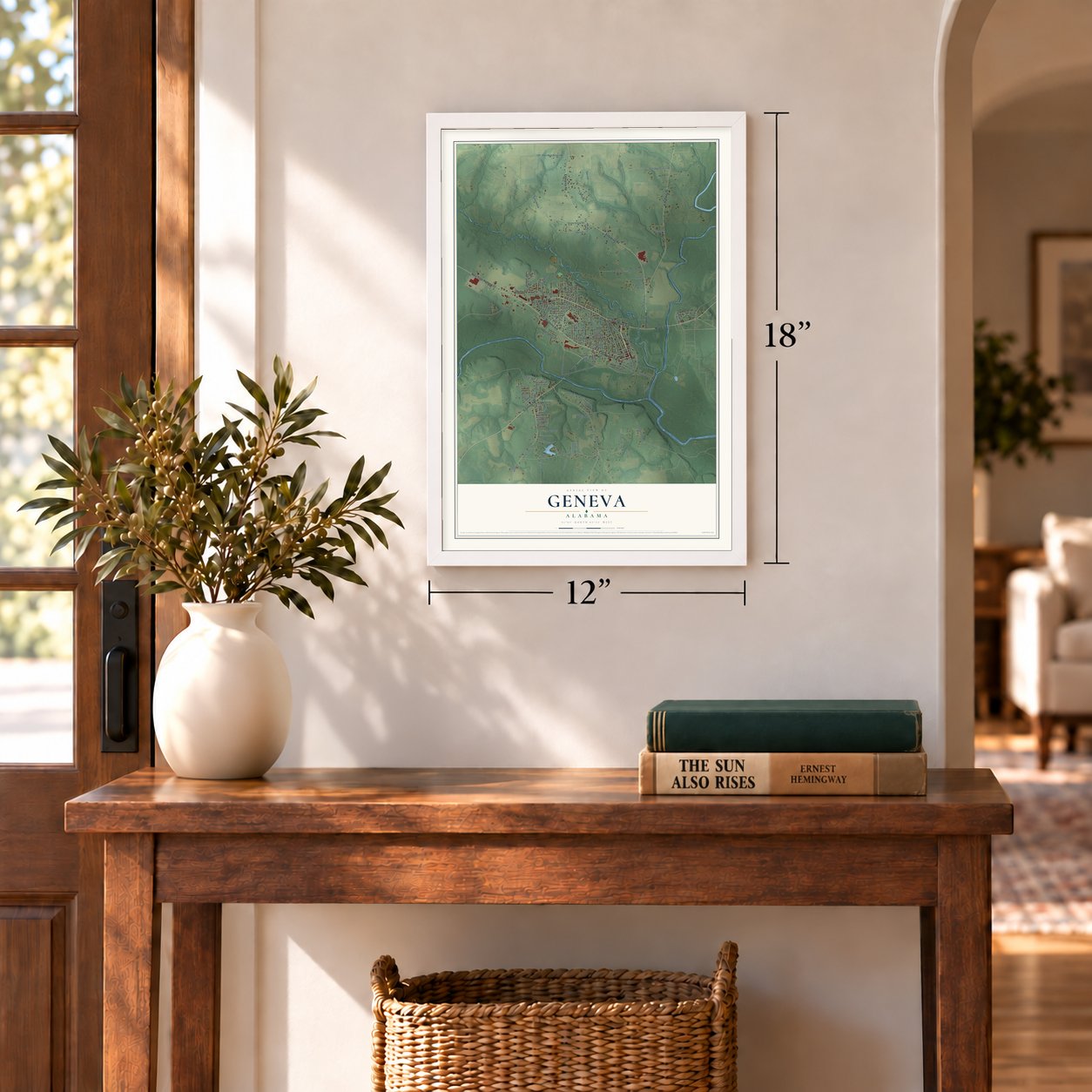
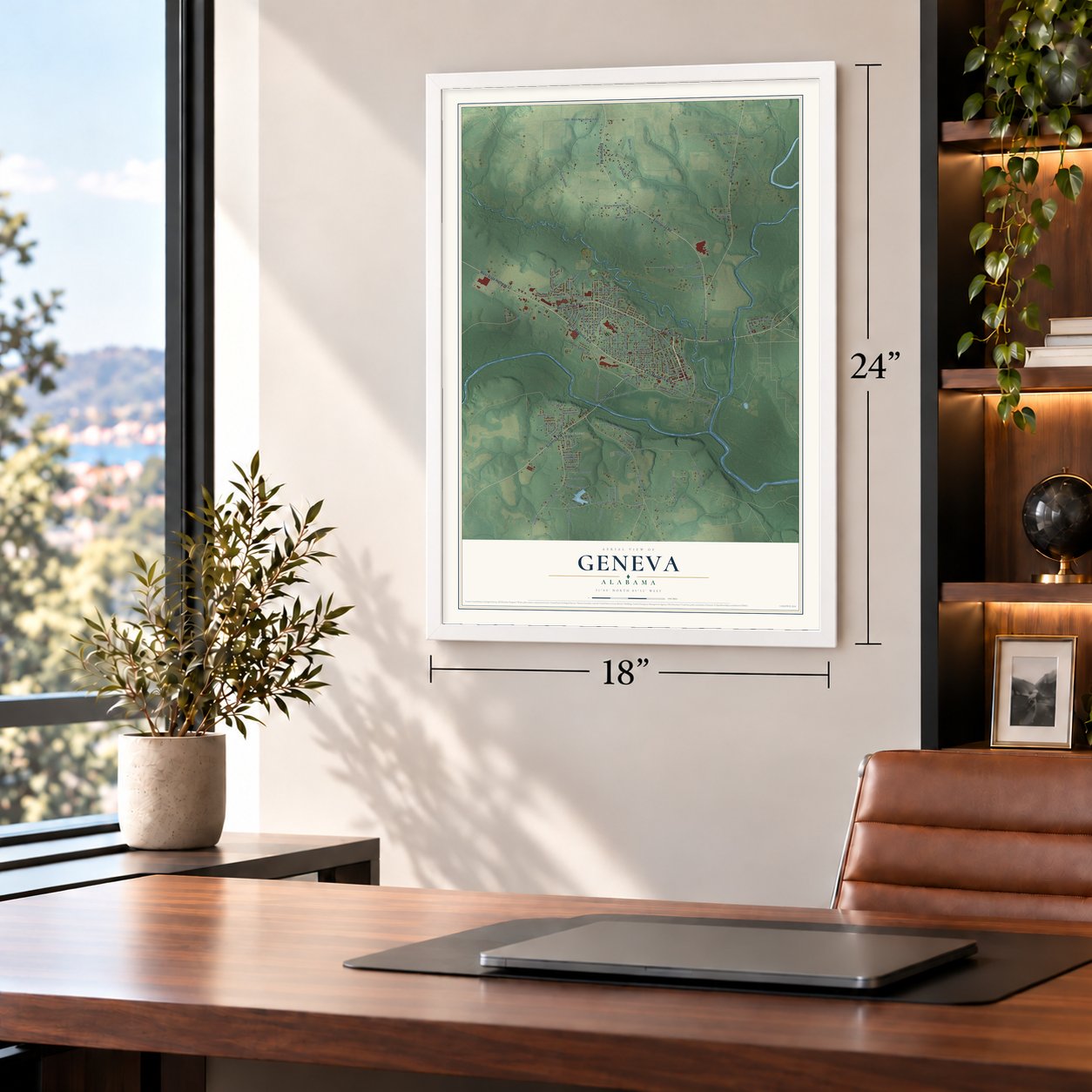
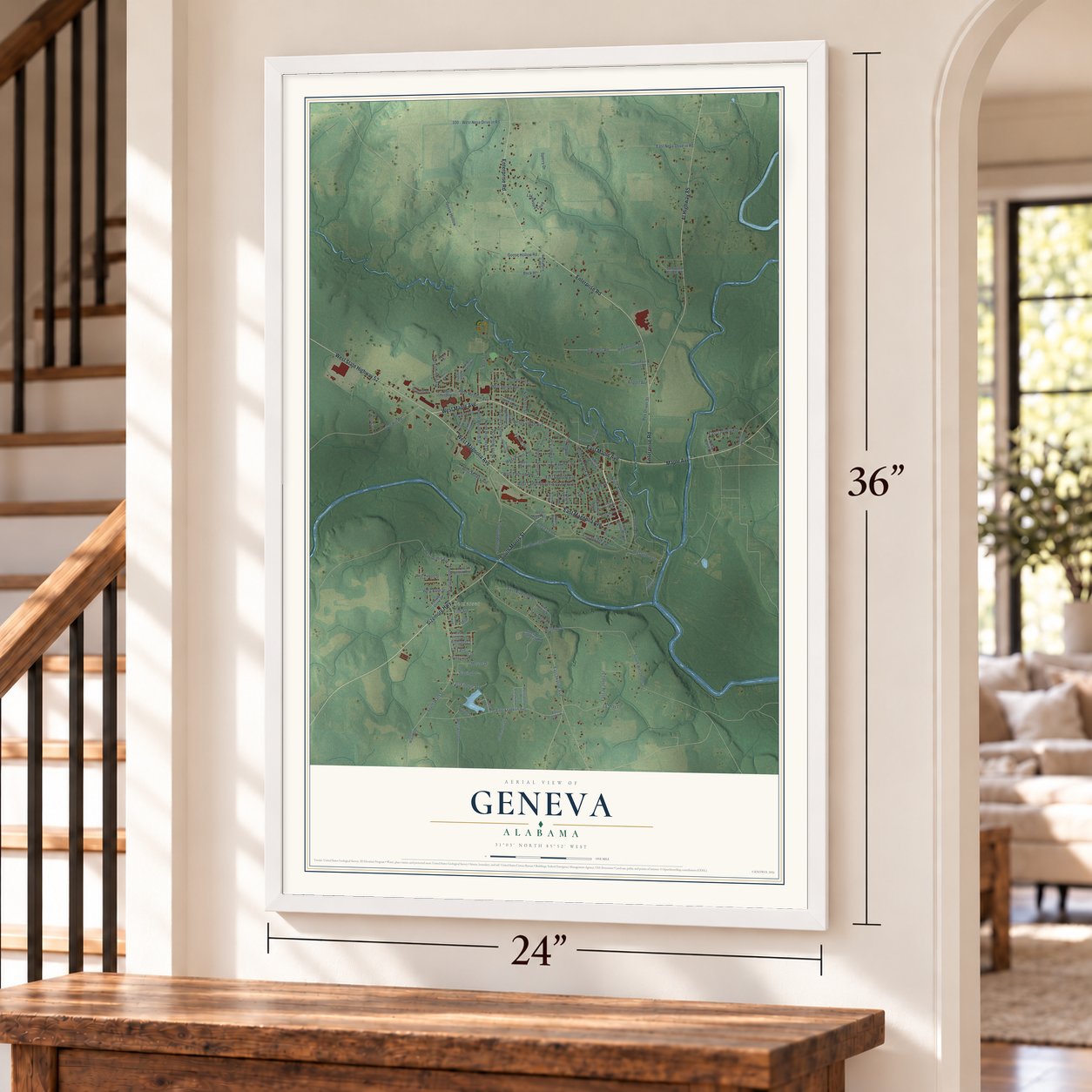
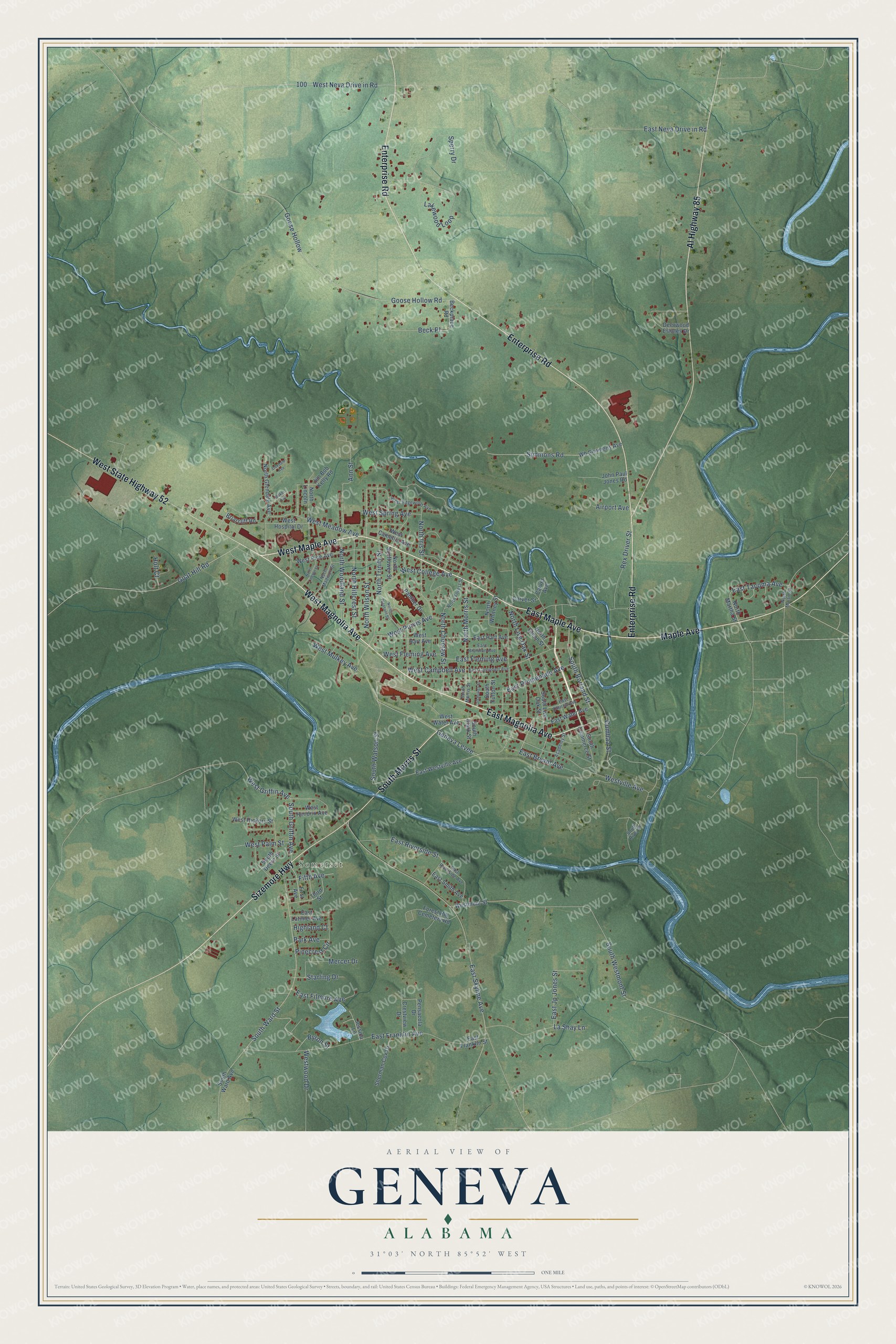
Geneva, Alabama Map Art
Building by building, with labeled streets and shaded relief.
12" x 18" Archival Matte Print
A Map of Home. A Work of Art.
Explore Geneva, Alabama from a whole new perspective. Created using aerial imagery and detailed geographic data, this map captures Geneva building by building, with labeled streets, familiar landmarks, and shaded topographical relief that highlights the natural contours of the landscape.
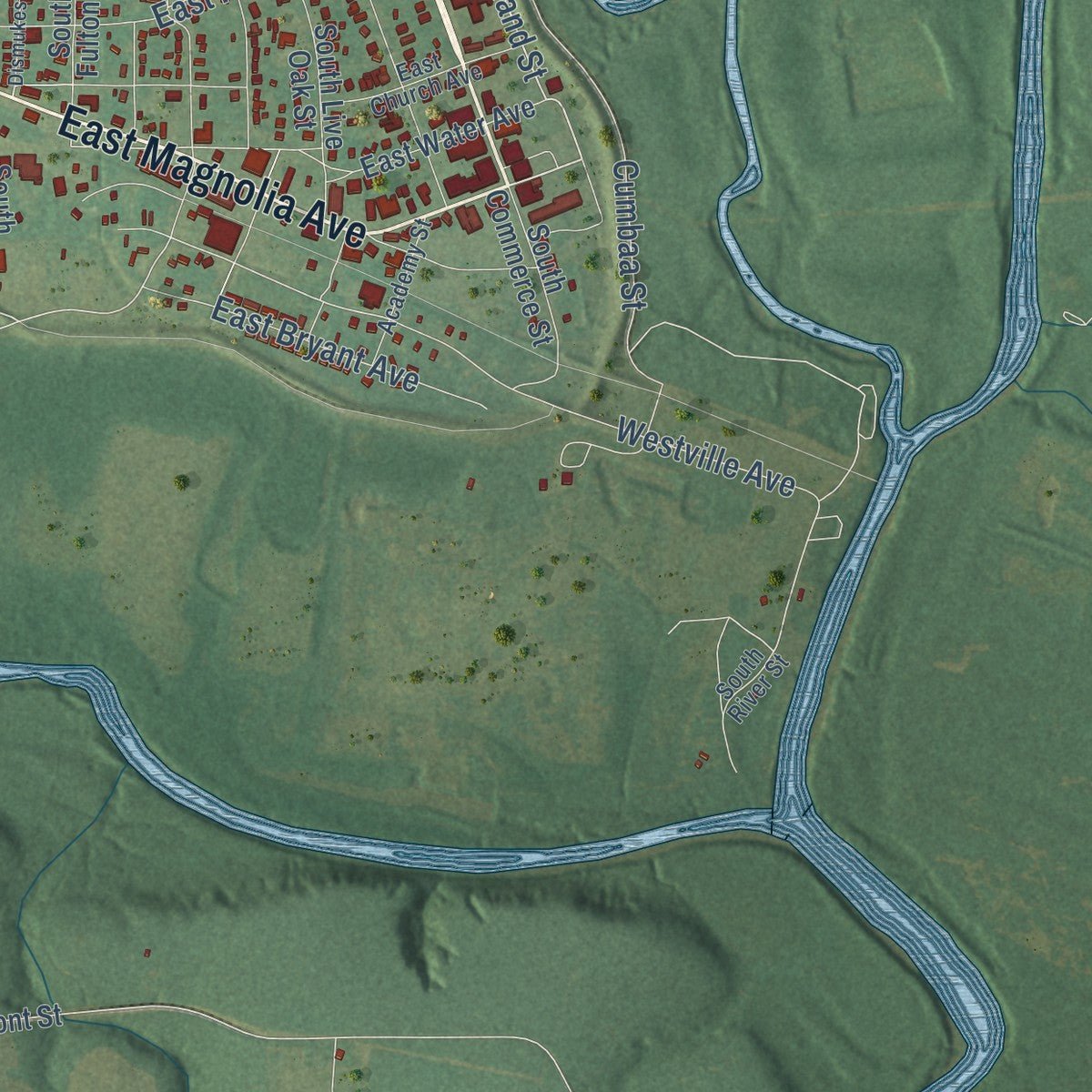
Combining modern data with the timeless character of a vintage atlas, this map is just as interesting up close as it is beautiful on the wall. Whether you grew up in Geneva, spent memorable years there, or call it home today, this unique map is a great way to celebrate a place that means something to you. Zoom in on the preview to look for your street, and then order a print to put your memories on the wall.
Three ways to hang it
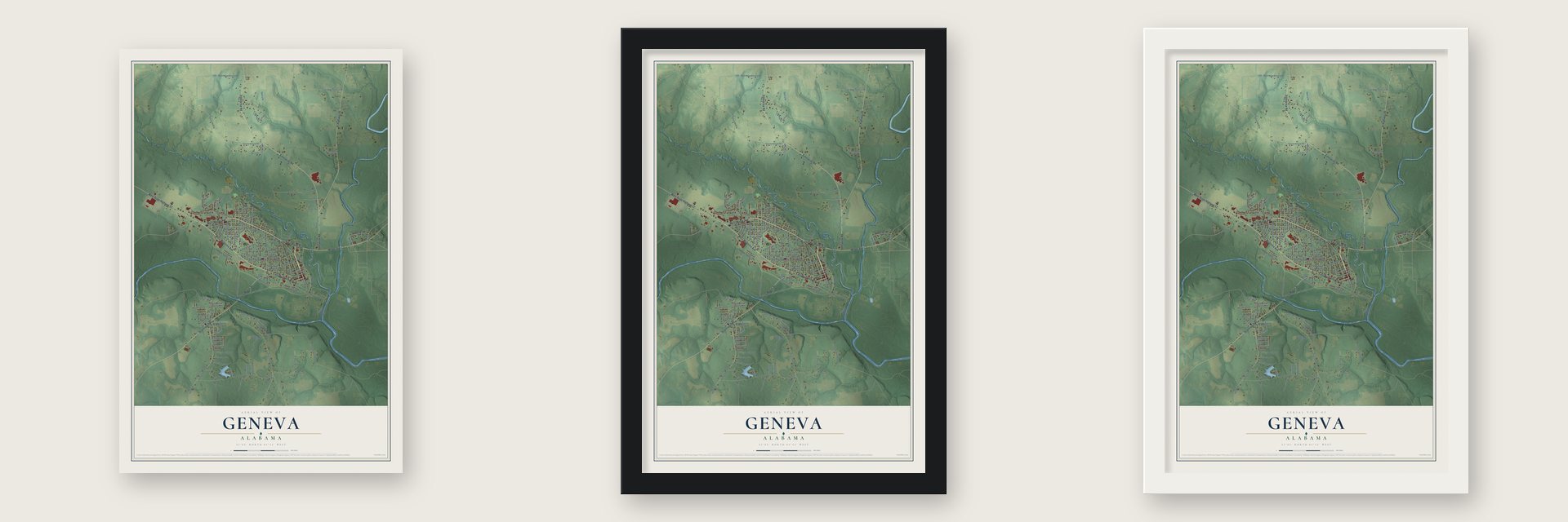
Unframed archival matte, a black wood frame or a white wood frame.
Up close
Geography Worth Displaying
This map was created using accurate cartographic data and authoritative geographic sources, including the U.S. Geological Survey and the Census Bureau. The map brings together terrain, waterways, roads, and building detail. The majority of the streets are labeled, houses are accurately depicted, and the topography is derived from government sources. Combining local data with carefully composed color and shading leads to this beautifully detailed Geneva artwork for your wall.
Rather than simply showing street outlines, we’ve included as many of the street names as we could reasonably fit on the map while keeping their names legible. Zoom in on the high resolution preview to see exactly what’s on the map. We truly set out to create a statement piece for anyone who loves Geneva. So whether it’s for you, or a gift for someone you love, we hope this map of Geneva brings back fond memories.
Read the story behind this map of Geneva, Alabama from 2026.

Find your street
Names on the Geneva map
Every name below is printed on this map. Look for your street, your school, the park where you played, or the pond down the road.
Places and landmarks1
- Somerset
Streets and roads123
- West Magnolia Avenue
- West Maple Avenue
- East Magnolia Avenue
- East Maple Avenue
- Maple Avenue
- Sizemore Highway
- Al Highway 85
- West State Highway 52
- Enterprise Road
- South Morris Street
- South Borland Street
- Geneva Levee
- South Watson Street
- Byron Street
- South Westmont Street
- West Campbell Avenue
- North Wilson Street
- North Live Oak Street
- East Tacoma Avenue
- La Shay Lane
- East Promenade Avenue
- Ann Street
- East Skyline Avenue
- South Ward Street
- Goose Hollow Road
- East Franklin Avenue
- North Trinity Street
- North Choctaw Street
- Lakewood Loop
- East Neva Drive in Road
Show all 123 streets
- Simmons Road
- North Woodland Street
- Cumbaa Street
- Goose Hollow
- West College Avenue
- Beck Place
- North Iris Street
- North Morris Street
- West Neva Drive in Road
- Westville Avenue
- West Meadow Avenue
- West Mulkey Avenue
- North Hillcrest Street
- Goat Hill Road
- West Purvis Avenue
- Sperry Drive
- East Riverside Street
- Rex Driver Street
- East Jp Jones Street
- East Fleming Avenue
- East Bryant Avenue
- South Griffin Avenue
- Mercer Drive
- East Filmore Avenue
- West Fleming Avenue
- West Spring Avenue
- West Palm Street
- West Griffin Avenue
- Fifth Avenue
- Starling Drive
- Westwood Drive
- Pinecrest Circle
- Airport Avenue
- Highland Court
- Park Avenue
- Holt Court
- South Clark Street
- North Whitney Street
- East Westville Avenue
- East Water Avenue
- West Water Avenue
- North Lincoln
- North Martha Street
- Wb Simmons Avenue
- North Glendale Avenue
- West Camellia Avenue
- South Live Oak Street
- North Sunflower Street
- West Pine Avenue
- Deerwood Estates Drive
- Forest Hill Cemetery Road
- West Hendrix Avenue
- Briarcliff Road
- West Hart Avenue
- North Glenn Street
- Sherman Cox Drive
- South Deere Street
- East Hart Avenue
- South Commerce Street
- Beckplace Road
- Panther Drive
- John Paul Jones Road
- West Hickory Street
- West Hospital Drive
- Jessica Lane
- Jim Bob Kelly Road
- East Smith Avenue
- East Latimer Avenue
- Pensacola Drive
- Westmont Street
- East Franklin Street
- First Avenue
- Crestview Drive
- South Fulton Street
- Third Street
- Carver Street
- South Ward Avenue
- Carver Avenue
- North Martin Street
- East Campbell Avenue
- East Church Avenue
- North Madison Street
- East Riverside Avenue
- West Edgewood Avenue
- North Forest Street
- Academy Street
- East Brannon Avenue
- South River Street
- North Pleasant Street
- North Lincoln Street
- Dismukes Street
- Oakdale Avenue
- Baker Avenue
Names are listed as they appear on the printed map. Zoom into the product photos to find them.
About Geneva, Alabama
Geneva is a city of 4,245 people and the seat of Geneva County, where the Pea River joins the Choctawhatchee just north of the Florida line. Henry Alexander Yonge and his brother, Walter S. C. Yonge, opened a trading post here in 1819, and settlers from Georgia and the Carolinas soon came looking for cheap farmland. As the village grew, Henry Yonge began calling it Geneva, the name of the New York town his wife came from, and by 1836 he was its first postmaster.
The Yonges and other residents started a shipping company together, and by the mid-1830s the village drew a steady stream of traders and travelers. The Lincoln Flood of 1865 wiped out the town, so its people rebuilt Geneva on higher ground up the riverbank. When Geneva County was created in 1868, it took the name of its largest settlement, and the state chartered the town in 1875.
- Head of navigationGeneva sat at the head of navigation on the Choctawhatchee, and the river carried its trade to markets in Pensacola and Mobile. Steam riverboats kept the town busy into the early 20th century. Geneva grew from 126 people in 1870 to 637 in 1890 and 1,032 in 1900.
- A steamboat seized in 1862In late December 1862 the stern-wheel steamboat Bloomer lay at Geneva on the Choctawhatchee. Union soldiers of the 91st New York Volunteers, under Lieutenant James H. Stewart, seized the boat and took it to Pensacola, Florida.
- Five courthousesGeneva County's court first met in 1869 at the school in town, and a log courthouse was built later that year. A brick courthouse later took its place but burned in 1889. The building that replaced it burned in 1911, and a new one opened in 1912. That fourth courthouse came down in 1969, and the current one rose in its place.
- The levee after 1929In 1929 the Hoover Flood, named for President Herbert Hoover, struck the town. Townspeople answered by building a levee with help from the federal Works Progress Administration, though floods still threaten Geneva from time to time.
- Festival on the RiversEvery April, Geneva holds its Festival on the Rivers where the two rivers meet, at Robert Fowler Memorial Park. Crowds come for canoe races, a 5-mile road race, a greasy pole climb, tug-of-war and the Annual Worm Fiddlin' Contest. The park is also home to the Constitution Oak, 75 feet tall with a spread of 175 feet, thought to be one of the largest live oaks in the world.
Keep exploring Alabama
Geneva is one of 675 Alabama towns we've mapped. Every dot on the map is a print of its own.
The search covers every state, Alabama first.
Near Geneva
Order 2 or more town maps and save 10%. Shown in the size and finish you picked above, so they hang as a set.
- Eunola 12" x 18" / Archival Matte Print $39.99
- Black 12" x 18" / Archival Matte Print $39.99
- Coffee Springs 12" x 18" / Archival Matte Print $39.99


More maps nearby: Samson, Hartford, Clayhatchee, Slocomb and Level Plains.
The art of mapping a place
How This Map Was Made
Real places. Remarkable detail. Discover the layers that turn geographic data into a map of home.

The view from above
Aerial imagery reveals the character of the land: woodland, open fields, and the patterns of a place.

The shape of the land
Elevation data brings hills, valleys, and subtle changes in the landscape into view.

The details of home
Roads, waterways, and building footprints come together to make the map feel unmistakably local.

Geography becomes art
Considered color, shading, and typography bring the layers together in a map made for your wall.


Process illustrated with Mendon, Massachusetts. Aerial imagery: USDA NAIP. Terrain: USGS 3D Elevation Program. Map details and finished artwork: KNOWOL.
The Details
About This Print
Choose an archival matte print, or a black or white Ayous wood frame. The archival matte print is unframed.
Select your size and finish above to see the matching product image and price.
Materials & Craftsmanship
A contemporary map with the character of a classic atlas, printed on archival matte paper. Optional frames are made from Ayous wood.
Your printed map does not include the watermark shown in the full-map preview.
Shipping & Delivery
Free shipping within the United States. Every print is made to order in the USA.
Buying a gift? Add a note in your cart and we'll include it. We never put prices in the package.
Prints ship within 2 to 3 business days. Allow 7 to 10 days total from ordering for delivery. Timing may vary during holidays or periods of high order volume.
Read our shipping policy.
Returns and damaged prints
Each print is made to order. Change-of-mind refunds are not available after production.
If your print arrives damaged, misprinted or incorrect, contact support@knowol.com within 30 days of receiving it. Include your order number, photos and a description of the issue.
Read our full refund and replacement policy. For questions about your order, email support@knowol.com.