
Search for another town


Free U.S. delivery 7 to 10 days after you order
Gibsonville, North Carolina Map Art
Building by building, with labeled streets and shaded relief.
12" x 18" Archival Matte Print
A Map of Home. A Work of Art.
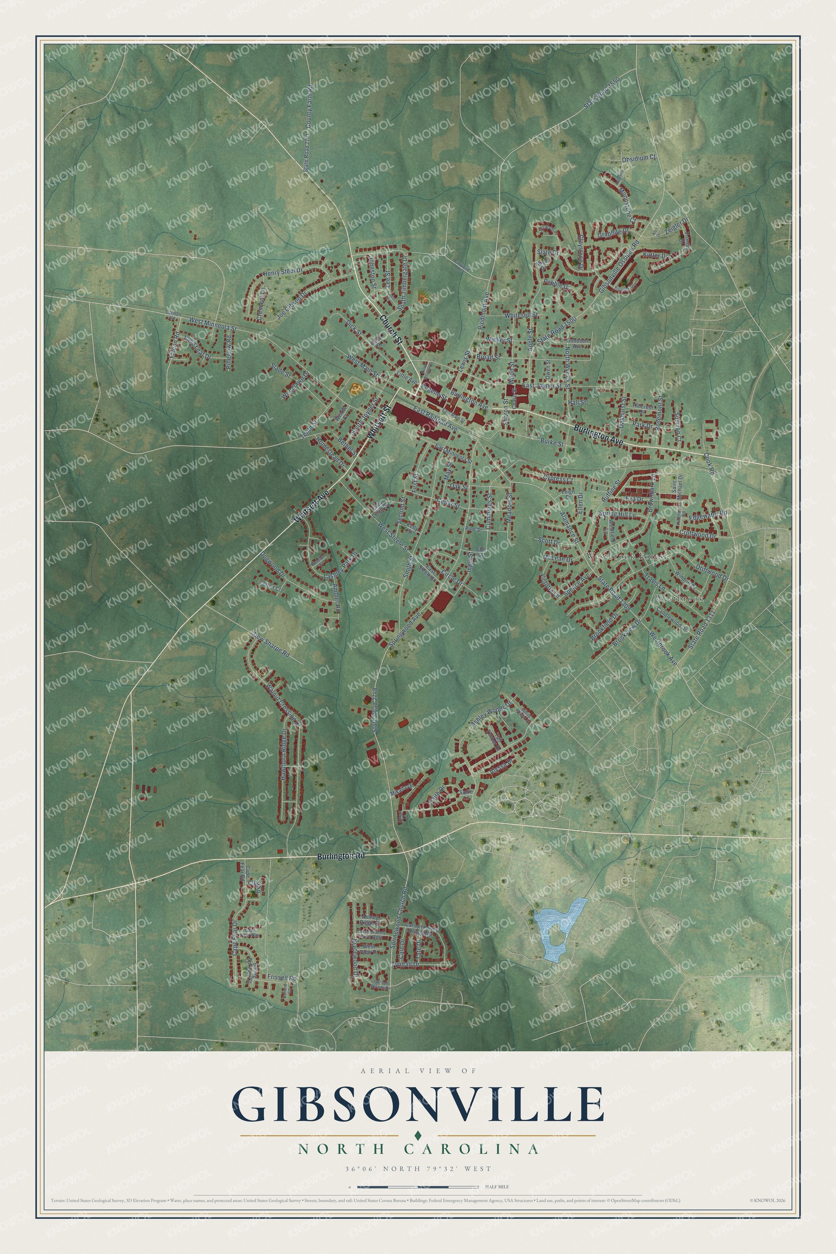
Explore Gibsonville, North Carolina from a whole new perspective. Created using aerial imagery and detailed geographic data, this map captures Gibsonville building by building, with labeled streets, familiar landmarks, and shaded topographical relief that highlights the natural contours of the landscape.
Combining modern data with the timeless character of a vintage atlas, this map is just as interesting up close as it is beautiful on the wall. Whether you grew up in Gibsonville, spent memorable years there, or call it home today, this unique map is a great way to celebrate a place that means something to you. Zoom in on the preview to look for your street, and then order a print to put your memories on the wall.
Three ways to hang it

Unframed archival matte, a black wood frame or a white wood frame.
Up close
Geography Worth Displaying
This map was created using accurate cartographic data and authoritative geographic sources, including the U.S. Geological Survey and the Census Bureau. The map brings together terrain, waterways, roads, and building detail. The majority of the streets are labeled, houses are accurately depicted, and the topography is derived from government sources. Combining local data with carefully composed color and shading leads to this beautifully detailed Gibsonville artwork for your wall.
Rather than simply showing street outlines, we’ve included as many of the street names as we could reasonably fit on the map while keeping their names legible. Zoom in on the high resolution preview to see exactly what’s on the map. We truly set out to create a statement piece for anyone who loves Gibsonville. So whether it’s for you, or a gift for someone you love, we hope this map of Gibsonville brings back fond memories.
Read the story behind this map of Gibsonville, North Carolina from 2026.

Find your street
Names on the Gibsonville map
Every name below is printed on this map. Look for your street, your school, the park where you played, or the pond down the road.
Places and landmarks2
- Westbrook Forest
- Westbrook
Streets and roads151
- Church Street
- Burlington Road
- Burlington Avenue
- Whitsett Avenue
- Whitsett Street
- West Main Street
- Ashley Woods Drive
- Alamance Street
- Cummings Street
- East Railroad Avenue
- State Road 2748
- East Joyner Street
- Springwood Avenue
- West Minneola Street
- State Road 1309
- Walnut Crossing Drive
- Gibsonville Ossipee Road
- State Road 1500
- Cook Road
- Smith Street
- Piedmont Avenue
- State Road 1311
- Apple Street
- Brookview Drive
- Driftwood Drive
- Burke Street
- Faith Drive
- Frissell Road
- Westbrook Avenue
- Joe Gibson Drive
Show all 151 streets
- Brownbark Lane
- Henry Steel Drive
- Lashley Park Drive
- Huffine Street
- Slate Drive
- Broad Street
- Tenth Street
- Springwood Church Road
- Hawthorn Ridge Drive
- Cedar Street
- West Steele Street
- Lewis Street
- Cape Fear Drive
- North Wyrick Street
- Dogwood Drive
- Dick Street
- County Farm Road
- Wood Street
- Travis Lane
- Ellen Drive
- Brycewood Drive
- Eva Drive
- Slade Street
- South Timbergate Drive
- South Joyner Street
- Bethel Street
- Kutter Drive
- Croftwood Drive
- State Road 1550
- Circle Drive
- Oak Street
- Moonstone Court
- Ingle Street
- Oakhurst Street
- Graphite Drive
- Long Leaf Drive
- Whitesell Street
- Second Street
- Tyndall Drive
- Meadow Street
- Cypress Court
- Park Drive
- Wicker Street
- Rosemont Street
- Ambler Road
- First Street
- Zeigler Drive
- Spring Hill Lane
- Falcon Road
- Spence Avenue
- Brookfield Drive
- Claystone Drive
- Homestead Drive
- Dew Sharpe Road
- May Street
- Victoria Lane
- Alyssa Drive
- Crescent Lane
- Sharon Street
- Edgewater Road
- Pebble Drive
- Sullivan Court
- Scott Drive
- Pineview Road
- Club Square
- McLean Drive
- Lee Street
- Woodlawn Drive
- Johnston Street
- Cale Drive
- Obsidium Court
- Tate Drive
- Eugene Street
- Hall Street
- Pine Street
- State Road 2741
- Carson Farms Drive East
- Westfield Lane
- Trimble Drive
- Candlewood Drive
- Windrift Drive
- Boling Springs Court
- Goodson Avenue
- East Minneola Street
- East Steele Street
- Owen Street
- Carol Leigh Drive
- Hillcrest Drive
- Ashley Ridge Drive
- Little Avenue
- Leigh Drive
- Saint Michael Drive
- West View Drive
- Cape Fear Road
- Mikaila Drive
- Tall Timber Drive
- Cobb Street
- Elm Street
- Chase Street
- Kelly Street
- Mica Drive
- Cotton Court
- Willow Court
- Sadie Lane
- White Poplar Drive
- Carson Farms Drive West
- Carson Woods Drive
- Triumph Drive
- East Main Street
- Hutchinson Road
- Farwood Road
- Cape Fear Way
- Bolivia Court
- Riverton Court
- Carmon Road
- Still Water Circle
- Forest Drive
- Dolomite Drive
- North Wharton Street
- Kfc Drive
- Abigail Lane
Names are listed as they appear on the printed map. Zoom into the product photos to find them.
About Gibsonville, North Carolina
Gibsonville is a town of 8,920 people in Guilford County, and part of it reaches into Alamance County. Joseph Gibson's father had farmed and mined gold here as early as 1775, and in 1851 Gibson, a local farmer, did grading work for the new North Carolina Railroad. When the first train pulled in on October 9, 1855, the railroad called its depot Gibson Station in his honor, and the state legislature chartered the Town of Gibsonville on February 18, 1871.
For its first decades the town mostly shipped livestock and farm goods out by rail from the Depot Greens. That changed in 1886, when Berry Davidson, a self-taught mill builder, opened a textile mill run by steam, the Minneola, on Railroad Avenue, and in 1893 he added the Hiawatha mill on Eugene Street. The mills gave the old shipping station an industrial base. After they closed in the 1980s, Gibsonville became a home for people who work in Burlington and Greensboro.
- Gold on Gibson HillMiners found gold early in the 1800s on Gibson Hill, south of town, a rise some people called Gold Hill. The Chifar Consolidated Gold Mine Company started crushing ore there in August 1899, half a mile south of the depot. The town cemetery sits in that same area, and none of its graves has turned up gold.
- A rough town before 1860Before 1860 Captain Billy Gilmer opened one of the first stores, a wooden general store at Main and Piedmont streets that sold to farmers and miners. Wooden saloons downtown gave Gibsonville its name as a rough town.
- Brick on Main StreetIn 1894 Dr. Jordan put up downtown's first brick building of two stories, at the corner of Main and Lewis streets, where Wade's Jewelry is now. The rest of the brick fronts facing the Greens went up between 1905 and 1920. The early 1920s brought a boom: Main Street was paved, water and sewer lines went in, street lights were put up, and brick buildings replaced the wooden ones.
- The Gibsonville Development CompanyBefore 1912, Berry Davidson's son D. M. Davidson joined with A. B. Owens and J.W. Burke to found the Gibsonville Development Company, and P.L. Kivett came in later. They gave the town its telephone exchange, a bank, a lumber yard, several houses and the Gibsonville Hosiery Mill on Apple Street. They also built up the Rock Creek Dairy until it was the largest dairy in North Carolina.
- The City of RosesGibsonville has carried the nickname City of Roses since 1920 at the latest. That year, passengers looking out from the train could see rose bushes planted in rows beside the tracks at the Minneola Mill. The Minneola Manufacturing Company's cloth warehouse joined the National Register in 2018.
Keep exploring North Carolina
Gibsonville is one of 952 North Carolina towns we've mapped. Every dot on the map is a print of its own.
The search covers every state, North Carolina first.
Near Gibsonville
Order 2 or more town maps and save 10%. Shown in the size and finish you picked above, so they hang as a set.
- Elon 12" x 18" / Archival Matte Print $39.99
- Whitsett 12" x 18" / Archival Matte Print $39.99
- Glen Raven 12" x 18" / Archival Matte Print $39.99
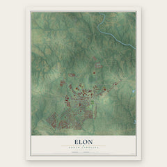

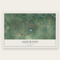
More maps nearby: Burlington, Sedalia, Ossipee, Alamance and McLeansville.
The art of mapping a place
How This Map Was Made
Real places. Remarkable detail. Discover the layers that turn geographic data into a map of home.

The view from above
Aerial imagery reveals the character of the land: woodland, open fields, and the patterns of a place.

The shape of the land
Elevation data brings hills, valleys, and subtle changes in the landscape into view.

The details of home
Roads, waterways, and building footprints come together to make the map feel unmistakably local.

Geography becomes art
Considered color, shading, and typography bring the layers together in a map made for your wall.


Process illustrated with Mendon, Massachusetts. Aerial imagery: USDA NAIP. Terrain: USGS 3D Elevation Program. Map details and finished artwork: KNOWOL.
The Details
About This Print
Choose an archival matte print, or a black or white Ayous wood frame. The archival matte print is unframed.
Select your size and finish above to see the matching product image and price.
Materials & Craftsmanship
A contemporary map with the character of a classic atlas, printed on archival matte paper. Optional frames are made from Ayous wood.
Your printed map does not include the watermark shown in the full-map preview.
Shipping & Delivery
Free shipping within the United States. Every print is made to order in the USA.
Buying a gift? Add a note in your cart and we'll include it. We never put prices in the package.
Prints ship within 2 to 3 business days. Allow 7 to 10 days total from ordering for delivery. Timing may vary during holidays or periods of high order volume.
Read our shipping policy.
Returns and damaged prints
Each print is made to order. Change-of-mind refunds are not available after production.
If your print arrives damaged, misprinted or incorrect, contact support@knowol.com within 30 days of receiving it. Include your order number, photos and a description of the issue.
Read our full refund and replacement policy. For questions about your order, email support@knowol.com.