
Search for another town


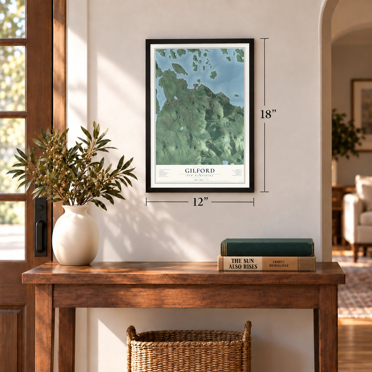
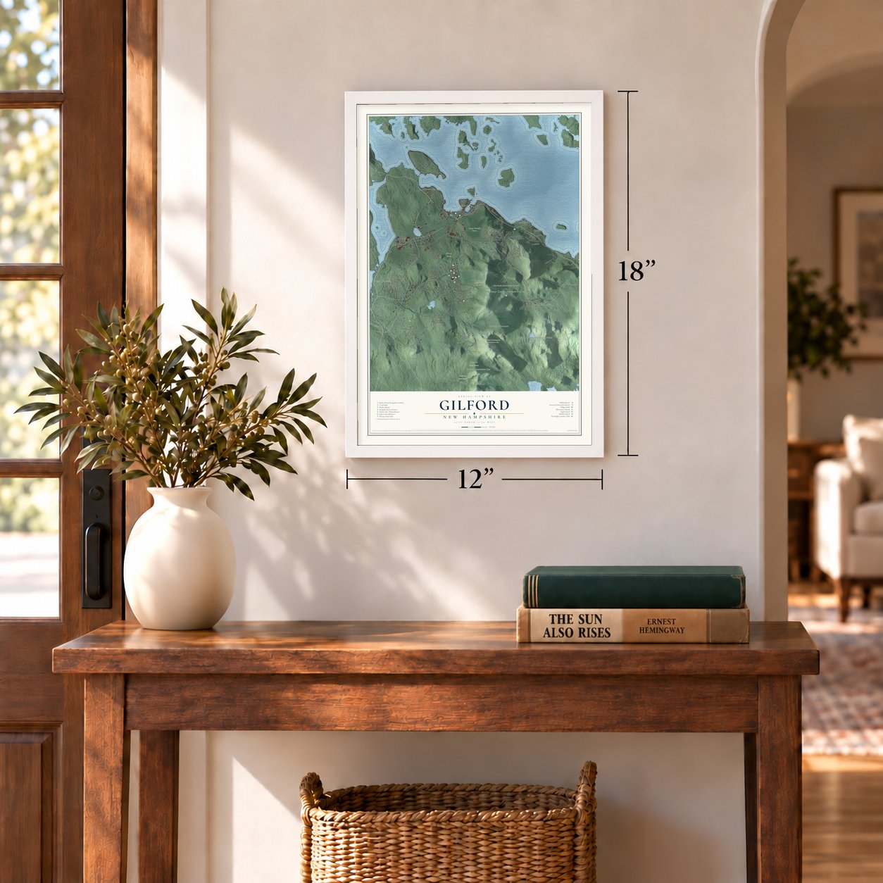
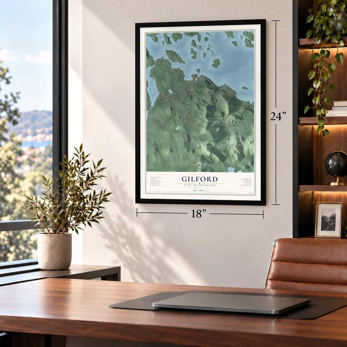
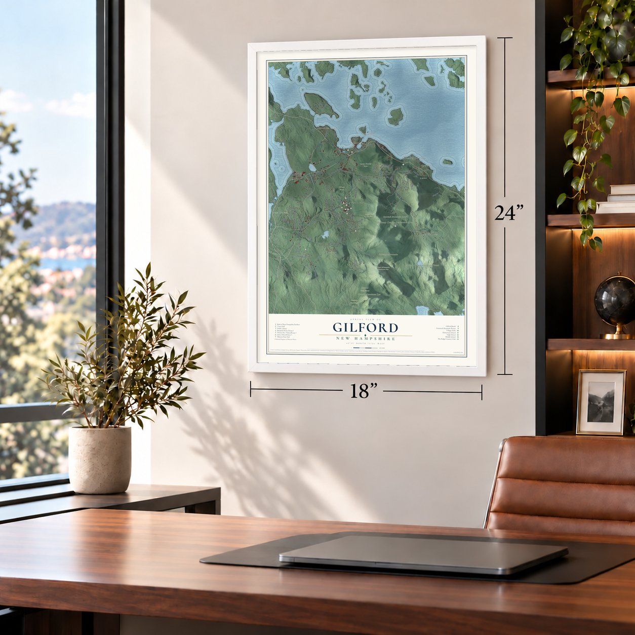


Free U.S. delivery 7 to 10 days after you order
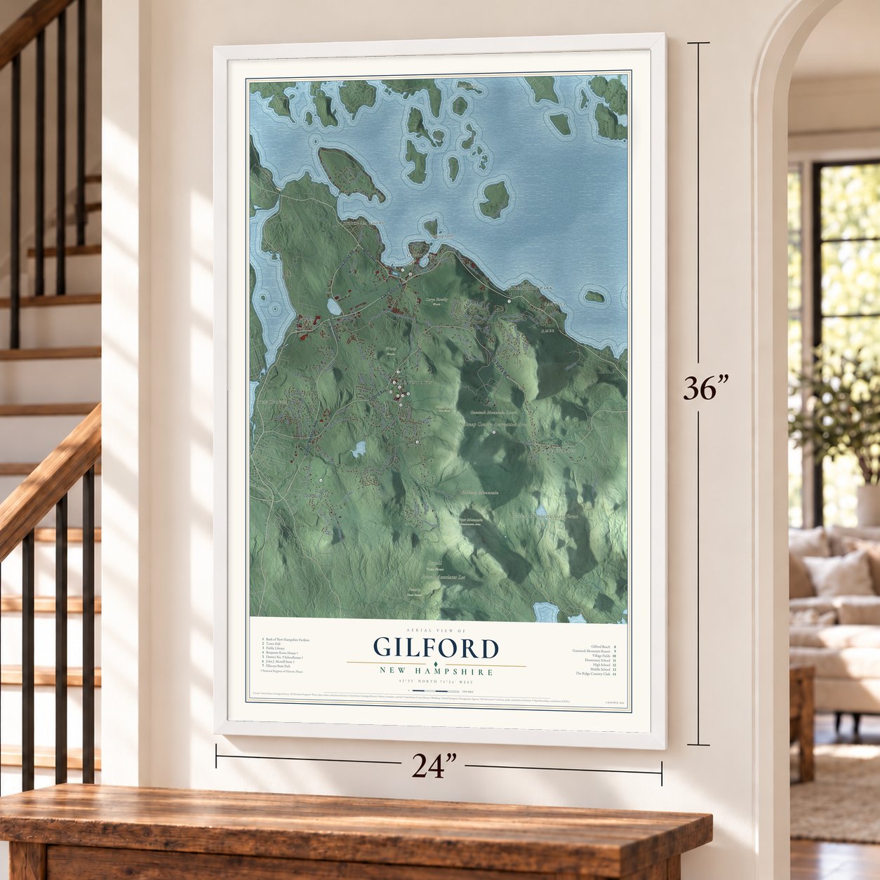
Gilford, New Hampshire Map Art
Building by building, with labeled streets and shaded relief.
12" x 18" Archival Matte Print
A Map of Home. A Work of Art.
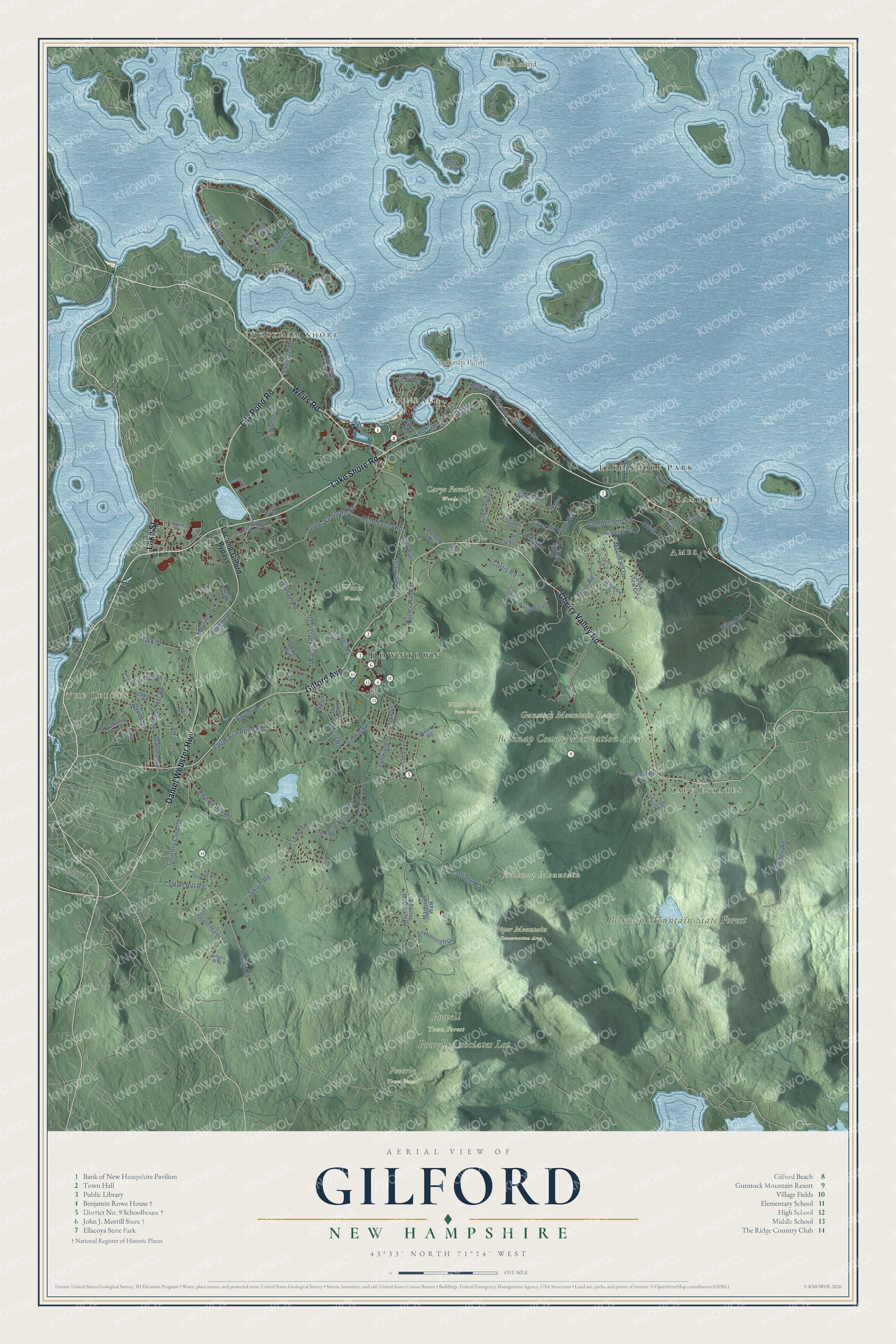
Explore Gilford, New Hampshire from a whole new perspective. Created using aerial imagery and detailed geographic data, this map captures Gilford building by building, with labeled streets, familiar landmarks, and shaded topographical relief that highlights the natural contours of the landscape.
Combining modern data with the timeless character of a vintage atlas, this map is just as interesting up close as it is beautiful on the wall. Whether you grew up in Gilford, spent memorable years there, or call it home today, this unique map is a great way to celebrate a place that means something to you. Zoom in on the preview to look for your street, and then order a print to put your memories on the wall.
Three ways to hang it
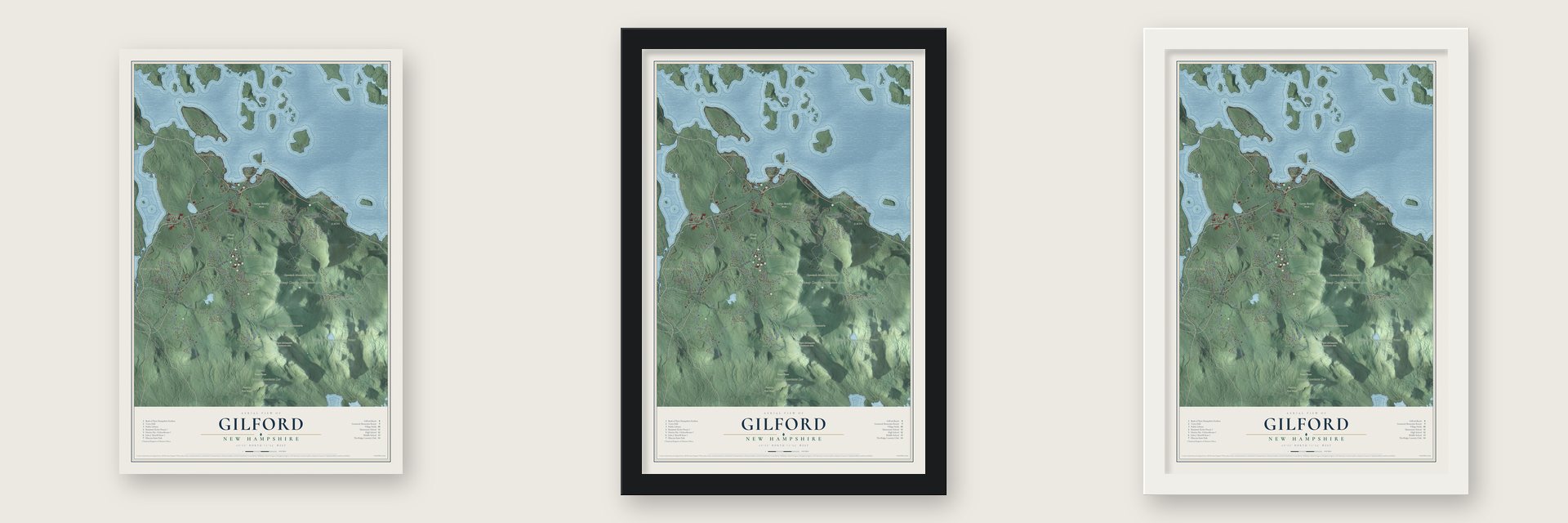
Unframed archival matte, a black wood frame or a white wood frame.
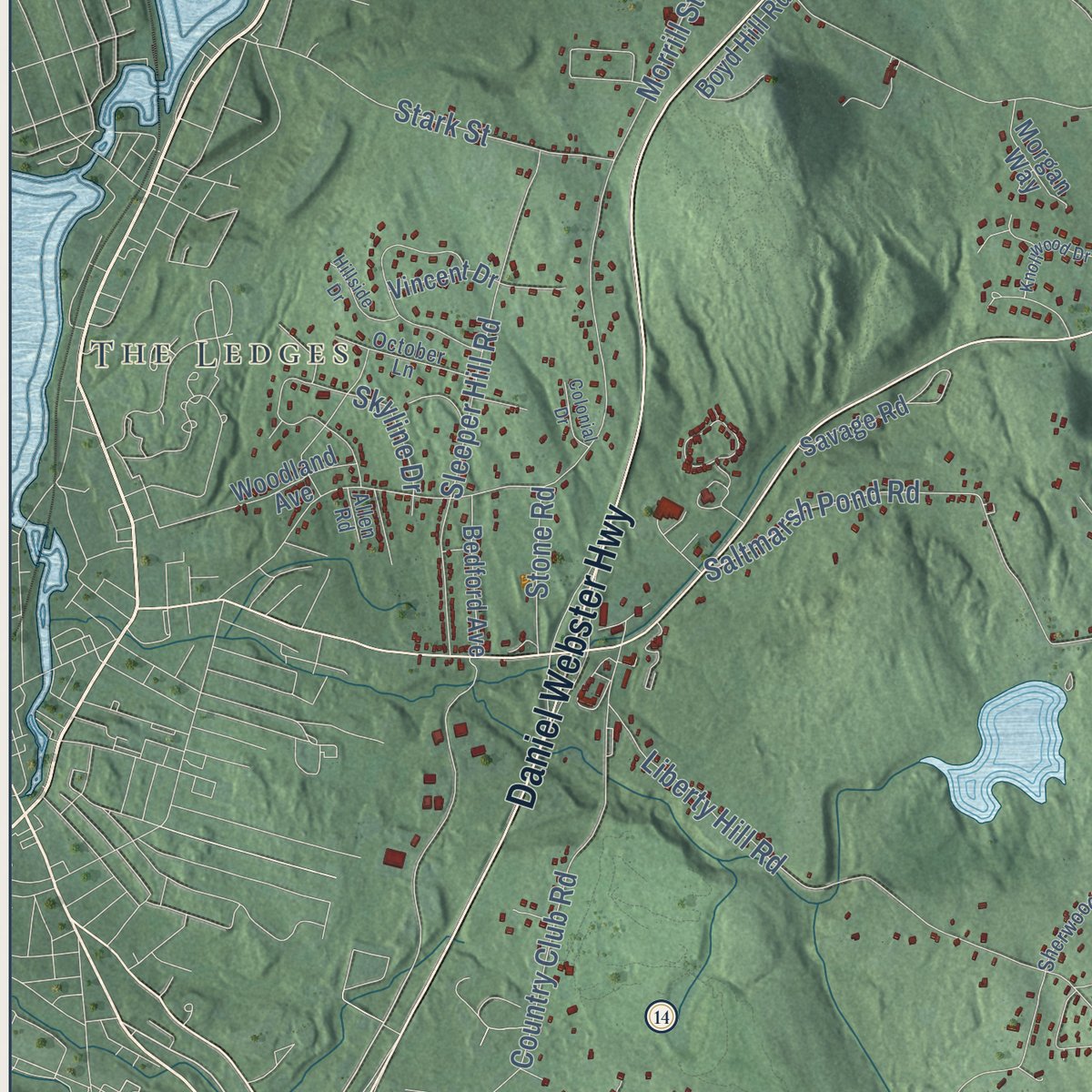
Up close
Geography Worth Displaying
This map was created using accurate cartographic data and authoritative geographic sources, including the U.S. Geological Survey (USGS) and FEMA. The map brings together terrain, waterways, roads, and building detail. The majority of the streets are labeled, houses are accurately depicted, and the topography is derived from government sources. Combining local data with carefully composed color and shading leads to this beautifully detailed Gilford artwork for your wall.
Rather than simply showing street outlines, we’ve included as many of the street names as we could reasonably fit on the map while keeping their names legible. Zoom in on the high resolution preview to see exactly what’s on the map. We truly set out to create a statement piece for anyone who loves Gilford. So whether it’s for you, or a gift for someone you love, we hope this map of Gilford brings back fond memories.
Explore the full map of Gilford, New Hampshire and read about the local places it shows.

Find your street
Names on the Gilford map
Every name below is printed on this map. Look for your street, your school, the park where you played, or the pond down the road.
Places and landmarks21
- Downtown
- The Ledges
- Yale Estates
- Dockham Shore
- Ames
- Samoset
- Belknap Mountain
- Belknap Point
- Birch Island
- Belknap County Recreation Area
- Belknap Mountain State Forest
- Powell Associates Lot
Show all 21 places
- Carye Family Woods
- Gunstock Mountain Resort
- Peverly Town Forest
- Piper Mountain Conservation Area
- Powell Town Forest
- Weeks Woods
- Wilson Weeks Town Forest
- Glendale
- Lake Shore Park
Streets and roads114
- Lake Street
- Weirs Road
- Lily Pond Road
- Lake Shore Road
- Cherry Valley Road
- Daniel Webster Highway
- Gilford Avenue
- Old Lake Shore Road
- Intervale Road
- Morrill Street
- Edgewater Drive
- Liberty Hill Road
- Glidden Road
- Hoyt Road
- Welch Island
- Gunstock Hill Road
- Carriage Road
- Saltmarsh Pond Road
- Mountain Drive
- Scenic Drive
- Chestnut Drive
- Cotton Hill Road
- Sagamore Road
- Country Club Road
- Potter Hill Road
- Swain Road
- Cumberland Road
- Sleeper Hill Road
- Round Is
- Watson Road
Show all 114 streets
- Wild Acres Road
- Tate Road
- Belknap Point Road
- Camp Is
- Jolly Is
- Summit Avenue
- Silver Street
- Riley Road
- Stark Street
- Young Road
- Curtis Road
- Shore Road
- Henderson Road
- Sanborn Road
- Hook Road
- Stone Road
- Cat Path
- Linda Lane
- River Road
- Skyline Drive
- Laconia-Gilford Bypass
- Belknap Mountain Road
- Dockham Shore Road
- Lockes Is
- Kimball Road
- Yasmin Drive
- White Birch Drive
- Garden Hill Drive
- Valley Drive
- Briarcliff Road
- Longridge Drive
- Varney Point Left
- Mink Island
- Foxborough Drive
- Boyd Hill Road
- Bickford Road
- Marjories Walk
- Crestview Drive
- Goodwin Road
- Timber Lane
- Bedford Avenue
- Partridge Lane
- Gilford East Drive
- Morgan Way
- Glendale Place
- Woodland Avenue
- Savage Road
- Lockes Hill Road
- Vincent Drive
- Hazelnut Road
- Trail View Drive
- Pineway
- Weeks Road
- Orchard Drive
- Larch Drive
- Dow Road
- Irish Setter Lane
- Greenleaf Trail
- Annis Drive
- School House Hill Road
- Blueberry Hill Lane
- Sherwood Forest Drive
- Sand Hill Road
- Foxglove Road
- Deer Run Lane
- Sargents Place
- October Lane
- Farm View Lane
- Farmer Drive
- Judges Way
- Airport Road
- Allen Road
- Juniper Ridge Road
- Broadview Terrace
- Dinsmoor Point Road
- Knollwood Drive
- Abenaki Path
- Hillside Drive
- Aviation Drive
- Beacon Hill Road
- Barefoot Place
- Colonial Drive
- Rocky Road
- Loch Lane
Names are listed as they appear on the printed map. Zoom into the product photos to find them.
About Gilford, New Hampshire
Gilford is a town of 7,699 people in Belknap County, on Lake Winnipesaukee. Settlers came in 1778, when this land belonged to Gilmanton and went by the name Gunstock Parish. Captain Lemuel B. Mason was a veteran of the 1781 Battle of Guilford Court House, fought in North Carolina. After he retired to the parish, he proposed in 1812 that it break away as a new town named Guilford. The proposal succeeded, and a clerk's mistake later shortened the spelling to Gilford.
The old parish name stayed on the mountain, and in the 1930s the mountain made Gilford a ski town. The first snow train out of Boston ran here, and in 1934 a rope tow driven by a gasoline engine became New Hampshire's first motorized ski lift. The Works Progress Administration then hired hundreds of workers who had lost their jobs to build the Belknap Mountain Recreation Area, finished in 1937. Now called Gunstock Mountain Resort and still owned by Belknap County, it was the first ski area in the eastern United States to put in a chairlift, and most of its trails carry the names of guns or gun parts, such as Musket, Flintlock and Trigger.
- A brick Cape turned museumThe Benjamin Rowe House on Belknap Mountain Road probably dates from the 1830s. Built of brick as a single-story Cape, it has four thin chimneys and a granite lintel above its door. In the early 1900s it was the center of a dairy farm. The town bought the farm in 1970, used the house for town offices for a time in the 1980s, and restored it in the 1990s. It now holds a local history museum.
- District No. 9 Schoolhouse, 1815This schoolhouse on Hoyt Road is the best preserved of Gilford's old district schools. Around 1835 it gained a gable roof and a vestibule, more windows came in the 1850s, and in 1892 desks and chairs took the place of its benches. Classes stopped in the mid-1920s, and since 1938 the building has served as a private summer home.
- A summer embassy on the lakeGovernors Island, out in Lake Winnipesaukee, is part of Gilford. In 1885 Stilson Hutchins, founder of The Washington Post, put up a mansion of granite on the island. Germany's ambassador rented the island from 1903 to 1908, and each summer he ran the German embassy from there.
- Penny Pitou's two silversPenny Pitou first skied in her girlhood with the Gilford Outing Club and at the Belknap Mountain ski area that became Gunstock. At the 1960 Winter Olympics she won silver medals in both the downhill and the giant slalom, the first Olympic medal for an American woman in downhill skiing.
Keep exploring New Hampshire
Gilford is one of 276 New Hampshire towns we've mapped. Every dot on the map is a print of its own.
The search covers every state, New Hampshire first.
Near Gilford
Order 2 or more town maps and save 10%. Shown in the size and finish you picked above, so they hang as a set.
- Gilmanton 12" x 18" / Archival Matte Print $39.99
- Belmont 12" x 18" / Archival Matte Print $39.99
- Laconia 12" x 18" / Archival Matte Print $39.99


More maps nearby: Alton, Meredith, Tilton, Sanbornton and Tuftonboro.
The art of mapping a place
How This Map Was Made
Real places. Remarkable detail. Discover the layers that turn geographic data into a map of home.

The view from above
Aerial imagery reveals the character of the land: woodland, open fields, and the patterns of a place.

The shape of the land
Elevation data brings hills, valleys, and subtle changes in the landscape into view.

The details of home
Roads, waterways, and building footprints come together to make the map feel unmistakably local.

Geography becomes art
Considered color, shading, and typography bring the layers together in a map made for your wall.


Process illustrated with Mendon, Massachusetts. Aerial imagery: USDA NAIP. Terrain: USGS 3D Elevation Program. Map details and finished artwork: KNOWOL.
The Details
About This Print
Choose an archival matte print, or a black or white Ayous wood frame. The archival matte print is unframed.
Select your size and finish above to see the matching product image and price.
Materials & Craftsmanship
A contemporary map with the character of a classic atlas, printed on archival matte paper. Optional frames are made from Ayous wood.
Your printed map does not include the watermark shown in the full-map preview.
Shipping & Delivery
Free shipping within the United States. Every print is made to order in the USA.
Buying a gift? Add a note in your cart and we'll include it. We never put prices in the package.
Prints ship within 2 to 3 business days. Allow 7 to 10 days total from ordering for delivery. Timing may vary during holidays or periods of high order volume.
Read our shipping policy.
Returns and damaged prints
Each print is made to order. Change-of-mind refunds are not available after production.
If your print arrives damaged, misprinted or incorrect, contact support@knowol.com within 30 days of receiving it. Include your order number, photos and a description of the issue.
Read our full refund and replacement policy. For questions about your order, email support@knowol.com.