
Search for another town




Free U.S. delivery 7 to 10 days after you order
Grand Island, Nebraska Map Art
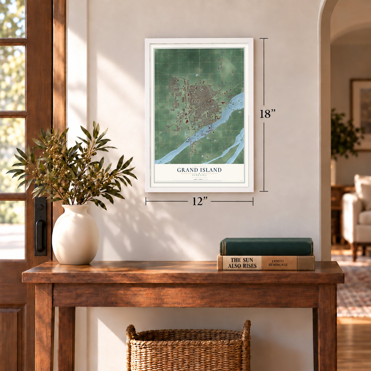
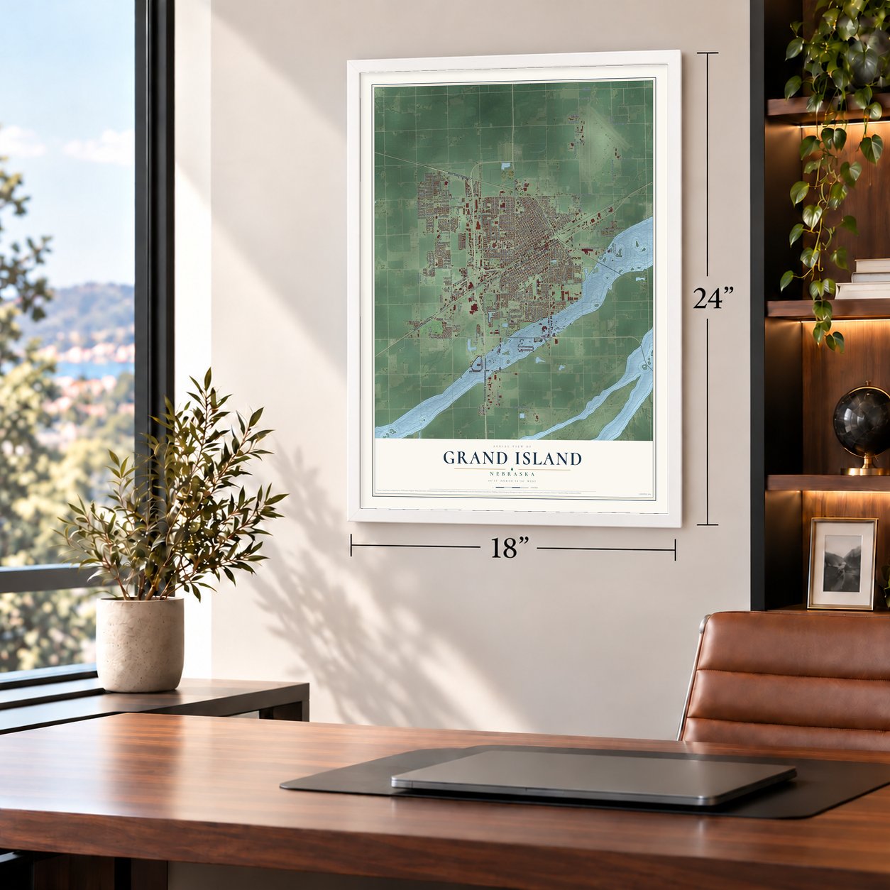
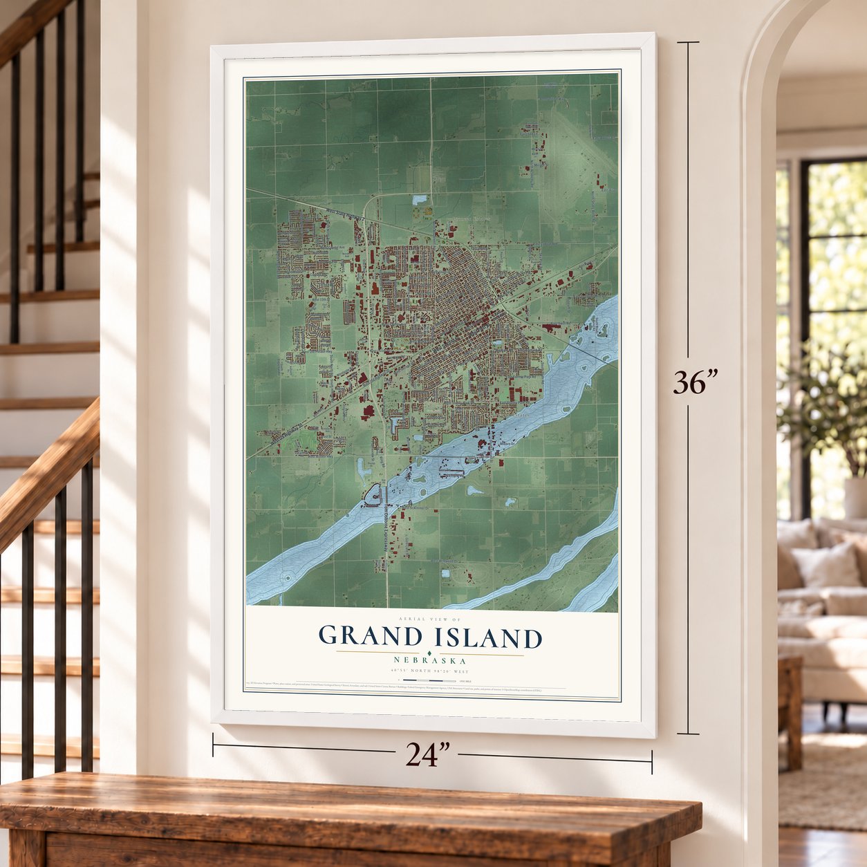
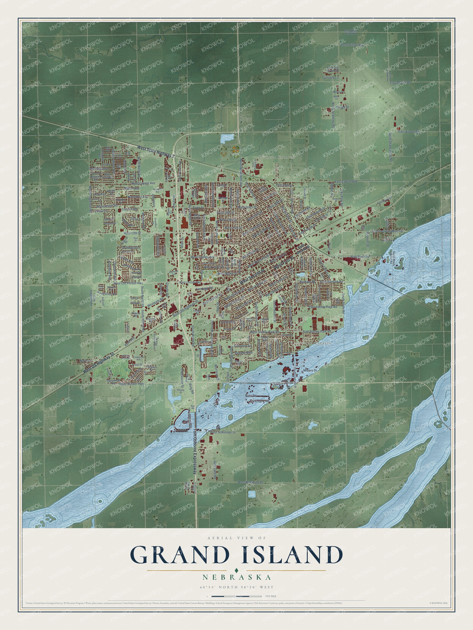
A new map of Grand Island, Nebraska, made in 2026 and printed to order on thick archival matte paper.
12" x 18" Archival Matte Print
A Map of Home. A Work of Art.
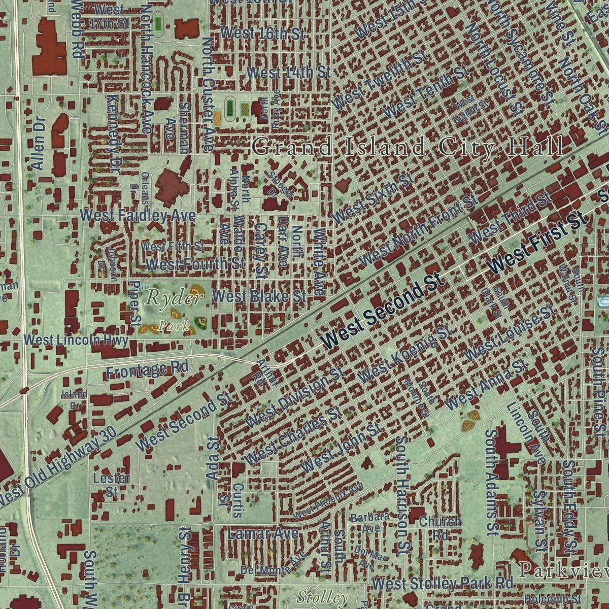
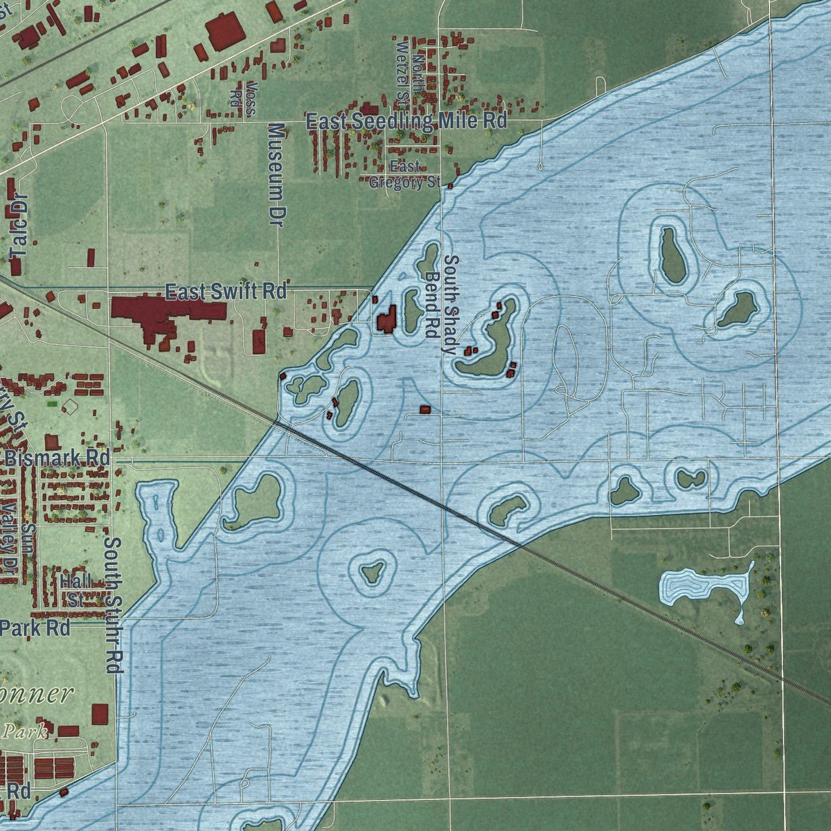
Explore Grand Island, Nebraska from a whole new perspective. Created using aerial imagery and detailed geographic data, this map captures Grand Island building by building, with labeled streets, familiar landmarks, and shaded topographical relief that highlights the natural contours of the landscape.
Combining modern data with the timeless character of a vintage atlas, this map is just as interesting up close as it is beautiful on the wall. Whether you grew up in Grand Island, spent memorable years there, or call it home today, this unique map is a great way to celebrate a place that means something to you. Zoom in on the preview to look for your street, and then order a print to put your memories on the wall.
Three ways to hang it
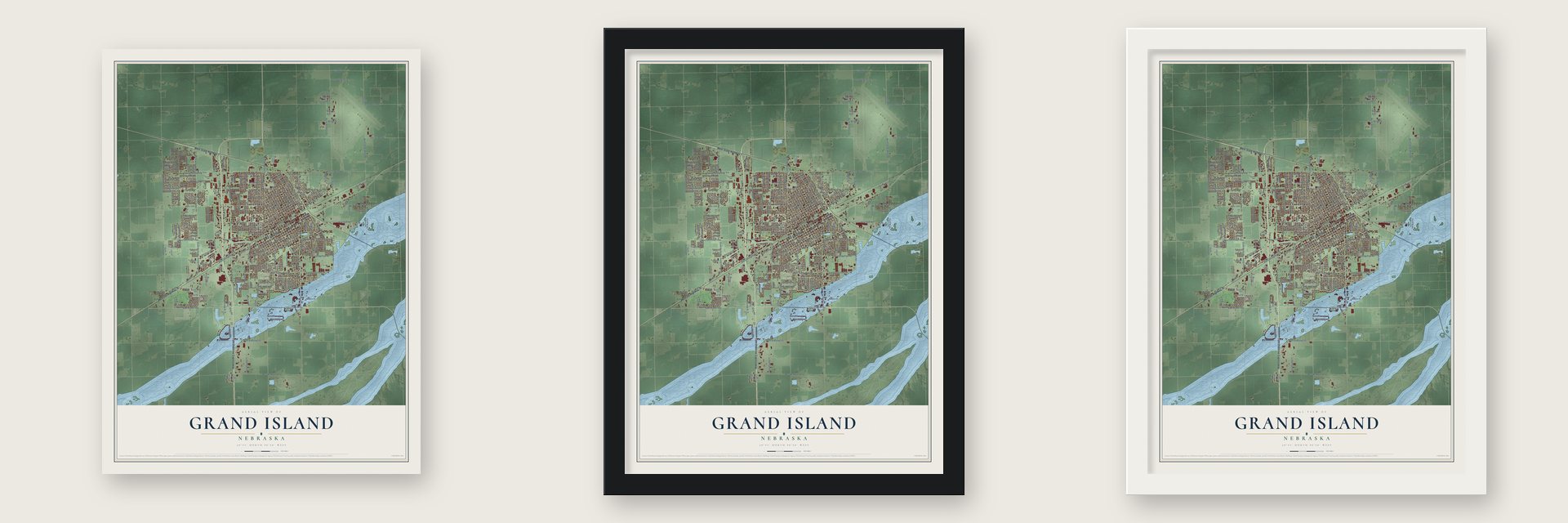
Unframed archival matte, a black wood frame or a white wood frame.
Up close
Geography Worth Displaying
This map was created using accurate cartographic data and authoritative geographic sources, including the U.S. Geological Survey and the Census Bureau. The map brings together terrain, waterways, roads, and building detail. The majority of the streets are labeled, houses are accurately depicted, and the topography is derived from government sources. Combining local data with carefully composed color and shading leads to this beautifully detailed Grand Island artwork for your wall.
Rather than simply showing street outlines, we’ve included as many of the street names as we could reasonably fit on the map while keeping their names legible. Zoom in on the high resolution preview to see exactly what’s on the map. We truly set out to create a statement piece for anyone who loves Grand Island. So whether it’s for you, or a gift for someone you love, we hope this map of Grand Island brings back fond memories.
Read the story behind this map of Grand Island, Nebraska from 2026.
About Grand Island, Nebraska
Grand Island is a city of 53,131 people and the county seat of Hall County. The first settlers came in 1857, when 35 Germans set out from Davenport, Iowa, for an island that French traders had named La Grande Isle, formed by the Platte and Wood rivers. The group arrived on July 4, 1857, and by September they had built homes from the island's own timber. The farmers had nowhere to sell their crops until Fort Kearny opened a market. Once the Pike's Peak Gold Rush started, travelers stopped here for their last supplies before heading across the plains.
In the spring of 1866 the Union Pacific Railroad laid out a new town, Grand Island Station, a little inland from the island, and many settlers moved over to it. Trains arrived in 1868. The town became the end of the railroad's east division, so Union Pacific built service buildings for its locomotives and a fine hotel for passengers. The price was the island's hardwood, since most of its trees were cut down for railroad ties. By 1870 the town had 1,057 people, and it was incorporated as Grand Island in 1872.
- The nation's first sugar beet factorySugar beets came to Nebraska as a crop in about 1890, and the first factory in the United States for processing them went up on the city's southwest side. By 1900 Grand Island was the third largest city in the state. It kept that rank for the rest of the century, until Bellevue passed it in 2000.
- Seven tornadoes in one nightOn the evening of June 3, 1980, a huge supercell storm sent seven tornadoes through Grand Island. The strongest was rated F4, the north Locust business district took the worst damage, and five people died. Ivy Ruckman told the story in her book Night of the Twisters, which was also made into a movie.
- Tornado HillStorm debris that couldn't be recycled was burned near Fonner Park, and the rest was buried in Ryder Park and J. Dibbern Park, at the city's west end. The pile became Tornado Hill, 40 feet high, and in a town this flat it is the place people go sledding.
- State Fair since 2010The Nebraska State Fair moved to Grand Island in 2010. Thousands of visitors come to the city for it every year, and attendance set a record of over 300,000 in 2024.
Find your street
Names on the Grand Island map
Every name below is printed on this map. Look for your street, your school, the park where you played, or the pond down the road.
Places and landmarks7
- Grand Island City Hall
- Pioneer Estates
- Kingwood Estates
- Parkview
- Fonner Park
- Ryder Park
- Stolley State Park
Streets and roads261
- Tom Osborne Expressway
- West State Highway 2
- West US Highway 30
- West Second Street
- West First Street
- West Husker Highway
- Riverview Drive
- North Broadwell Avenue
- West 15th Street
- East 15th Street
- South Stuhr Road
- East Seedling Mile Road
- East Swift Road
- West Old Potash Highway
- Carey Street
- West Old Highway 30
- Brentwood Boulevard
- Henry Street
- West 18th Street
- Ebony Lane
- North North Road
- West Sixth Street
- South Webb Road
- East Airport Road
- Faidley Avenue
- Claude Road
- Ring Road
- South Locust Street
- South Blaine Street
- West 13th Street
Show all 261 streets
- West Stolley Park Road
- Sky Park Road
- West Capital Avenue
- North Webb Road
- Diers Avenue
- State Street
- West State Street
- East Capital Avenue
- West Wildwood Drive
- North Custer Avenue
- South North Road
- South Hilltop Road
- West North Front Street
- West Fourth Street
- West Koenig Street
- West Tenth Street
- West Louise Street
- North Sycamore Street
- West Division Street
- East Bismark Road
- West Anna Street
- West Third Street
- West Charles Street
- West John Street
- North Oak Street
- West Schimmer Drive
- Independence Avenue
- East Seventh Street
- West Faidley Avenue
- North Shady Bend Road
- West 16th Street
- Ponderosa Drive
- West 14th Street
- South Eddy Street
- East Fourth Street
- North Locust Street
- North Vine Street
- North Academy Road
- South Vine Street
- Norseman Avenue
- South Oak Street
- East Abbott Road
- North Engleman Road
- South Adams Street
- South Cherry Street
- Pioneer Boulevard
- South Harrison Street
- South Pine Street
- East Stolley Park Road
- North Howard Avenue
- North Park Avenue
- Manchester Road
- East Fonner Park Road
- West Twelfth Street
- Prairieview Street
- Gold Core Road
- Bismark Road
- Apache Road
- North Hancock Avenue
- Riverside Drive
- White Avenue
- Lamar Avenue
- Midaro Drive
- East Ninth Street
- Kennedy Drive
- Ada Street
- Ammunition Way
- Allen Drive
- Michigan Avenue
- Westgate Road
- Sheridan Avenue
- Sagewood Avenue
- East 20th Street
- Idaho Avenue
- Kay Avenue
- Lariat Lane
- Fairchild Lane
- Huston Avenue
- Meadow Road
- Rainbow Road
- Museum Drive
- Sylvan Street
- West Blake Street
- Mason Avenue
- Frontage Road
- North Lane
- Bass Road
- Cherokee Avenue
- Arapahoe Avenue
- Allen Avenue
- Driftwood Drive
- Wortman Drive
- Geddes Street
- Cannon Road
- Kent Avenue
- Zola Lane
- Talc Drive
- Trust Street
- Mirage Street
- Gold Road
- Jay Street
- Jan Street
- East Second Street
- Arrowhead Road
- Grand Avenue
- Waldo Avenue
- Rue de College
- North Wheeler Avenue
- West Lincoln Highway
- South Lincoln Avenue
- West 17th Street
- East Fifth Street
- South Engleman Road
- College Street
- South Arthur Street
- Cottage Street
- South Plum Street
- Saint Paul Road
- South Shady Bend Road
- Northwest Avenue
- Piper Street
- South Kimball Street
- Beal Street
- East 18th Street
- Shanna Street
- Sandalwood Drive
- Hall Street
- Sun Valley Drive
- Garland Street
- Stockyard Lane
- Saint Patrick Avenue
- North Darr Avenue
- Indianhead Road
- Indianhead Drive
- Commerce Avenue
- Lakewood Drive
- New York Avenue
- East White Cloud Road
- Indian Grass Road
- Curtis Street
- Ramada Road
- Johnstown Road
- South Elk Drive
- Tech Drive
- Aspen Circle
- Church Road
- Stauss Road
- Lillie Drive
- East Gulf Stream Drive
- Carleton Avenue
- Wicklow Drive
- Hampton Road
- Sherman Avenue
- Holland Drive
- Utah Avenue
- Reuting Road
- Blauvelt Road
- Hartford Street
- Peach Street
- Wagon Road
- Lee Street
- Metro Street
- Arch Avenue
- Roth Road
- Reed Road
- Spur Lane
- Lester Street
- Nordic Road
- Yarrow Drive
- East 21st Street
- James Road
- Monarch Avenue
- West Fifth Street
- Redwood Road
- East Roberts Street
- South August Street
- Pleasant View Drive
- Del Monte Avenue
- North Alpha Street
- Kaufman Avenue
- South Antelope Drive
- South Memorial Park Road
- Ewoldt Street
- Kenneth Drive
- Norwood Drive
- Rolling Green Drive
- Palace Drive
- Holcomb Street
- North Quandt Road
- North Wetzel Street
- Rae Road
- Sandra Road
- Edna Drive
- East Gregory Street
- Enterprise Avenue
- Barbara Avenue
- Iowa Avenue
- Freedom Drive
- Arthur Road
- Baron Lane
- Aster Drive
- Voss Road
- Gus Street
- West Phoenix Avenue
- Stagecoach Road
- West Eighth Street
- South Clark Street
- Stonewood Avenue
- Park Drive
- North Ruby Avenue
- Texas Avenue
- South Walnut Street
- Arizona Avenue
- Woodridge Boulevard
- Circle Drive
- South Monroe Street
- Orleans Drive
- Del Mar Avenue
- Sherwood Road
- Willow Street
- Joehnck Road
- Claussen Road
- Johnson Drive
- Mary Lane
- Saint Andrews Circle
- Windridge Avenue
- Curran Avenue
- Raborn Street
- Overland Road
- Stoeger Drive
- Island Drive
Names are listed as they appear on the printed map. Zoom into the product photos to find them.
The art of mapping a place
How This Map Was Made
Real places. Remarkable detail. Discover the layers that turn geographic data into a map of home.

The view from above
Aerial imagery reveals the character of the land: woodland, open fields, and the patterns of a place.

The shape of the land
Elevation data brings hills, valleys, and subtle changes in the landscape into view.

The details of home
Roads, waterways, and building footprints come together to make the map feel unmistakably local.

Geography becomes art
Considered color, shading, and typography bring the layers together in a map made for your wall.


Process illustrated with Mendon, Massachusetts. Aerial imagery: USDA NAIP. Terrain: USGS 3D Elevation Program. Map details and finished artwork: KNOWOL.
The Details
About This Print
Choose an archival matte print, or a black or white Ayous wood frame. The archival matte print is unframed.
Select your size and finish above to see the matching product image and price.
Materials & Craftsmanship
A contemporary map with the character of a classic atlas, printed on archival matte paper. Optional frames are made from Ayous wood.
Your printed map does not include the watermark shown in the full-map preview.
Shipping & Delivery
Free shipping within the United States. Every print is made to order in the USA.
Buying a gift? Add a note in your cart and we'll include it. We never put prices in the package.
Prints ship within 2 to 3 business days. Allow 7 to 10 days total from ordering for delivery. Timing may vary during holidays or periods of high order volume.
Read our shipping policy.
Returns and damaged prints
Each print is made to order. Change-of-mind refunds are not available after production.
If your print arrives damaged, misprinted or incorrect, contact support@knowol.com within 30 days of receiving it. Include your order number, photos and a description of the issue.
Read our full refund and replacement policy. For questions about your order, email support@knowol.com.
Find your town
Looking for another city?
Find a map of home in our Nebraska collection, or any town in the country.
Nearby
Maps of towns near Grand Island
Know someone from one of these towns? Their map makes a great gift.
 Alda
Alda, Nebraska
From $39.99See the map
 Phillips
, Nebraska
From $39.99See the map
 Doniphan
, Nebraska
From $39.99See the map
More maps nearby: St. Libory, Chapman, Cairo, Wood River and Giltner.