


Search for another town





Free U.S. delivery 7 to 10 days after you order
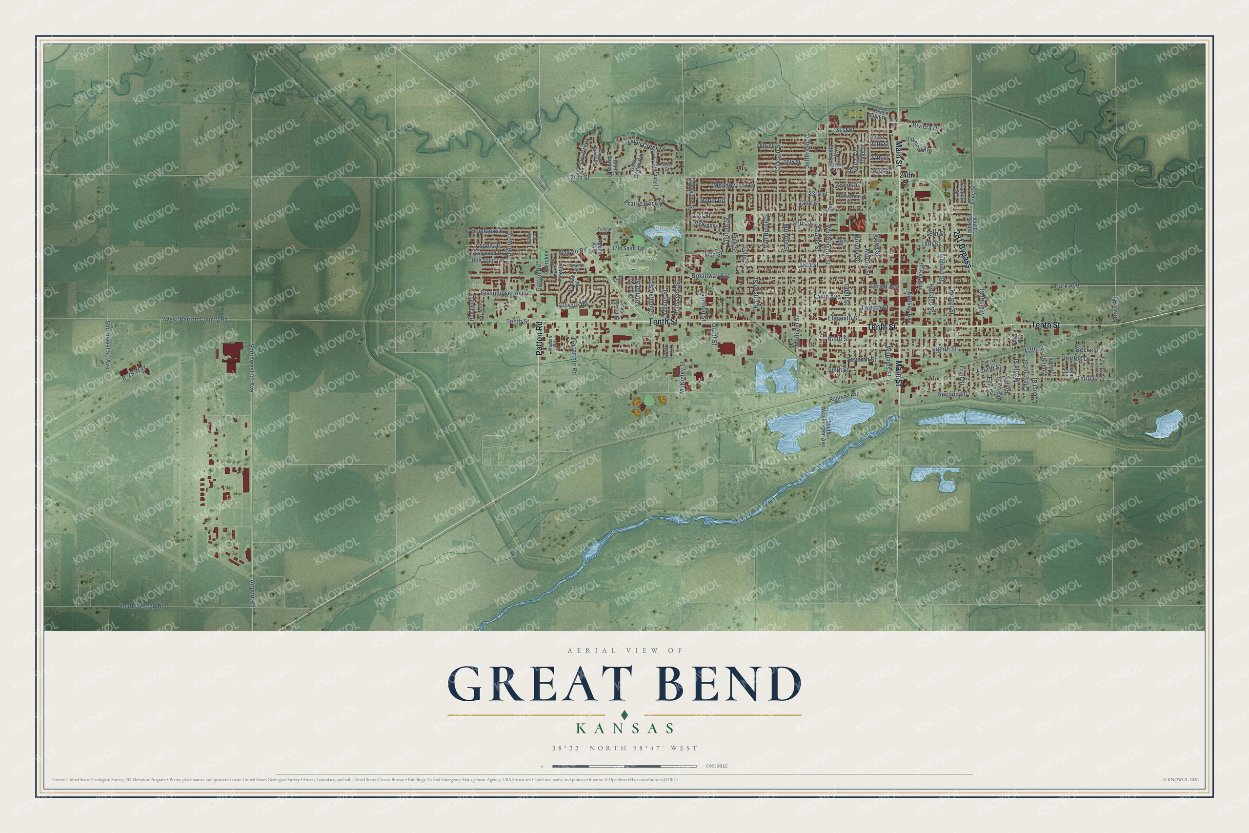
Great Bend, Kansas Map Art
Building by building, with labeled streets and shaded relief.
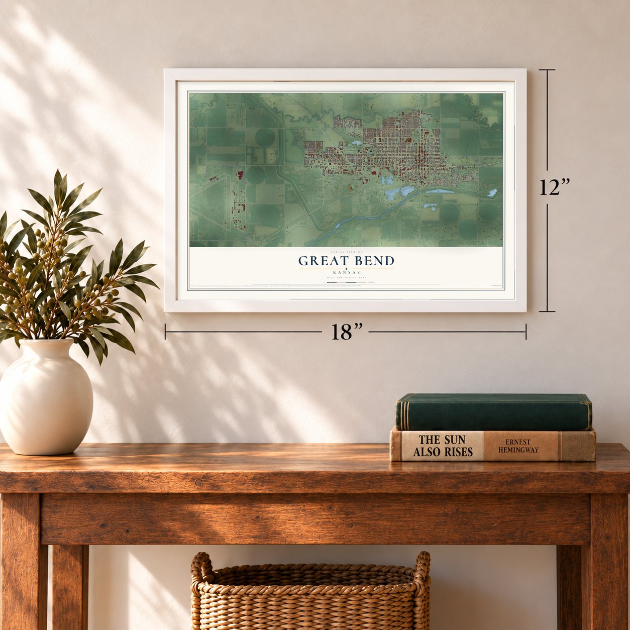
12" x 18" Archival Matte Print
A Map of Home. A Work of Art.
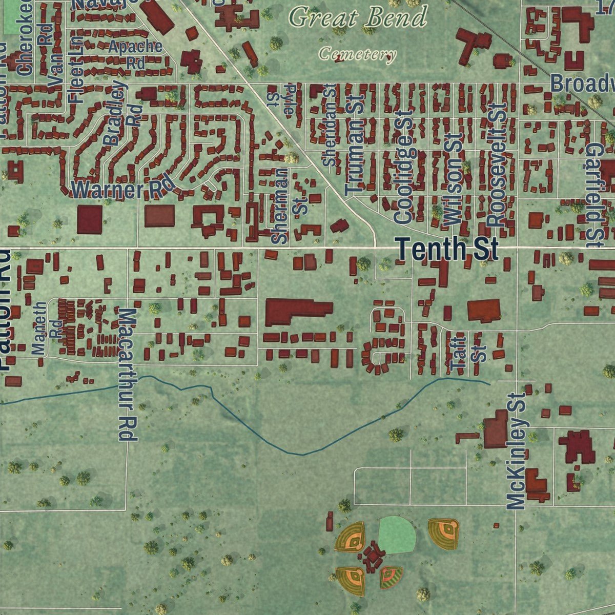
Explore Great Bend, Kansas from a whole new perspective. Created using aerial imagery and detailed geographic data, this map captures Great Bend building by building, with labeled streets, familiar landmarks, and shaded topographical relief that highlights the natural contours of the landscape.
Combining modern data with the timeless character of a vintage atlas, this map is just as interesting up close as it is beautiful on the wall. Whether you grew up in Great Bend, spent memorable years there, or call it home today, this unique map is a great way to celebrate a place that means something to you. Zoom in on the preview to look for your street, and then order a print to put your memories on the wall.
Three ways to hang it
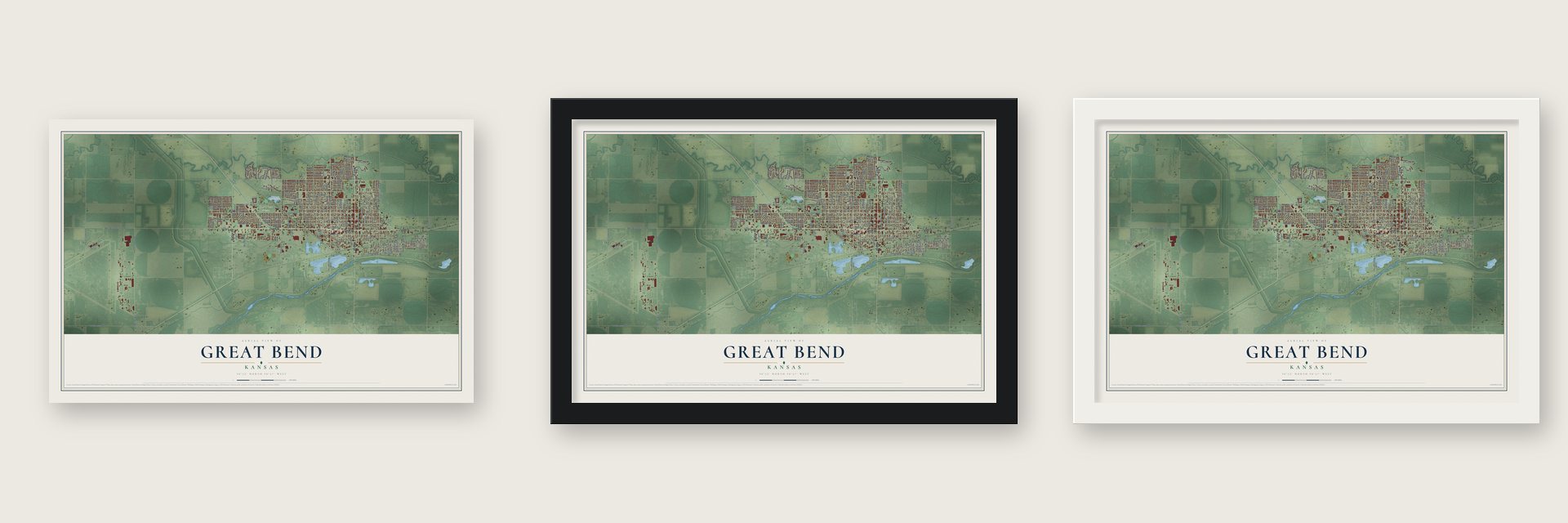
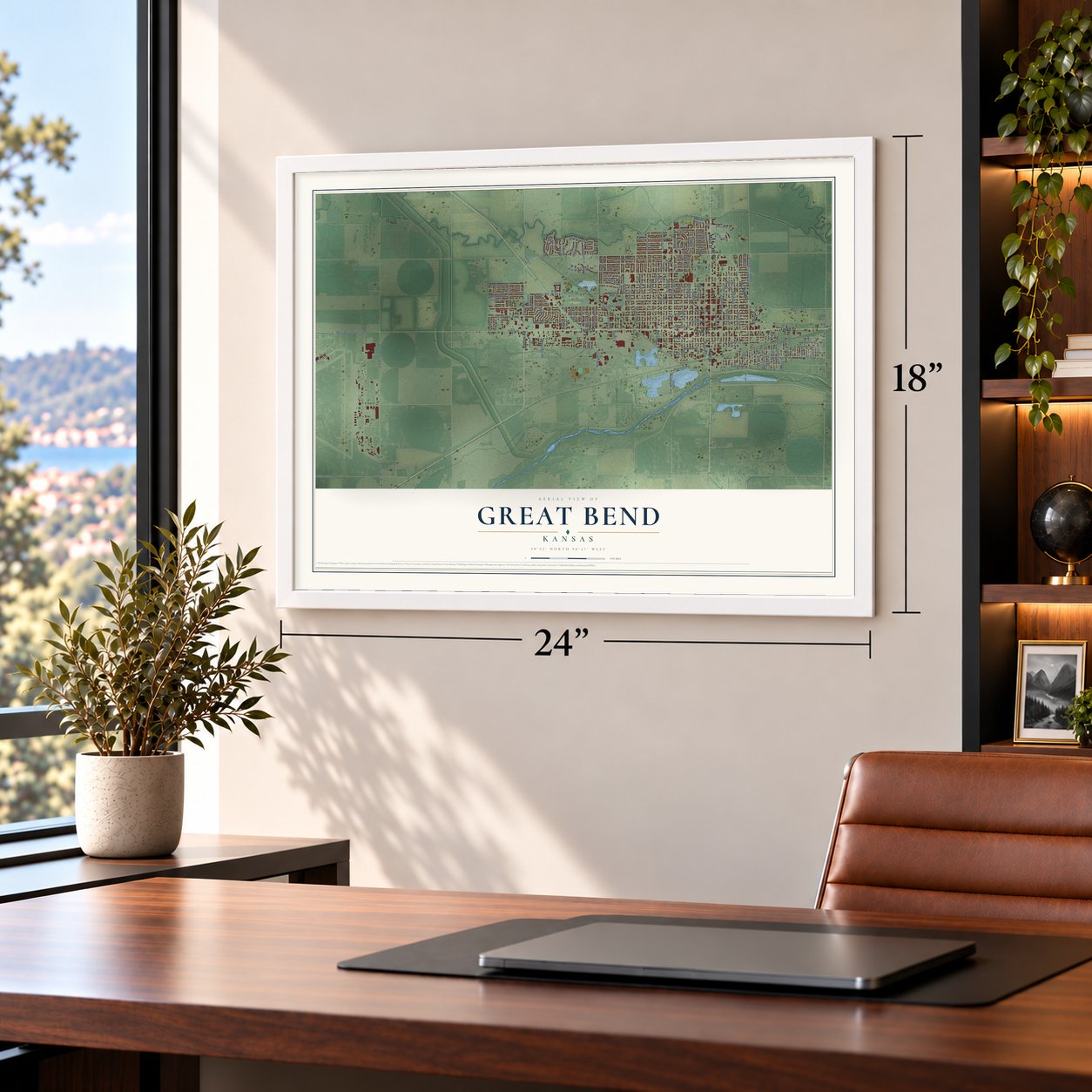
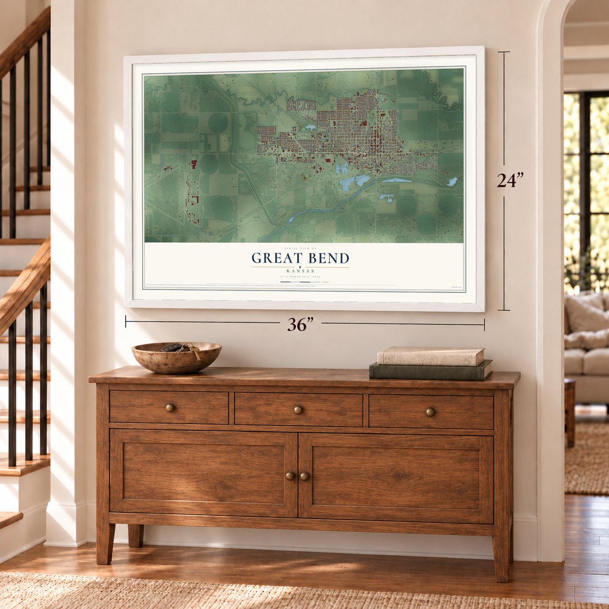
Unframed archival matte, a black wood frame or a white wood frame.
Up close
Geography Worth Displaying
This map was created using accurate cartographic data and authoritative geographic sources, including the U.S. Geological Survey and the Census Bureau. The map brings together terrain, waterways, roads, and building detail. The majority of the streets are labeled, houses are accurately depicted, and the topography is derived from government sources. Combining local data with carefully composed color and shading leads to this beautifully detailed Great Bend artwork for your wall.
Rather than simply showing street outlines, we’ve included as many of the street names as we could reasonably fit on the map while keeping their names legible. Zoom in on the high resolution preview to see exactly what’s on the map. We truly set out to create a statement piece for anyone who loves Great Bend. So whether it’s for you, or a gift for someone you love, we hope this map of Great Bend brings back fond memories.
Read the story behind this map of Great Bend, Kansas from 2026.

Find your street
Names on the Great Bend map
Every name below is printed on this map. Look for your street, your school, the park where you played, or the pond down the road.
Places and landmarks2
- Great Bend Cemetery
- Veteran's Memorial Park
Streets and roads139
- Patton Road
- Tenth Street
- Main Street
- 281 Bypass
- 24th Street
- Maple Street
- Southwest 40 Avenue
- Washington Street
- Fifth Street
- B-29 Way
- Broadway Avenue
- Eighth Street
- Lakin Avenue
- Twelfth Street
- Ninth Street
- 19th Street
- Forest Avenue
- 17th Street
- Morton Street
- McKinley Street
- Frey Street
- Airport Road
- 21st Street
- 16th Street
- Adams Street
- Second Street
- 18th Street
- Jefferson Street
- Williams Street
- Seventh Street
Show all 139 streets
- Eisenhower Avenue
- Harrison Street
- Park Avenue
- Odell Street
- Heizer Street
- Third Street
- Kansas Avenue
- Hubbard Street
- Holland Street
- Fourth Street
- Jackson Street
- Monroe Street
- Baker Avenue
- Madison Street
- 22nd Street
- Stone Street
- Southwest 20 Road
- 23rd Street
- Morphy Street
- West Barton County Road
- Eleventh Street
- 20th Street
- Polk Street
- Quail Creek Drive
- Meadowlark Lane
- Lincoln Street
- Sixth Street
- Warner Road
- Van Buren Street
- Macarthur Road
- 27th Street
- Walnut Street
- Tyler Street
- Quivira Avenue
- Coolidge Street
- Grant Street
- Cherry Lane
- 29th Street
- Aspen Drive
- 25th Street
- Hemlock Drive
- Prairie Rose Drive
- Pine Street
- Southwest 50 Avenue
- Garfield Street
- Kiowa Road
- Elm Street
- 31st Street
- Wilson Street
- Locust Street
- Chestnut Street
- Barton Drive
- Roosevelt Street
- Dry Creek
- Riviera Drive
- Plum Street
- Navajo Road
- Truman Street
- Fruit Street
- Becker Court
- Robin Road
- Zarah Drive
- Northeast 10 Avenue
- Cleveland Street
- 17th Saint Terrace
- 28th Street
- 26th Street
- Canterbury Lane
- 16th Saint Terrace
- Rosewood Drive
- Hickory Street
- Railroad Avenue
- Taft Street
- Paseo Drive
- South Washington Avenue
- Van Fleet Lane
- Oakmont Avenue
- Gano Street
- Sherman Street
- White Sands Drive
- McKinney Drive
- Rock Bridge Road
- Bradley Road
- Roxanne Drive
- Shawnee Drive
- Cherokee Road
- Franklin Street
- Bonita Avenue
- 32nd Saint Place
- Apollo Avenue
- Cedar Street
- Pine Place
- Timber Creek Road
- Sheridan Street
- Parrish Road
- Apache Road
- Pyle Street
- Telstar Lane
- 30th Street
- Falcon Drive
- Maneth Road
- Willow Lane
- 32nd Street
- Northwest 20 Avenue
- Sunset Road
- Grapevine Street
- Almond Street
- Firethorn Street
- McBride Parkway
Names are listed as they appear on the printed map. Zoom into the product photos to find them.
About Great Bend, Kansas
Great Bend is a city of 14,733 people and the county seat of Barton County. It sits on the north side of the Arkansas River, at the point where the river turns east, and that turn gave the town its name. The first settlers came in 1870, lived in sod houses and dugouts, and hunted buffalo, because the herds trampled any crops they tried to plant.
In 1871 the Great Bend Town Company expected the Santa Fe railroad to build west, so it laid out a town on the Santa Fe Trail, about three miles west of Fort Zarah. Its first building, later called the Southern Hotel, was finished that fall on the public square, and Edwin Tyler opened the first store in January 1872. The railroad arrived in July 1872, voters made Great Bend the permanent county seat, and early in 1873 it was incorporated with A. A. Hurd as mayor.
- The town site fightIn 1873 the government deeded the town's land to the mayor in trust for the people living on it, but the mayor turned it over to the town company. Angry settlers sued and won in December 1873. Under a compromise, the land was split among the 80 people living there on September 6, 1872, by what each had spent on improvements, and each gave half their lots back to the company. The plan was filed on February 2, 1874.
- A rowdy cowtownOnce the railroad came, Great Bend began shipping cattle in 1873. The trade brought business but also made the town violent. In 1876 the Kansas Legislature pushed the legal dead line for cattle from Texas farther out, so that it ran 30 miles beyond Barton County. The herds followed it west, and the city grew calmer.
- The first drug store, 1872A. S. Allen came to Great Bend in May 1872 and opened a drug store on the west side of the square. For three years no other drug store stood between his and the state's western line. The A. S. Allen Buildings joined the National Register in 2018.
- Oil and gas moneyLocal speculators began paying to search for oil in 1886. By 1930 the oil and gas business brought the county more than $20 million a year, and more than 3,000 wells pumped during the 1930s, drawing so many workers that the city's population jumped.
- B-29 crews in 1943In 1943 the Army Air Forces built Great Bend Army Airfield on the west side of town, where crews trained to fly B-29 bombers in World War II. Once the fighting ended, the city took over the base and turned it into the Great Bend Municipal Airport. Its hangar and the Norden Bombsight Storage Vaults joined the National Register in 2015.
Keep exploring Kansas
Great Bend is one of 764 Kansas towns we've mapped. Every dot on the map is a print of its own.
The search covers every state, Kansas first.
Near Great Bend
Order 2 or more town maps and save 10%. Shown in the size and finish you picked above, so they hang as a set.
- Hoisington 12" x 18" / Archival Matte Print $39.99
- Ellinwood 12" x 18" / Archival Matte Print $39.99
- Pawnee Rock 12" x 18" / Archival Matte Print $39.99


The art of mapping a place
How This Map Was Made
Real places. Remarkable detail. Discover the layers that turn geographic data into a map of home.

The view from above
Aerial imagery reveals the character of the land: woodland, open fields, and the patterns of a place.

The shape of the land
Elevation data brings hills, valleys, and subtle changes in the landscape into view.

The details of home
Roads, waterways, and building footprints come together to make the map feel unmistakably local.

Geography becomes art
Considered color, shading, and typography bring the layers together in a map made for your wall.


Process illustrated with Mendon, Massachusetts. Aerial imagery: USDA NAIP. Terrain: USGS 3D Elevation Program. Map details and finished artwork: KNOWOL.
The Details
About This Print
Choose an archival matte print, or a black or white Ayous wood frame. The archival matte print is unframed.
Select your size and finish above to see the matching product image and price.
Materials & Craftsmanship
A contemporary map with the character of a classic atlas, printed on archival matte paper. Optional frames are made from Ayous wood.
Your printed map does not include the watermark shown in the full-map preview.
Shipping & Delivery
Free shipping within the United States. Every print is made to order in the USA.
Buying a gift? Add a note in your cart and we'll include it. We never put prices in the package.
Prints ship within 2 to 3 business days. Allow 7 to 10 days total from ordering for delivery. Timing may vary during holidays or periods of high order volume.
Read our shipping policy.
Returns and damaged prints
Each print is made to order. Change-of-mind refunds are not available after production.
If your print arrives damaged, misprinted or incorrect, contact support@knowol.com within 30 days of receiving it. Include your order number, photos and a description of the issue.
Read our full refund and replacement policy. For questions about your order, email support@knowol.com.